Signs Tagged With Bridge
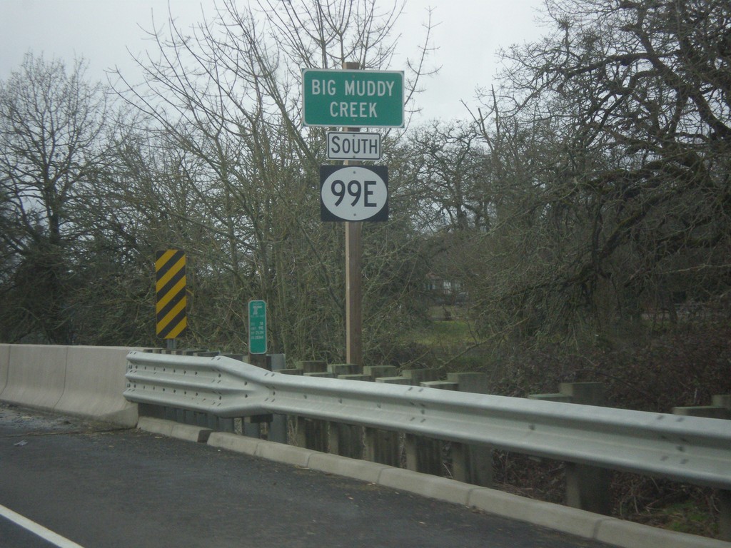
OR-99E - Big Muddy Creek
OR-99E at Big Muddy Creek. The OR-99E shield here is not a typical Oregon state highway style, rather a plain white circle. There were a few shields along or OR-99E in southern Linn County that were not standard.
Taken 02-13-2014
 Harrisburg
Linn County
Oregon
United States
Harrisburg
Linn County
Oregon
United States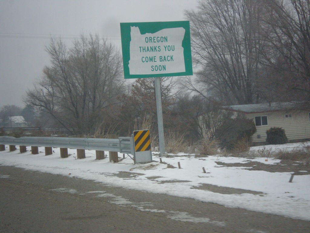
US-95 Spur North - Leaving Oregon
Oregon Thanks You - Come Back Soon on US-95 Spur approaching the Snake River bridge into Idaho.
Taken 12-15-2013
 Ontario
Malheur County
Oregon
United States
Ontario
Malheur County
Oregon
United States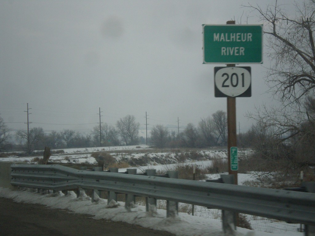
OR-201 North - Malheur River
OR-201 north at the Malheur River bridge. The Malheur River flows into the Snake River just east of here.
Taken 12-15-2013
 Ontario
Malheur County
Oregon
United States
Ontario
Malheur County
Oregon
United States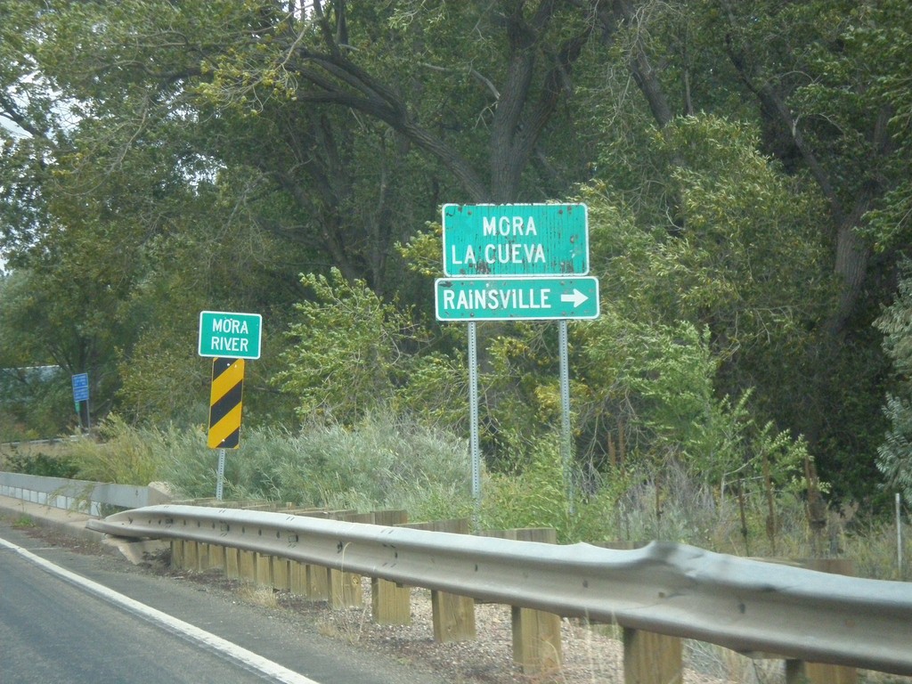
NM-518 North At NM-442
NM-518 north at NM-442. Turn right on NM-442 for Rainsville. Continue north on NM-518 for Mora and La Cueva. Crossing the Mora River.
Taken 10-10-2013

 Mora
Mora County
New Mexico
United States
Mora
Mora County
New Mexico
United States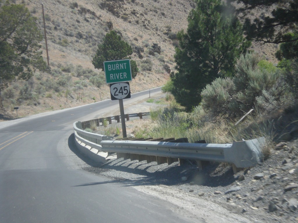
OR-245 East - Burnt River
Burnt River on OR-245 East.
Taken 07-15-2013
 Hereford
Baker County
Oregon
United States
Hereford
Baker County
Oregon
United States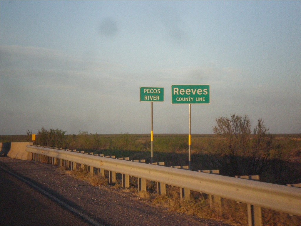
TX-302 West - Reeves County Line
Reeves County Line on TX-302 west, crossing the Pecos River (dry when this photo was taken).
Taken 04-15-2013
 Mentone
Loving County
Texas
United States
Mentone
Loving County
Texas
United States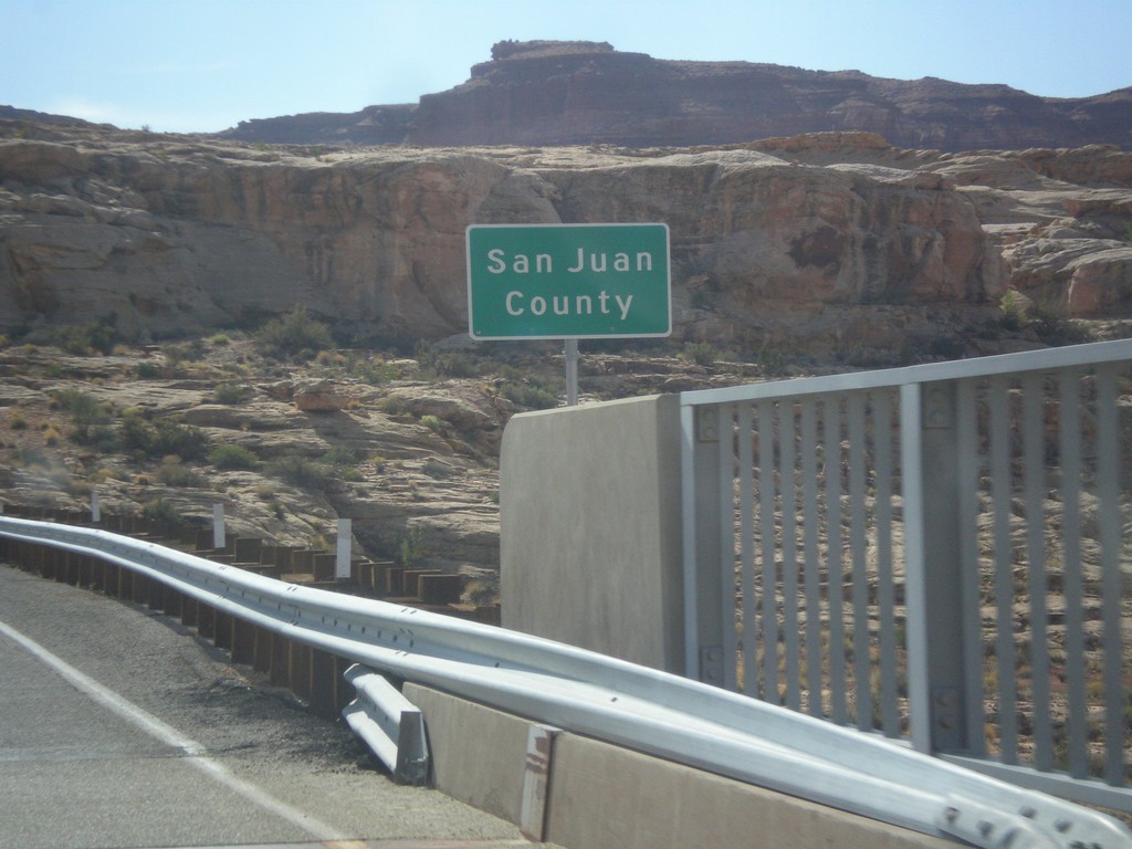
UT-95 East - San Juan County
Entering San Juan County on UT-95 east, crossing the Colorado River. This is the backwaters of Lake Powell, near Hite Marina.
Taken 10-10-2012
 Lake Powell
San Juan County
Utah
United States
Lake Powell
San Juan County
Utah
United States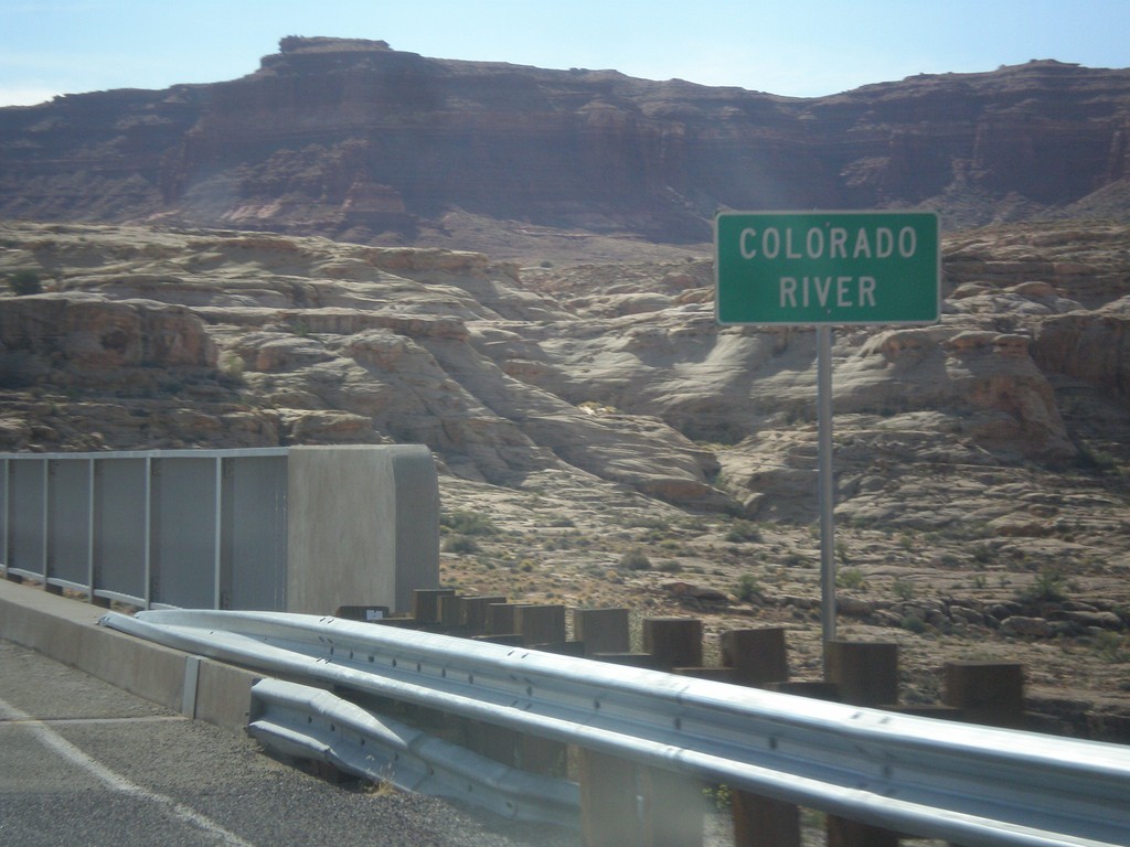
UT-95 East - Colorado River
Colorado River crossing on UT-95 east. This is the backwaters of Lake Powell.
Taken 10-10-2012
Lake Powell
Garfield County
Utah
United States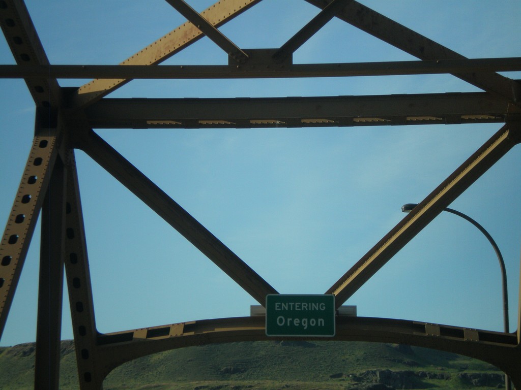
US-97 South - Entering Oregon
Entering Oregon on US-97 south, crossing the Columbia River.
Taken 05-27-2012
 Biggs Junction
Sherman County
Oregon
United States
Biggs Junction
Sherman County
Oregon
United States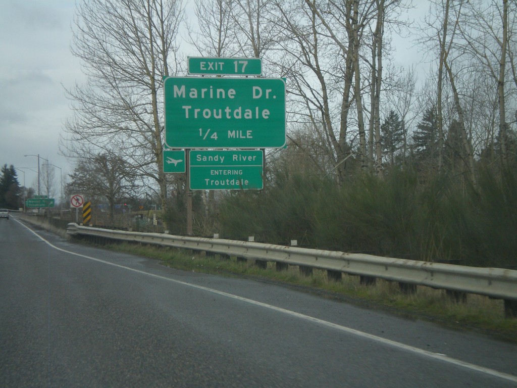
I-84 West - Exit 17
I-84 west approaching Exit 17 - Marine Drive/Troutdale. Entering Troutdale and crossing the Sandy River. The Sandy River is the boundary of the Columbia River Gorge National Scenic Area.
Taken 02-18-2012

 Troutdale
Multnomah County
Oregon
United States
Troutdale
Multnomah County
Oregon
United States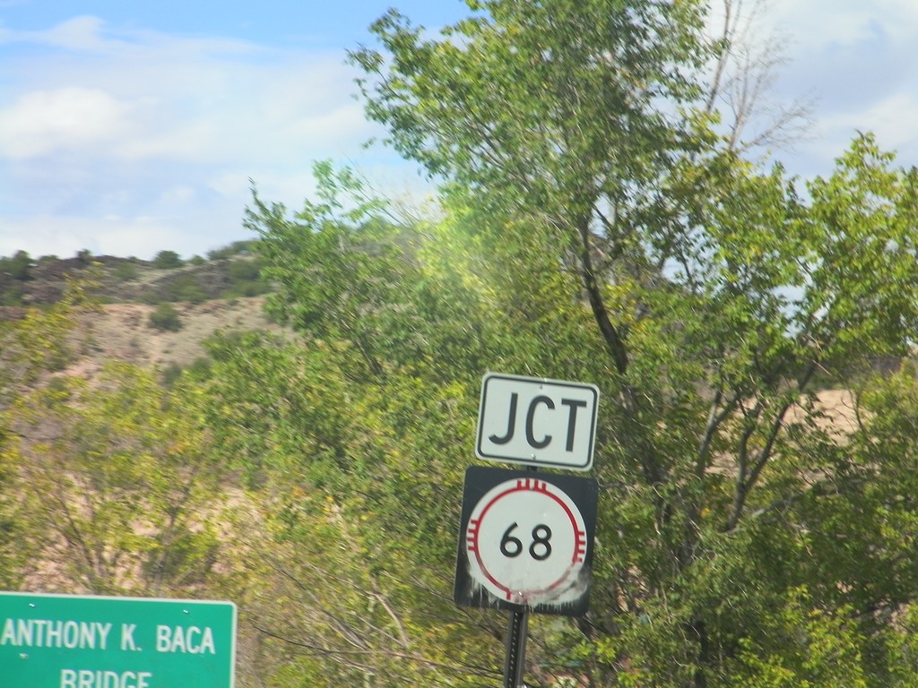
NM-75 East Approaching NM-68
NM-75 East approaching NM-68 at the Anthony K. Baca Bridge over Embudo Creek.
Taken 10-03-2011

 Dixon
Rio Arriba County
New Mexico
United States
Dixon
Rio Arriba County
New Mexico
United States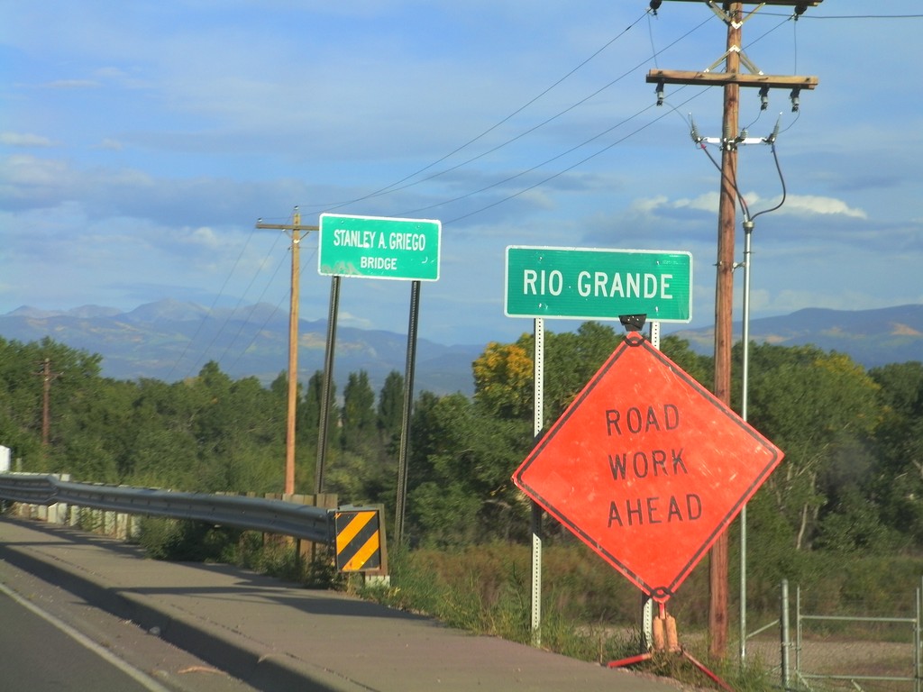
US-84/US-285 South - Rio Grande
US-84/US-285 South - Rio Grande in Española. The bridge over the Rio Grande is called the Stanley A. Griego Bridge.
Taken 10-02-2011

 Española
Rio Arriba County
New Mexico
United States
Española
Rio Arriba County
New Mexico
United States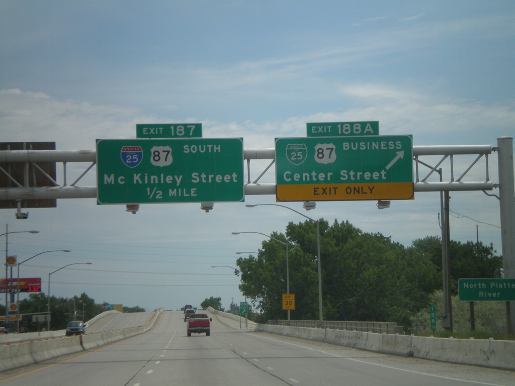
I-25 South - Exits 188A and 187
I-25 south at Exit 188A - BL-25/BL-87/Center St. Approaching Exit 187 - McKinley St. Exit 187 is signed as I-25 and US-87 south, but this is an error. Neither highway exit at McKinley St.
Taken 07-04-2011


 Casper
Natrona County
Wyoming
United States
Casper
Natrona County
Wyoming
United States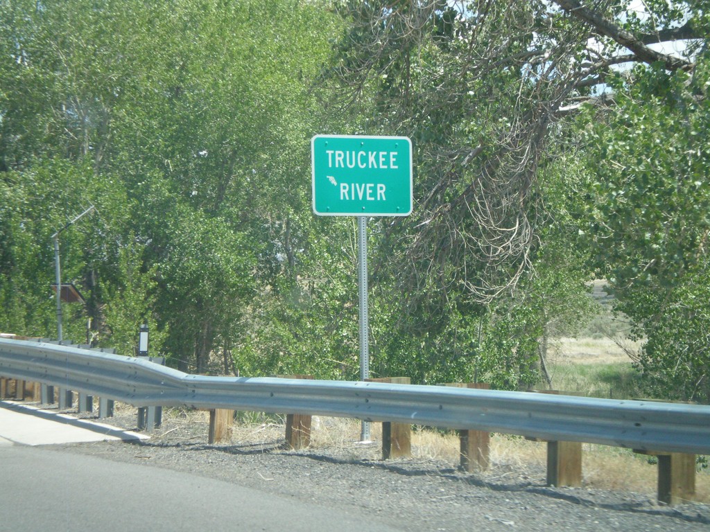
NV-427 South - Truckee River
NV-427 south crossing the Truckee River in Wadsworth.
Taken 06-13-2011
 Sparks
Washoe County
Nevada
United States
Sparks
Washoe County
Nevada
United States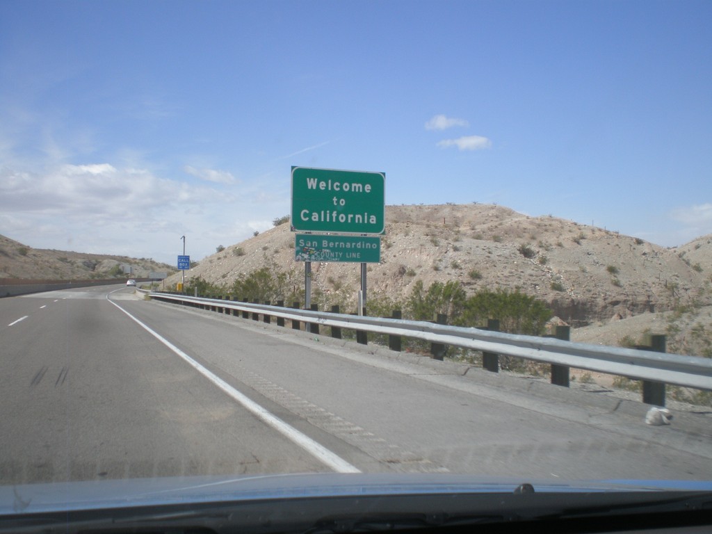
Welcome To California - I-40 West
Welcome to California on I-40 west at the Arizona-California state line crossing the Colorado River. San Bernardino County line.
Taken 02-25-2011
 Needles
San Bernardino County
California
United States
Needles
San Bernardino County
California
United States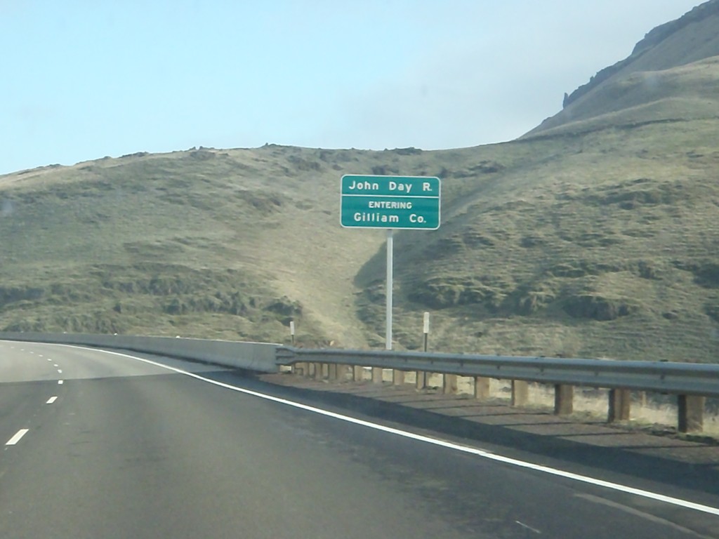
I-84 East - Entering Gilliam County
Entering Gilliam County on I-84 west, crossing the John Day River.
Taken 01-19-2011
Arlington
Sherman County
Oregon
United States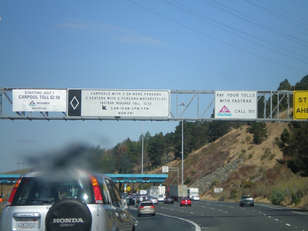
I-80 East - Carquinez Bridge Toll Plaza
Approaching the Carquinez Bridge Toll Plaza on I-80 east. When this photo was taken in Fall 2010, the auto toll was $5.00. The Carquinez Bridge crosses the Carquinez Straits, through which the Sacramento and San Joaquin Delta empty into, before reaching the San Pablo Bay.
Taken 10-01-2010
 Vallejo
Solano County
California
United States
Vallejo
Solano County
California
United States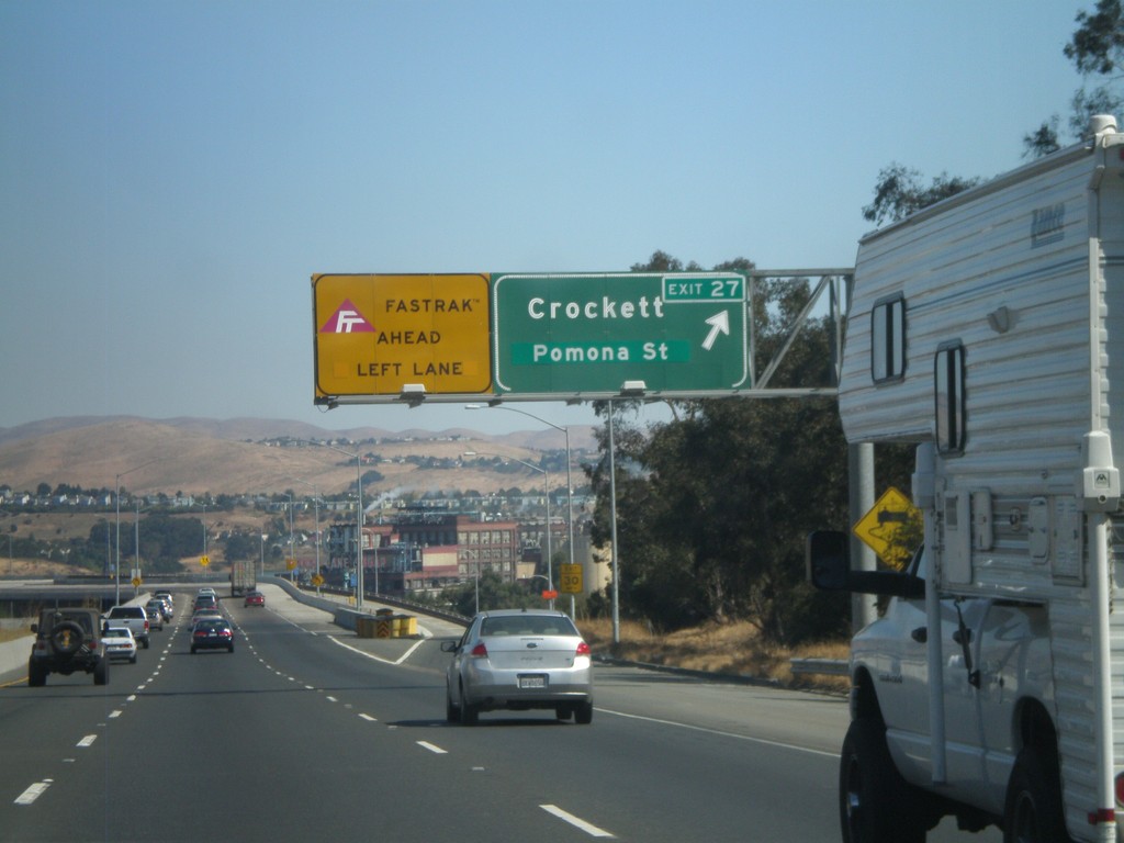
I-80 East - Exit 26
I-80 east at Exit 26 - Crockett/Pomona St. The Carqinuez Bridge bridge over the Carquinez Straits begins here. The eastbound direction over the bridge pays tolls. All Fastrak users, use the left lane. Fastrak is a transponder system used to pay tolls in California.
Taken 10-01-2010
Crockett
Contra Costa County
California
United States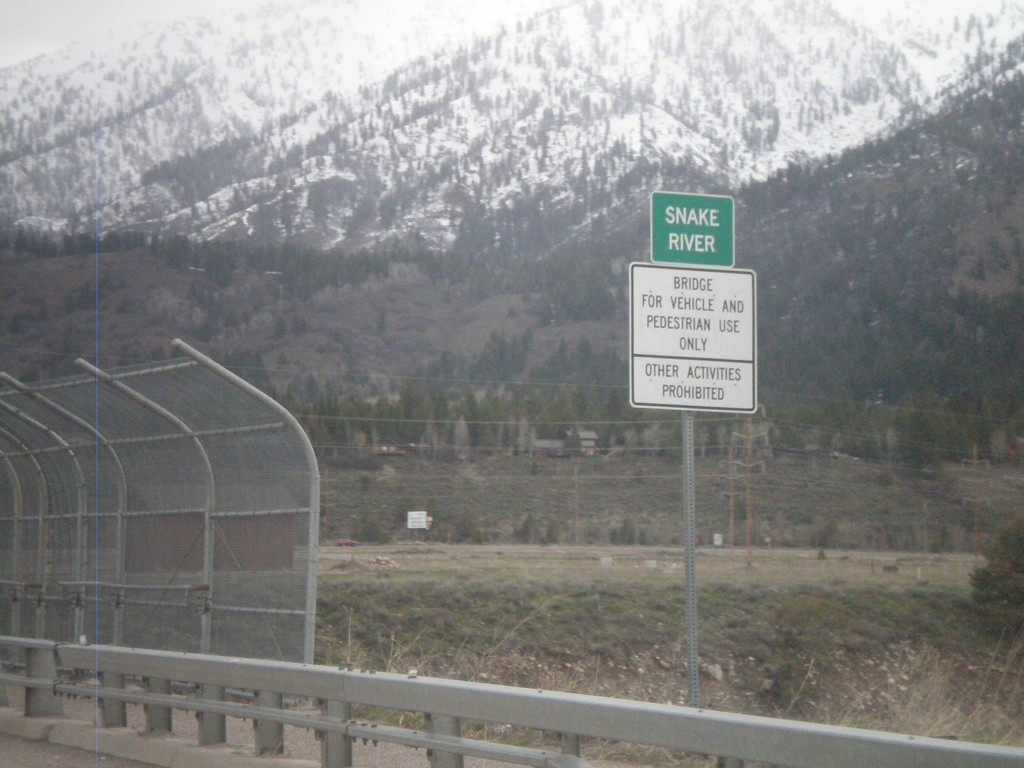
US-89 North - Snake River
Crossing the Snake River on US-89 north.
Taken 05-01-2010
 Alpine
Lincoln County
Wyoming
United States
Alpine
Lincoln County
Wyoming
United States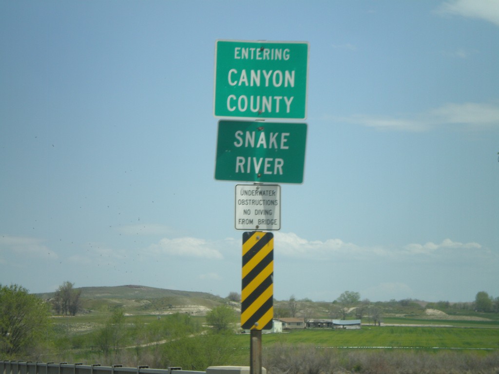
ID-55 North at Canyon County Line
ID-55 north crossing the Snake River and entering Canyon County.
Taken 04-20-2010
 Marsing
Owyhee County
Idaho
United States
Marsing
Owyhee County
Idaho
United States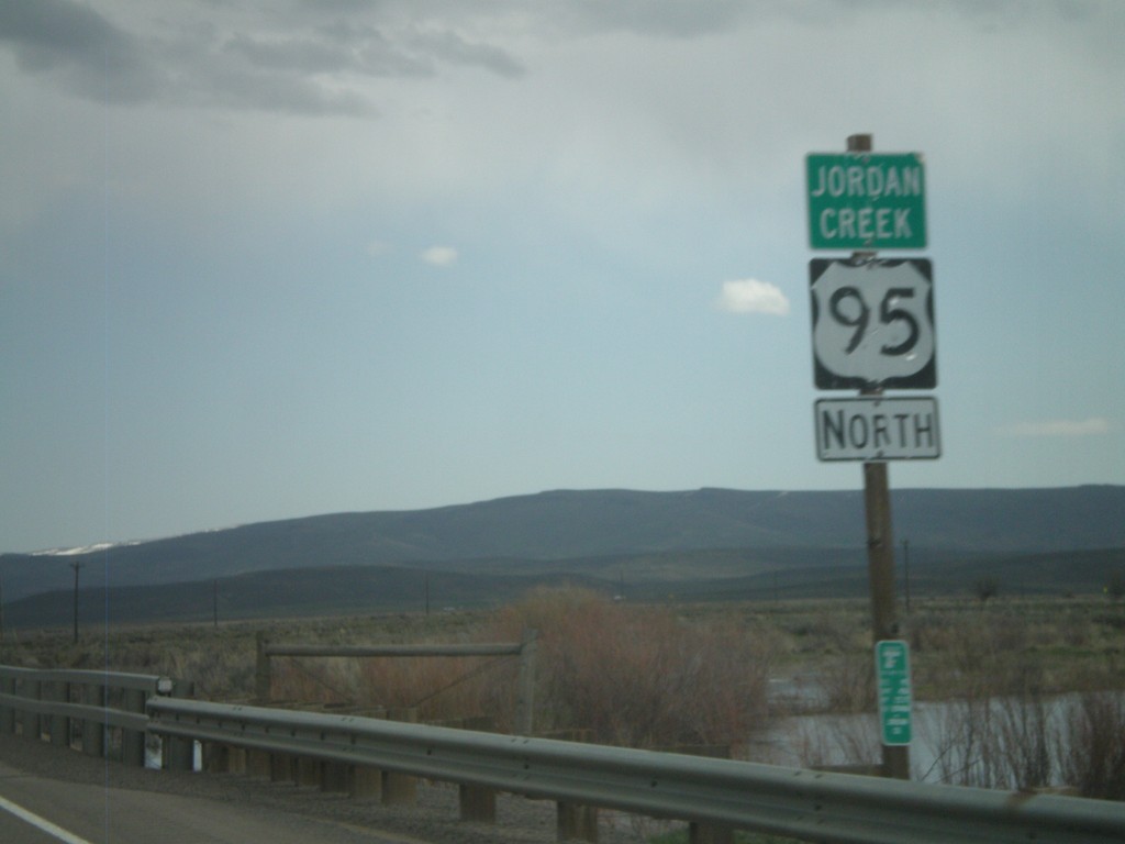
US-95 North - Jordan Creek
US-95 north crossing Jordan Creek. Jordan Creek is overflowing in this picture from spring runoff.
Taken 04-20-2010
 Jordan Valley
Malheur County
Oregon
United States
Jordan Valley
Malheur County
Oregon
United States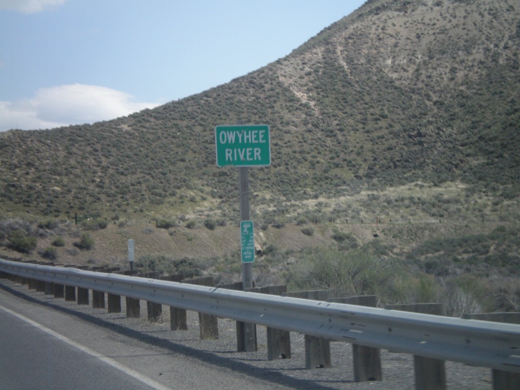
US-95 North - Owyhee River
US-95 north at the Owyhee River.
Taken 04-20-2010
Jordan Valley
Malheur County
Oregon
United States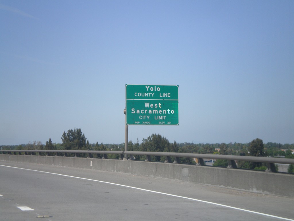
US-50/BL-80 West - Yolo-Sacramento County Line
US-50/BL-80 west at the Yolo-Sacramento County Line at the Sacramento River. Also entering the city of West Sacramento.
Taken 04-16-2010

 Sacramento
 County
California
United States
Sacramento
Sacramento County
California
United States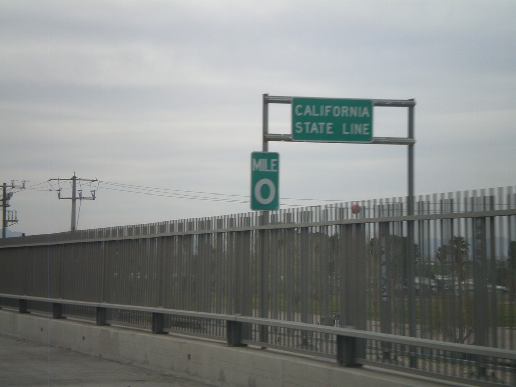
I-10 West - California State Line
California State Line on I-10 west crossing the Colorado River, at the Arizona-California Border.
Taken 03-22-2010
 Blythe
Riverside County
California
United States
Blythe
Riverside County
California
United States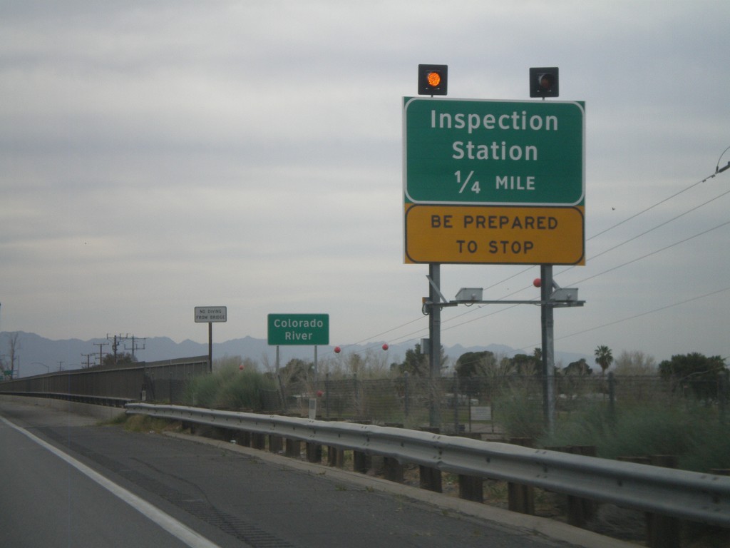
I-10 West - Approaching California Inspection Station
Approaching California Inspection Station and Colorado River on I-10 West/US-95 north.
Taken 03-22-2010
Ehrenberg
La Paz County
Arizona
United States