Signs Tagged With Bridge
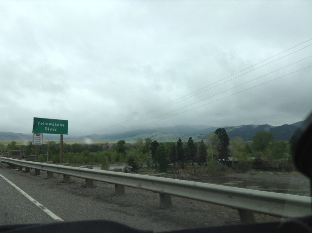
I-90 East - Yellowstone River
I-90 east crossing the Yellowstone River. This is the first crossing of the Yellowstone River on I-90. I-90 follows the Yellowstone River east to Bilings; thence I-94 follows it down to Glendive, Montana near the North Dakota line.
Taken 05-08-2015


 Livingston
Park County
Montana
United States
Livingston
Park County
Montana
United States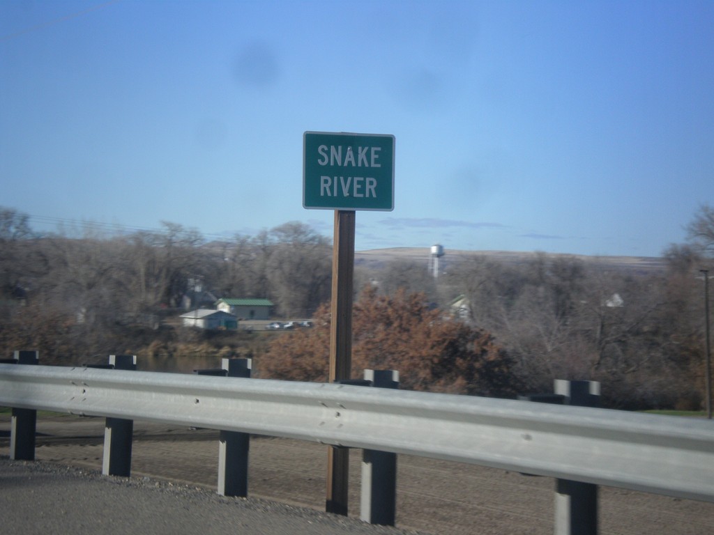
US-20/US-26 West - Snake River
US-20/US-26 West at the Snake River. The Snake River marks the boundary between Oregon and Idaho, starting just south of here.
Taken 12-14-2014

 Parma
Canyon County
Idaho
United States
Parma
Canyon County
Idaho
United States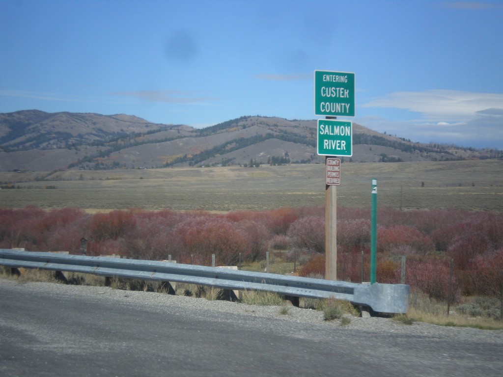
ID-75 North - Entering Custer County
Entering Custer County on ID-75 north at the Salmon River.
Taken 10-04-2014
 Obsidian
Custer County
Idaho
United States
Obsidian
Custer County
Idaho
United States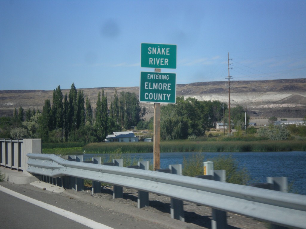
ID-51 North - Entering Elmore County
Entering Elmore County on ID-51 north, on the bridge over the Snake River.
Taken 08-31-2014
 Mountain Home
Elmore County
Idaho
United States
Mountain Home
Elmore County
Idaho
United States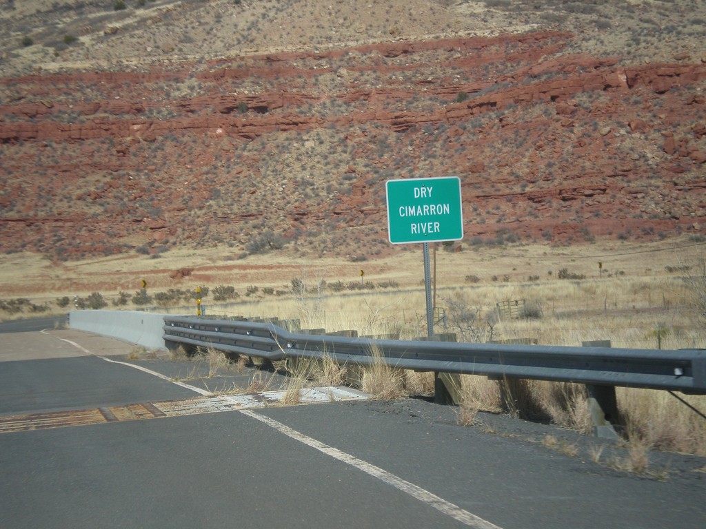
NM-456 - Dry Cimarron River
Crossing the Dry Cimarron River on NM-456 east. The Dry Cimarron River is known as the Cimarron River when it crosses into Oklahoma. When this photo was taken in the spring of 2014, there were puddles in the river.
Taken 03-29-2014
 Folsom
Union County
New Mexico
United States
Folsom
Union County
New Mexico
United States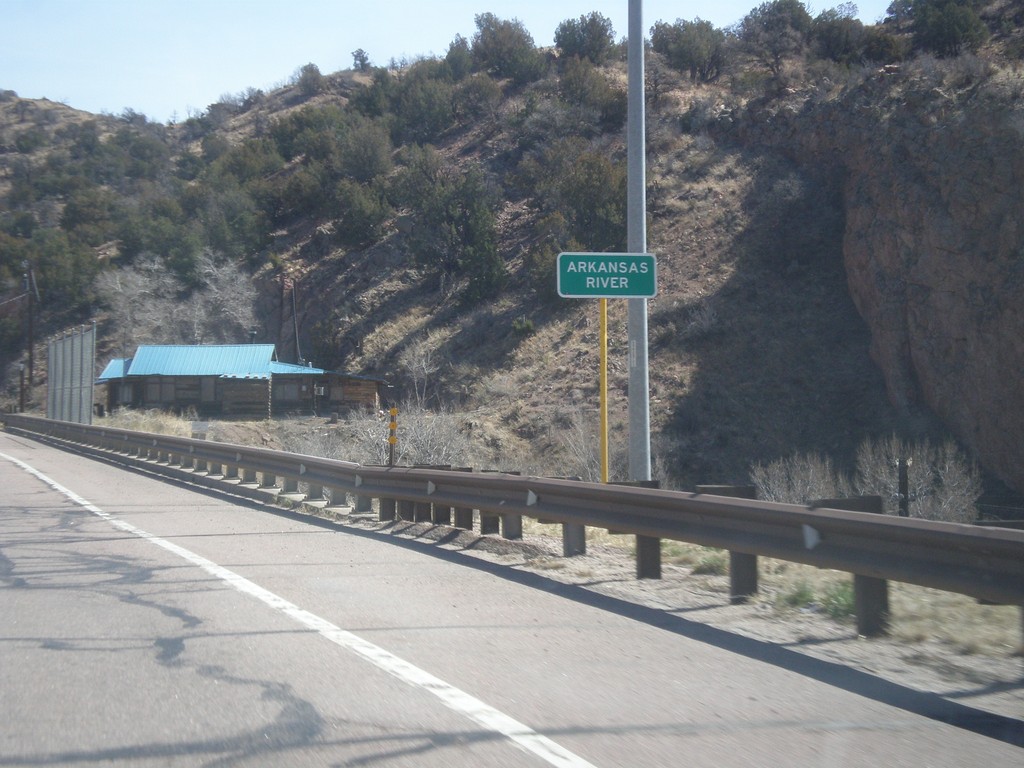
US-50 East - Arkansas River
US-50 east at the Arkansas River bridge. The Arkansas River leaves the highway here and enters Royal Gorge.
Taken 03-29-2014
 Cañon City
Fremont County
Colorado
United States
Cañon City
Fremont County
Colorado
United States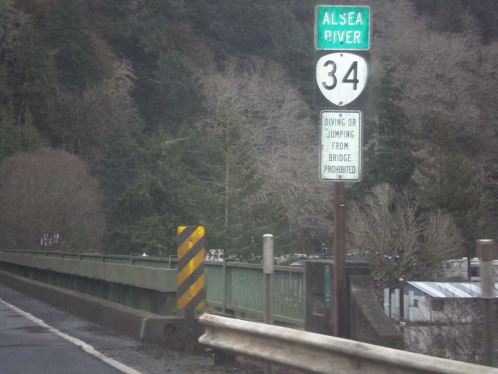
OR-34 East - Alsea River
OR-34 east at the Alsea River bridge.
Taken 02-21-2014
 Waldport
Lincoln County
Oregon
United States
Waldport
Lincoln County
Oregon
United States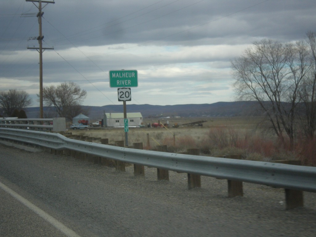
US-20 East - Malheur River
Malheur River bridge on US-20 east in Malheur County.
Taken 02-17-2014
Vale
Malheur County
Oregon
United States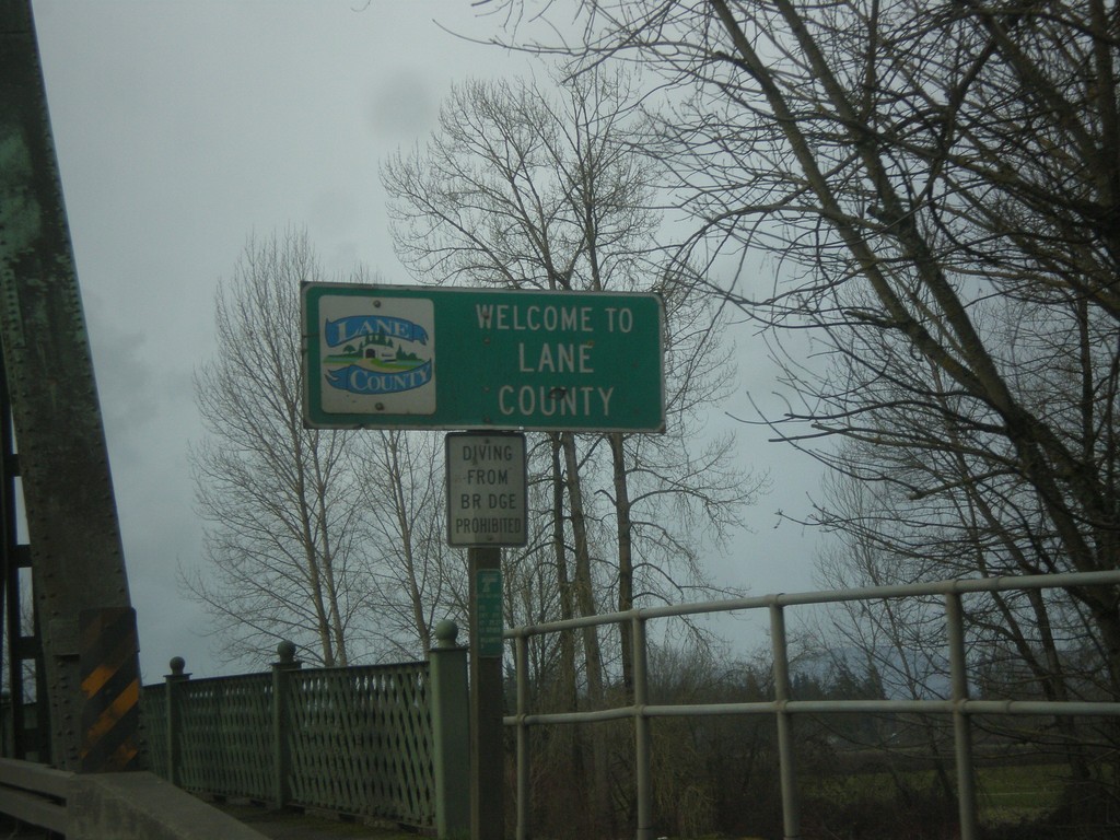
OR-99E South - Entering Lane County
Entering Lane County on OR-99E south on the Willamette River bridge. Many of the counties on western Oregon put logos on their county welcome signs.
Taken 02-13-2014
 Harrisburg
Lane County
Oregon
United States
Harrisburg
Lane County
Oregon
United States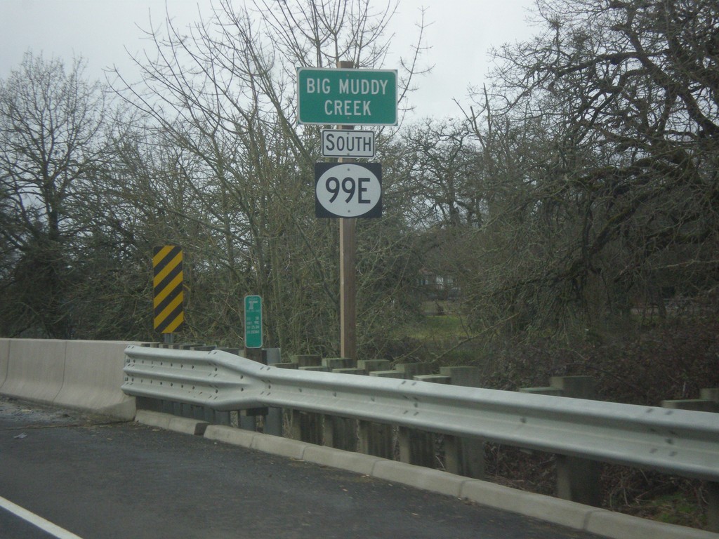
OR-99E - Big Muddy Creek
OR-99E at Big Muddy Creek. The OR-99E shield here is not a typical Oregon state highway style, rather a plain white circle. There were a few shields along or OR-99E in southern Linn County that were not standard.
Taken 02-13-2014
Harrisburg
Linn County
Oregon
United States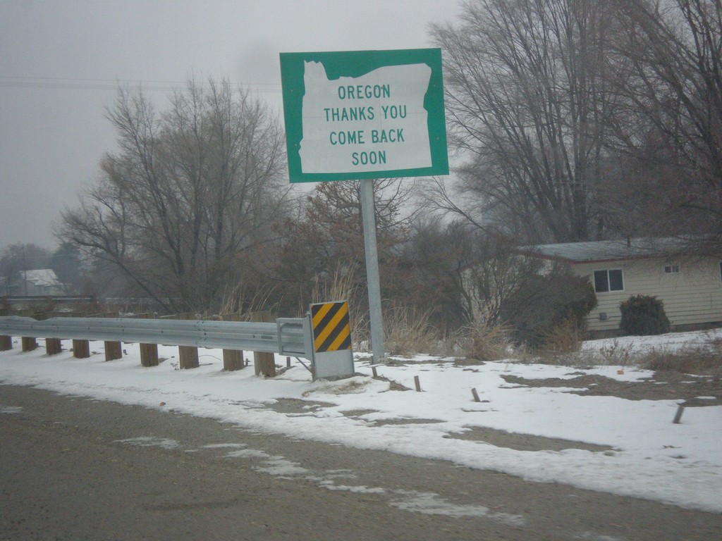
US-95 Spur North - Leaving Oregon
Oregon Thanks You - Come Back Soon on US-95 Spur approaching the Snake River bridge into Idaho.
Taken 12-15-2013
 Ontario
Malheur County
Oregon
United States
Ontario
Malheur County
Oregon
United States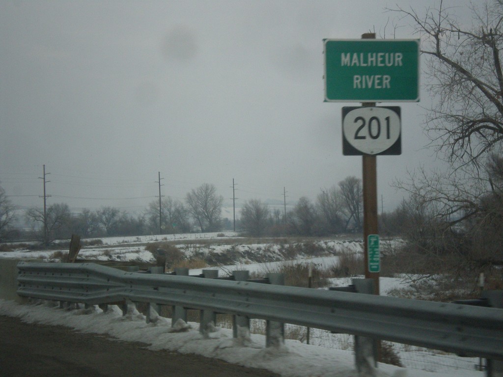
OR-201 North - Malheur River
OR-201 north at the Malheur River bridge. The Malheur River flows into the Snake River just east of here.
Taken 12-15-2013
 Ontario
Malheur County
Oregon
United States
Ontario
Malheur County
Oregon
United States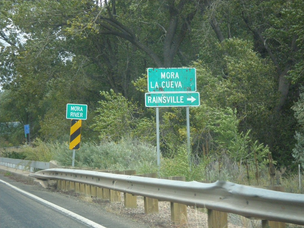
NM-518 North At NM-442
NM-518 north at NM-442. Turn right on NM-442 for Rainsville. Continue north on NM-518 for Mora and La Cueva. Crossing the Mora River.
Taken 10-10-2013

 Mora
Mora County
New Mexico
United States
Mora
Mora County
New Mexico
United States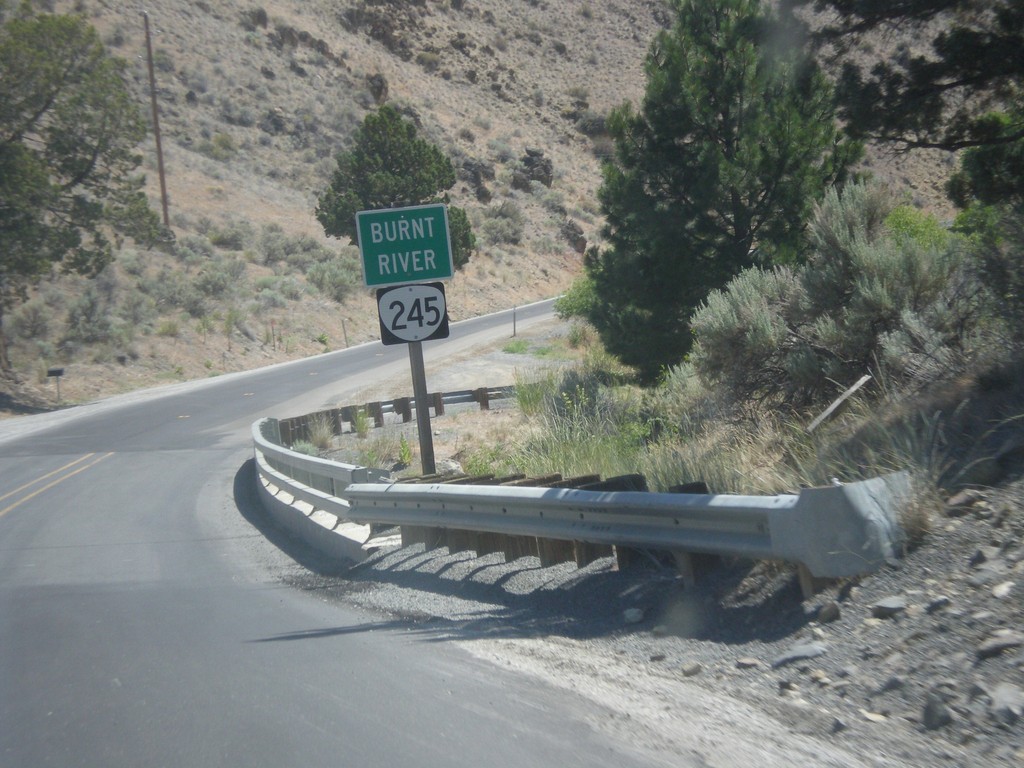
OR-245 East - Burnt River
Burnt River on OR-245 East.
Taken 07-15-2013
 Hereford
Baker County
Oregon
United States
Hereford
Baker County
Oregon
United States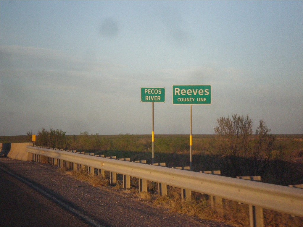
TX-302 West - Reeves County Line
Reeves County Line on TX-302 west, crossing the Pecos River (dry when this photo was taken).
Taken 04-15-2013
 Mentone
Loving County
Texas
United States
Mentone
Loving County
Texas
United States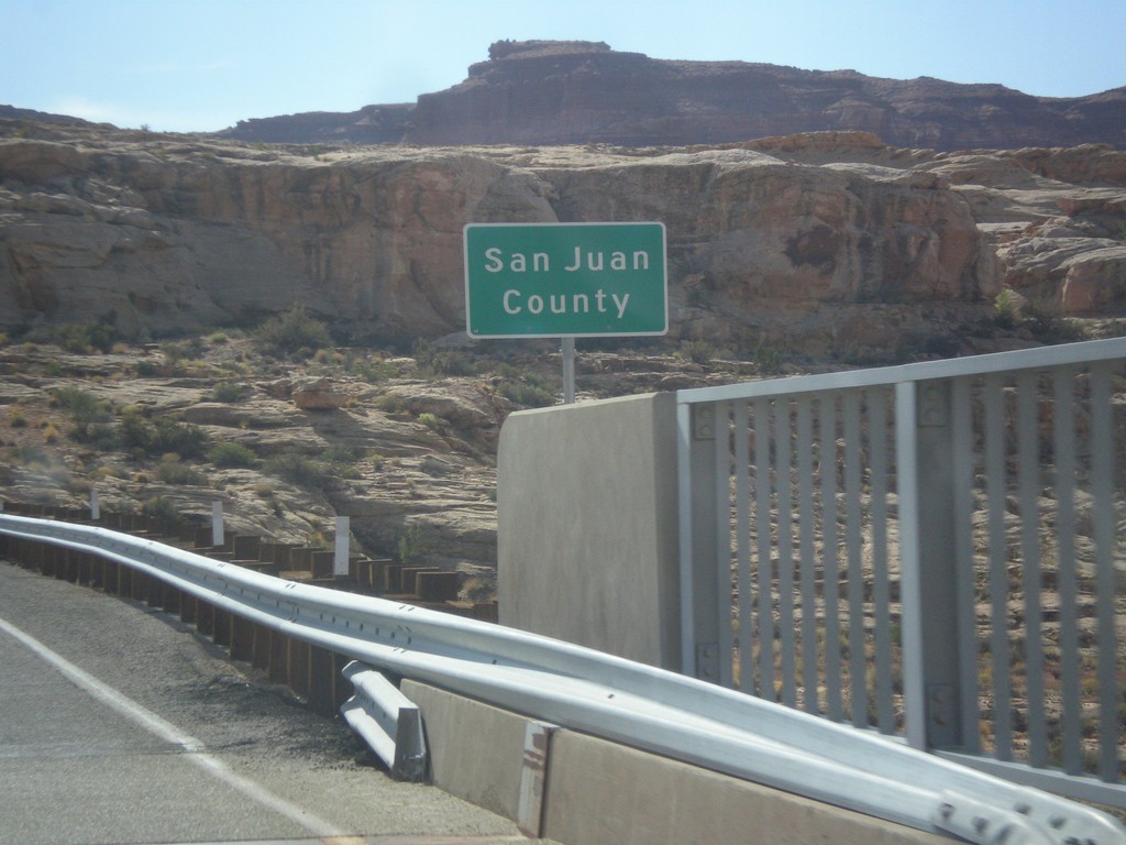
UT-95 East - San Juan County
Entering San Juan County on UT-95 east, crossing the Colorado River. This is the backwaters of Lake Powell, near Hite Marina.
Taken 10-10-2012
 Lake Powell
San Juan County
Utah
United States
Lake Powell
San Juan County
Utah
United States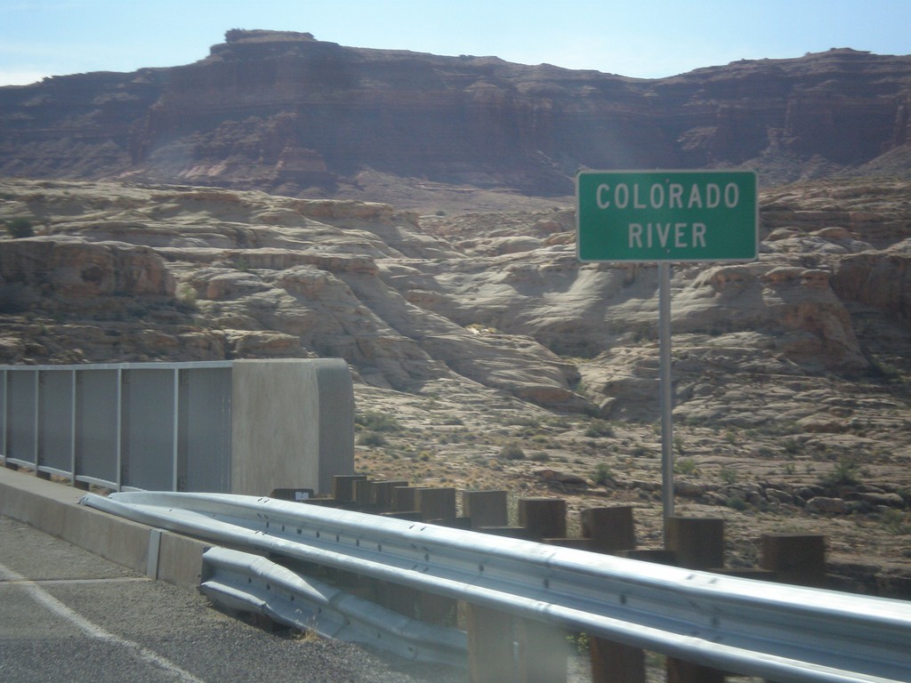
UT-95 East - Colorado River
Colorado River crossing on UT-95 east. This is the backwaters of Lake Powell.
Taken 10-10-2012
Lake Powell
Garfield County
Utah
United States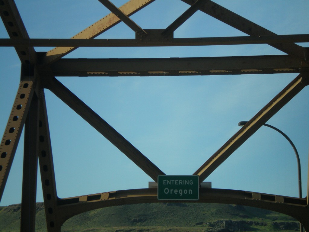
US-97 South - Entering Oregon
Entering Oregon on US-97 south, crossing the Columbia River.
Taken 05-27-2012
 Biggs Junction
Sherman County
Oregon
United States
Biggs Junction
Sherman County
Oregon
United States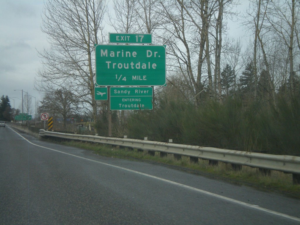
I-84 West - Exit 17
I-84 west approaching Exit 17 - Marine Drive/Troutdale. Entering Troutdale and crossing the Sandy River. The Sandy River is the boundary of the Columbia River Gorge National Scenic Area.
Taken 02-18-2012

 Troutdale
Multnomah County
Oregon
United States
Troutdale
Multnomah County
Oregon
United States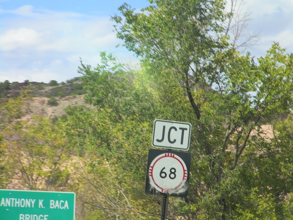
NM-75 East Approaching NM-68
NM-75 East approaching NM-68 at the Anthony K. Baca Bridge over Embudo Creek.
Taken 10-03-2011

 Dixon
Rio Arriba County
New Mexico
United States
Dixon
Rio Arriba County
New Mexico
United States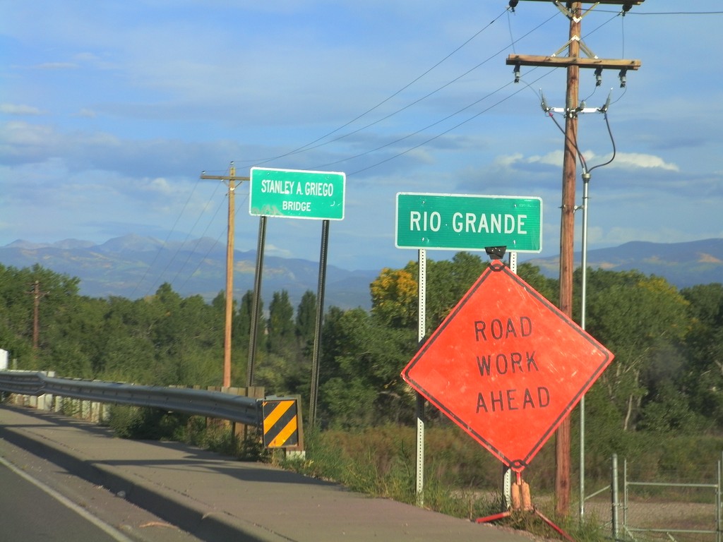
US-84/US-285 South - Rio Grande
US-84/US-285 South - Rio Grande in Española. The bridge over the Rio Grande is called the Stanley A. Griego Bridge.
Taken 10-02-2011

 Española
Rio Arriba County
New Mexico
United States
Española
Rio Arriba County
New Mexico
United States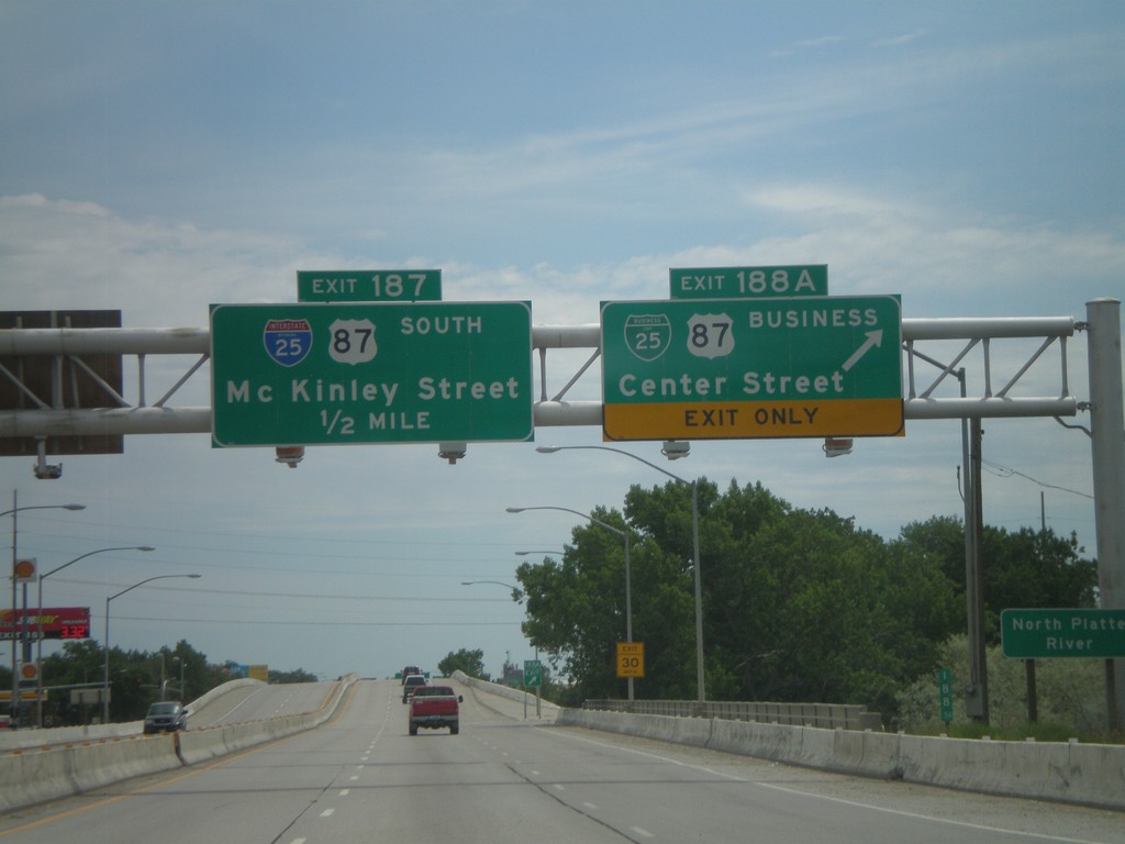
I-25 South - Exits 188A and 187
I-25 south at Exit 188A - BL-25/BL-87/Center St. Approaching Exit 187 - McKinley St. Exit 187 is signed as I-25 and US-87 south, but this is an error. Neither highway exit at McKinley St.
Taken 07-04-2011


 Casper
Natrona County
Wyoming
United States
Casper
Natrona County
Wyoming
United States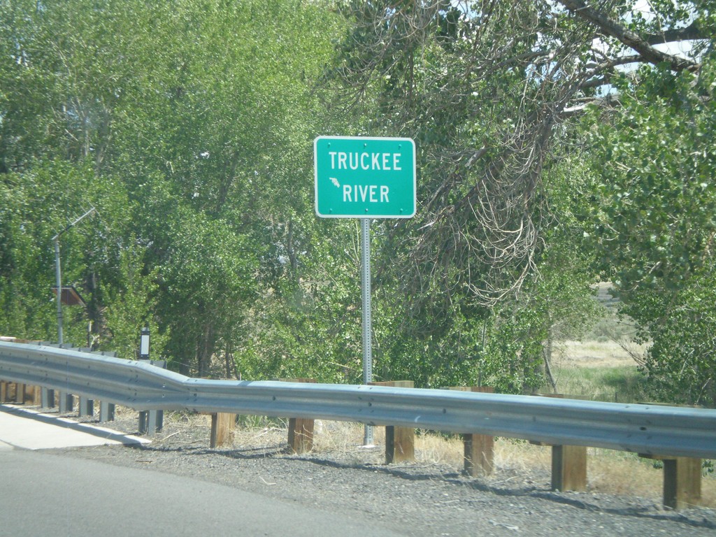
NV-427 South - Truckee River
NV-427 south crossing the Truckee River in Wadsworth.
Taken 06-13-2011
 Sparks
Washoe County
Nevada
United States
Sparks
Washoe County
Nevada
United States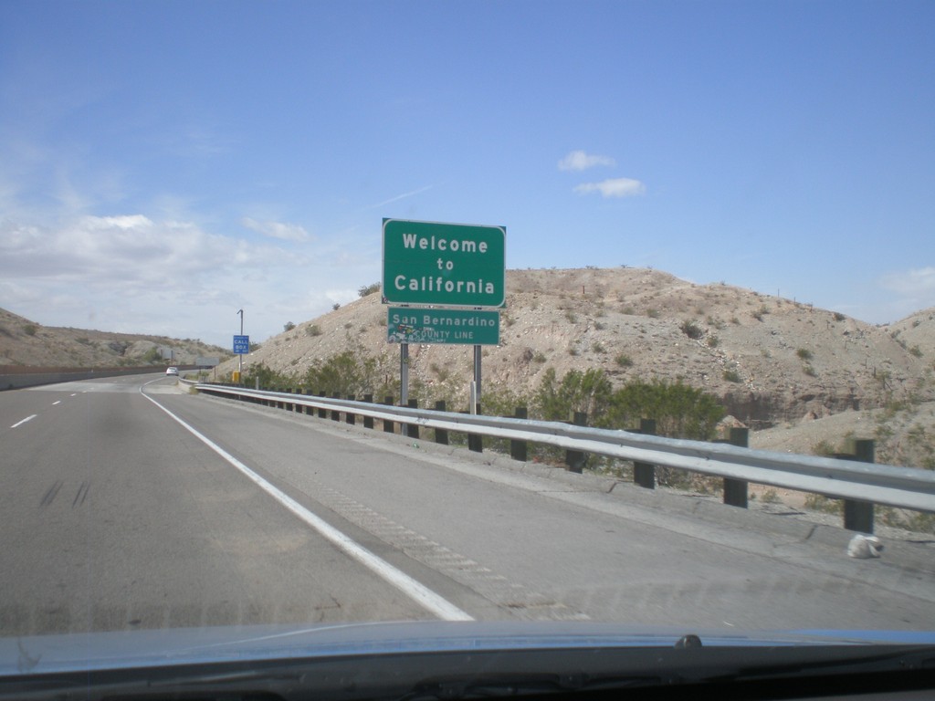
Welcome To California - I-40 West
Welcome to California on I-40 west at the Arizona-California state line crossing the Colorado River. San Bernardino County line.
Taken 02-25-2011
 Needles
San Bernardino County
California
United States
Needles
San Bernardino County
California
United States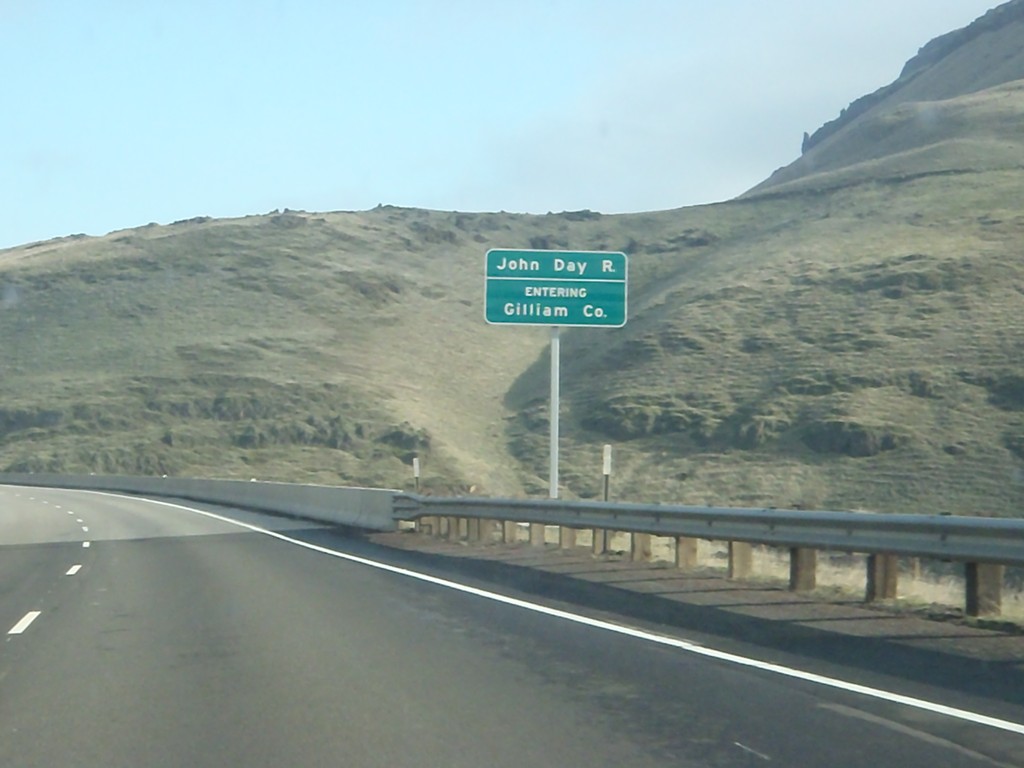
I-84 East - Entering Gilliam County
Entering Gilliam County on I-84 west, crossing the John Day River.
Taken 01-19-2011
Arlington
Sherman County
Oregon
United States