Signs Tagged With Bridge
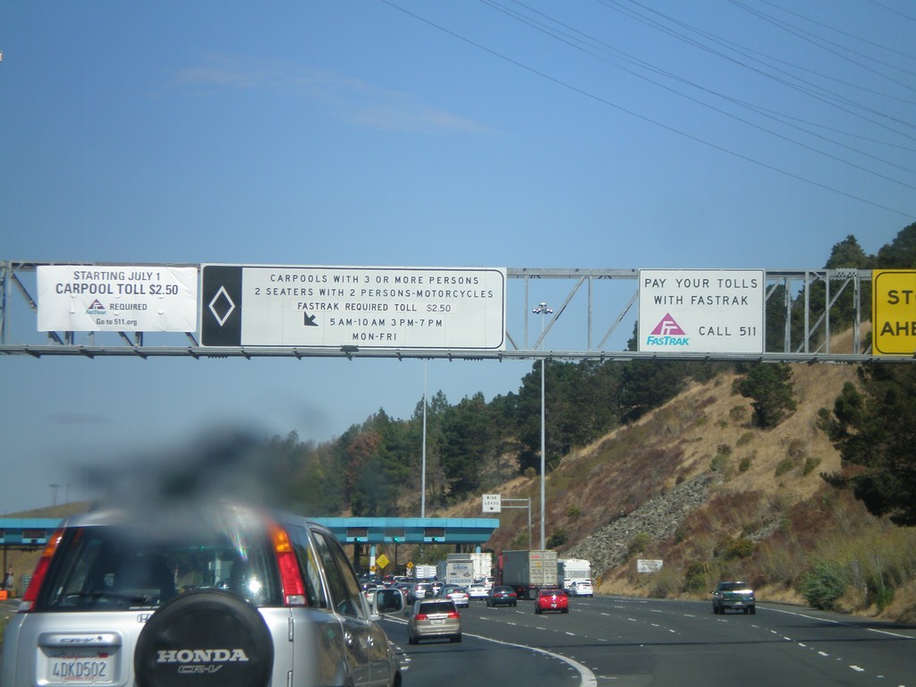
I-80 East - Carquinez Bridge Toll Plaza
Approaching the Carquinez Bridge Toll Plaza on I-80 east. When this photo was taken in Fall 2010, the auto toll was $5.00. The Carquinez Bridge crosses the Carquinez Straits, through which the Sacramento and San Joaquin Delta empty into, before reaching the San Pablo Bay.
Taken 10-01-2010
 Vallejo
Solano County
California
United States
Vallejo
Solano County
California
United States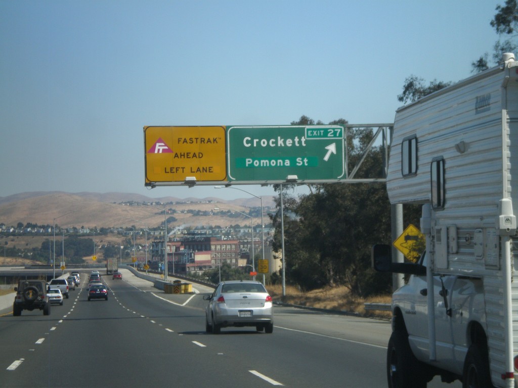
I-80 East - Exit 26
I-80 east at Exit 26 - Crockett/Pomona St. The Carqinuez Bridge bridge over the Carquinez Straits begins here. The eastbound direction over the bridge pays tolls. All Fastrak users, use the left lane. Fastrak is a transponder system used to pay tolls in California.
Taken 10-01-2010
Crockett
Contra Costa County
California
United States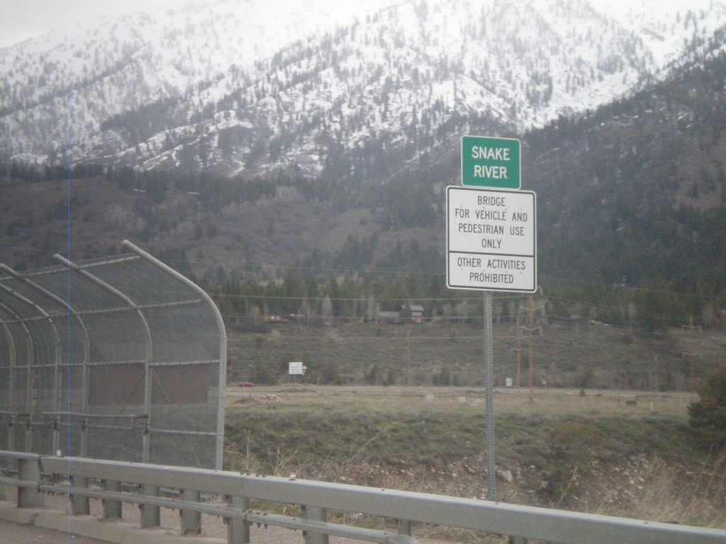
US-89 North - Snake River
Crossing the Snake River on US-89 north.
Taken 05-01-2010
 Alpine
Lincoln County
Wyoming
United States
Alpine
Lincoln County
Wyoming
United States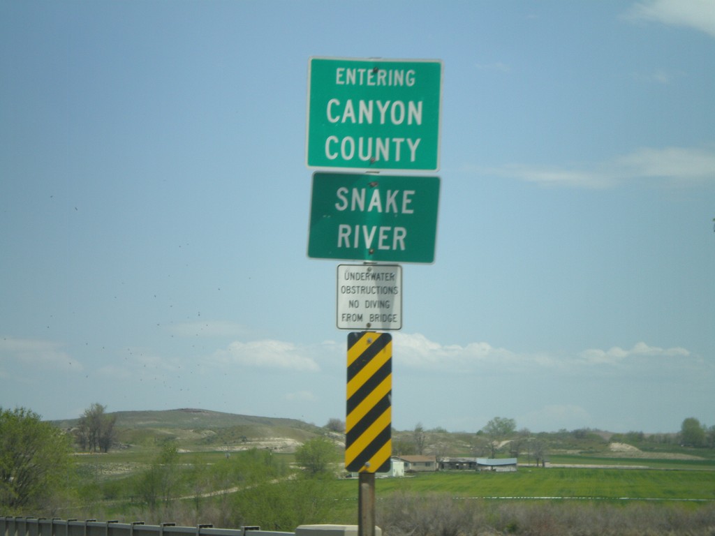
ID-55 North at Canyon County Line
ID-55 north crossing the Snake River and entering Canyon County.
Taken 04-20-2010
 Marsing
Owyhee County
Idaho
United States
Marsing
Owyhee County
Idaho
United States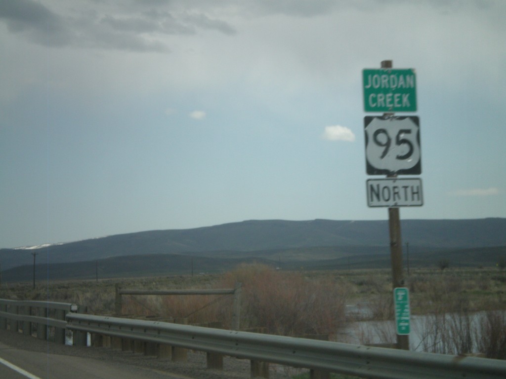
US-95 North - Jordan Creek
US-95 north crossing Jordan Creek. Jordan Creek is overflowing in this picture from spring runoff.
Taken 04-20-2010
 Jordan Valley
Malheur County
Oregon
United States
Jordan Valley
Malheur County
Oregon
United States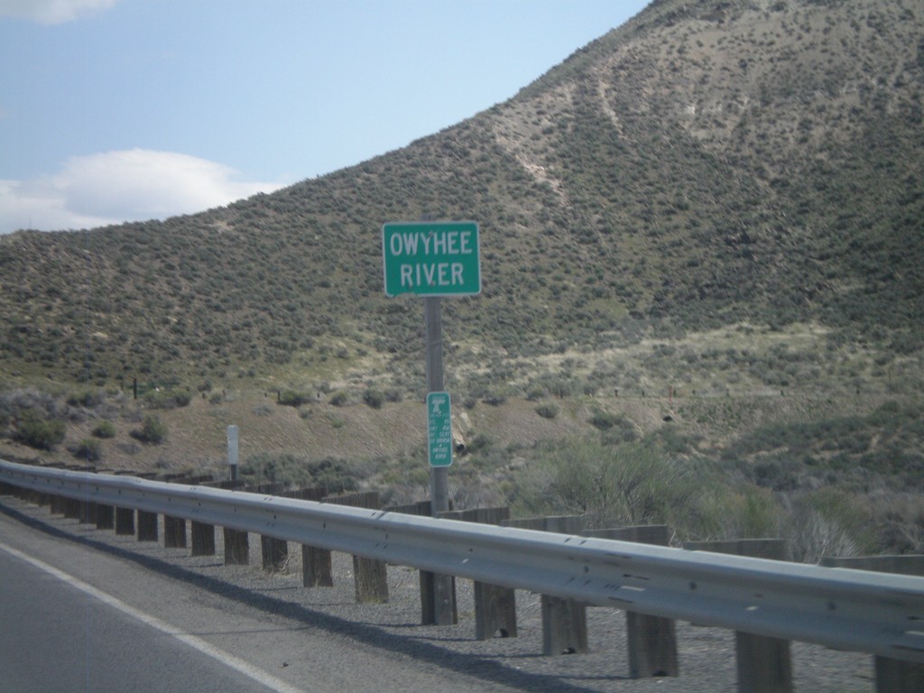
US-95 North - Owyhee River
US-95 north at the Owyhee River.
Taken 04-20-2010
Jordan Valley
Malheur County
Oregon
United States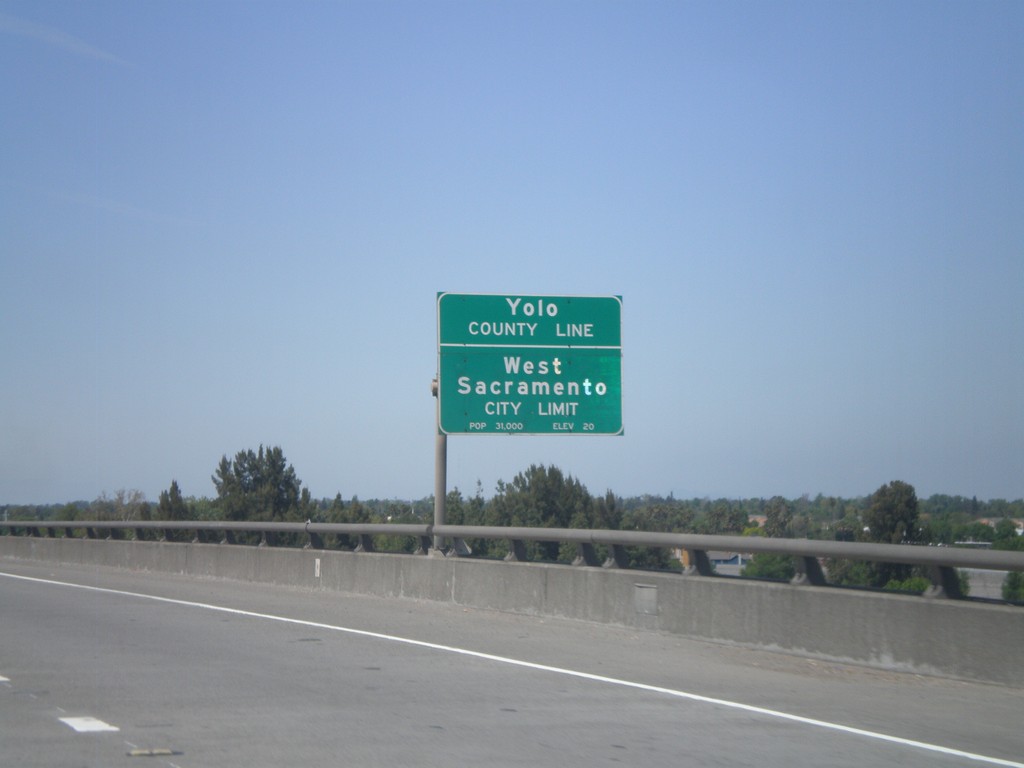
US-50/BL-80 West - Yolo-Sacramento County Line
US-50/BL-80 west at the Yolo-Sacramento County Line at the Sacramento River. Also entering the city of West Sacramento.
Taken 04-16-2010

 Sacramento
 County
California
United States
Sacramento
Sacramento County
California
United States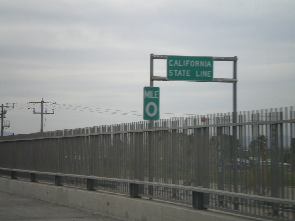
I-10 West - California State Line
California State Line on I-10 west crossing the Colorado River, at the Arizona-California Border.
Taken 03-22-2010
 Blythe
Riverside County
California
United States
Blythe
Riverside County
California
United States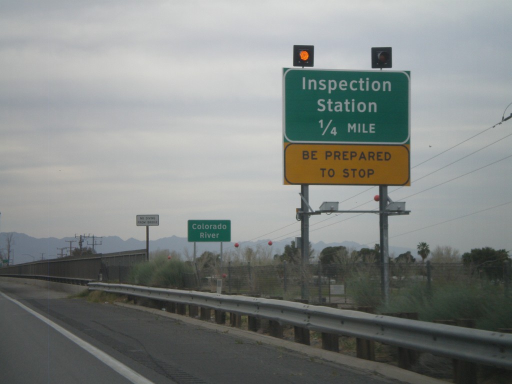
I-10 West - Approaching California Inspection Station
Approaching California Inspection Station and Colorado River on I-10 West/US-95 north.
Taken 03-22-2010
Ehrenberg
La Paz County
Arizona
United States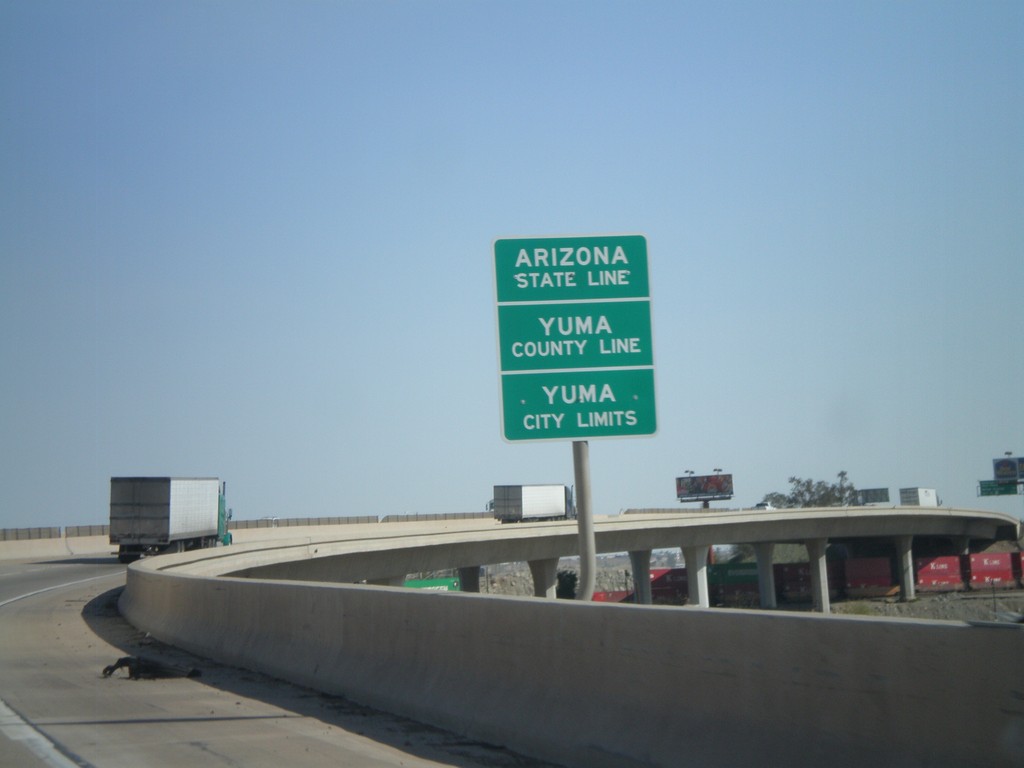
I-8 East - Arizona State Line
Arizona State Line, Yuma County Line, and Yuma City Limits on the Colorado River bridge at the Arizona-California State Line.
Taken 03-20-2010
 Yuma
Yuma County
Arizona
United States
Yuma
Yuma County
Arizona
United States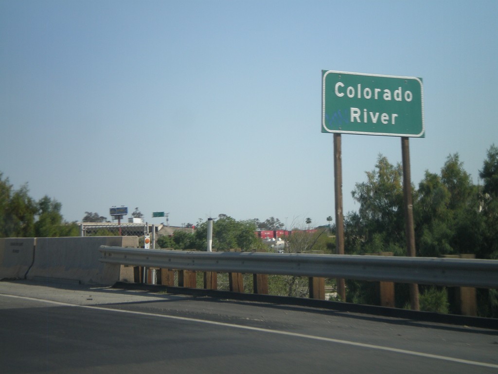
I-8 East - Colorado River
I-8 east at the Colorado River. The Colorado River marks the boundary between California and Arizona.
Taken 03-20-2010
Winterhaven
Imperial County
California
United States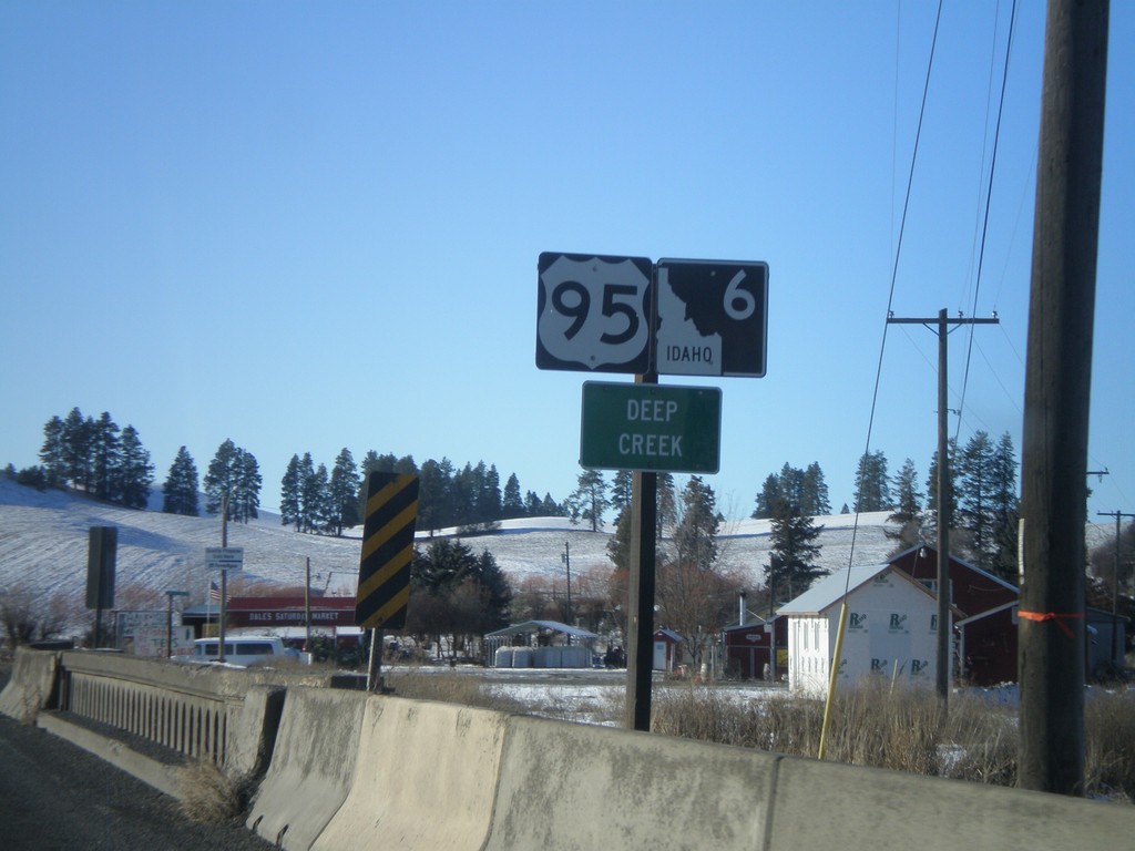
US-95 South/ID-6 West - Deep Creek
US-95/ID-6 at the Deep Creek bridge.
Taken 12-26-2009
 Potlatch
Latah County
Idaho
United States
Potlatch
Latah County
Idaho
United States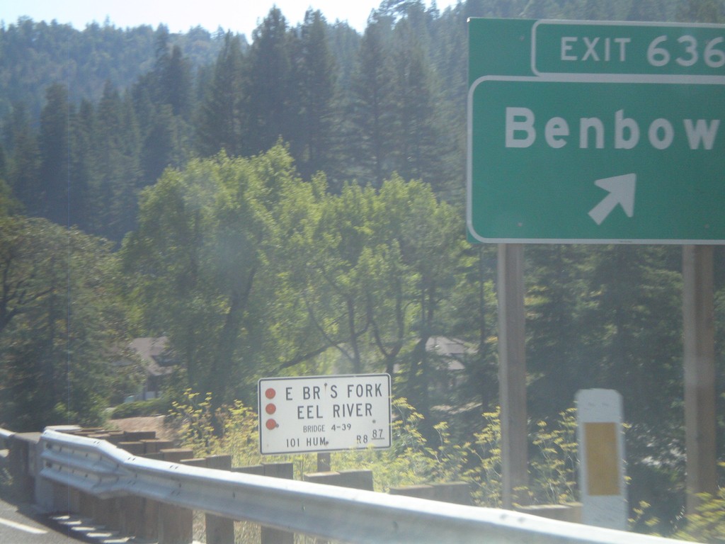
US-101 South - Exit 636
US-101 south at Exit 636 - Benbow
Taken 09-25-2009
 Garberville
Humboldt County
California
United States
Garberville
Humboldt County
California
United States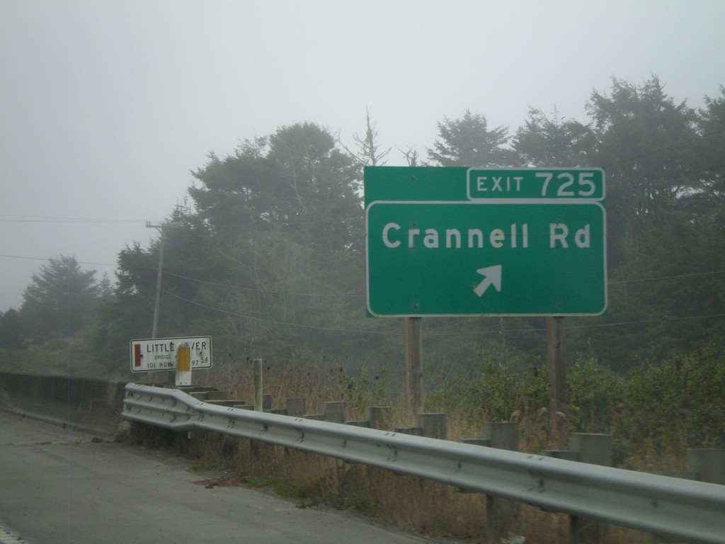
US-101 South - Exit 725
US-101 south Exit 725 - Crannell Road
Taken 09-25-2009
McKinleyville
Humboldt County
California
United States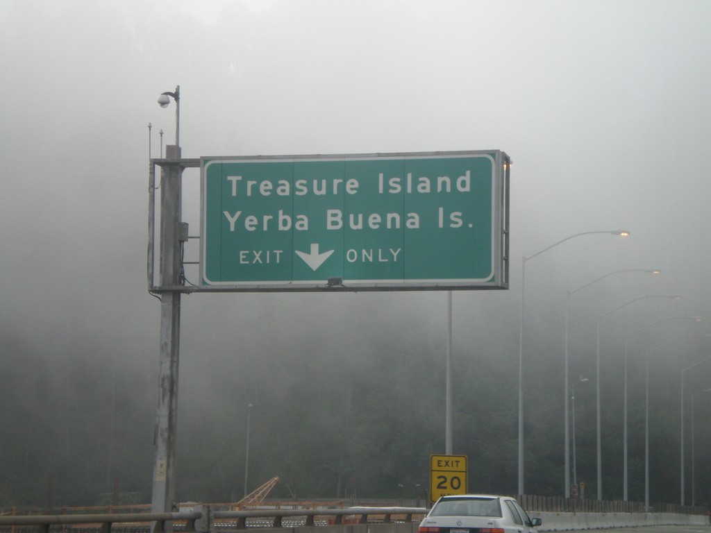
I-80 West - Exit 4
I-80 west at Exit 4 - Treasure Island/Yerba Buena Island. This is on Yerba Buena Island in the San Francsico Bay - halfway across the San Francisco-Oakland Bay Bridge.
Taken 12-31-2008
San Francisco
San Francisco County
California
United States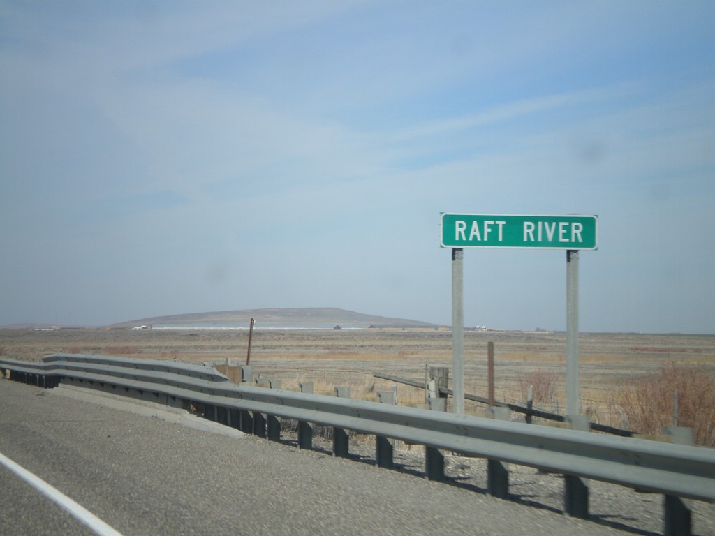
I-84 West - Raft River
I-84 West - Raft River bridge in Cassia County.
Taken 10-26-2008
 Declo
Cassia County
Idaho
United States
Declo
Cassia County
Idaho
United States
US-12 East - Idaho State Line
Errant US-12 shield displayed as a state route shield on the Interstate bridge over the Snake River on the Idaho border.
Taken 07-27-2008
 Clarkston
Asotin County
Washington
United States
Clarkston
Asotin County
Washington
United States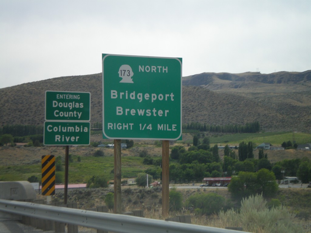
WA-17 South Approaching WA-173 North
WA-17 south approaching WA-173 North/Bridgeport/Brewster. Crossing the Columbia River into Douglas County.
Taken 07-26-2008

 Bridgeport
Okanogan County
Washington
United States
Bridgeport
Okanogan County
Washington
United States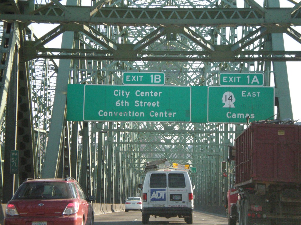
I-5 North - Exit 1A and Exit 1B (Washington)
I-5 north approaching Washington Exit 1A - WA-14 East/Camas and Exit 1B - City Center/6th St./Convention Center. Taken on Interstate Bridge over Columbia River.
Taken 07-24-2008
 Portland
Multnomah County
Oregon
United States
Portland
Multnomah County
Oregon
United States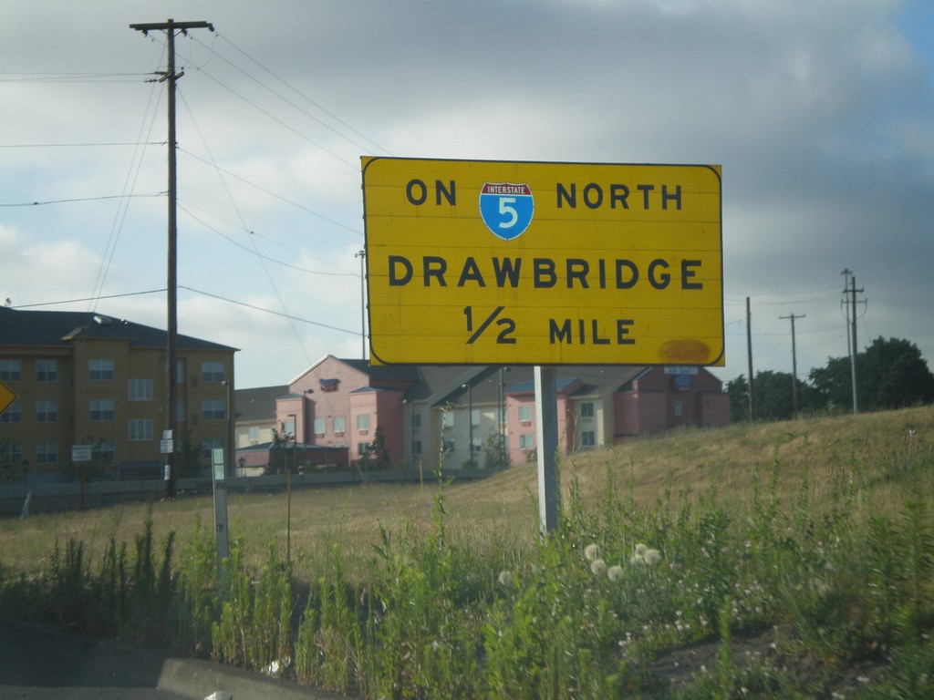
I-5 North Exit 307 Onramp - Drawbridge
Exit 307 onramp onto I-5 north. Warning sign for drawbridge on I-5 north over the Columbia River.
Taken 07-24-2008
Portland
Multnomah County
Oregon
United States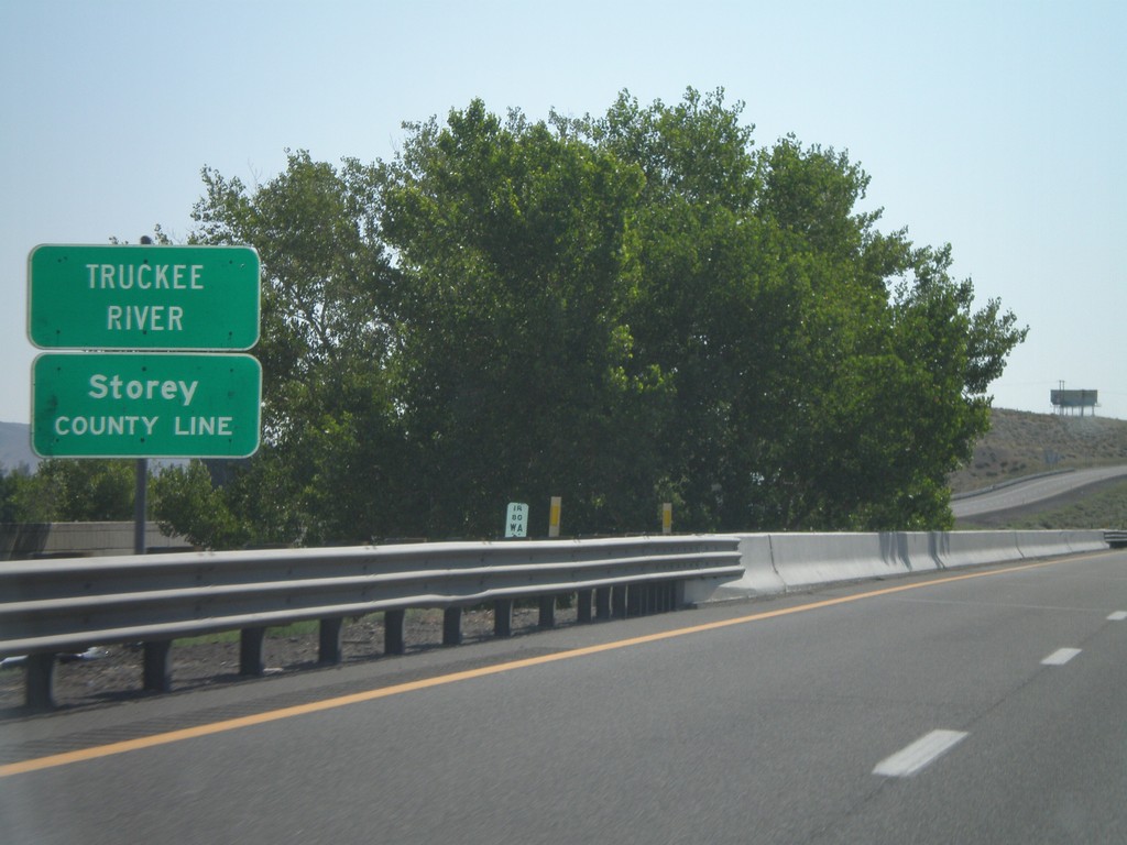
I-80 East - Storey County Line
I-80 east at Storey County Line and Truckee River.
Taken 07-07-2008
Wadsworth
Washoe County
Nevada
United States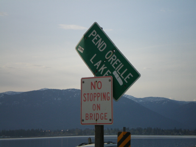
US-95 North - Pend Oreille Lake
Pend Oreille Lake on US-95 north.
Taken 05-06-2008
Sagle
Bonner County
Idaho
United States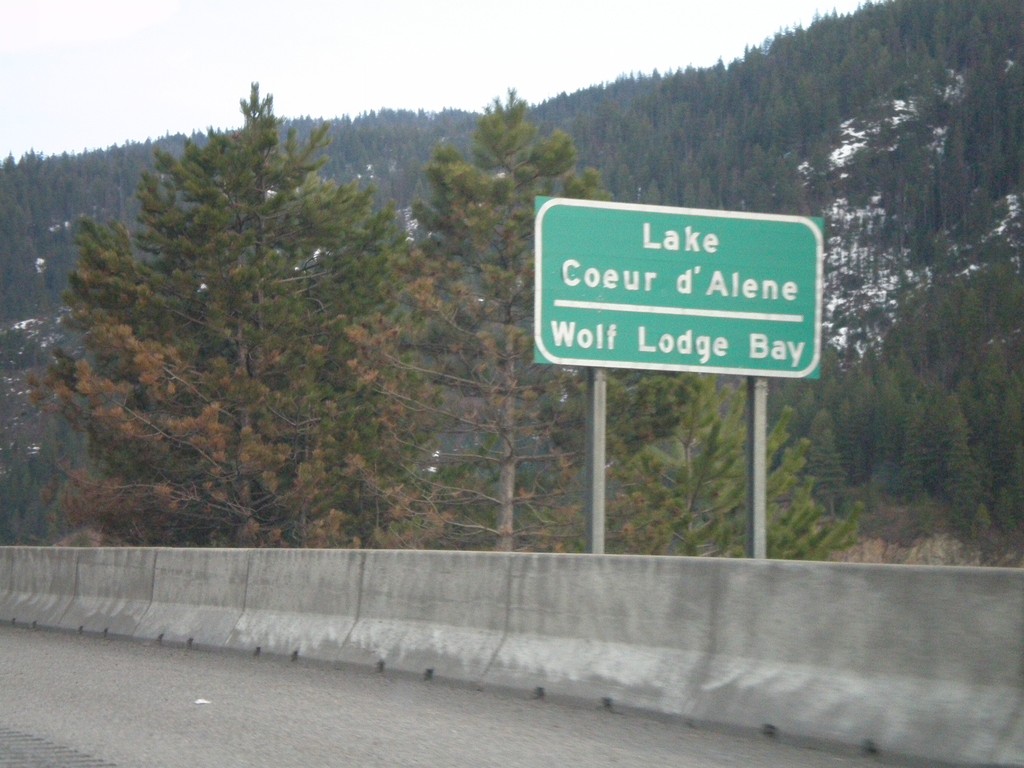
I-90 East - Lake Coeur d'Alene
I-90 east crossing Wolf Lodge Bay of Lake Coeur d’Alene.
Taken 04-13-2008
 Coeur d'Alene
Kootenai County
Idaho
United States
Coeur d'Alene
Kootenai County
Idaho
United States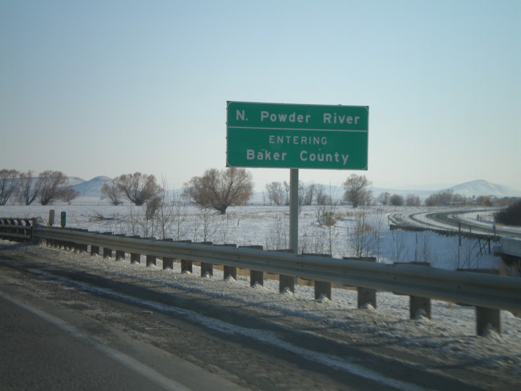
I-84 East - Entering Baker County
I-84 east at the North Powder River. Entering Baker County.
Taken 01-22-2008
North Powder
Union County
Oregon
United States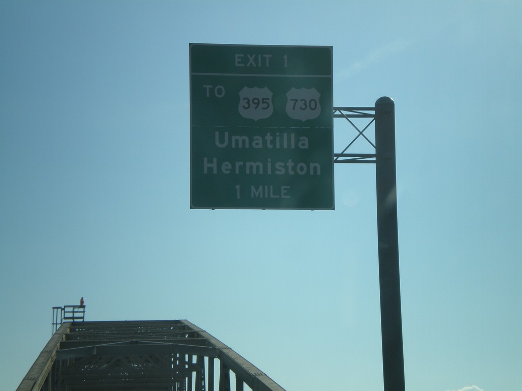
I-82 East - Exit 1 (Oregon)
I-82 east on the Columbia River bridge approaching Oregon Exit 1, To US-395/US-730/Hermiston/Umatilla.
Taken 01-22-2008


 Plymouth
Benton County
Washington
United States
Plymouth
Benton County
Washington
United States