Signs Tagged With Continental Divide
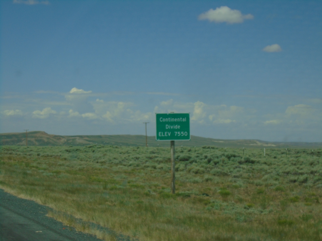
WY-28 West - Continental Divide
WY-28 West - Continental Divide (South Pass) - Elevation 7550 Feet.
Taken 07-04-2025
 Lander
Fremont County
Wyoming
United States
Lander
Fremont County
Wyoming
United States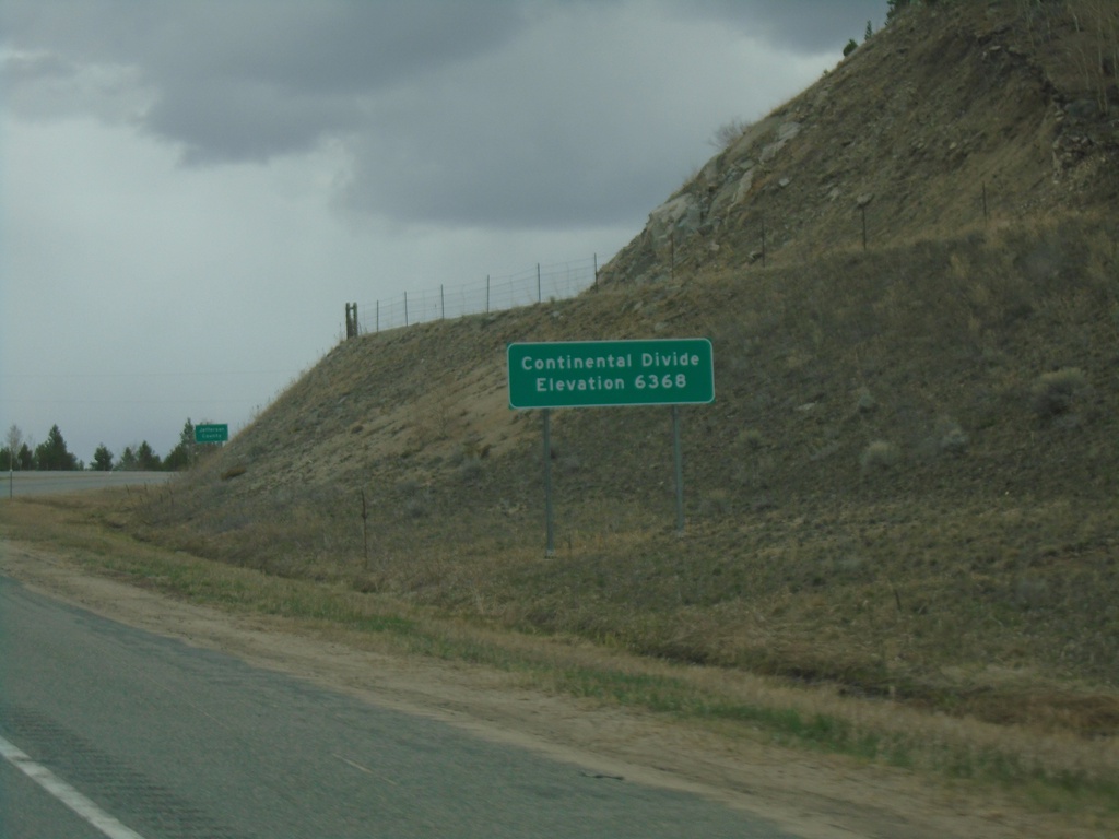
I-15 North - Elk Park Pass
I-15 north at Elk Park Pass (Continental Divide). Elevation 6368 Feet. This is also the county boundary between Silver Bow and Jefferson County. Water north of this point flows into the Gulf of Mexico.
Taken 05-11-2023
 Woodville
Jefferson County
Montana
United States
Woodville
Jefferson County
Montana
United States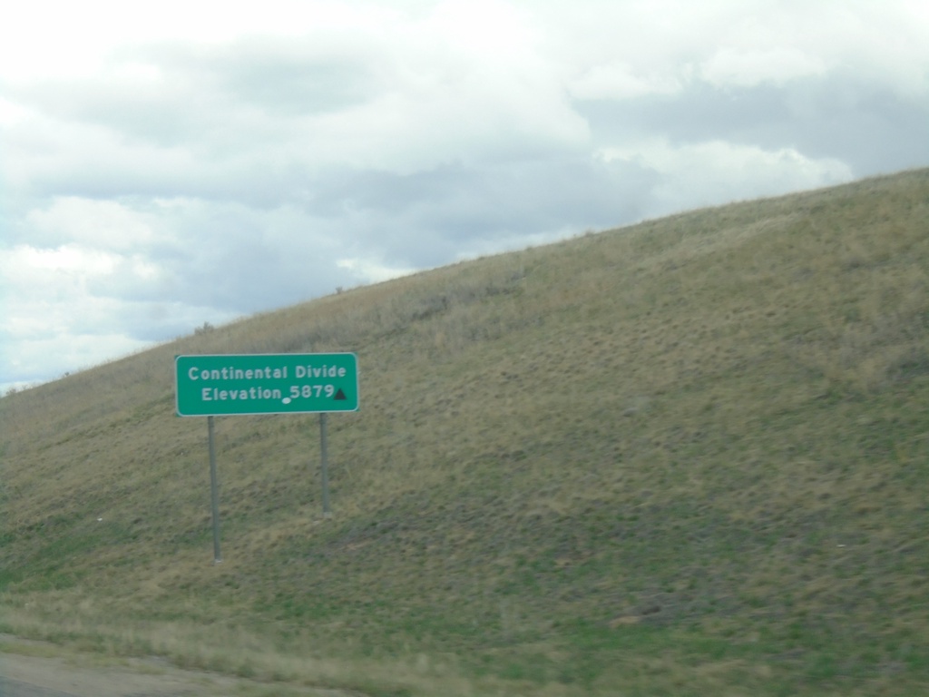
I-15 North - Continental Divide
I-15 North - Continental Divide - Elevation 5879. Waters north of this point flow into the Pacific Ocean, via the Columbia River.
Taken 05-11-2023
Butte
Silver Bow County
Montana
United States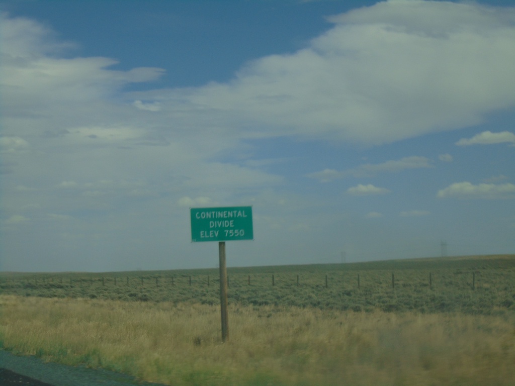
WY-28 East - Continental Divide
WY-28 East - Continental Divide (South Pass) - Elevation 7550 Feet.
Taken 08-13-2020
Lander
Fremont County
Wyoming
United States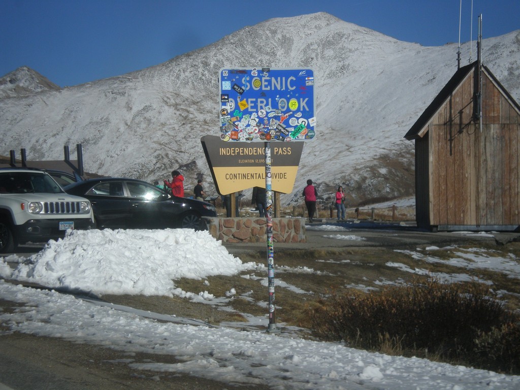
CO-82 East - Independence Pass
Independence Pass on CO-82 east. Independence Pass is 12,095 Feet and on the Continental Divide. Independence Pass is one of the highest mountain passes in Colorado on the state highway system. The only higher pass on the state highway system is US-34 in Rocky Mountain National Park. Independence Pass divides the Arkansas River watershed which flows into the Gulf of Mexico; and the Roaring Fork River which flows into the Colorado River and the Gulf of California.
Taken 10-07-2016
 Pitkin County
Colorado
United States
Pitkin County
Colorado
United States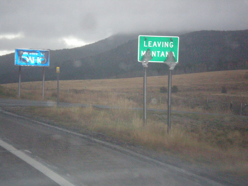
MT-87 South - Raynolds Pass
MT-87 at Raynolds Pass - Leaving Montana. The Idaho welcome sign is in the background. An early season snow storm had just passed through the area, leaving wet snow on all of the signs.
Taken 10-03-2015
 Madison County
Montana
United States
Madison County
Montana
United States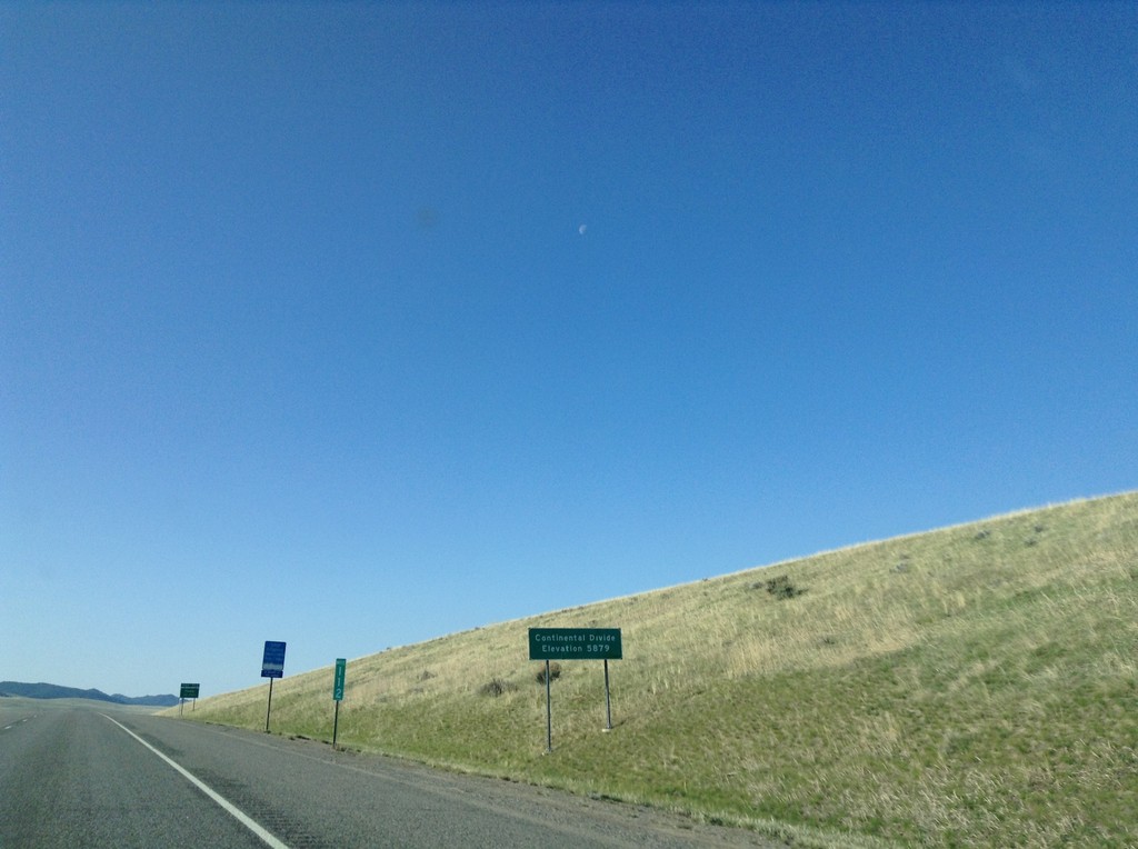
I-15 South - Deer Lodge Pass
I-15 south at Deer Lodge Pass - Elevation 5902 Feet. This is the Continental Divide. Southbound traffic enters the Missouri River drainage (via the Big Hole River, and Jefferson River). Northbound traffic enters the Columbia River drainage (via the Clark Fork, and Pend Oreille River). I-15 crosses the Continental Divide three times in Montana. Once at Monida Pass at the Idaho-Montana state line. Here at Deer Lodge Pass, and north of Butte and Elk Park Pass.
Taken 05-10-2015
Butte
Silver Bow County
Montana
United States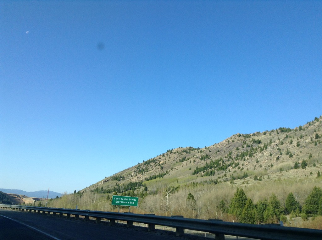
I-15 South - Elk Park Pass
I-15 south at Elk Park Pass (Continental Divide). Elevation 6368 Feet. This is also the county boundary between Silver Bow and Jefferson County.
Taken 05-10-2015
Woodville
Jefferson County
Montana
United States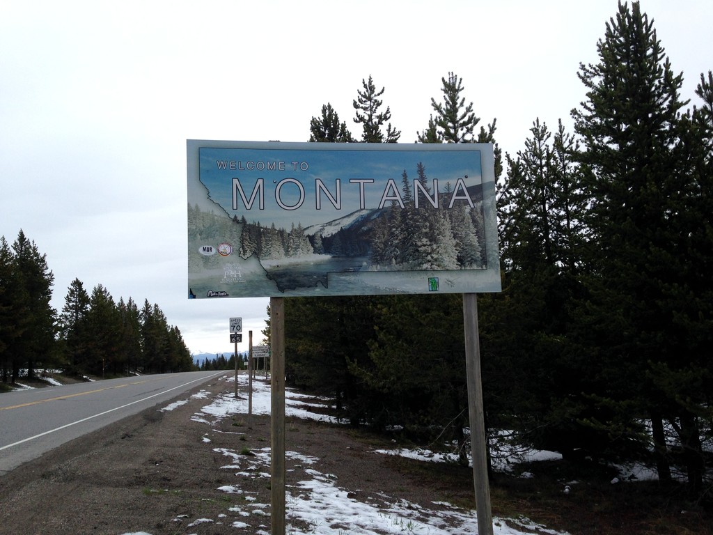
US-20 East - Welcome To Montana
Welcome to Montana on US-20 East at Targhee Pass. Targhee Pass is on the Continental Divide. This style of Montana welcome sign is fairly recent. Previous welcome signs were blue, and were cut-out in the state outline.
Taken 05-08-2015
 West Yellowstone
Gallatin County
Montana
United States
West Yellowstone
Gallatin County
Montana
United States
US-20 East - Welcome To Montana
Welcome to Montana on US-20 East at Targhee Pass. Targhee Pass is on the Continental Divide. West of here water flows into the Henrys Fork, the Snake River, and the Columbia River into the Pacific Ocean. East of here water flows into the Madison River, the Missouri River, the Mississippi River into the Gulf of Mexico.
Taken 05-08-2015
West Yellowstone
Gallatin County
Montana
United States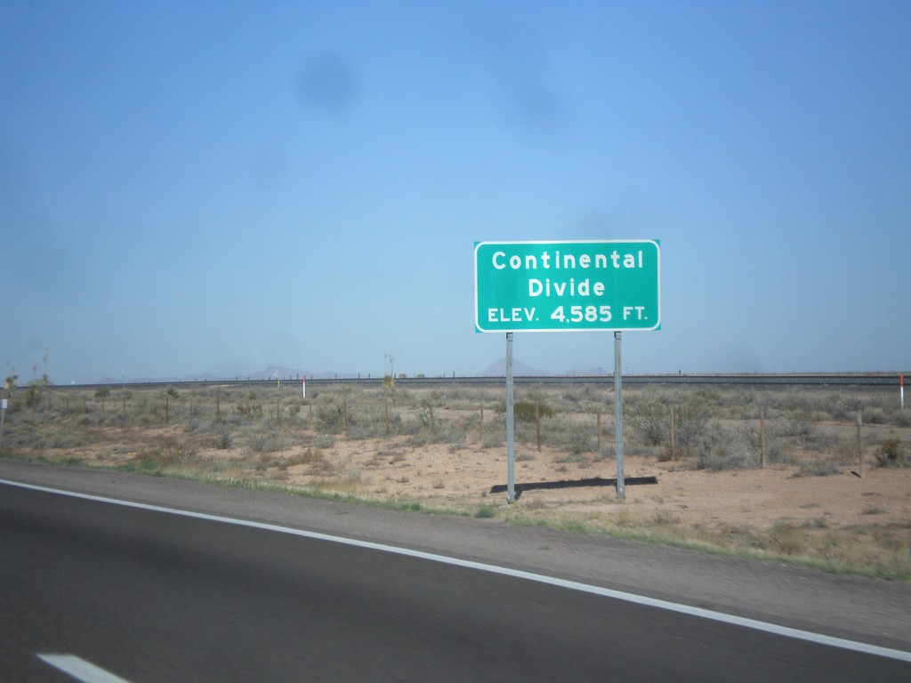
I-10 West - Continental Divide
Continental Divide on I-10 west - Elevation 4,585 Feet. This is the dividing line between the Gila River (flows to Colorado River) and the Mimbres River (flows into a closed basin).
Taken 04-14-2013
 Deming
Luna County
New Mexico
United States
Deming
Luna County
New Mexico
United States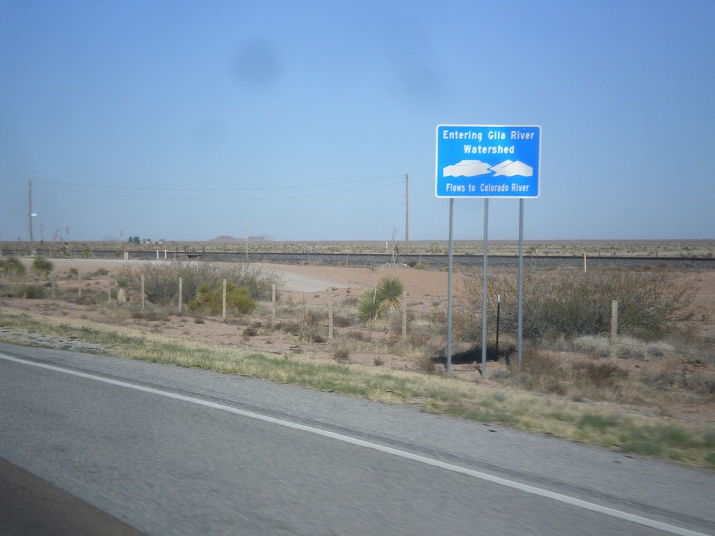
I-10 West - Entering Gila River Watershed
Entering Gila River Watershed on I-10 west. The Gila River flows to the Colorado River. This is the Continental Divide.
Taken 04-14-2013
Wilna
Grant County
New Mexico
United States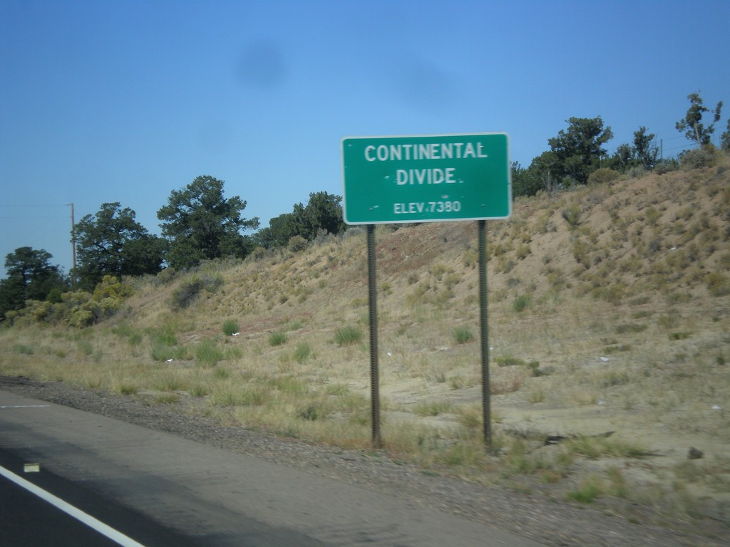
US-550 North - Continental Divide
Continental Divide - Elevation 7380 Feet on US-550 north. This is the divide between the San Juan River drainage and the Rio Grande drainage.
Taken 10-15-2012
 Cuba
Sandoval County
New Mexico
United States
Cuba
Sandoval County
New Mexico
United States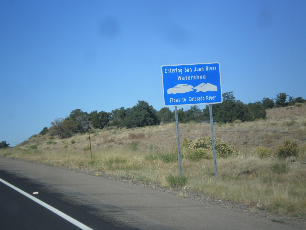
US-550 North - San Juan River Watershed
Entering the San Juan River watershed at the Continental Divide on US-550 north. The San Juan River flows into the Colorado River.
Taken 10-15-2012
Cuba
Sandoval County
New Mexico
United States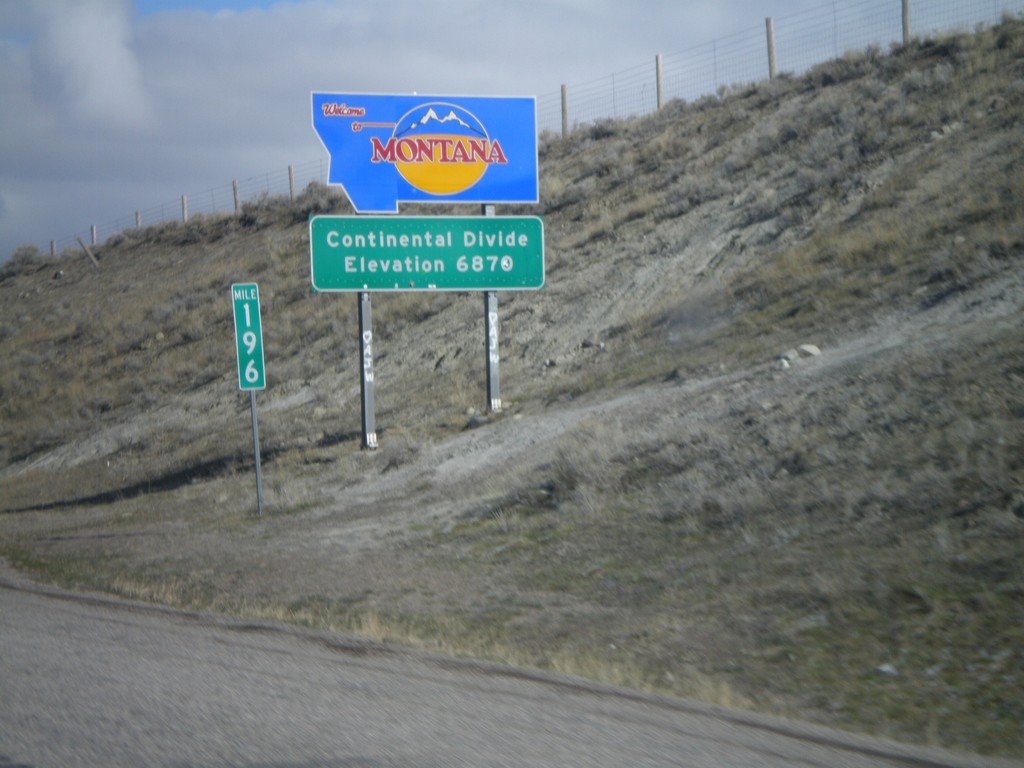
Welcome To Montana - I-15 North
Welcome to Montana on I-15 North at the Idaho-Montana state line on Monida Pass. Monida Pass is the Continental Divide.
Taken 05-02-2010
Humphrey
Clark County
Idaho
United States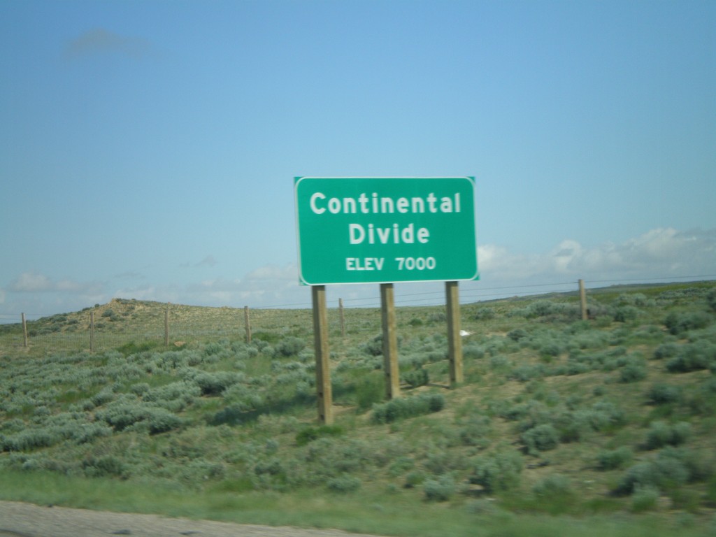
I-80 West - Continental Divide (East)
I-80 west at the eastern Continental Divide, 7000 Feet. I-80 west crosses the Great Divide Basin.
Taken 05-29-2007


 Rawlins
Carbon County
Wyoming
United States
Rawlins
Carbon County
Wyoming
United States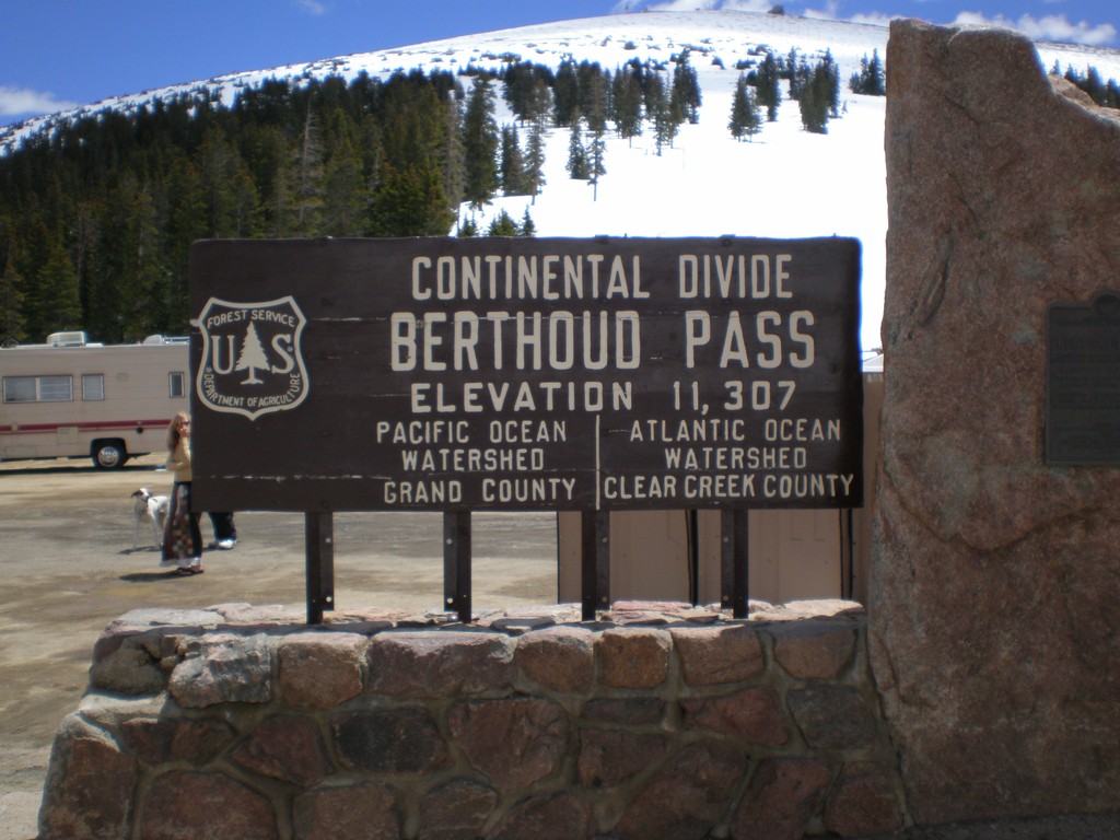
US-40 - Berthoud Pass
US-40 at Berthoud Pass. Continental Divide and Grand-Clear Creek County Line.
Taken 05-25-2007
 Winter Park
Grand County
Colorado
United States
Winter Park
Grand County
Colorado
United States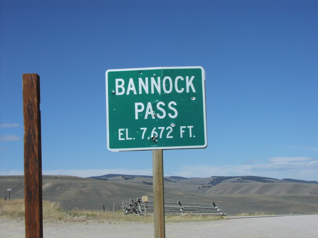
ID-29 - Bannock Pass - ID/MT Border
Bannock Pass at end of ID-29 on ID-MT Border
Taken 09-01-2004
 Leadore
Lemhi County
Idaho
United States
Leadore
Lemhi County
Idaho
United States