Signs Tagged With Diagram
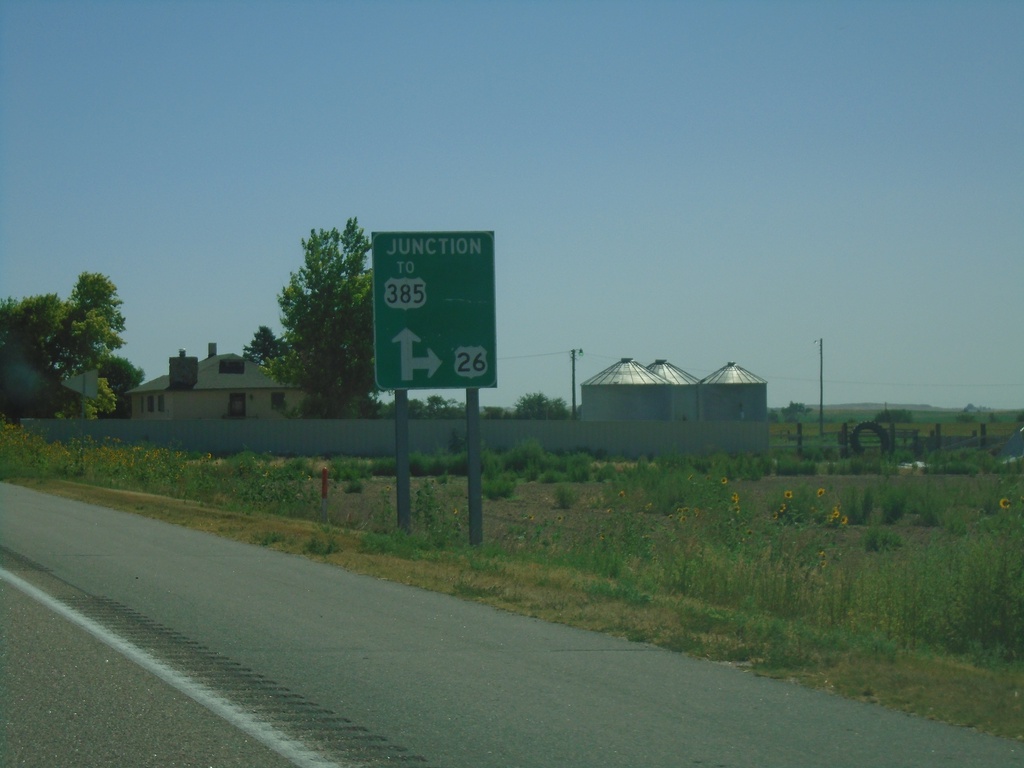
US-26 East Approaching NE-62A Link/To US-385
US-26 East Approaching NE-62A Link/To US-385. Turn right to continue east on US-26.
Taken 08-14-2020


 Bayard
Morrill County
Nebraska
United States
Bayard
Morrill County
Nebraska
United States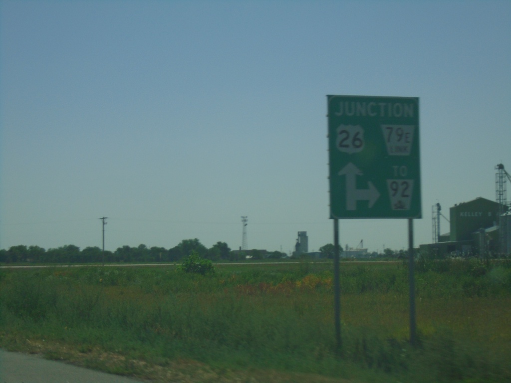
US-26 East Approaching NE-79E Link South to NE-92
US-26 East Approaching NE-79E Link South to NE-92 in Scotts Bluff County.
Taken 08-14-2020

 Minatare
Scotts Bluff County
Nebraska
United States
Minatare
Scotts Bluff County
Nebraska
United States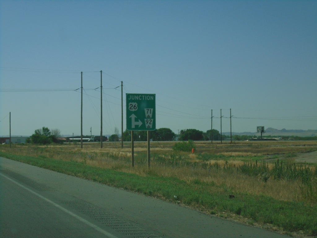
US-26/NE-92 East/NE-71 South approaching NE-92/NE-71 Junction
US-26/NE-92 East/NE-71 South approaching NE-92/NE-71 Junction in Scotts Bluff County.
Taken 08-14-2020
 Scottsbluff
Scotts Bluff County
Nebraska
United States
Scottsbluff
Scotts Bluff County
Nebraska
United States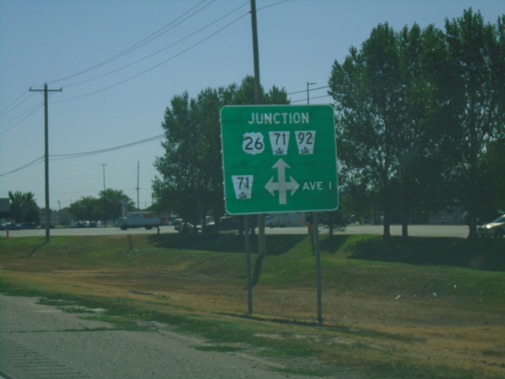
US-26/NE-92 East Approaching NE-71 North
US-26/NE-92 East approaching NE-71 North and Ave I. NE-71 South joins US-26/NE-92 east through Scottsbluff.
Taken 08-14-2020
Scottsbluff
Scotts Bluff County
Nebraska
United States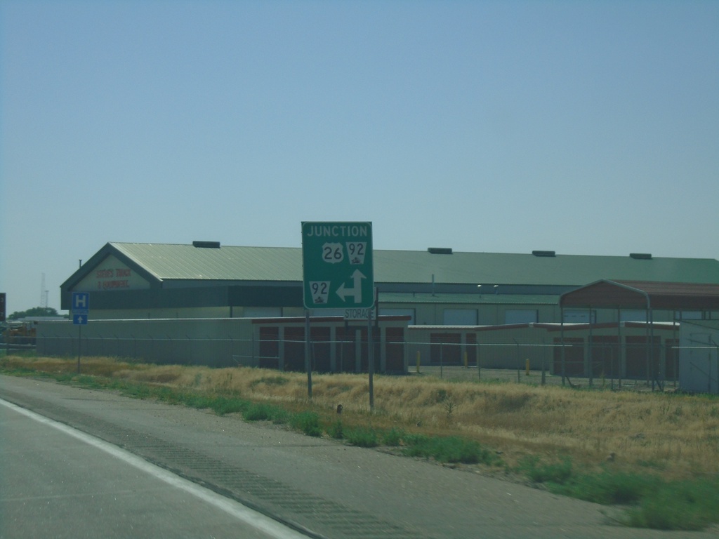
US-26 East Approaching NE-92
US-26 East approaching NE-92 in Scotts Bluff County. NE-92 east joins US-26 eastbound.
Taken 08-14-2020
Scottsbluff
Scotts Bluff County
Nebraska
United States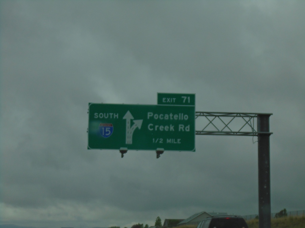
I-15 South - Exit 71
I-15 south approaching Exit 71 - Pocatello Creek Road.
Taken 05-22-2020

 Pocatello
Bannock County
Idaho
United States
Pocatello
Bannock County
Idaho
United States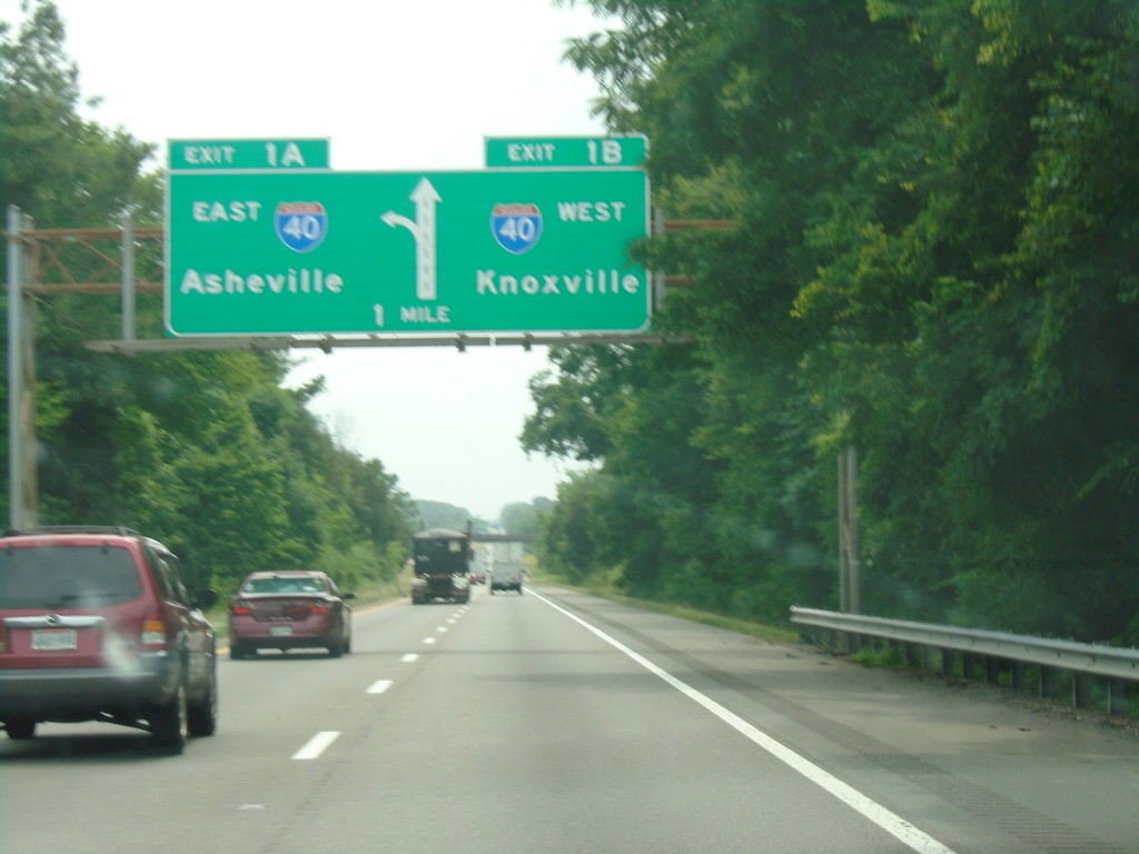
I-81 South - Exits 1A and 1B
I-81 south approaching Exit 1B - I-40 West/Knoxville. Approaching Exit 1A - I-40 East/Asheville (NC). This is the southern end of I-81.
Taken 06-24-2019

 Dandridge
Jefferson County
Tennessee
United States
Dandridge
Jefferson County
Tennessee
United States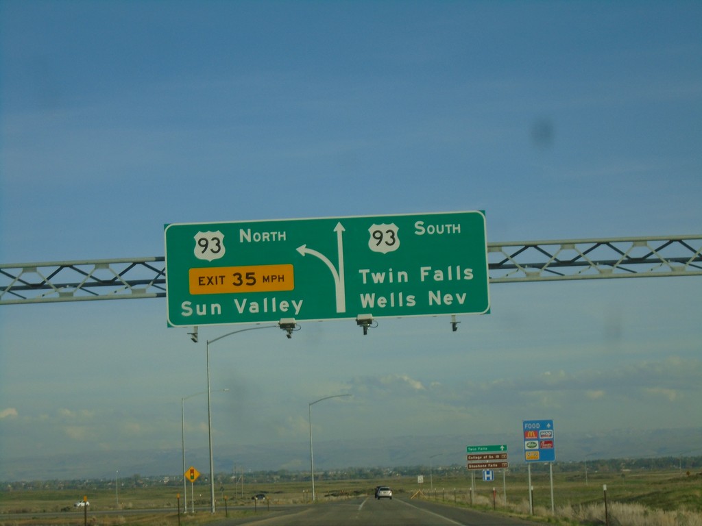
I-84 East at Exit 173 Offramp
I-84 east - Exit 173 offramp. Use right lane for US-93 south to Twin Falls and Wells, Nev. Use left lane for US-93 north to Sun Valley.
Taken 04-25-2019

 Twin Falls
 County
Idaho
United States
Twin Falls
Twin Falls County
Idaho
United States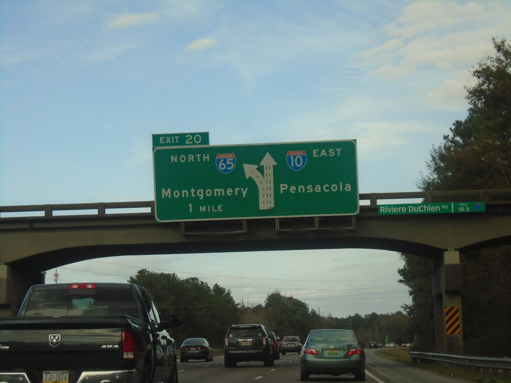
I-10 East Approaching Exit 20
I-10 East Approaching Exit 20 - I-65 North/Montgomery. Continue east on I-10 for Pensacola (Florida).
Taken 12-23-2018

 Mobile
 County
Alabama
United States
Mobile
Mobile County
Alabama
United States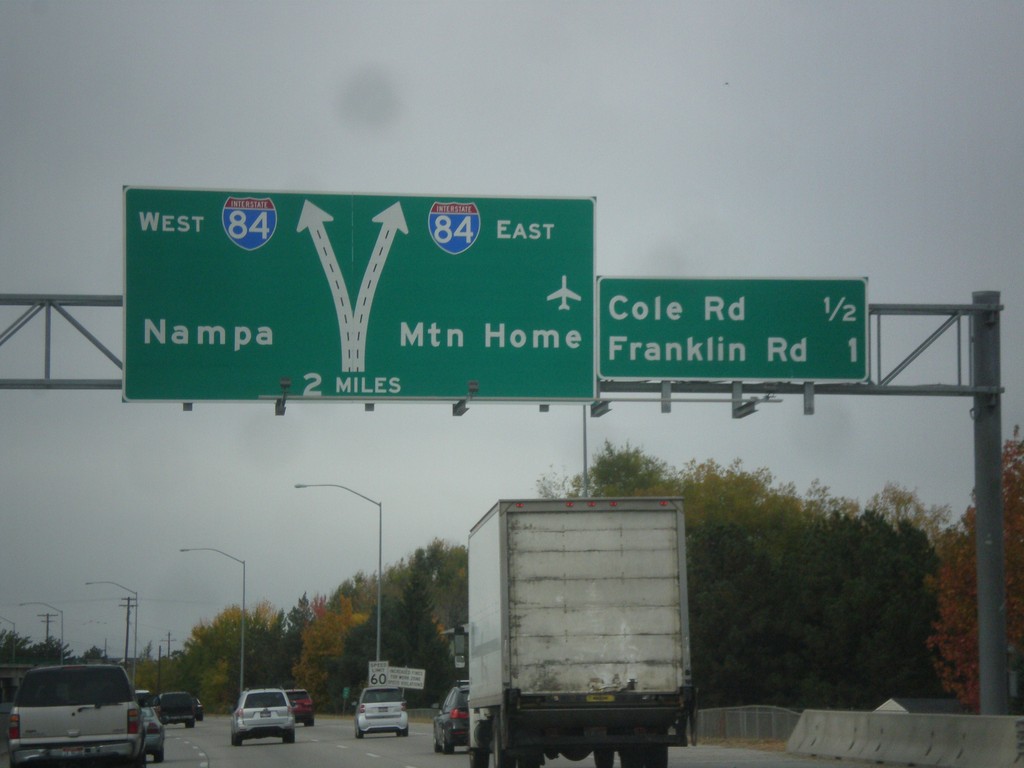
I-184 West Approaching I-84
I-184 west approaching I-84 to Nampa and Mountain Home. Also approaching Cole Road and Franklin Road interchanges. I-184 west ends at I-84.
Taken 10-21-2017

 Boise
Ada County
Idaho
United States
Boise
Ada County
Idaho
United States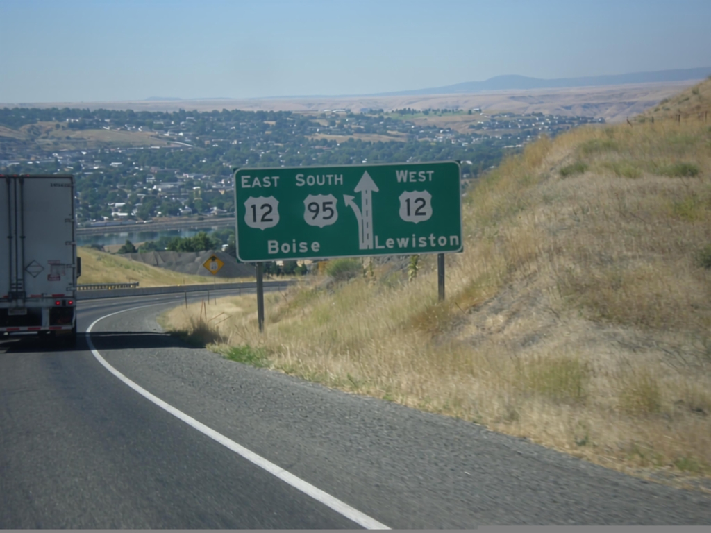
US-95 South Approaching US-12
US-95 south approaching US-12. Use right lane for US-12 west to Lewiston; left lane for US-95 South/US-12 East to Boise.
Taken 07-30-2017

 Lewiston
Nez Perce County
Idaho
United States
Lewiston
Nez Perce County
Idaho
United States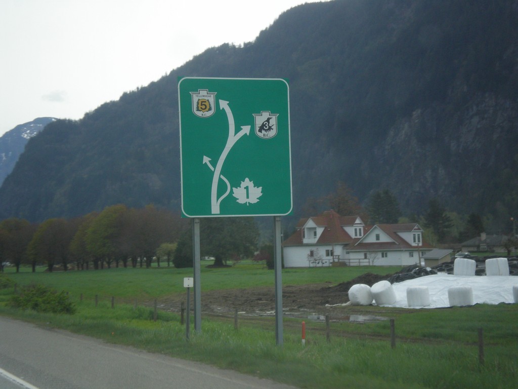
TC-1 East - Route Diagram
TC-1 East - Route Diagram showing BC-5 (Coquihalla Highway), BC-3 (Crowsnest Highway) and TC-1 (Trans-Canada Highway). TC-1 leaves the freeway at Hope.
Taken 04-29-2017


 Hope
Fraser Valley
British Columbia
Canada
Hope
Fraser Valley
British Columbia
Canada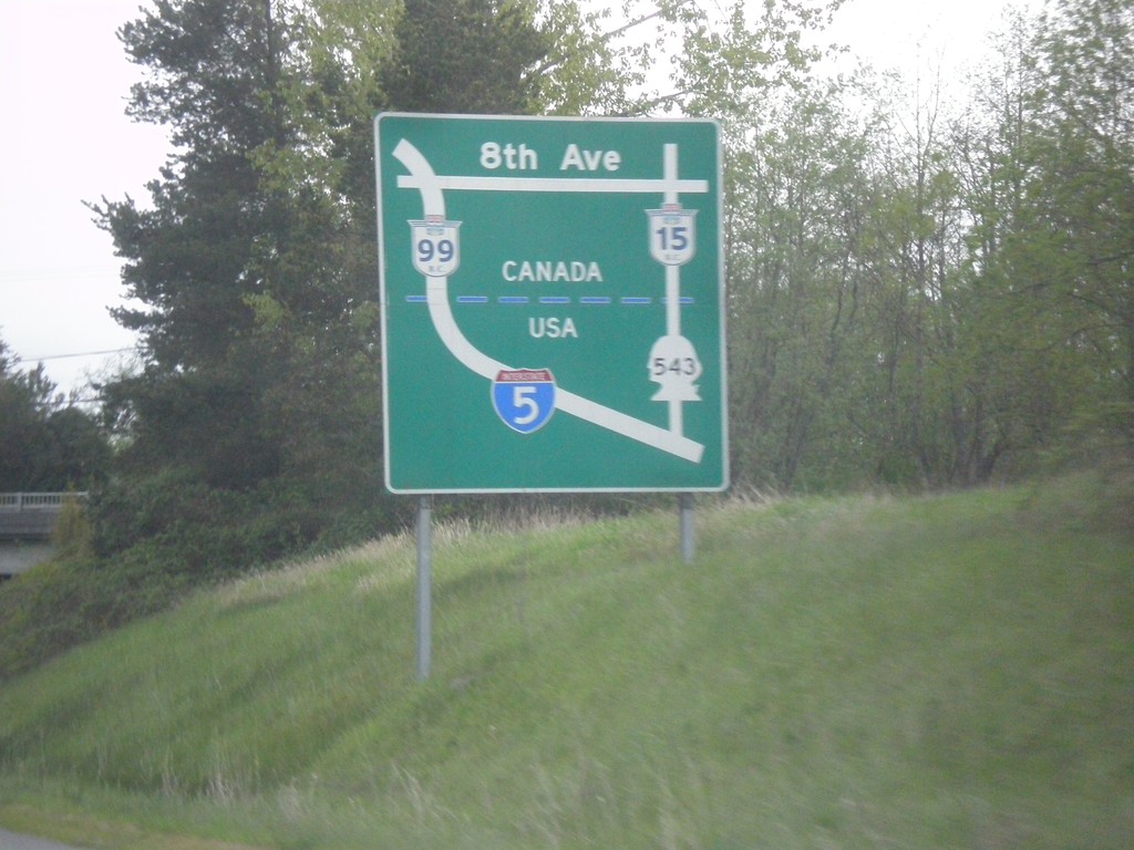
I-5 North - Border Crossing Map
Border Crossing map on I-5 north approaching WA-543.
Taken 04-29-2017

 Blaine
Whatcom County
Washington
United States
Blaine
Whatcom County
Washington
United States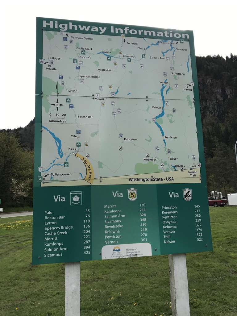
Hunter Creek Rest Area - Highway Information
Route map for the adjacent area of British Columbia, and distances to major destinations. Three routes split off into the interior of British Columbia at Hope just east of here: BC-5 to Coquihalla Pass, TC-1 through the Frasier River Canyon, and BC-3 over Allison Pass.
Taken 04-29-2017
Hope
Fraser Valley
British Columbia
Canada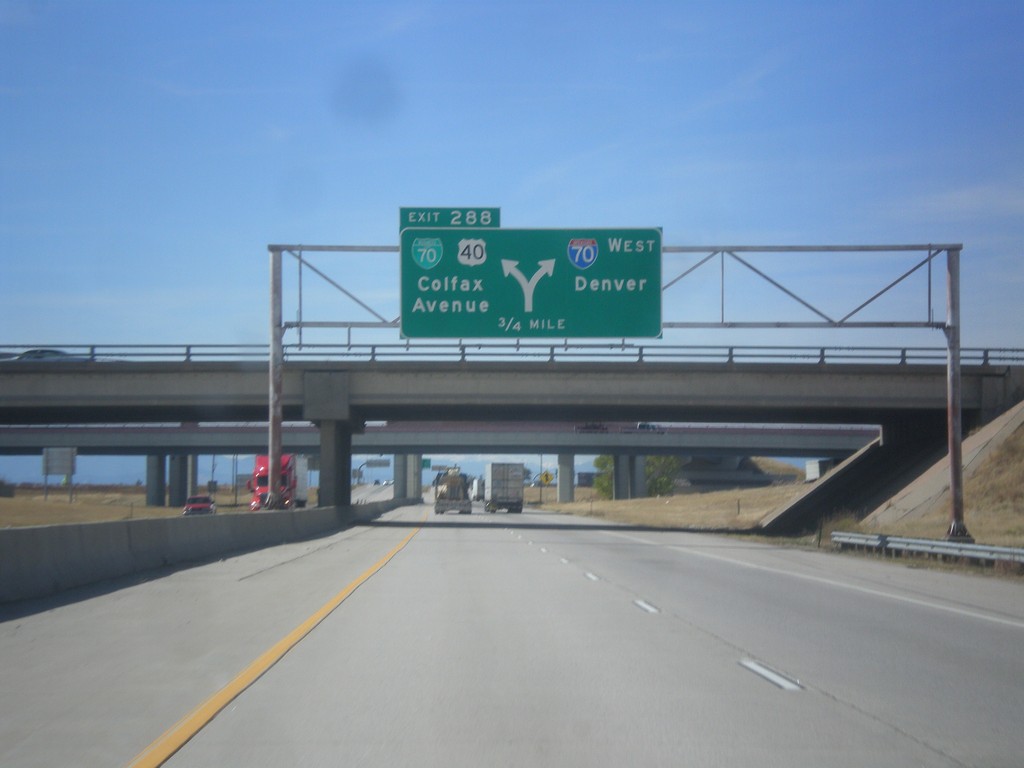
I-70 West - Exit 288
I-70 west approaching Exit 288 - BL-70/US-40/Colfax Ave. Exit 288 is a left exit; merge right to continue west on I-70 to Denver. US-40 leaves I-70 westbound here, and follows Colfax Ave. through Denver. US-40 rejoins I-70 near Golden. This is the eastern end of the Denver business loop.
Taken 10-08-2016


 Adams County
Colorado
United States
Adams County
Colorado
United States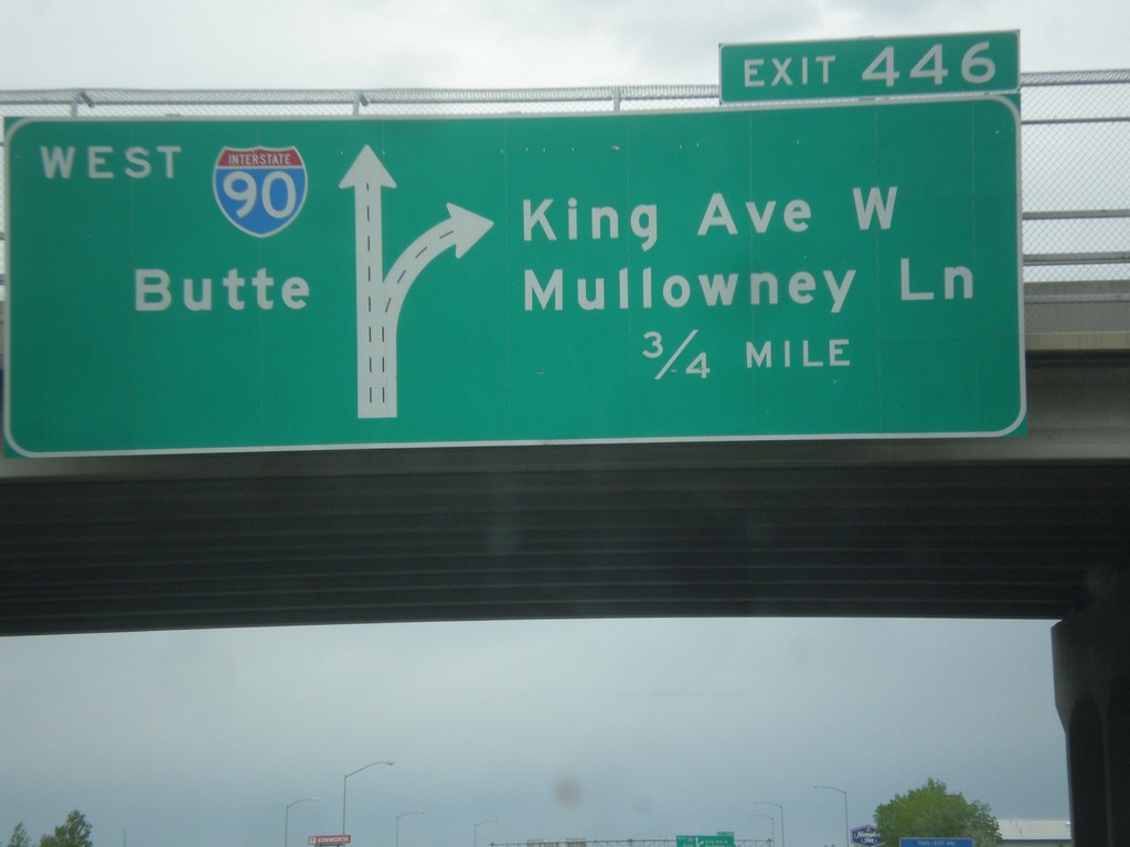
I-90 West - Exit 446
I-90 west approaching Exit 446 - King Ave W./Mullowney Lane. I-90 continues west towards Butte. This is the western end of the Billings business loop.
Taken 05-15-2016


 Billings
Yellowstone County
Montana
United States
Billings
Yellowstone County
Montana
United States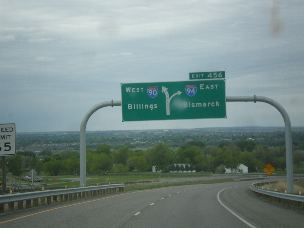
I-90 West - Exit 456
I-90 west approaching Exit 456 - I-94 East/Bismarck (North Dakota).
Taken 05-15-2016

 Billings
Yellowstone County
Montana
United States
Billings
Yellowstone County
Montana
United States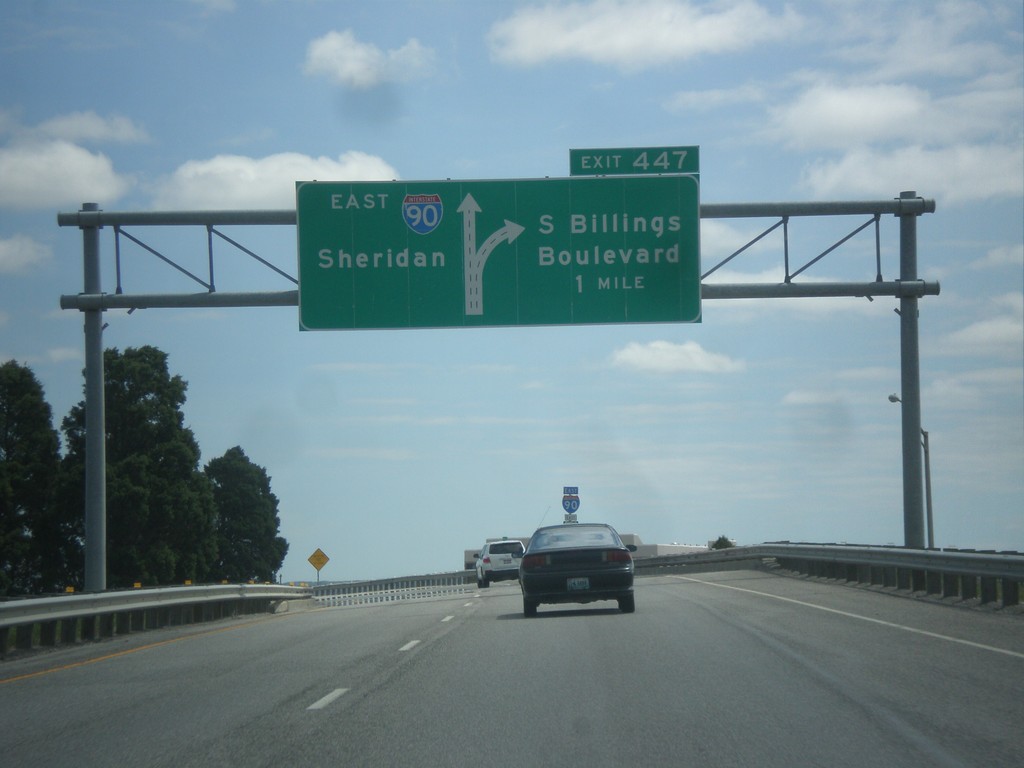
I-90 East - Exit 447
I-90 east approaching Exit 447 - S. Billings Blvd. Continue east on I-90 for Sheridan (Wyoming).
Taken 05-14-2016
Billings
Yellowstone County
Montana
United States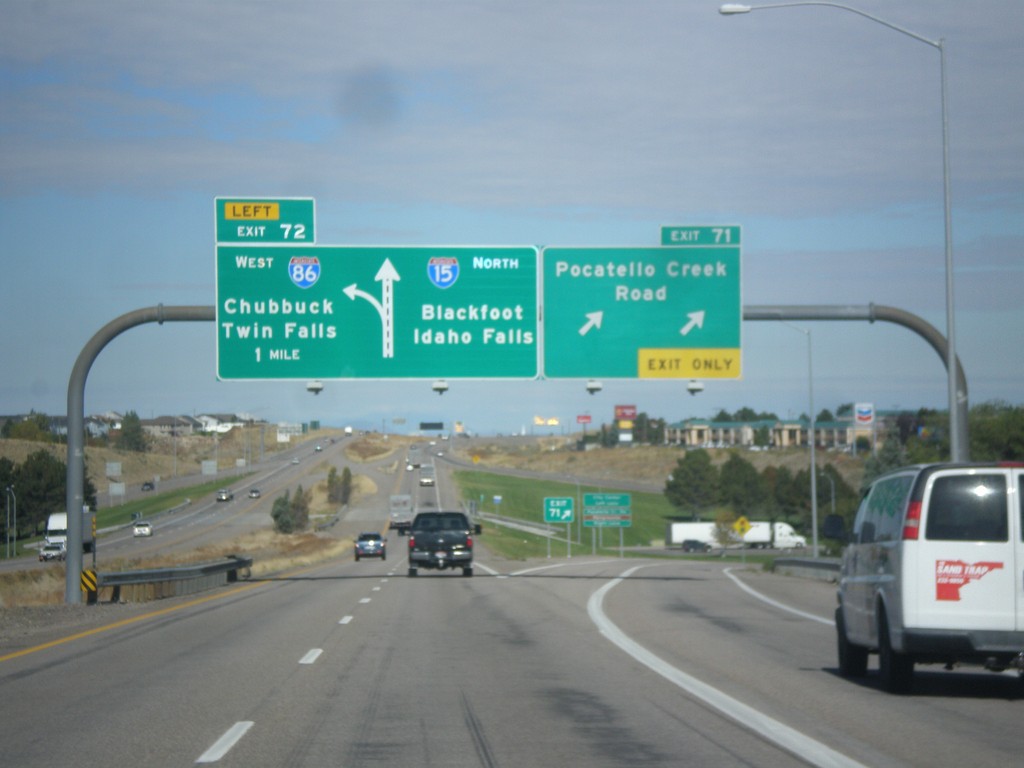
I-15 North - Exits 71 and 72
I-15 north at Exit 71 - Pocatello Creek Road. Approaching Exit 72 - I-86 West/Chubbuck/Twin Falls. Continue north on I-15 for Idaho Falls and Blackfoot.
Taken 10-04-2015
Pocatello
Bannock County
Idaho
United States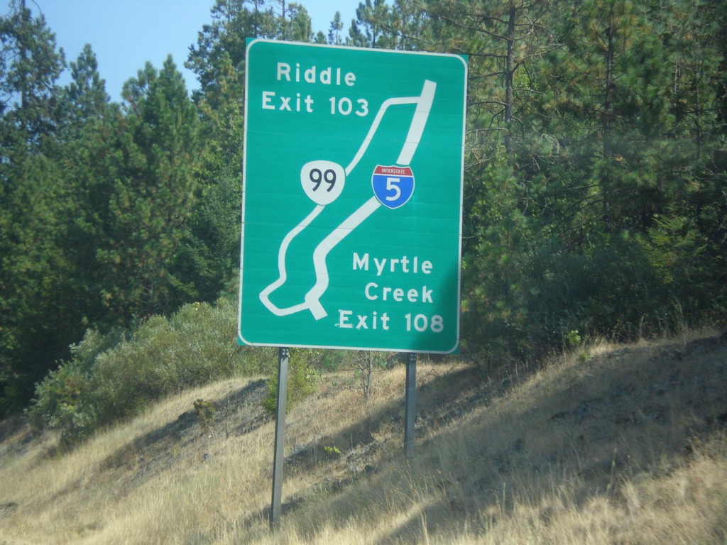
I-5 South - Exit 109 and 103 Route Diagram
Route Diagram showing OR-99 access to I-5 for Myrtle Creek and Riddle.
Taken 08-17-2015
 Myrtle Creek
Douglas County
Oregon
United States
Myrtle Creek
Douglas County
Oregon
United States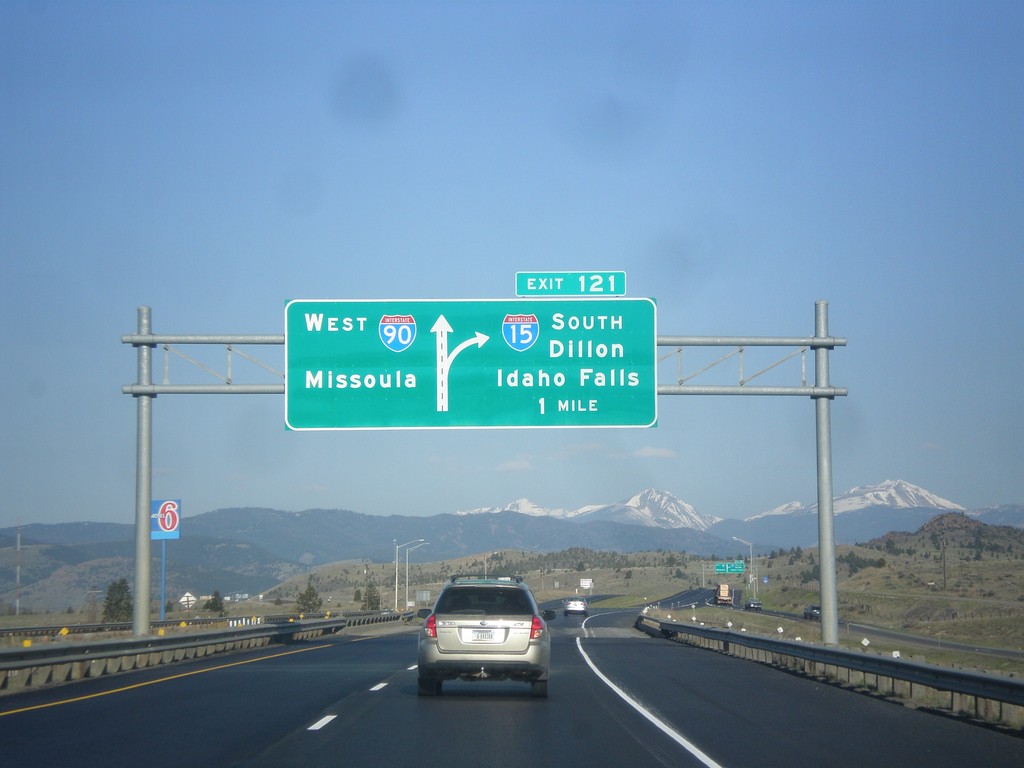
I-15 South/I-90 East - Exit 121
I-15 South/I-90 East approaching Exit 121 - I-15 South/Dillon/Idaho Falls. Continue west on I-90 for Missoula.
Taken 05-10-2015
Butte
Silver Bow County
Montana
United States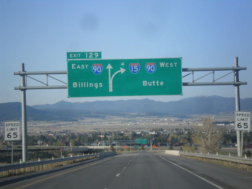
I-15 South - Exit 129
I-15 south approaching Exit 129 - I-90 East/Billings. Continue south on I-15/I-90 West to Butte. I-15 joins I-90 through Butte.
Taken 05-10-2015
Butte
Silver Bow County
Montana
United States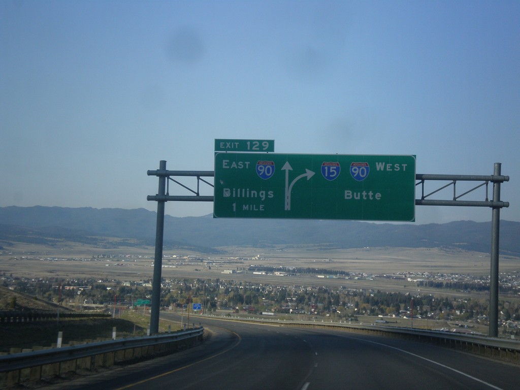
I-15 South - Exit 129
I-15 south approaching Exit 129 - I-90 East/Billings. I-15 South joins I-90 West to Butte.
Taken 05-10-2015
Butte
Silver Bow County
Montana
United States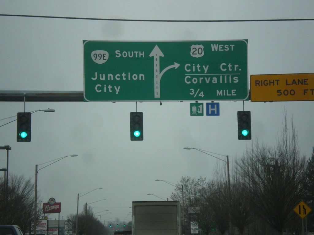
US-20 West/OR-99E South at Geary Blvd.
US-20 West/OR-99E South (Pacific Blvd. SE) at Geary Blvd. Continue south on Pacific Blvd. SE for OR-99E/Junction City. Approaching ramp for US-20 West to City Center (Albany) and Corvallis.
Taken 02-13-2015

 Albany
Linn County
Oregon
United States
Albany
Linn County
Oregon
United States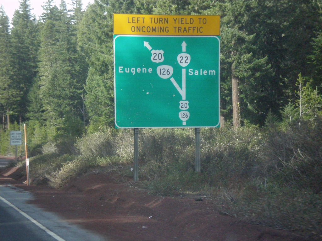
Diagram of US-20/OR-126/OR-22 Junction - US-20/OR-126 West
Map diagram of junction at US-20/OR-126/OR-22 junction on US-20/OR-126 West. Continue straight for OR-22 west to Salem; merge left to continue west on US-20/OR-126 West to Eugene.
Taken 02-13-2015

 Santiam Junction
Linn County
Oregon
United States
Santiam Junction
Linn County
Oregon
United States