Signs Tagged With Diagram
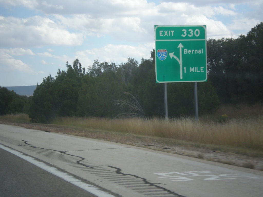
I-25 North - Exit 330
I-25 North approaching Exit 330 - Bernal.
Taken 10-10-2013

 Serafina
San Miguel County
New Mexico
United States
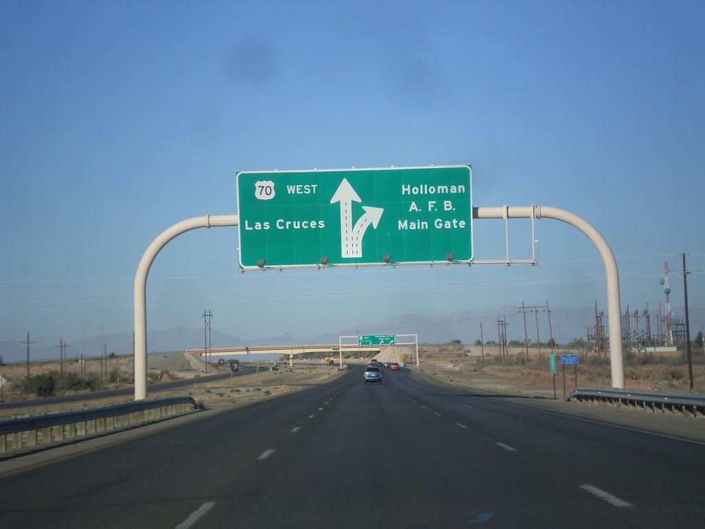
US-70 West - Holloman AFB Main Gate IC
US-70 west approaching Holloman AFB Main Gate interchange. US-70 continues west towards Las Cruces.
Taken 04-15-2013
 Holloman Air Force Base
Otero County
New Mexico
United States
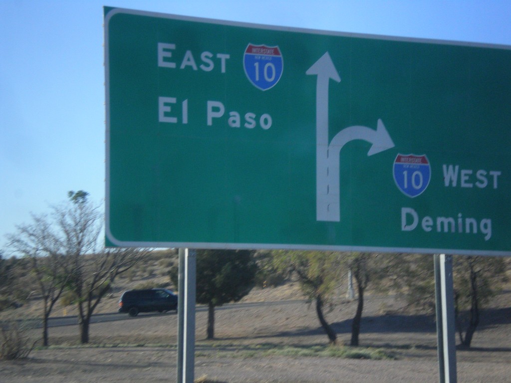
End NM-188 at I-10
End NM-188 at I-10 junction. Use right lanes for I-10 west to Deming; left lanes for I-10 east to El Paso (Texas).
Taken 04-14-2013

 Las Cruces
Doña Ana County
New Mexico
United States
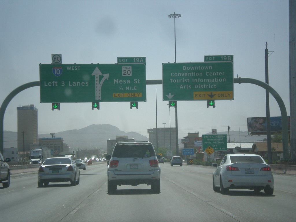
I-10 West - Exits 19B and 19A
I-10 west at Exit 19B - Downtown/Convention Center/Tourist Information/Arts District. Approaching Exit 19A - TX-20/Mesa St. Use left 3 lanes for I-10 west.
Taken 04-14-2013

 El Paso
 County
Texas
United States
El Paso
El Paso County
Texas
United States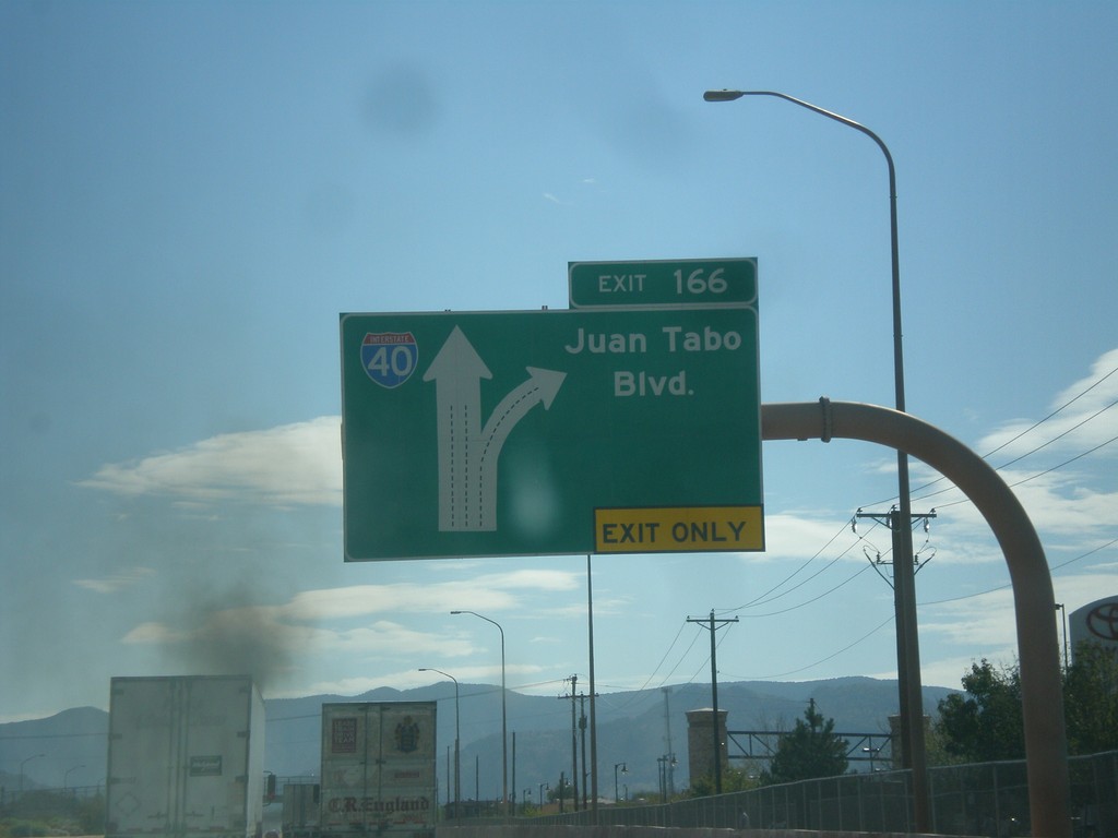
I-40 East - Exit 160
I-40 east at Exit 160 - Juan Tabo Blvd.
Taken 10-11-2012
 Albuquerque
Bernalillo County
New Mexico
United States
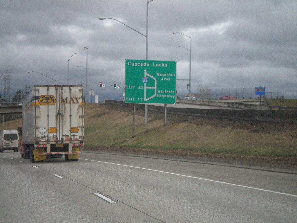
I-84/US-30 East - Historic Columbia River Highway Diagram
Route diagram for the Historic Columbia River Highway on I-84/US-30 East. Use Exit 17 (last Portland Metro. Area exit) on I-84/US-30 East for the Historic Highway. The Historic Columbia River Highway and I-84/US-30 rejoin before Cascade Locks.
Taken 02-21-2012

 Fairview
Multnomah County
Oregon
United States
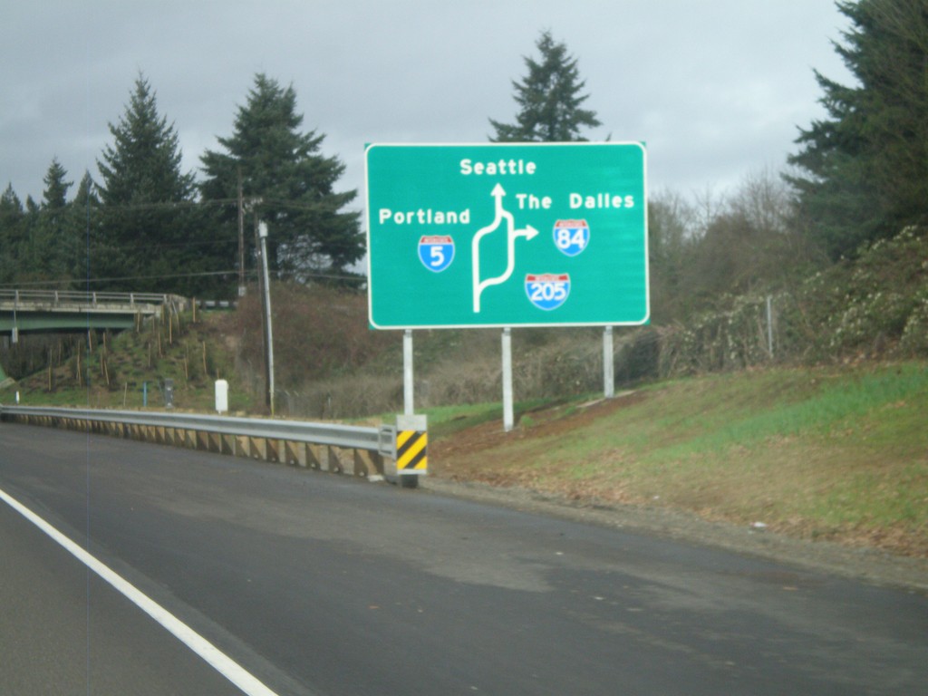
I-5 North - Portland Route Diagram
Portland area route diagram on I-5 north approaching I-205 junction.
Taken 02-21-2012

 Tualatin
Washington County
Oregon
United States
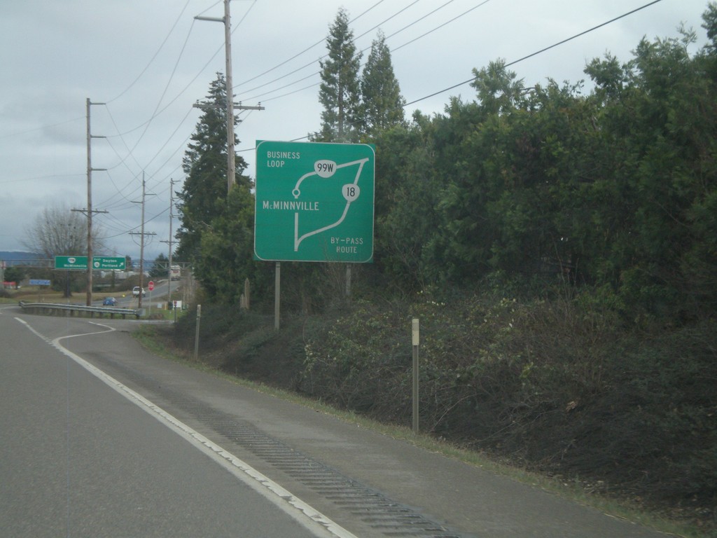
OR-18 East - Route Diagram
OR-18 East route diagram for McMinnville area, approaching OR-99W junction. Use OR-99W as a business loop through McMinnville. Use OR-18 as a bypass around McMinnville.
Taken 02-21-2012

 McMinnville
Yamhill County
Oregon
United States
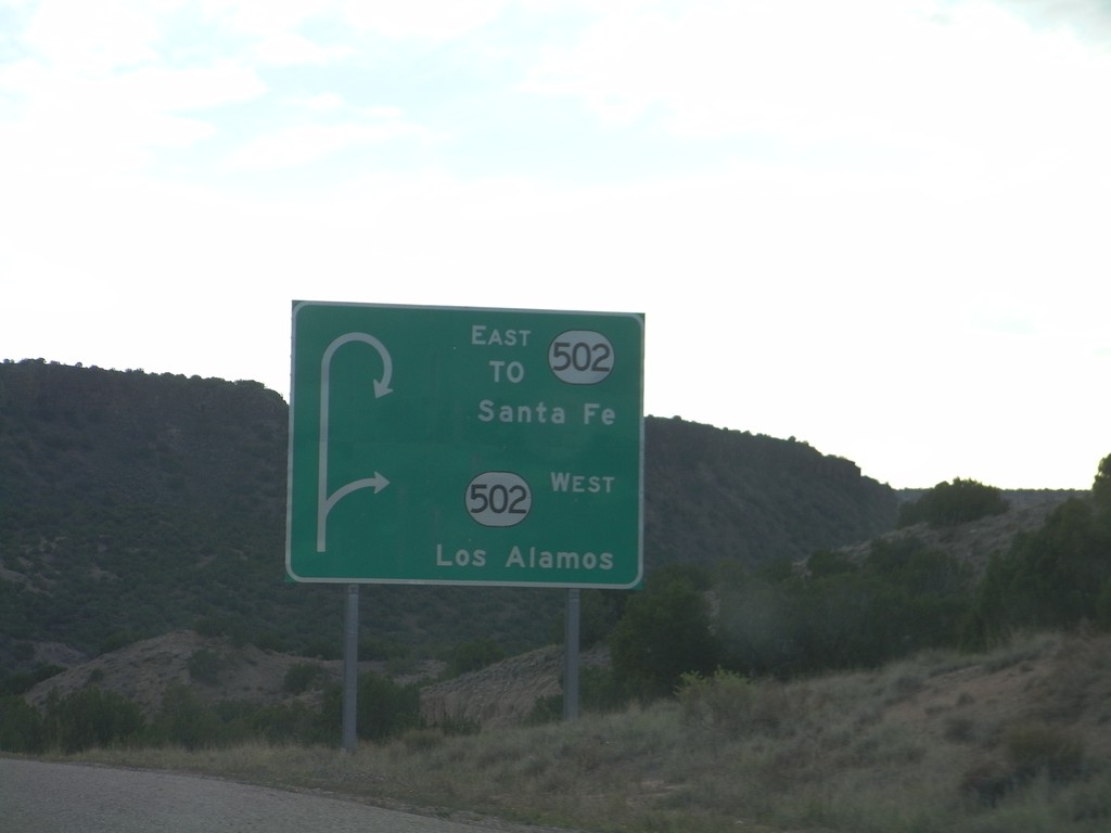
Route Diagram on NM-30 Approaching NM-502
Route Diagram on NM-30 south approaching NM-502. Use NM-502 west for Los Alamos; use NM-502 east for Santa Fe.
Taken 10-02-2011

 Santa Fe
 County
New Mexico
United States
Santa Fe
Santa Fe County
New Mexico
United States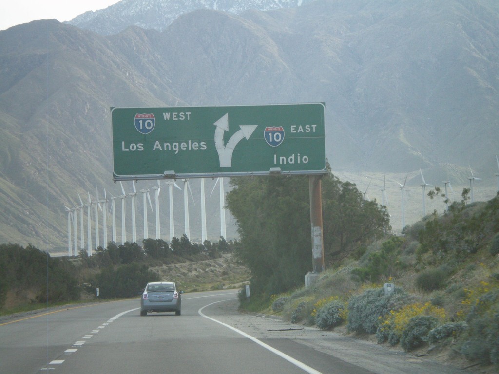
End CA-62 West at I-10
End CA-62 west at I-10. Use I-10 west for Los Angeles; use I-10 east for Indio.
Taken 02-25-2011

 Palm Springs
Riverside County
California
United States
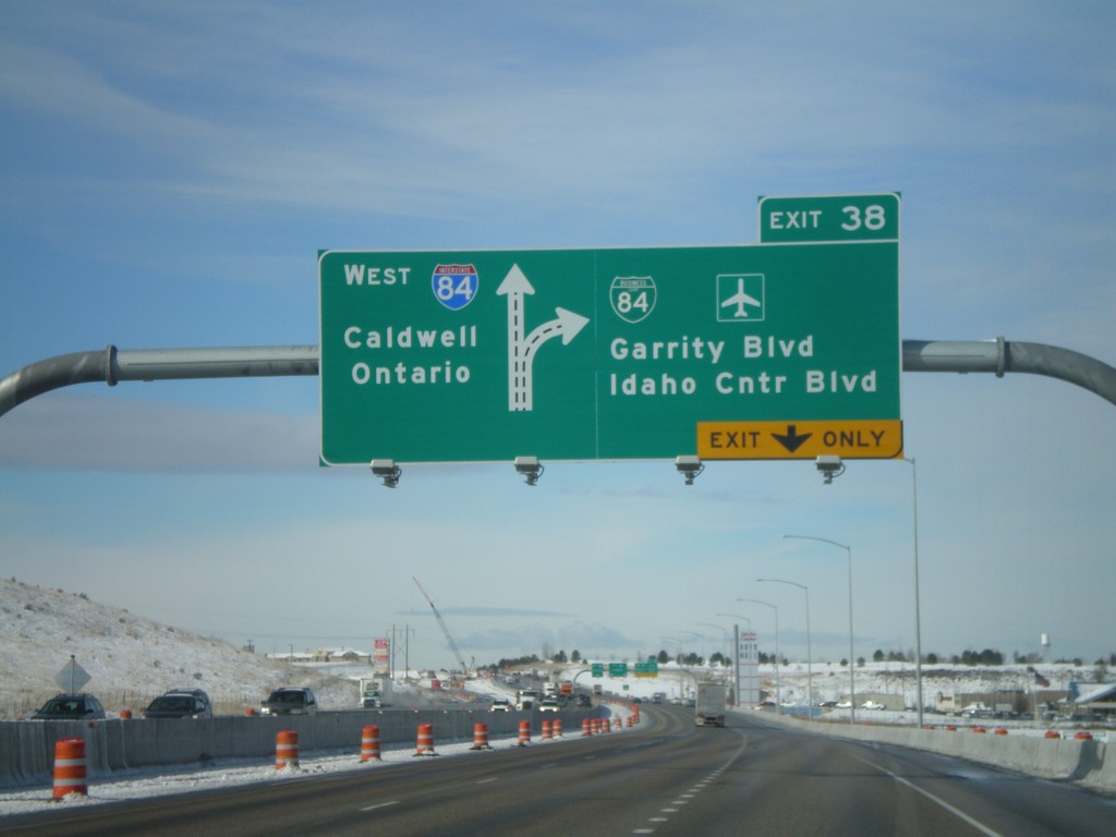
I-84 West - Exit 38
I-84/US-30 west at Exit 38 - BL-84/Garrity Blvd./Idaho Center Blvd. Westbound I-84 traffic continues towards Caldwell and Ontario (OR).
Taken 02-07-2011


 Nampa
Canyon County
Idaho
United States
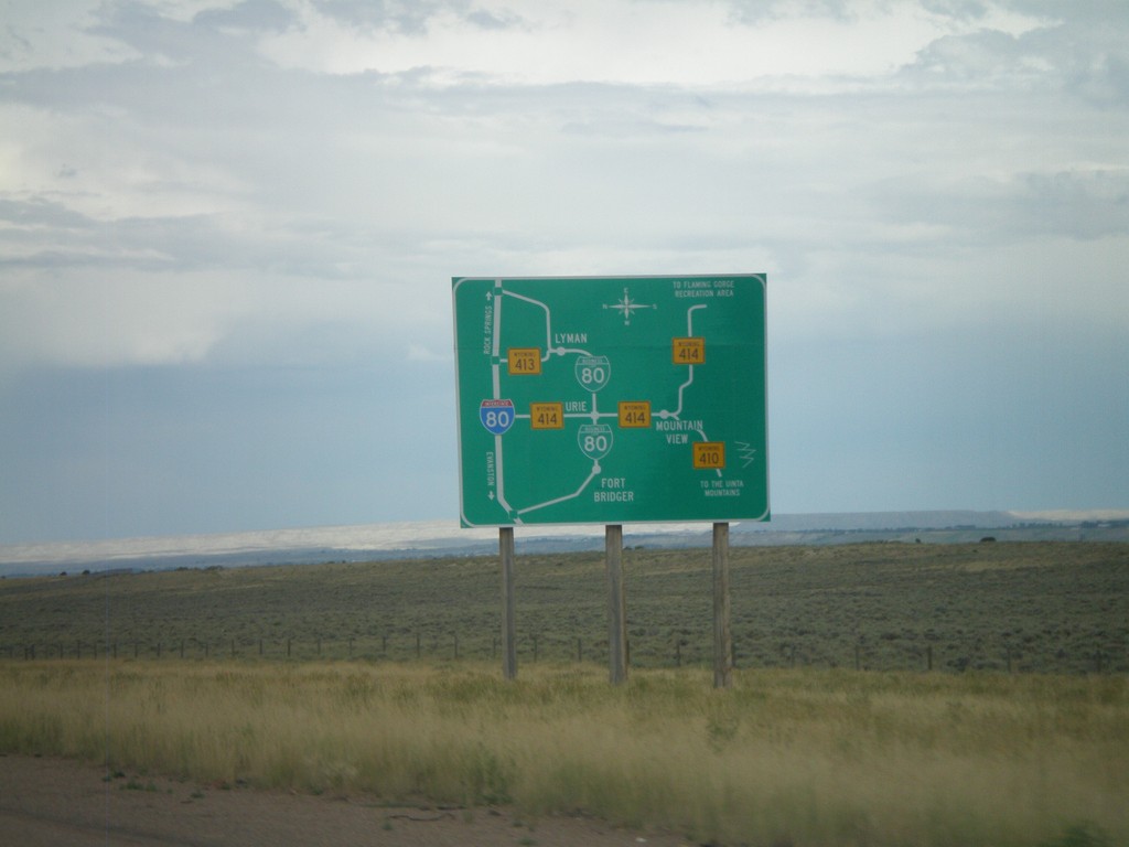
Bridger Valley Route Diagram
Route diagram for the Bridger Valley on I-80 east, descending into the Bridger Valley.
Taken 07-31-2010


 Fort Bridger
Uinta County
Wyoming
United States
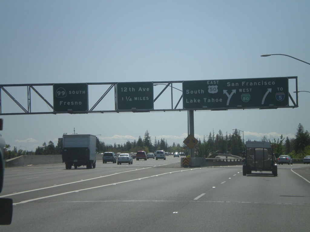
BL-80 West at US-50 and CA-99
BL-80 west at Exits 6A and 6B. Exit 6A is BL-80 West/US-50/To I-5/South Lake Tahoe/San Francisco. Exit 6B is CA-99 South/Fresno.
Taken 04-16-2010


 Sacramento
 County
California
United States
Sacramento
Sacramento County
California
United States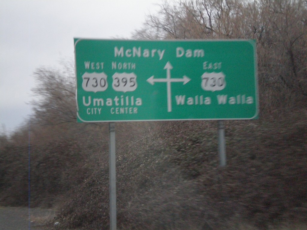
Route Diagram at US-395 North/US-730 Junction
Route diagram at US-395 north/US-730 junction. US-730 heads east to Walla Walla. US-395 North joins US-730 West into Umatilla. Continue straight for McNary Dam on the Columbia River.
Taken 01-14-2010

 Umatilla
 County
Oregon
United States
Umatilla
Umatilla County
Oregon
United States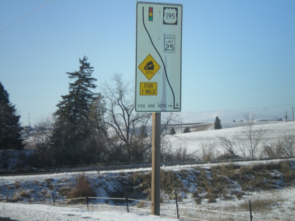
WA-272 East - Grade Information
WA-272 west at the top of a 10% grade above Colfax. Route diagram showing the speed and grade information, and the stoplight at the bottom of the hill at US-195.
Taken 12-26-2009
 Colfax
Whitman County
Washington
United States
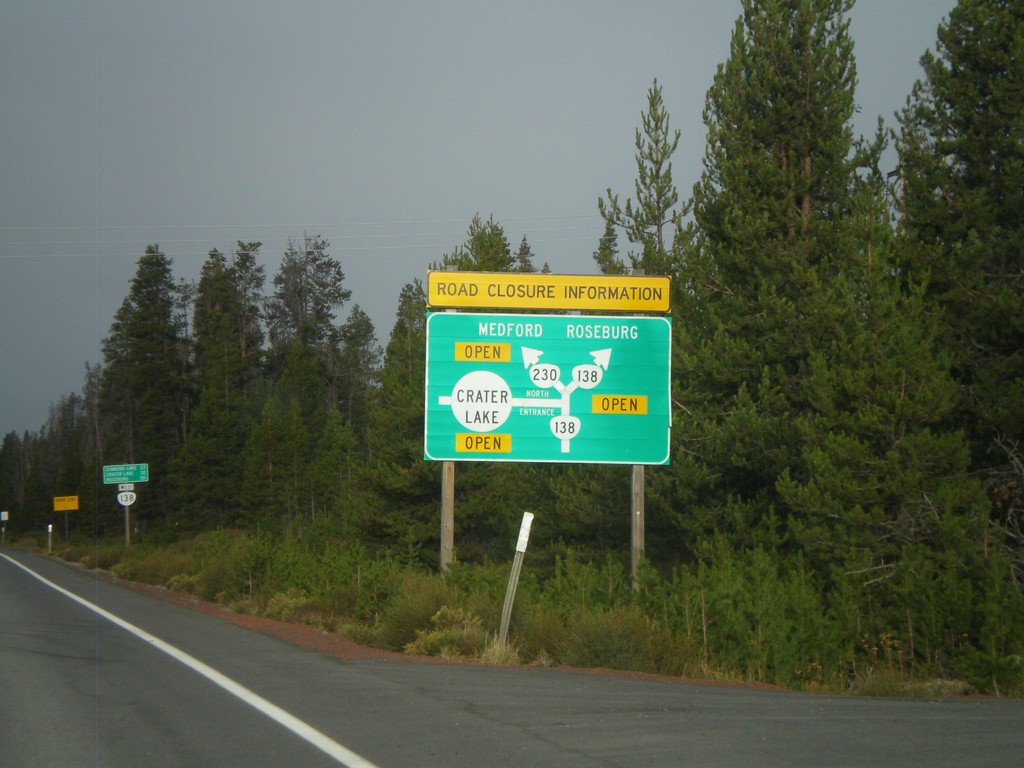
Cascades Closure Information
Road closure information for OR-230, OR-138, and Crater Lake in the Oregon Cascades. Closures are listed in a simple route diagram.
Taken 09-20-2009
 Chemult
Klamath County
Oregon
United States
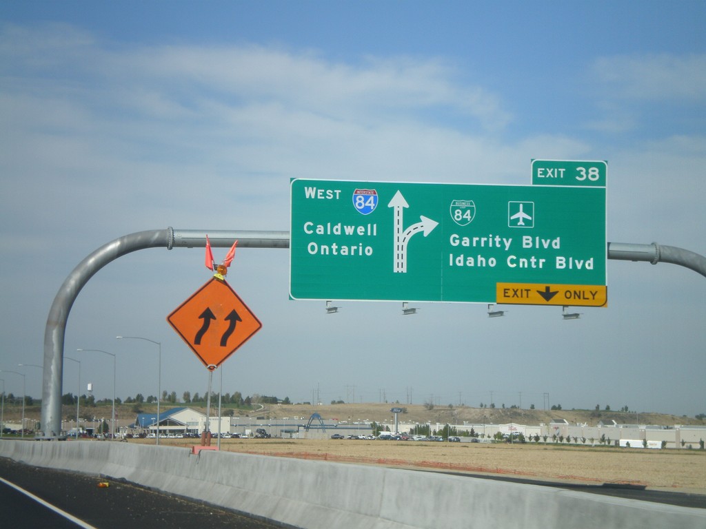
I-84 West - Exit 38
I-84/US-30 west at Exit 38 - BL-84/Garrity Blvd./Idaho Center Blvd. Westbound I-84 traffic continues towards Caldwell and Ontario (OR).
Taken 09-19-2009


 Nampa
Canyon County
Idaho
United States
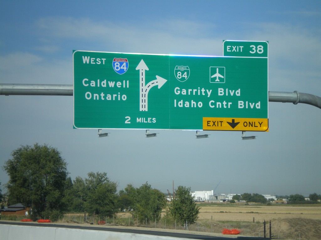
I-84 West Approaching Exit 38
I-84/US-30 west approaching Exit 38 - BL-84/Garrity Blvd./Idaho Center Blvd. Westbound I-84 traffic continues towards Caldwell and Ontario (OR). This is a new sign as part of the I-84 widening between Meridian and Nampa.
Taken 09-19-2009


 Nampa
Canyon County
Idaho
United States
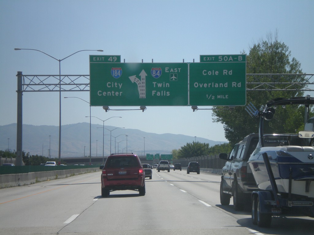
I-84 East Approaching Exit 49 and 50A-B
I-84/US-30 east approaching Exit 49 - I-184/City Center. Also approaching Exit 50A-B - Cole Road/Overland Road.
Taken 06-28-2009


 Boise
Ada County
Idaho
United States
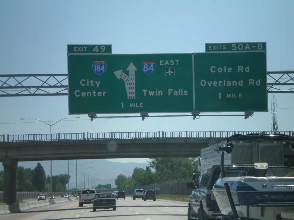
I-84 East Exits 49 and Exits 50AB
I-84 east approaching Exit 49 - I-184/City Center. Also approaching Exits 50A-B Cole Road/Overland Road. I-84 east continues towards Twin Falls and the Boise Air Terminal.
Taken 06-28-2009


 Boise
Ada County
Idaho
United States
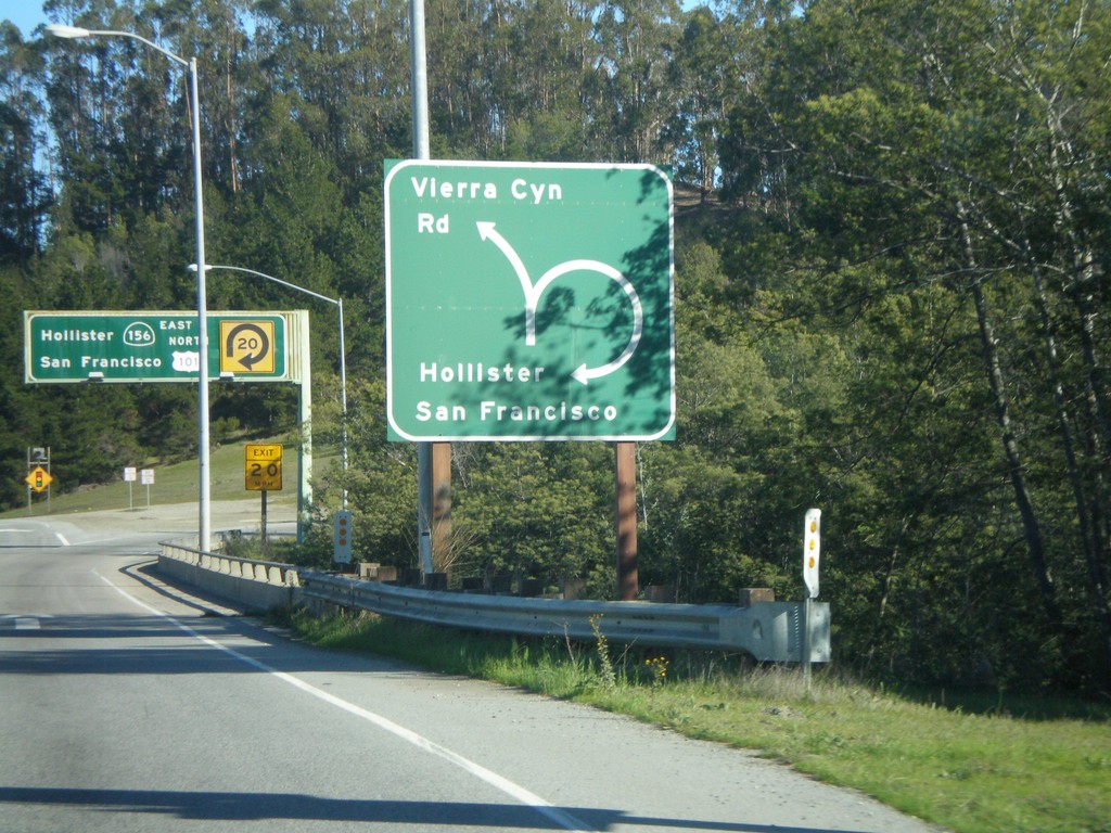
CA-156 East Approaching US-101 North Onramp
Diagram of CA-156 East/US-101 junction. Continue straight for Vierra Canyon Road. Exit right for Hollister and San Francisco.
Taken 01-01-2009

 Prunedale
Monterey County
California
United States
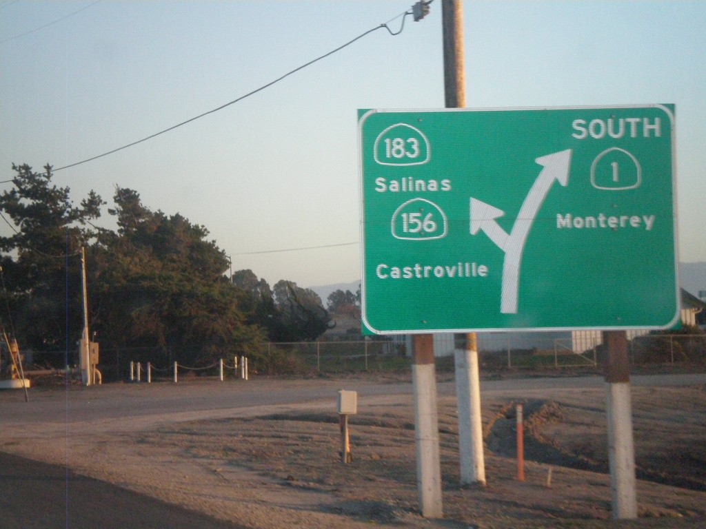
CA-1 South at CA-183 South (To CA-156)
Diagram of CA-1 south at CA-183. Use CA-183 south for CA-156 to Castroville and Salinas.
Taken 12-31-2008


 Castroville
Monterey County
California
United States
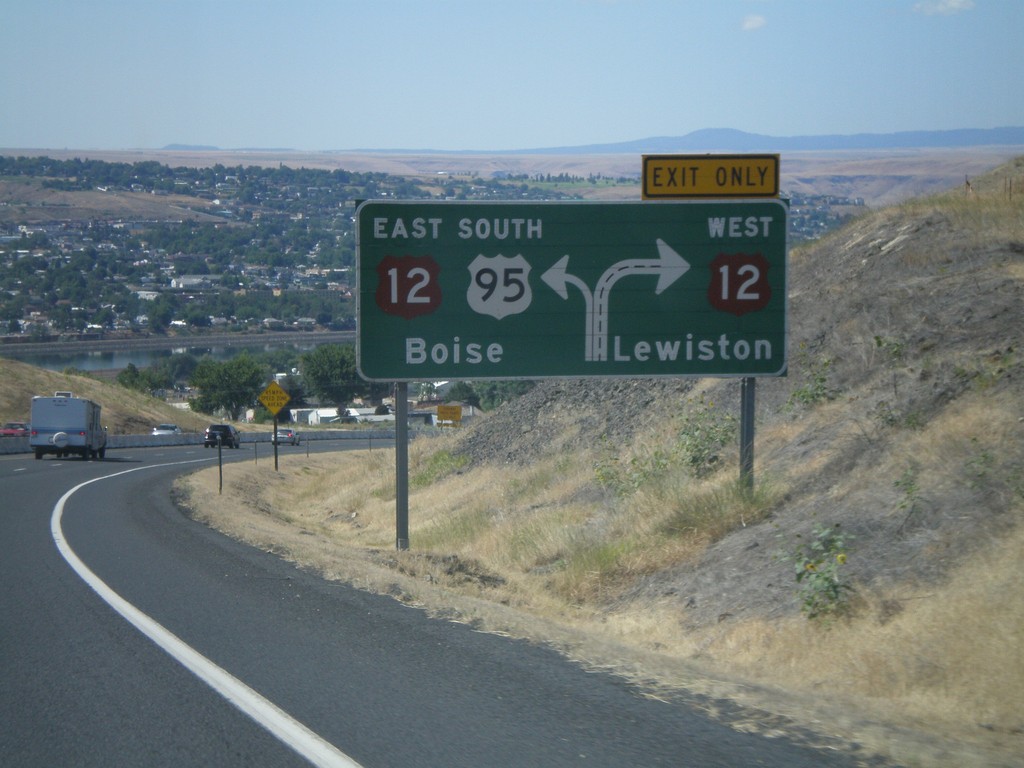
US-95 South Approaching US-12
US-95 south approaching US-12. Use right lane for US-12 west to Lewiston; left lane for US-95 South/US-12 East to Boise.
Taken 07-27-2008

 Lewiston
Nez Perce County
Idaho
United States
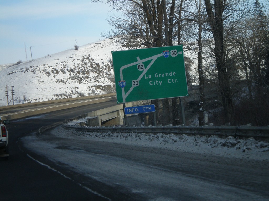
I-84 East - La Grande Route Diagram
Route diagram of La Grande routes on I-84 east approaching Exit 261.
Taken 01-22-2008
 La Grande
Union County
Oregon
United States
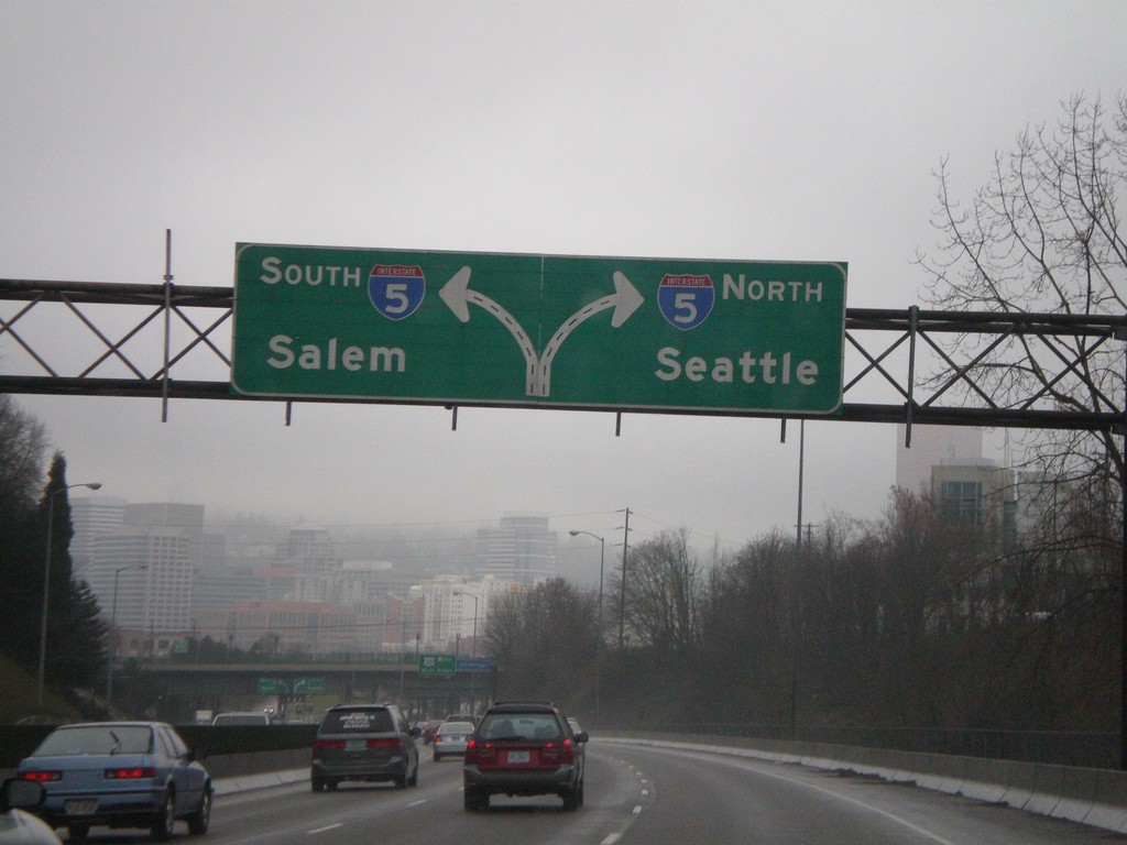
I-84 West Approaching I-5
I-84 west approaching I-5 in Portland. Use right lanes for I-5 north to Seattle; left lanes for I-5 south to Salem. This is the western end of I-84.
Taken 01-19-2008


 Portland
Multnomah County
Oregon
United States