Signs Tagged With Diagram
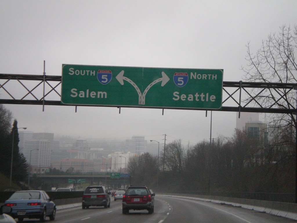
I-84 West Approaching I-5
I-84 west approaching I-5 in Portland. Use right lanes for I-5 north to Seattle; left lanes for I-5 south to Salem. This is the western end of I-84.
Taken 01-19-2008


 Portland
Multnomah County
Oregon
United States
Portland
Multnomah County
Oregon
United States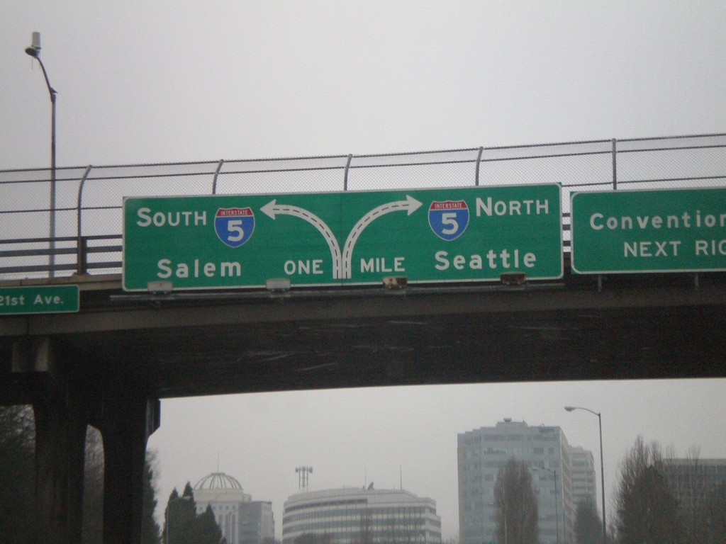
I-84 West Approaching I-5 to Salem and Seattle
I-84 West approaching I-5 to Salem and Seattle.
Taken 01-19-2008
Portland
Multnomah County
Oregon
United States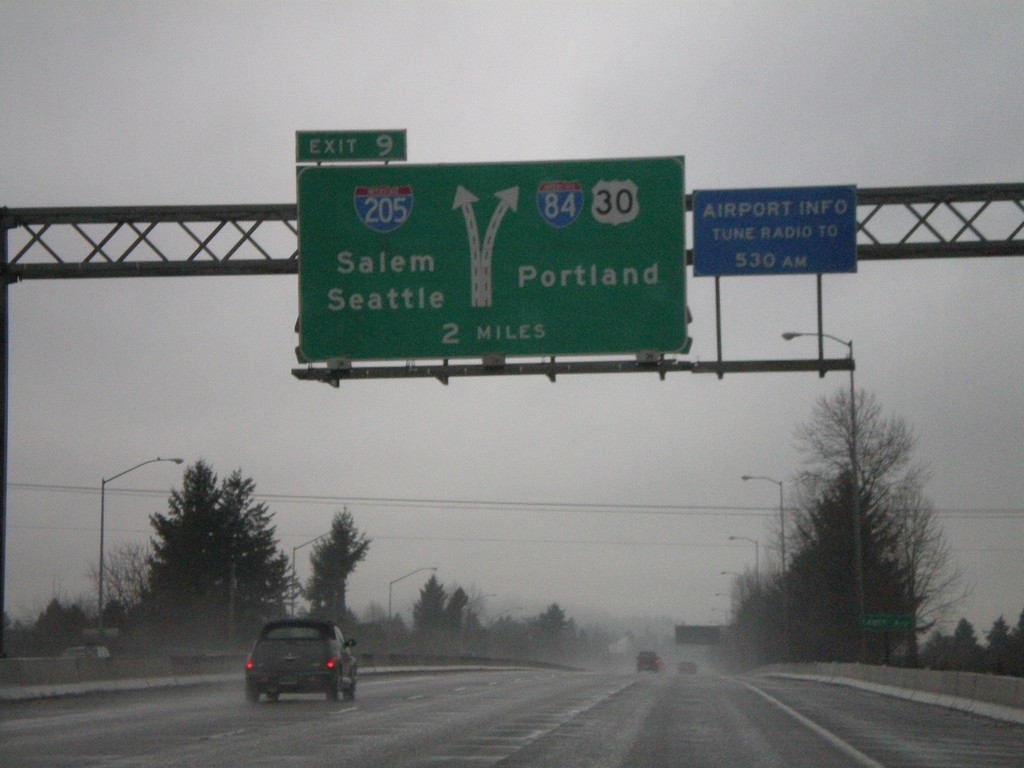
I-84 West Approaching Exit 9
I-84/US-30 west approaching Exit 9 - I-205/Seattle/Salem. Use right lanes to continue west on I-84/US-30 to Portland.
Taken 01-19-2008
 Portland
Multnomah County
Oregon
United States
Portland
Multnomah County
Oregon
United States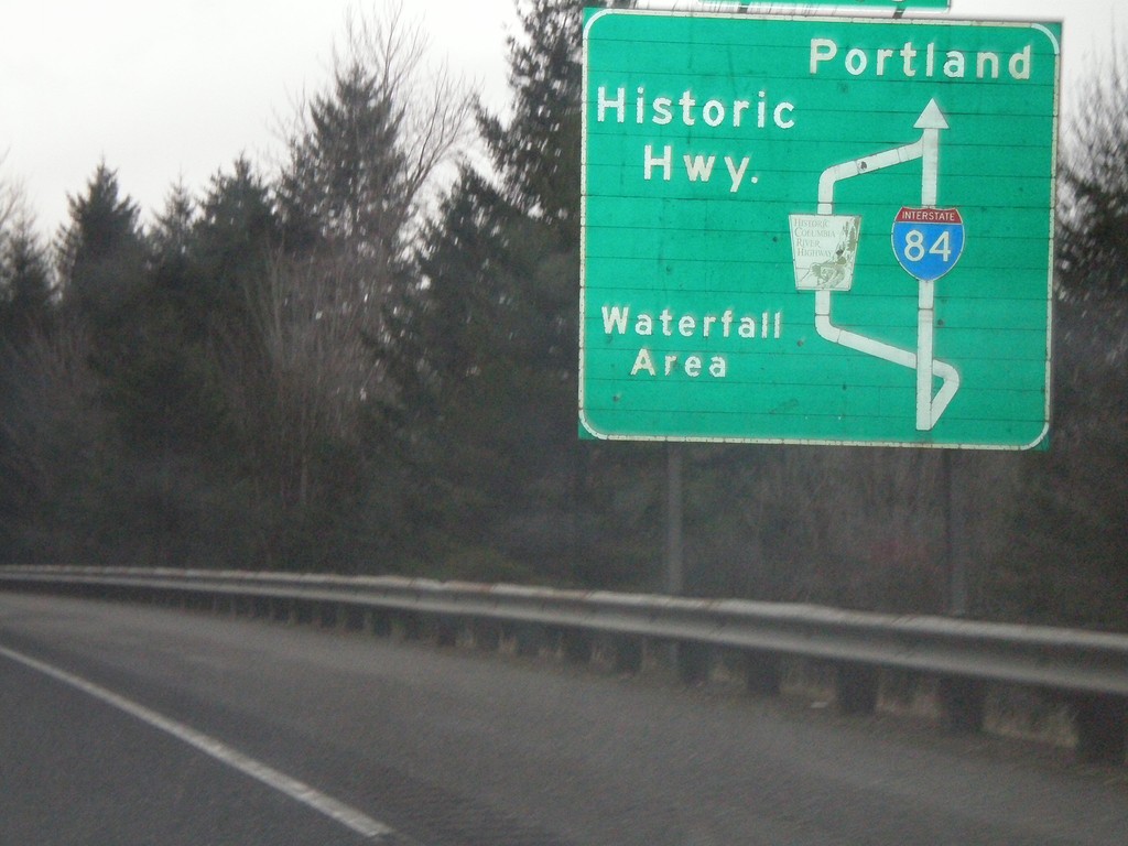
I-84 West - Historic Highway Diagram (Exit 35)
I-84 West - Exit 35 Exit Diagram. Use Exit 35 for the Historic Columbia River Highway.
Taken 01-19-2008
Dodson
Multnomah County
Oregon
United States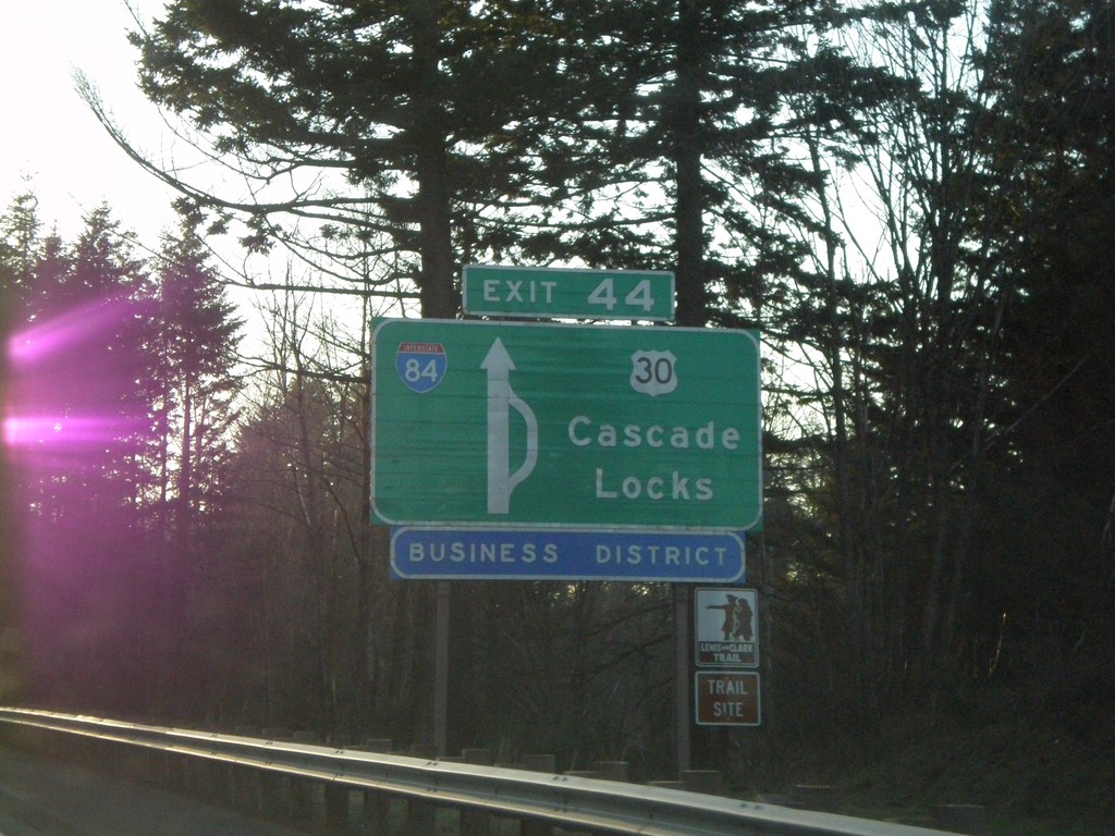
I-84 West Approaching Exit 44 - Route Diagram
I-84 west approaching Exit 44 - US-30/Cascade Locks.
Taken 01-18-2008
Cascade Locks
Hood River County
Oregon
United States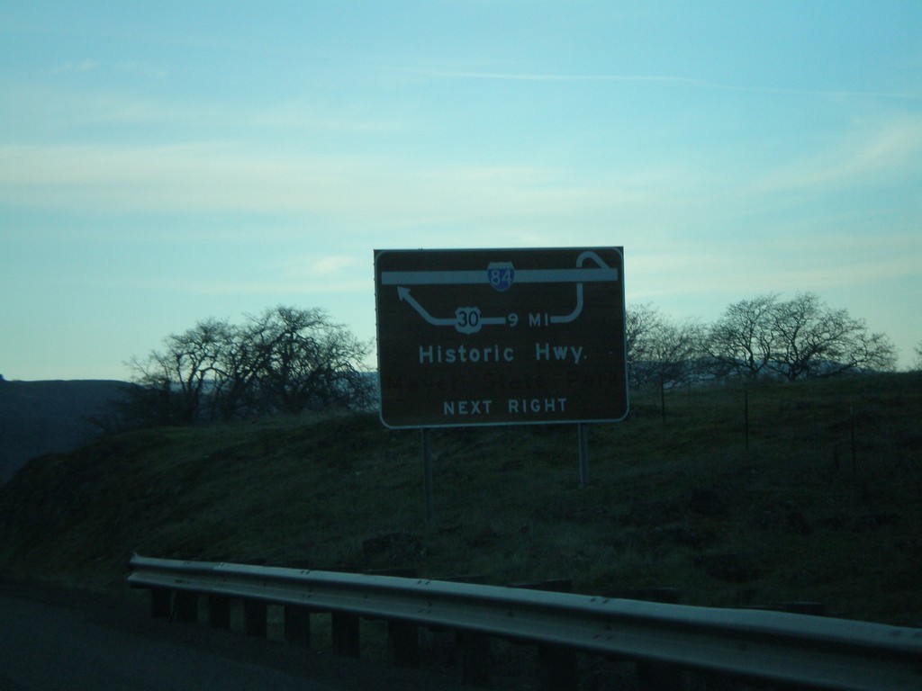
I-84 West Route Diagram Approaching Exit 76
Route diagram for Historic Columbia River Highway approaching Exit 76 on I-84 west.
Taken 01-18-2008
The Dalles
Wasco County
Oregon
United States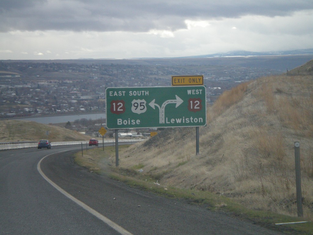
US-95 South Approaching US-12
Route diagram for US-95/US-12 junction on US-95 south. View of the Clearwater Valley and the city of Lewiston. The river in the background is the Clearwater River.
Taken 12-26-2007

 Lewiston
Nez Perce County
Idaho
United States
Lewiston
Nez Perce County
Idaho
United States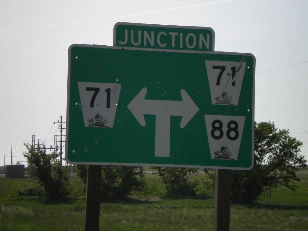
NE-88 East Approaching NE-71
NE-88 east approaching NE-71.
Taken 05-27-2007

 Harrisburg
Banner County
Nebraska
United States
Harrisburg
Banner County
Nebraska
United States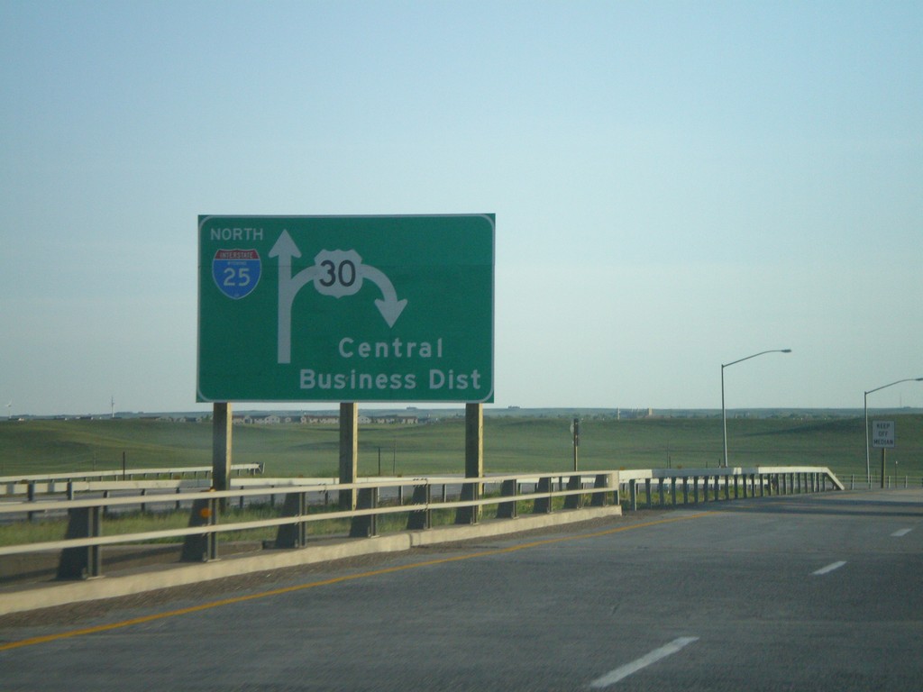
I-25 North - Exit 9 Diagram
Diagram for Exit 9 US-30 interchange, on I-25 north.
Taken 05-27-2007

 Cheyenne
Laramie County
Wyoming
United States
Cheyenne
Laramie County
Wyoming
United States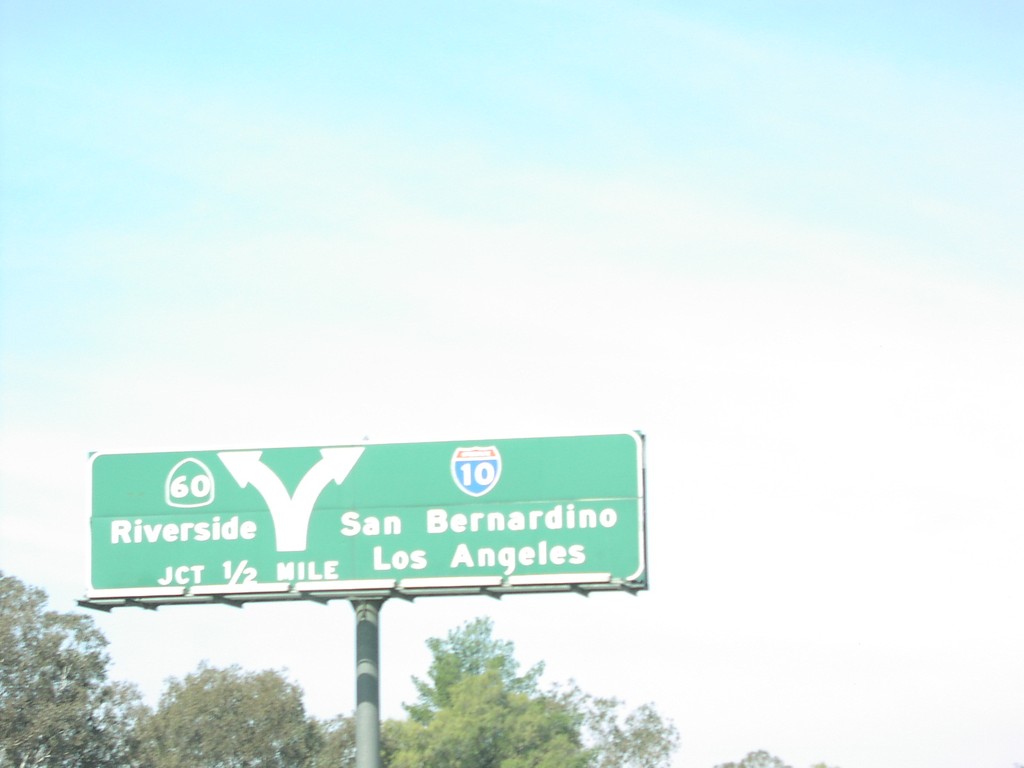
I-10 West Exit 93
I-10 west approaching Exit 93 - CA-60/Riverside, 1/2 mile.
Taken 03-01-2007

 Beaumont
Riverside County
California
United States
Beaumont
Riverside County
California
United States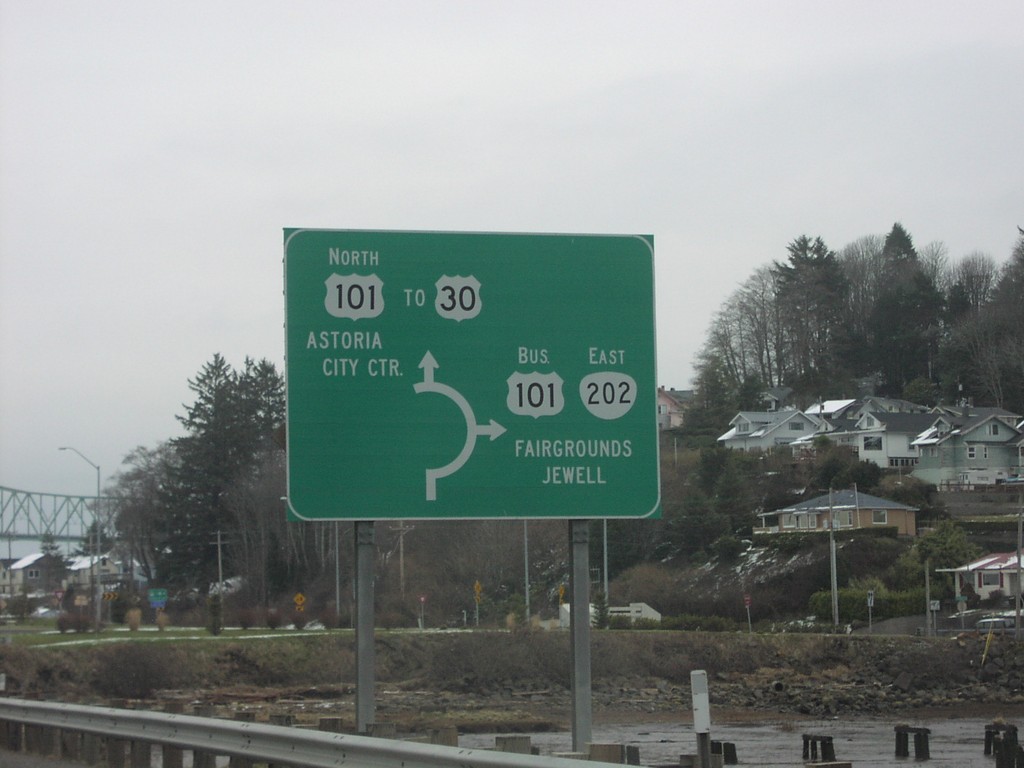
US-101 North at OR-202 South - Roundabout
US-101 north at OR-202 East/Bus. US-101 South to Jewell and Fairgrounds. US-101/OR-202 junction is a roundabout.
Taken 01-01-2007

 Astoria
Clatsop County
Oregon
United States
Astoria
Clatsop County
Oregon
United States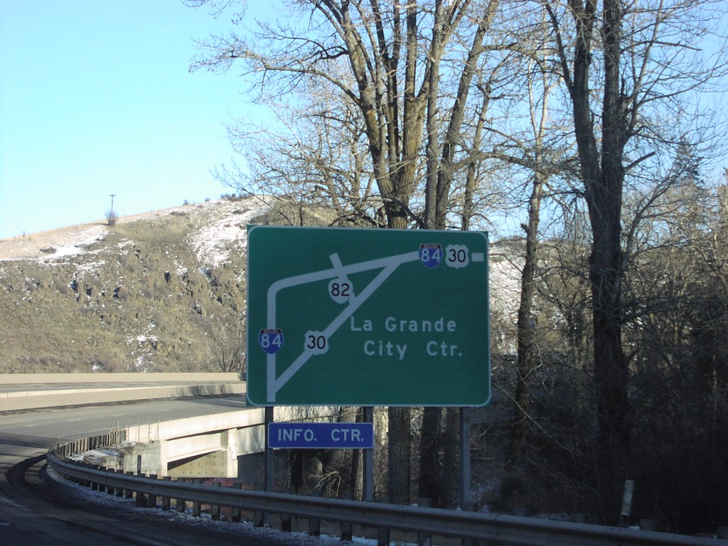
I-84 East - La Grande Route Diagram
I-84 east approaching La Grande. Map of routes in the La Grande area.
Taken 01-01-2007
 La Grande
Union County
Oregon
United States
La Grande
Union County
Oregon
United States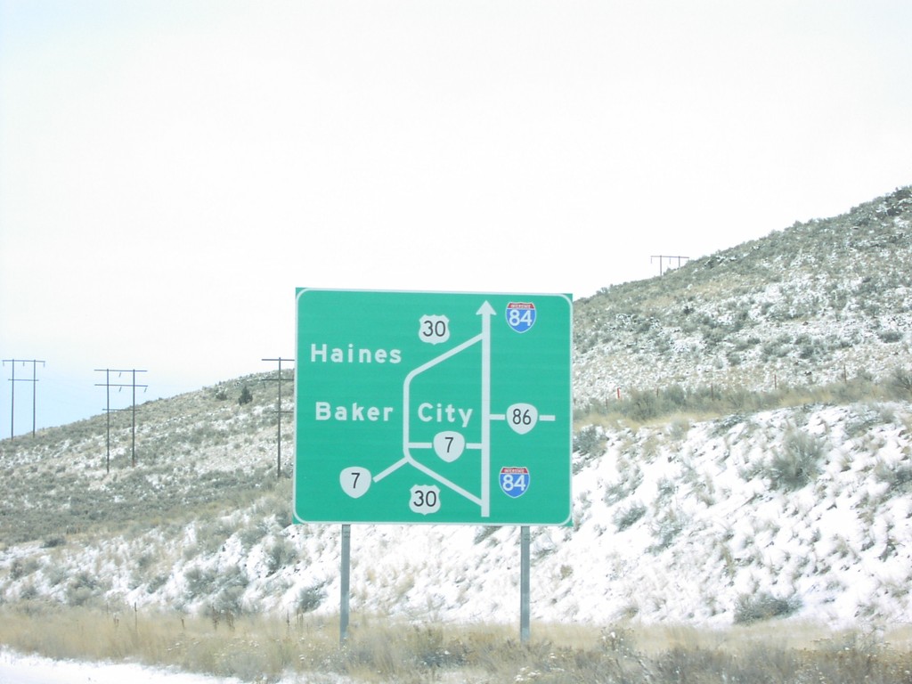
I-84 West - Baker City Route Map
Diagram of Baker City area routes on I-84 west, approaching eastern Baker City exit, #306.
Taken 12-01-2006

 Baker City
Baker County
Oregon
United States
Baker City
Baker County
Oregon
United States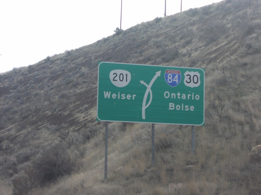
I-84 East Exit 356 Jct. Diagram
I-84 east approaching Exit 356, OR-201/Weiser. Route map of I-84/US-30, and OR-201.
Taken 12-01-2006
 Weiser
Malheur County
Oregon
United States
Weiser
Malheur County
Oregon
United States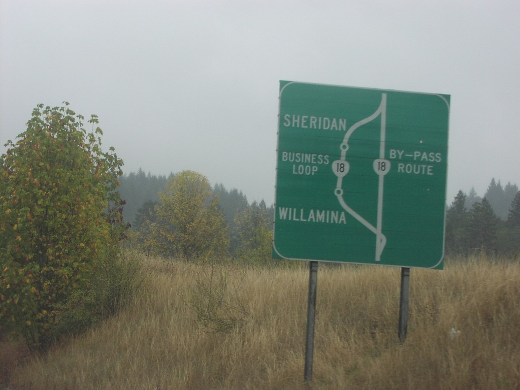
OR-18 Bus. Loop Route Diagram
Diagram of Bus. OR-18 through Willamina and Sheridan on OR-18/OR-22 east.
Taken 10-01-2006

 Willamina
Polk County
Oregon
United States
Willamina
Polk County
Oregon
United States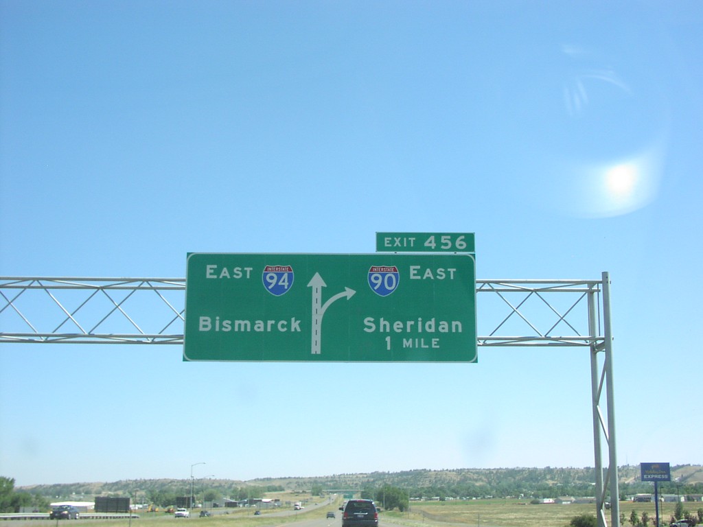
I-90 East Exit 456
I-90 east to Sheridan approaching Exit456, I-94 East/Bismarck, 1 mile.
Taken 07-01-2006
 Billings
Yellowstone County
Montana
United States
Billings
Yellowstone County
Montana
United States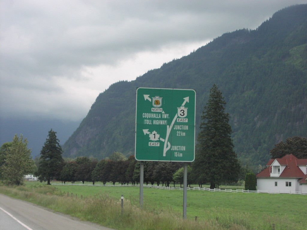
TC-1 East Route Diagram
Hope area route diagram for TC-1, BC-3, and BC-5.
Taken 06-01-2006


 Hope
Fraser Valley
British Columbia
Canada
Hope
Fraser Valley
British Columbia
Canada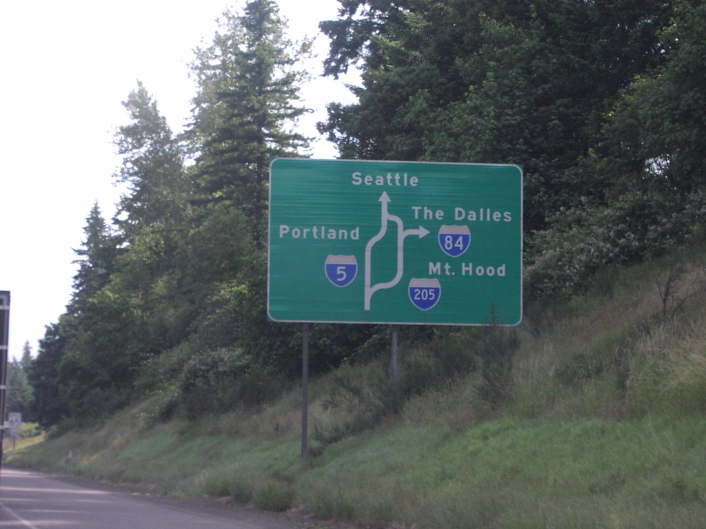
I-5 North Portland Route Diagram
Portland area route diagram on I-5 north approaching I-205 junction.
Taken 06-01-2006
Tualatin
Washington County
Oregon
United States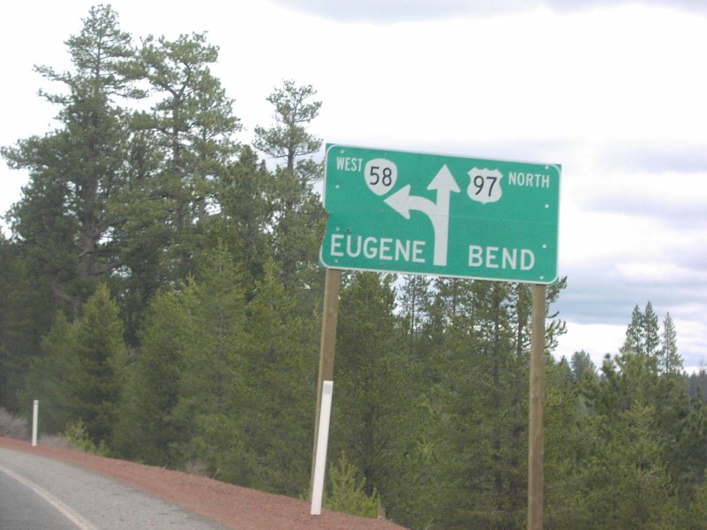
US-97 North at OR-58/Eugene
US-97 North to Bend/OR-58 to Eugene split.
Taken 04-01-2006
 Crescent
Klamath County
Oregon
United States
Crescent
Klamath County
Oregon
United States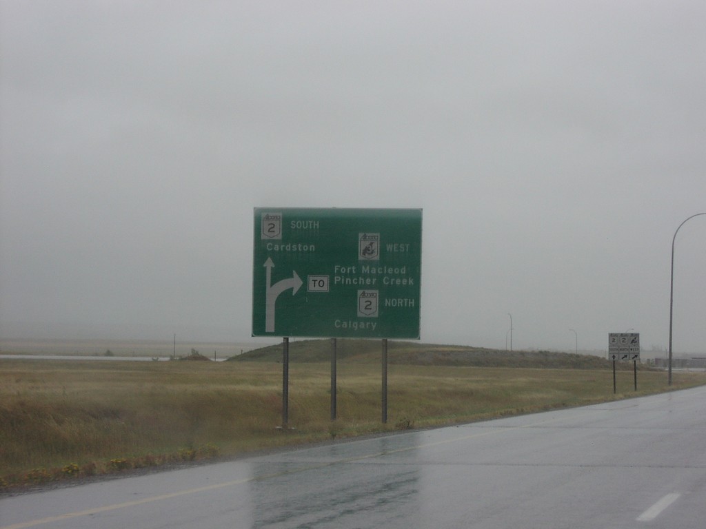
Fort Macleod Route Diagram on AB-3 West
Diagram on AB-3 west approaching AB-2 south to Cardston, and AB-3/AB-2 north to
Taken 09-10-2005

 Fort Macleod
Willow Creek No. 26
Alberta
Canada
Fort Macleod
Willow Creek No. 26
Alberta
Canada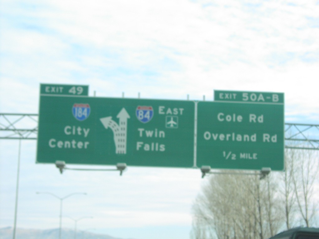
I-84 West Exits 49 and Exits 50AB
I-84 east at Exit 49 - I-184/City Center interchange. Also approaching Exit 50AB - Cole Road/Overland Road. Eastbound I-84 traffic has a control city of Twin Falls.
Taken 12-01-2004
 Boise
Ada County
Idaho
United States
Boise
Ada County
Idaho
United States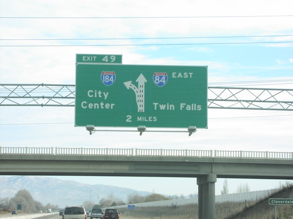
I-84 East Exit 49
I-84 east approaching Exit 49 - I-184/City Center interchange. This interchange is referred to the "Flying Wye."
Taken 12-01-2004
Boise
Ada County
Idaho
United States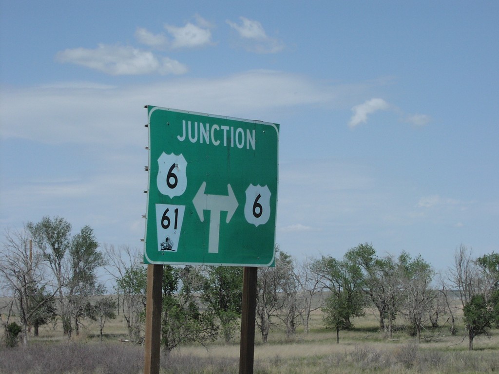
NE-61 North at US-6
Junction NE-61/US-6 on NE-61 North
Taken 05-01-2004

 Enders
Chase County
Nebraska
United States
Enders
Chase County
Nebraska
United States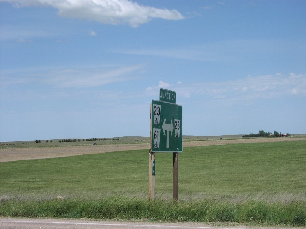
NE-61 North at NE-23
NE-61 North at NE-23 Junction Assembly
Taken 05-01-2004
 Grant
Perkins County
Nebraska
United States
Grant
Perkins County
Nebraska
United States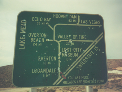
NV-169 South - Route Diagram
Lake Mead Map on NV-169 South
Taken 03-01-2001
 Moapa Valley
Clark County
Nevada
United States
Moapa Valley
Clark County
Nevada
United States