Signs Tagged With Diagram
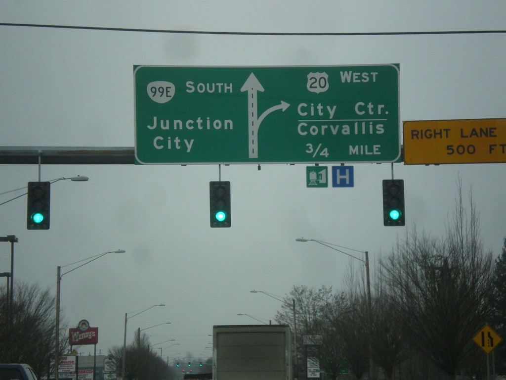
US-20 West/OR-99E South at Geary Blvd.
US-20 West/OR-99E South (Pacific Blvd. SE) at Geary Blvd. Continue south on Pacific Blvd. SE for OR-99E/Junction City. Approaching ramp for US-20 West to City Center (Albany) and Corvallis.
Taken 02-13-2015

 Albany
Linn County
Oregon
United States
Albany
Linn County
Oregon
United States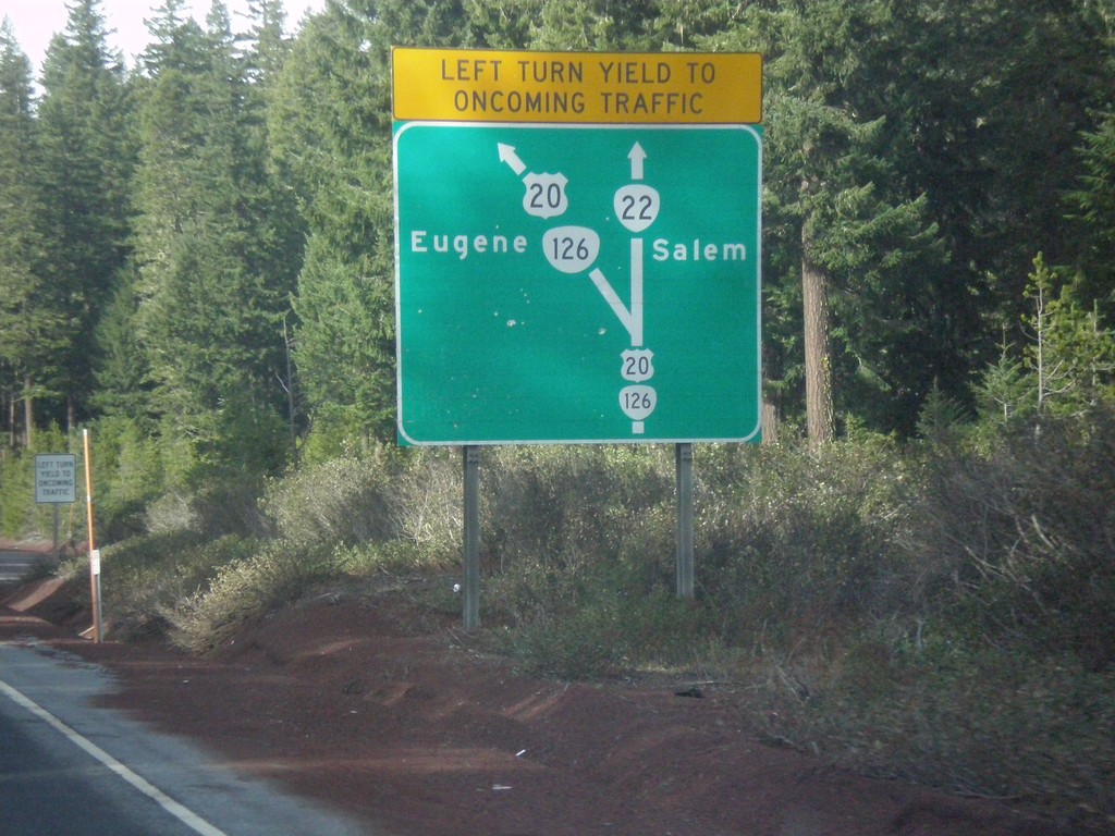
Diagram of US-20/OR-126/OR-22 Junction - US-20/OR-126 West
Map diagram of junction at US-20/OR-126/OR-22 junction on US-20/OR-126 West. Continue straight for OR-22 west to Salem; merge left to continue west on US-20/OR-126 West to Eugene.
Taken 02-13-2015

 Santiam Junction
Linn County
Oregon
United States
Santiam Junction
Linn County
Oregon
United States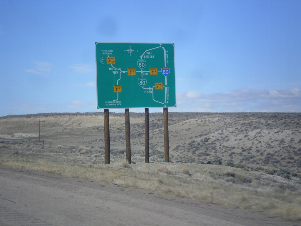
I-80 West - Bridger Valley Route Diagram
Bridger Valley route diagram on I-80 west.
Taken 03-31-2014
 Lyman
Uinta County
Wyoming
United States
Lyman
Uinta County
Wyoming
United States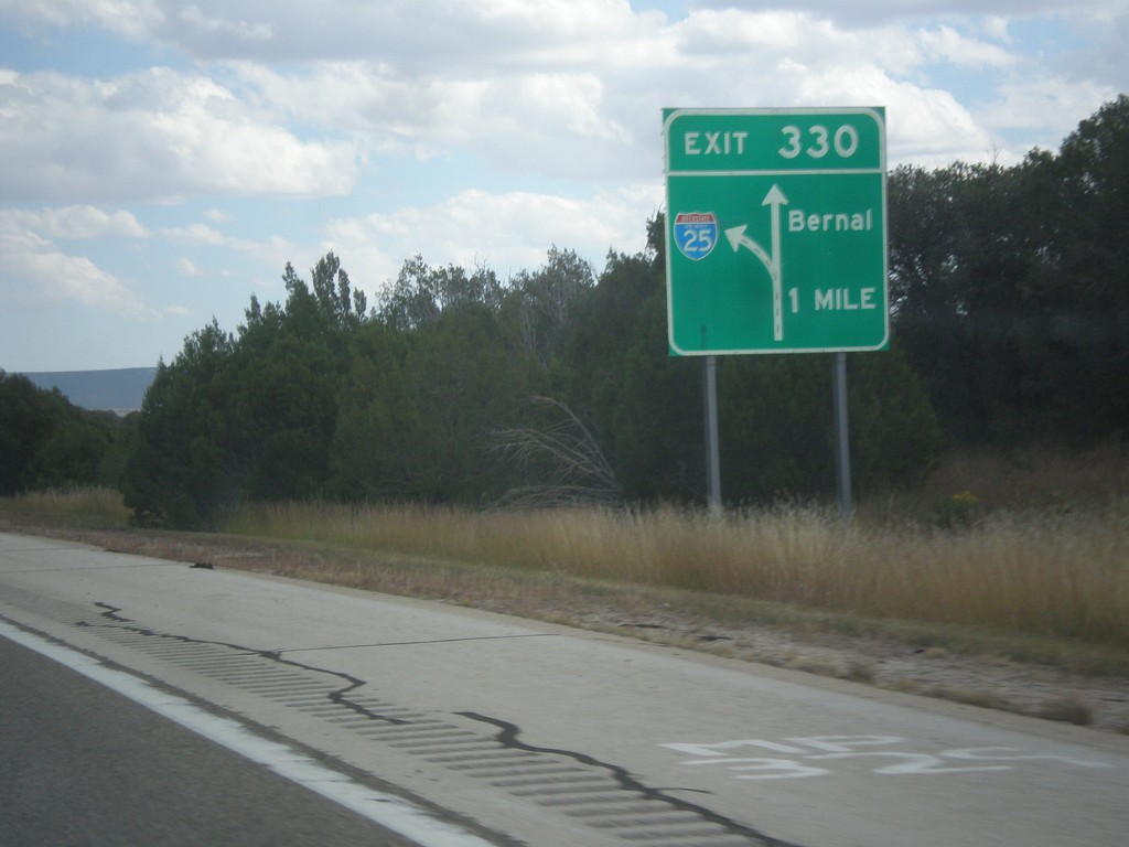
I-25 North - Exit 330
I-25 North approaching Exit 330 - Bernal.
Taken 10-10-2013

 Serafina
San Miguel County
New Mexico
United States
Serafina
San Miguel County
New Mexico
United States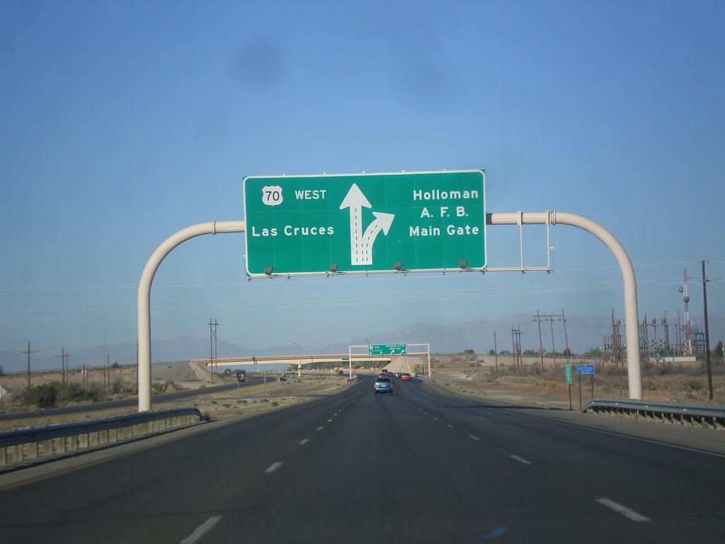
US-70 West - Holloman AFB Main Gate IC
US-70 west approaching Holloman AFB Main Gate interchange. US-70 continues west towards Las Cruces.
Taken 04-15-2013
 Holloman Air Force Base
Otero County
New Mexico
United States
Holloman Air Force Base
Otero County
New Mexico
United States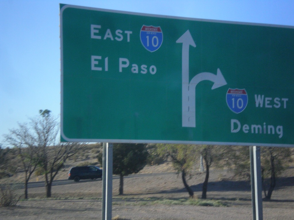
End NM-188 at I-10
End NM-188 at I-10 junction. Use right lanes for I-10 west to Deming; left lanes for I-10 east to El Paso (Texas).
Taken 04-14-2013

 Las Cruces
Doña Ana County
New Mexico
United States
Las Cruces
Doña Ana County
New Mexico
United States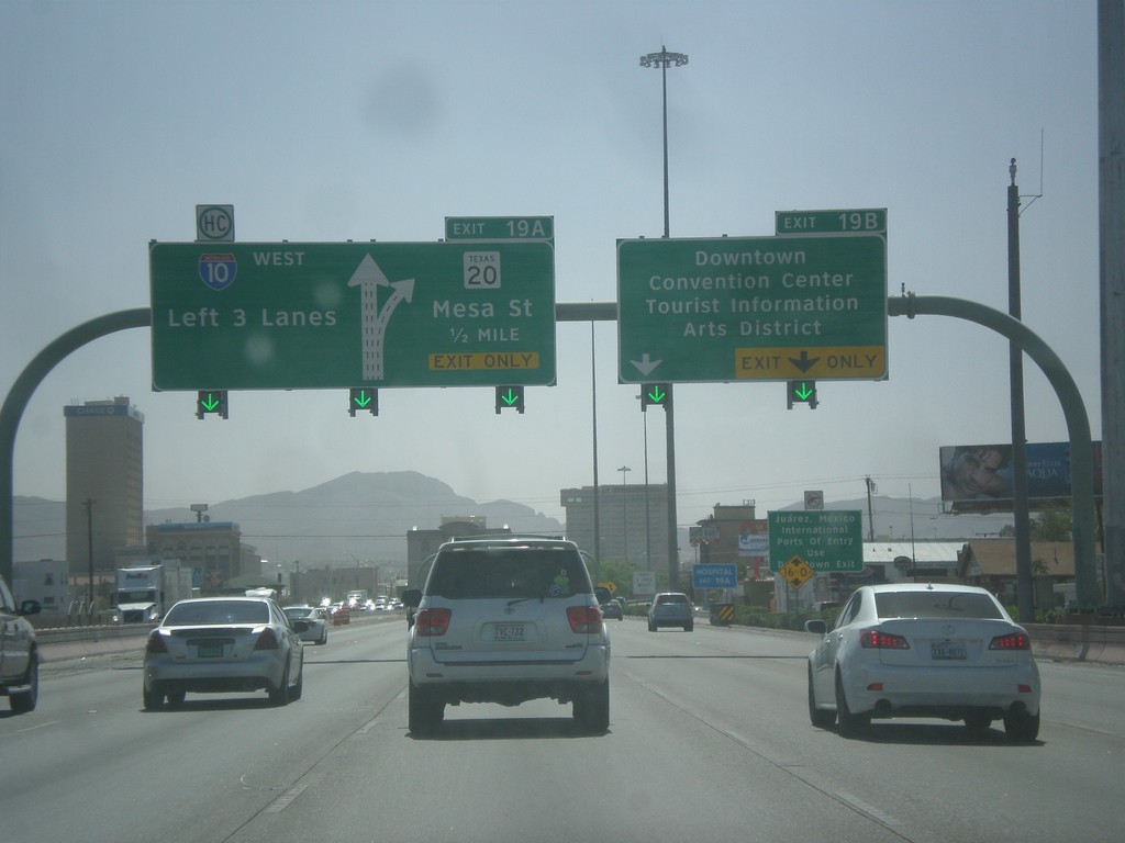
I-10 West - Exits 19B and 19A
I-10 west at Exit 19B - Downtown/Convention Center/Tourist Information/Arts District. Approaching Exit 19A - TX-20/Mesa St. Use left 3 lanes for I-10 west.
Taken 04-14-2013
 El Paso
 County
Texas
United States
El Paso
El Paso County
Texas
United States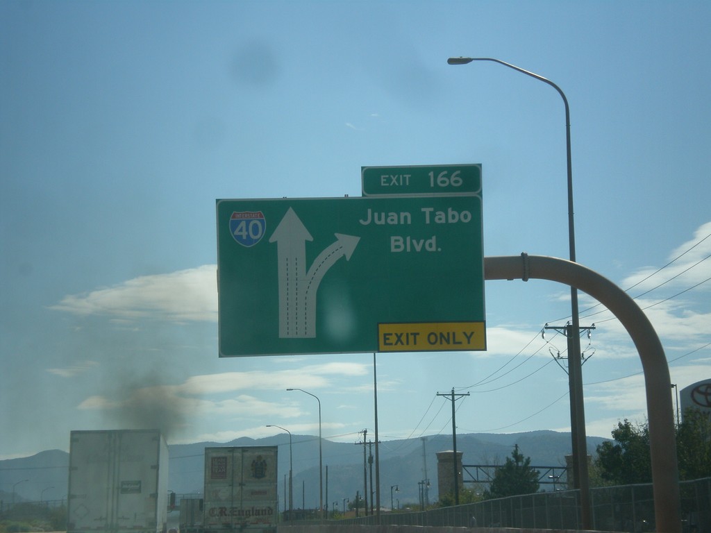
I-40 East - Exit 160
I-40 east at Exit 160 - Juan Tabo Blvd.
Taken 10-11-2012
 Albuquerque
Bernalillo County
New Mexico
United States
Albuquerque
Bernalillo County
New Mexico
United States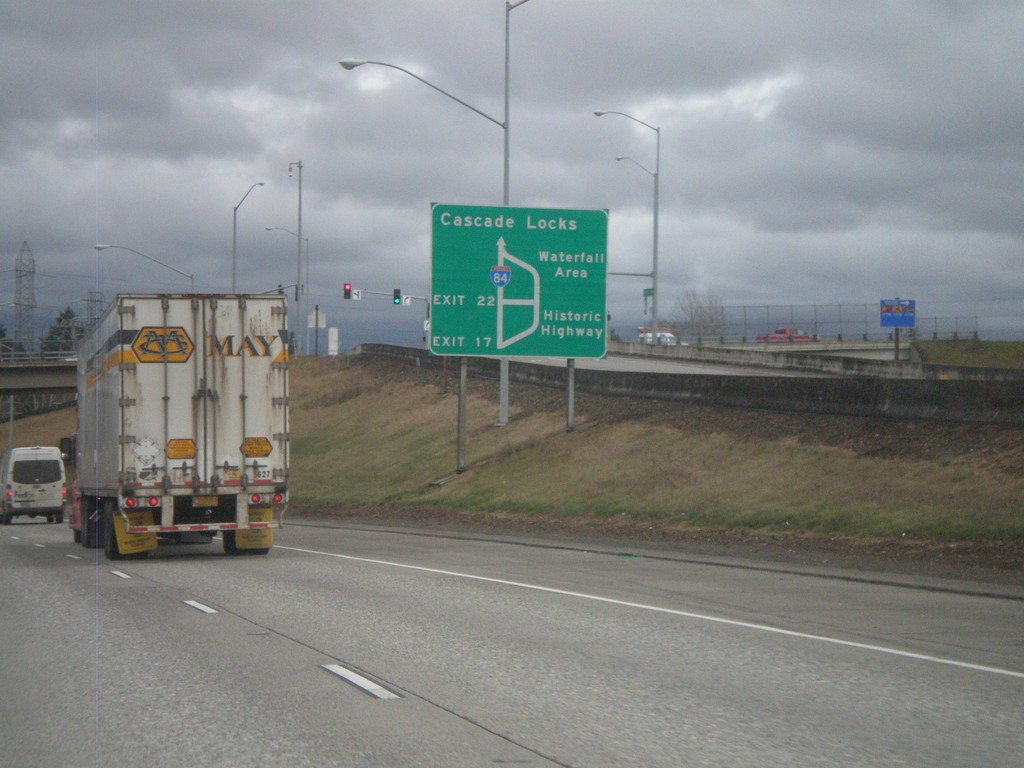
I-84/US-30 East - Historic Columbia River Highway Diagram
Route diagram for the Historic Columbia River Highway on I-84/US-30 East. Use Exit 17 (last Portland Metro. Area exit) on I-84/US-30 East for the Historic Highway. The Historic Columbia River Highway and I-84/US-30 rejoin before Cascade Locks.
Taken 02-21-2012

 Fairview
Multnomah County
Oregon
United States
Fairview
Multnomah County
Oregon
United States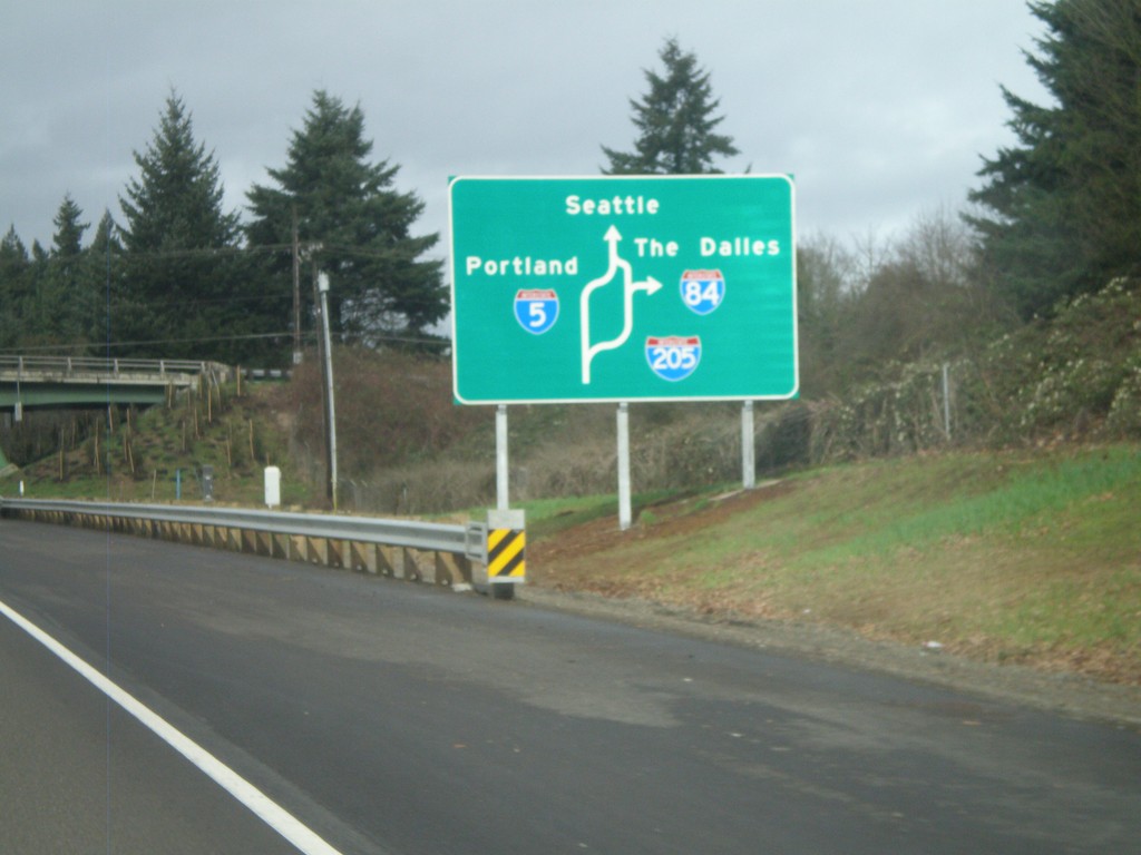
I-5 North - Portland Route Diagram
Portland area route diagram on I-5 north approaching I-205 junction.
Taken 02-21-2012

 Tualatin
Washington County
Oregon
United States
Tualatin
Washington County
Oregon
United States