Signs Tagged With Diagram
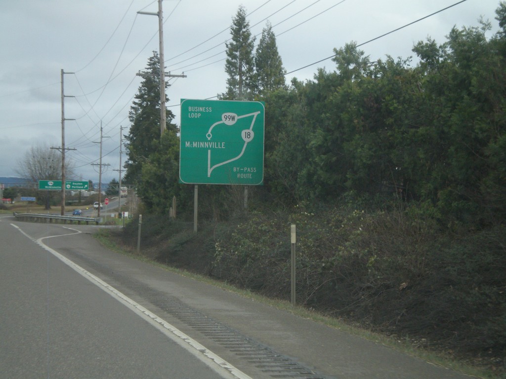
OR-18 East - Route Diagram
OR-18 East route diagram for McMinnville area, approaching OR-99W junction. Use OR-99W as a business loop through McMinnville. Use OR-18 as a bypass around McMinnville.
Taken 02-21-2012

 McMinnville
Yamhill County
Oregon
United States
McMinnville
Yamhill County
Oregon
United States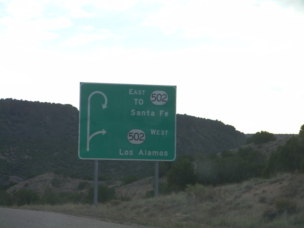
Route Diagram on NM-30 Approaching NM-502
Route Diagram on NM-30 south approaching NM-502. Use NM-502 west for Los Alamos; use NM-502 east for Santa Fe.
Taken 10-02-2011

 Santa Fe
 County
New Mexico
United States
Santa Fe
Santa Fe County
New Mexico
United States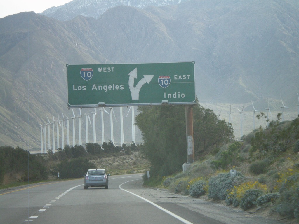
End CA-62 West at I-10
End CA-62 west at I-10. Use I-10 west for Los Angeles; use I-10 east for Indio.
Taken 02-25-2011

 Palm Springs
Riverside County
California
United States
Palm Springs
Riverside County
California
United States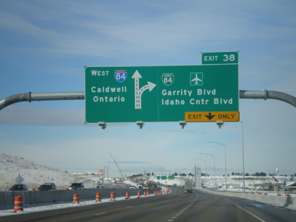
I-84 West - Exit 38
I-84/US-30 west at Exit 38 - BL-84/Garrity Blvd./Idaho Center Blvd. Westbound I-84 traffic continues towards Caldwell and Ontario (OR).
Taken 02-07-2011


 Nampa
Canyon County
Idaho
United States
Nampa
Canyon County
Idaho
United States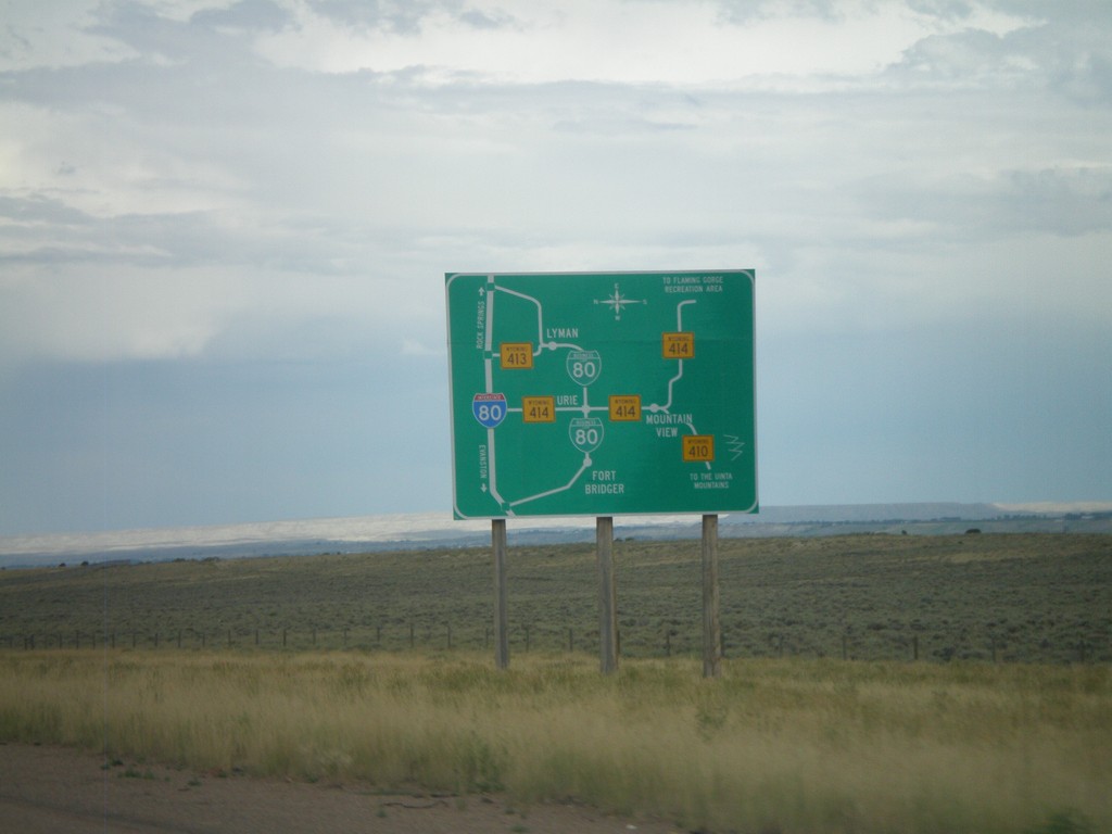
Bridger Valley Route Diagram
Route diagram for the Bridger Valley on I-80 east, descending into the Bridger Valley.
Taken 07-31-2010


 Fort Bridger
Uinta County
Wyoming
United States
Fort Bridger
Uinta County
Wyoming
United States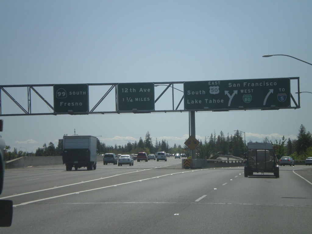
BL-80 West at US-50 and CA-99
BL-80 west at Exits 6A and 6B. Exit 6A is BL-80 West/US-50/To I-5/South Lake Tahoe/San Francisco. Exit 6B is CA-99 South/Fresno.
Taken 04-16-2010

 Sacramento
 County
California
United States
Sacramento
Sacramento County
California
United States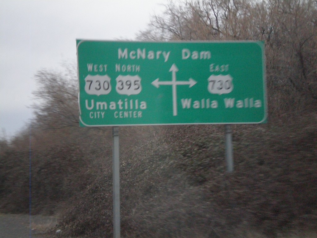
Route Diagram at US-395 North/US-730 Junction
Route diagram at US-395 north/US-730 junction. US-730 heads east to Walla Walla. US-395 North joins US-730 West into Umatilla. Continue straight for McNary Dam on the Columbia River.
Taken 01-14-2010

 Umatilla
 County
Oregon
United States
Umatilla
Umatilla County
Oregon
United States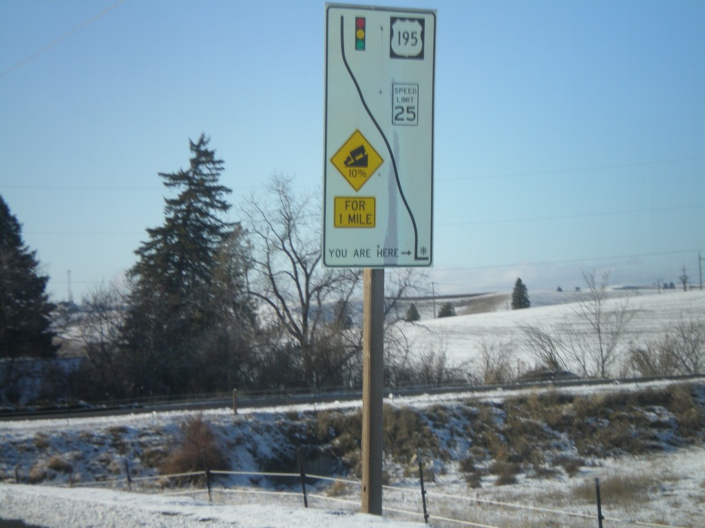
WA-272 East - Grade Information
WA-272 west at the top of a 10% grade above Colfax. Route diagram showing the speed and grade information, and the stoplight at the bottom of the hill at US-195.
Taken 12-26-2009
 Colfax
Whitman County
Washington
United States
Colfax
Whitman County
Washington
United States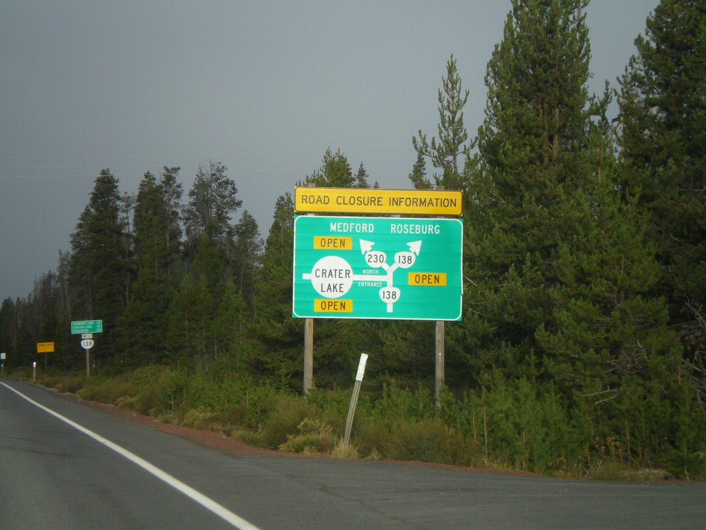
Cascades Closure Information
Road closure information for OR-230, OR-138, and Crater Lake in the Oregon Cascades. Closures are listed in a simple route diagram.
Taken 09-20-2009
 Chemult
Klamath County
Oregon
United States
Chemult
Klamath County
Oregon
United States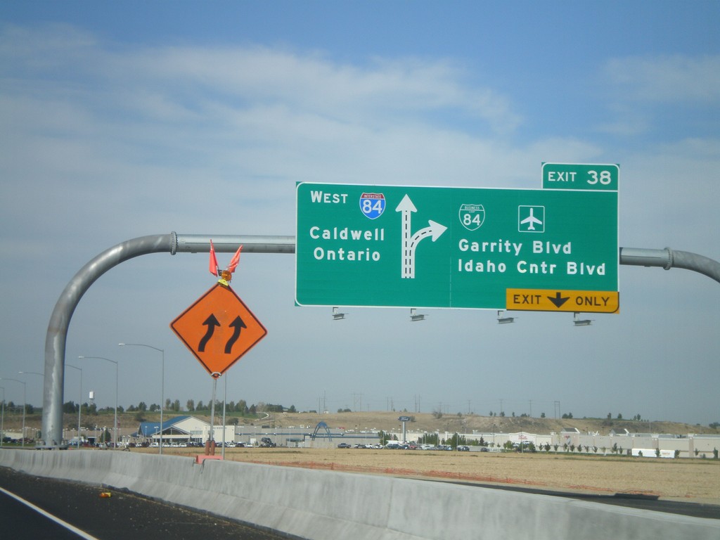
I-84 West - Exit 38
I-84/US-30 west at Exit 38 - BL-84/Garrity Blvd./Idaho Center Blvd. Westbound I-84 traffic continues towards Caldwell and Ontario (OR).
Taken 09-19-2009
Nampa
Canyon County
Idaho
United States