Signs Tagged With Distance Marker
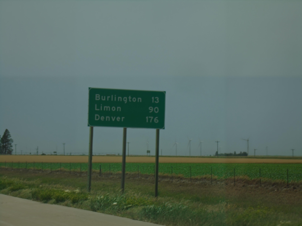
I-70 West - Distance Marker
Last distance marker on I-70 west in Kansas. Distance to Burlington, Limon, and Denver. All destinations on sign are in Colorado.
Taken 06-20-2026

 Kanorado
Sherman County
Kansas
United States
Kanorado
Sherman County
Kansas
United States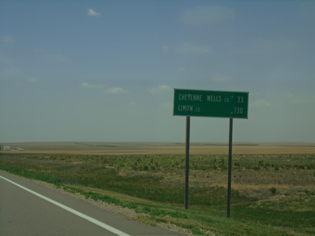
US-40 West - Distance Marker
Distance marker on US-40 west. Distance to Cheyenne Wells, Colorado and Limon, Colorado.
Taken 06-20-2026
 Sharon Springs
Wallace County
Kansas
United States
Sharon Springs
Wallace County
Kansas
United States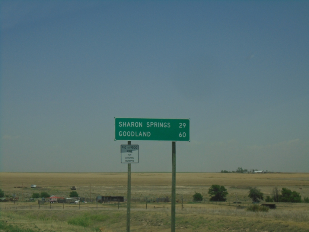
KS-27 North - Distance Marker
Distance marker on KS-27 North. Distance to Sharon Springs and Goodland.
Taken 06-20-2026
 Tribune
Greeley County
Kansas
United States
Tribune
Greeley County
Kansas
United States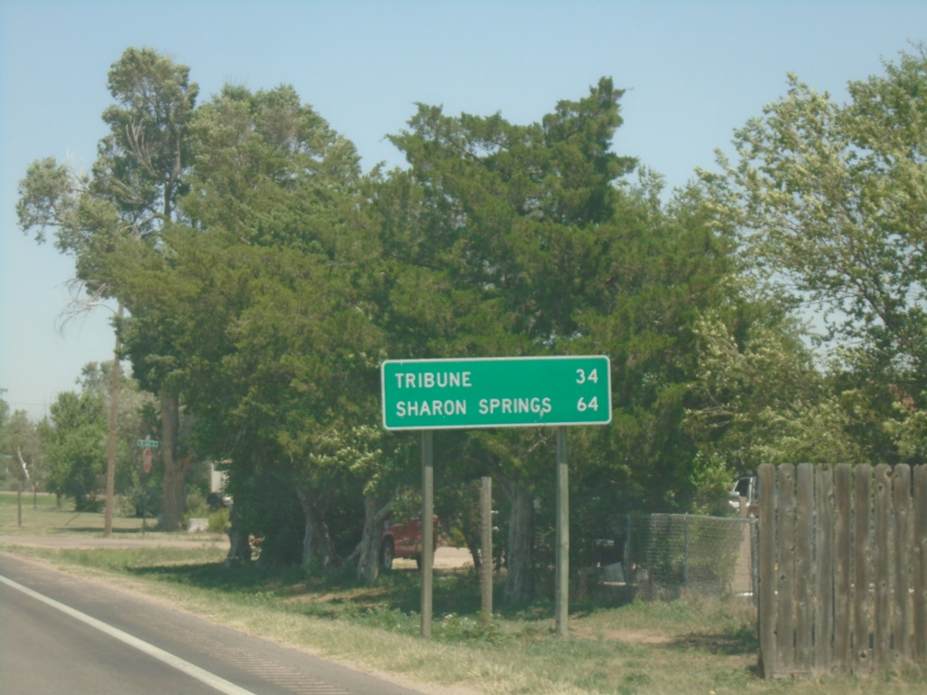
KS-27 North - Distance Marker
Distance marker on KS-27 North. Distance to Tribune and Sharon Springs.
Taken 06-20-2026
Syracuse
Hamilton County
Kansas
United States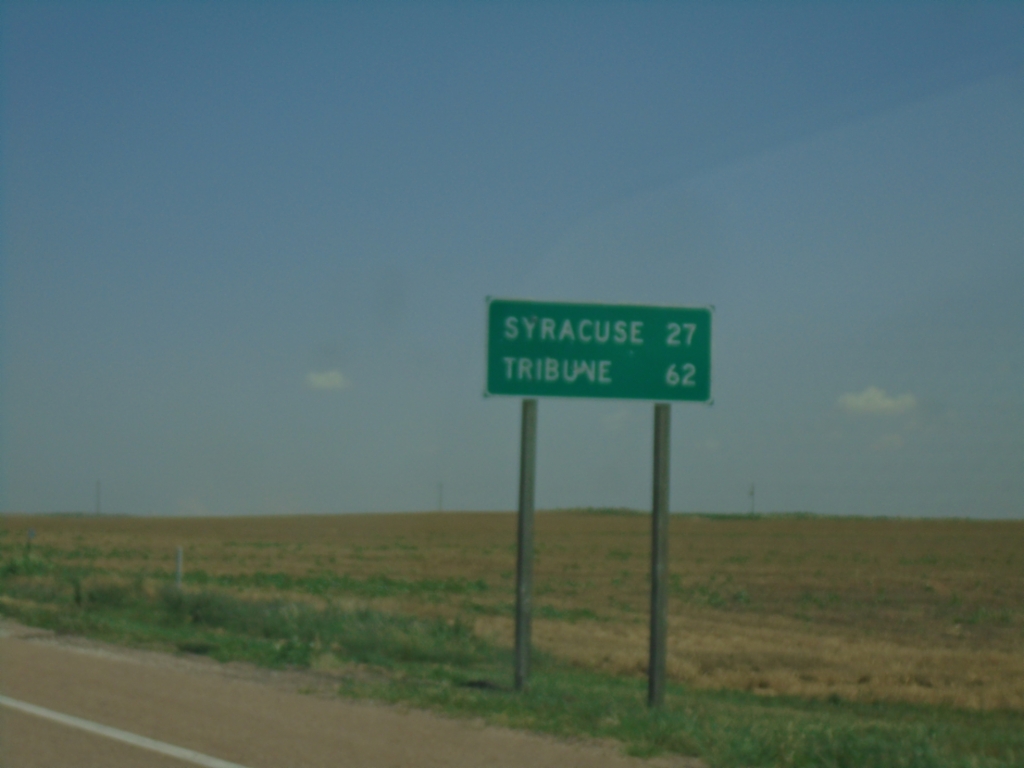
KS-27 North - Distance Marker
Distance marker on KS-27 north. Distance to Syracuse and Tribune.
Taken 06-20-2026
Johnson City
Stanton County
Kansas
United States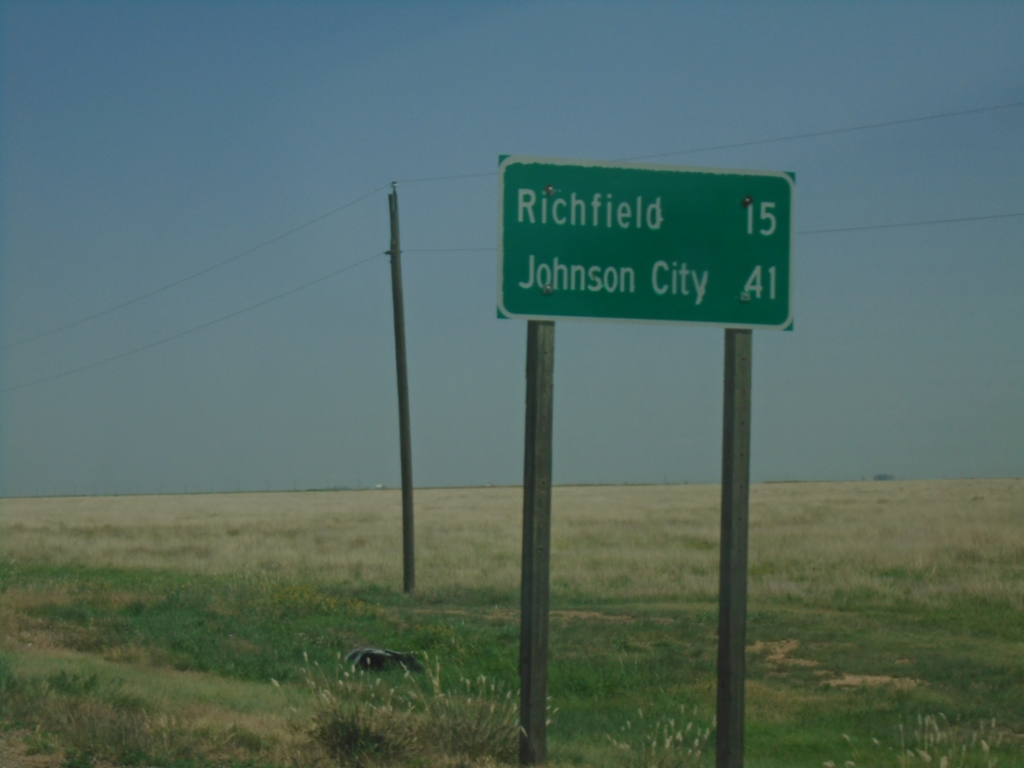
KS-27 North/KS-51 East - Distance Marker
Distance Marker on KS-27 North/KS-51 East. Distance to Richfield and Johnson City.
Taken 06-20-2026
 Westola
Morton County
Kansas
United States
Westola
Morton County
Kansas
United States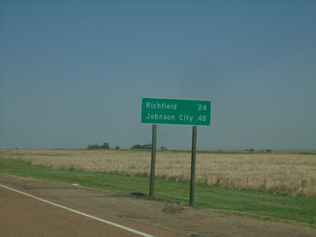
KS-27 North - Distance Marker
Distance marker on KS-27 north. Distance to Richfield and Johnson City.
Taken 06-20-2026
Taloga
Morton County
Kansas
United States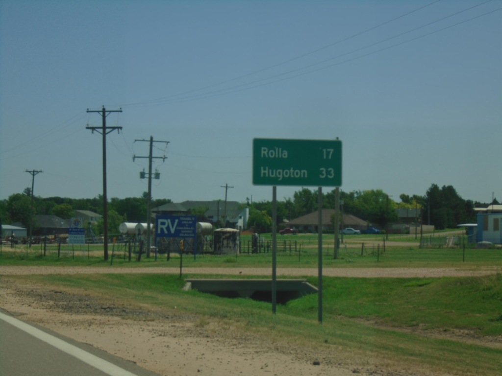
US-56 East - Distance Marker
Distance marker on US-56 east. This is the last distance marker in Oklahoma on US-56. Distance to Rolla and Hugoton (both destinations in Kansas).
Taken 06-20-2026
 Elkhart
Texas County
Oklahoma
United States
Elkhart
Texas County
Oklahoma
United States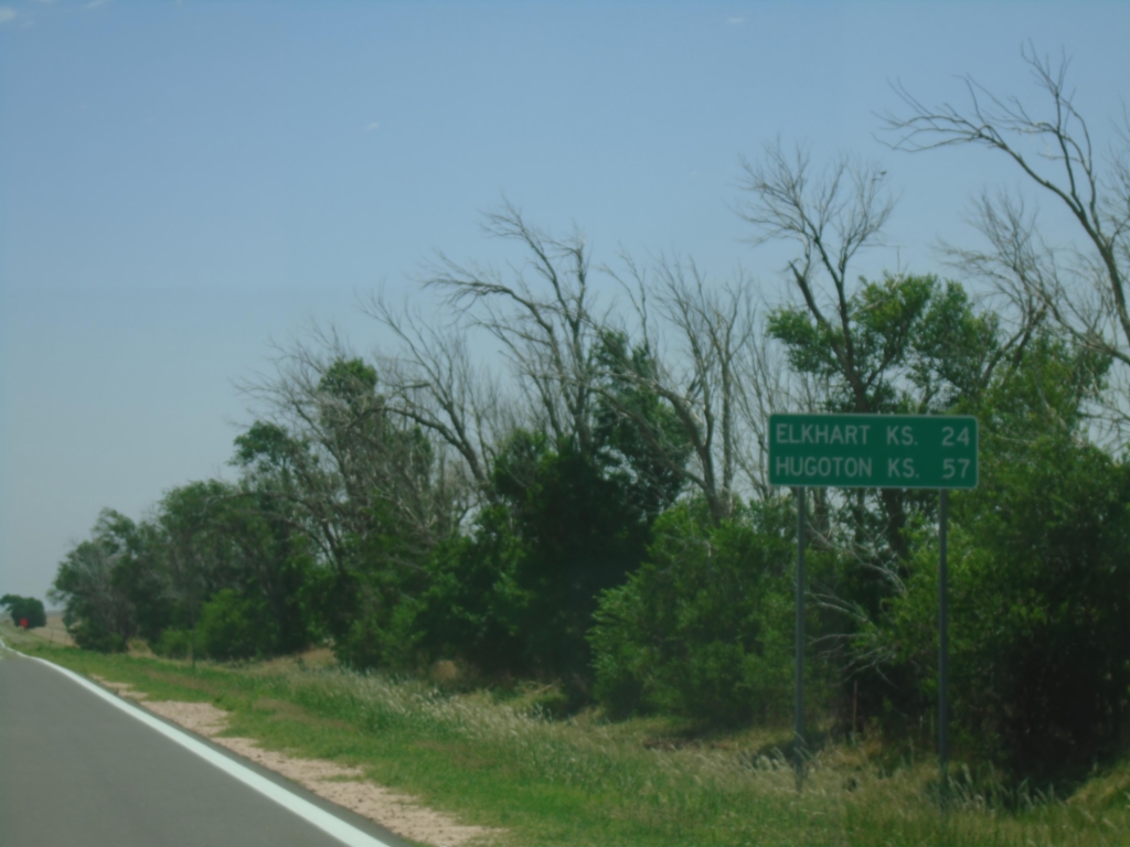
US-56 East - Distance Marker
Distance marker on US-56 east. Distance to Elkhart, KS and Hugoton, KS.
Taken 06-20-2026
Keyes
Cimarron County
Oklahoma
United States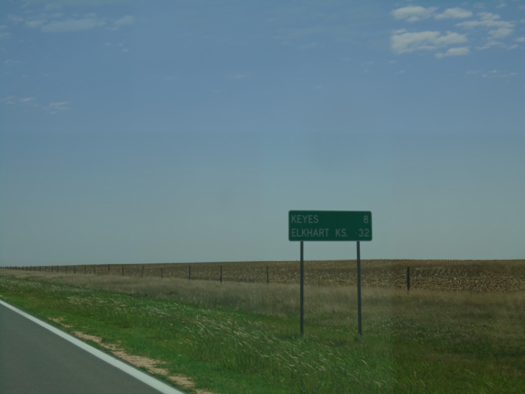
US-56 East - Distance Marker
Distance marker on US-56 East. Distance to Keyes and Elkhart, Kansas.
Taken 06-20-2026
Cimarron County
Oklahoma
United States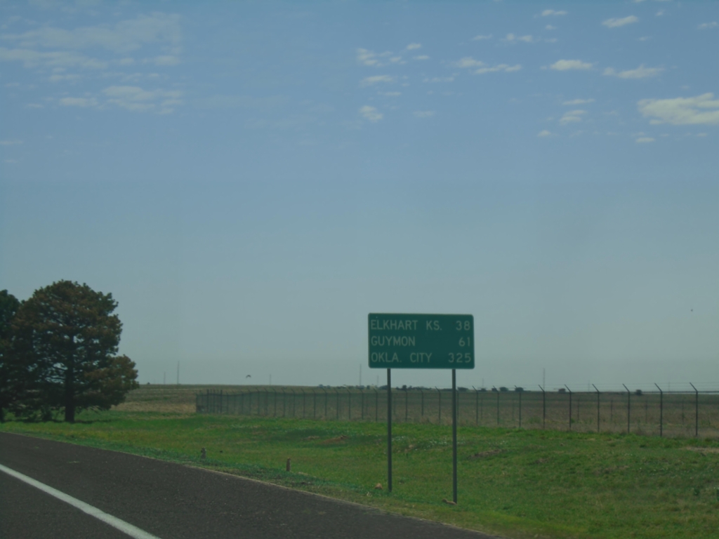
US-56/US-64/US-412/OK-3 East - Distance Marker
Distance Marker on US-56/US-64/US-412/OK-3 East. Distance to Elkhart, KS (via US-56), Guymon, and Oklahoma City.
Taken 06-20-2026


 Cimarron County
Oklahoma
United States
Cimarron County
Oklahoma
United States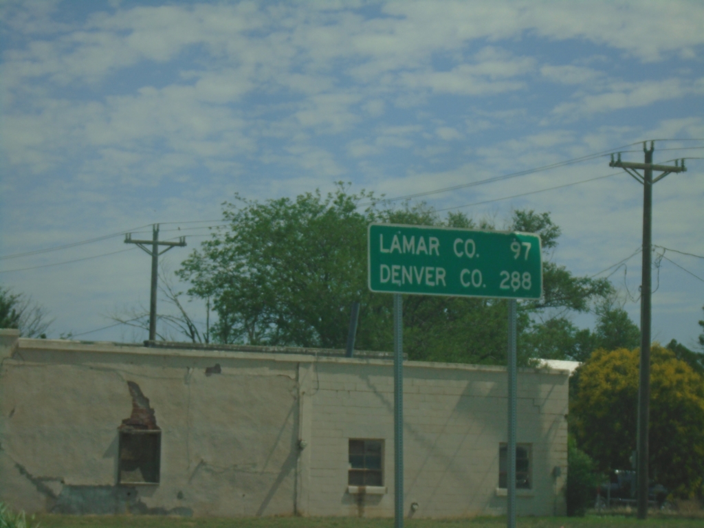
US-385 North/OK-3 West - Distance Marker
Distance Marker on US-385 North/OK-3 West. Distance to Lamar, Colorado and Denver, Colorado.
Taken 06-20-2026
 Boise City
Cimarron County
Oklahoma
United States
Boise City
Cimarron County
Oklahoma
United States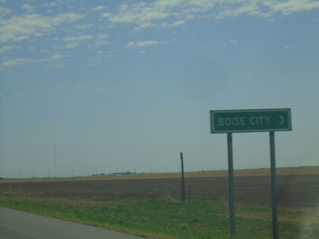
US-56/US-64/US-412 East/US-385 North - Distance Marker
Distance marker on US-56/US-64/US-412 East/US-385 North. Distance to Boise City.
Taken 06-20-2026
Boise City
Cimarron County
Oklahoma
United States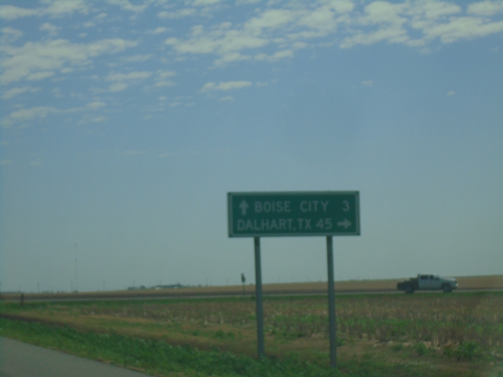
US-56/US-64/US-412 East Approaching US-385
US-56/US-64/US-412 East approaching US-385 south to Dalhart, Texas. Continue on US-56/US-64/US-412 East to Boise City.
Taken 06-20-2026
Cimarron County
Oklahoma
United States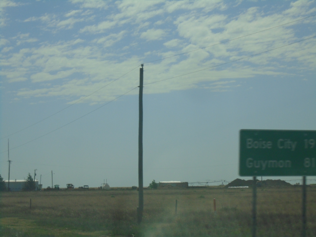
US-56/US-64/US-412 East - Distance Marker
Distance Marker on US-56/US-64/US-412 East. Distance to Boise City and Guymon.
Taken 06-20-2026
Felt
Cimarron County
Oklahoma
United States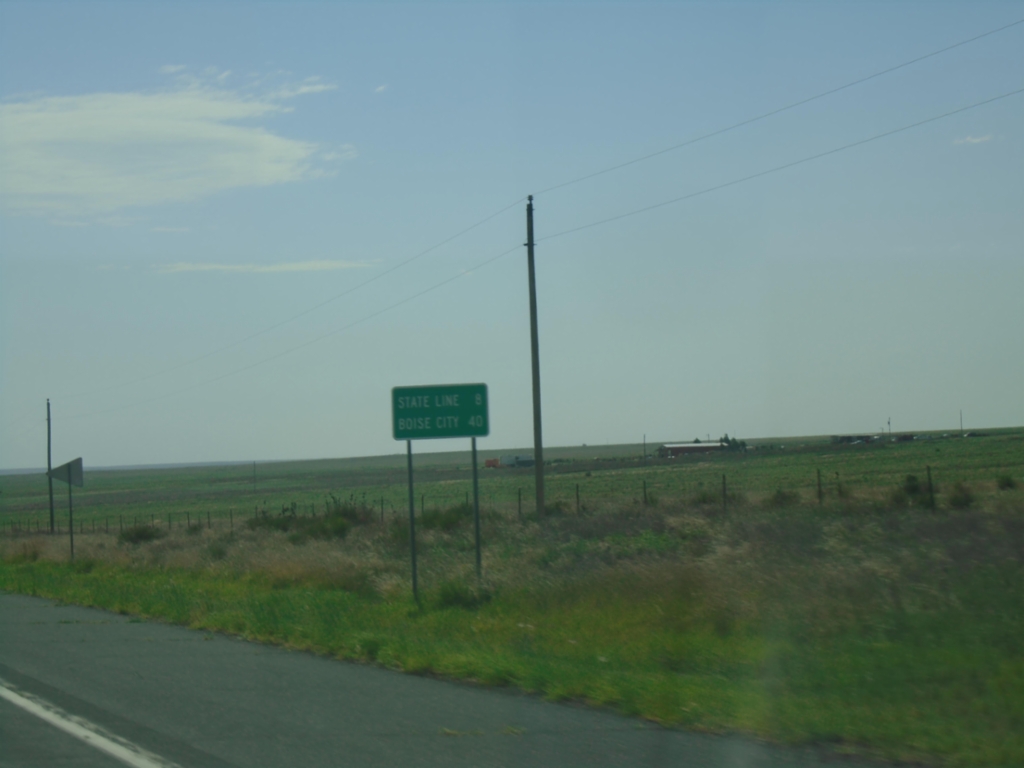
US-56/US-64/US-412 East - Distance Marker
Distance Marker on US-56/US-64/US-412 East. Distance to (Oklahoma) State Line and Boise City (Oklahoma).
Taken 06-20-2026
Union County
New Mexico
United States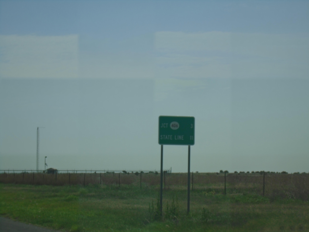
US-56/US-64/US-412 East - Distance Marker
Distance Marker on US-56/US-64/US-412 East. Distance to NM-406 and (Oklahoma) State Line
Taken 06-20-2026
 Union County
New Mexico
United States
Union County
New Mexico
United States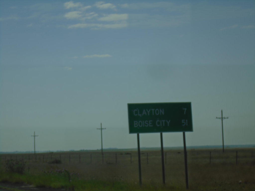
US-64 East/US-87 South - Distance Marker
Distance marker on US-64 East/US-87 South. Distance to Clayton and Boise City (Oklahoma).
Taken 06-20-2026
 Royce
Union County
New Mexico
United States
Royce
Union County
New Mexico
United States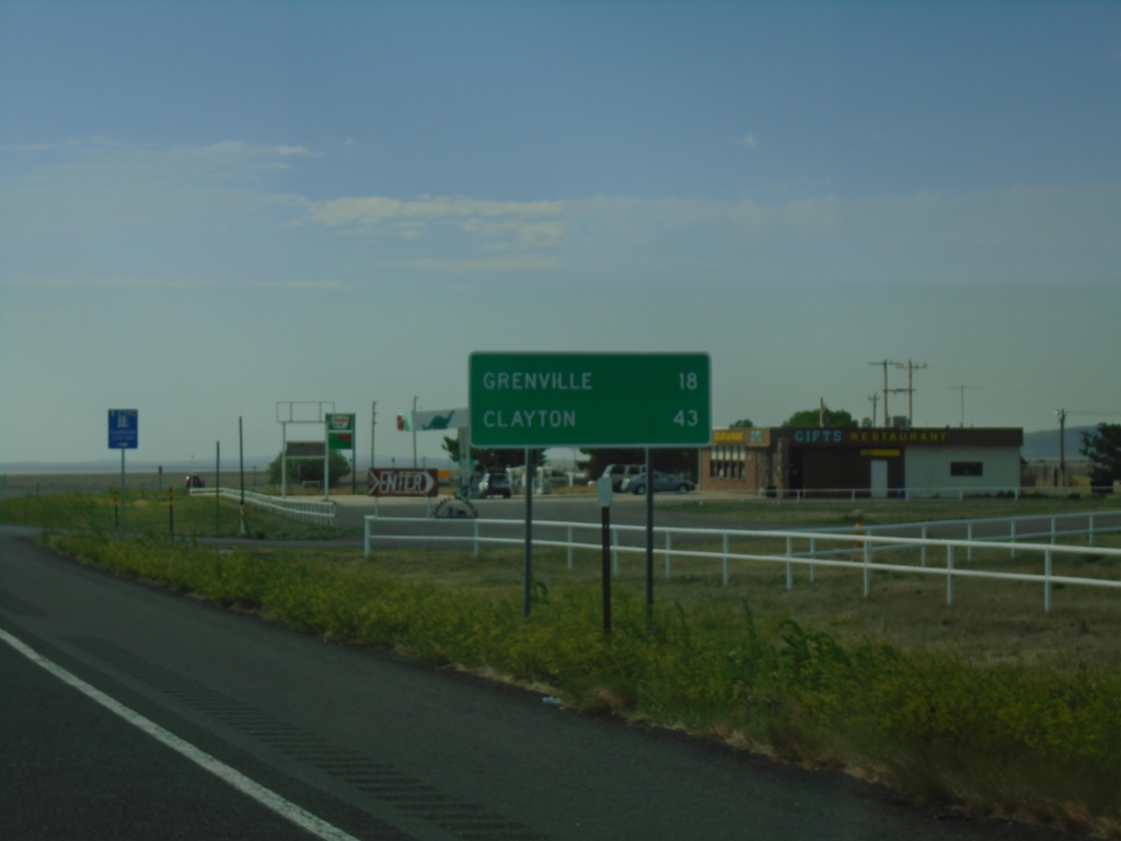
US-64 East/US-87 South - Distance Marker
Distance marker on US-64 East/US-87 South. Distance to Grenville and Clayton.
Taken 06-20-2026
Des Moines
Union County
New Mexico
United States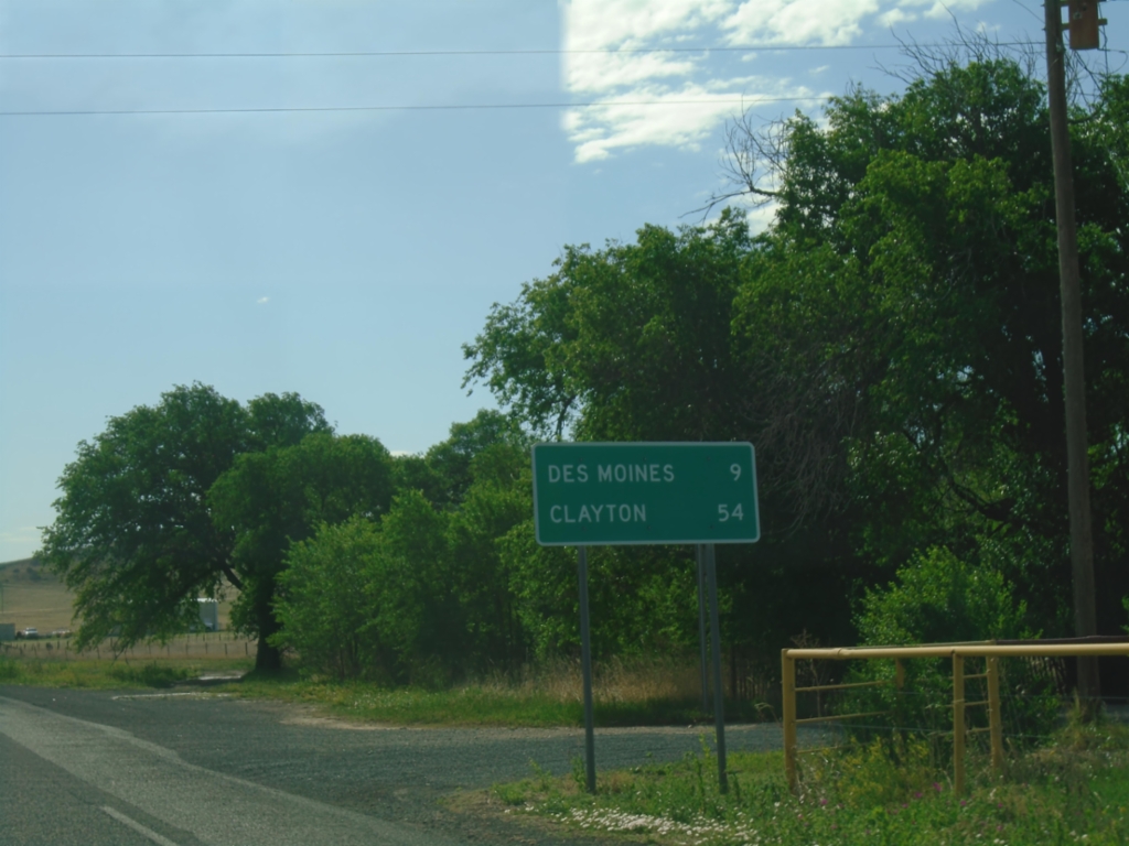
US-64 East/US-87 South - Distance Marker
Distance Marker on US-64 East/US-87 South. Distance to Des Moines and Clayton.
Taken 06-20-2026
Capulin
Union County
New Mexico
United States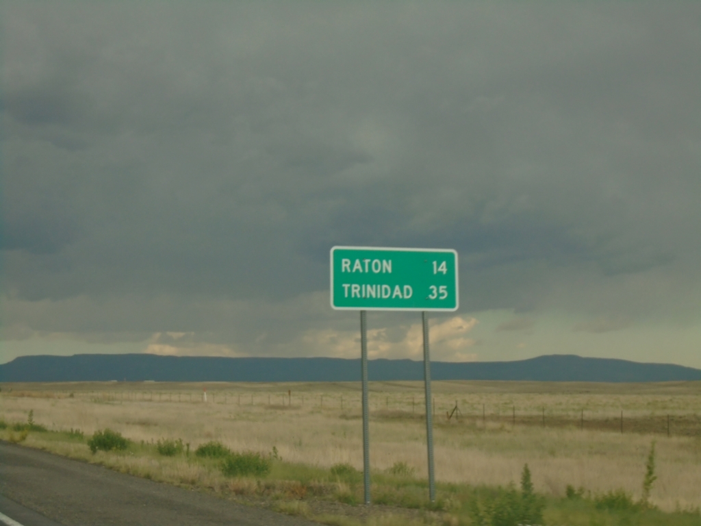
US-64 - Distance Marker
Distance marker on US-64. Distance to Raton and Trinidad (Colorado).
Taken 06-19-2026
Colfax County
New Mexico
United States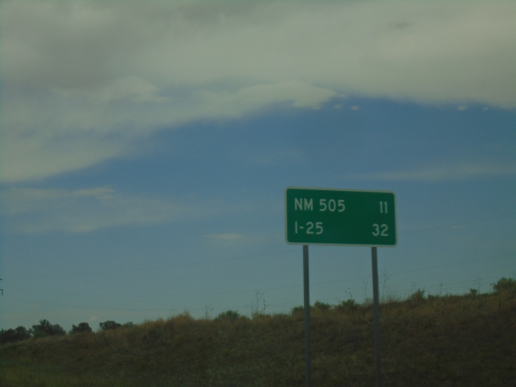
US-64 East - Distance Marker
Distance marker on US-64 east. Distance to NM-505 Junction and I-25 Junction.
Taken 06-19-2026

 Cimarron
Colfax County
New Mexico
United States
Cimarron
Colfax County
New Mexico
United States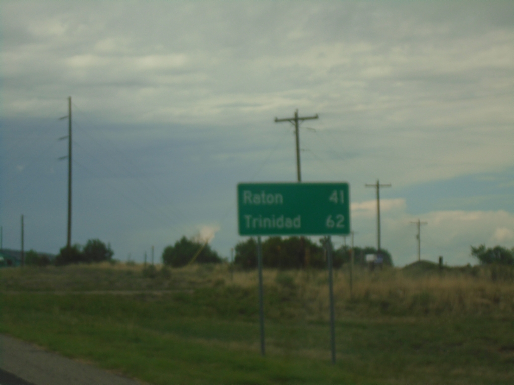
US-64 East - Distance Marker
Distance marker on US-64 East. Distance to Raton and Trinidad (Colorado).
Taken 06-19-2026
Cimarron
Colfax County
New Mexico
United States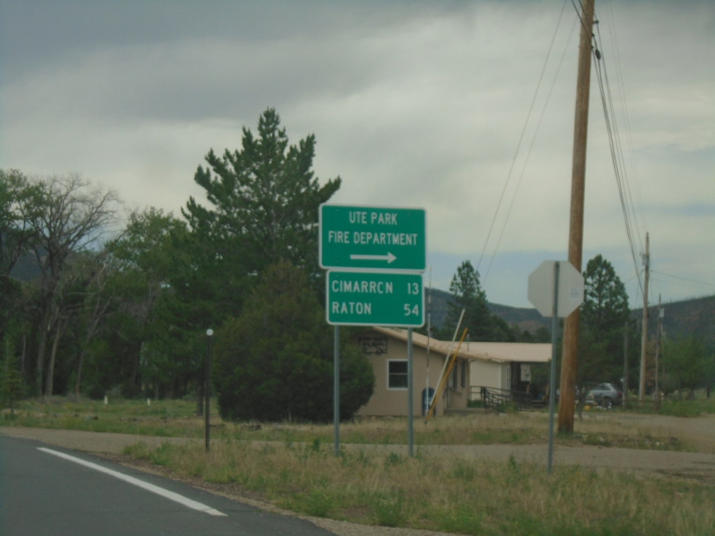
US-64 East - Ute Park
US-64 East at Ute Park Fire Department junction. Continue east on US-64 for Cimarron and Raton.
Taken 06-19-2026
Ute Park
Colfax County
New Mexico
United States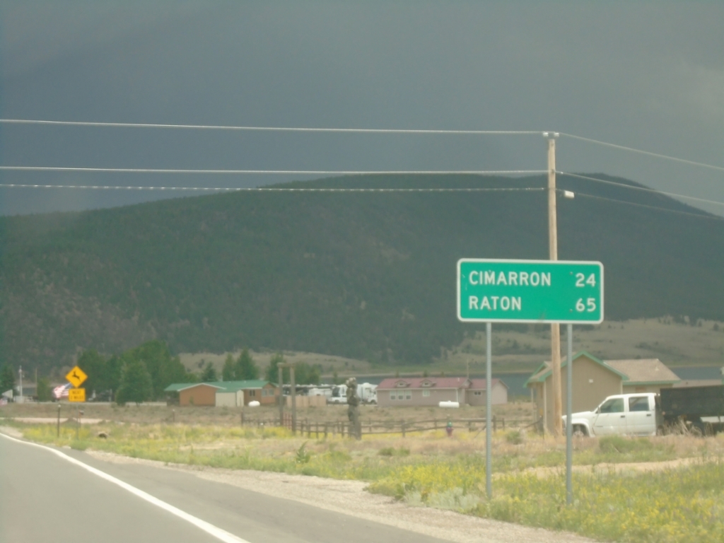
US-64 East - Distance Marker
Distance marker on US-64 east. Distance to Cimarron and Raton.
Taken 06-19-2026
Eagle Nest
Colfax County
New Mexico
United States