Signs Tagged With Distance Marker
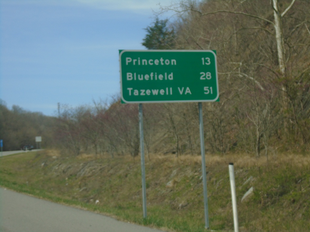
US-460 West - Distance Marker
Distance marker on US-460 west. Distance to Princeton, Bluefield, and Tazewell, VA.
Taken 03-30-2024
 Princeton
Mercer County
West Virginia
United States
Princeton
Mercer County
West Virginia
United States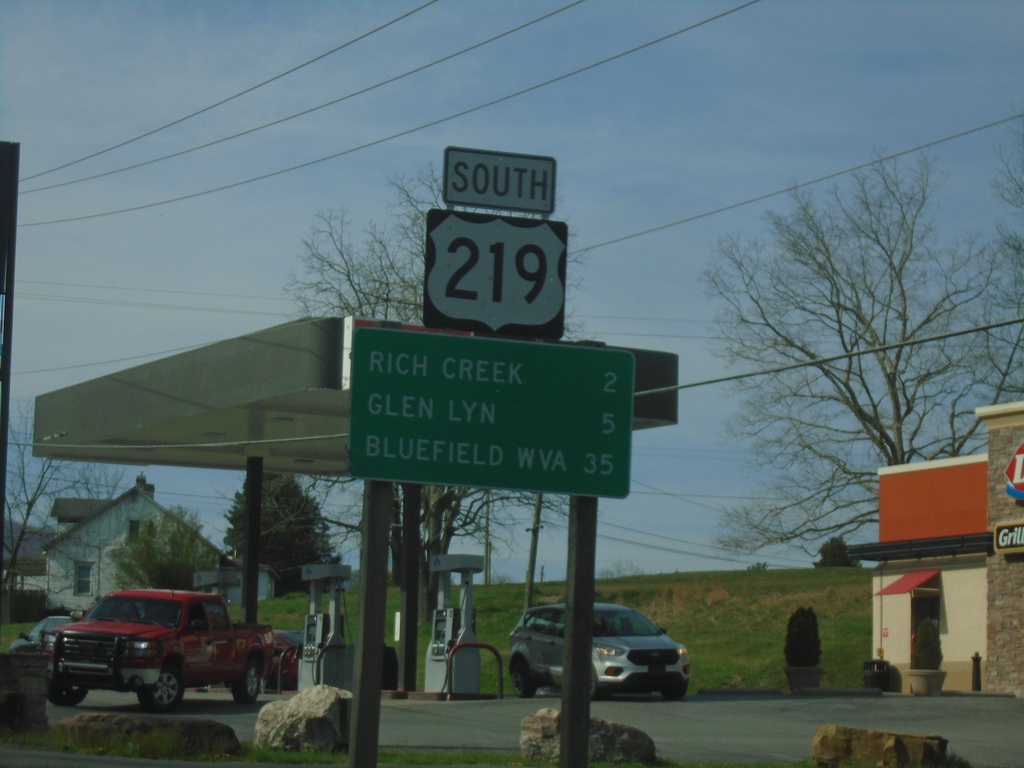
US-219 South - Distance Marker
Distance marker on US-219 south. Distance to Rich Creek, Glen Lyn, and Bluefield, WV.
Taken 03-30-2024
 Rich Creek
Giles County
Virginia
United States
Rich Creek
Giles County
Virginia
United States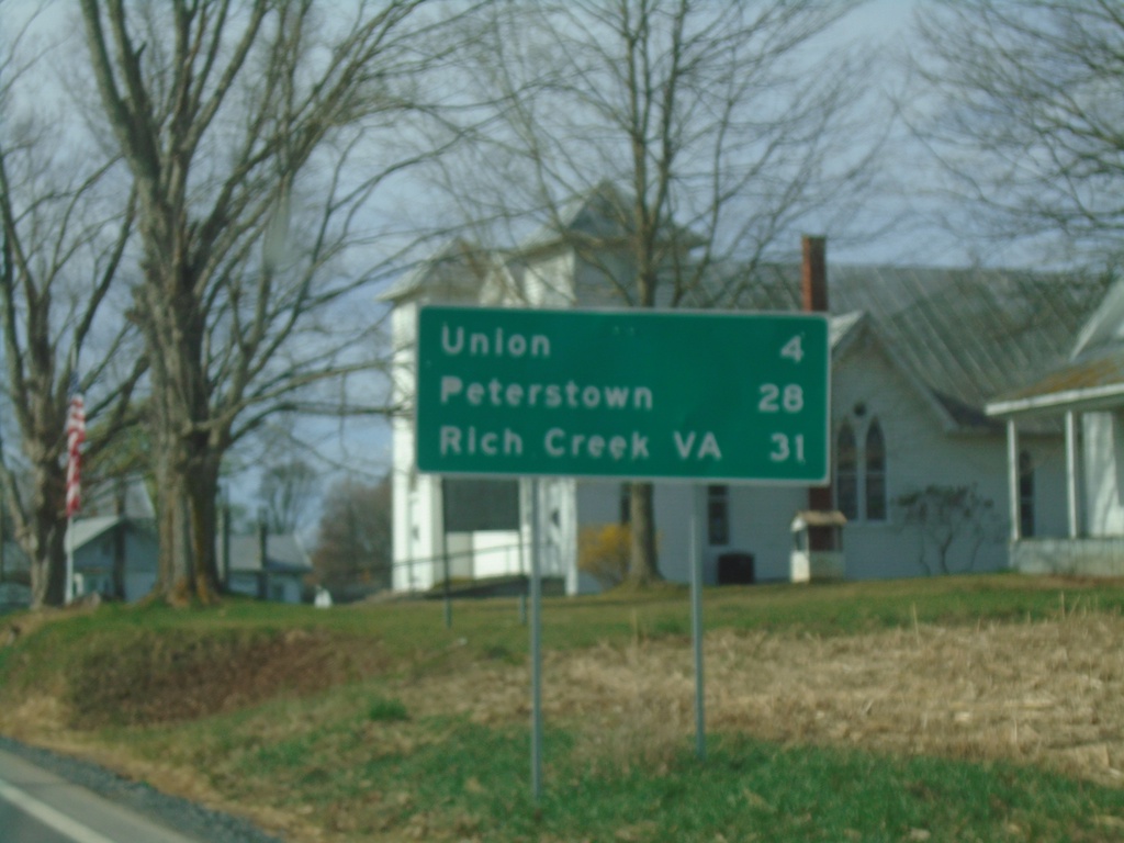
US-219 South/WV-3 East - Distance Marker
Distance Marker on US-219 South/WV-3 East. Distance to Union, Peterstown, and Rich Creek, VA.
Taken 03-30-2024
 Sinks Grove
Monroe County
West Virginia
United States
Sinks Grove
Monroe County
West Virginia
United States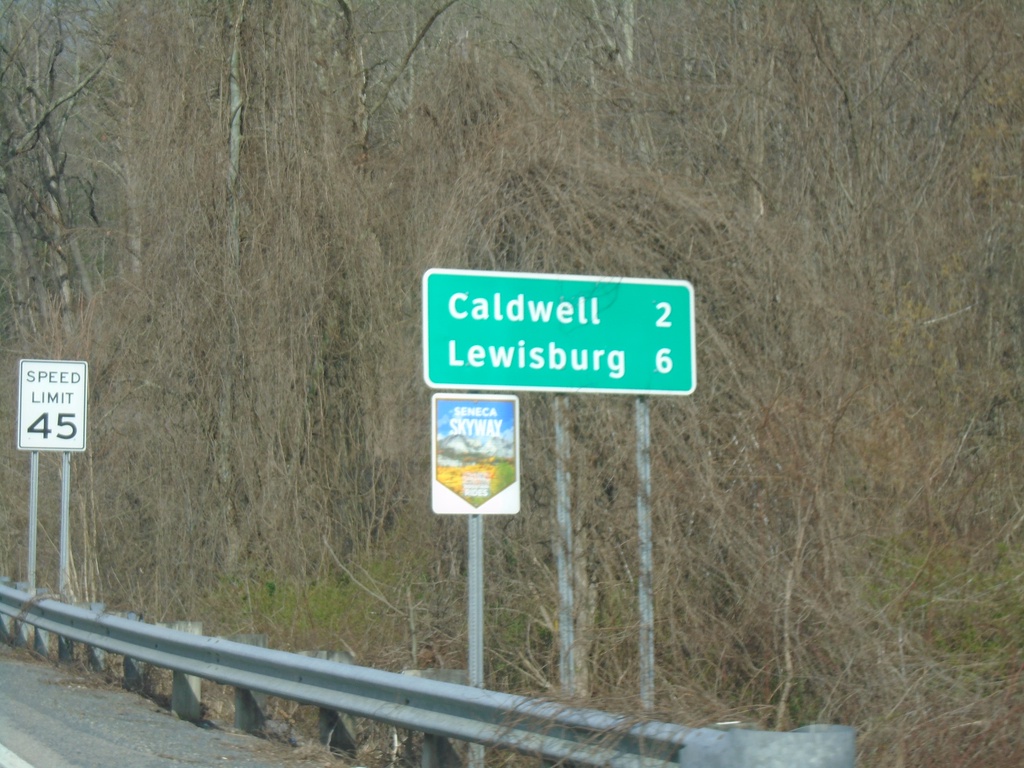
US-60 West - Distance Marker
Distance marker on US-60 west. Distance to Caldwell and Lewisburg. US-60 is part of the Seneca Skyway Mountain Ride.
Taken 03-30-2024
 Caldwell
Greenbrier County
West Virginia
United States
Caldwell
Greenbrier County
West Virginia
United States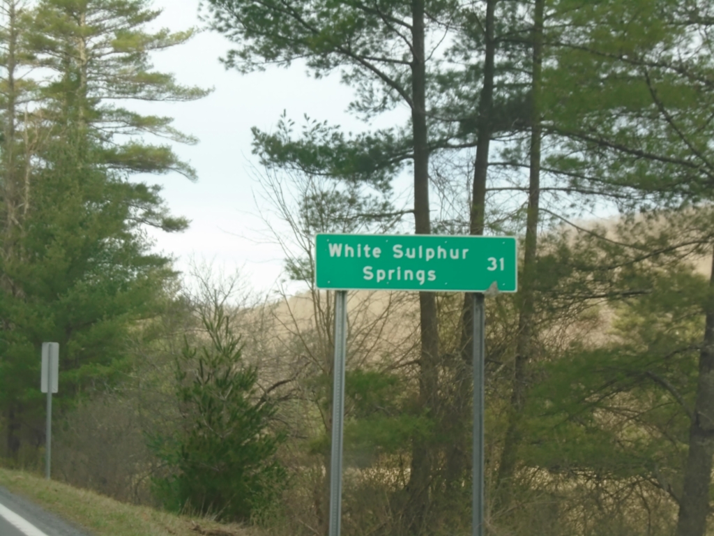
WV-92 South - Distance Marker
Distance marker on WV-92 south. Distance to White Sulphur Springs.
Taken 03-30-2024
 Marlinton
Pocahontas County
West Virginia
United States
Marlinton
Pocahontas County
West Virginia
United States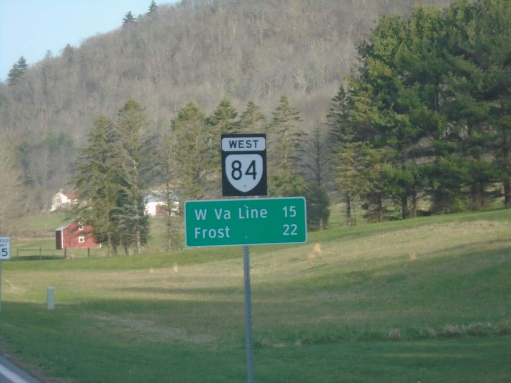
VA-84 West - Distance Marker
Distance marker on VA-84 west. Distance to West Virginia Line and Frost, WV.
Taken 03-30-2024
 Monterey
Highland County
Virginia
United States
Monterey
Highland County
Virginia
United States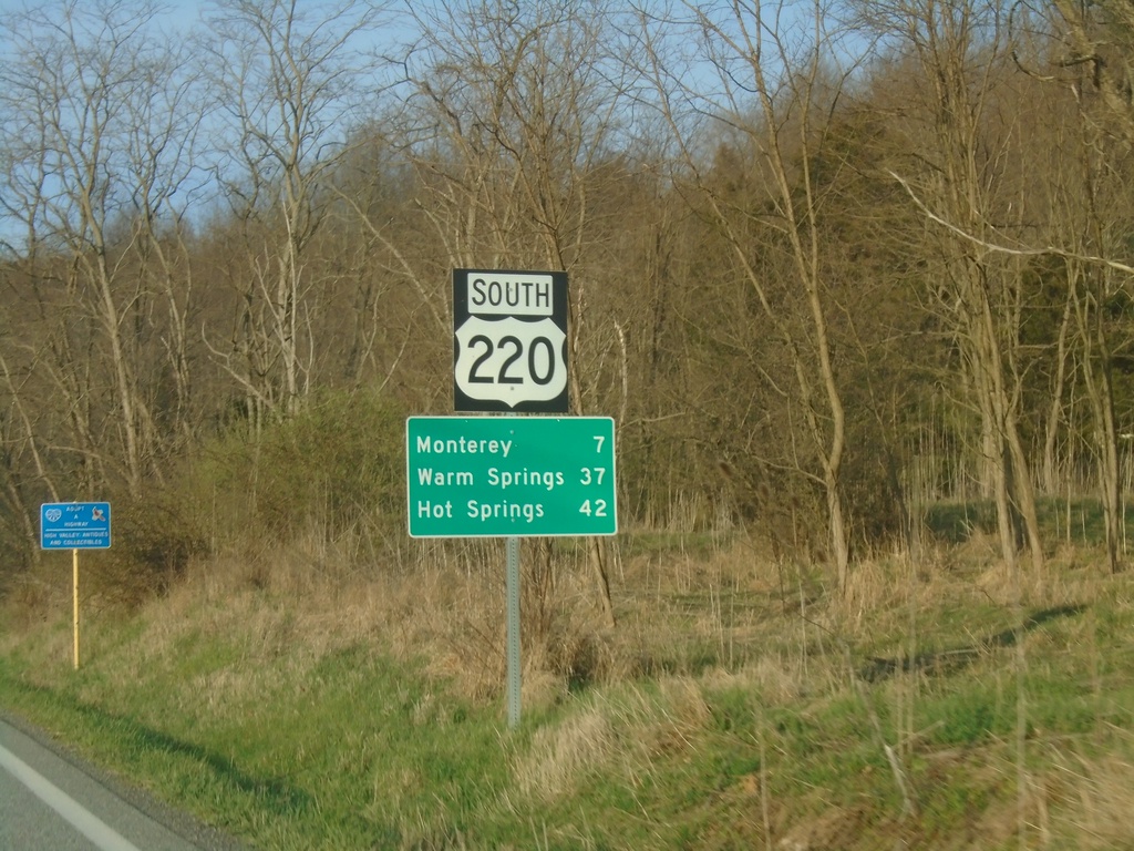
US-220 South - Distance Marker
Distance marker on US-220 south. Distance to Monterey, Warm Springs, and Hot Springs. This is the first distance marker southbound in Virginia. Most of the highway shields in Highland County seem to have a combined shield and banner into one assembly.
Taken 03-30-2024
 Monterey
Highland County
Virginia
United States
Monterey
Highland County
Virginia
United States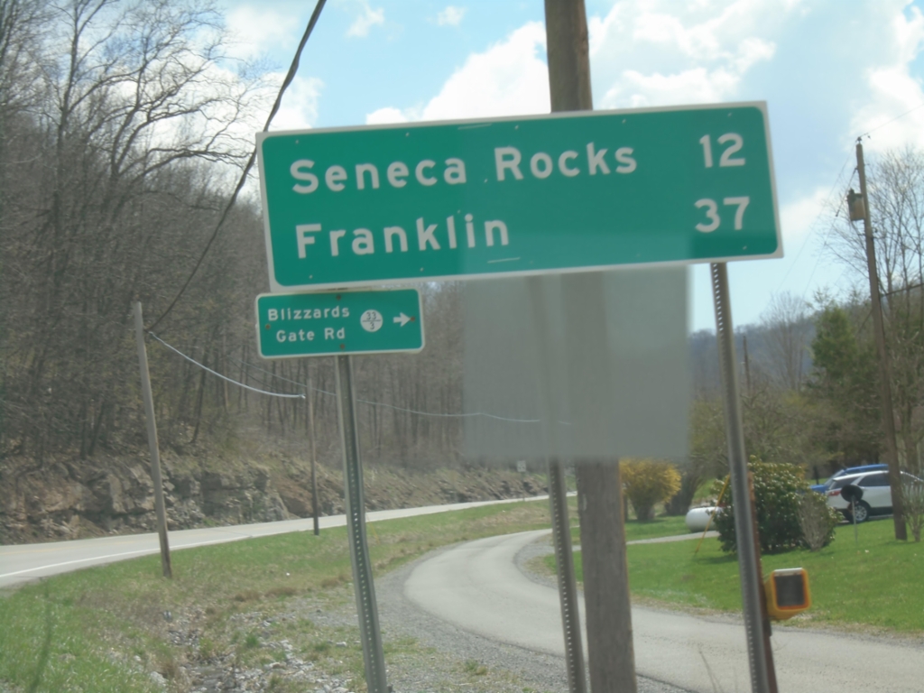
US-33/WV-55 East - Distance Marker and WVCR-33/3 Junction
Distance Marker on US-33/WV-55 East. Distance to Seneca Rocks and Franklin. Junction with WVCR-33/3 / Blizzards Gate Road.
Taken 03-29-2024


 Harman
Randolph County
West Virginia
United States
Harman
Randolph County
West Virginia
United States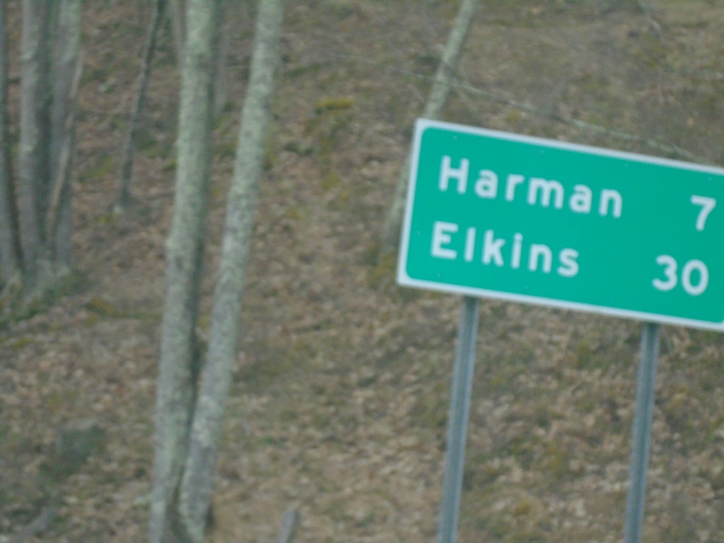
WV-32 South - Distance Marker
Distance marker on WV-32 south. Distance to Harman and Elkins.
Taken 03-29-2024
 Davis
Tucker County
West Virginia
United States
Davis
Tucker County
West Virginia
United States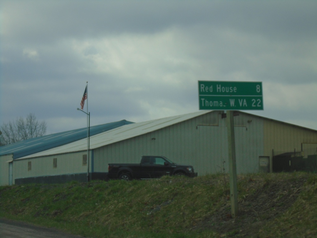
US-219 South - Distance Marker
Distance marker on US-219 south. Distance to Red House and Thomas, WV.
Taken 03-29-2024
Oakland
Garrett County
Maryland
United States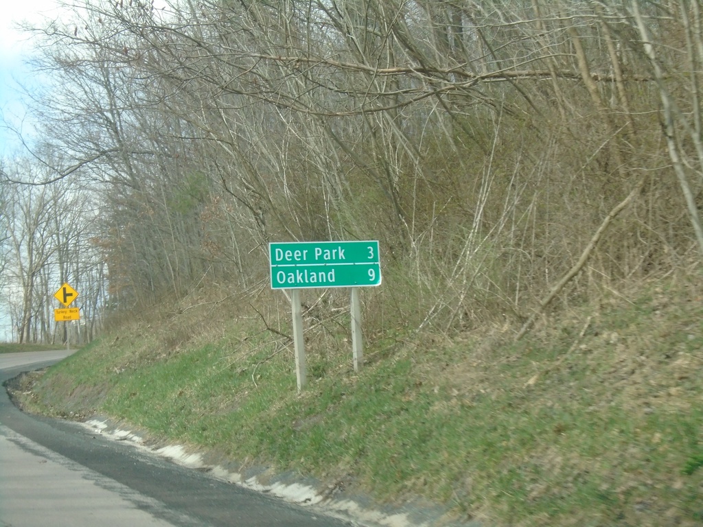
MD-135 West - Distance Marker
Distance marker on MD-135 west. Distance to Deer Park and Oakland.
Taken 03-29-2024
 Swanton
Garrett County
Maryland
United States
Swanton
Garrett County
Maryland
United States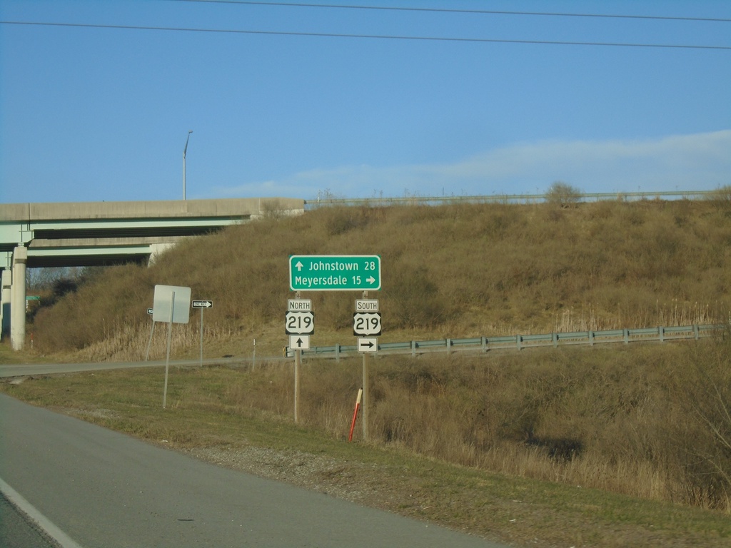
PA-281 North at US-219 Interchange
PA-281 North at US-219 interchange. Use US-219 South to Meyersdale; US-219 North to Johnstown.
Taken 03-28-2024
 Somerset
 County
Pennsylvania
United States
Somerset
Somerset County
Pennsylvania
United States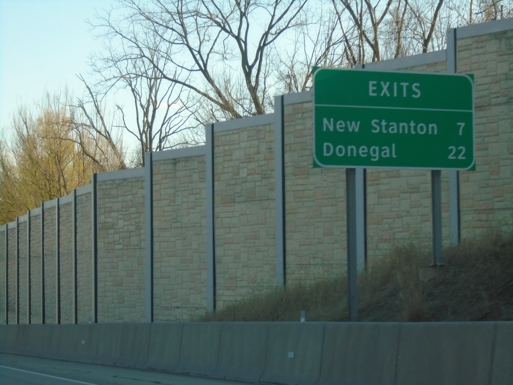
I-76 (Pennsylvania Turnpike) - Next Exits
Distance marker on I-76/Pennsylvania Turnpike. Distance to New Stanton and Donegal exits.
Taken 03-28-2024
 Irwin
Westmoreland County
Pennsylvania
United States
Irwin
Westmoreland County
Pennsylvania
United States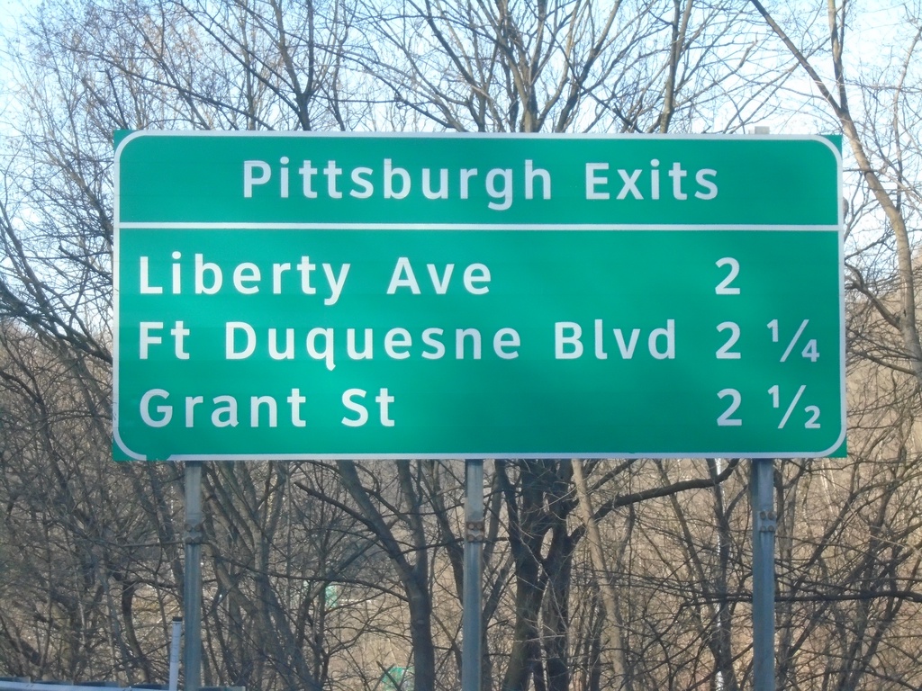
I-376 East - Pittsburgh Exits
Pittsburgh Exits - Liberty Ave., Fort Duquesne Blvd., and Grant St.
Taken 03-28-2024


 Pittsburgh
Allegheny County
Pennsylvania
United States
Pittsburgh
Allegheny County
Pennsylvania
United States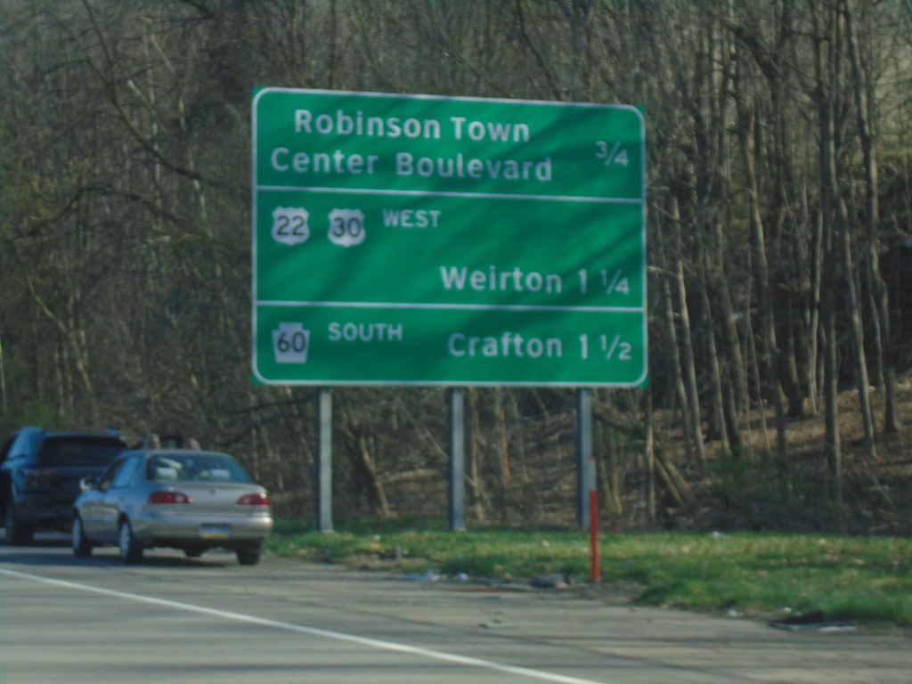
I-376 East - Next Pittsburgh Area Exits
Next 3 exits on I-376 East. Robinson Town Center Blvd., US-22/US-30 West/Weirton, and PA-60 South/Crafton.
Taken 03-28-2024
 Coraopolis
Allegheny County
Pennsylvania
United States
Coraopolis
Allegheny County
Pennsylvania
United States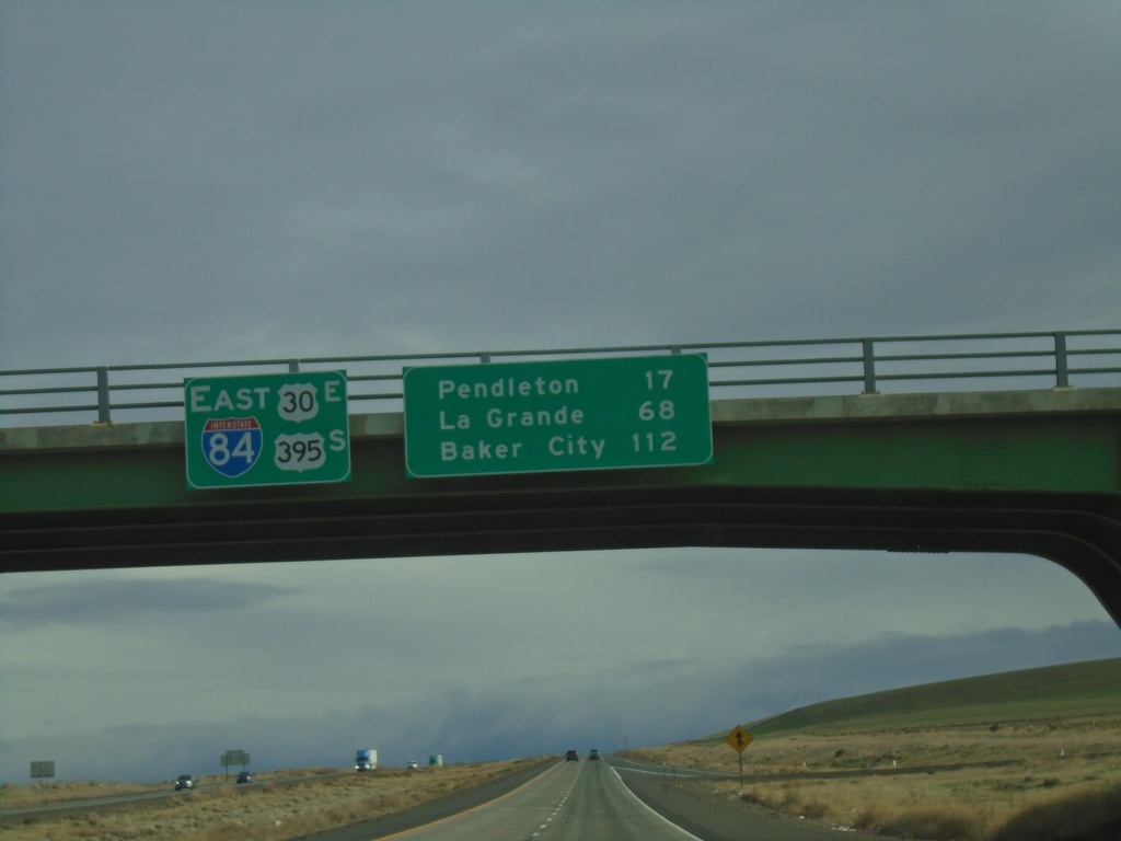
I-84/US-30 East/US-395 South - Distance Marker
Distance Marker on I-84/US-30 East/US-395 South at the overpass over Exit 193. Distance to Pendleton, La Grande, and Baker City.
Taken 01-06-2024

 Echo
Umatilla County
Oregon
United States
Echo
Umatilla County
Oregon
United States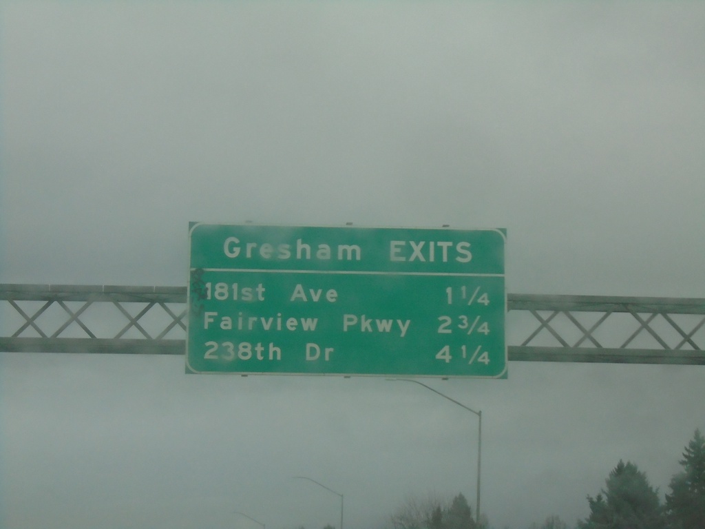
I-84 East - Gresham Exits
Gresham Exits along I-84 east: 181st Ave., Fairview Parkway, and 238th Drive.
Taken 01-06-2024
Portland
Multnomah County
Oregon
United States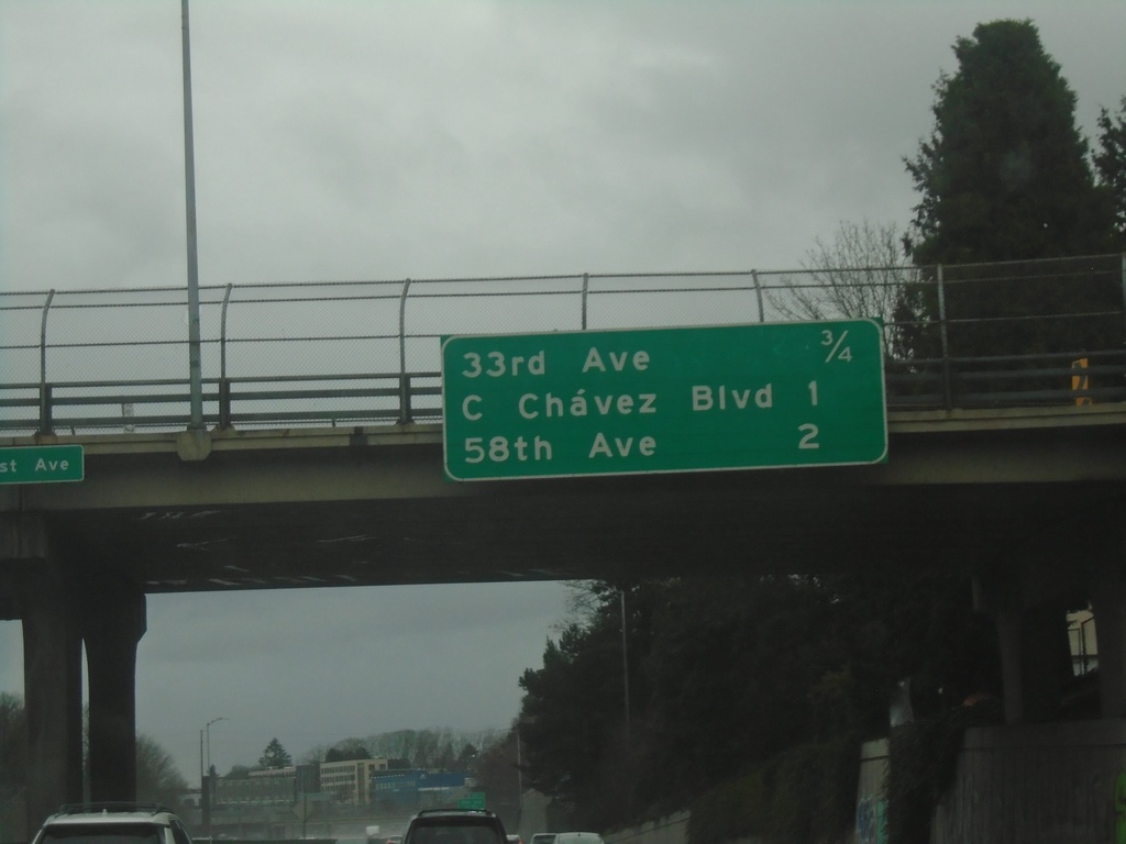
I-84 East - Portland Exits
Next 3 Portland exits on I-84 eastbound. Distance to 33rd Ave., Cesar Chavez Blvd., and 58th Ave.
Taken 01-06-2024
Portland
Multnomah County
Oregon
United States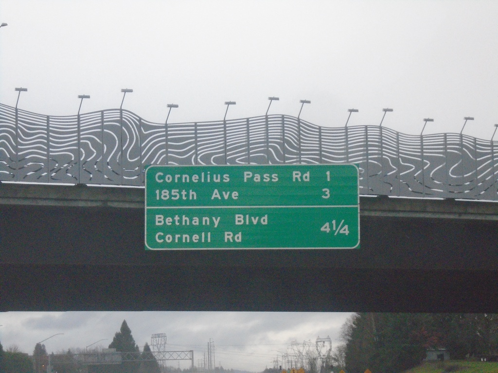
US-26 East - Next Exits
Distance marker overhead on US-26 east. Distance to Cornelius Pass Road, 185th Ave., Bethany Ave./Cornell Road exits.
Taken 01-06-2024
 Hillsboro
Washington County
Oregon
United States
Hillsboro
Washington County
Oregon
United States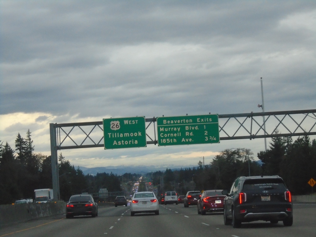
US-26 West - Beaverton Exits
Beaverton Exits on US-26 west. Murray Blvd., Cornell Road, and 185th Ave. Continue west on US-26 for Tillamook and Astoria.
Taken 01-02-2024
Portland
Washington County
Oregon
United States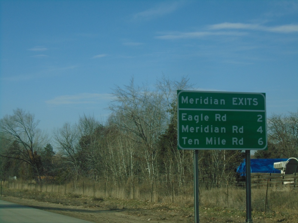
I-84 West - Meridian Exits
Meridian Exits on I-84 west: Eagle Road (ID-55), Meridian Road (ID-69), and Ten Mile Road.
Taken 01-01-2024
Boise
Ada County
Idaho
United States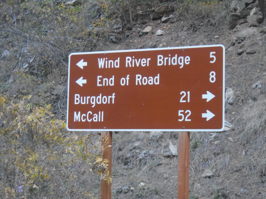
Salmon River Road at French Creek Road
Salmon River Road at French Creek Road. Turn right for French Creek Road south to Burgdorf and McCall. Turn left for Salmon River Road east to Wind River Bridge and End of Road.
Taken 10-20-2023
Riggins Idaho County Idaho United States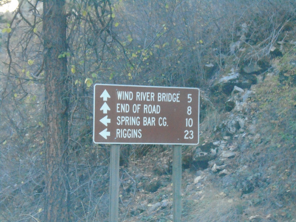
French Creek Road at Salmon River Road
End French Creek Road at Salmon River Road. Continue straight for the Salmon River Road east to Wind River Bridge and End of Road. Turn left for Salmon River Road west to Spring Bar Camp Ground and Riggins.
Taken 10-20-2023
Riggins Idaho County Idaho United States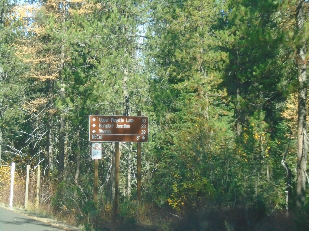
Warren Wagon Road at East Side Road
Warren Wagon Road northbound at East Side Road. Use East Side Road to return to McCall via the east side of Payette Lake. Continue north on Warren Wagon Road for Upper Payette Lake, Burgdorf Junction and Warren.
Taken 10-20-2023
McCall Valley County Idaho United States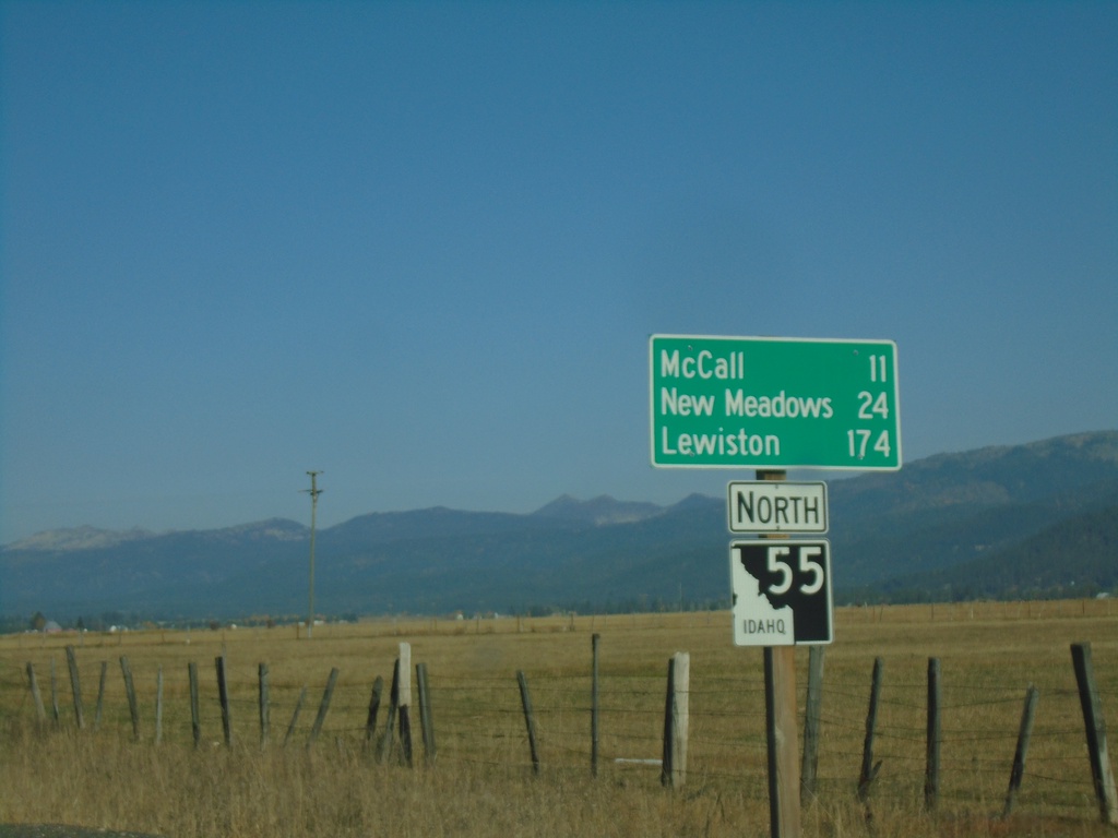
ID-55 North - Distance Marker
Distance marker on ID-55 north. Distance to McCall, New Meadows, and Lewiston.
Taken 10-20-2023
 McCall
Valley County
Idaho
United States
McCall
Valley County
Idaho
United States