Signs Tagged With Distance Marker
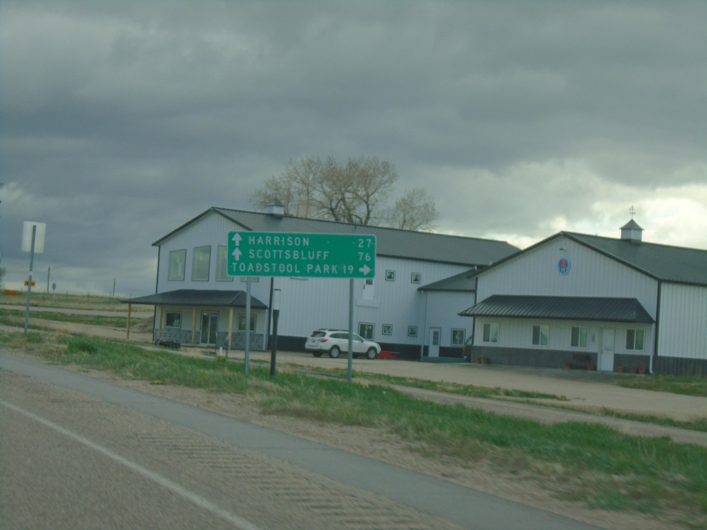
US-20 West Approaching NE-2/NE-71
US-20 West approaching NE-2/NE-71 in Crawford. Use NE-2 West/NE-71 South to Toadstool Park. Continue on US-20 West/NE-2 East/NE-71 South to Harrison (via US-20), and Scotts Bluff (via NE-71/NE-2).
Taken 05-02-2022


 Crawford
Dawes County
Nebraska
United States
Crawford
Dawes County
Nebraska
United States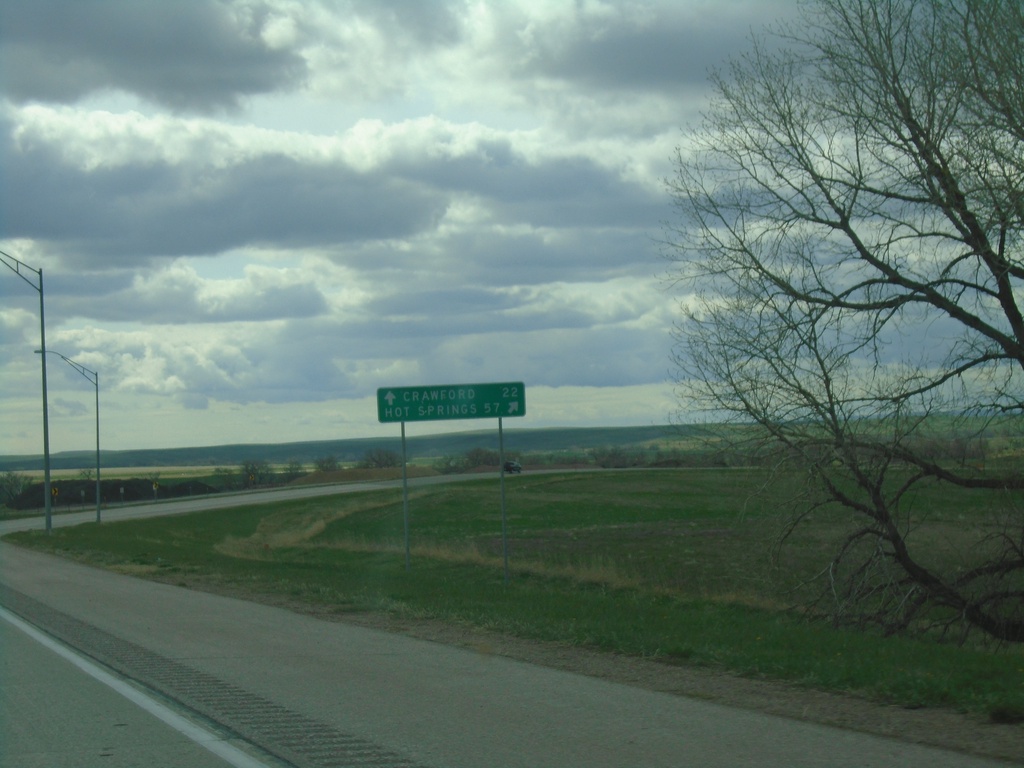
US-20 West/US-385 North at US-20/US-385 Split
US-20 West/US-385 North at US-20/US-385 split in Dawes County. Use US-385 North to Hot Springs, SD; continue west on US-20 for Crawford.
Taken 05-02-2022
 Chadron
Dawes County
Nebraska
United States
Chadron
Dawes County
Nebraska
United States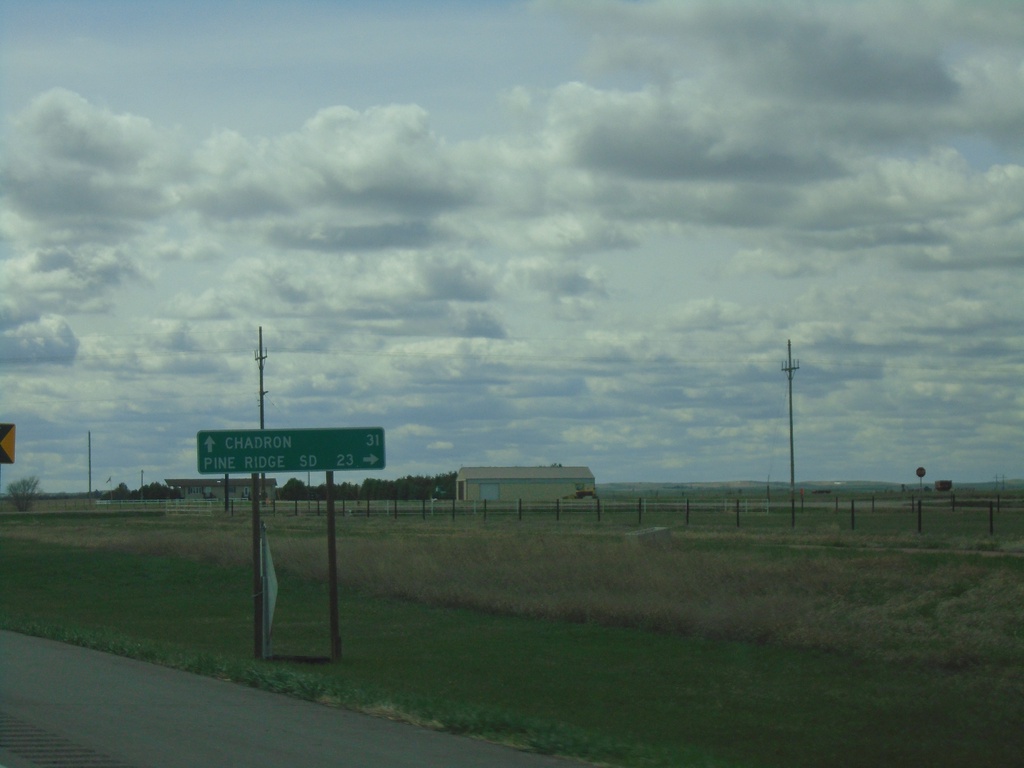
US-20 West at NE-87
US-20 West at NE-87 in Sheridan County. Use NE-87 North to Pine Ridge, SD. Continue west on US-20 to Chadron. NE-87 South joins US-20 West to Hay Springs.
Taken 05-02-2022
 Rushville
Sheridan County
Nebraska
United States
Rushville
Sheridan County
Nebraska
United States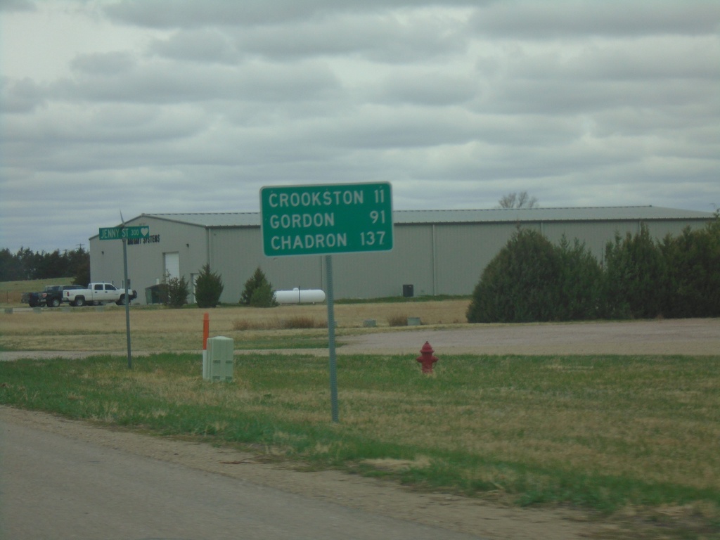
US-20 West - Distance Marker
Distance marker on US-20 west. Distance to Crookston, Gordon, and Chadron.
Taken 05-02-2022
Valentine
Cherry County
Nebraska
United States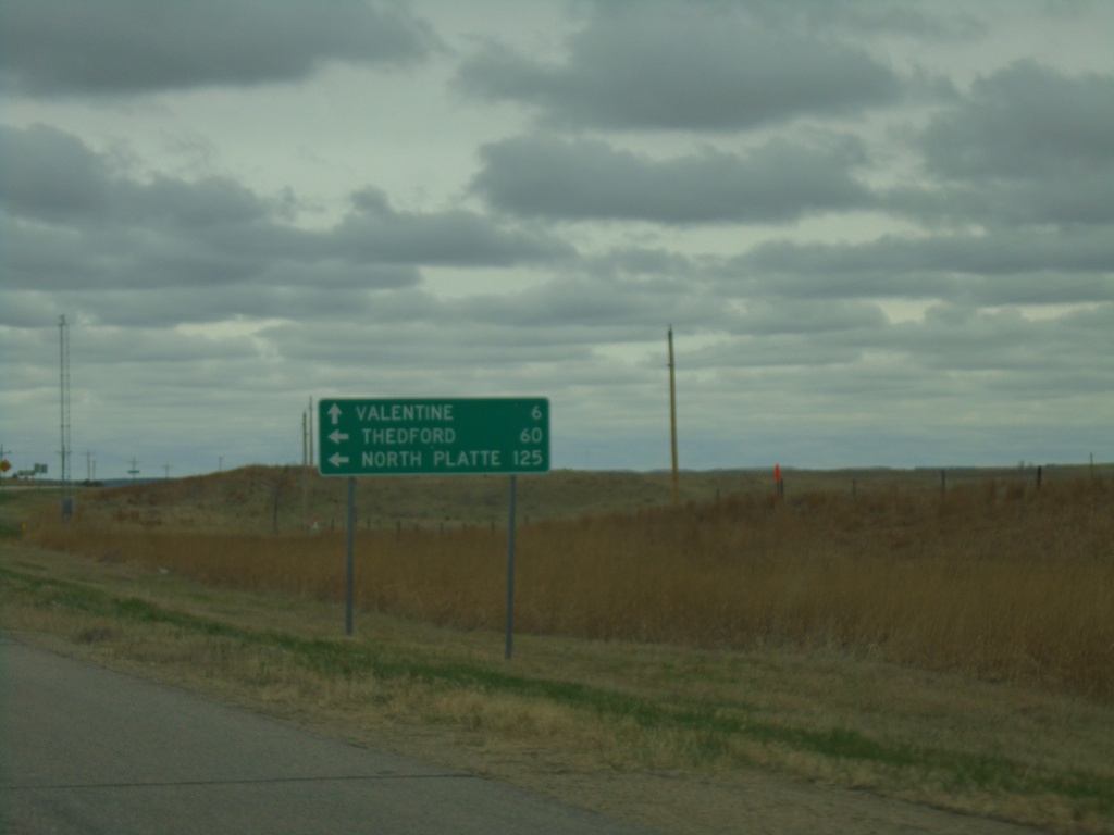
US-20 West at US-83
US-20 West at US-83 in Cherry County. Use US-83 south to North Platte and Thedford. Continue on US-20 West/US-83 North to Valentine.
Taken 05-02-2022
 Valentine
Cherry County
Nebraska
United States
Valentine
Cherry County
Nebraska
United States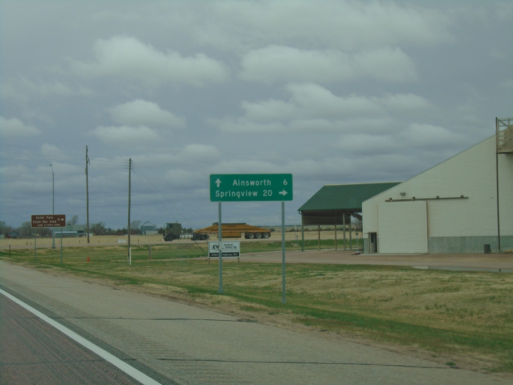
US-20 West/US-183 North/NE-7 South at US-183 North
US-20 West/US-183 North/NE-7 South at US-183 North in Brown County. Use US-183 North to Springview. Continue on US-20 West/NE-7 South to Ainsworth.
Taken 05-02-2022

 Ainsworth
Brown County
Nebraska
United States
Ainsworth
Brown County
Nebraska
United States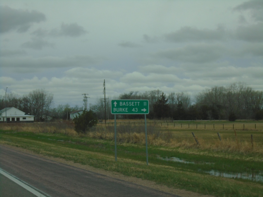
US-20 West at NE-137 North
US-20 West at NE-137 North to Burke (South Dakota). Continue west on US-20 to Bassett.
Taken 05-02-2022
 Newport
Rock County
Nebraska
United States
Newport
Rock County
Nebraska
United States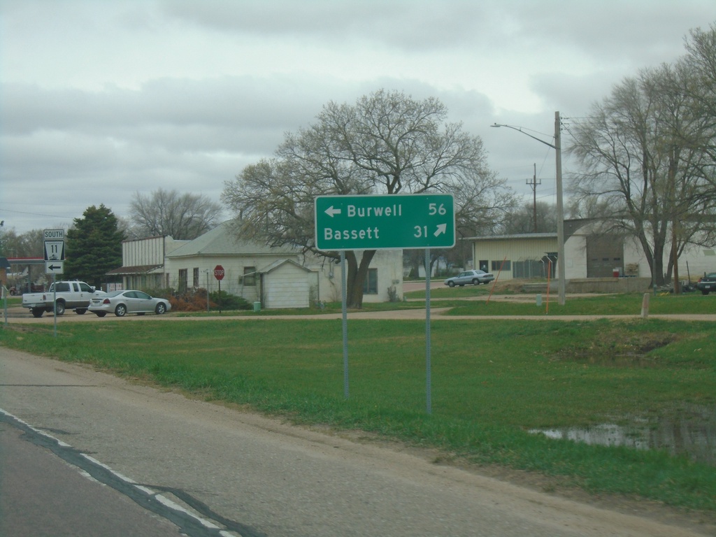
US-20 West at NE-11 - Atkinson
US-20 West at NE-11 in Atkinson. Use NE-11 South to Burwell. Continue west on US-20 to Bassett. NE-11 North joins US-20 west through Atkinson.
Taken 05-02-2022
 Atkinson
Holt County
Nebraska
United States
Atkinson
Holt County
Nebraska
United States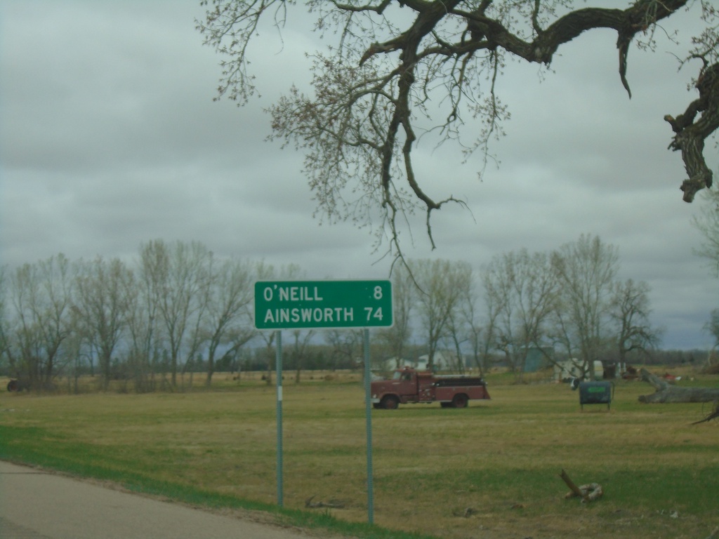
US-20/US-275 West - Distance Marker
Distance Marker on US-20/US-275 West. Distance to O’Neill and Ainsworth. O’Neill has been the control city from Sioux City, Iowa on US-20 westbound. Ainsworth is the control city west from O’Neill to Ainsworth.
Taken 05-02-2022
 Inman
Holt County
Nebraska
United States
Inman
Holt County
Nebraska
United States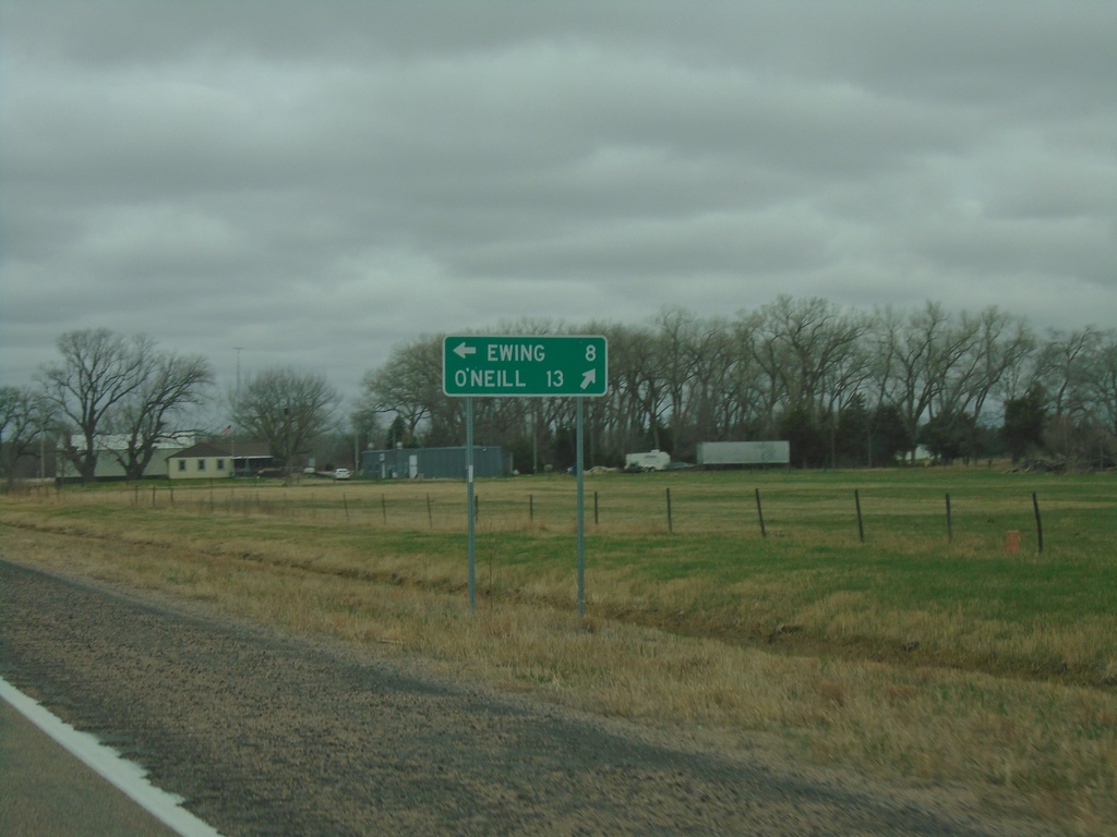
US-20 West Approaching US-275
US-20 West approaching US-275 in Holt County. Use US-275 East to Ewing; use US-20/US-275 West to O’Neill.
Taken 05-02-2022
Page
Holt County
Nebraska
United States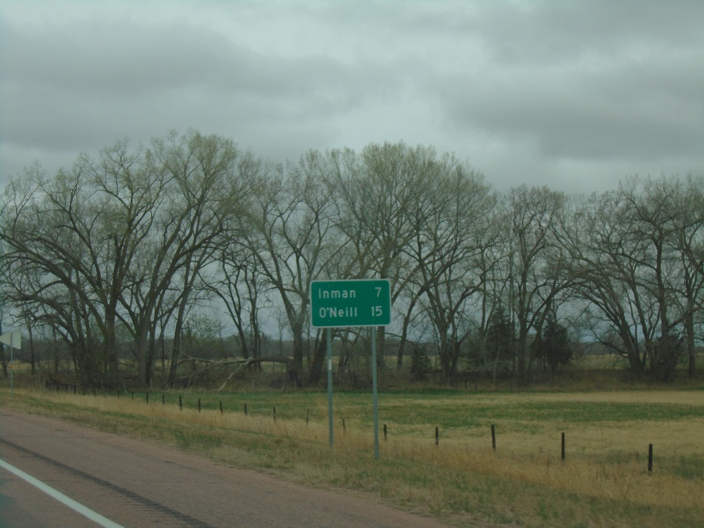
US-20 West - Distance Marker
Distance marker on US-20 west. Distance to Inman and O’Neill.
Taken 05-02-2022
Ewing
Holt County
Nebraska
United States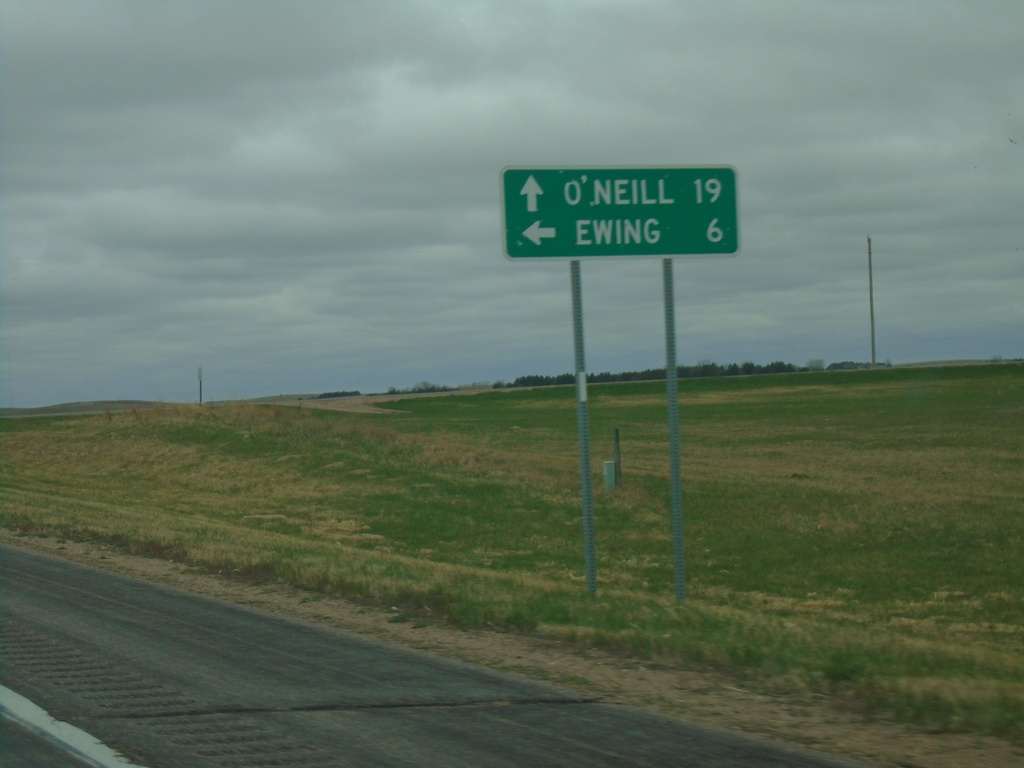
US-20 West at NE-45B Link South
US-20 West at NE-45B Link South to Ewing. Continue west on US-20 for O’Neill.
Taken 05-02-2022
 Orchard
Antelope County
Nebraska
United States
Orchard
Antelope County
Nebraska
United States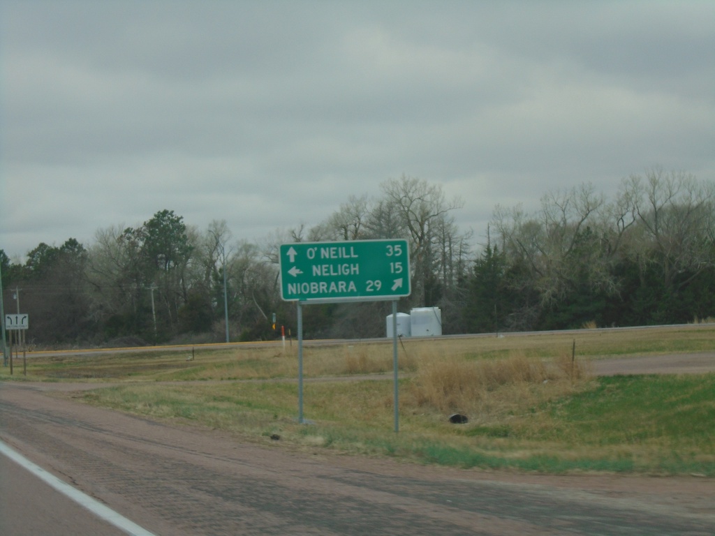
US-20 West at NE-14
US-20 West at NE-14 in Antelope County. Use NE-14 north to Niobrara; NE-14 south to Neligh. Continue west on US-20 to O’Neill.
Taken 05-02-2022
 Brunswick
Antelope County
Nebraska
United States
Brunswick
Antelope County
Nebraska
United States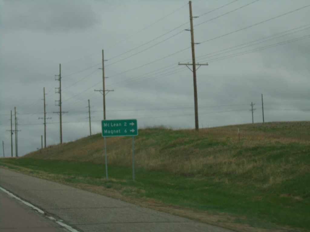
US-20 West at NE-70A Spur
US-20 West at NE-70A Spur to Mc Lean and Magnet.
Taken 05-02-2022
 McLean
Pierce County
Nebraska
United States
McLean
Pierce County
Nebraska
United States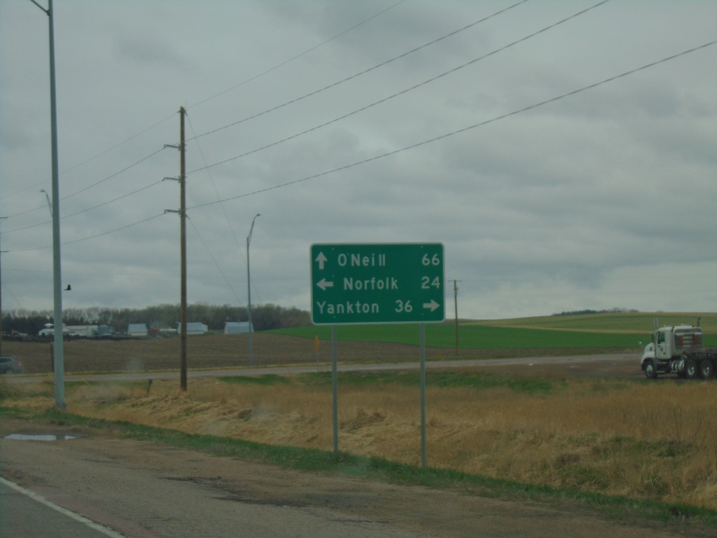
US-20 West at US-81
US-20 West at US-81 in Pierce County. Use US-81 north to Yankton (SD); US-81 south to Norfolk. Continue east on US-20 to O’Neill.
Taken 05-02-2022
 McLean
Pierce County
Nebraska
United States
McLean
Pierce County
Nebraska
United States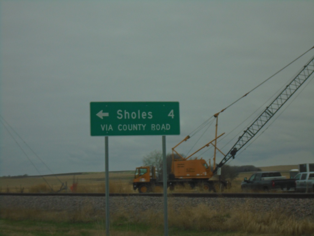
US-20 West - Sholes Junction
US-20 West - Sholes via County Road. Sholes is not connected to the state highway system, and it appears the state is calling out that the connection to Sholes is only via a county road.
Taken 05-02-2022
Randolph
Cedar County
Nebraska
United States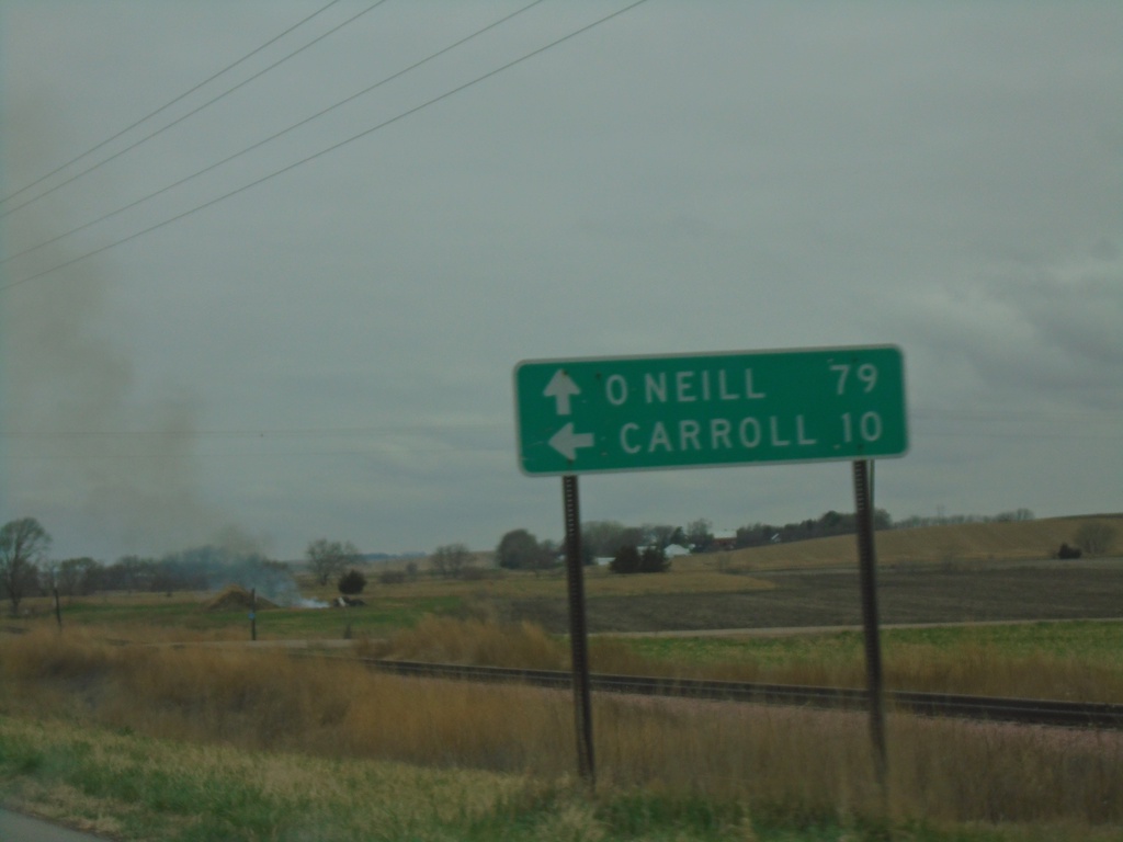
US-20 West at NE-57
US-20 West at NE-57 in Cedar County. Use NE-57 south to Carroll. Use US-20 west for O’Neill. NE-57 north joins US-20 westbound.
Taken 05-02-2022
 Belden
Cedar County
Nebraska
United States
Belden
Cedar County
Nebraska
United States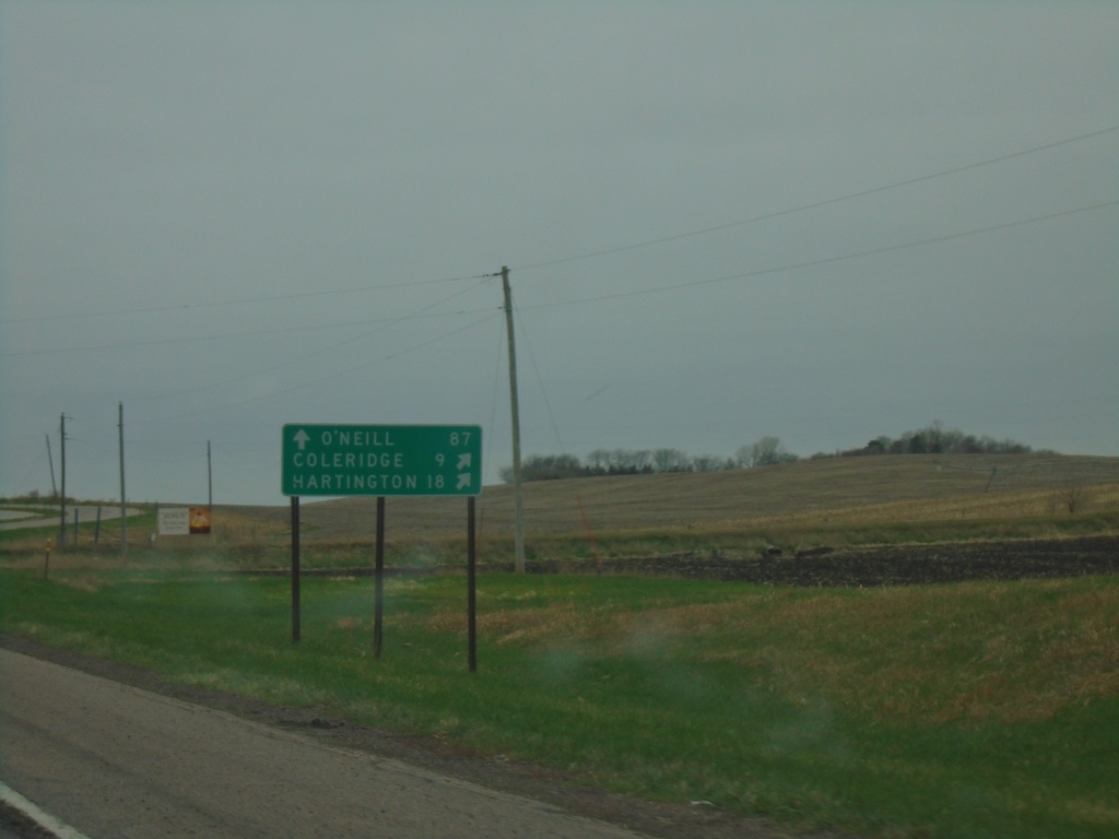
US-20 West at NE-15/NE-59
US-20 West at NE-15/NE-59 to Coleridge and Hartington. Continue west on US-20 to O’Neill.
Taken 05-02-2022

 Laurel
Cedar County
Nebraska
United States
Laurel
Cedar County
Nebraska
United States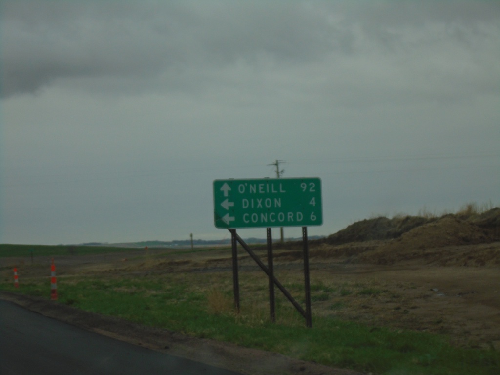
US-20 West at NE-116 South
US-20 West at NE-116 South to Dixon and Concord. Continue on US-20 west for O’Neill.
Taken 05-02-2022
 Dixon
Dixon County
Nebraska
United States
Dixon
Dixon County
Nebraska
United States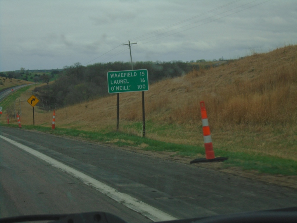
US-20 West/NE-9 South - Distance Marker
Distance Marker on US-20 West/NE-9 South. Distance to Wakefield (via NE-9 South), Laurel, and O’Neill.
Taken 05-02-2022
 Allen
Dixon County
Nebraska
United States
Allen
Dixon County
Nebraska
United States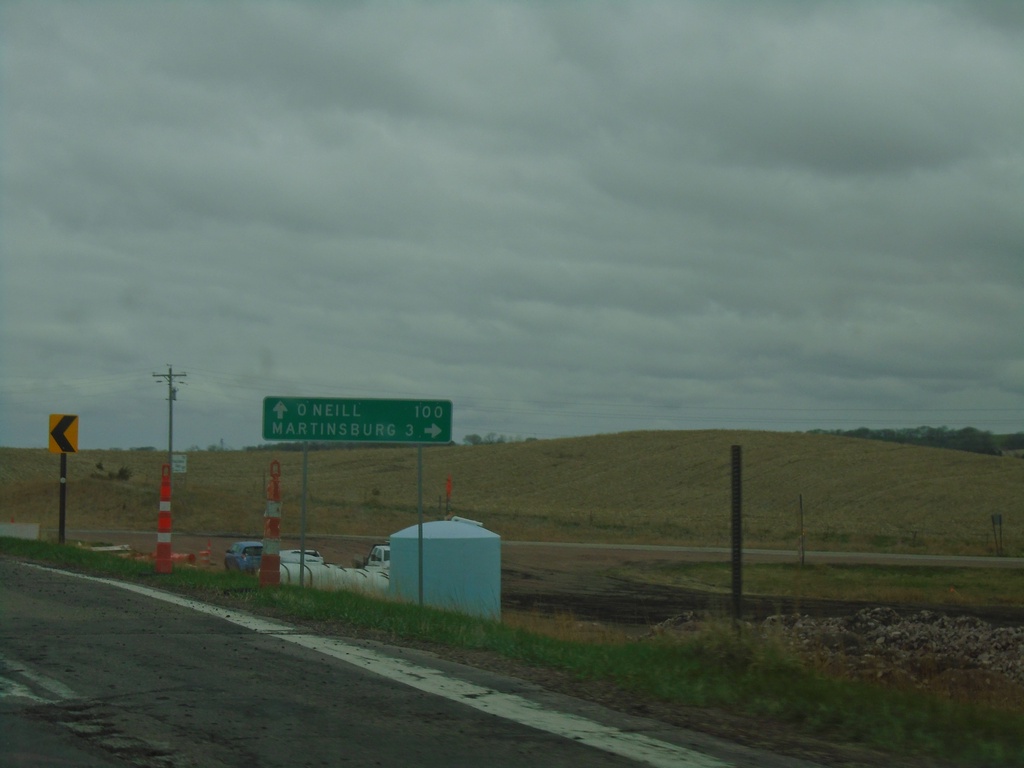
US-20 West at NE-9
US-20 West at NE-9 in Dixon County. Use NE-9 north to Martinsburg. Continue west on US-20 to O’Neill. NE-9 south joins US-20 westbound.
Taken 05-02-2022
Allen
Dixon County
Nebraska
United States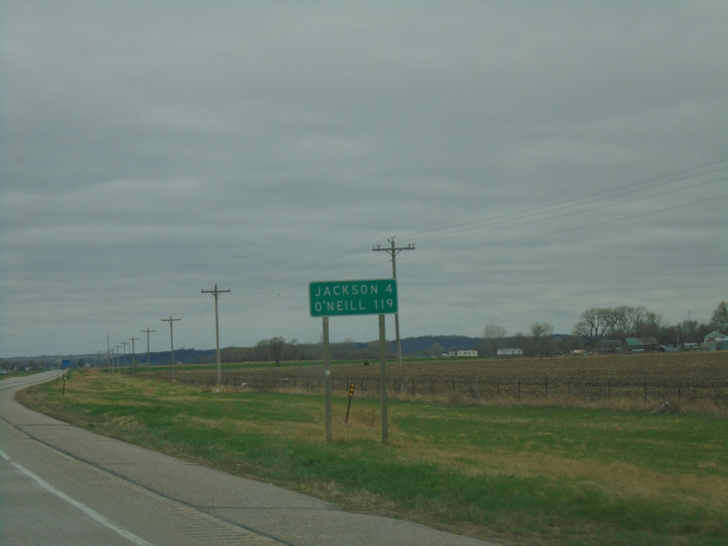
US-20 West - Distance Marker
Distance marker on US-20 west. Distance to Jackson and O’Neill
Taken 05-02-2022
South Sioux City
Dakota County
Nebraska
United States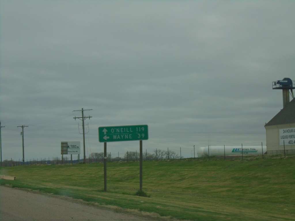
US-20 West Approaching NE-110
US-20 West approaching NE-110. Use NE-110 South to Wayne; continue west on US-20 to O’Neill.
Taken 05-02-2022
 South Sioux City
Dakota County
Nebraska
United States
South Sioux City
Dakota County
Nebraska
United States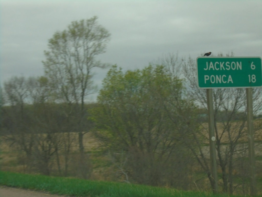
US-20 West - Distance Marker
Distance marker on US-20 west. Distance to Jackson and Ponca. This is the first distance marker westbound on US-20 in Nebraska.
Taken 05-02-2022
South Sioux City
Dakota County
Nebraska
United States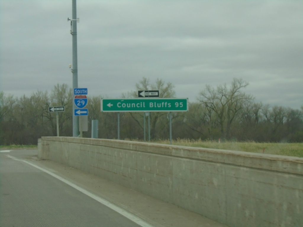
End IA-12 South at I-29 South
End IA-12 South at I-29 South to Council Bluffs.
Taken 05-02-2022

 Sioux City
Woodbury County
Iowa
United States
Sioux City
Woodbury County
Iowa
United States