Signs Tagged With Distance Marker
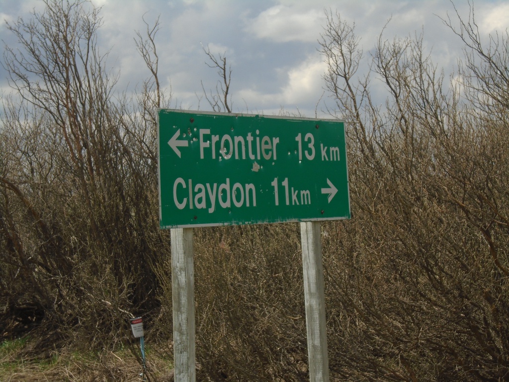
SK-614 South at SK-18
SK-614 South at SK-18 near Loomis. Use SK-18 west for Claydon; SK-18 east for Frontier. Distance units are marked with the text km, which is different than the other distance markers in southern Saskatchewan.
Taken 05-13-2023

 Claydon
Frontier No. 19
Saskatchewan
Canada
Claydon
Frontier No. 19
Saskatchewan
Canada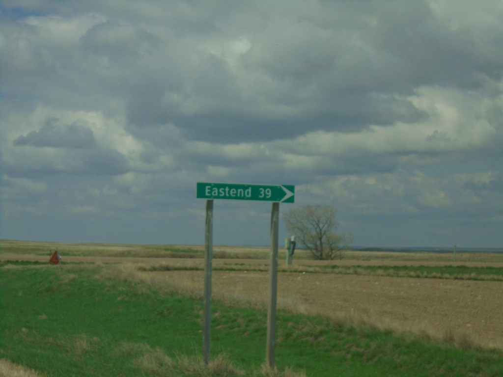
SK-18 West at SK-614 North
SK-18 West at SK-614 North to Eastend
Taken 05-13-2023
Claydon
Frontier No. 19
Saskatchewan
Canada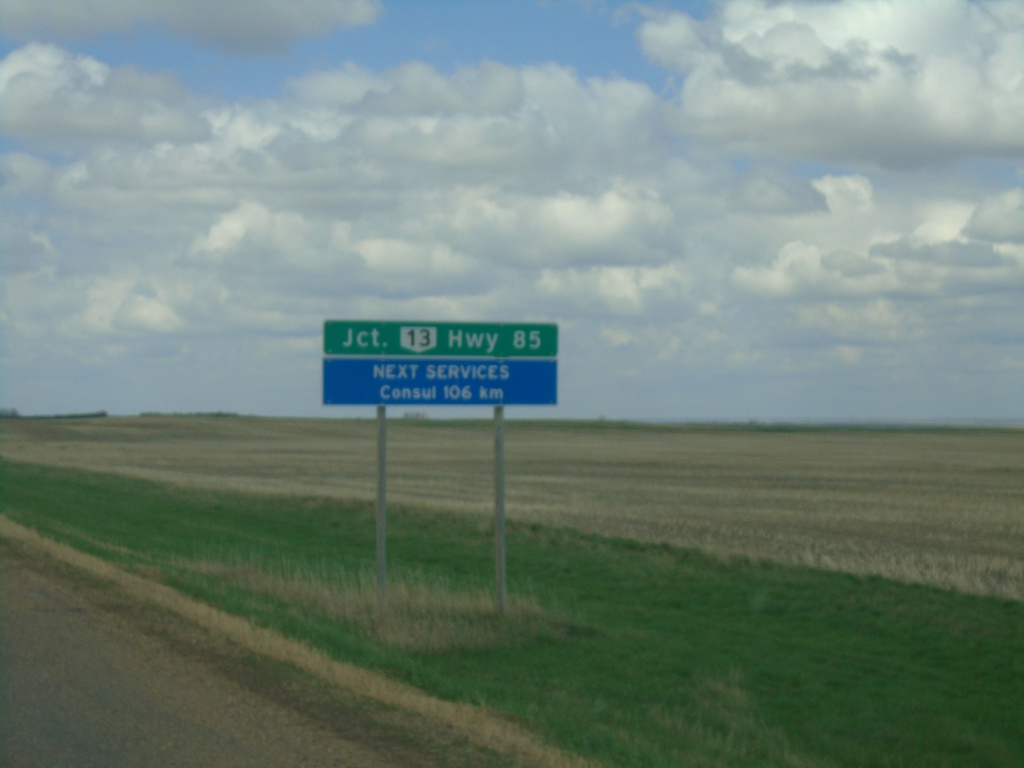
SK-18 West - Distance Marker
Distance marker on SK-18 west. Distance to Junction SK-13. Next Services in Consul - 106km.
Taken 05-13-2023
 Frontier
 No. 19
Saskatchewan
Canada
Frontier
Frontier No. 19
Saskatchewan
Canada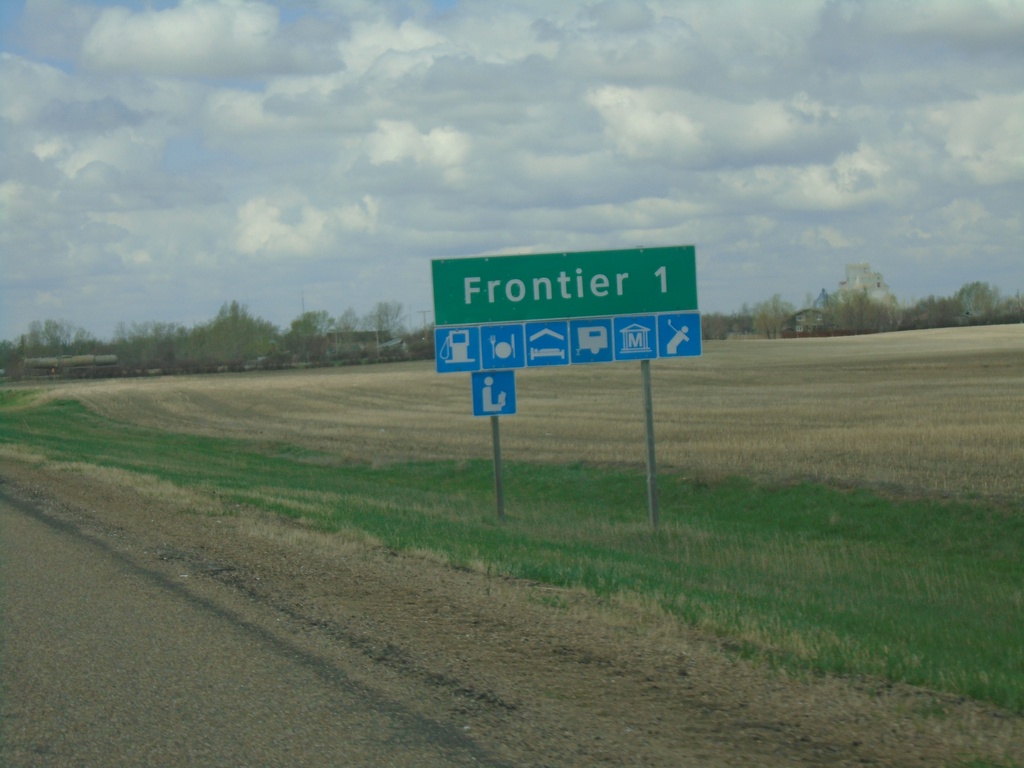
SK-18 West - Frontier
SK-18 west approaching Frontier.
Taken 05-13-2023
Frontier
Frontier No. 19
Saskatchewan
Canada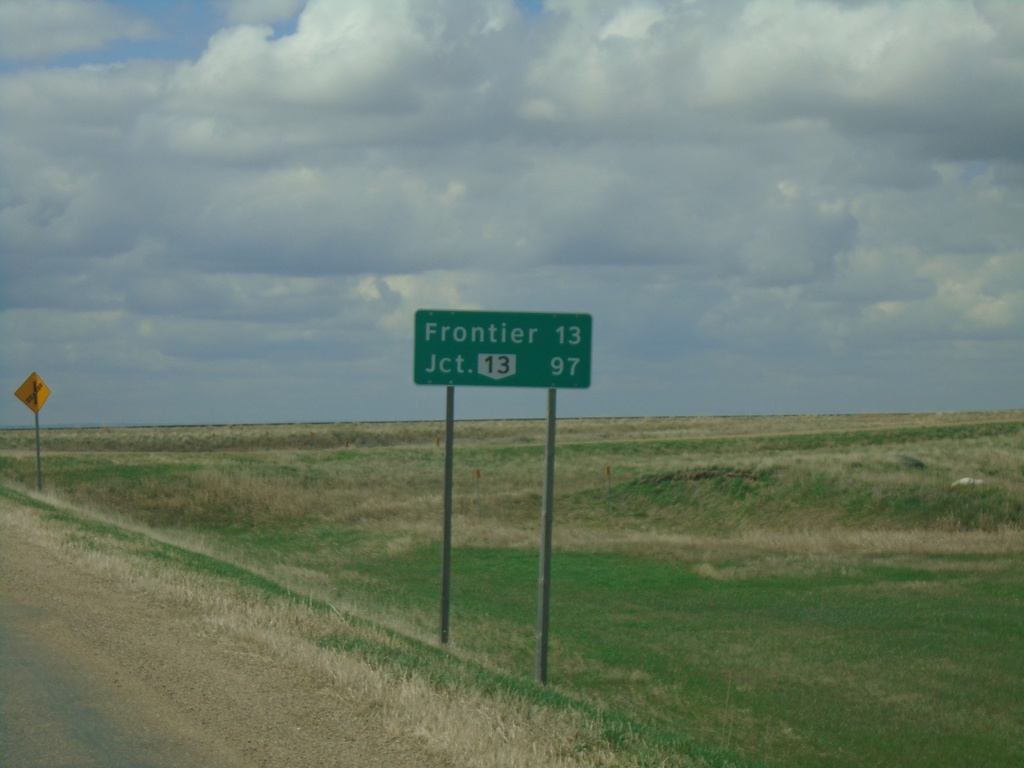
SK-18 West - Distance Marker
Distance marker on SK-18 west. Distance to Frontier and SK-13 junction.
Taken 05-13-2023
Climax
Saskatchewan
Canada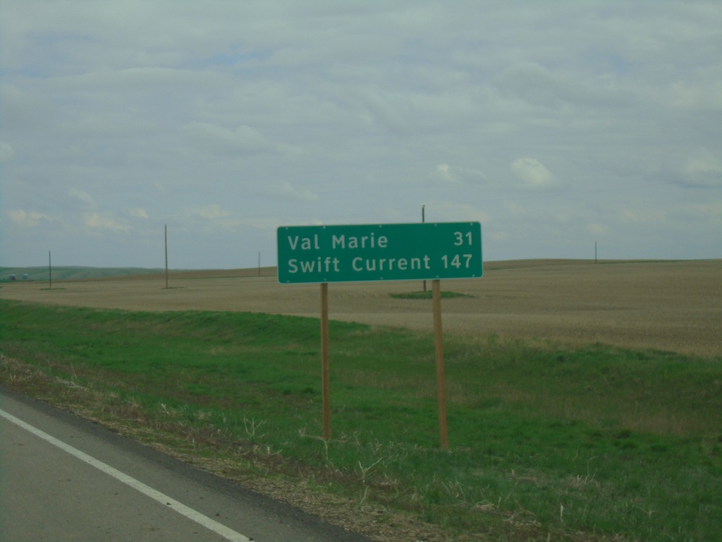
SK-4 North - Distance Marker
Distance marker on SK-4 north. Distance to Val Marie and Swift Current.
Taken 05-13-2023
 Orkney
Val Marie No. 17
Saskatchewan
Canada
Orkney
Val Marie No. 17
Saskatchewan
Canada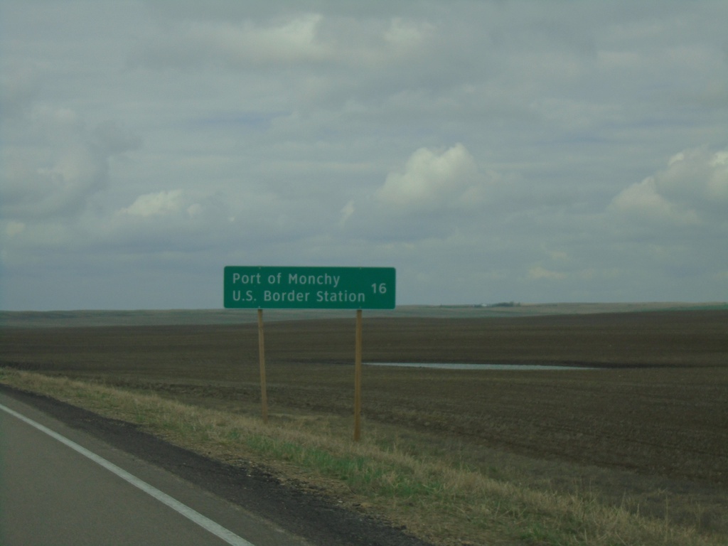
SK-4 South - Distance Marker
Distance marker on SK-4 south. Distance to Port of Monchy U.S. Border Station.
Taken 05-13-2023
Masefield
Val Marie No. 17
Saskatchewan
Canada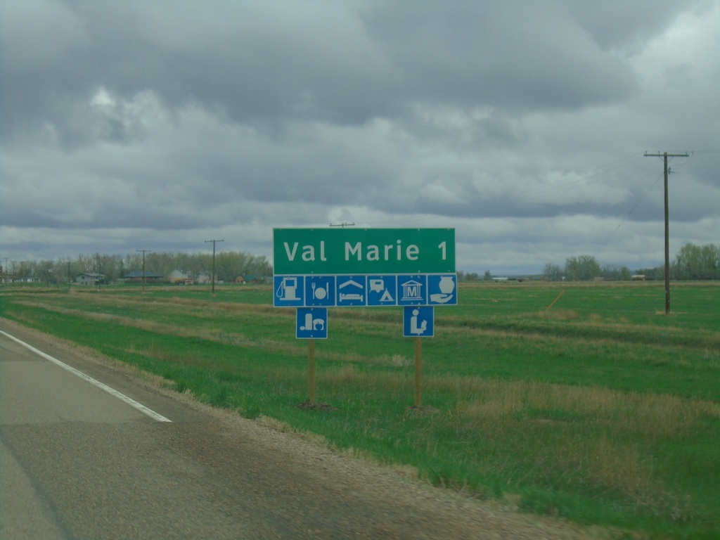
SK-4 North/SK-18 East Approaching Val Marie
Approaching Val Marie on SK-4 North/SK-18 East. Val Marie is home to the visitor center for Grasslands National Park.
Taken 05-12-2023
Val Marie
Val Marie No. 17
Saskatchewan
Canada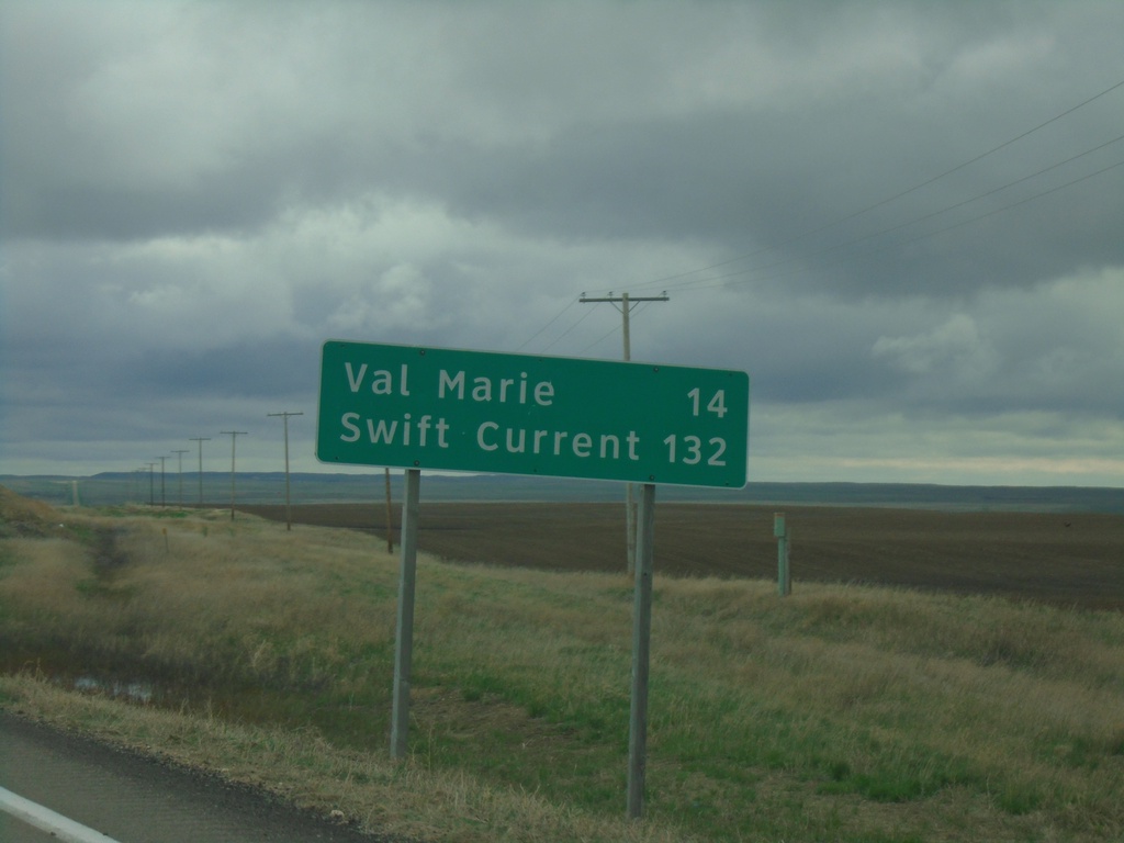
SK-4 North/SK-18 East - Distance Marker
Distance Marker on SK-4 North/SK-18 East. Distance to Val Marie and Swift Current.
Taken 05-12-2023
Orkney
Val Marie No. 17
Saskatchewan
Canada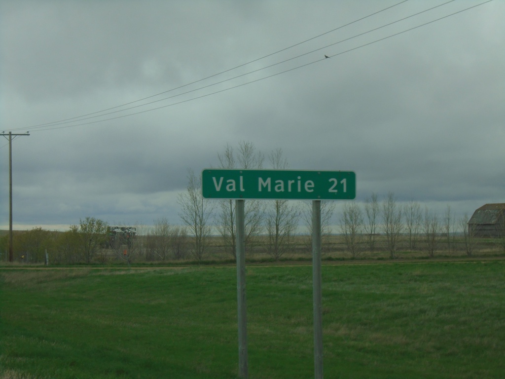
SK-18 East - Distance Marker
Distance marker on SK-18 east. Distance to Val Marie.
Taken 05-12-2023
Orkney
Val Marie No. 17
Saskatchewan
Canada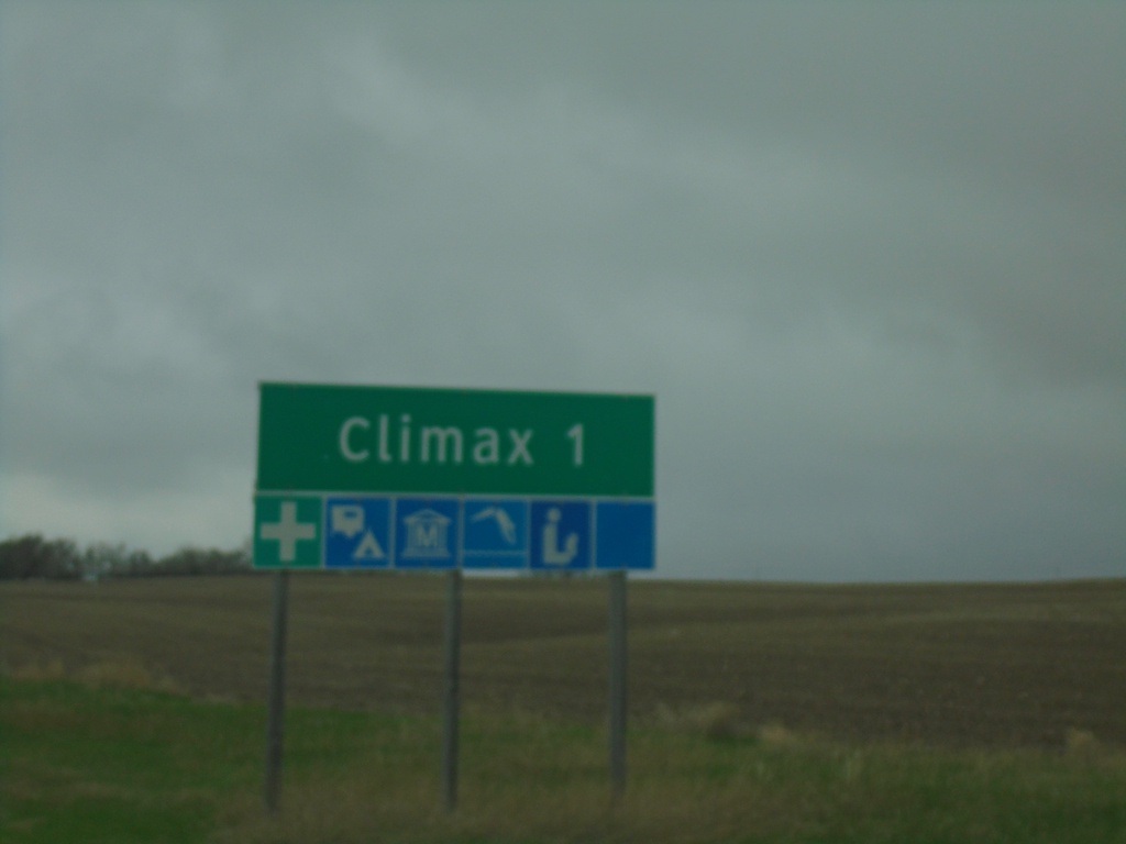
SK-37 North - Climax
Approaching Climax on SK-37 north.
Taken 05-12-2023
 Climax
Lone Tree No. 18
Saskatchewan
Canada
Climax
Lone Tree No. 18
Saskatchewan
Canada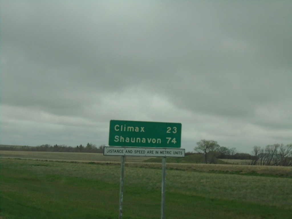
SK-37 North - Distance Marker
Distance marker on SK-37 north. Distance to Climax and Shaunavon. Distances and Speed are in Metric Units.
Taken 05-12-2023
Frontier
Lone Tree No. 18
Saskatchewan
Canada
MTS-241 North - Distance Marker
Distance marker on MTS-241 north. Distance to Turner.
Taken 05-12-2023
 Harlem
Blaine County
Montana
United States
Harlem
Blaine County
Montana
United States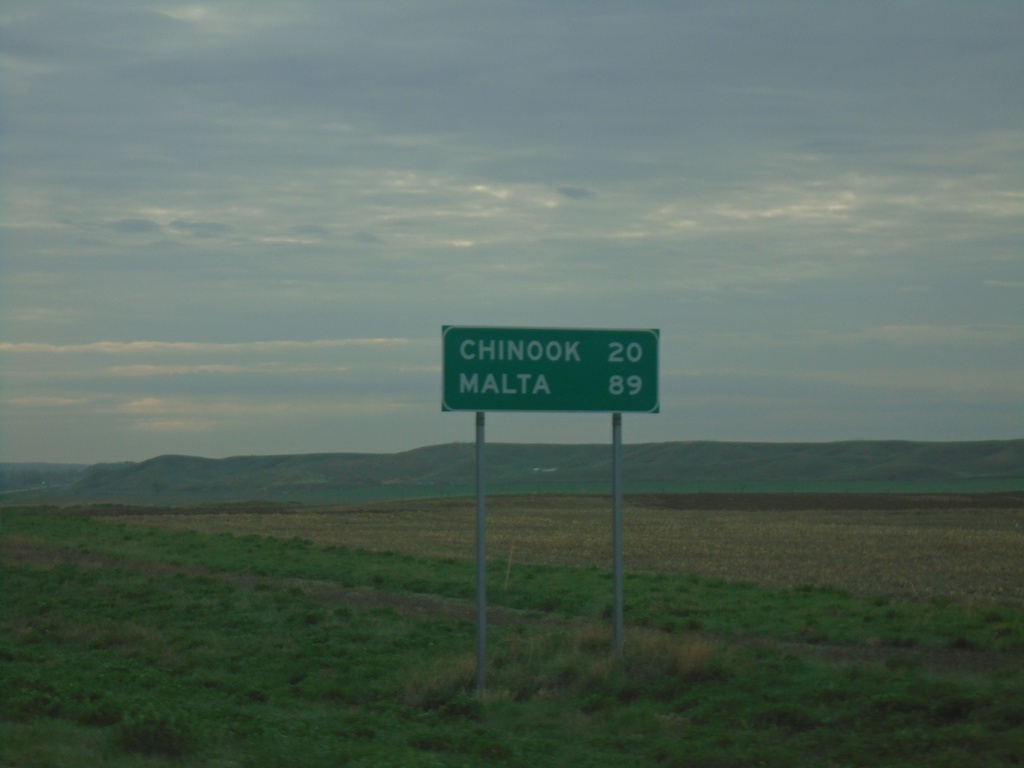
US-2 East - Distance Marker
Distance marker on US-2 east. Distance to Chinook and Malta.
Taken 05-12-2023
 Havre
Hill County
Montana
United States
Havre
Hill County
Montana
United States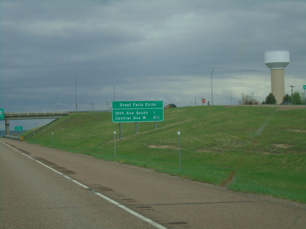
I-15 North - Great Falls Exits
Great Falls Exits on I-15 North: 10th Ave South and Central Ave West
Taken 05-11-2023
 Great Falls
Cascade County
Montana
United States
Great Falls
Cascade County
Montana
United States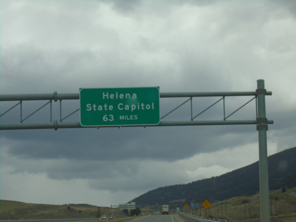
I-15 North - Distance Marker
Distance marker on I-15 north. Distance to Helena - State Capitol. A similar sign is located just south of Great Falls on I-15.
Taken 05-11-2023
Butte
Silver Bow County
Montana
United States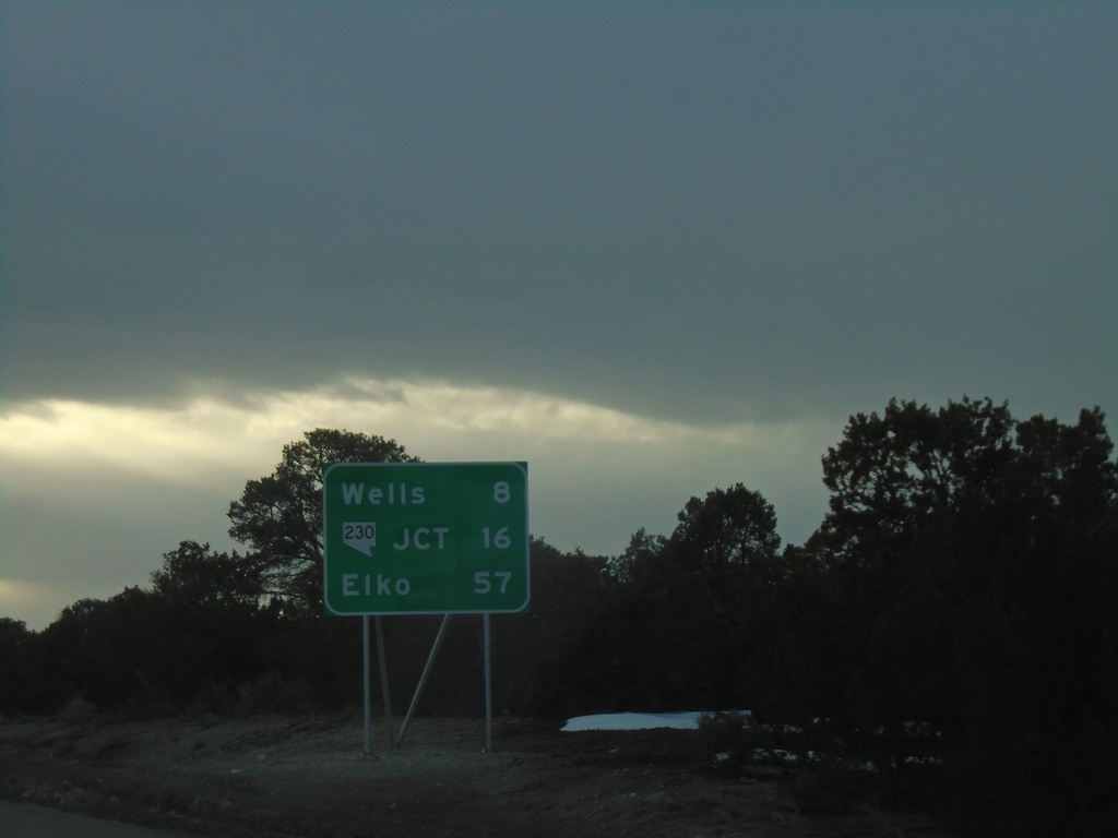
I-80 West - Distance Marker
Distance marker on I-80 west. Distance to Wells, NV-230 Junction and Elko.
Taken 04-01-2023

 Wells
Elko County
Nevada
United States
Wells
Elko County
Nevada
United States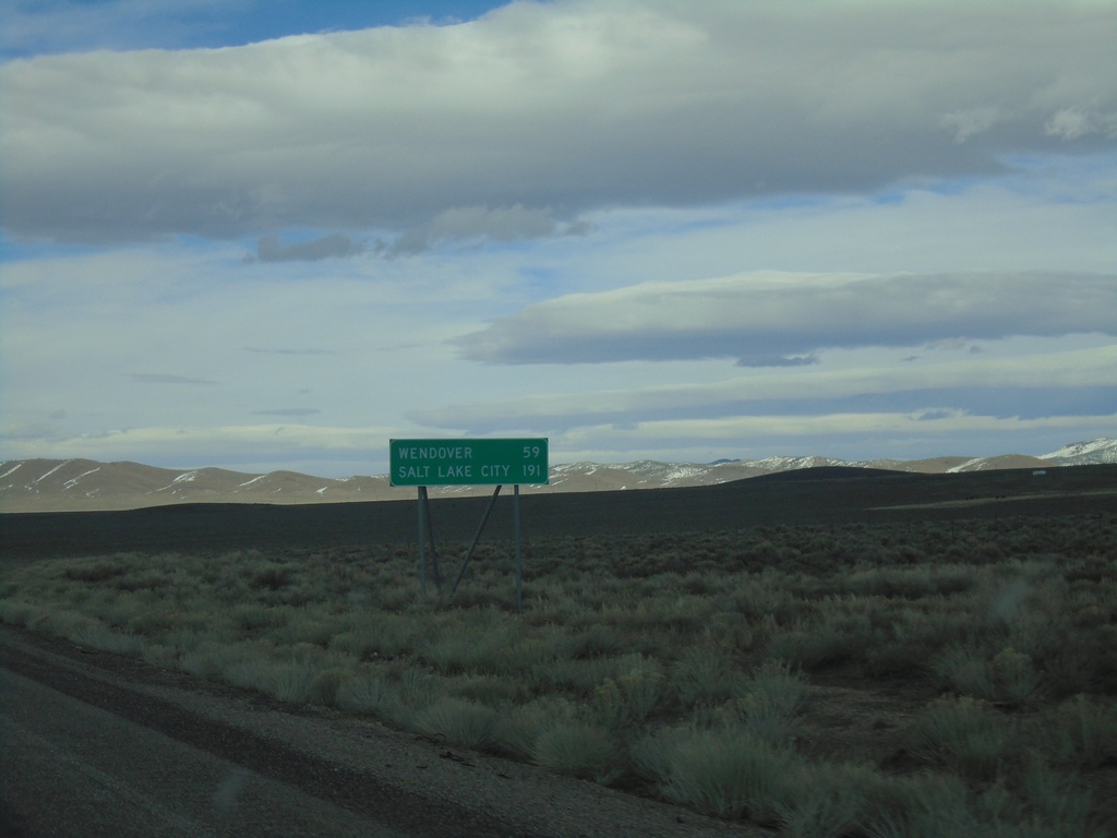
Alt. US-93 North - Distance Marker
Distance Marker on Alt. US-93 North. Distance to Wendover and Salt Lake City (Utah).
Taken 04-01-2023
Ely
White Pine County
Nevada
United States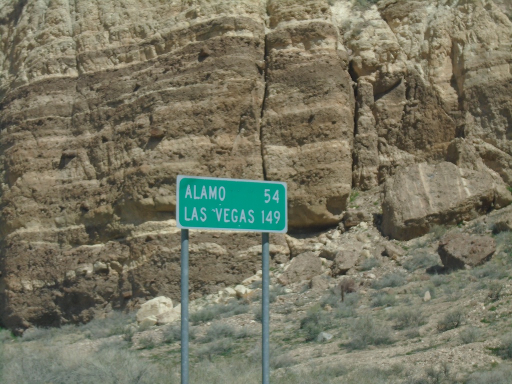
US-93 South - Distance Marker
Distance marker on US-93 south. Distance to Alamo and Las Vegas.
Taken 04-01-2023
 Caliente
Lincoln County
Nevada
United States
Caliente
Lincoln County
Nevada
United States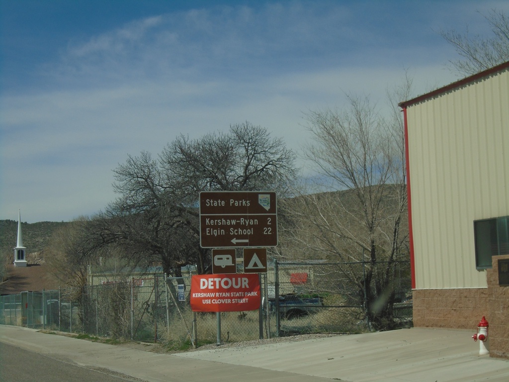
US-93 South approaching NV-317 - Caliente
US-93 South approaching NV-317 south to Kershaw-Ryan State Park and Elgin School State Park.
Taken 04-01-2023
 Caliente
Lincoln County
Nevada
United States
Caliente
Lincoln County
Nevada
United States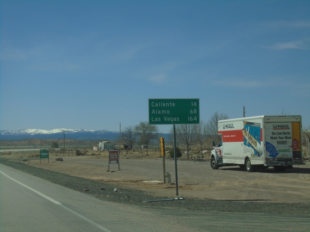
US-93 South - Distance Marker
Distance marker on US-93 south. Distance to Caliente, Alamo, and Las Vegas.
Taken 04-01-2023
Panaca
Lincoln County
Nevada
United States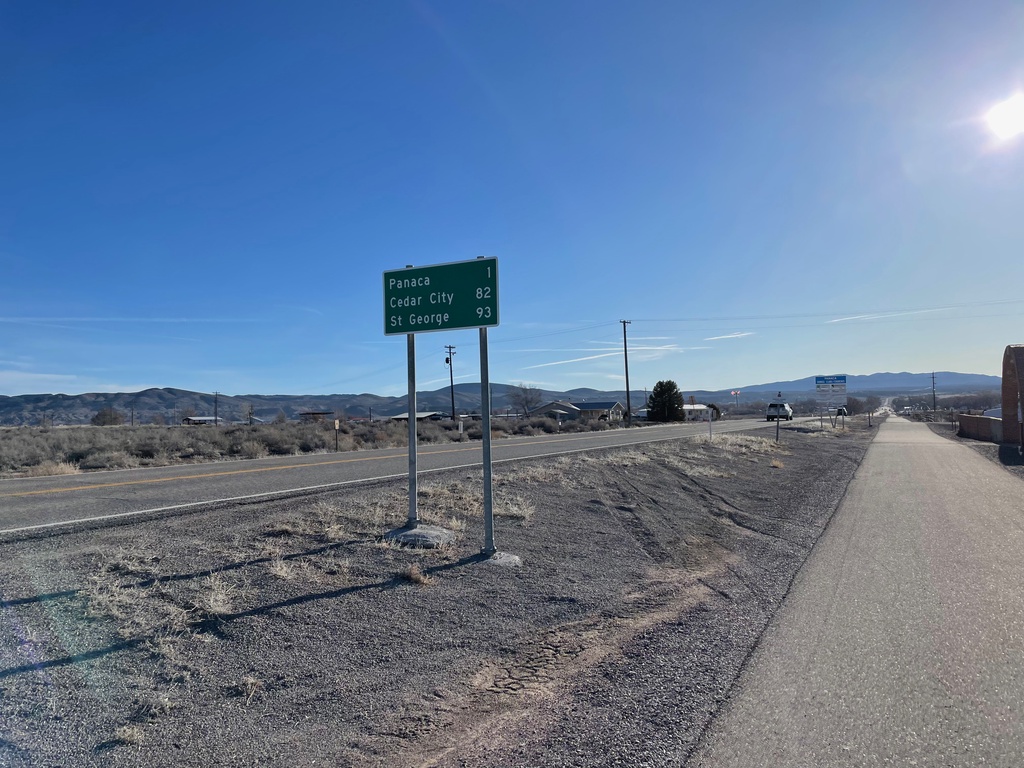
NV-319 East - Distance Marker
Distance marker on NV-319 east. Distance to Panaca, Cedar City (Utah) and St. George (Utah).
Taken 04-01-2023
 Panaca
Lincoln County
Nevada
United States
Panaca
Lincoln County
Nevada
United States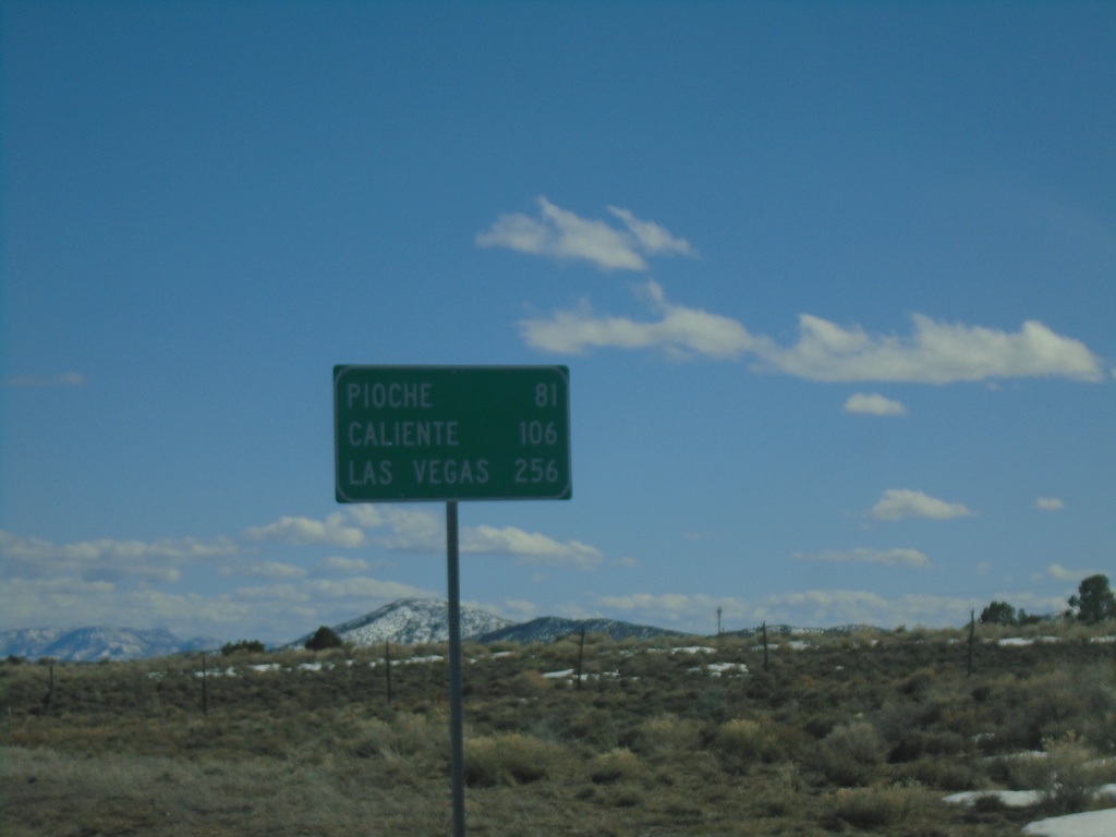
US-93 South - Distance Marker
Distance marker on US-93 south. Distance to Pioche, Caliente, and Las Vegas.
Taken 03-31-2023
Ely
White Pine County
Nevada
United States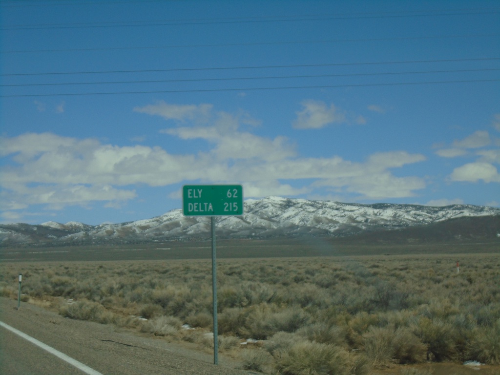
US-50 East - Distance Marker
Distance marker on US-50 east. Distance to Ely and Delta (Utah).
Taken 03-31-2023

 Eureka
White Pine County
Nevada
United States
Eureka
White Pine County
Nevada
United States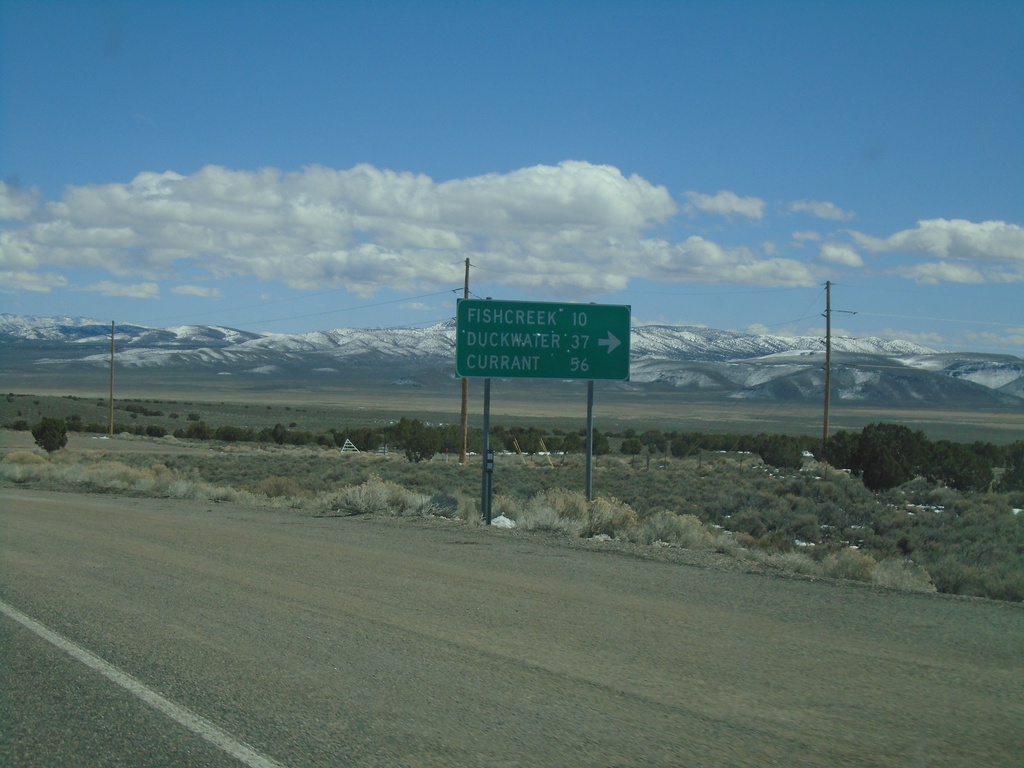
US-50 East - Duckwater Jct.
US-50 East at junction to Fishcreek, Duckwater, and Currant.
Taken 03-31-2023
Eureka
Eureka County
Nevada
United States