Signs Tagged With Distance Marker
US-24 East - Distance Marker
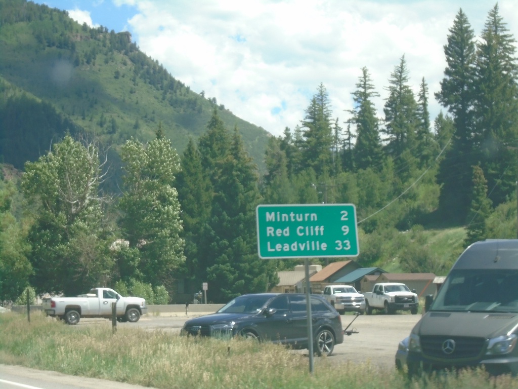
Distance marker on US-24 east. Distance to Minturn, Red Cliff, and Leadville. This is the first distance marker eastbound on US-24.
Taken 07-09-2022
 Vail
Eagle County
Colorado
United States
Vail
Eagle County
Colorado
United States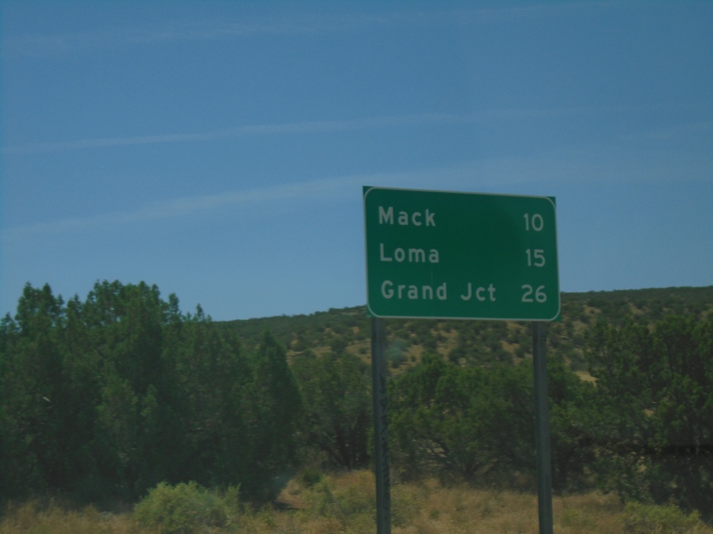
I-70 East - Distance Marker
Distance marker on I-70 east. Distance to Mack, Loma, and Grand Junction. This is the first distance marker in Colorado on I-70 east.
Taken 07-09-2022


 Mack
Mesa County
Colorado
United States
Mack
Mesa County
Colorado
United States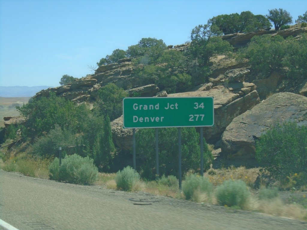
I-70 East - Distance Marker
Distance marker on I-70 west. Distance to Grand Junction and Denver. This is the last distance marker along I-70 in Utah.
Taken 07-09-2022
Cisco
Grand County
Utah
United States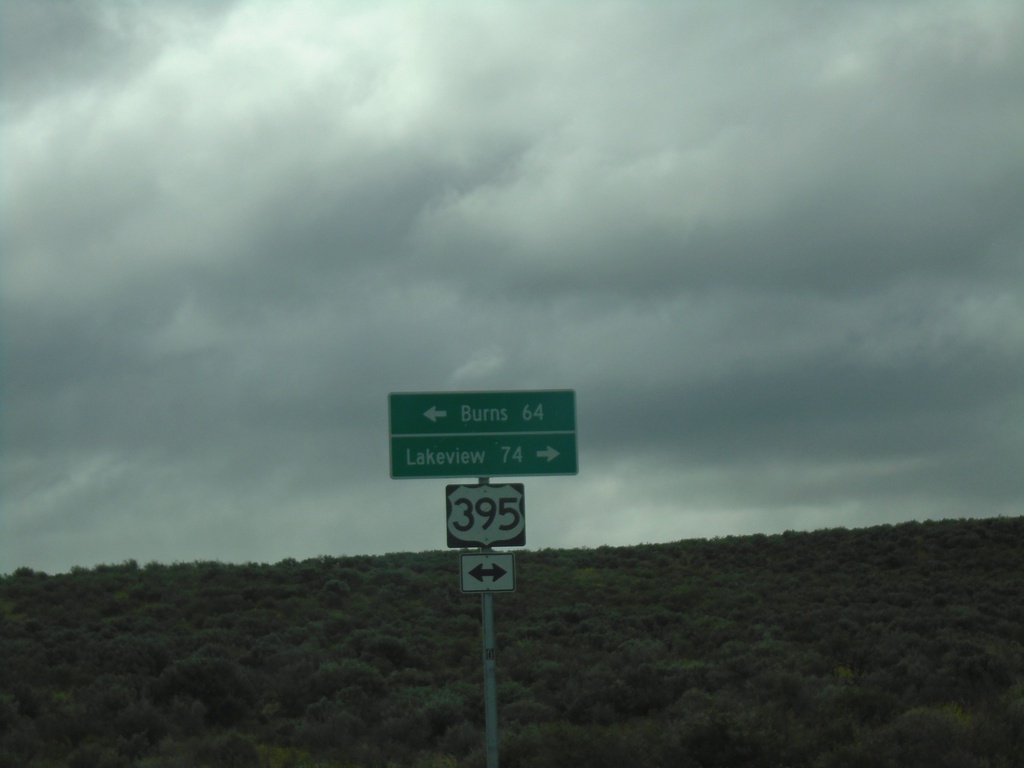
End Christmas Valley Highway at US-395
End Christmas Valley Highway at US-395 in Lake County. Use US-395 South to Lakeview; US-395 North to Burns.
Taken 05-29-2022
 Wagontire
Harney County
Oregon
United States
Wagontire
Harney County
Oregon
United States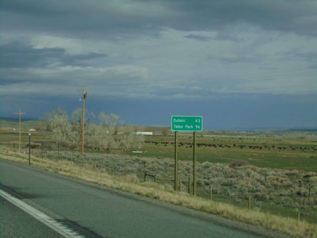
US-26 West/US-287 North - Distance Marker
Distance marker on US-26 West/US-287 North. Distance to Dubois and Teton Park.
Taken 05-03-2022

 Kinnear
Fremont County
Wyoming
United States
Kinnear
Fremont County
Wyoming
United States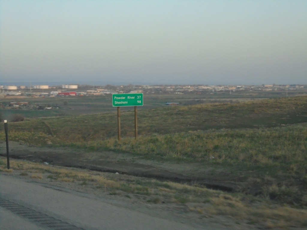
US-20/US-26 West - Distance Marker
Distance marker on US-20/US-26 West. Distance to Powder River and Shoshoni.
Taken 05-03-2022
 Casper
Natrona County
Wyoming
United States
Casper
Natrona County
Wyoming
United States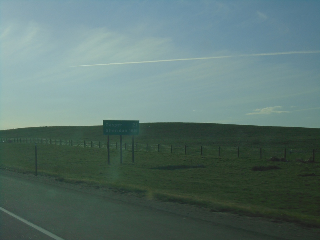
I-25 North - Distance Marker
Distance marker on I-25 north. Distance to Casper and Sheridan (via I-90).
Taken 05-02-2022
 Glenrock
Converse County
Wyoming
United States
Glenrock
Converse County
Wyoming
United States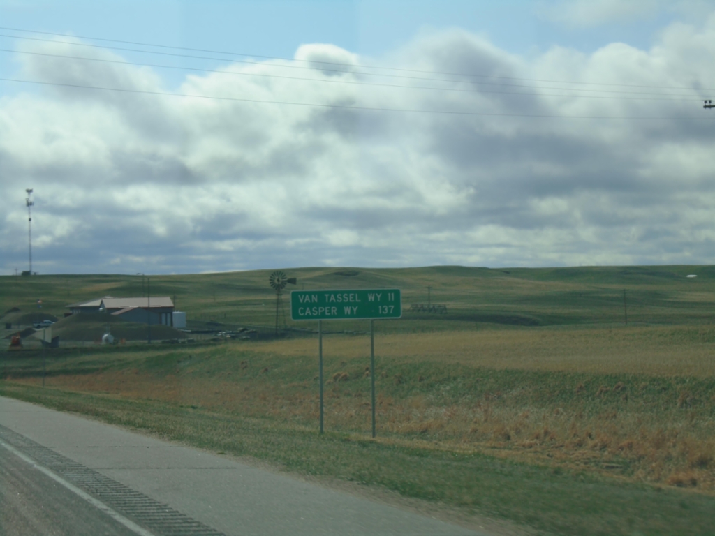
US-20 West - Distance Marker
Distance marker on US-20 west. Distance to Van Tassel, WY and Casper, WY. This is the last distance marker on US-20 westbound in Nebraska.
Taken 05-02-2022
Harrison
Sioux County
Nebraska
United States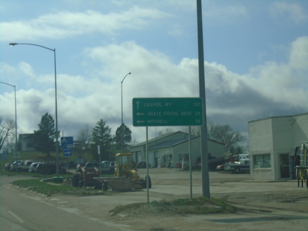
US-20 West Approaching NE-29
US-20 West approaching NE-29 in Harrison. Use US-20 West to Casper, WY. South NE-29 South for Agate Fossil Beds and Mitchell. This is the first appearance of Casper, WY on a distance marker or junction along US-20 in Nebraska.
Taken 05-02-2022
 Harrison
Sioux County
Nebraska
United States
Harrison
Sioux County
Nebraska
United States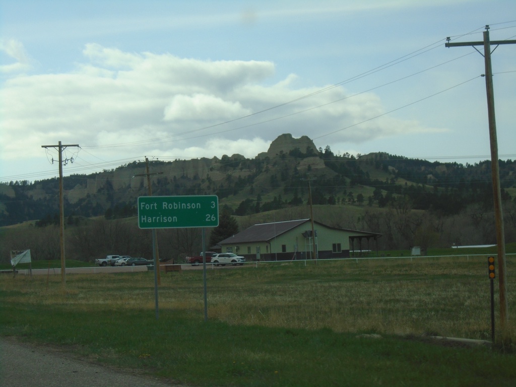
US-20 West - Distance Marker
Distance marker on US-20 west. Distance to Fort Robinson and Harrison. The Red Cloud Buttes are in the background.
Taken 05-02-2022
Crawford
Dawes County
Nebraska
United States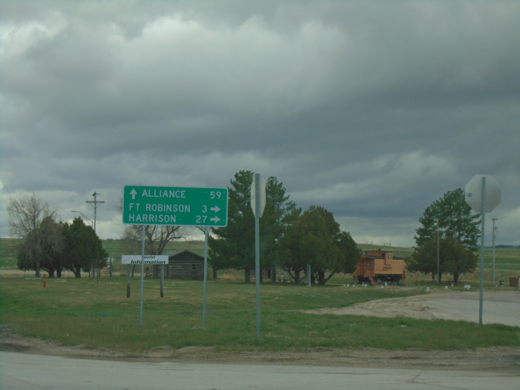
US-20 West/NE-71 South/NE-2 East at NE-71/NE-2
US-20 West/NE-71 South/NE-2 East at NE-71/NE-2 in Crawford. Use NE-71 South/NE-2 East to Alliance; use US-20 West for Fort Robinson and Harrison.
Taken 05-02-2022

 Crawford
Dawes County
Nebraska
United States
Crawford
Dawes County
Nebraska
United States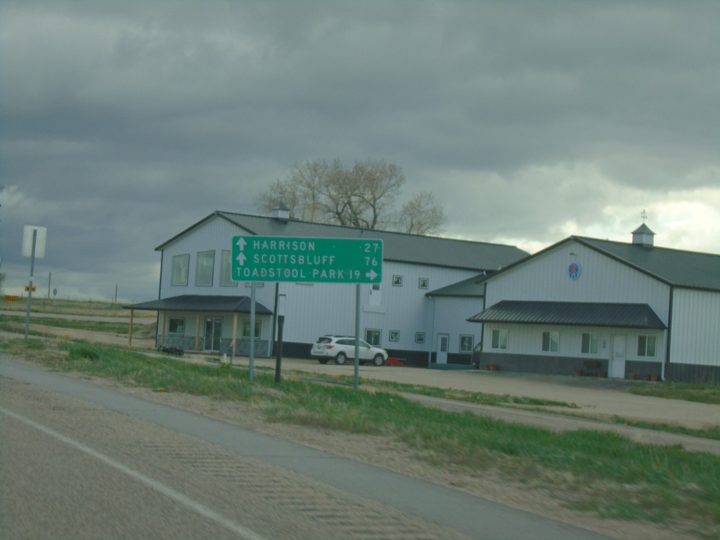
US-20 West Approaching NE-2/NE-71
US-20 West approaching NE-2/NE-71 in Crawford. Use NE-2 West/NE-71 South to Toadstool Park. Continue on US-20 West/NE-2 East/NE-71 South to Harrison (via US-20), and Scotts Bluff (via NE-71/NE-2).
Taken 05-02-2022
Crawford
Dawes County
Nebraska
United States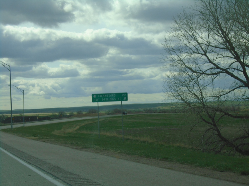
US-20 West/US-385 North at US-20/US-385 Split
US-20 West/US-385 North at US-20/US-385 split in Dawes County. Use US-385 North to Hot Springs, SD; continue west on US-20 for Crawford.
Taken 05-02-2022
 Chadron
Dawes County
Nebraska
United States
Chadron
Dawes County
Nebraska
United States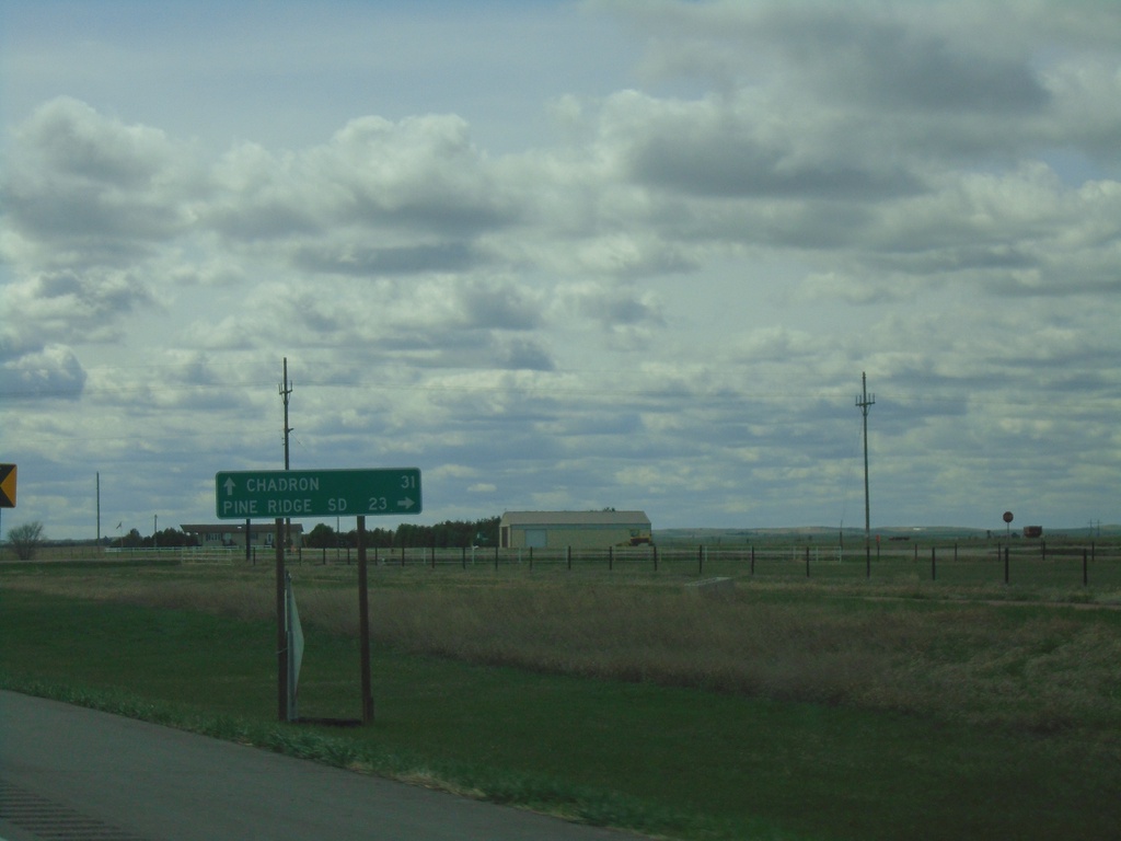
US-20 West at NE-87
US-20 West at NE-87 in Sheridan County. Use NE-87 North to Pine Ridge, SD. Continue west on US-20 to Chadron. NE-87 South joins US-20 West to Hay Springs.
Taken 05-02-2022
 Rushville
Sheridan County
Nebraska
United States
Rushville
Sheridan County
Nebraska
United States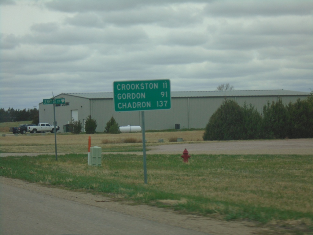
US-20 West - Distance Marker
Distance marker on US-20 west. Distance to Crookston, Gordon, and Chadron.
Taken 05-02-2022
Valentine
Cherry County
Nebraska
United States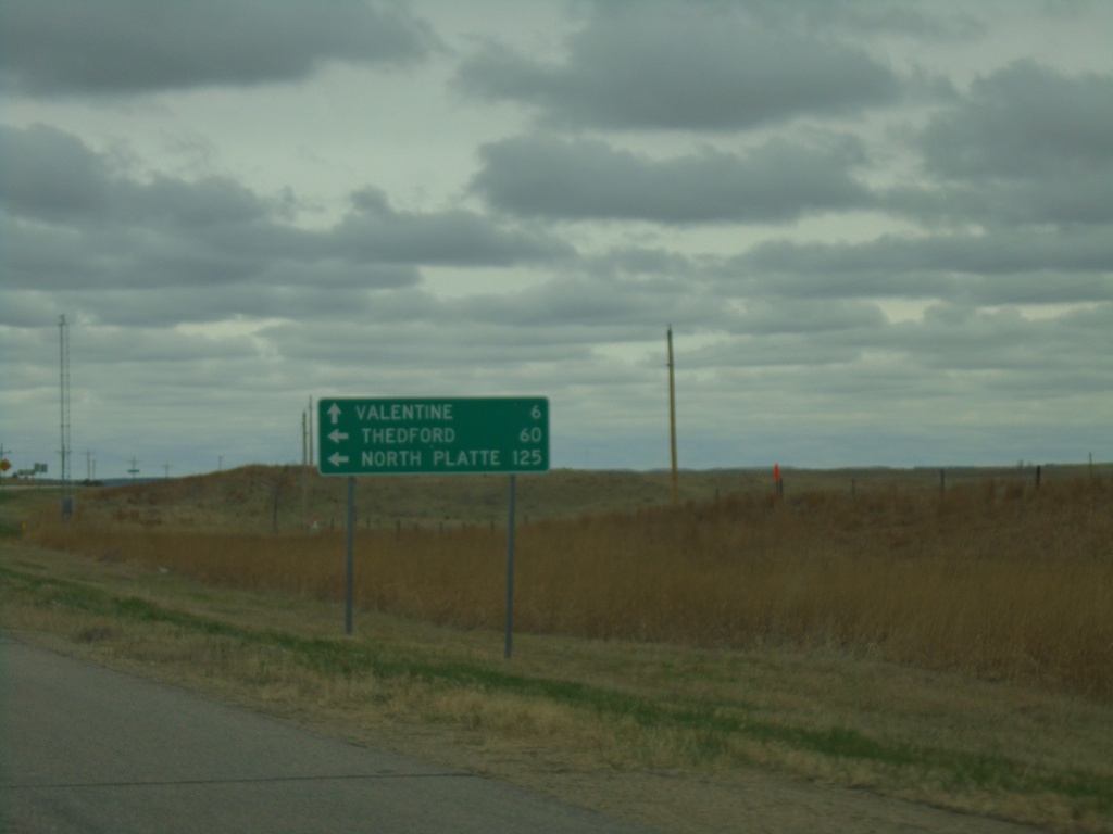
US-20 West at US-83
US-20 West at US-83 in Cherry County. Use US-83 south to North Platte and Thedford. Continue on US-20 West/US-83 North to Valentine.
Taken 05-02-2022
 Valentine
Cherry County
Nebraska
United States
Valentine
Cherry County
Nebraska
United States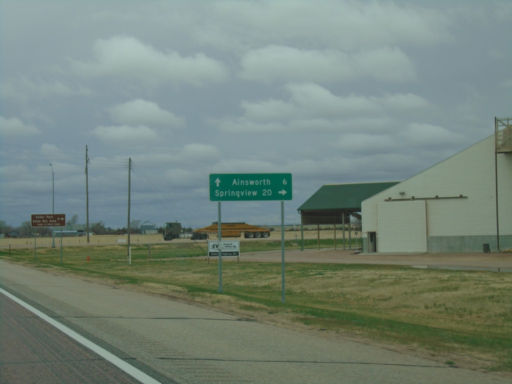
US-20 West/US-183 North/NE-7 South at US-183 North
US-20 West/US-183 North/NE-7 South at US-183 North in Brown County. Use US-183 North to Springview. Continue on US-20 West/NE-7 South to Ainsworth.
Taken 05-02-2022

 Ainsworth
Brown County
Nebraska
United States
Ainsworth
Brown County
Nebraska
United States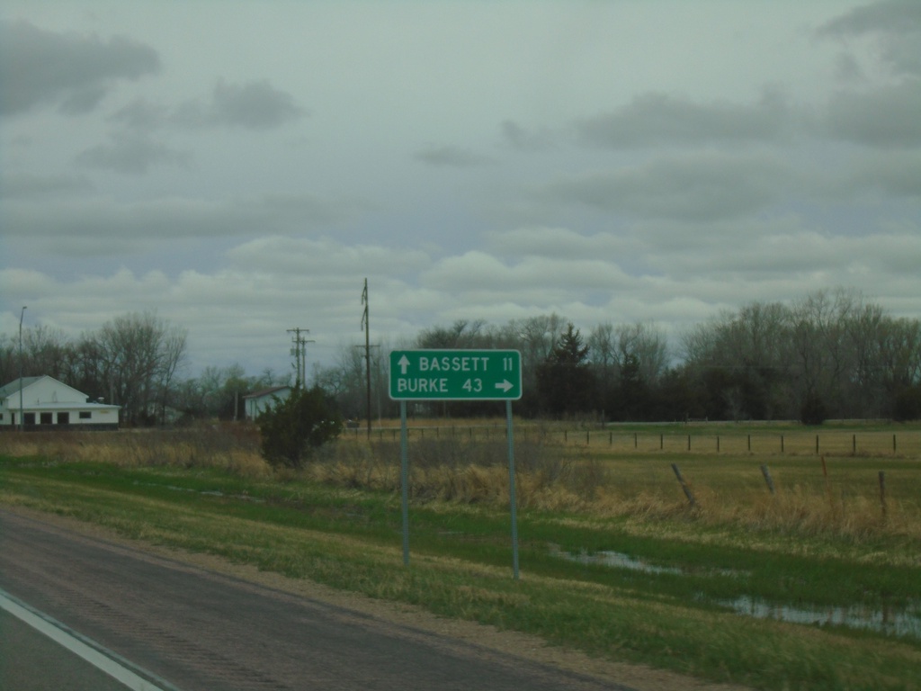
US-20 West at NE-137 North
US-20 West at NE-137 North to Burke (South Dakota). Continue west on US-20 to Bassett.
Taken 05-02-2022
 Newport
Rock County
Nebraska
United States
Newport
Rock County
Nebraska
United States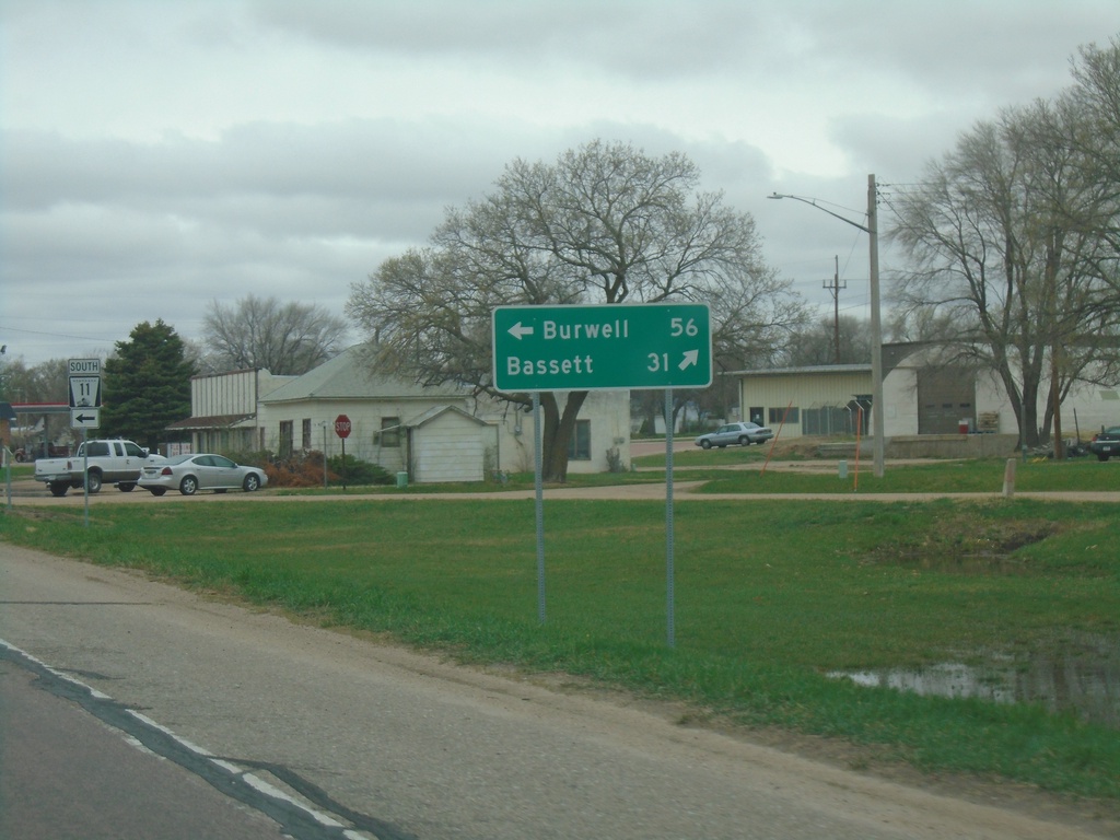
US-20 West at NE-11 - Atkinson
US-20 West at NE-11 in Atkinson. Use NE-11 South to Burwell. Continue west on US-20 to Bassett. NE-11 North joins US-20 west through Atkinson.
Taken 05-02-2022
 Atkinson
Holt County
Nebraska
United States
Atkinson
Holt County
Nebraska
United States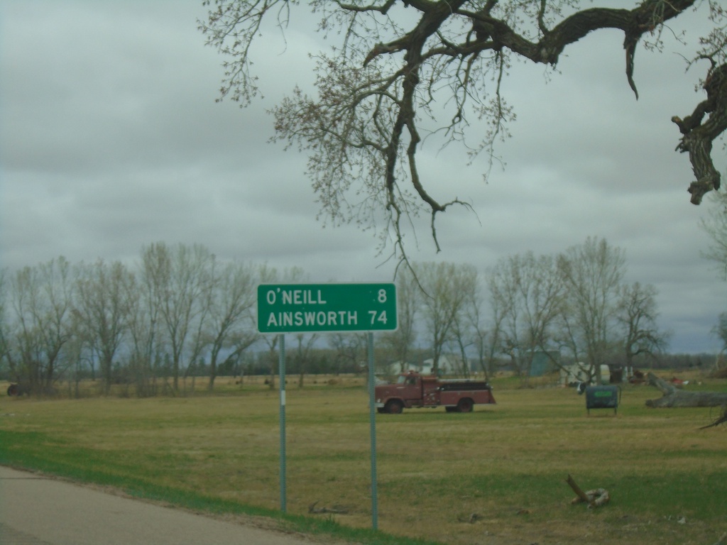
US-20/US-275 West - Distance Marker
Distance Marker on US-20/US-275 West. Distance to O’Neill and Ainsworth. O’Neill has been the control city from Sioux City, Iowa on US-20 westbound. Ainsworth is the control city west from O’Neill to Ainsworth.
Taken 05-02-2022
 Inman
Holt County
Nebraska
United States
Inman
Holt County
Nebraska
United States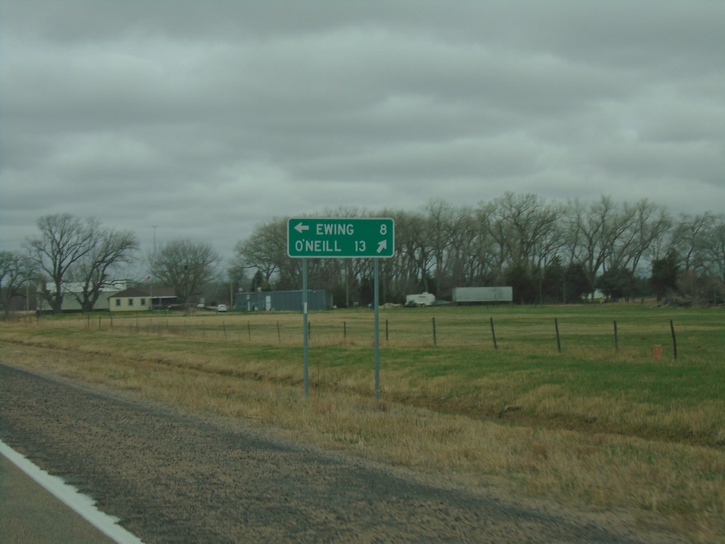
US-20 West Approaching US-275
US-20 West approaching US-275 in Holt County. Use US-275 East to Ewing; use US-20/US-275 West to O’Neill.
Taken 05-02-2022
Page
Holt County
Nebraska
United States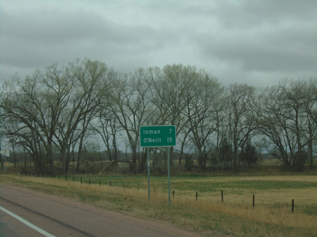
US-20 West - Distance Marker
Distance marker on US-20 west. Distance to Inman and O’Neill.
Taken 05-02-2022
Ewing
Holt County
Nebraska
United States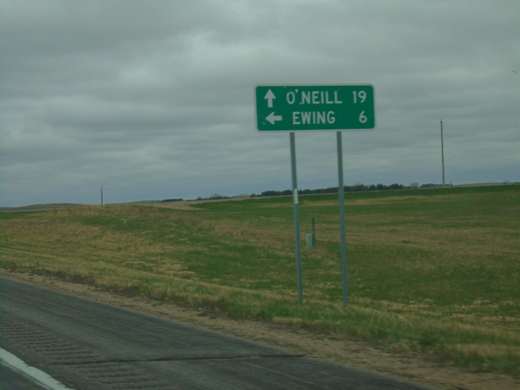
US-20 West at NE-45B Link South
US-20 West at NE-45B Link South to Ewing. Continue west on US-20 for O’Neill.
Taken 05-02-2022
 Orchard
Antelope County
Nebraska
United States
Orchard
Antelope County
Nebraska
United States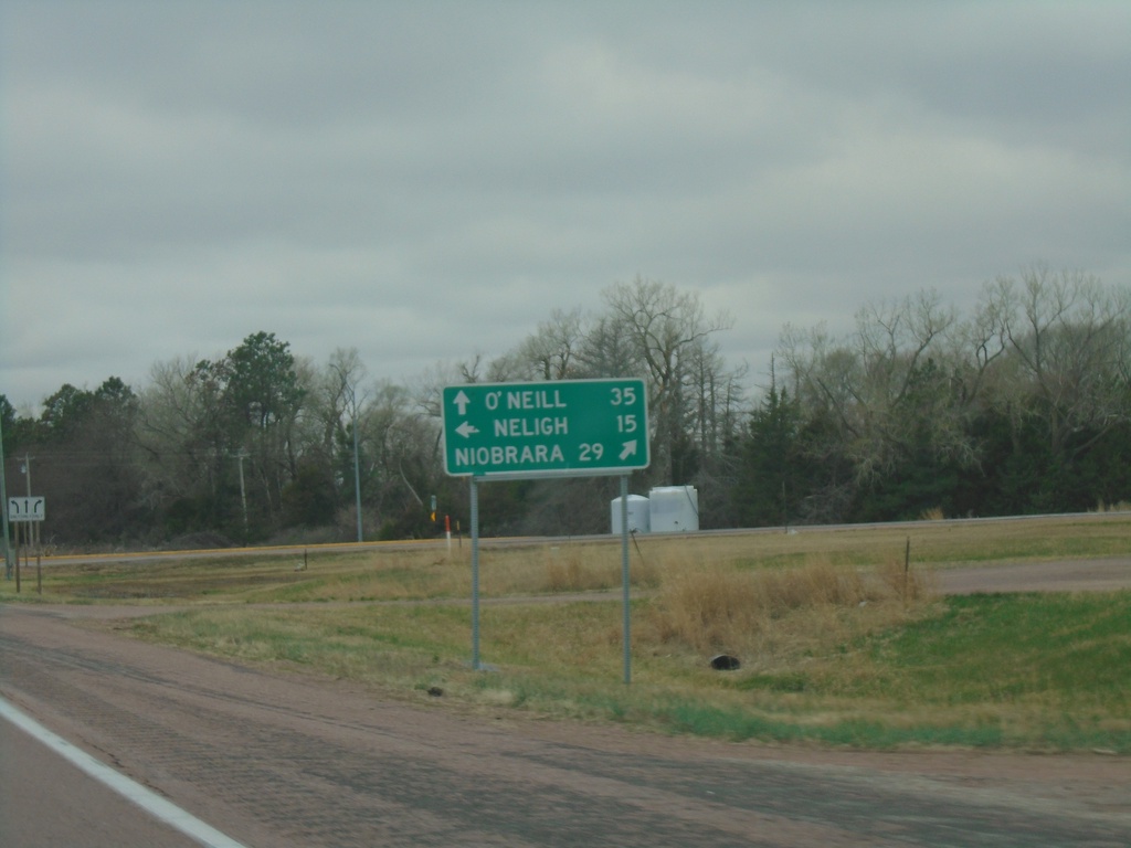
US-20 West at NE-14
US-20 West at NE-14 in Antelope County. Use NE-14 north to Niobrara; NE-14 south to Neligh. Continue west on US-20 to O’Neill.
Taken 05-02-2022
 Brunswick
Antelope County
Nebraska
United States
Brunswick
Antelope County
Nebraska
United States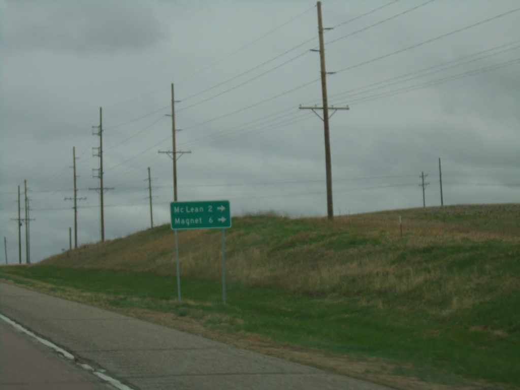
US-20 West at NE-70A Spur
US-20 West at NE-70A Spur to Mc Lean and Magnet.
Taken 05-02-2022
 McLean
Pierce County
Nebraska
United States
McLean
Pierce County
Nebraska
United States