Signs Tagged With Distance Marker
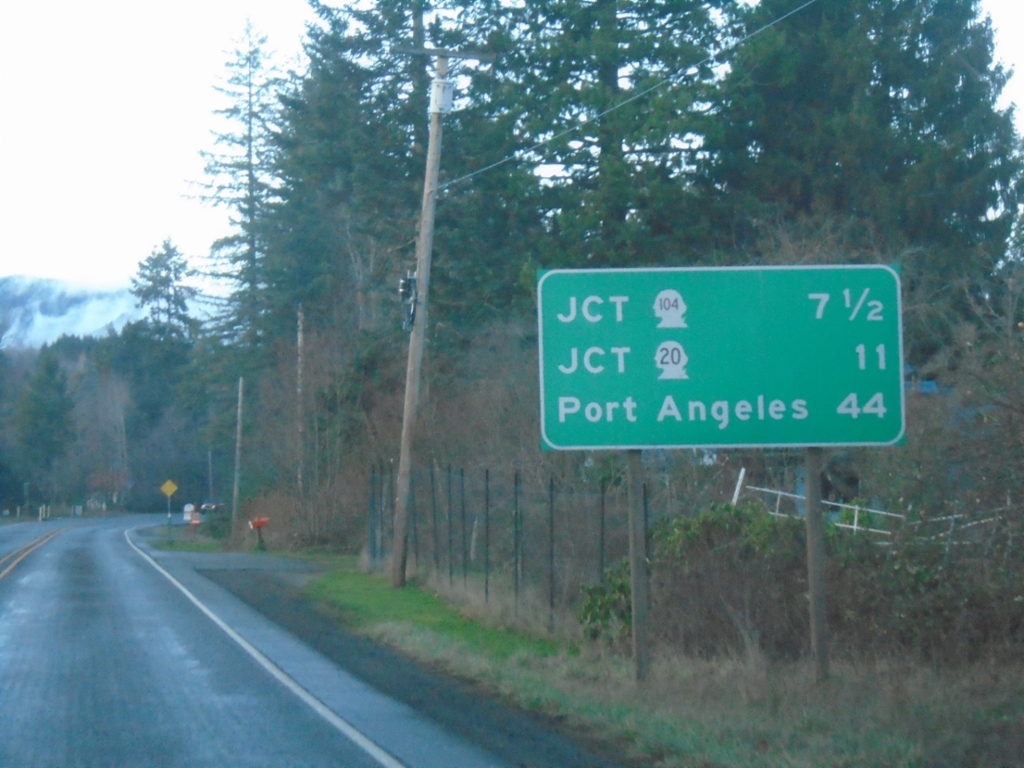
US-101 North - Distance Marker
Distance marker on US-101 north. Distance to WA-104, WA-20, and Port Angeles.
Taken 12-21-2025


 Quilcene
Jefferson County
Washington
United States
Quilcene
Jefferson County
Washington
United States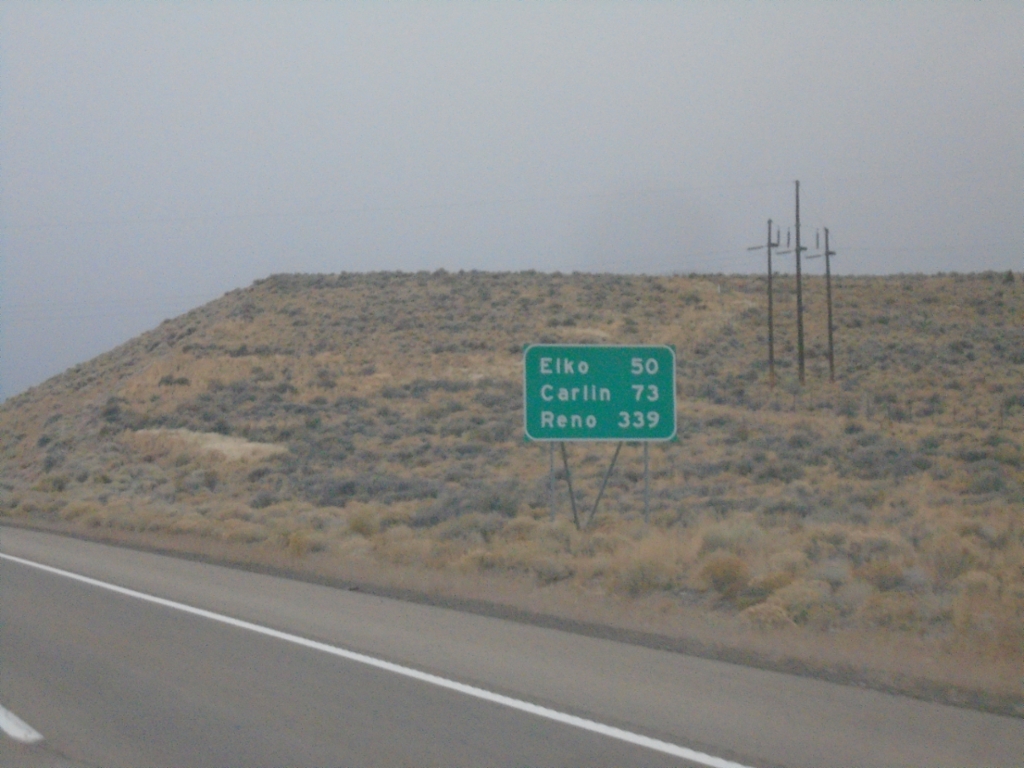
I-80 West - Distance Marker
Distance marker on I-80 west. Distance to Elko, Carlin, and Reno.
Taken 10-26-2025
 Wells
Elko County
Nevada
United States
Wells
Elko County
Nevada
United States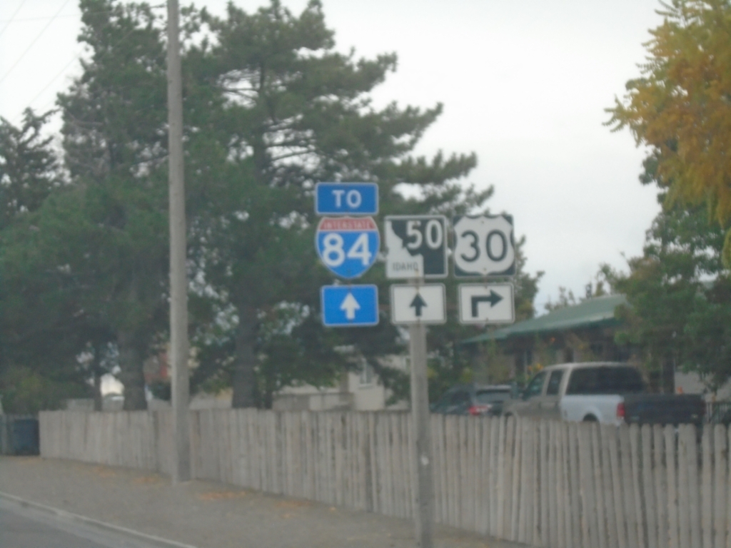
US-30 East Approaching ID-50
US-30 east approaching ID-50 to I-84.
Taken 10-25-2025


 Kimberly
Twin Falls County
Idaho
United States
Kimberly
Twin Falls County
Idaho
United States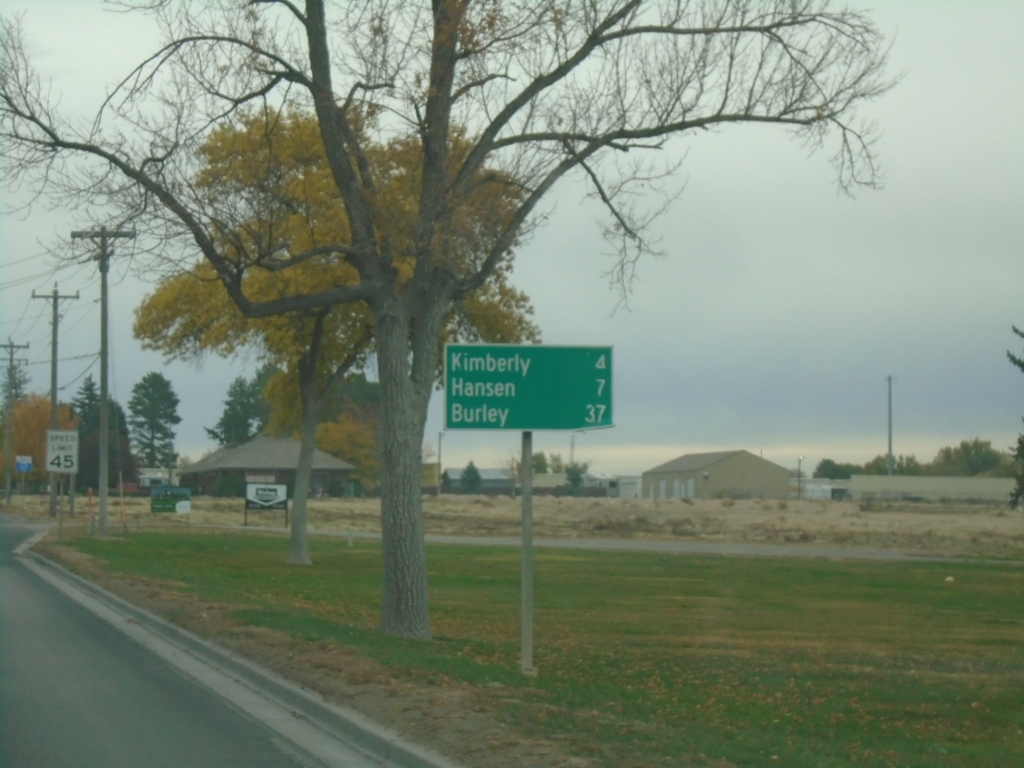
US-30 East - Distance Marker
Distance marker on US-30 east. Distance to Kimberly, Hanson, and Burley.
Taken 10-25-2025
Twin Falls
Twin Falls County
Idaho
United States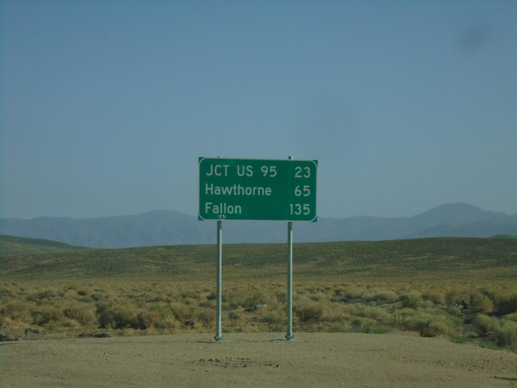
NV-360 North - Distance Marker
Distance marker on NV-360 north. Distance to Jct. US-95, Hawthorne, and Fallon.
Taken 07-22-2025
 Dyer
Mineral County
Nevada
United States
Dyer
Mineral County
Nevada
United States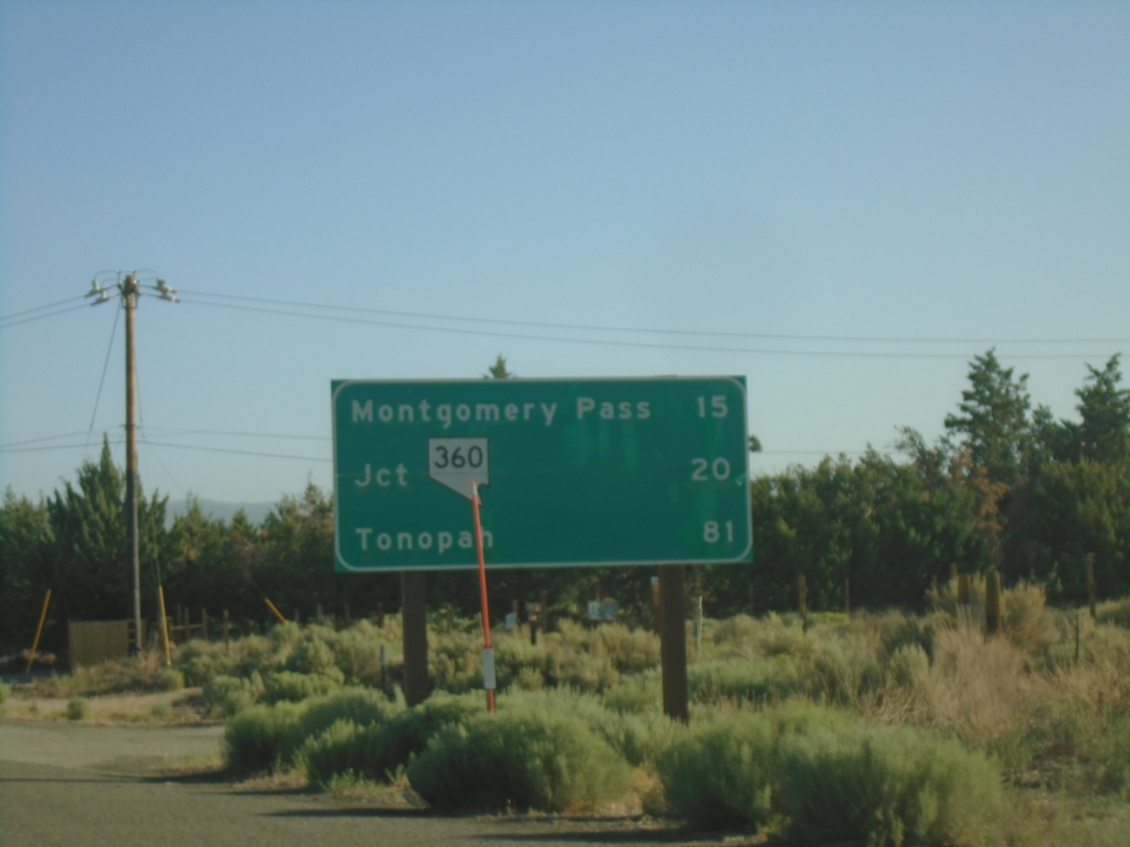
US-6 East - Distance Marker
Distance marker on US-6 east. Distance to Montgomery Pass (NV), Jct NV-360, Tonopah (NV).
Taken 07-22-2025
 Benton
Mono County
California
United States
Benton
Mono County
California
United States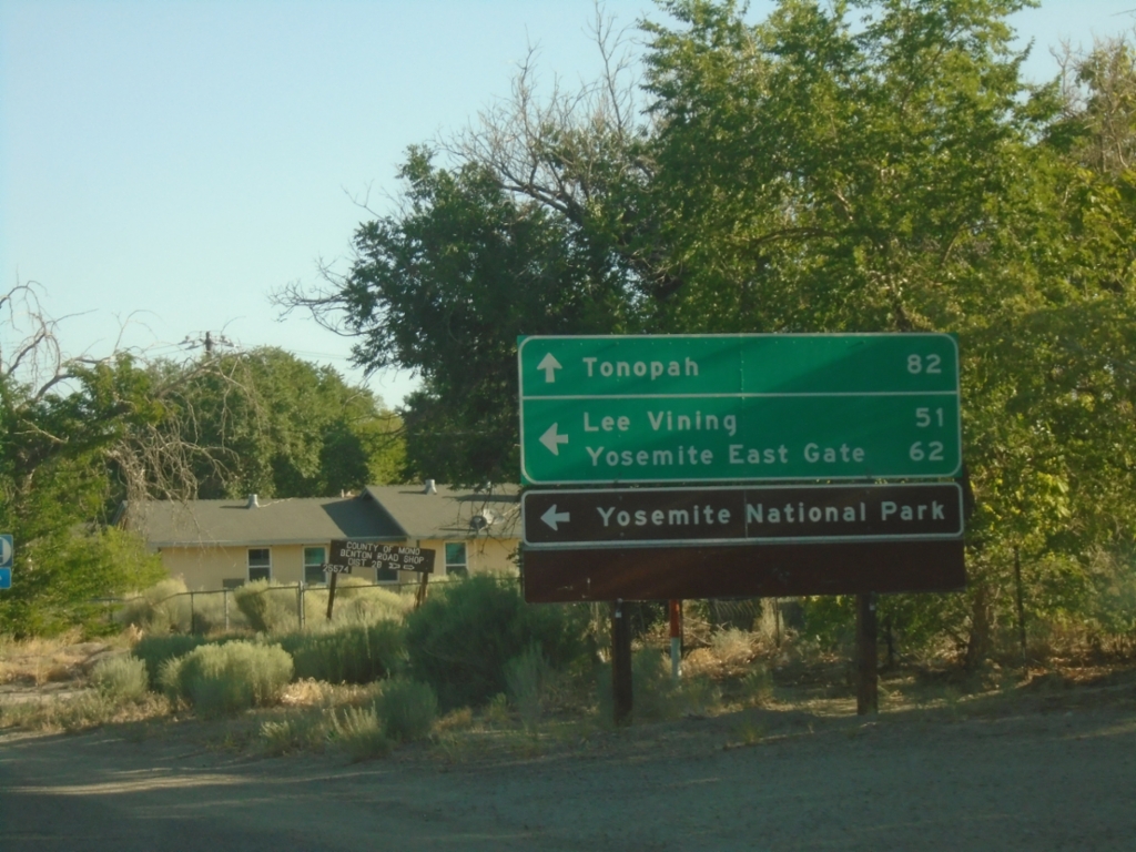
US-6 East Approaching CA-120
US-6 East approaching CA-120 west to Lee Vining, Yosemite East Gate and Yosemite National Park. Continue east on US-6 to Tonopah (Nevada).
Taken 07-22-2025
 Benton
Mono County
California
United States
Benton
Mono County
California
United States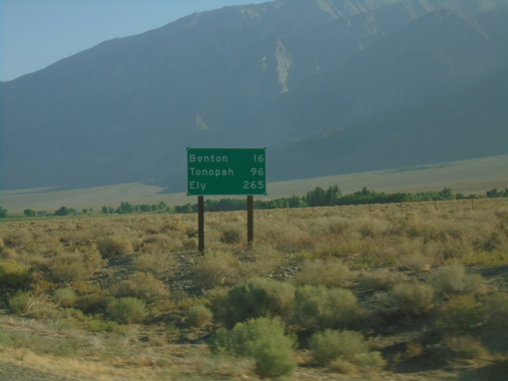
US-6 East - Distance Marker
Distance marker on US-6 east. Distance to Benton, Tonopah (NV), and Ely (NV).
Taken 07-22-2025
Bishop
Mono County
California
United States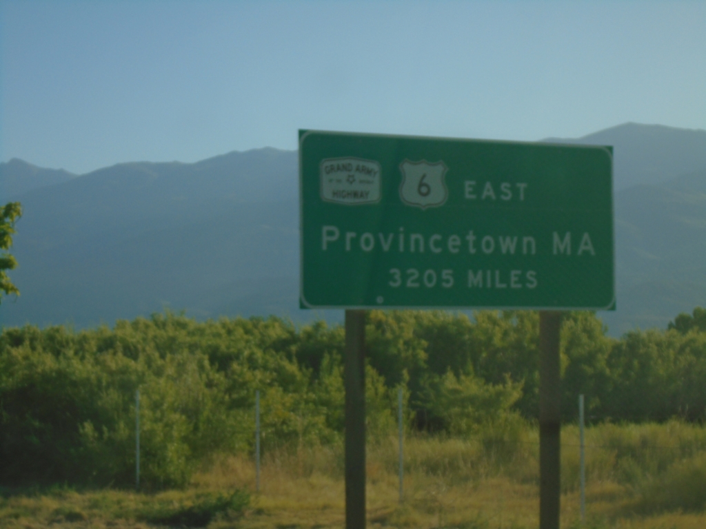
US-6 East - Distance Marker
Distance marker on US-6 east. Distance to eastern terminus in Provincetown, MA - 3205 miles. US-6 is the Grand Army of the Republic Highway.
Taken 07-22-2025
Bishop
Inyo County
California
United States
US-6 East - Distance Marker
First distance marker eastbound on US-6. Distance to Chaflant, Benton, and Tonopah (Nevada).
Taken 07-22-2025
Bishop
Inyo County
California
United States
US-395 North at US-6
US-395 north at US-6 in Bishop. Use US-6 east for Tonopah (Nevada). This is the western terminus of US-6. The eastern end of US-6 is Provincetown, MA.
Taken 07-22-2025
 Bishop
Inyo County
California
United States
Bishop
Inyo County
California
United States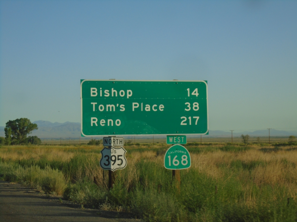
US-395 North/CA-168 West - Distance Marker
Distance marker on US-395 North/CA-168 West. Distance to Bishop, Tom’s Place, and Reno (Nevada)
Taken 07-22-2025
 Big Pine
Inyo County
California
United States
Big Pine
Inyo County
California
United States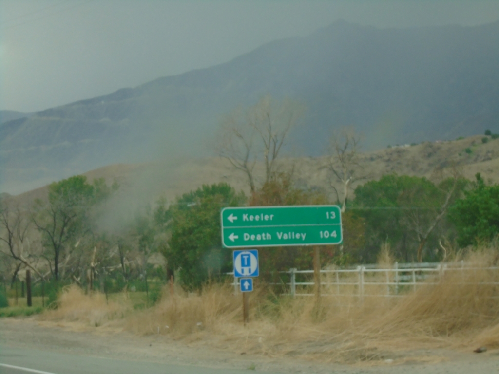
US-395 South at CA-136
US-395 south at CA-136 east to Keeler and Death Valley.
Taken 07-20-2025
 Lone Pine
Inyo County
California
United States
Lone Pine
Inyo County
California
United States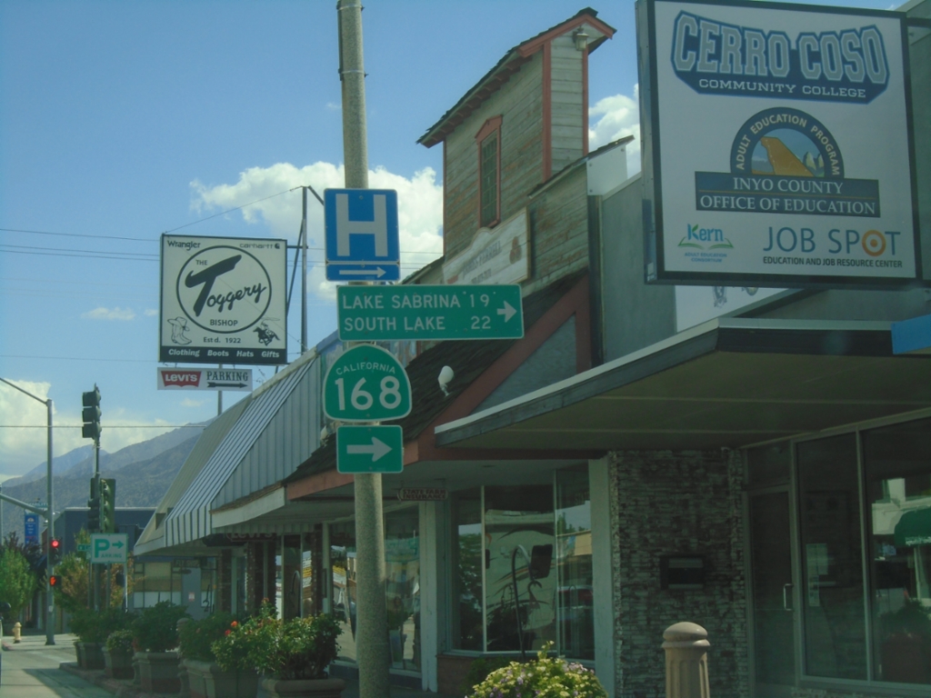
US-395 South at CA-168 West
US-395 South at CA-168 West to Lake Sabrina and South Lake. CA-168 east joins US-395 south to Big Pine.
Taken 07-20-2025
Bishop
Inyo County
California
United States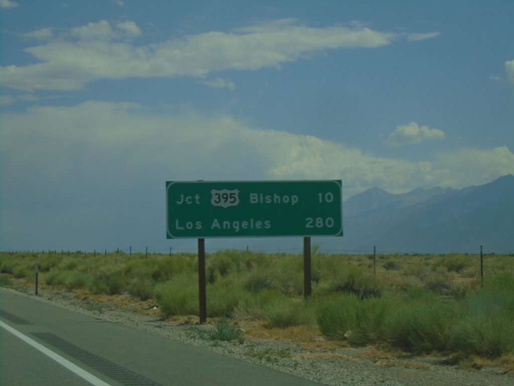
US-6 West - Distance Marker
Distance marker on US-6 west. Distances to Jct. US-395 - Bishop, and Los Angeles.
Taken 07-20-2025
Bishop
Mono County
California
United States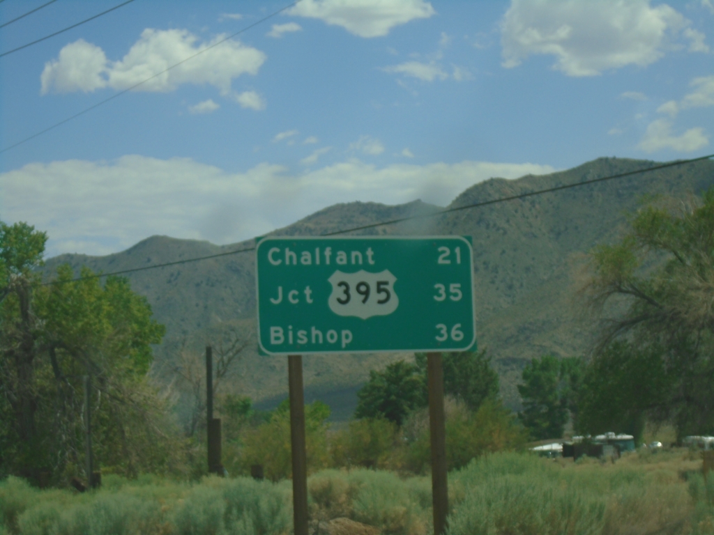
US-6 West - Distance Marker
Distance marker on US-6. Distance to Chaflant, Jct. US-395, and Bishop.
Taken 07-20-2025
Benton
Mono County
California
United States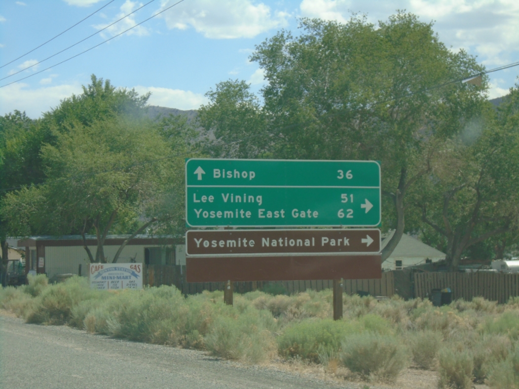
US-6 West at CA-120 West
US-6 West at CA-120 West. Use CA-120 west for Lee Vining, Yosemite East Gate, and Yosemite National Park. Continue west on US-6 for Bishop.
Taken 07-20-2025
Benton
Mono County
California
United States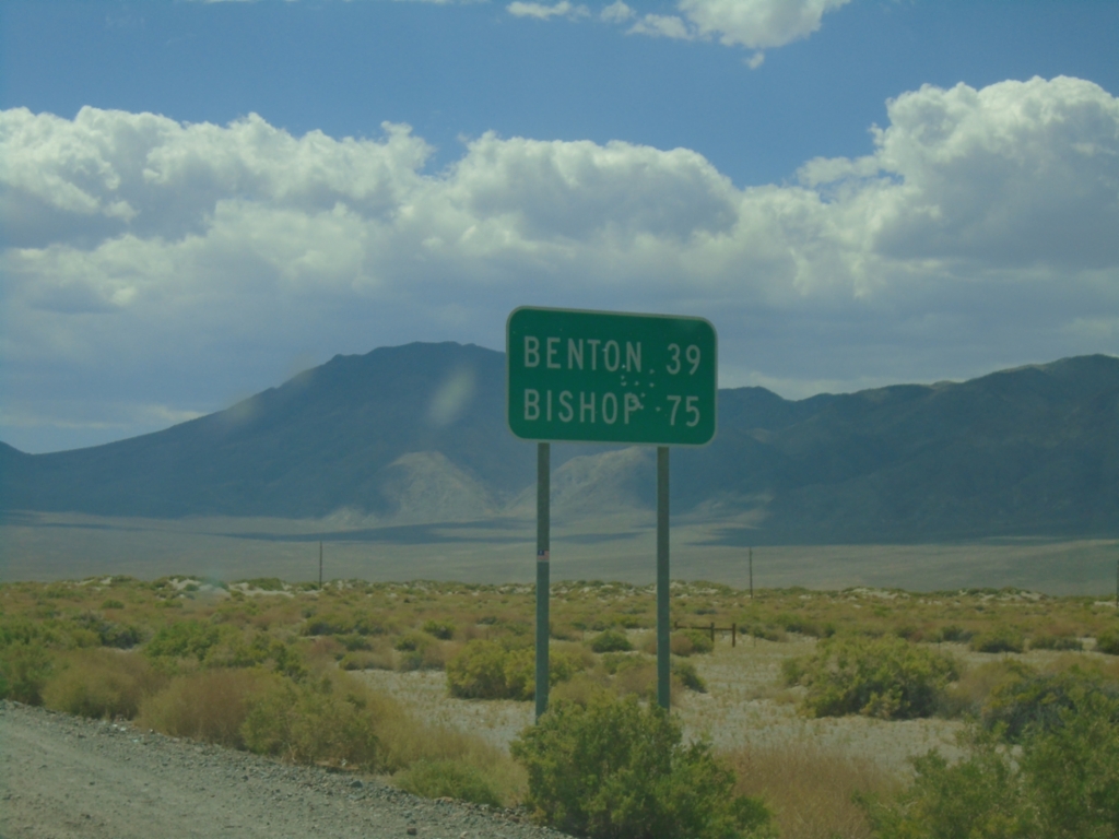
NV-360 South - Distance Marker
Distance marker on NV-360 south. Distance to Benton (CA) and Bishop (CA).
Taken 07-20-2025
Mina
Mineral County
Nevada
United States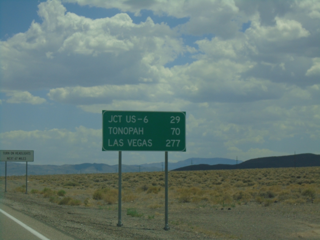
US-95 South - Distance Marker
Distance marker on US-95 south. Distance to Jct. US-6, Tonopah, and Las Vegas.
Taken 07-20-2025
 Mina
Mineral County
Nevada
United States
Mina
Mineral County
Nevada
United States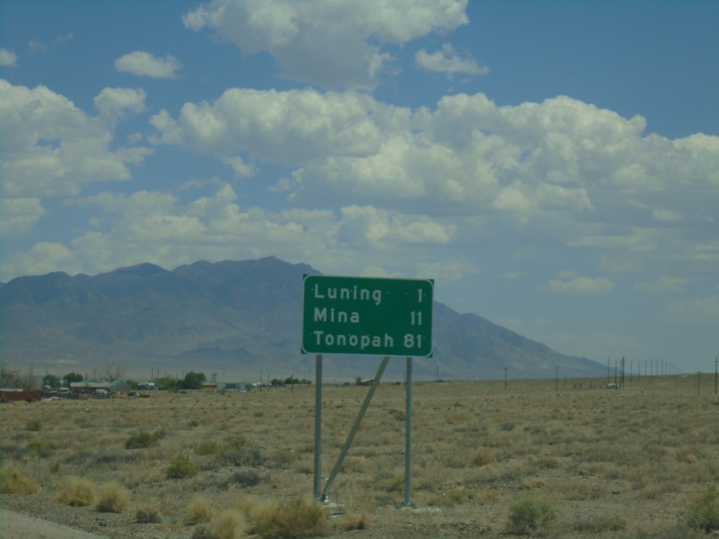
US-95 South - Distance Marker
Distance marker on US-95 south. Distance to Luning, Mina, and Tonopah.
Taken 07-20-2025
Luning
Mineral County
Nevada
United States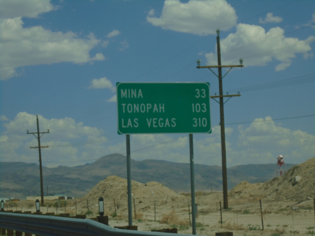
US-95 South - Distance Marker
Distance marker on US-95 south. Distance to Mina, Tonopah, and Las Vegas.
Taken 07-20-2025
Hawthorne
Mineral County
Nevada
United States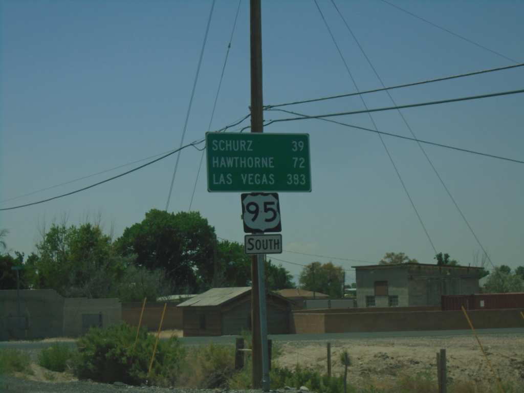
US-95 South - Distance Marker
Distance marker on US-95 south. Distance to Schurz, Hawthorne, and Las Vegas.
Taken 07-20-2025
Fallon
Churchill County
Nevada
United States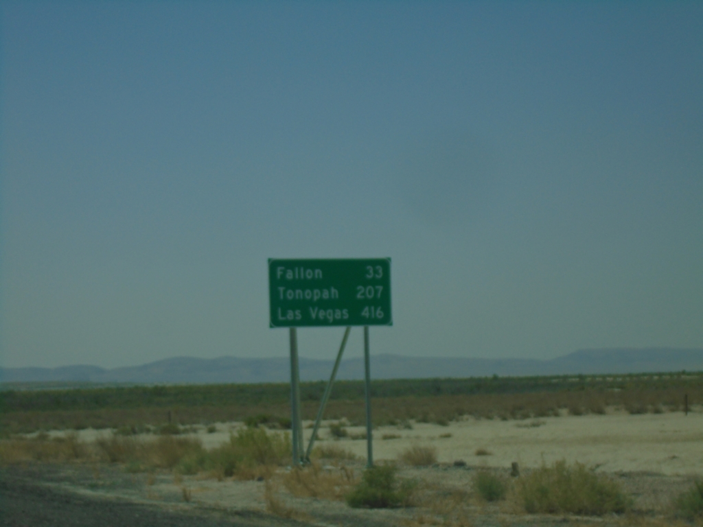
US-95 South - Distance Marker
Distance marker on US-95 South. Distance to Fallon, Tonopah, and Las Vegas.
Taken 07-20-2025
Churchill County
Nevada
United States
US-30 West - Distance Marker
First distance marker on US-30 west in Idaho. Distance to Montpelier, Soda Springs, and Pocatello.
Taken 07-04-2025
Montpelier
Bear Lake County
Idaho
United States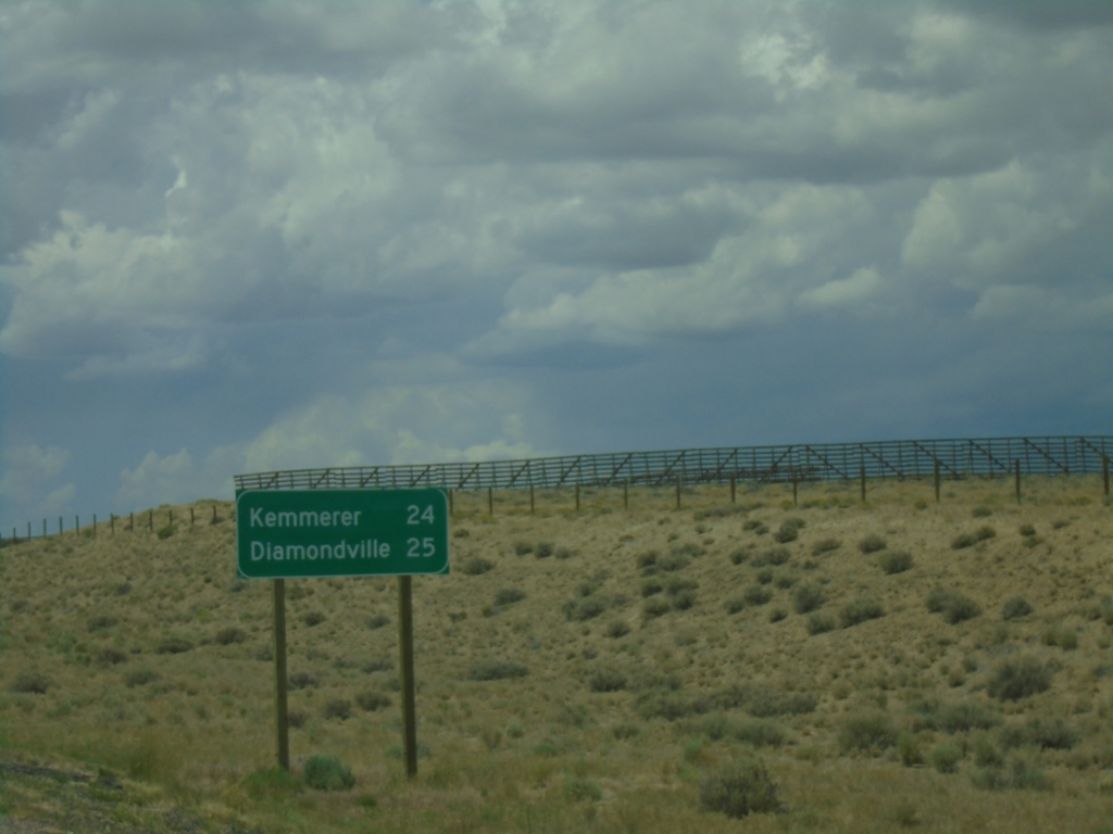
US-189 South - Distance Marker
Distance marker on US-189 south. Distance to Kemmerer and Diamondville.
Taken 07-04-2025
 Kemmerer
Lincoln County
Wyoming
United States
Kemmerer
Lincoln County
Wyoming
United States