Signs Tagged With Distance Marker
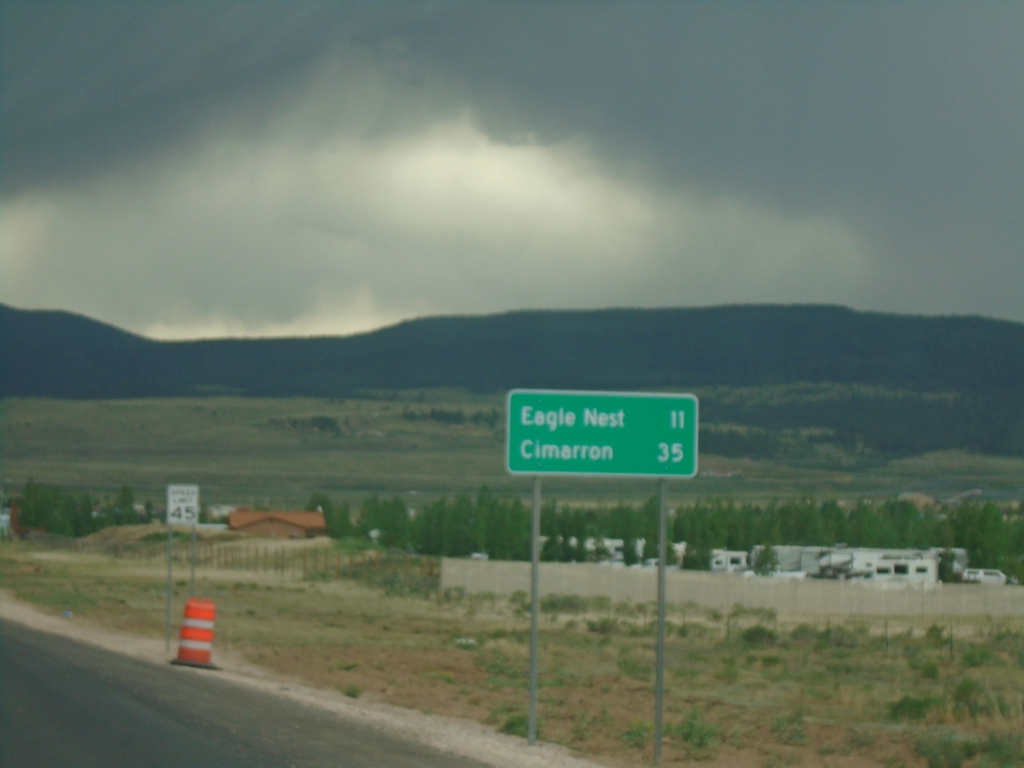
US-64 East - Distance Marker
Distance marker on US-64 east. Distance to Eagle Nest and Cimarron.
Taken 06-19-2026
 Eagle Nest
Colfax County
New Mexico
United States
Eagle Nest
Colfax County
New Mexico
United States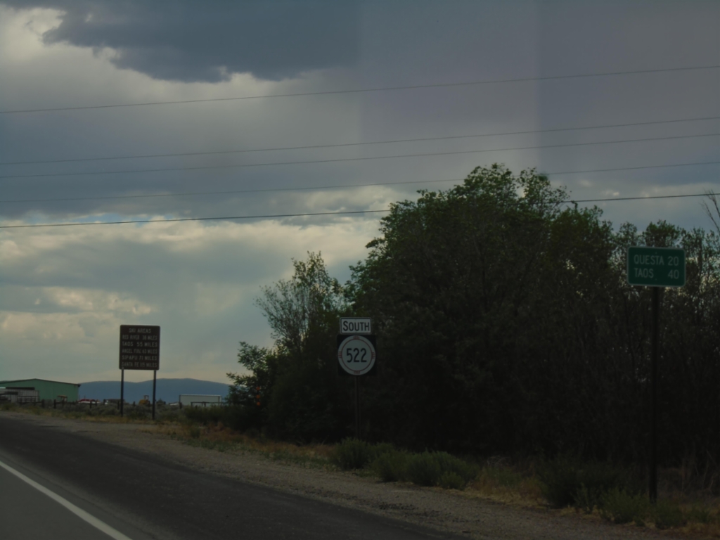
NM-522 South - Distance Marker
Distance marker on NM-522 south to Questa and Taos.
Taken 06-18-2026
 Costilla
Taos County
New Mexico
United States
Costilla
Taos County
New Mexico
United States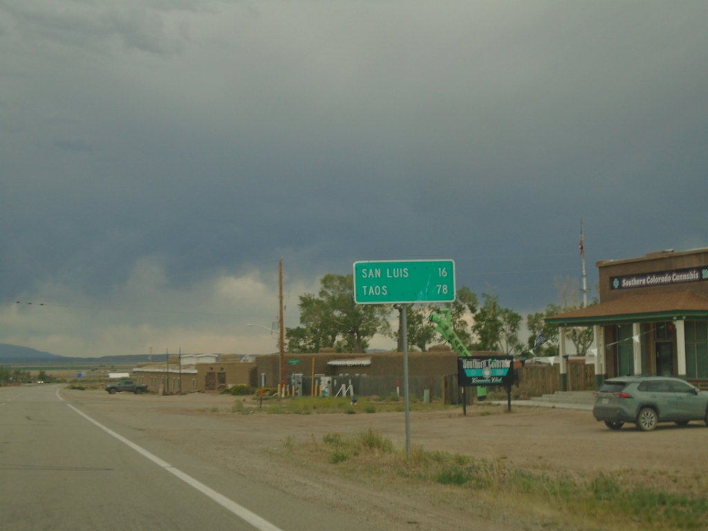
CO-159 South - Distance Marker
Distance marker on CO-159 south. Distance to San Luis and Taos (New Mexico).
Taken 06-18-2026
 Fort Garland
Costilla County
Colorado
United States
Fort Garland
Costilla County
Colorado
United States
US-160 East at CO-159 South
US-160 East at CO-159 South in Fort Garland. Use CO-159 south to San Luis and Taos (New Mexico).
Taken 06-18-2026
 Fort Garland
Costilla County
Colorado
United States
Fort Garland
Costilla County
Colorado
United States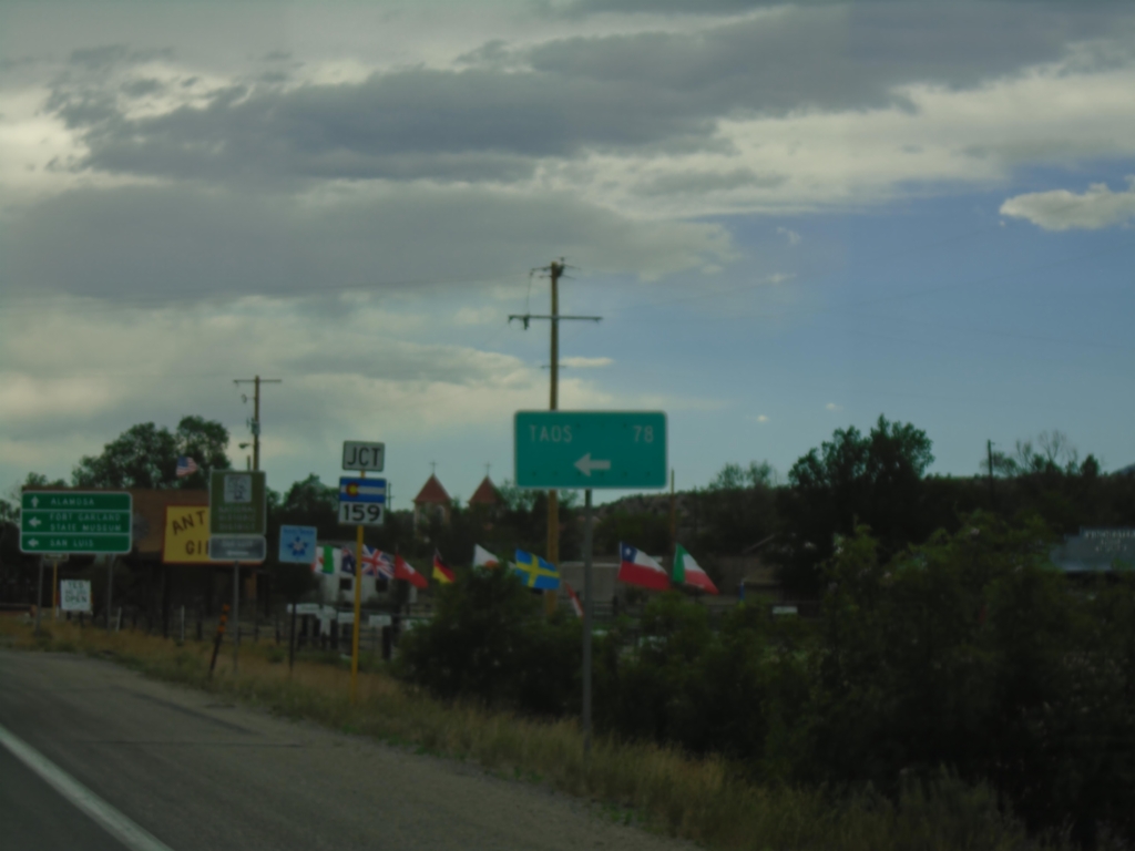
US-160 West Approaching CO-159
US-160 West approaching CO-159 in Fort Garland. Use CO-159 South to Taos (New Mexico), San Luis, and Fort Garland State Museum. Continue west on US-160 for Alamosa.
Taken 06-18-2026
Fort Garland
Costilla County
Colorado
United States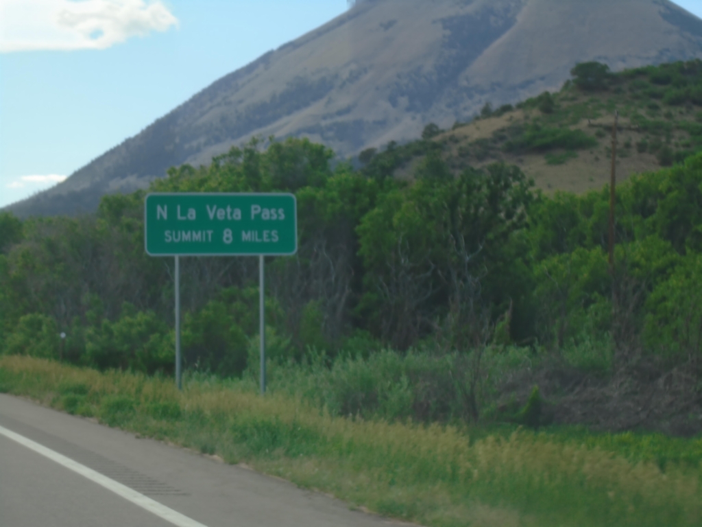
US-160 West Approaching North La Veta Pass
US-160 West - North La Veta Pass Summit 8 Miles. North La Veta Pass crosses the Sangre de Cristo Mountain Range.
Taken 06-18-2026
Huerfano County
Colorado
United States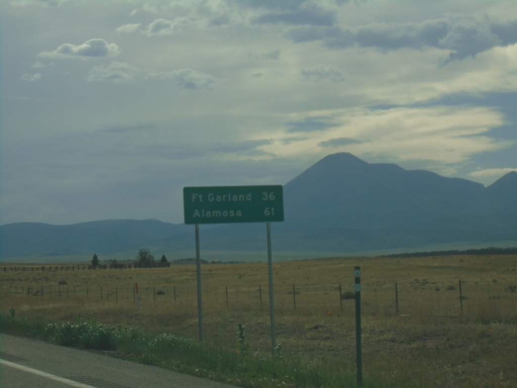
US-160 West - Distance Marker
Distance marker on US-160 west. Distance to Fort Garland and Alamosa.
Taken 06-18-2026
Huerfano County
Colorado
United States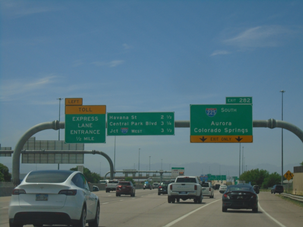
I-70 West - Exit 282
I-70 west approaching Exit 282 - I-225 South/Aurora/Colorado Springs. Continue on I-70 for Havana St., Central Park Blvd., and Jct. I-270 West. Use left lane for Toll Express Lane Entrance.
Taken 06-18-2026


 Aurora
Adams County
Colorado
United States
Aurora
Adams County
Colorado
United States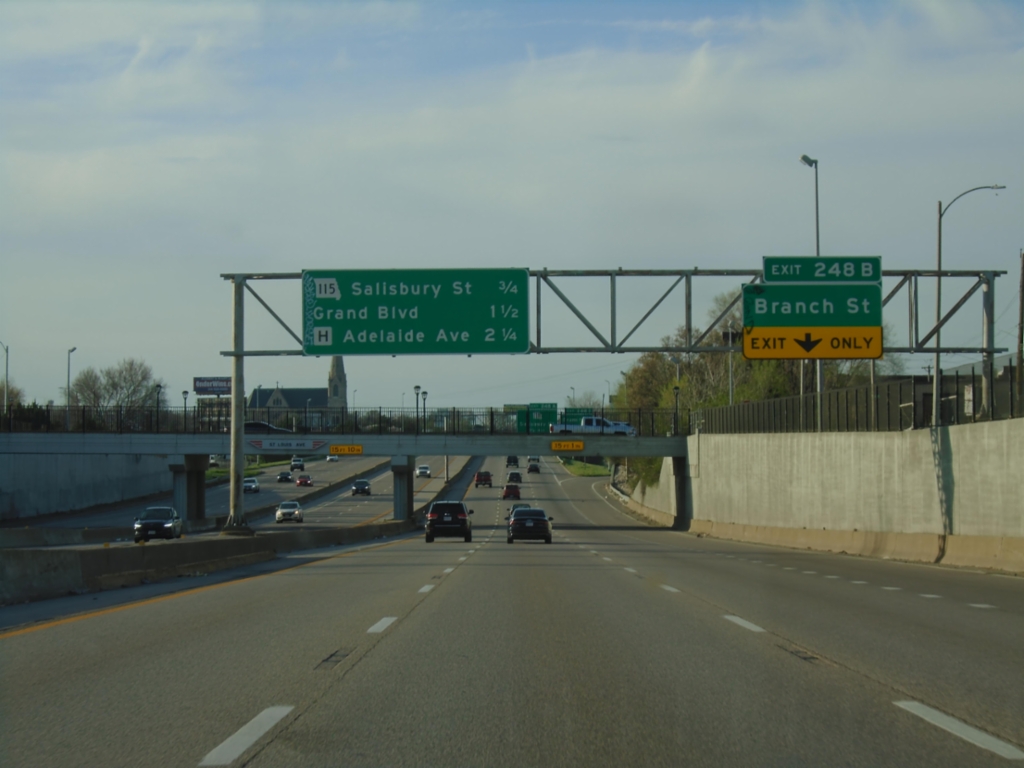
I-70 West - Exit 248B
I-70 west approaching Exit 248B - Branch St. Next 3 exits are MO-115/Salisbury St., Grand Blvd., and MO-H/Adelaide Ave.
Taken 03-29-2026

 St. Louis
City of St. Louis
Missouri
United States
St. Louis
City of St. Louis
Missouri
United States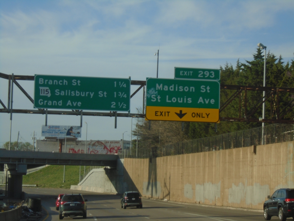
I-44 East - Exit 293
I-44 east approaching Exit 293 - Madison St./Saint Louis Ave. This is the last exit eastbound on I-44, which continues as I-70 west. The next 3 exits on I-70 west are: Branch St., MO-115/Salisbury St., and Grand Ave.
Taken 03-29-2026
 St. Louis
City of St. Louis
Missouri
United States
St. Louis
City of St. Louis
Missouri
United States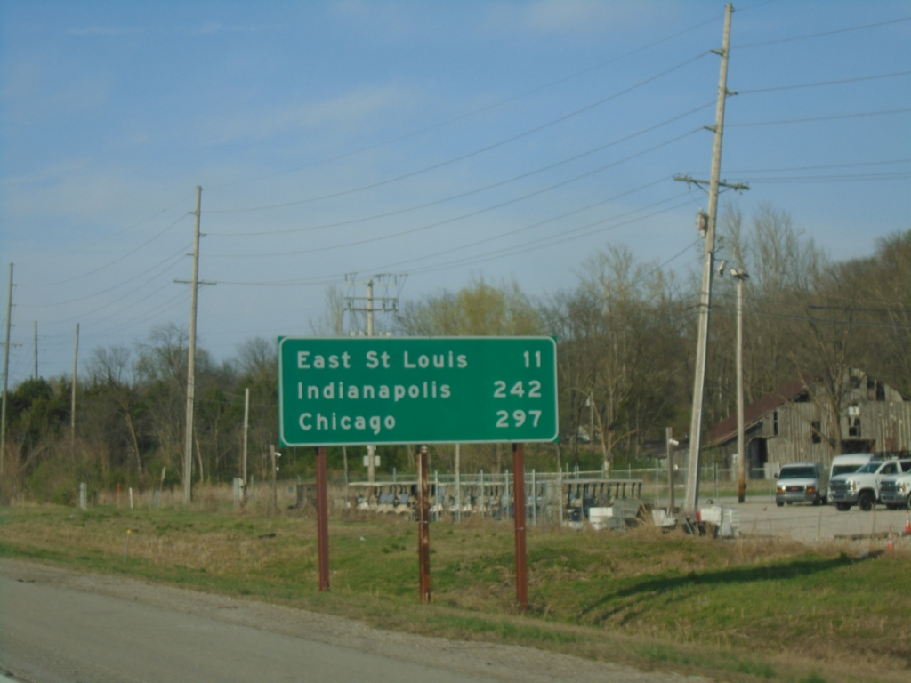
I-255 North - Distance Marker
Distance marker on I-255 North. Distance to East Saint Louis, Chicago (via I-55), and Indianapolis (via I-70).
Taken 03-29-2026


 Columbia
St. Clair County
Illinois
United States
Columbia
St. Clair County
Illinois
United States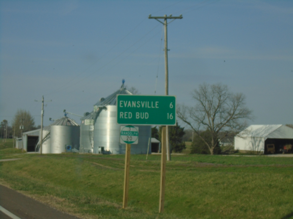
IL-3 North - Distance Marker/Milemarker
Distance marker on IL-3 North. Distance to Evansville and Red Bud. Milemarker 20 (Randolph County).
Taken 03-29-2026
Ellis Grove
Randolph County
Illinois
United States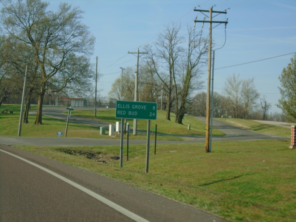
IL-3 North - Distance Marker
Distance maker on IL-3 North. Distance to Ellis Grove and Red Bud.
Taken 03-29-2026
Chester
Randolph County
Illinois
United States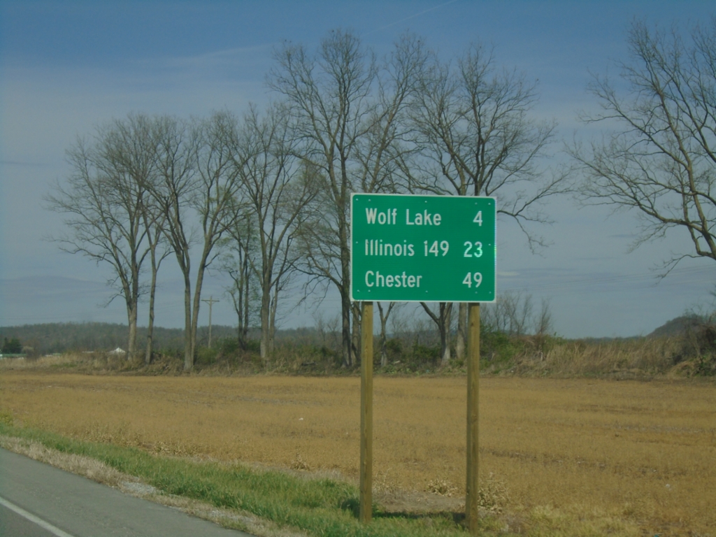
IL-3 North - Distance Marker
Distance marker on IL-3 North. Distance to Wolf Lake, Illinois 149, and Chester.
Taken 03-29-2026
 Ware
Union County
Illinois
United States
Ware
Union County
Illinois
United States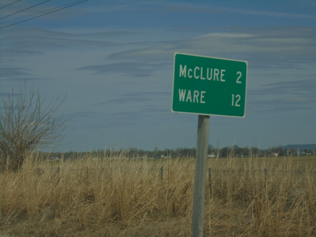
IL-3 North/IL-146 East - Distance Marker
Distance Marker on IL-3 North/IL-146 East. Distance to McClure and Ware.
Taken 03-29-2026
 Mcclure
Alexander County
Illinois
United States
Mcclure
Alexander County
Illinois
United States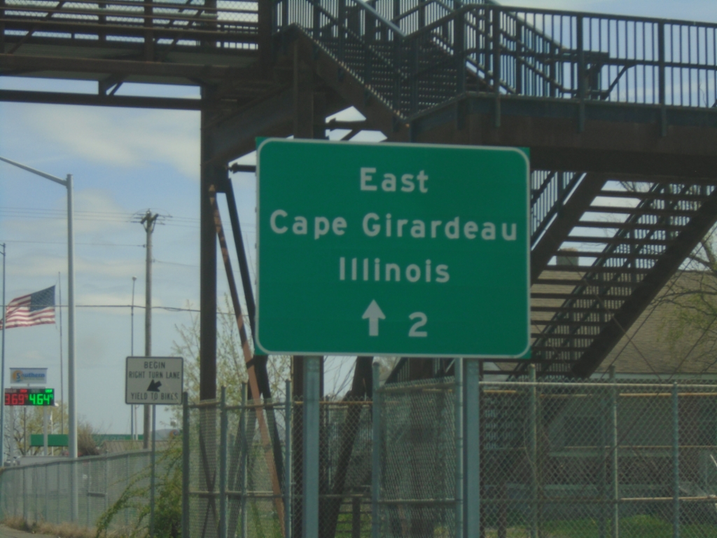
MO-74 East - Distance Marker
Distance marker to East Cape Girardeau on MO-74 east.
Taken 03-29-2026
 Cape Girardeau
 County
Missouri
United States
Cape Girardeau
Cape Girardeau County
Missouri
United States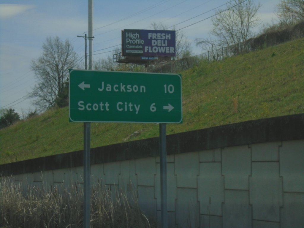
MO-74 East Approaching US-61/BL-55
MO-74 East approaching US-61/BL-55 (Kingshighway). Use US-61/BL-55 South to Scott City; US-61/BL-55 North to Jackson.
Taken 03-29-2026

 Cape Girardeau
 County
Missouri
United States
Cape Girardeau
Cape Girardeau County
Missouri
United States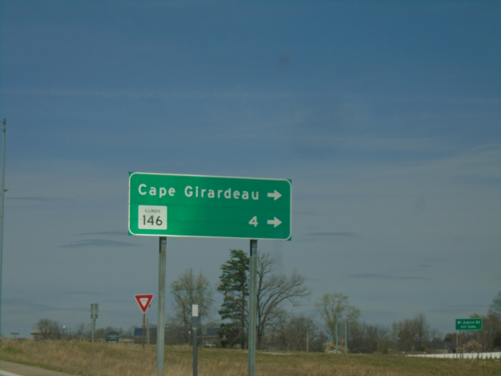
I-55 North/MO-74 East - Exit 95 Offramp
I-55 North/MO-74 East - Exit 95 Offramp. Turn right on MO-74 East for Cape Girardeau and IL-146 (Illinois State Line).
Taken 03-29-2026
 Cape Girardeau
 County
Missouri
United States
Cape Girardeau
Cape Girardeau County
Missouri
United States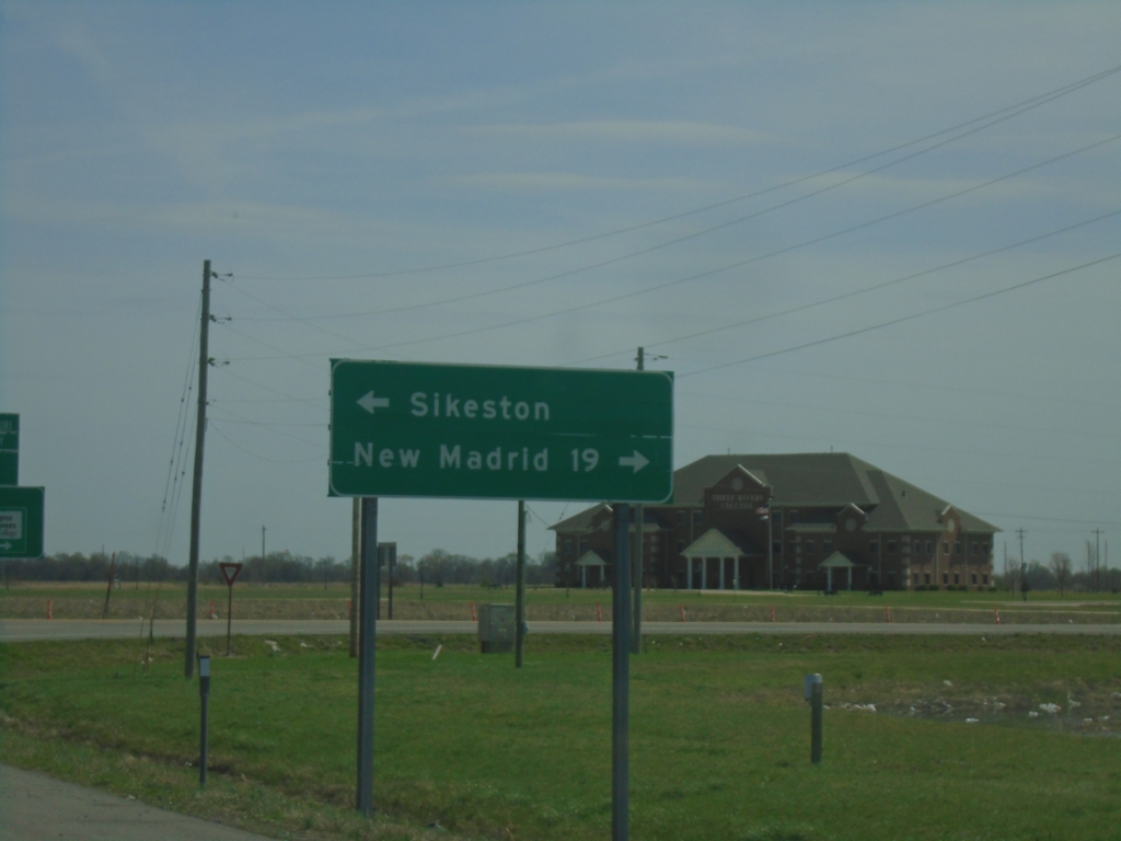
US-60 East Offramp at US-61/62
US-60 East Offramp at US-61/62 junction. Turn right for US-61 South/US-62 West to New Madrid; left for US-61 North/US-62 East to Sikeston.
Taken 03-29-2026

 Sikeston
Scott County
Missouri
United States
Sikeston
Scott County
Missouri
United States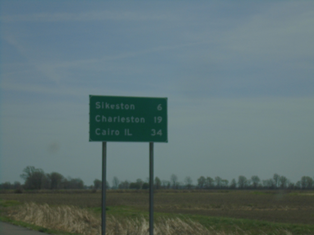
US-60 East - Distance Marker
Distance marker on US-60 East. Distance to Sikeston, Charleston, and Cairo, IL.
Taken 03-29-2026
Morehouse
New Madrid County
Missouri
United States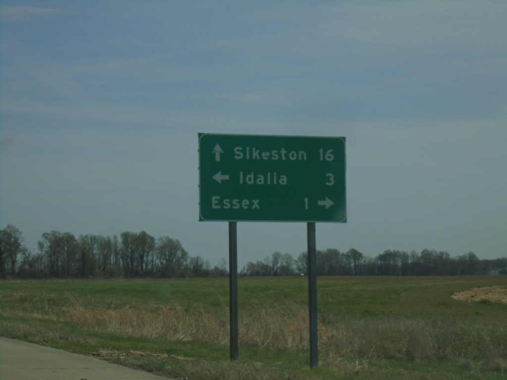
US-60 East at MO-FF
US-60 East at MO-FF Junction. Use MO-FF South to Essex; north to Idalia. Continue east on US-60 to Sikeston.
Taken 03-29-2026
 Essex
Stoddard County
Missouri
United States
Essex
Stoddard County
Missouri
United States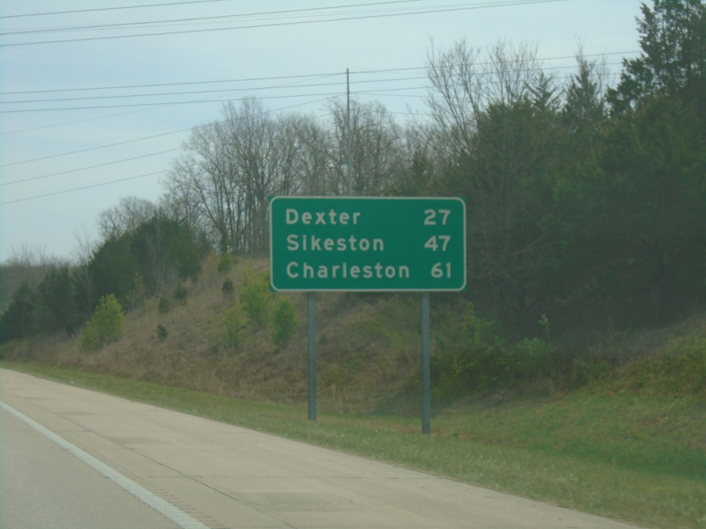
US-60 East - Distance Marker
Distance marker on US-60 east. Distance to Dexter, Sikeston, and Charleston.
Taken 03-29-2026
Poplar Bluff
Butler County
Missouri
United States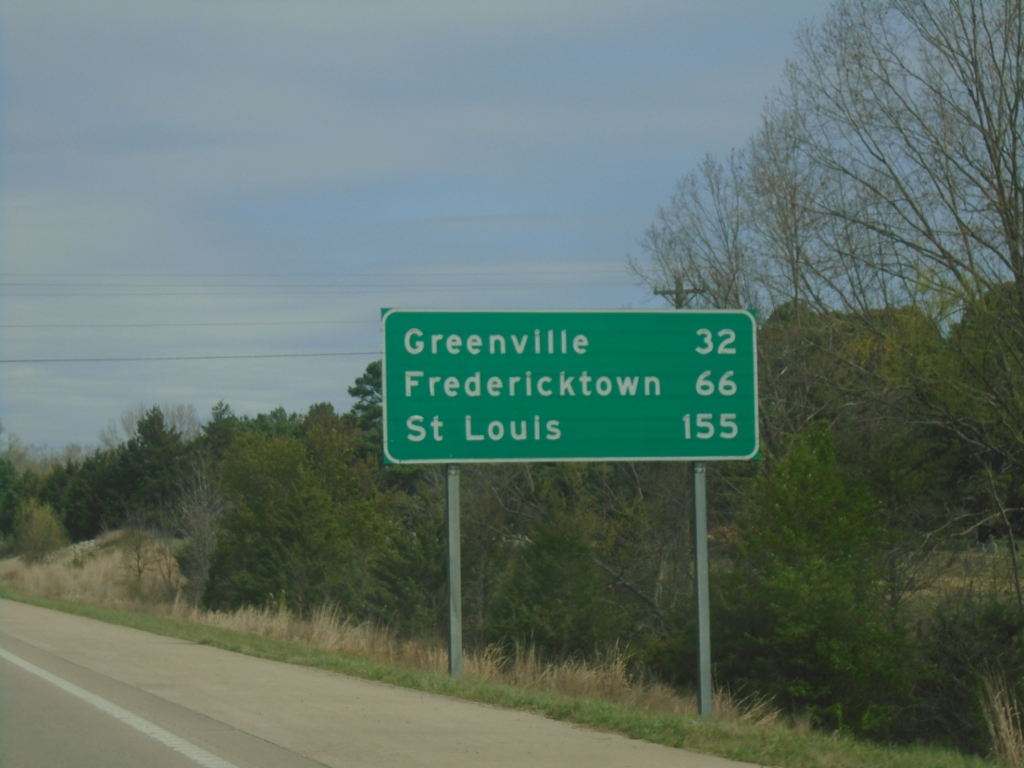
US-67 North - Distance Marker
Distance marker on US-67 North. Distance to Greenville, Fredericktown, and Saint Louis.
Taken 03-29-2026
 Poplar Bluff
Butler County
Missouri
United States
Poplar Bluff
Butler County
Missouri
United States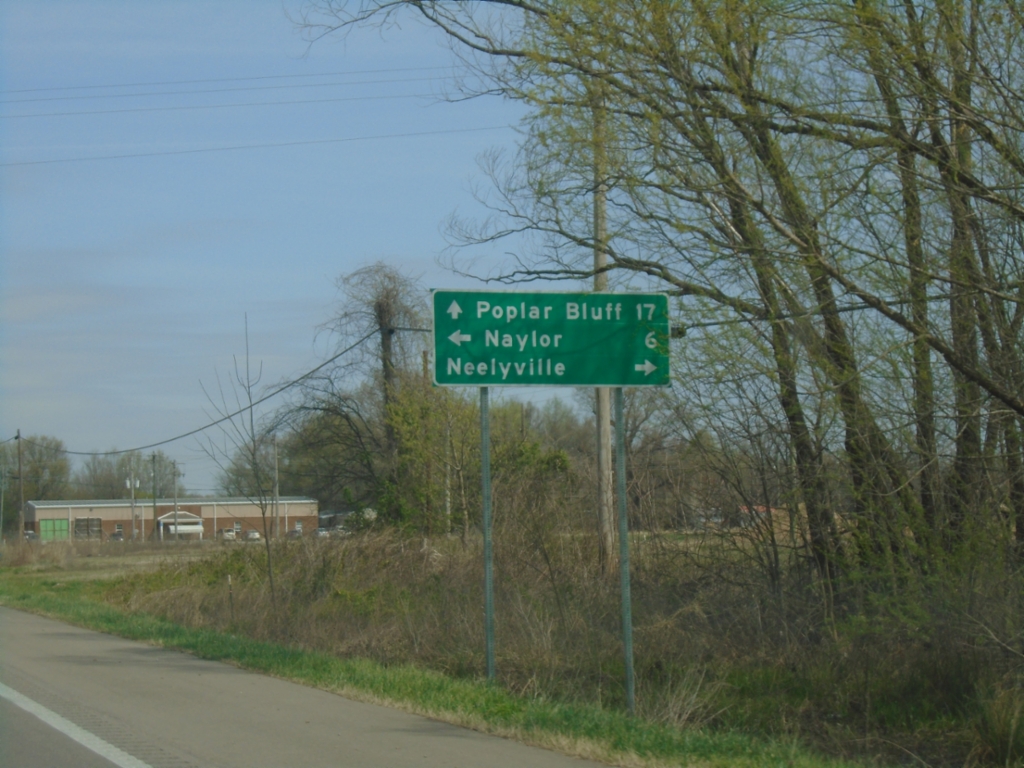
US-67 North at MO-142
US-67 North at MO-142 in Neelyville. Use MO-142 West to Naylor; MO-142 East to Neelyville. Continue north on US-67 for Poplar Bluff.
Taken 03-29-2026
 Neelyville
Butler County
Missouri
United States
Neelyville
Butler County
Missouri
United States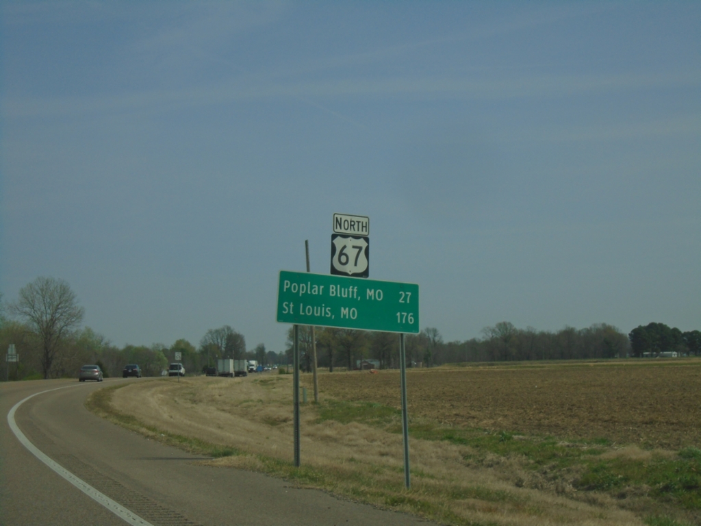
US-67 North - Distance Marker
Distance marker on US-67 north. Distance to Poplar Bluff, MO and Saint Louis, MO.
Taken 03-29-2026
Corning
Clay County
Arkansas
United States