Signs Tagged With Distance Marker
US-30 West - Distance Marker
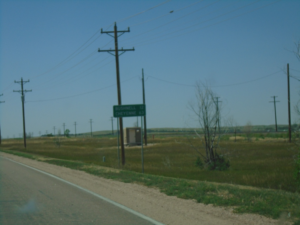
Distance marker on US-30 west. Distance to Bushnell and Cheyenne (Wyoming).
Taken 08-14-2020
 Kimball
 County
Nebraska
United States
Kimball
Kimball County
Nebraska
United States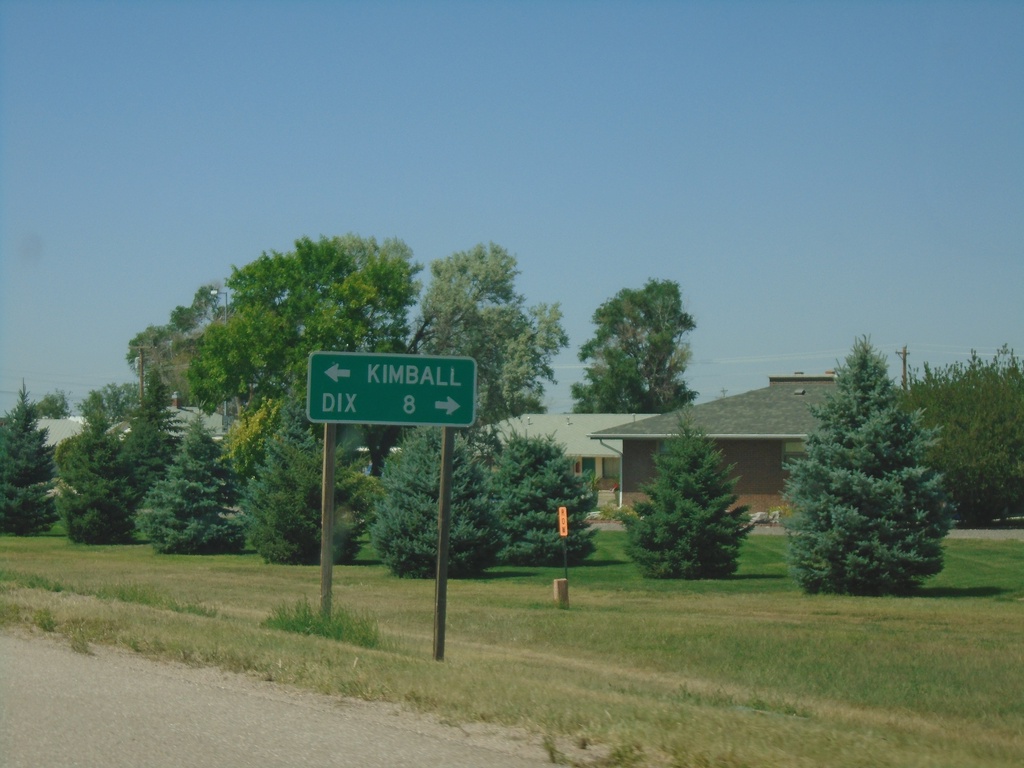
NE-53E Link North at US-30
NE-53E Link North at US-30. Turn right on US-30 for Dix; left for Kimball.
Taken 08-14-2020
 Kimball
 County
Nebraska
United States
Kimball
Kimball County
Nebraska
United States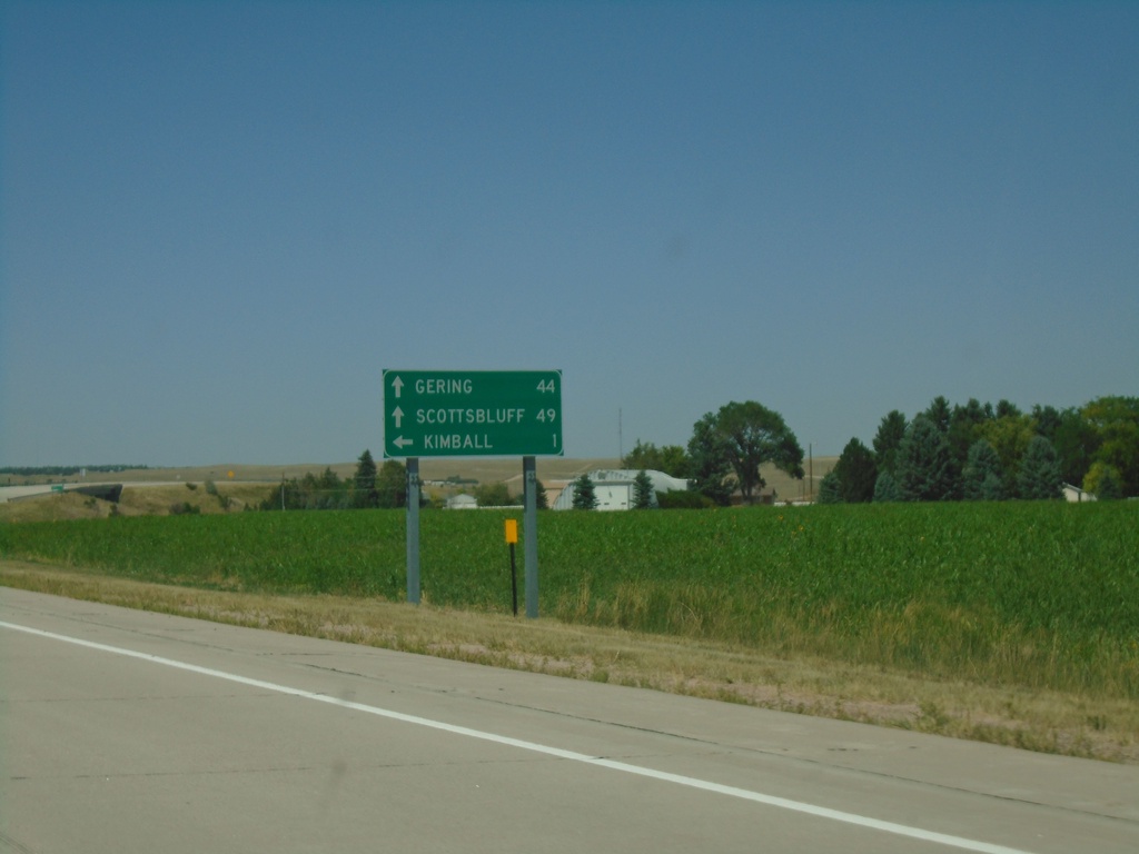
NE-71 North Approaching NE-53E Link
NE-71 North approaching NE-53E Link. Use NE-53E Link North for Kimball; continue north on NE-71 for Scottsbluff and Gering.
Taken 08-14-2020
 Kimball
 County
Nebraska
United States
Kimball
Kimball County
Nebraska
United States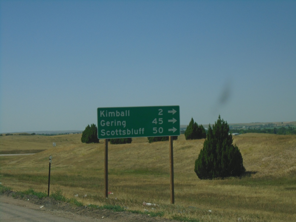
I-80 West - Exit 22 Offramp at NE-71
I-80 West - Exit 22 offramp at NE-71. Turn right on NE-71 for Kimball, Gering, and Scottsbluff.
Taken 08-14-2020
 Kimball
 County
Nebraska
United States
Kimball
Kimball County
Nebraska
United States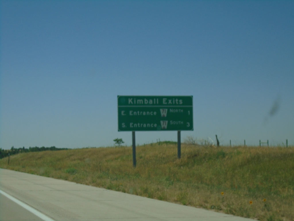
I-80 West - Kimball Exits
Kimball Exits on I-80 West. E Entrance - NE-71 North and W Entrance - NE-71 South.
Taken 08-14-2020
Kimball
Kimball County
Nebraska
United States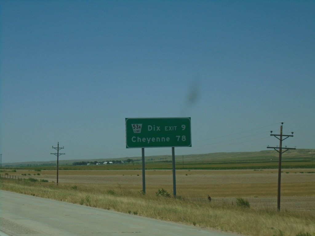
I-80 West - Distance Marker
Distance marker on I-80 west. Distance to NE-53A Link - Dix Exit and Cheyenne (Wyoming).
Taken 08-14-2020
 Potter
Cheyenne County
Nebraska
United States
Potter
Cheyenne County
Nebraska
United States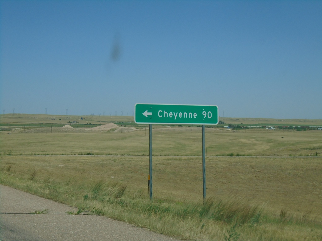
NE-17C Link North at I-80 West
NE-17C Link North at I-80 West to Cheyenne (Wyoming).
Taken 08-14-2020
 Sidney
Cheyenne County
Nebraska
United States
Sidney
Cheyenne County
Nebraska
United States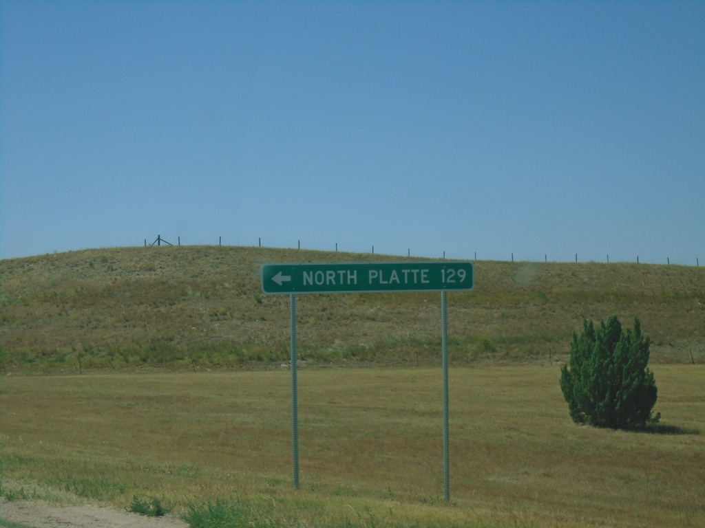
End NE-17C Link South at I-80
End NE-17C Link South at I-80 East to North Platte.
Taken 08-14-2020
Sidney
Cheyenne County
Nebraska
United States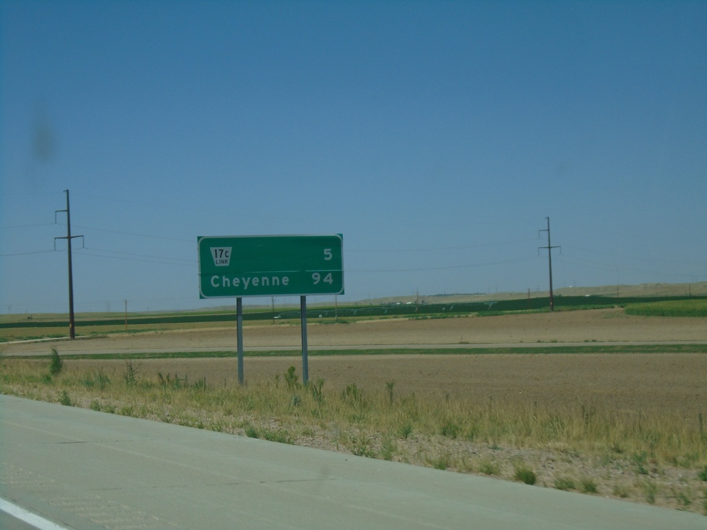
I-80 West - Distance Marker
Distance marker on I-80 west. Distance to NE-17C Link and Cheyenne (Wyoming).
Taken 08-14-2020
Sidney
Cheyenne County
Nebraska
United States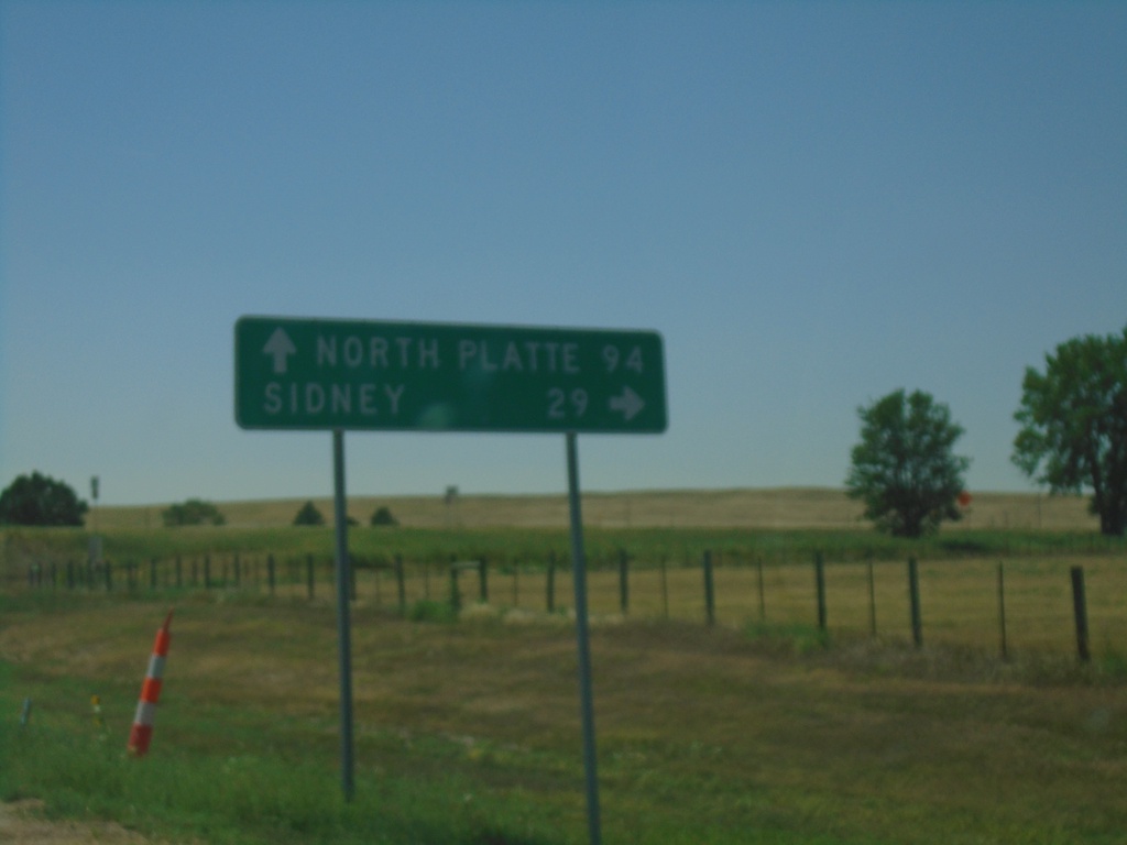
NE-25A Link South at I-80
NE-25A Link South at I-80 (Exit 85). Turn right for I-80 west to Sidney; continue under freeway for I-80 east to North Platte.
Taken 08-14-2020
 Chappell
Deuel County
Nebraska
United States
Chappell
Deuel County
Nebraska
United States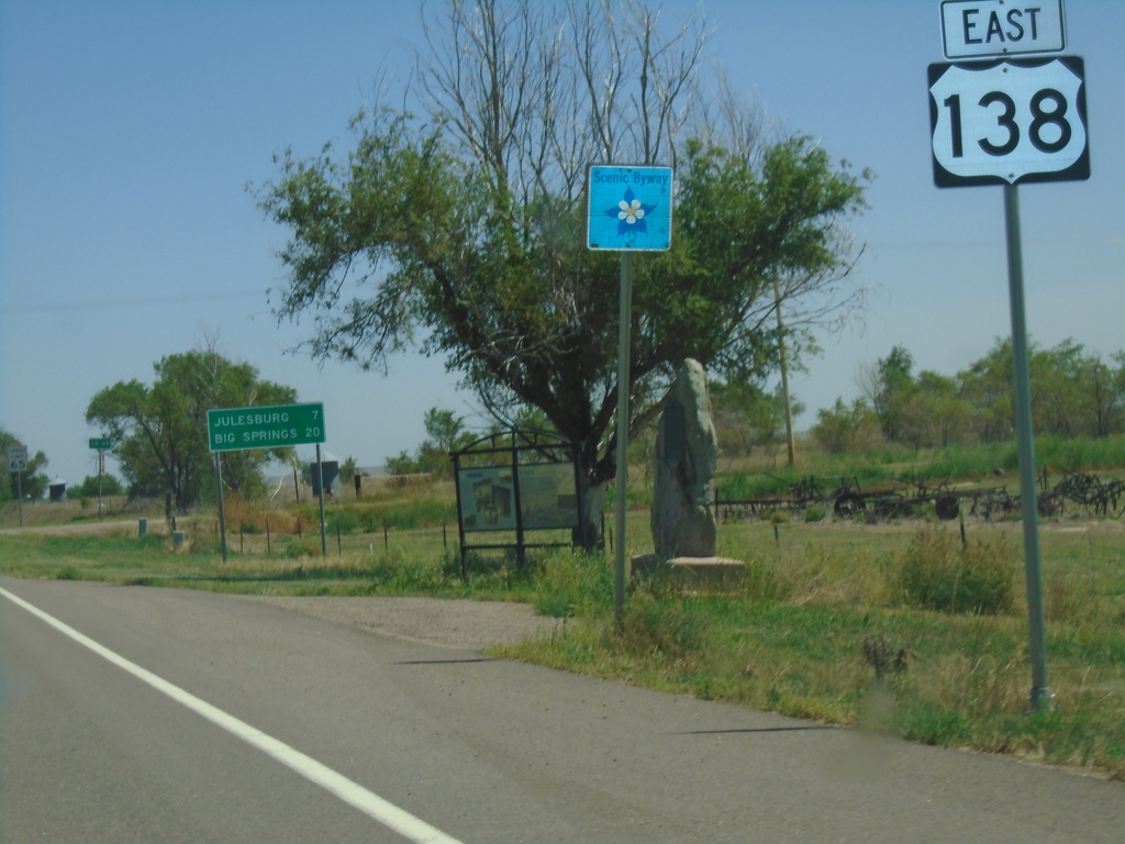
US-138 East - Distance Marker and Scenic Byway
Distance marker on US-138 east. Distance to Julesburg and Big Springs (NE). US-138 is part of the South Platte River Trail Scenic Byway.
Taken 08-14-2020
 Ovid
Sedgwick County
Colorado
United States
Ovid
Sedgwick County
Colorado
United States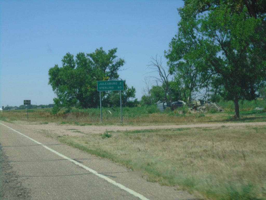
US-138 West - Distance Marker
Distance marker on US-138 west. Distance to Julesburg and Sterling.
Taken 08-14-2020
Julesburg
Sedgwick County
Colorado
United States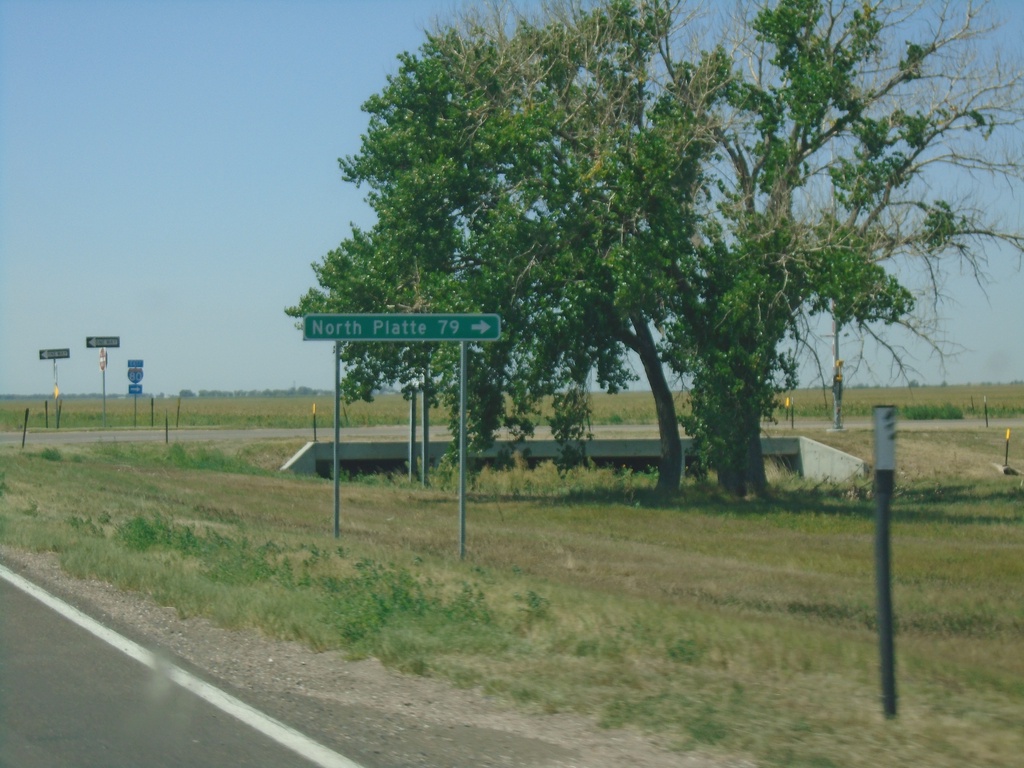
US-138 West at I-80 East (Exit 101)
US-138 West at I-80 East (Exit 101) to North Platte.
Taken 08-14-2020
Big Springs
Deuel County
Nebraska
United States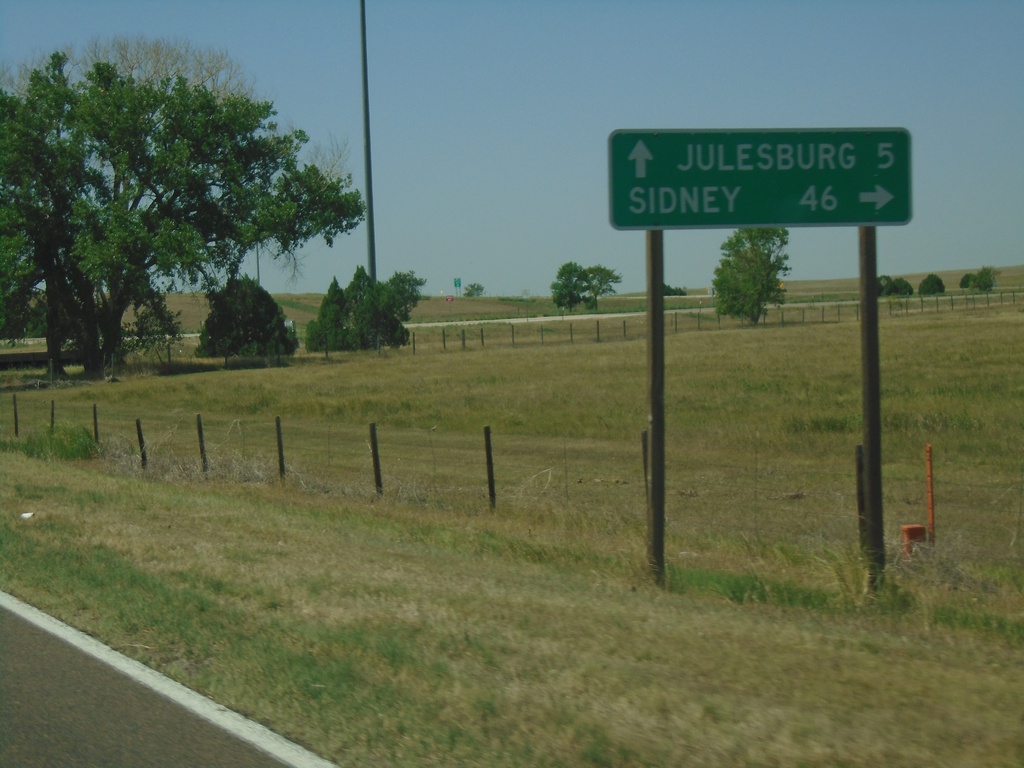
US-138 West at I-80 West (Exit 101)
US-138 West at I-80 West (Exit 101) to Sidney. Continue west on US-138 for Julesburg (CO).
Taken 08-14-2020
Big Springs
Deuel County
Nebraska
United States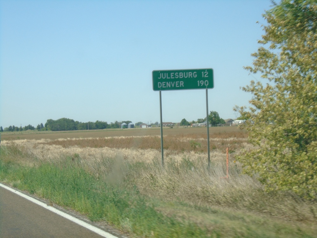
US-138 West - Distance Marker
Distance marker on US-138 west. Distance to Julesburg and Denver (both in Colorado).
Taken 08-14-2020
Big Springs
Deuel County
Nebraska
United States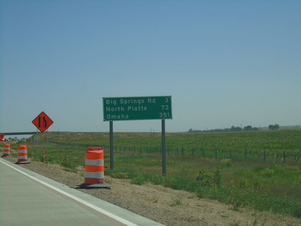
I-80 East - Distance Marker
Distance marker on I-80 east. Distance to Big Springs Road, North Platte, and Omaha.
Taken 08-14-2020
Big Springs
Deuel County
Nebraska
United States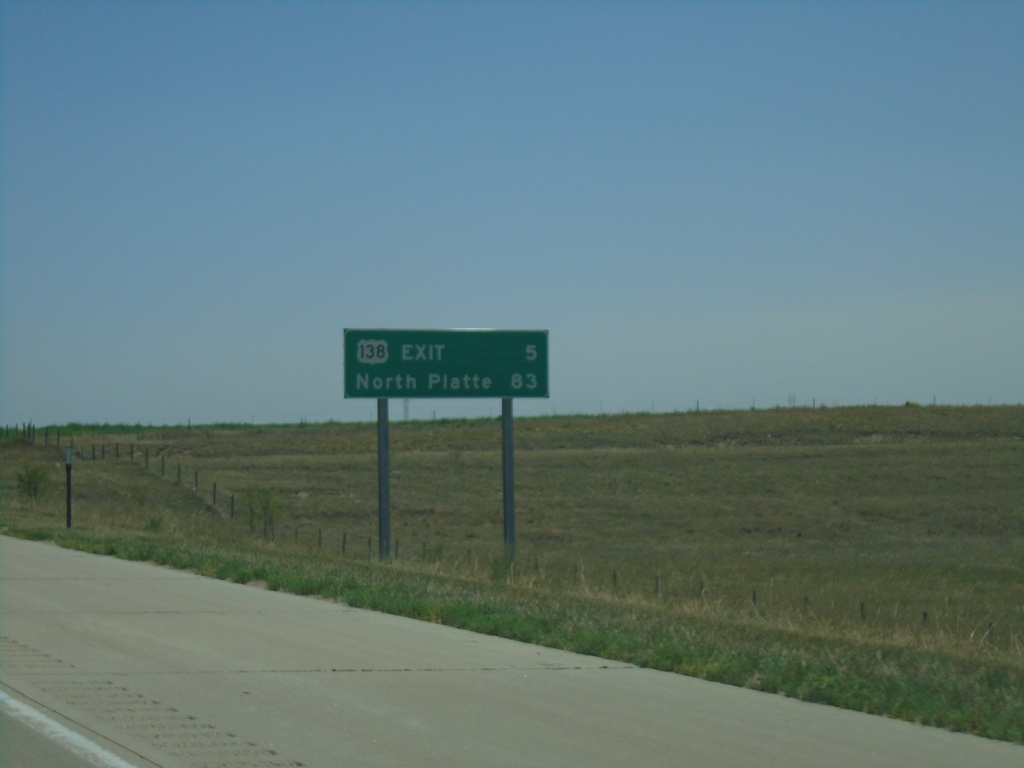
I-80 East - Distance Marker
Distance marker on I-80 east. Distance to US-138 Exit and North Platte.
Taken 08-14-2020
Julesburg
Deuel County
Nebraska
United States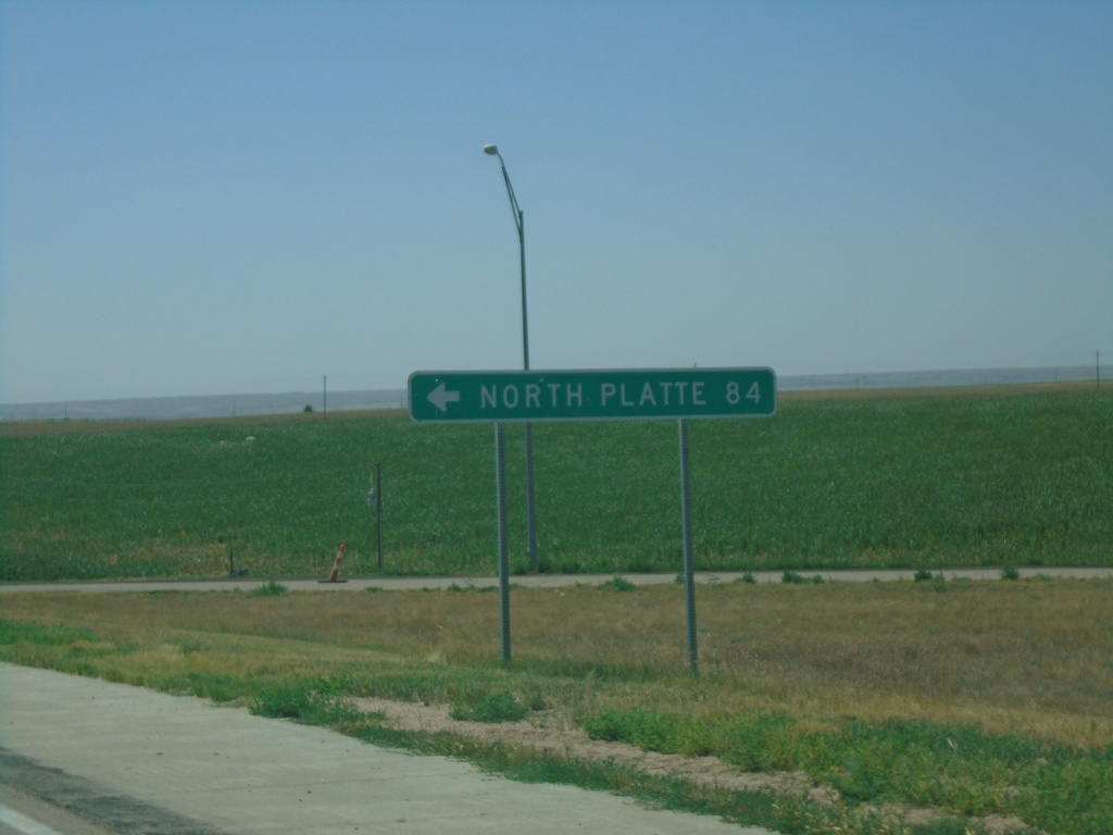
End NE-27 South at I-80
End NE-27 South at I-80 (Exit 95). Use I-80 east to North Platte.
Taken 08-14-2020
 Chappell
Deuel County
Nebraska
United States
Chappell
Deuel County
Nebraska
United States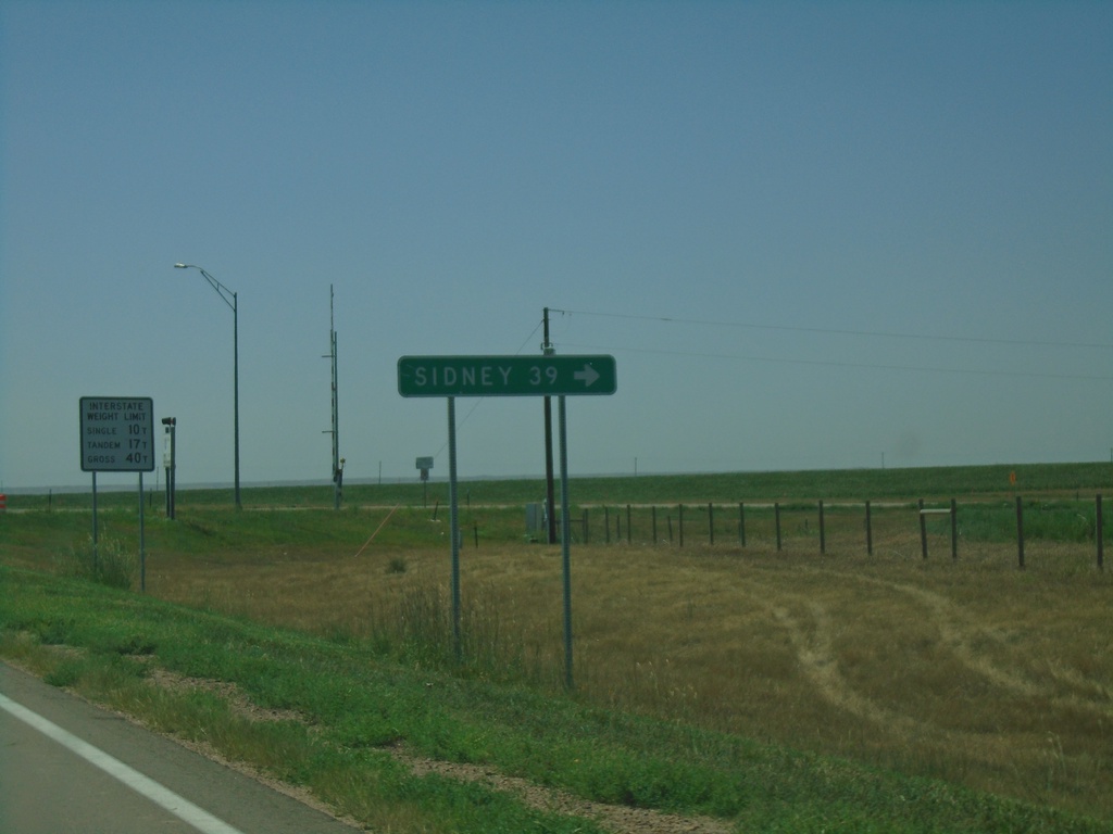
End NE-27 South at I-80 West
End NE-27 South at I-80. Use I-80 West to Sidney.
Taken 08-14-2020
Chappell
Deuel County
Nebraska
United States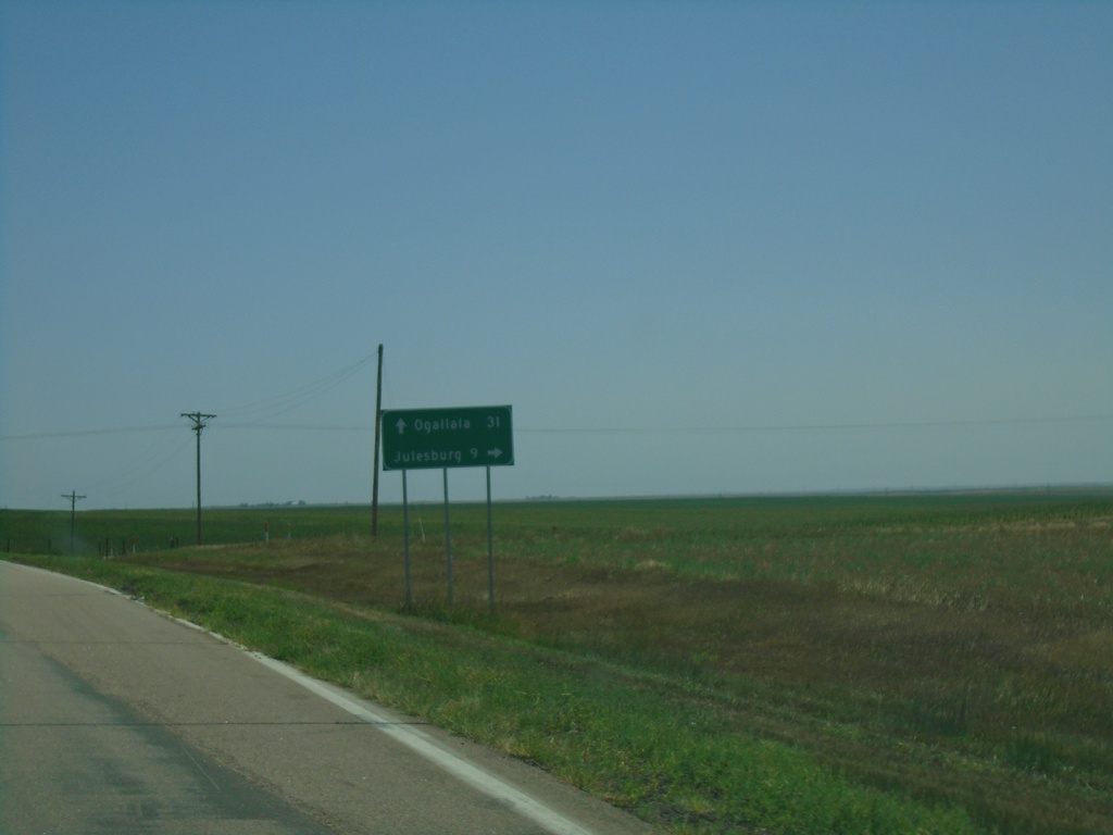
US-30 East/NE-27 South at US-30/NE-27 Split
US-30 East/NE-27 South at US-30/NE-27 split in Deuel County. Turn right for NE-27 south to Julesburg (Colorado). Continue east on US-30 for Ogallala.
Taken 08-14-2020
Chappell
Deuel County
Nebraska
United States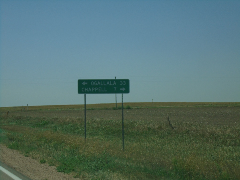
NE-27 South at US-30
NE-27 South at US-30 in Deuel County. Turn right for US-30 west to Chappell; left for US-30 east/NE-92 south to Ogallala.
Taken 08-14-2020
Chappell
Deuel County
Nebraska
United States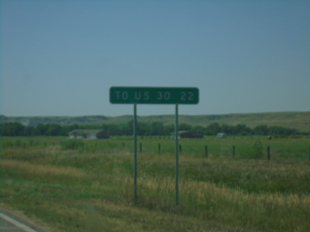
NE-27 South - Distance Marker
Distance marker on NE-27 south. Distance to US-30 Junction.
Taken 08-14-2020
Oshkosh
Garden County
Nebraska
United States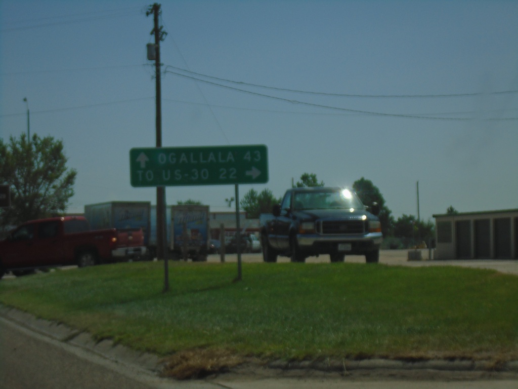
US-26 East/NE-92 East At NE-27
US-26 East/NE-92 East at NE-27 South in Oshkosh. Turn right for NE-27 to US-30 Jct; continue straight on US-26 East/NE-92 East for Ogallala.
Taken 08-14-2020

 Oshkosh
Garden County
Nebraska
United States
Oshkosh
Garden County
Nebraska
United States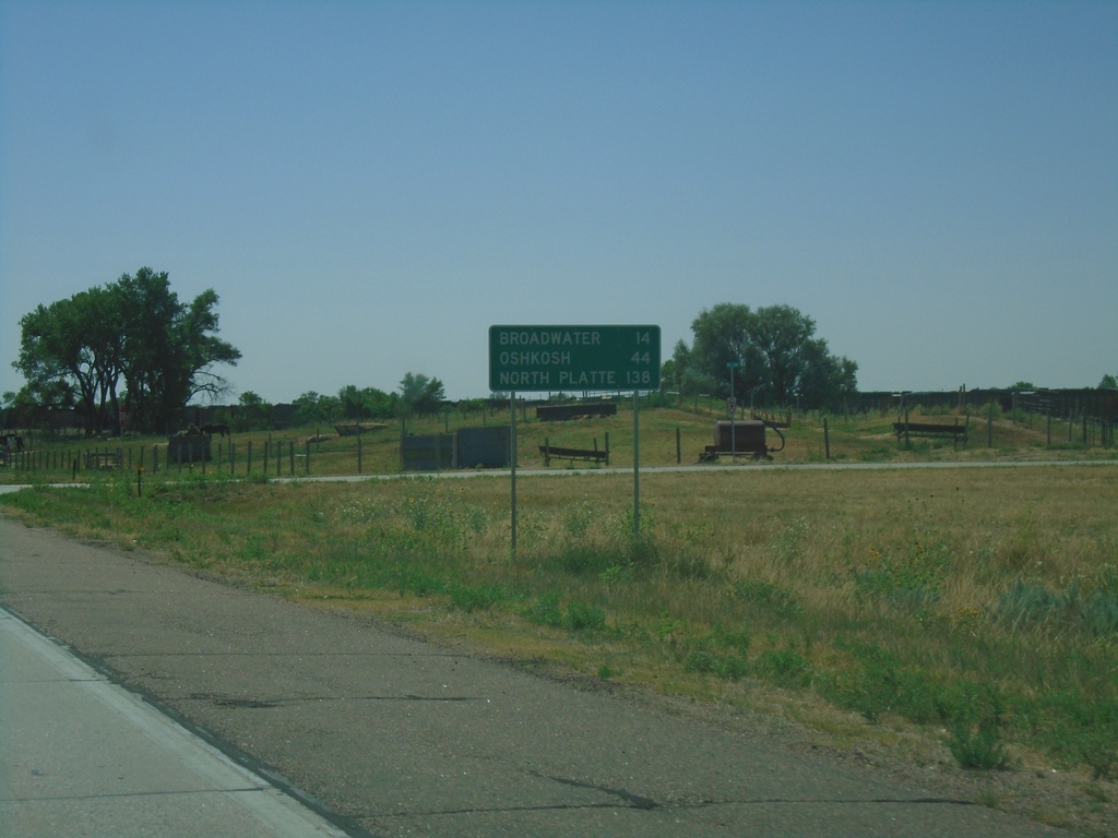
US-26 East - Distance Marker
Distance marker on US-26 east. Distance to Broadwater, Oshkosh, and North Platte (via I-80).
Taken 08-14-2020
Bridgeport
Morrill County
Nebraska
United States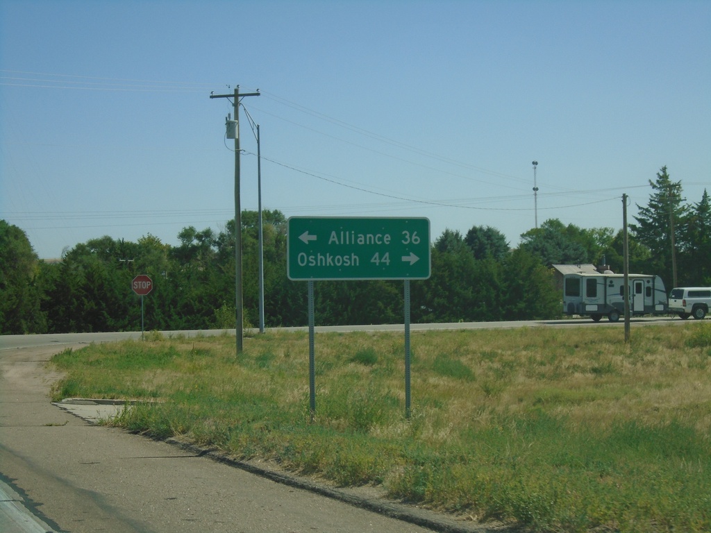
US-26 East/US-385 North Approaching US-26/US-385 Split
US-26 East/US-385 North approaching US-26/US-385 split. Turn left for US-385 North to Alliance; left for US-26 East to Oshkosh.
Taken 08-14-2020
 Bridgeport
Morrill County
Nebraska
United States
Bridgeport
Morrill County
Nebraska
United States