Signs Tagged With Distance Marker
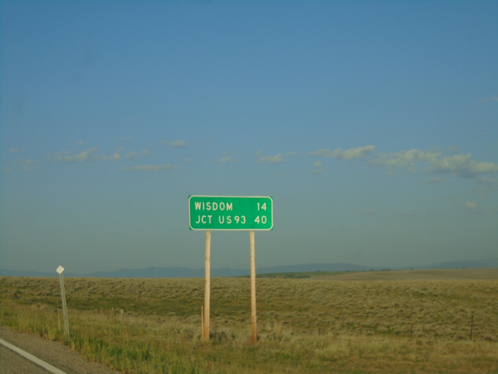
MT-43 West - Distance Marker
Distance marker on MT-43 west. Distance to Wisdom and Jct. US-93.
Taken 07-03-2021
 Wise River
Beaverhead County
Montana
United States
Wise River
Beaverhead County
Montana
United States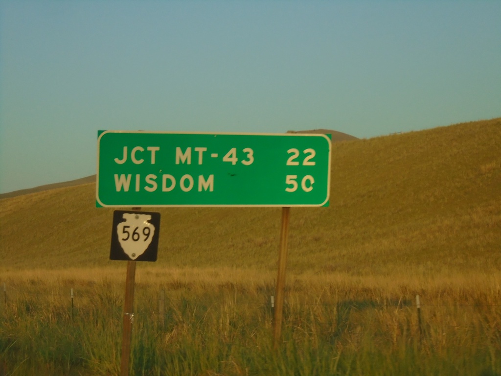
MTS-569 South - Distance Marker
Distance marker on MTS-569 south. Distance to Jct. MT-43 and Wisdom.
Taken 07-03-2021
 Anaconda
Deer Lodge County
Montana
United States
Anaconda
Deer Lodge County
Montana
United States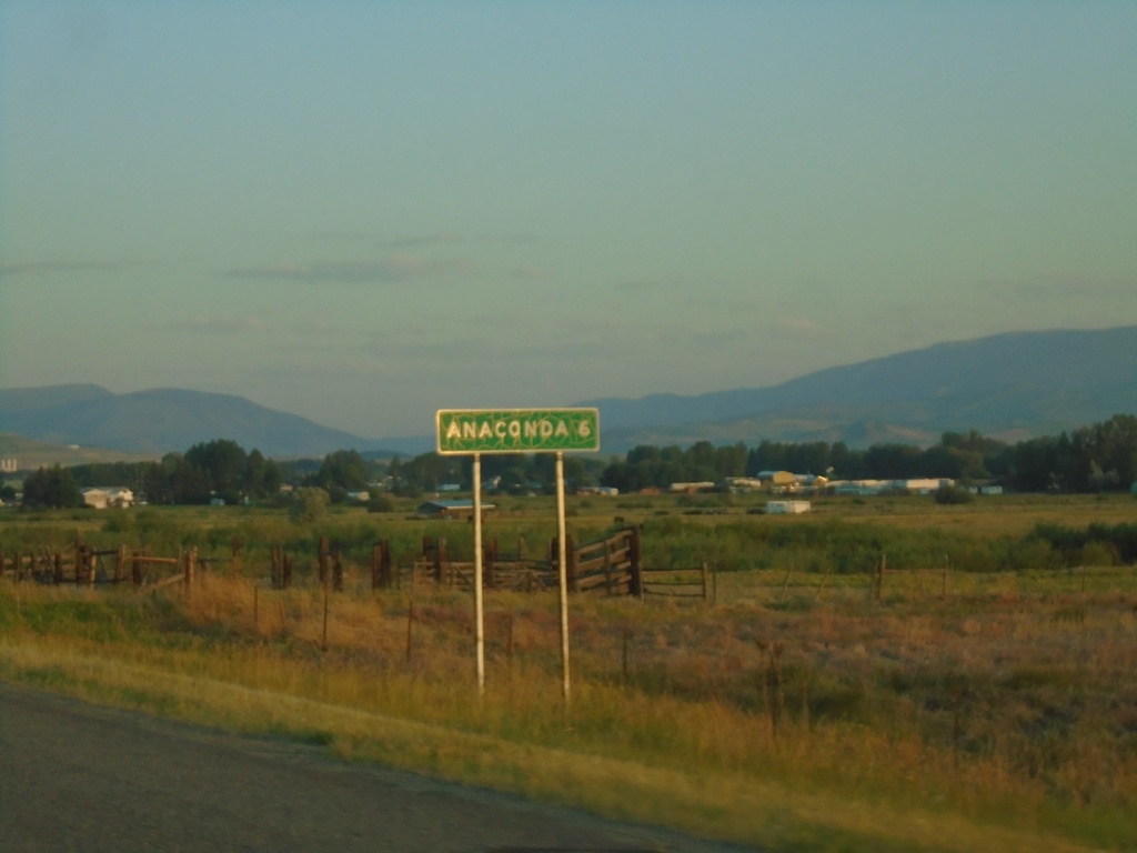
MT-1 West - Distance Marker
Distance marker on MT-1 west. Distance to Anaconda.
Taken 07-03-2021
 Anaconda
Deer Lodge County
Montana
United States
Anaconda
Deer Lodge County
Montana
United States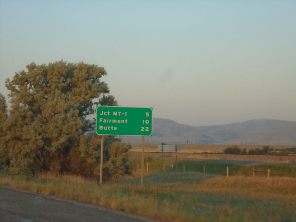
I-90 East - Distance Marker
Distance marker on I-90 East. Distance to Jct. MT-1, Fairmont, and Butte.
Taken 07-03-2021
 Anaconda
Deer Lodge County
Montana
United States
Anaconda
Deer Lodge County
Montana
United States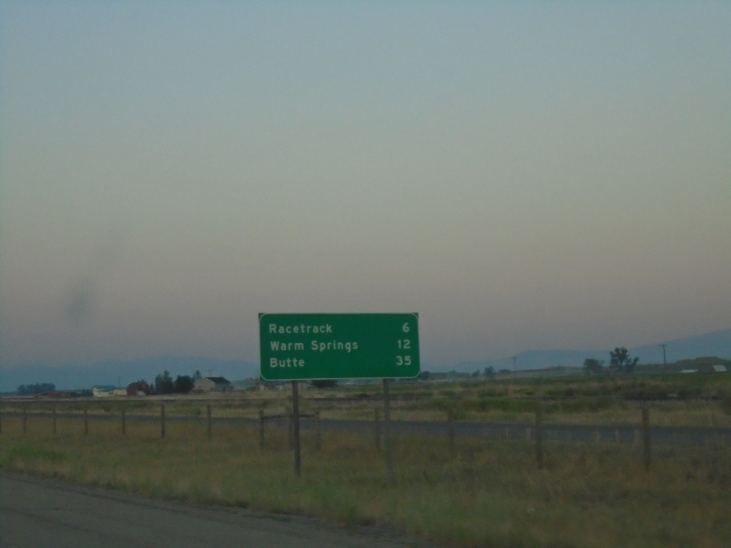
I-90 East - Distance Marker
Distance marker on I-90 east. Distance to Racetrack, Warm Springs, and Butte.
Taken 07-03-2021
Deer Lodge
Powell County
Montana
United States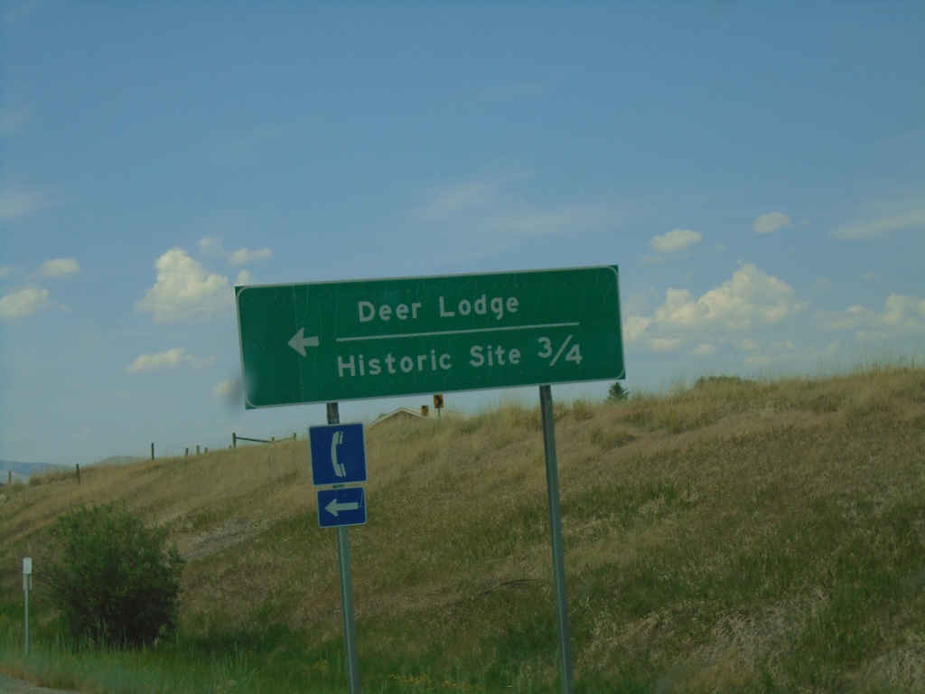
I-90 West - Exit 184 Offramp
I-90 West Exit 184 offramp at BL-90. Turn left on BL-90 for Historic Site and Deer Lodge.
Taken 07-02-2021
 Deer Lodge
Powell County
Montana
United States
Deer Lodge
Powell County
Montana
United States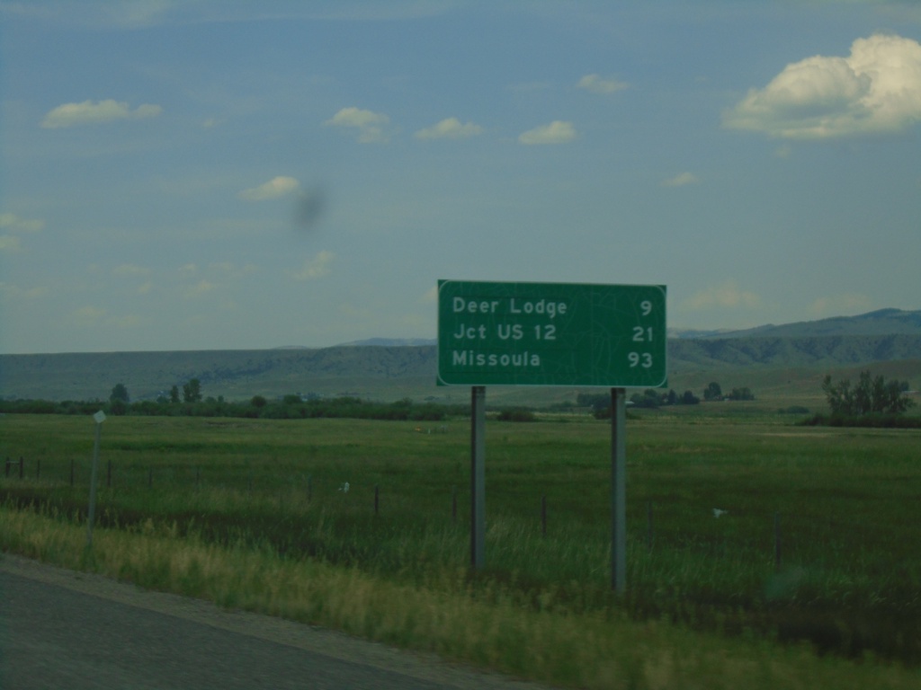
I-90 West - Distance Marker
Distance marker on I-90 west. Distance to Deer Lodge, Jct. US-12, and Missoula.
Taken 07-02-2021
Deer Lodge
Deer Lodge County
Montana
United States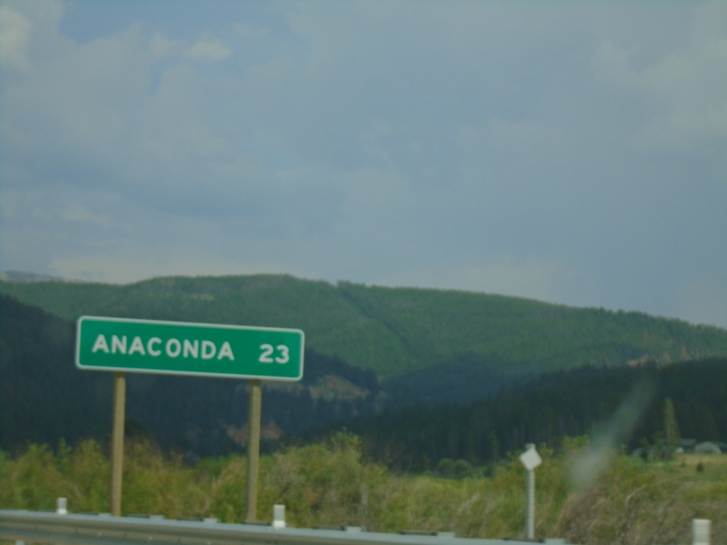
MT-1 East - Distance Marker
Distance marker on MT-1 east. Distance to Anaconda.
Taken 07-02-2021
Philipsburg
Granite County
Montana
United States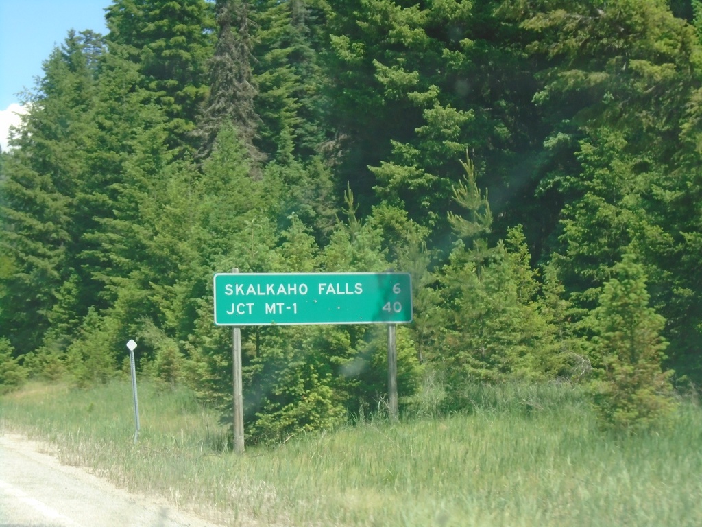
MT-38 East - Distance Marker
Distance marker on MT-38 east. Distance to Skalkaho Falls and Jct. MT-1.
Taken 07-02-2021
 Hamilton
Ravalli County
Montana
United States
Hamilton
Ravalli County
Montana
United States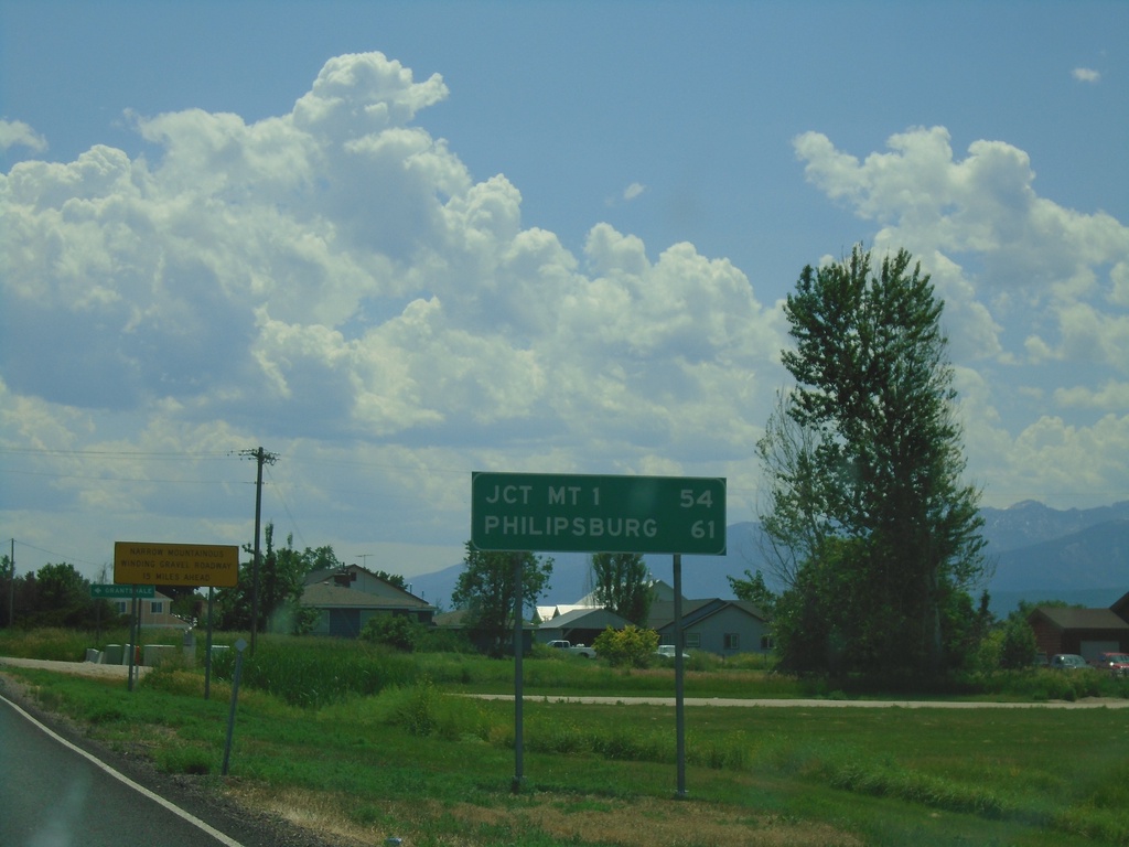
MT-38 East - Distance Marker
Distance marker on MT-38 east. Distance to MT-1 and Phillipsburg.
Taken 07-02-2021
Hamilton
Ravalli County
Montana
United States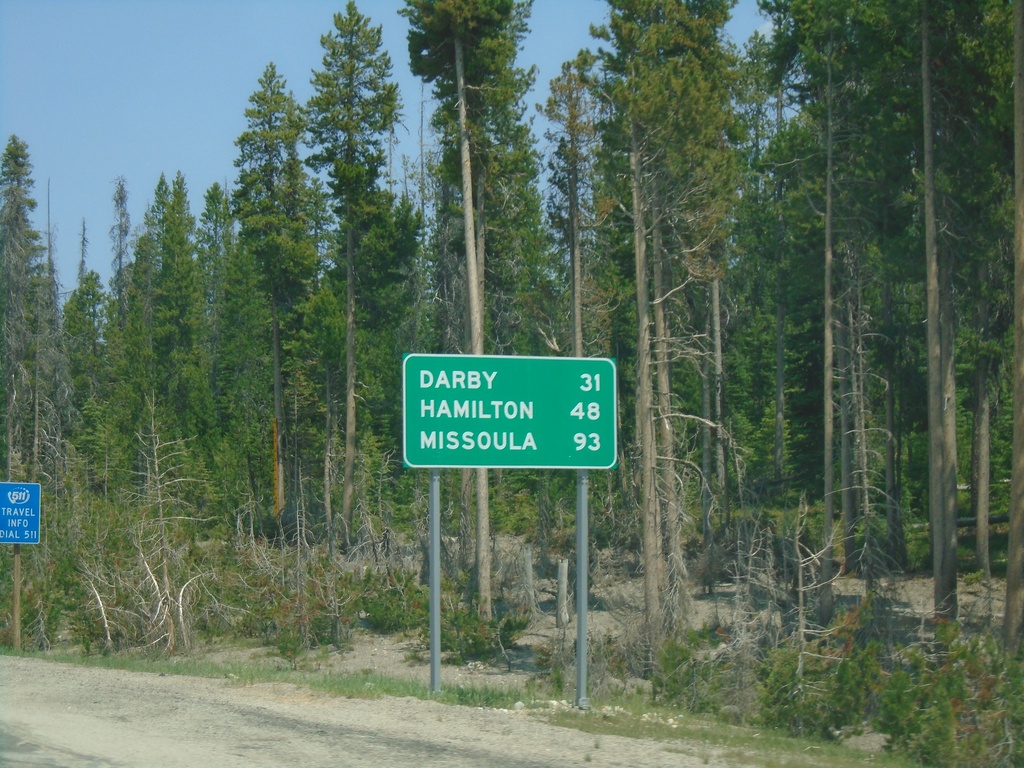
US-93 North - Distance Marker
Distance marker on US-93 north. Distance to Darby, Hamilton, and Missoula.
Taken 07-02-2021
 Sula
Ravalli County
Montana
United States
Sula
Ravalli County
Montana
United States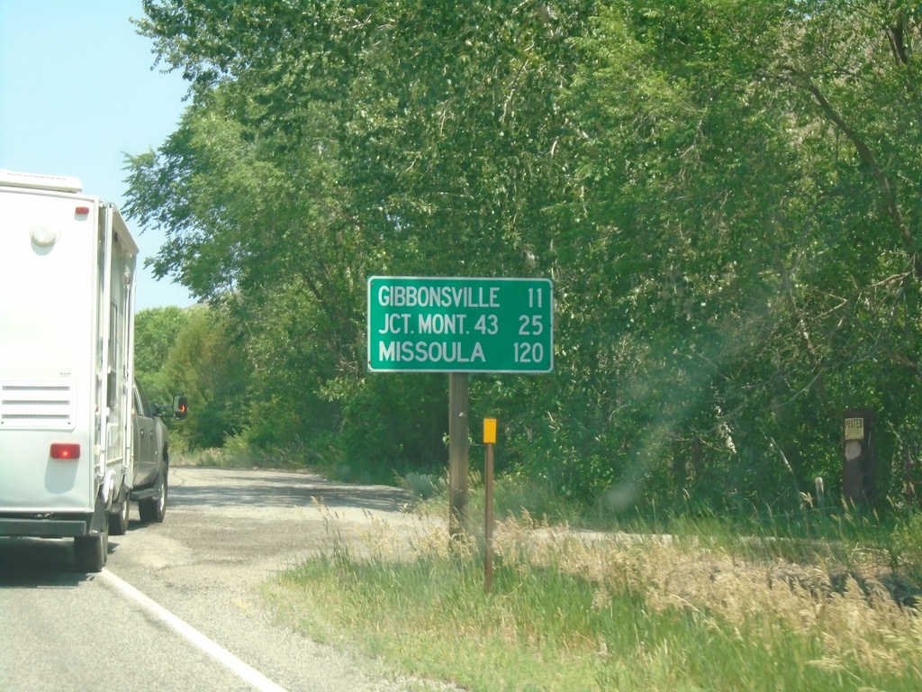
US-93 North - Distance Marker
Distance marker on US-93 north. Distance to Gibbonsville, Jct. Mont. 43 (at Lost Trail Pass), and Missoula (Montana).
Taken 07-02-2021
North Fork
Lemhi County
Idaho
United States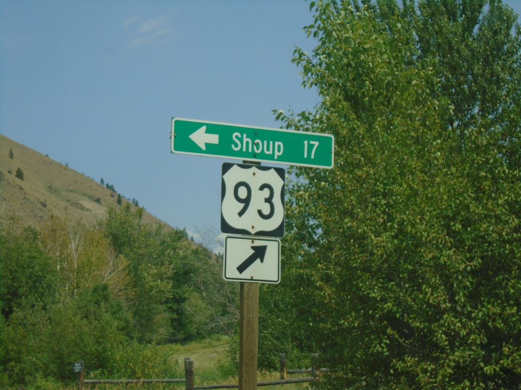
US-93 North - Shoup Jct.
US-93 north at Salmon River Road Jct. to Shoup. The Salmon River heads west here.
Taken 07-02-2021
North Fork
Lemhi County
Idaho
United States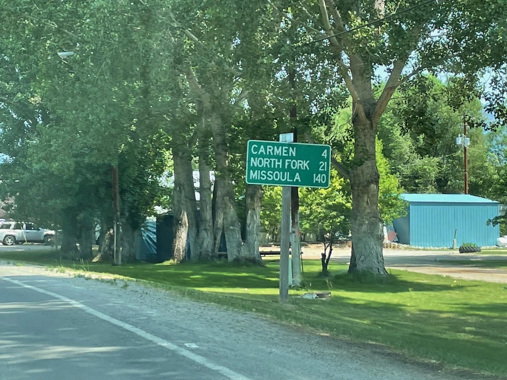
US-93 North - Distance Marker
Distance marker on US-93 north. Distance to Carmen, North Fork, and Missoula (Montana).
Taken 07-02-2021
Salmon
Lemhi County
Idaho
United States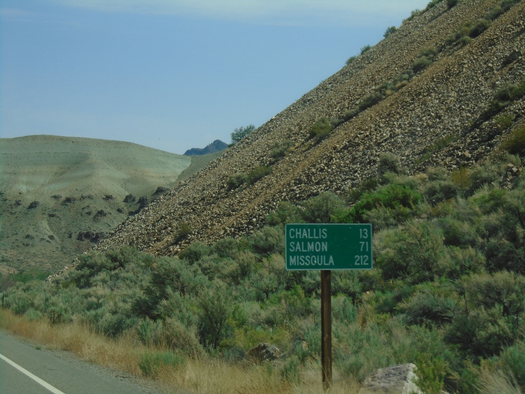
ID-75 North - Distance Marker
Distance marker on ID-75 north. Distance to Challis, Salmon, and Missoula (Montana).
Taken 07-02-2021
 Challis
Custer County
Idaho
United States
Challis
Custer County
Idaho
United States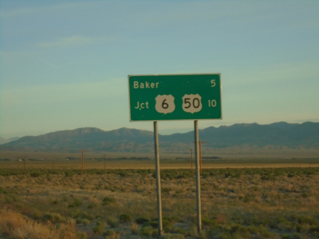
NV-487 North - Distance Marker
Distance marker on NV-487 North. Distance to Baker and US-50/US-6 Junction.
Taken 05-29-2021


 Baker
White Pine County
Nevada
United States
Baker
White Pine County
Nevada
United States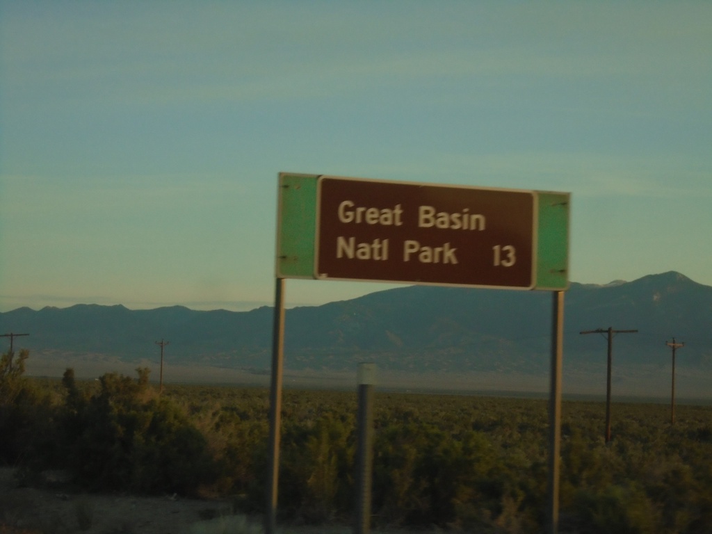
UT-21 East - Distance Marker
Distance marker on UT-21 east. Distance to Great Basin National Park.
Taken 05-29-2021
 Garrison
Millard County
Utah
United States
Garrison
Millard County
Utah
United States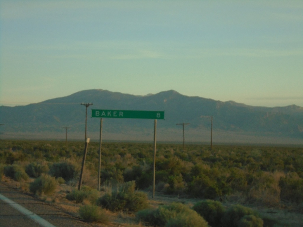
UT-21 East - Distance Marker
Distance marker on UT-21 east. Distance to Baker (Nevada).
Taken 05-29-2021
Garrison
Millard County
Utah
United States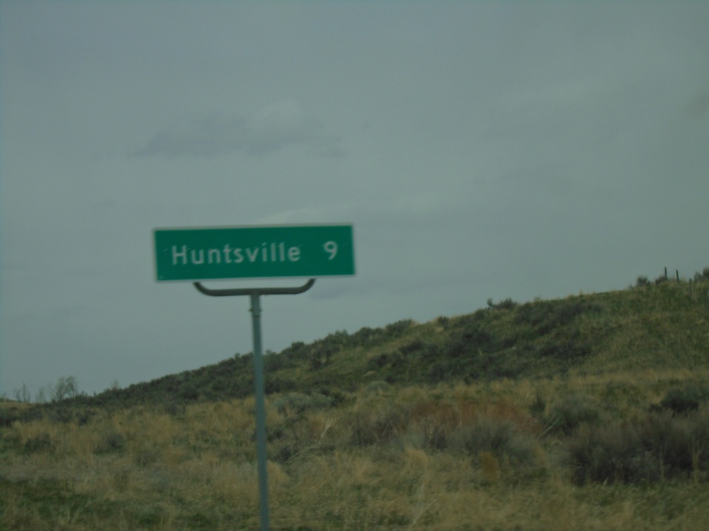
UT-167 North - Distance Marker
Distance marker on UT-167 north. Distance to Huntsville.
Taken 04-24-2021
 Morgan
 County
Utah
United States
Morgan
Morgan County
Utah
United States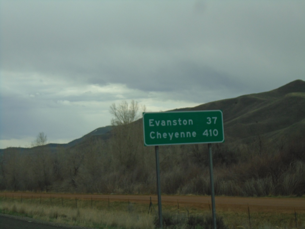
I-84 East - Distance Marker
Last distance marker on I-84 eastbound. Distance to Evanston (Wyoming) and Cheyenne (Wyoming). Both destinations via I-80 eastbound.
Taken 04-24-2021
 Henefer
Summit County
Utah
United States
Henefer
Summit County
Utah
United States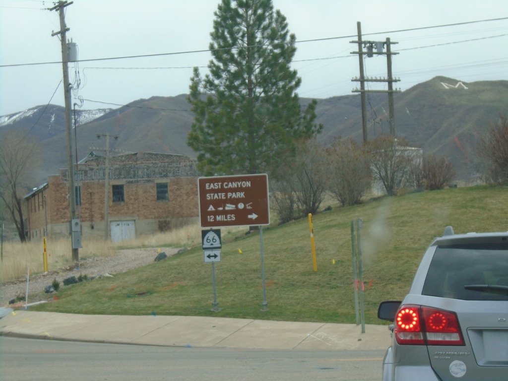
I-84 East - Exit 103 Offramp at UT-66
I-84 East - Exit 103 offramp at UT-66 in Morgan. Turn right on UT-66 for East Canyon State Park.
Taken 04-24-2021
 Morgan
 County
Utah
United States
Morgan
Morgan County
Utah
United States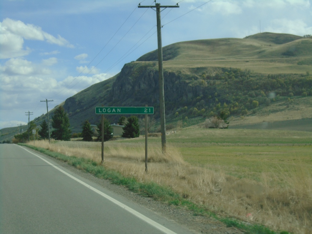
UT-23 South - Distance Marker
Distance marker on UT-23 south. Distance to Logan.
Taken 04-23-2021
 Trenton
Cache County
Utah
United States
Trenton
Cache County
Utah
United States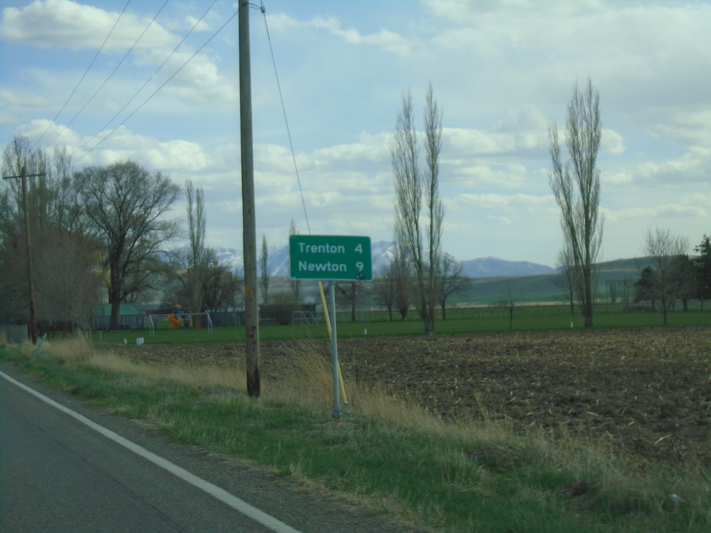
UT-23 South - Distance Marker
Distance marker on UT-23 south. Distance to Trenton and Newton.
Taken 04-23-2021
Cornish
Cache County
Utah
United States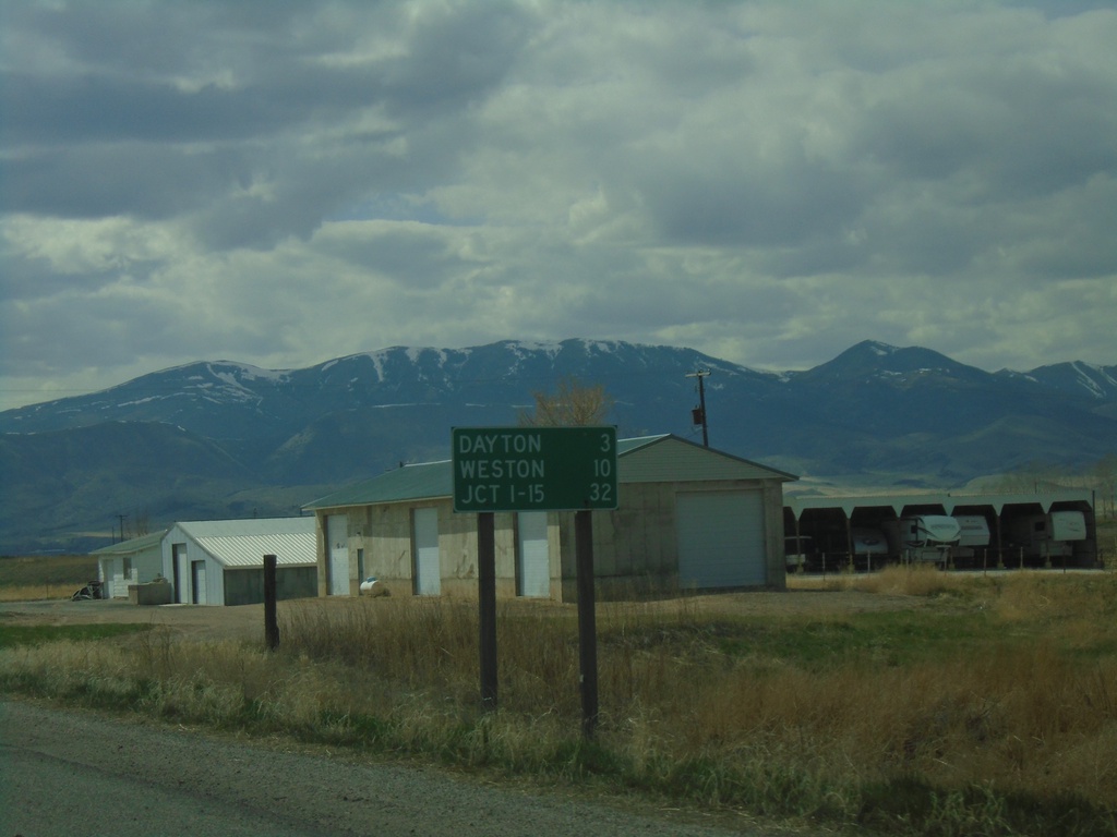
ID-36 West - Distance Marker
Distance marker on ID-36 west. Distance to Dayton, Weston, and Jct. I-15.
Taken 04-23-2021
 Preston
Franklin County
Idaho
United States
Preston
Franklin County
Idaho
United States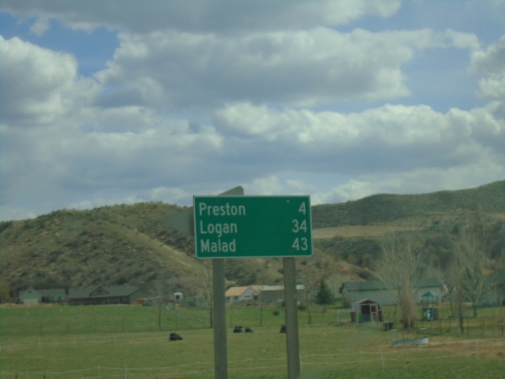
ID-34 South/ID-36 East - Distance Marker
Distance marker on ID-34 South/ID-36 East. Distance to Preston, Logan (Utah - via US-91), and Malad (via ID-36).
Taken 04-23-2021
 Preston
Franklin County
Idaho
United States
Preston
Franklin County
Idaho
United States