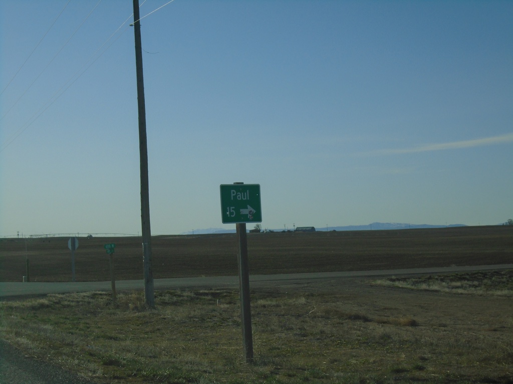
Signs Tagged With Distance Marker
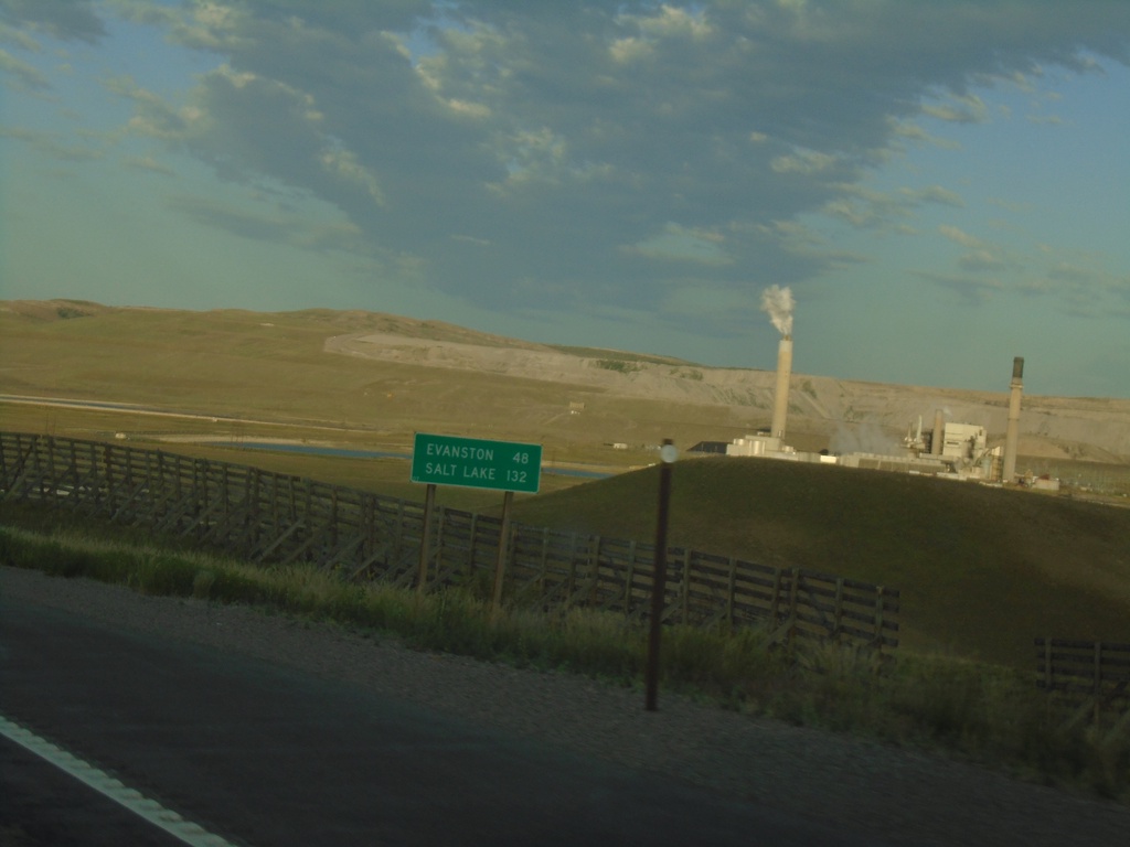
US-189 South - Distance Marker
Distance marker on US-189 south. Distance to Evanston and Salt Lake (Utah). Both destinations are via I-80 west.
Taken 07-18-2020
 Kemmerer
Lincoln County
Wyoming
United States
Kemmerer
Lincoln County
Wyoming
United States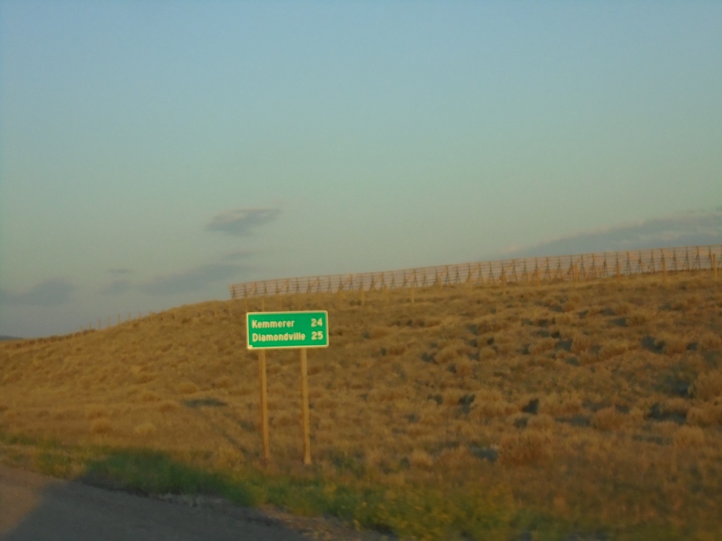
US-189 South - Distance Marker
Distance marker on US-189 south. Distance to Kemmerer and Diamondville.
Taken 07-18-2020
Kemmerer
Lincoln County
Wyoming
United States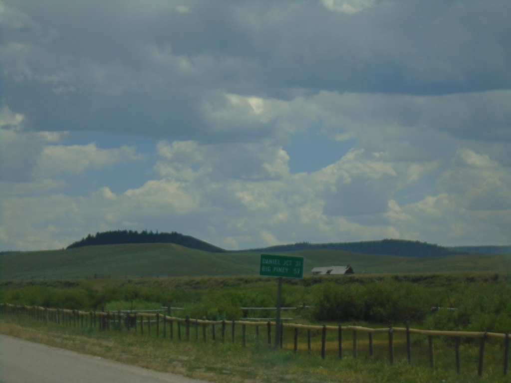
US-189/US-191 South - Distance Marker
Distance marker on US-189/US-191 South. Distance to Daniel Junction and Big Piney.
Taken 07-17-2020
 Bondurant
Sublette County
Wyoming
United States
Bondurant
Sublette County
Wyoming
United States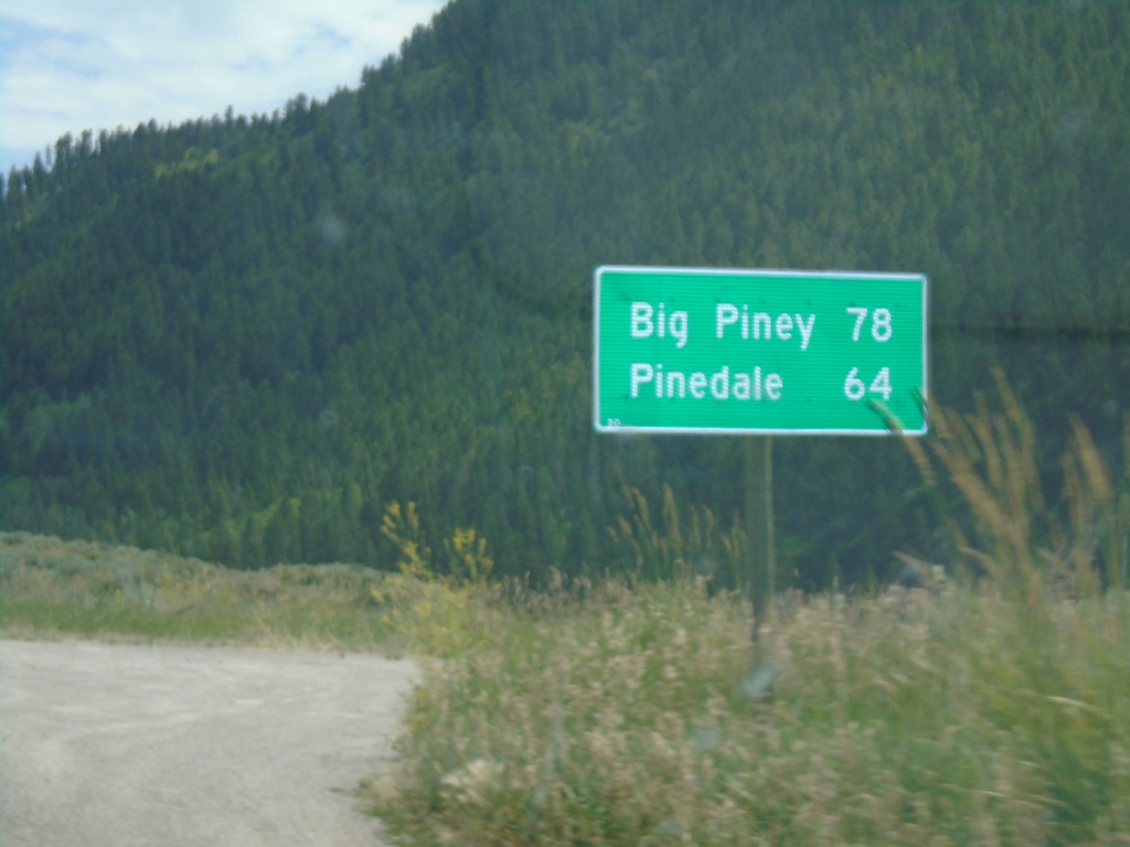
US-189/US-191 South - Distance Marker
Distance Marker on US-189/US-191 South. Distance to Pinedale (via US-191) and Big Piney (via US-189).
Taken 07-17-2020
Jackson
Teton County
Wyoming
United States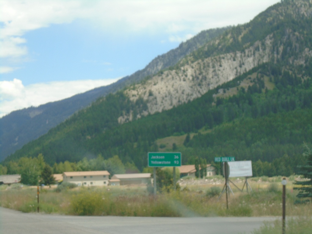
US-89 North/US-26 East - Distance Marker
Distance marker on US-89 North/US-26 East. Distance to Jackson and Yellowstone.
Taken 07-17-2020

 Alpine
Lincoln County
Wyoming
United States
Alpine
Lincoln County
Wyoming
United States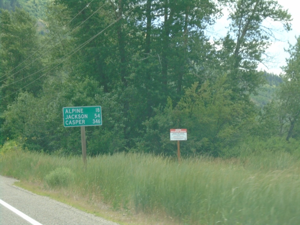
US-26 East - Distance Marker
Distance marker on US-26 east. Distance to Alpine, Jackson, and Casper. All three destinations are in Wyoming.
Taken 07-17-2020
Irwin
Bonneville County
Idaho
United States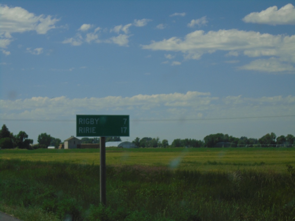
ID-48 East - Distance Marker
Distance marker on ID-48 east. Distance to Rigby and Ririe.
Taken 07-17-2020
 Menan
Jefferson County
Idaho
United States
Menan
Jefferson County
Idaho
United States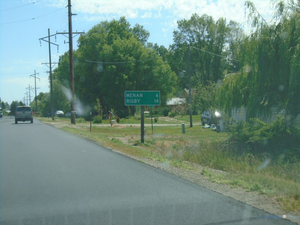
ID-48 East - Distance Marker
Distance marker on ID-48 east. Distance to Menan and Rigby.
Taken 07-17-2020
Roberts
Jefferson County
Idaho
United States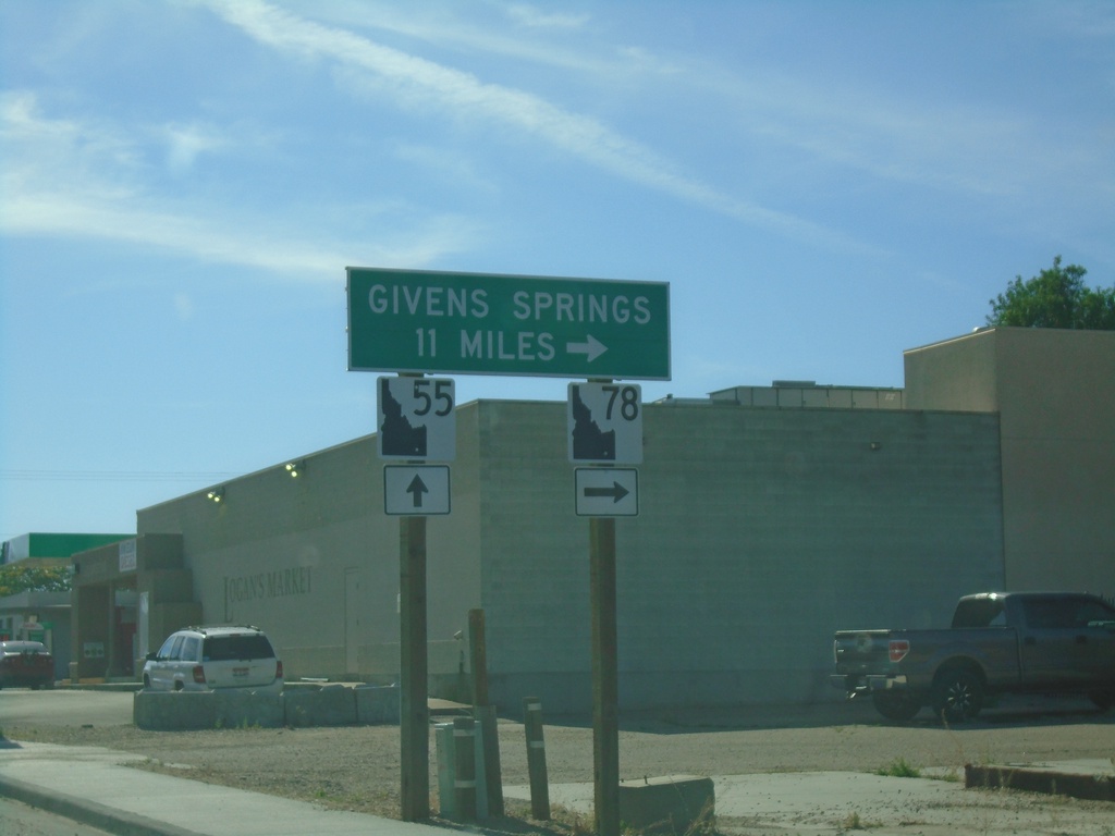
ID-55 North - Givens Hot Springs
ID-55 north approaching ID-78 junction in Marsing. Use ID-78 south for Givens (Hot) Springs.
Taken 06-19-2020

 Marsing
Owyhee County
Idaho
United States
Marsing
Owyhee County
Idaho
United States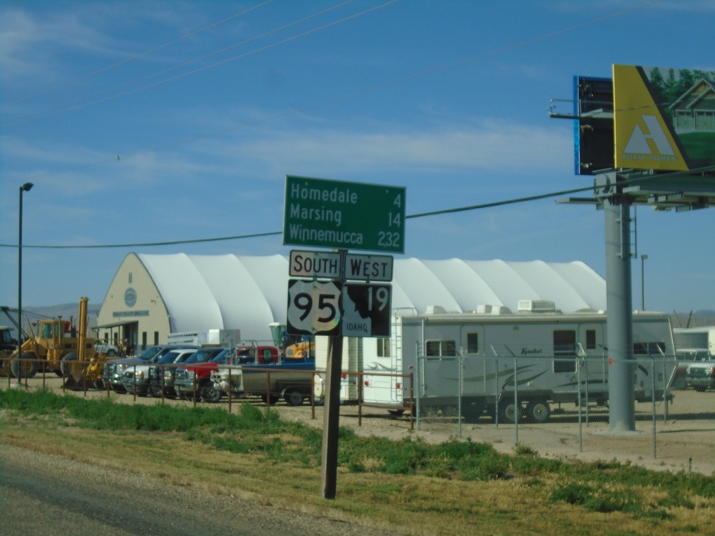
Distance Marker - US-95 South/ID-19 West South of Wilder
US-95 South/ID-19 West - Distance Marker. Distance to Homedale, Marsing, and Winnemucca (Nevada).
Taken 06-19-2020

 Wilder
Canyon County
Idaho
United States
Wilder
Canyon County
Idaho
United States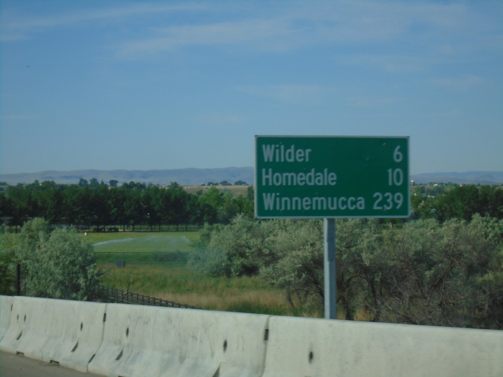
US-95 South - Distance Marker
Distance marker on US-95 south. Distance to Wilder, Homedale, and Winnemucca (Nevada).
Taken 06-19-2020
Parma
Canyon County
Idaho
United States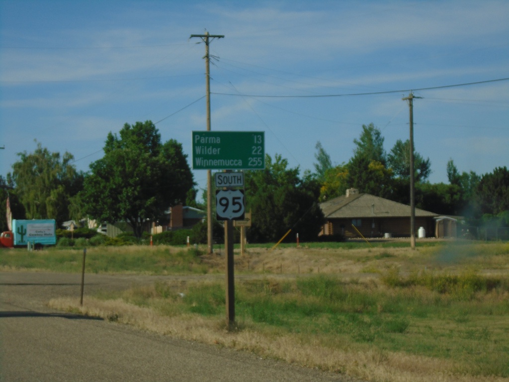
US-95 South - Distance Marker
Distance marker on US-95 south. Distance to Parma, Wilder, and Winnemucca (Nevada).
Taken 06-19-2020
Fruitland
Payette County
Idaho
United States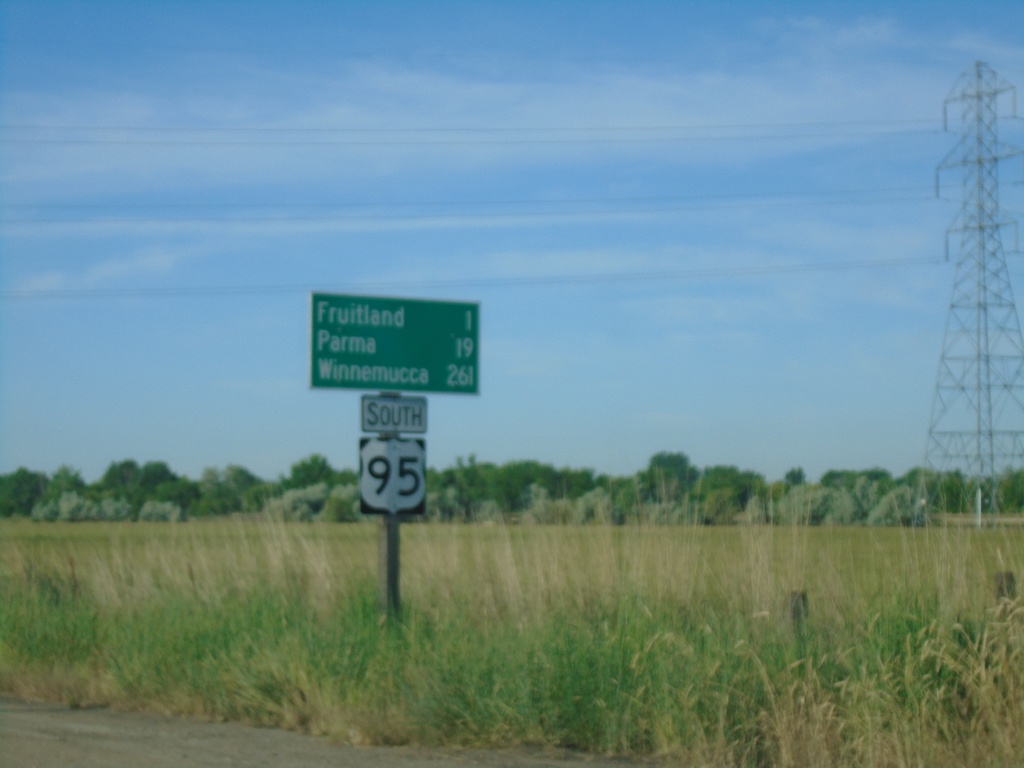
US-95 South - Distance Marker
Distance marker on US-95 south. Distance to Fruitland, Parma, and Winnemucca (Nevada).
Taken 06-19-2020
Payette
Payette County
Idaho
United States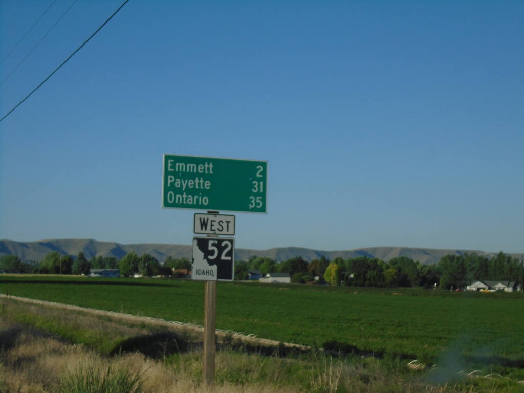
ID-52 West - Distance Marker
Distance marker on ID-52 west. Distance to Emmett, Payette, and Ontario.
Taken 06-19-2020
 Emmett
Gem County
Idaho
United States
Emmett
Gem County
Idaho
United States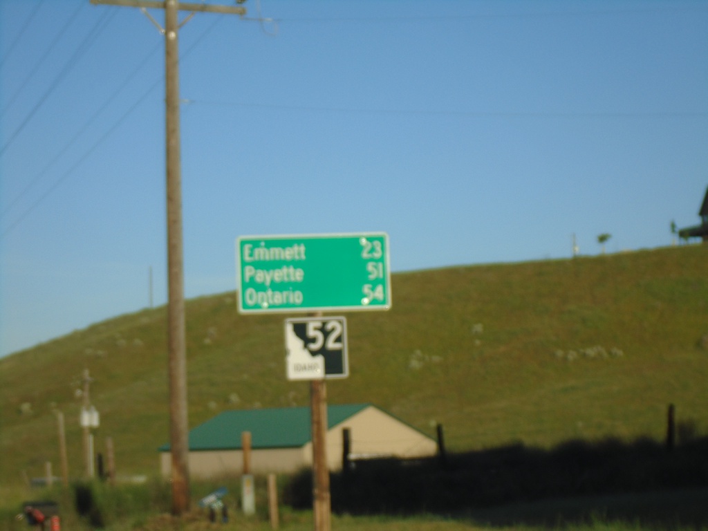
ID-52 West - Distance Marker
Distance marker on ID-52 west. Distance to Emmett, Payette, and Ontario.
Taken 06-19-2020
Horseshoe Bend
Boise County
Idaho
United States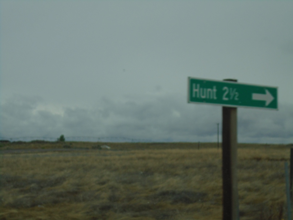
ID-25 West - Hunt Jct.
ID-25 west at Hunt Jct. Hunt is the site of the Minidoka War Relocation Center, a Japanese Internment Camp during World War 2.
Taken 05-22-2020
 Jerome
 County
Idaho
United States
Jerome
Jerome County
Idaho
United States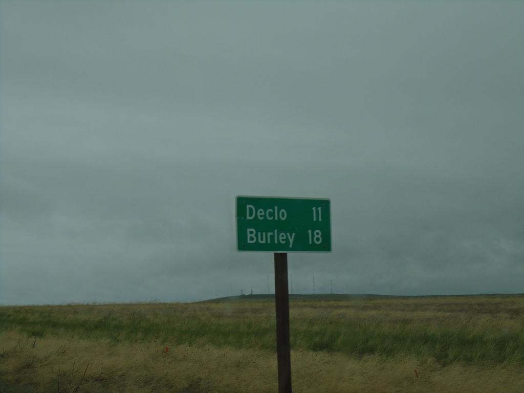
ID-81 North - Distance Marker
Distance marker on ID-81 north. Distance to Declo and Burley.
Taken 05-22-2020
 Declo
Cassia County
Idaho
United States
Declo
Cassia County
Idaho
United States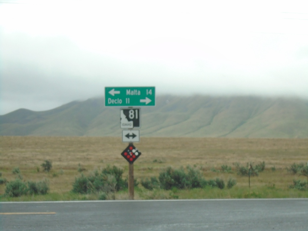
End Yale Road at ID-81
End Yale Road at ID-81. Turn left for ID-81 south to Malta; right for ID-81 north to Declo.
Taken 05-22-2020
Declo
Cassia County
Idaho
United States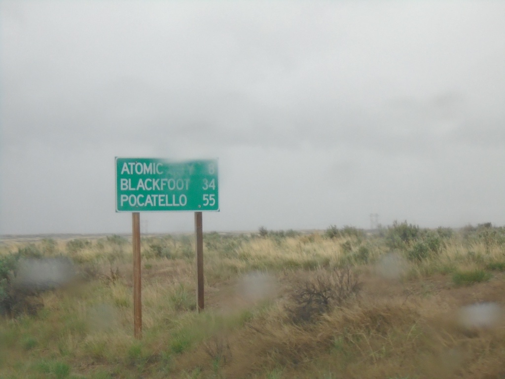
US-26 East - Distance Marker
Distance marker on US-26 east. Distance to Atomic City, Blackfoot, and Pocatello.
Taken 05-22-2020
Blackfoot
Butte County
Idaho
United States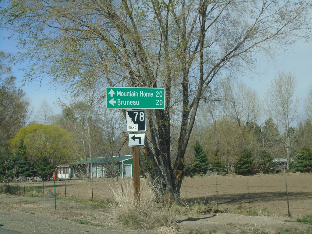
Old US-30 West Approaching ID-78
Old US-30 West approaching ID-78 in Hammett. Turn left for ID-78 west to Bruneau. Continue straight for ID-78 east to Mountain Home.
Taken 04-04-2020
Hammett
Elmore County
Idaho
United States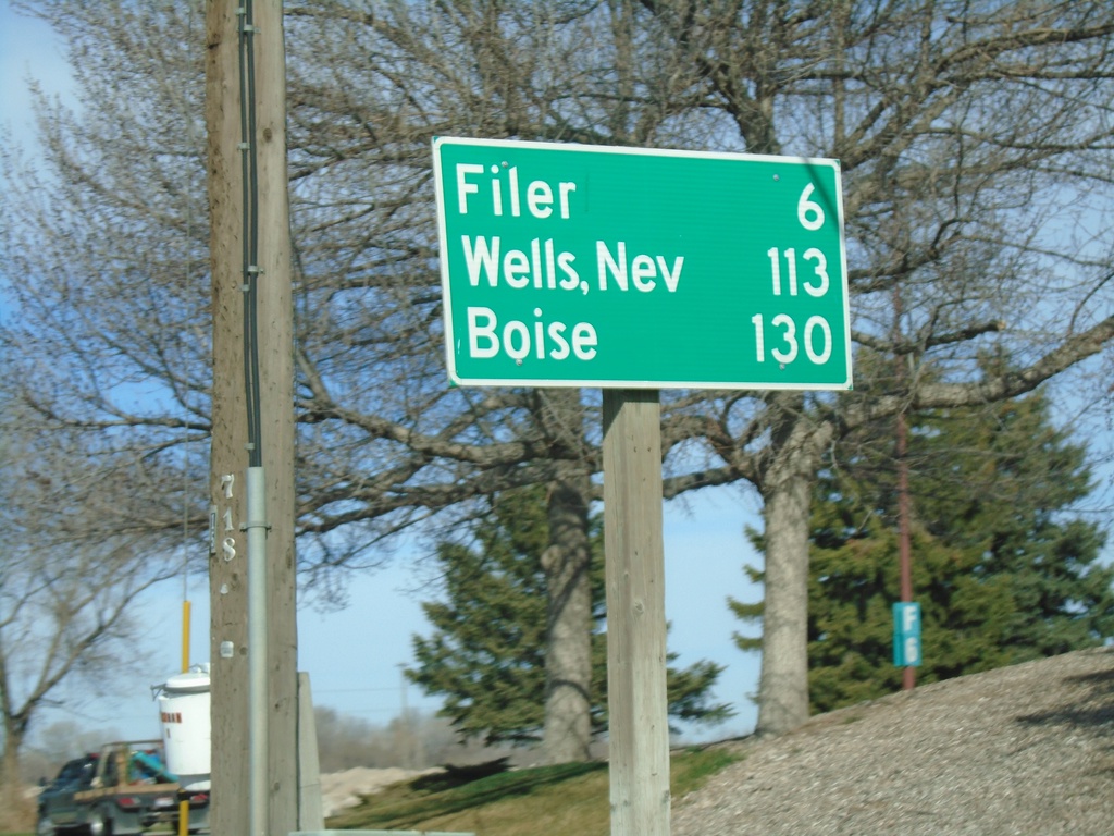
US-30 East/Bus. US-93 South - Distance Marker
Distance marker on US-30 East/Bus. US-93 South. Distance to Filer, Wells, Nev. (via US-93), and Boise.
Taken 04-04-2020

 Twin Falls
 County
Idaho
United States
Twin Falls
Twin Falls County
Idaho
United States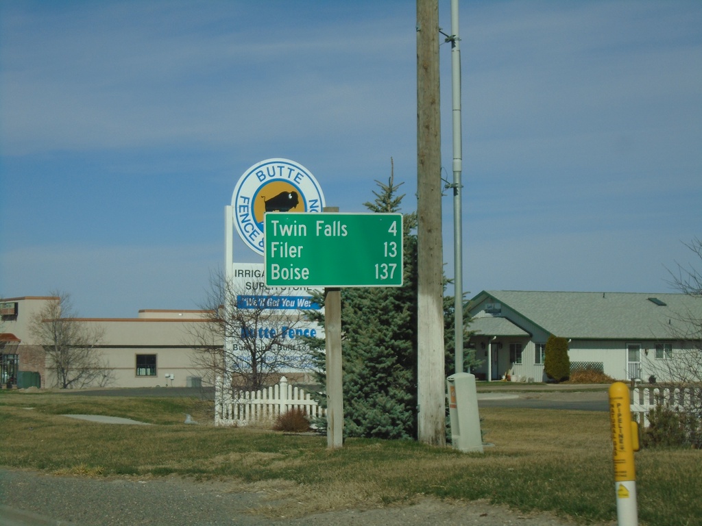
US-30 West - Distance Marker
Distance marker on US-30 west. Distance to Twin Falls, Filer, and Boise.
Taken 04-04-2020
Kimberly
Twin Falls County
Idaho
United States
ID-50 South - Distance Marker
Distance marker on ID-50 south. Distance to Kimberly and Twin Falls.
Taken 04-04-2020
 Eden
Jerome County
Idaho
United States
Eden
Jerome County
Idaho
United States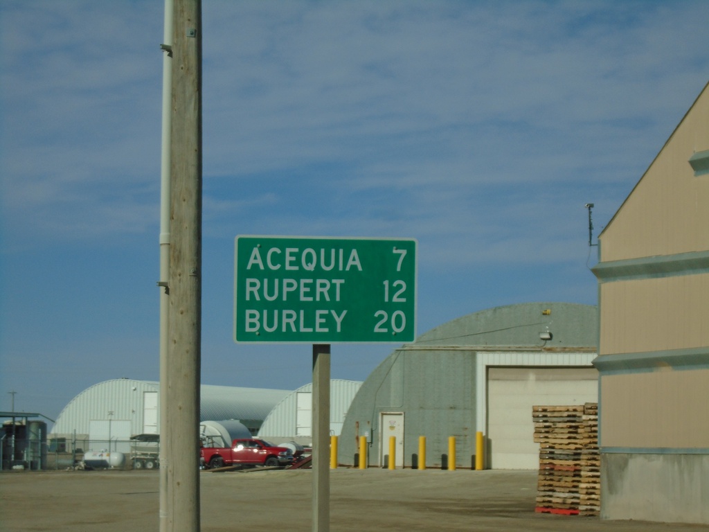
ID-24 East - Distance Marker
Distance market on ID-24 east. Distance to Acequia, Rupert, and Burley.
Taken 04-04-2020
 Minidoka
 County
Idaho
United States
Minidoka
Minidoka County
Idaho
United States