Signs Tagged With Distance Marker
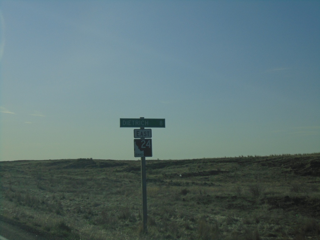
ID-24 East - Distance Marker
Distance marker on ID-24 east. Distance to Dietrich.
Taken 04-04-2020
 Shoshone
Lincoln County
Idaho
United States
Shoshone
Lincoln County
Idaho
United States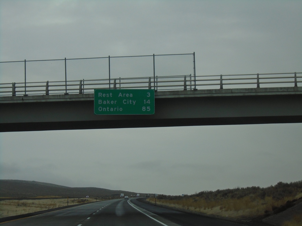
I-84 East - Distance Marker
Distance marker on I-84 east. Distance to Rest Area, Baker City, and Ontario.
Taken 12-29-2019
 Baker City
Baker County
Oregon
United States
Baker City
Baker County
Oregon
United States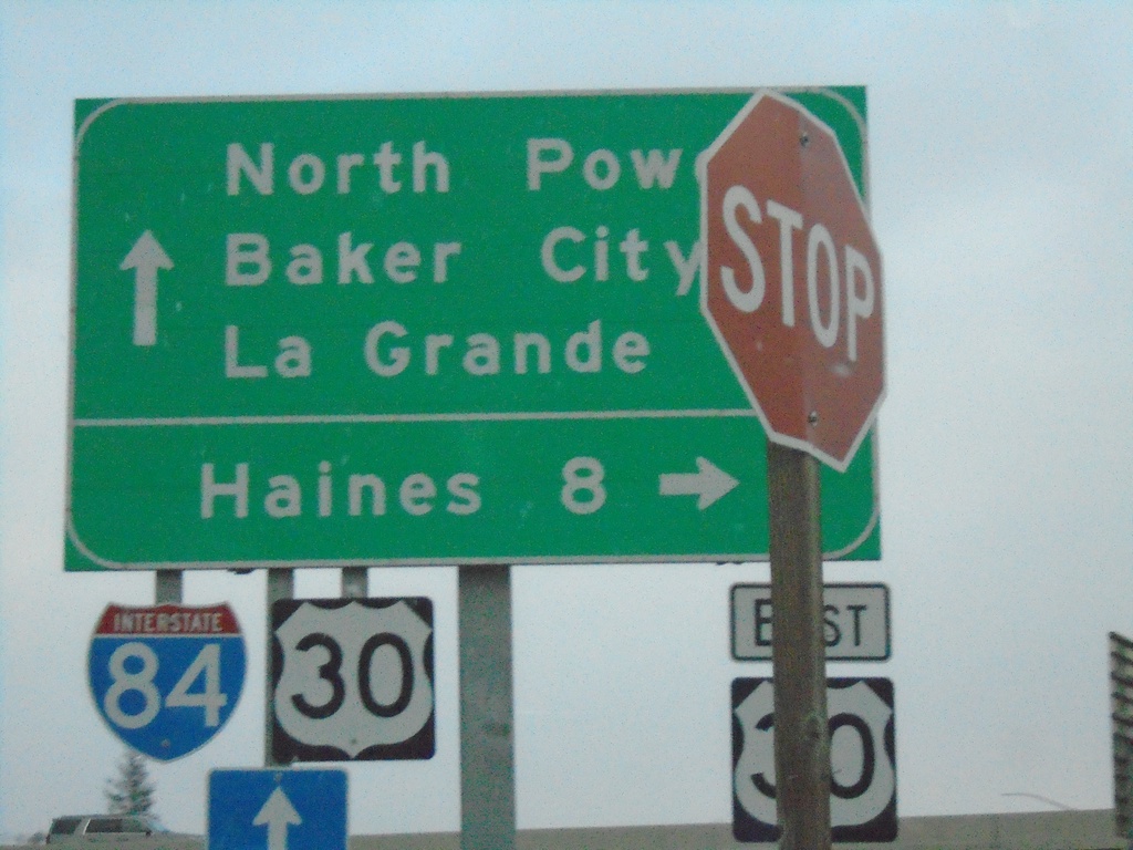
River Lane East at US-30 East And Approaching I-84
River Lane East at US-30 East to Haines. Approaching onramp for I-84. Use I-84 east to Baker City; I-84 West/US-30 West for La Grande. OR-237 North begins at the I-84 interchange. Use OR-237 for North Powder.
Taken 12-27-2019

 North Powder
Union County
Oregon
United States
North Powder
Union County
Oregon
United States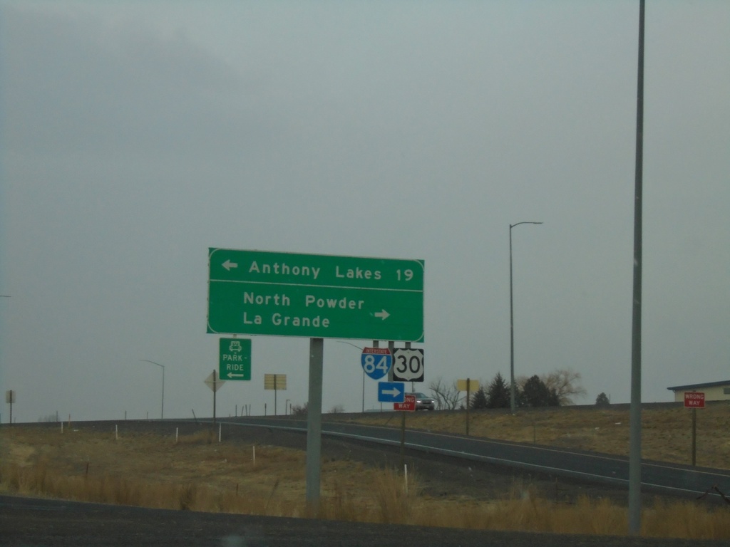
US-30 West at Anthony Lakes Jct. and I-84
US-30 West at Anthony Lakes Jct. and I-84. Turn left for Anthony Lakes (Ski Area). Turn right for North Powder I-84/US-30 west to La Grande.
Taken 12-27-2019
North Powder
Union County
Oregon
United States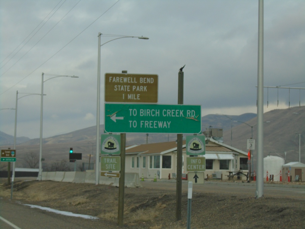
I-84 West - Exit 353 Offramp
I-84 West - Exit 353 offramp at US-30. Use US-30 west for Farewell Bend State Park. Turn left for Birch Creek Road and (I-84) Freeway.
Taken 12-27-2019
Huntington
Malheur County
Oregon
United States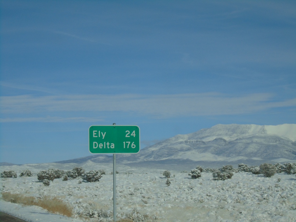
US-6 East - Distance Marker
Distance marker on US-6 east. Distance to Ely, and Delta (Utah).
Taken 11-30-2019
 Preston
White Pine County
Nevada
United States
Preston
White Pine County
Nevada
United States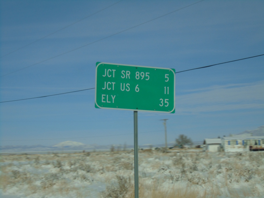
NV-318 North - Distance Marker
Distance marker on NV-318 north. Distance to SR-895, US-6, and Ely.
Taken 11-30-2019
 Lund
White Pine County
Nevada
United States
Lund
White Pine County
Nevada
United States
NV-318 North - Distance Marker
Distance marker on NV-318 north. Distance to Lund, Jct. US-6, and Ely.
Taken 11-30-2019
Lincoln County
Nevada
United States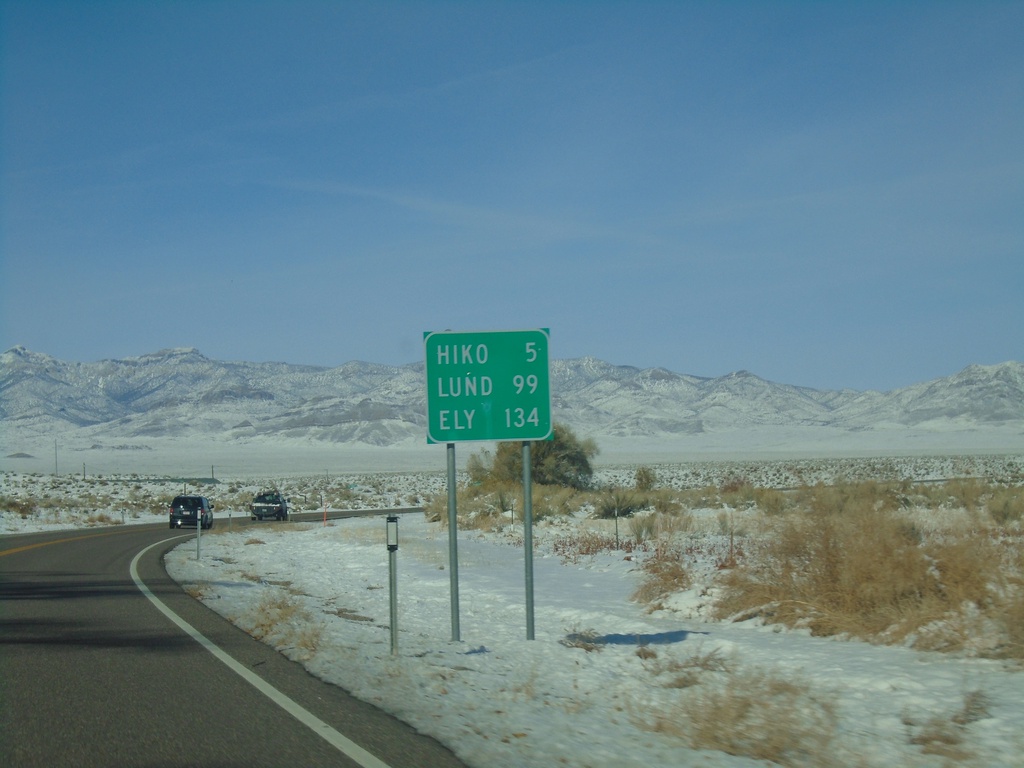
NV-318 North - Distance Marker
Distance marker on NV-318 north. Distance to Hiko, Lund, and Ely.
Taken 11-30-2019
Hiko
Lincoln County
Nevada
United States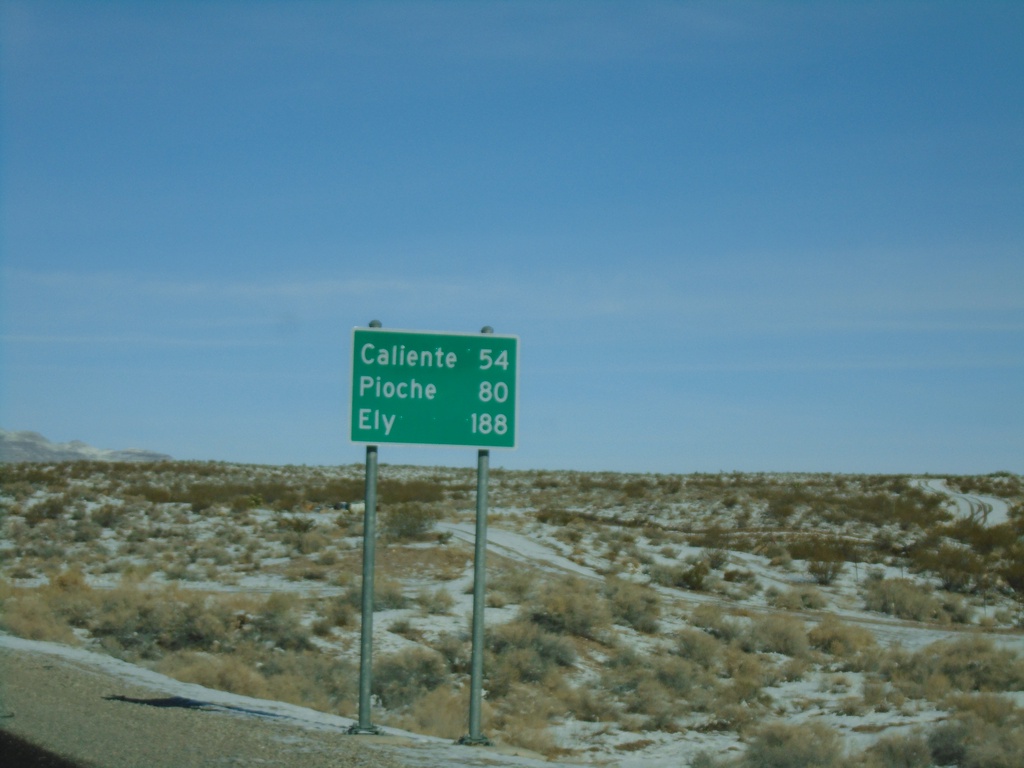
US-93 North - Distance Marker
Distance marker on US-93 north. Distance to Caliente, Pioche, and Ely.
Taken 11-30-2019
 Alamo
Lincoln County
Nevada
United States
Alamo
Lincoln County
Nevada
United States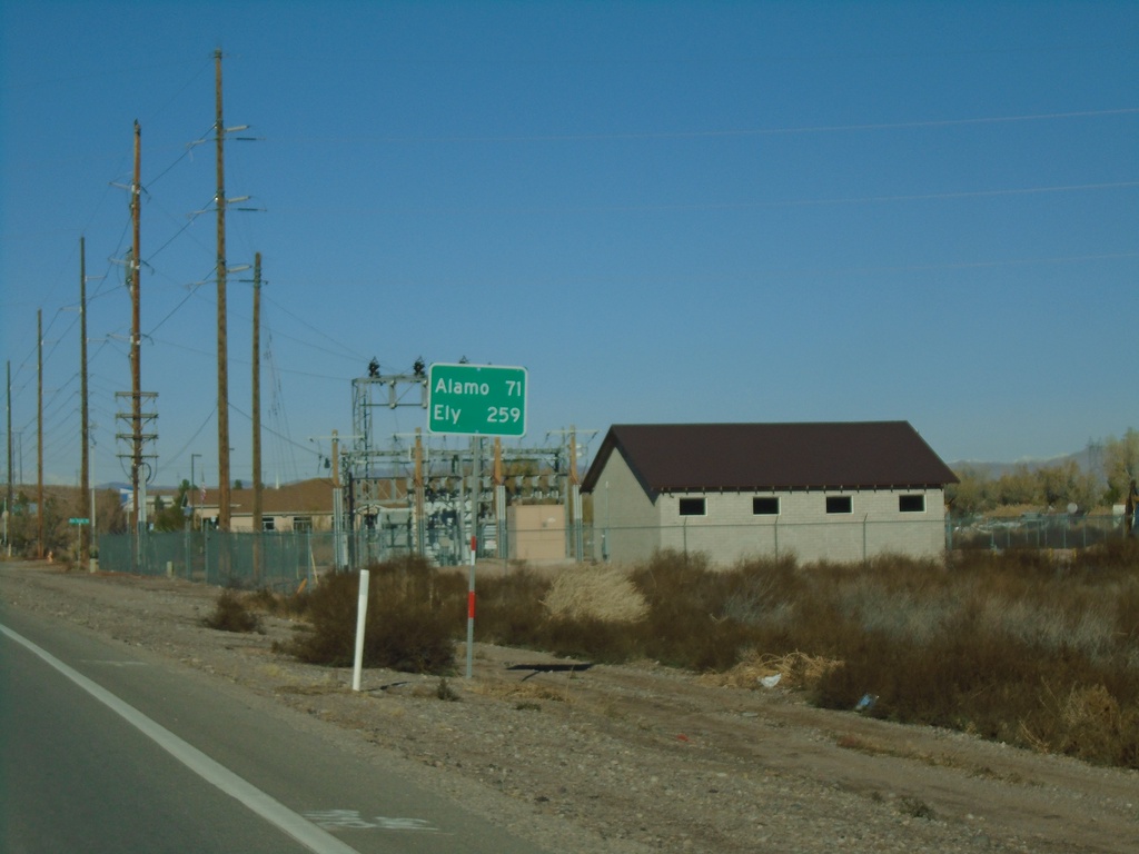
NV-168 West - Distance Marker
Distance marker on NV-168 west. Distance to Alamo and Ely (both via US-93).
Taken 11-30-2019
 Moapa
Clark County
Nevada
United States
Moapa
Clark County
Nevada
United States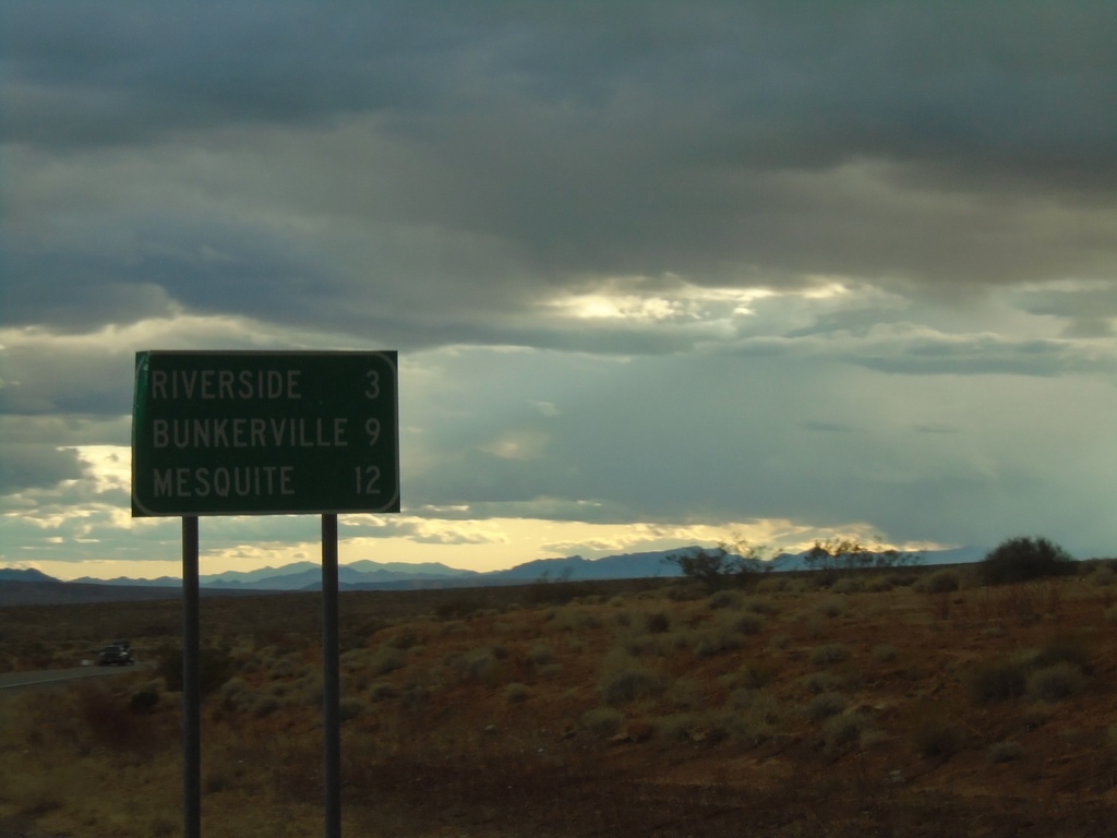
NV-170 East - Distance Marker
Distance marker on NV-170 east. Distance to Riverside, Bunkerville, and Mesquite.
Taken 11-29-2019
 Bunkerville
Clark County
Nevada
United States
Bunkerville
Clark County
Nevada
United States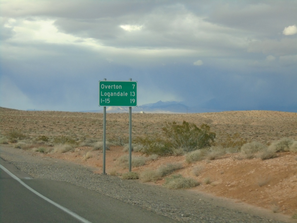
Begin NV-169 Northbound
Distance marker at beginning of NV-169 northbound. Distance to Overton, Logandale, and I-15.
Taken 11-29-2019
 Moapa Valley
Clark County
Nevada
United States
Moapa Valley
Clark County
Nevada
United States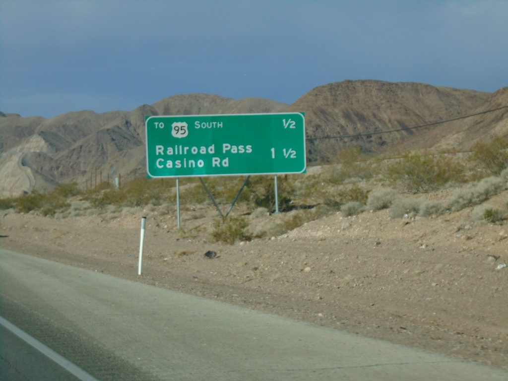
Bus. US-93 North - Distance Marker
Distance marker on Bus. US-93 north in Boulder City. Distance to US-95 South and Railroad Pass Casino Road
Taken 11-27-2019

 Boulder City
Clark County
Nevada
United States
Boulder City
Clark County
Nevada
United States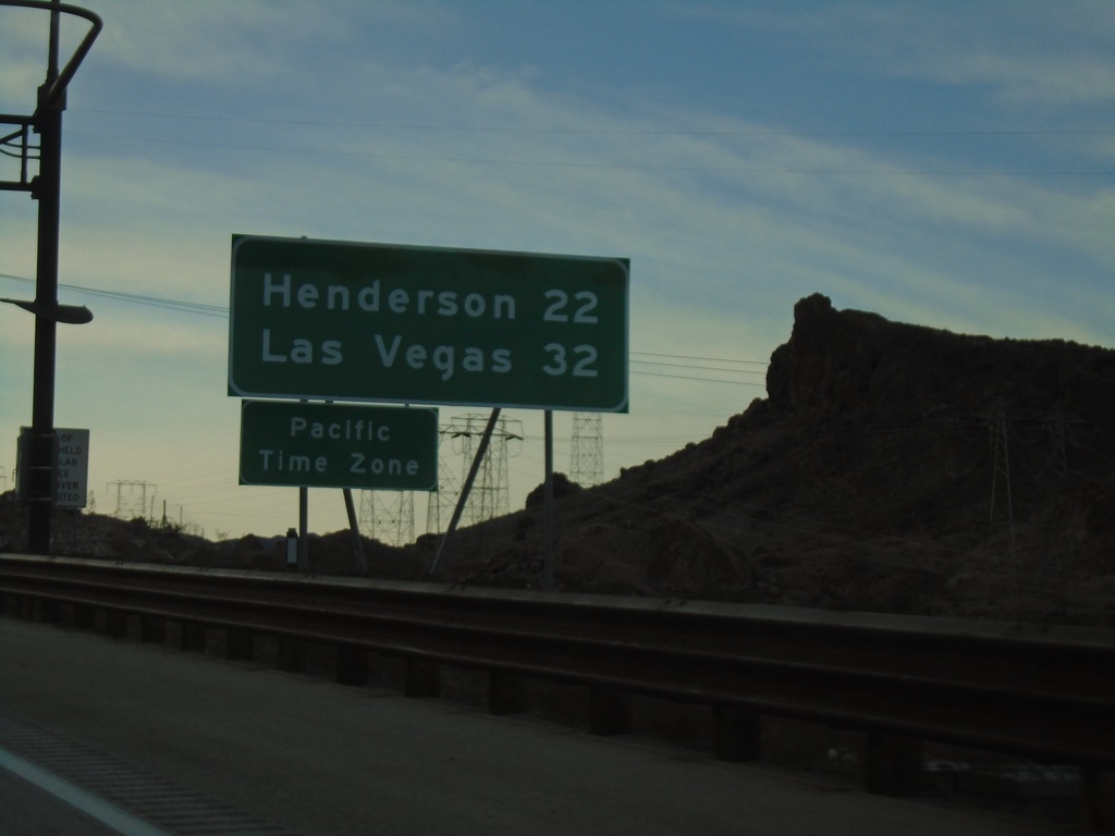
I-11 North - Distance Marker / Pacific Time
First distance marker on I-11 north in Nevada. Distance to Henderson and Las Vegas. Entering Pacific Time Zone.
Taken 11-26-2019
 Boulder City
Clark County
Nevada
United States
Boulder City
Clark County
Nevada
United States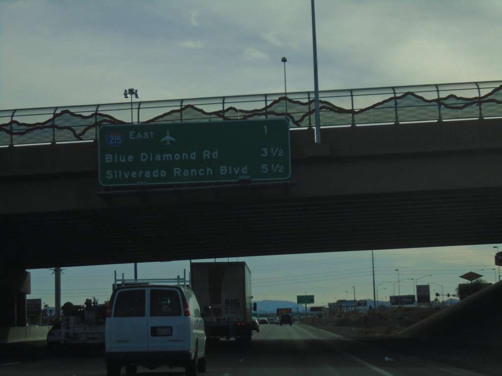
I-15 South - Next 3 Exits
Next 3 exits on I-15 south in Las Vegas area. I-215 East, Blue Diamond Road, Silverado Ranch Road
Taken 11-26-2019
 Las Vegas
Clark County
Nevada
United States
Las Vegas
Clark County
Nevada
United States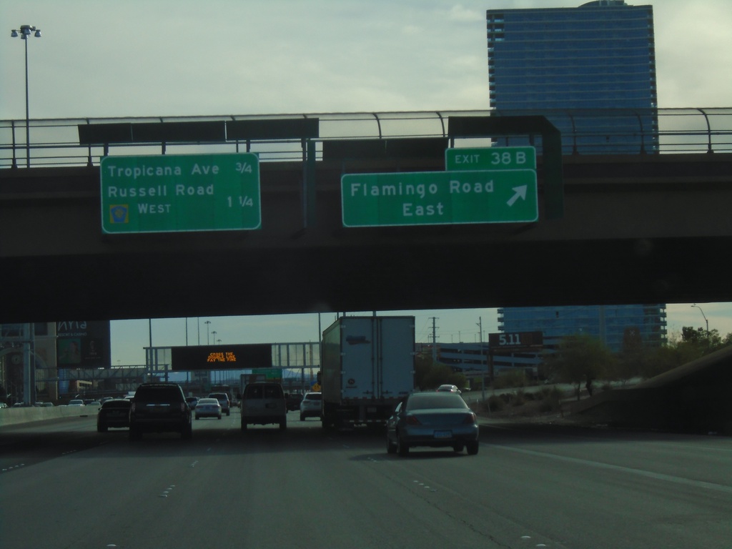
I-15 South - Exit 38B
I-15 south at Exit 38B - Flamingo Road East. Approaching Tropicana Ave., and Russell Road/CR-215 West.
Taken 11-26-2019
 Las Vegas
Clark County
Nevada
United States
Las Vegas
Clark County
Nevada
United States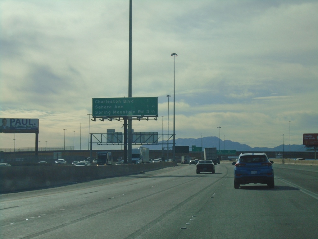
I-15 South - Las Vegas Exits
Las Vegas exits on I-15 south. Next 3 exits - Charleston Ave., Sahara Ave., Spring Mountain Road.
Taken 11-26-2019
Las Vegas
Clark County
Nevada
United States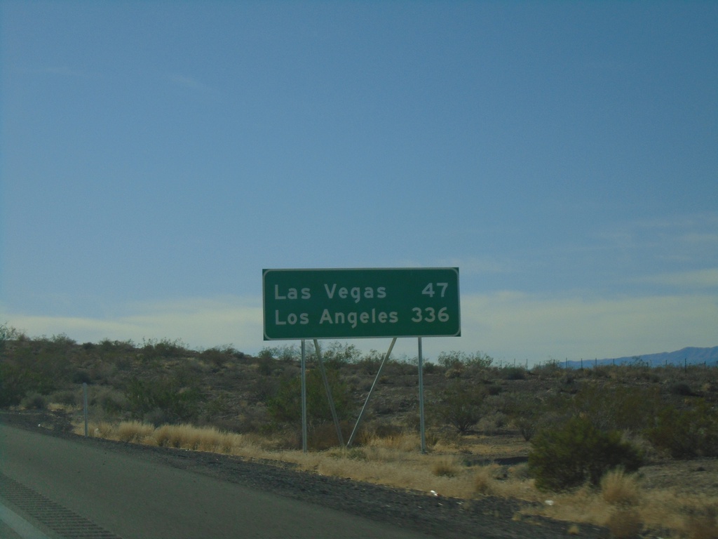
I-15 South - Distance Marker
Distance marker on I-15 south. Distance to Las Vegas and Los Angeles (CA). This is the first appearance of Los Angeles on a distance marker on I-15 southbound.
Taken 11-26-2019
Moapa
Clark County
Nevada
United States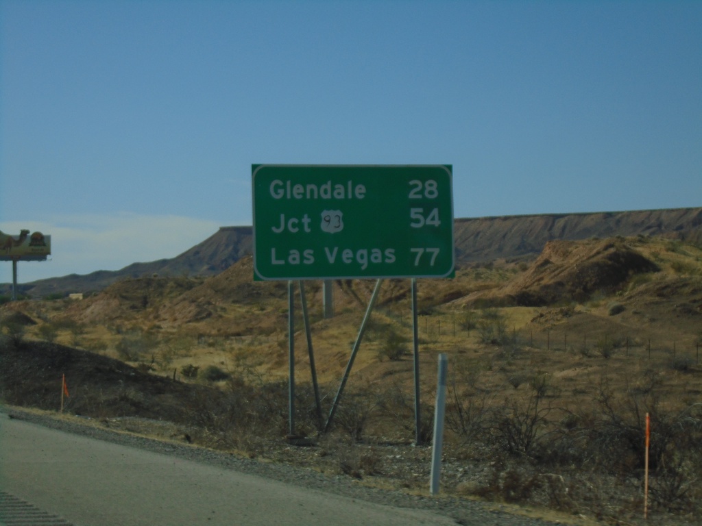
I-15 South - Distance Marker
Distance marker on I-15 south. Distance to Glendale, Jct. US-93, and Las Vegas.
Taken 11-26-2019
Mesquite
Clark County
Nevada
United States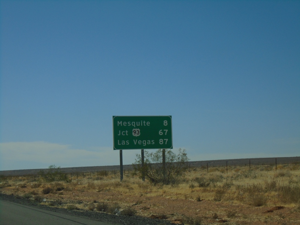
I-15 South - Distance Marker
Distance marker on I-15 south. Distance to Mesquite, Jct. US-93, and Las Vegas. All destinations are in Nevada. This is the last distance marker southbound on I-15 in Arizona.
Taken 11-26-2019
Littlefield
Mohave County
Arizona
United States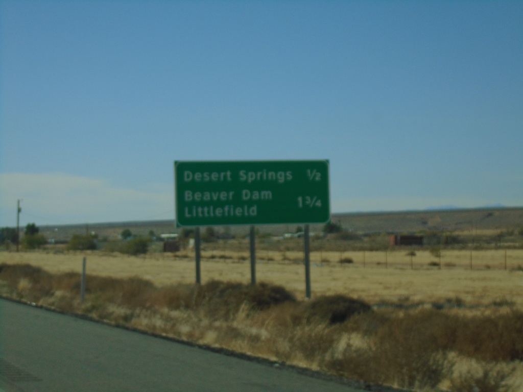
I-15 South Approaching Exits 9 and 8
I-15 south approaching Exit 9 - Desert Springs and approaching Exit 8 - Littlefield/Beaver Dam.
Taken 11-26-2019
Littlefield
Mohave County
Arizona
United States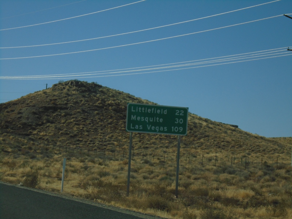
I-15 South - Distance Marker
Distance marker on I-15 south. Distance to Littlefield, Mesquite (Nevada), Las Vegas (Nevada). This is the first distance marker southbound along I-15 in Arizona.
Taken 11-26-2019
Littlefield
Mohave County
Arizona
United States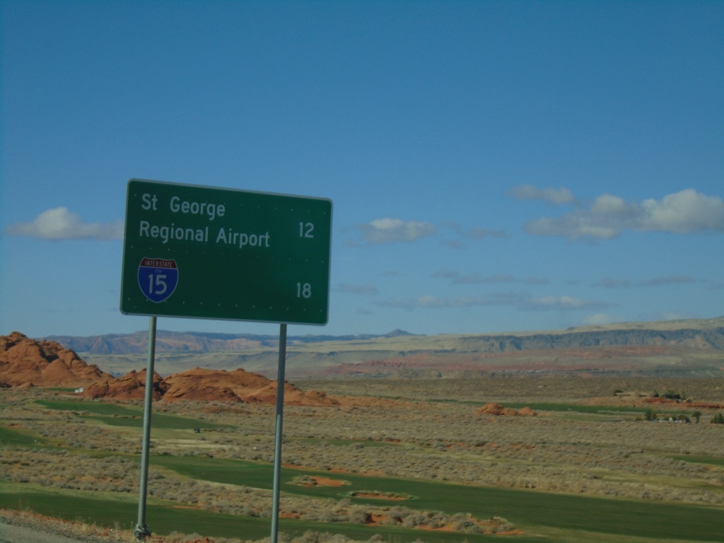
UT-7 West - Distance Marker
Distance marker on UT-7 west. Distance to St. George Regional Airport and I-15.
Taken 11-26-2019
 Hurricane
Washington County
Utah
United States
Hurricane
Washington County
Utah
United States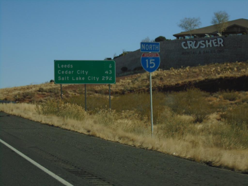
I-15 North - Distance Marker
Distance marker and I-15 shield on I-15 North. Distance to Leeds, Cedar City, and Salt Lake City.
Taken 11-26-2019
Hurricane
Washington County
Utah
United States