Signs Tagged With Distance Marker
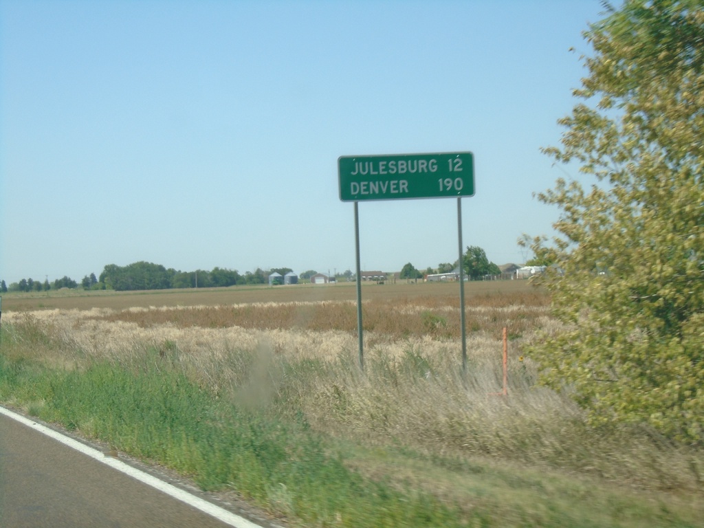
US-138 West - Distance Marker
Distance marker on US-138 west. Distance to Julesburg and Denver (both in Colorado).
Taken 08-14-2020
 Big Springs
Deuel County
Nebraska
United States
Big Springs
Deuel County
Nebraska
United States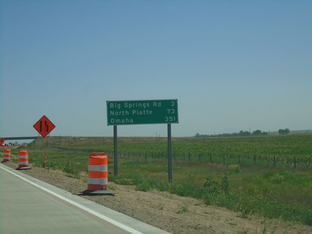
I-80 East - Distance Marker
Distance marker on I-80 east. Distance to Big Springs Road, North Platte, and Omaha.
Taken 08-14-2020
 Big Springs
Deuel County
Nebraska
United States
Big Springs
Deuel County
Nebraska
United States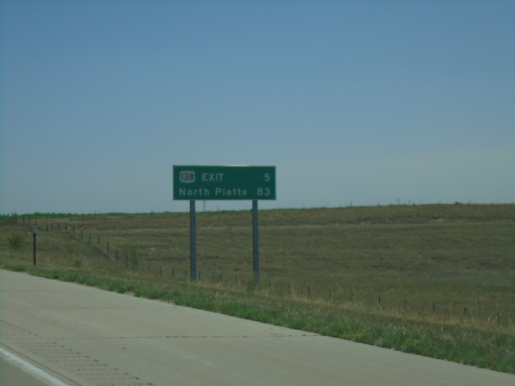
I-80 East - Distance Marker
Distance marker on I-80 east. Distance to US-138 Exit and North Platte.
Taken 08-14-2020
Julesburg
Deuel County
Nebraska
United States
End NE-27 South at I-80
End NE-27 South at I-80 (Exit 95). Use I-80 east to North Platte.
Taken 08-14-2020
 Chappell
Deuel County
Nebraska
United States
Chappell
Deuel County
Nebraska
United States
End NE-27 South at I-80 West
End NE-27 South at I-80. Use I-80 West to Sidney.
Taken 08-14-2020
Chappell
Deuel County
Nebraska
United States
US-30 East/NE-27 South at US-30/NE-27 Split
US-30 East/NE-27 South at US-30/NE-27 split in Deuel County. Turn right for NE-27 south to Julesburg (Colorado). Continue east on US-30 for Ogallala.
Taken 08-14-2020
 Chappell
Deuel County
Nebraska
United States
Chappell
Deuel County
Nebraska
United States
NE-27 South at US-30
NE-27 South at US-30 in Deuel County. Turn right for US-30 west to Chappell; left for US-30 east/NE-92 south to Ogallala.
Taken 08-14-2020
Chappell
Deuel County
Nebraska
United States
NE-27 South - Distance Marker
Distance marker on NE-27 south. Distance to US-30 Junction.
Taken 08-14-2020
Oshkosh
Garden County
Nebraska
United States
US-26 East/NE-92 East At NE-27
US-26 East/NE-92 East at NE-27 South in Oshkosh. Turn right for NE-27 to US-30 Jct; continue straight on US-26 East/NE-92 East for Ogallala.
Taken 08-14-2020

 Oshkosh
Garden County
Nebraska
United States
Oshkosh
Garden County
Nebraska
United States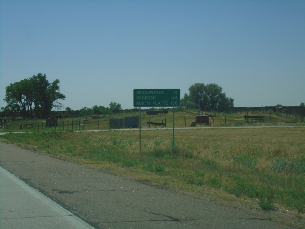
US-26 East - Distance Marker
Distance marker on US-26 east. Distance to Broadwater, Oshkosh, and North Platte (via I-80).
Taken 08-14-2020
Bridgeport
Morrill County
Nebraska
United States
US-26 East/US-385 North Approaching US-26/US-385 Split
US-26 East/US-385 North approaching US-26/US-385 split. Turn left for US-385 North to Alliance; left for US-26 East to Oshkosh.
Taken 08-14-2020
 Bridgeport
Morrill County
Nebraska
United States
Bridgeport
Morrill County
Nebraska
United States
US-26 East Approaching NE-92
US-26 East approaching NE-92. Use NE-92 West for Gering; US-26/NE-92 East for Bridgeport.
Taken 08-14-2020
Bayard
Morrill County
Nebraska
United States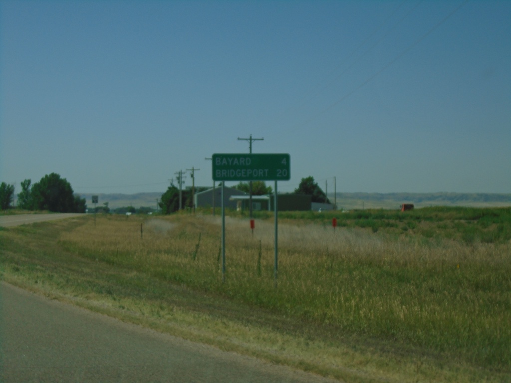
US-26 East - Distance Marker
Distance marker on US-26 east. Distance to Bayard and Bridgeport.
Taken 08-14-2020
Bayard
Morrill County
Nebraska
United States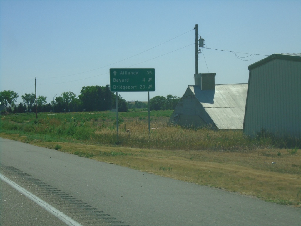
US-26 East Approaching NE-62A Link
US-26 East approaching NE-62A Link. Use NE-62A Link East to Alliance (via US-385 north). Merge right to continue east on US-26 for Bayard and Bridgeport.
Taken 08-14-2020
 Bayard
Morrill County
Nebraska
United States
Bayard
Morrill County
Nebraska
United States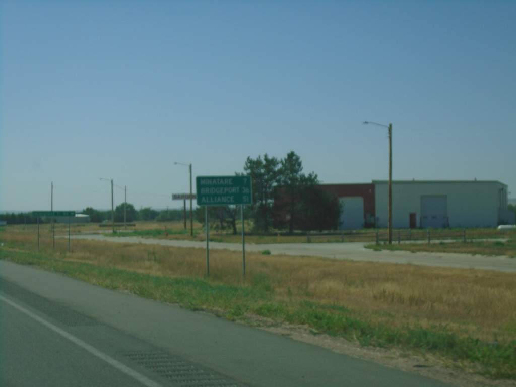
US-26 East - Distance Marker
Distance marker on US-26 east. Distance to Minitare, Bridgeport, and Alliance.
Taken 08-14-2020
Scottsbluff
Scotts Bluff County
Nebraska
United States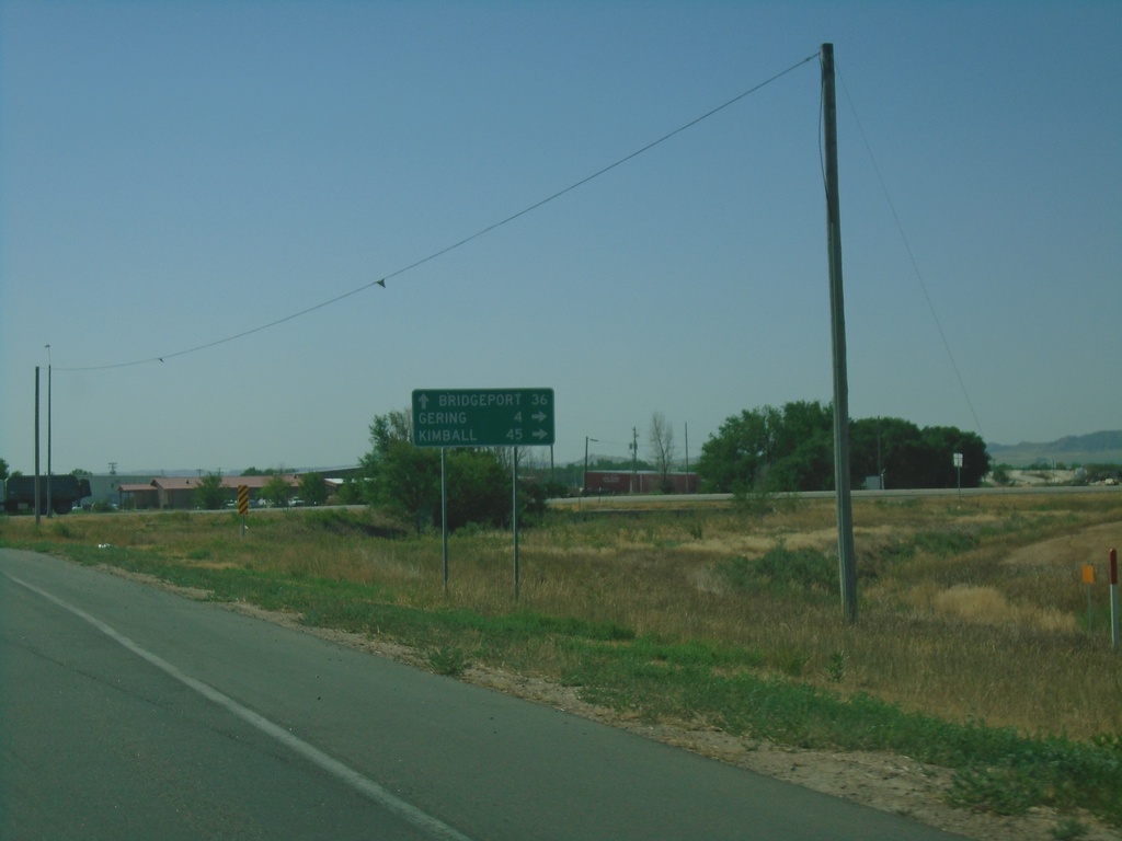
US-26/NE-92 East/NE-71 South at NE-92/NE-71
US-26/NE-92 East/NE-72 South at NE-92 East/NE-71 South to Gering and Kimball. Continue east on US-26 for Bridgeport.
Taken 08-14-2020
 Scottsbluff
Scotts Bluff County
Nebraska
United States
Scottsbluff
Scotts Bluff County
Nebraska
United States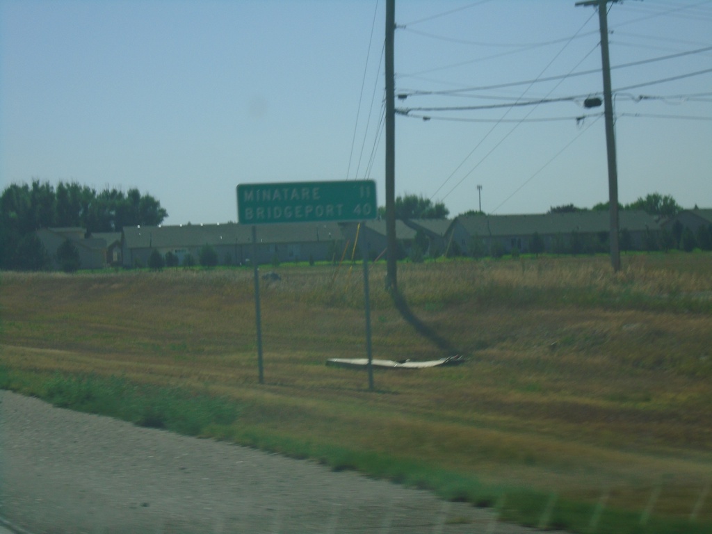
US-26/NE-92 East/NE-71 South - Distance Marker
Distance Marker on US-26/NE-92 East/NE-71 South. Distance to Minatare and Bridgeport.
Taken 08-14-2020
Scottsbluff
Scotts Bluff County
Nebraska
United States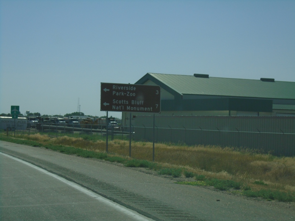
US-26 East Approaching NE-92
US-26 East approaching NE-92 in Scotts Bluff County. Use NE-92 West for Scotts Bluff National Monument and Riverside Park-Zoo.
Taken 08-14-2020
Scottsbluff
Scotts Bluff County
Nebraska
United States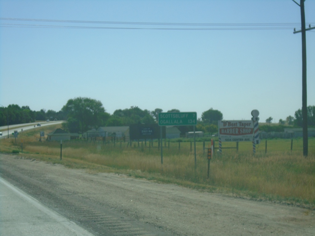
US-26 East - Distance Marker
Distance marker on US-26 east. Distance to Scottsbluff and Ogallala.
Taken 08-14-2020
Mitchell
Scotts Bluff County
Nebraska
United States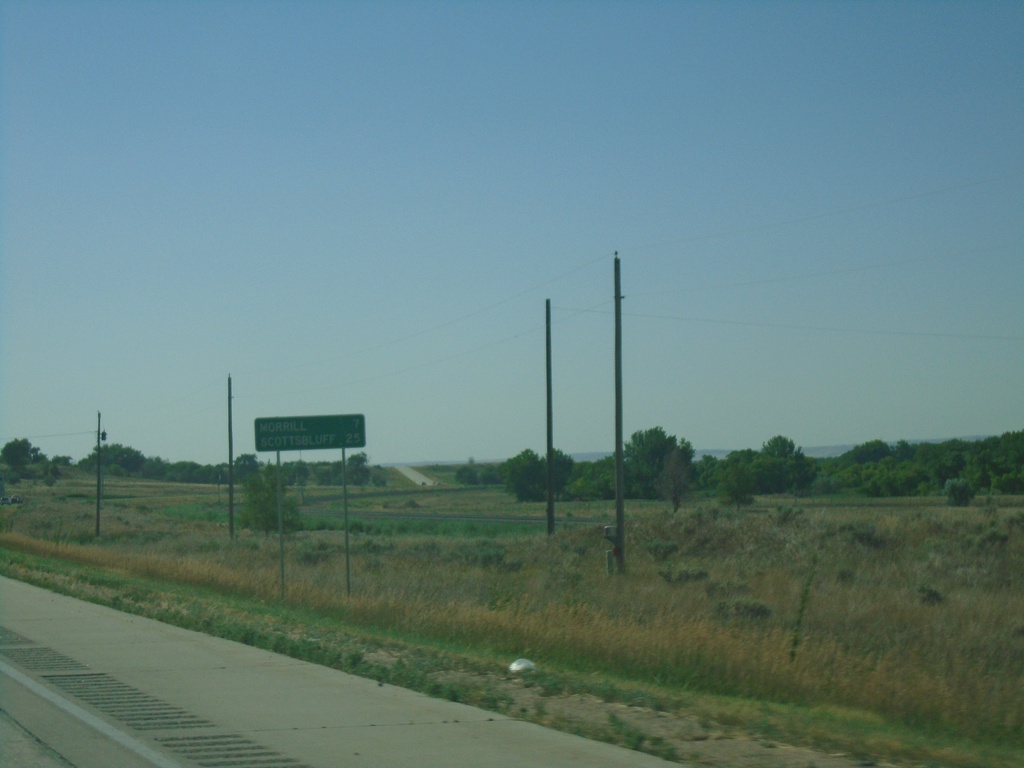
US-26 East - Distance Marker
Distance marker on US-26 east. Distance to Morrill and Scottsbluff. This is the first distance marker eastbound on US-26 in Nebraska.
Taken 08-14-2020
Henry
Scotts Bluff County
Nebraska
United States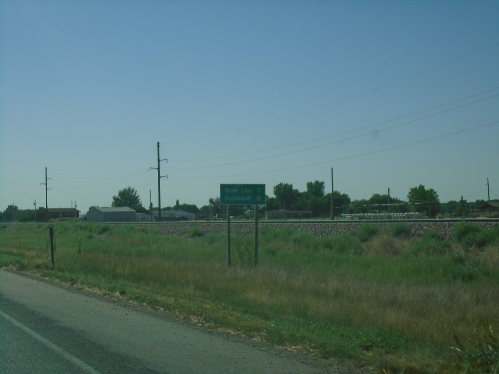
US-26 East - Distance Marker
Distance marker on US-26 east. Distance to (Nebraska) State Line and Scottsbluff (NE).
Taken 08-14-2020
Torrington
Goshen County
Wyoming
United States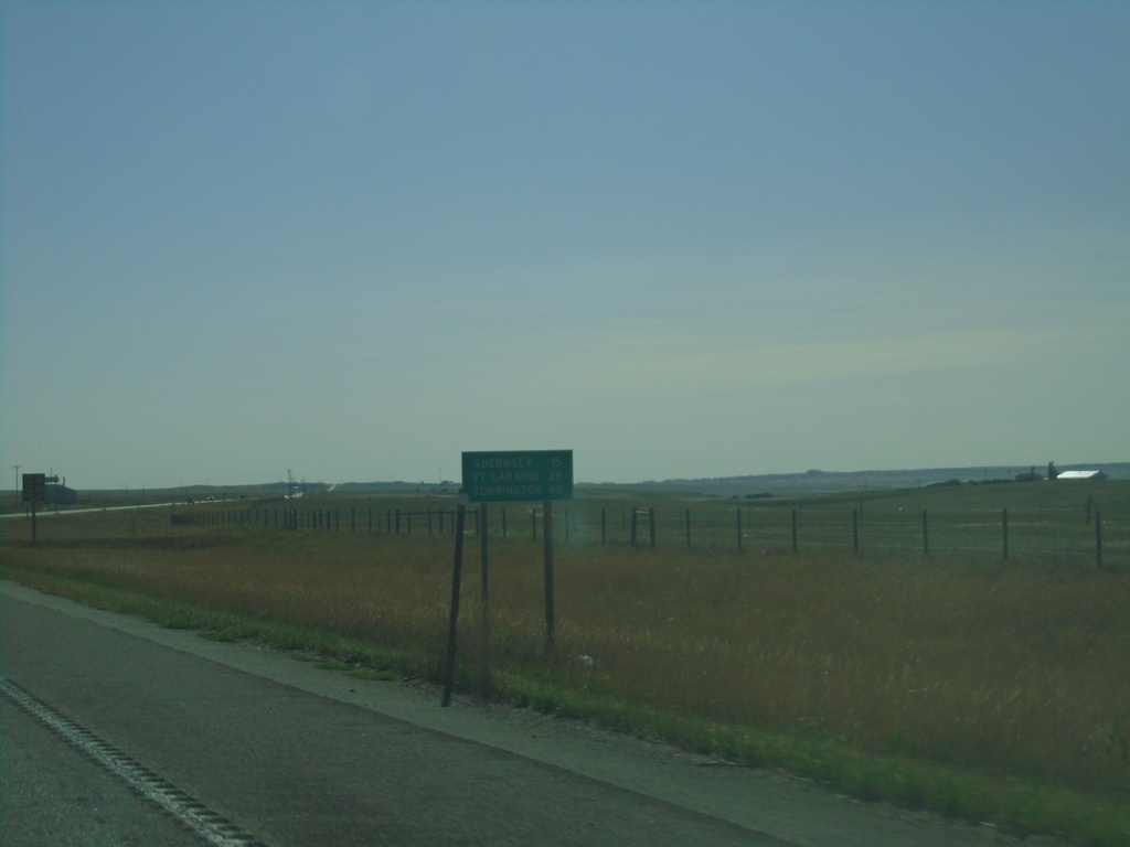
US-26 East - Distance Marker
Distance marker on US-26 east. Distance to Gurnsey, Fort Laramie, and Torrington.
Taken 08-14-2020
Wheatland
Platte County
Wyoming
United States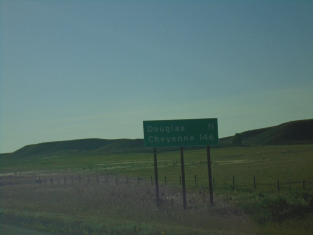
I-25 South - Distance Marker
Distance marker on I-25 south. Distance to Douglas and Cheyenne.
Taken 08-14-2020


 Douglas
Converse County
Wyoming
United States
Douglas
Converse County
Wyoming
United States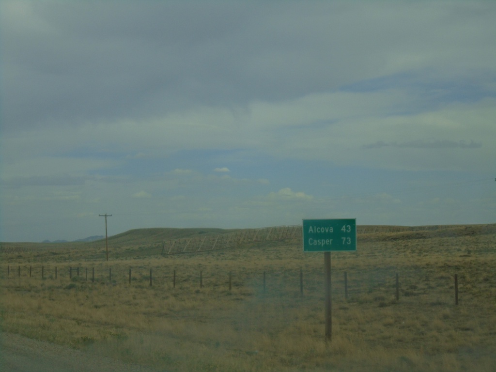
WY-220 East - Distance Marker
Distance marker on WY-220 east. Distance to Alcova and Casper.
Taken 08-13-2020
 Rawlins
Carbon County
Wyoming
United States
Rawlins
Carbon County
Wyoming
United States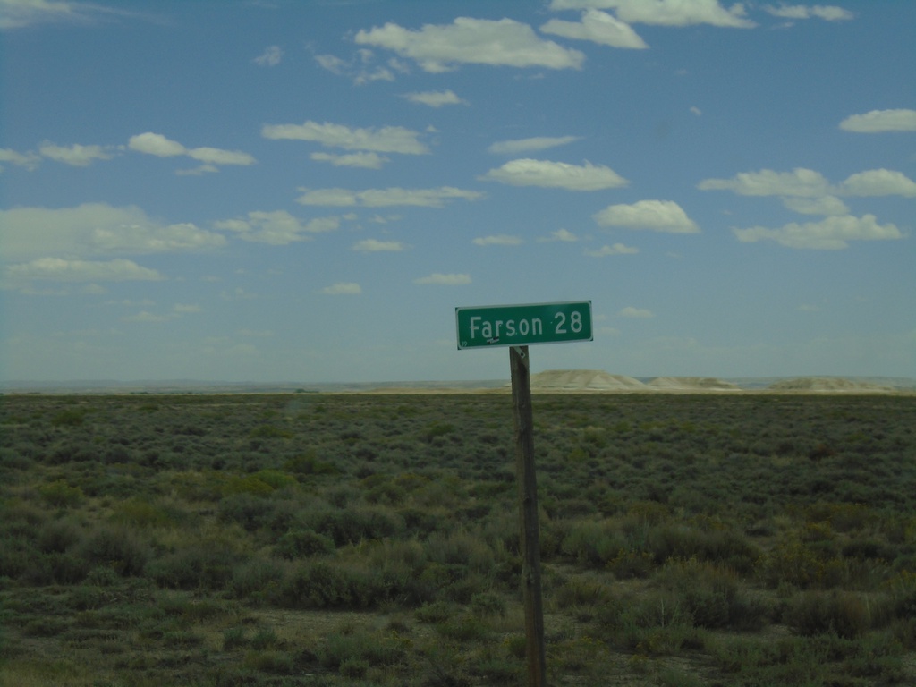
WY-28 East - Distance Marker
Distance marker on WY-28 east. Distance to Farson.
Taken 08-13-2020
 Green River
Sweetwater County
Wyoming
United States
Green River
Sweetwater County
Wyoming
United States