Signs Tagged With Distance Marker
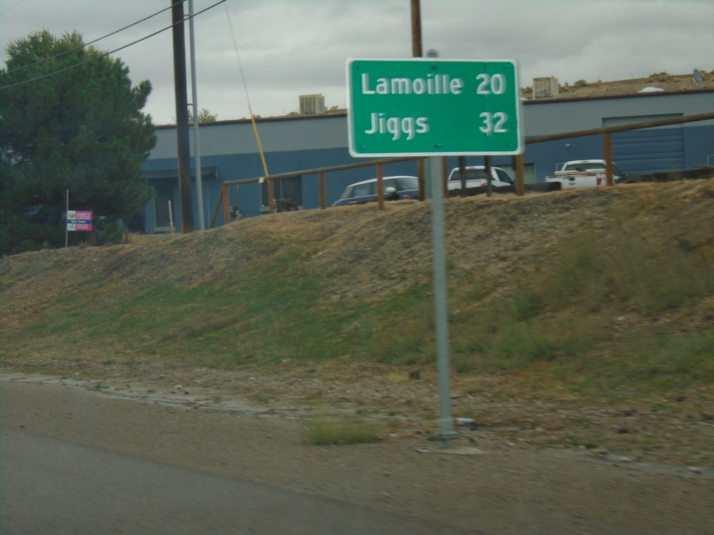
NV-227 South - Distance Marker
Distance marker on NV-227. Distance to Lamoille and Jiggs (via NV-228).
Taken 09-28-2019
 Elko
Elko County
Nevada
United States
Elko
Elko County
Nevada
United States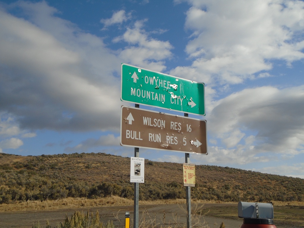
End NV-226 North
End NV-226 North in Elko County. Turn left for Owyhee and Wilson Reservoir; turn right for Mountain City and Bull Run Reservoir. Either road is unpaved.
Taken 09-28-2019
 Mountain City
Elko County
Nevada
United States
Mountain City
Elko County
Nevada
United States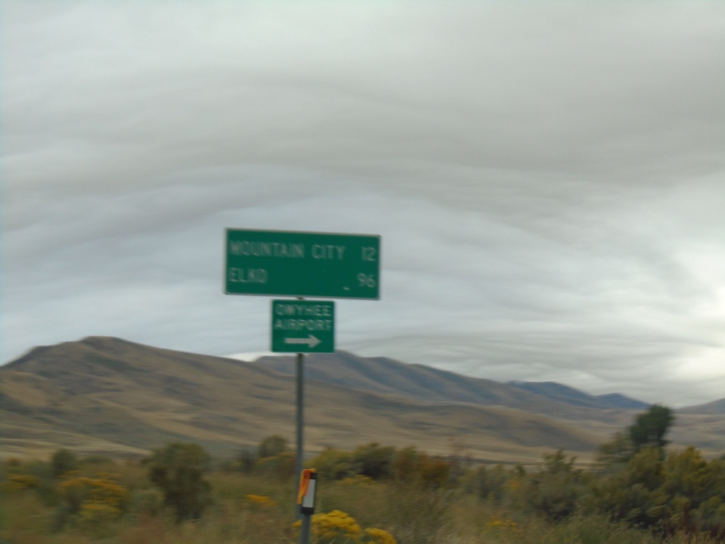
NV-225 South - Owyhee Road
NV-225 south at Owyhee Road to Owyhee Airport. Continue on NV-225 for Mountain City and Elko.
Taken 09-28-2019
 Owyhee
Elko County
Nevada
United States
Owyhee
Elko County
Nevada
United States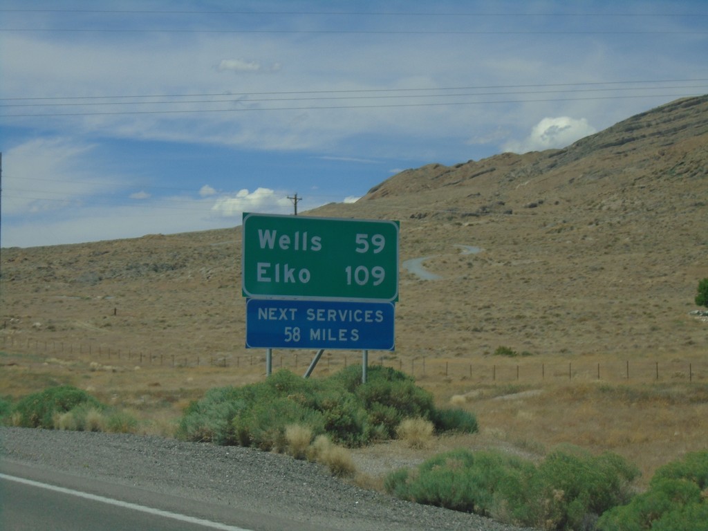
I-80 West - Distance Marker
I-80 west at first distance marker in Nevada westbound. Distance to Wells and Elko. Next services 58 miles.
Taken 08-03-2019

 West Wendover
Elko County
Nevada
United States
West Wendover
Elko County
Nevada
United States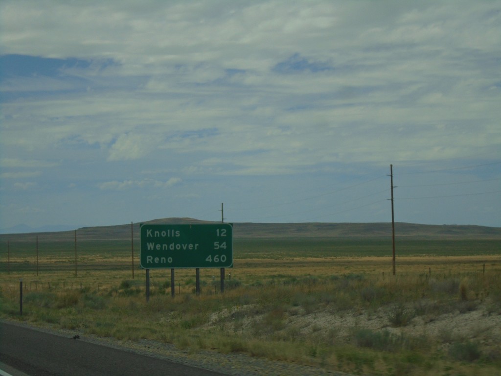
I-80 West - Distance Marker
Distance marker on I-80 west. Distance to Knolls, Wendover, and Reno (NV).
Taken 08-03-2019
Grantsville
Tooele County
Utah
United States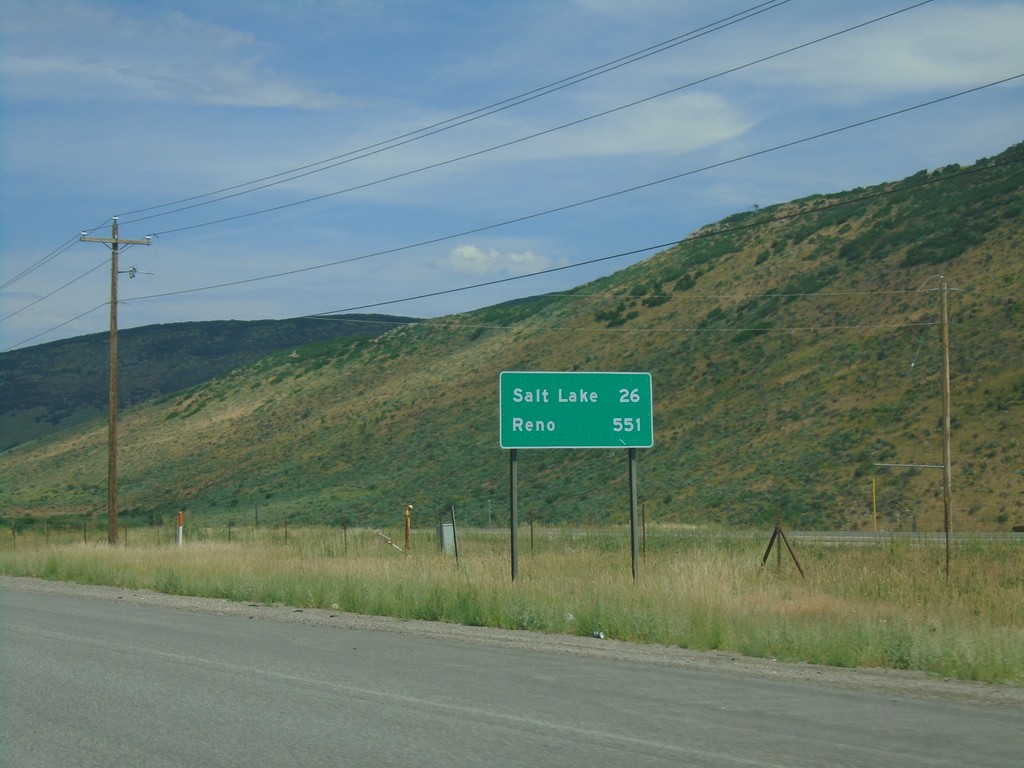
I-80 West - Distance Marker
Distance marker on I-80 west. Distance to Salt Lake and Reno (Nevada).
Taken 08-03-2019
Park City
Summit County
Utah
United States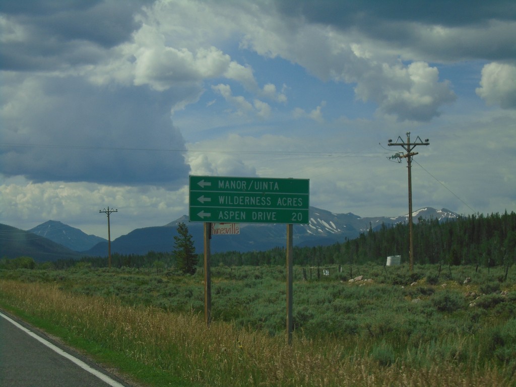
UT-150 South at Aspen Drive
UT-150 south at Aspen Drive/Manor/Uinta/Wilderness Acres.
Taken 08-03-2019
 Kamas
Summit County
Utah
United States
Kamas
Summit County
Utah
United States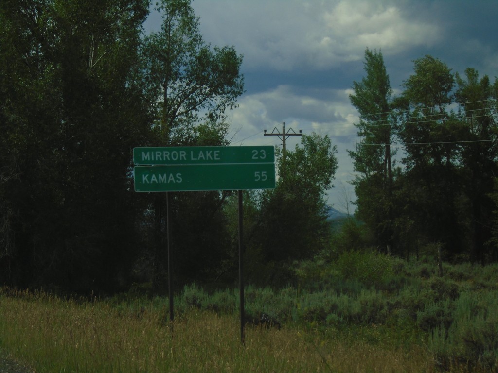
UT-150 South - Distance Marker
Distance marker on UT-150 south. Distance to Mirror Lake and Kamas.
Taken 08-03-2019
Coalville
Summit County
Utah
United States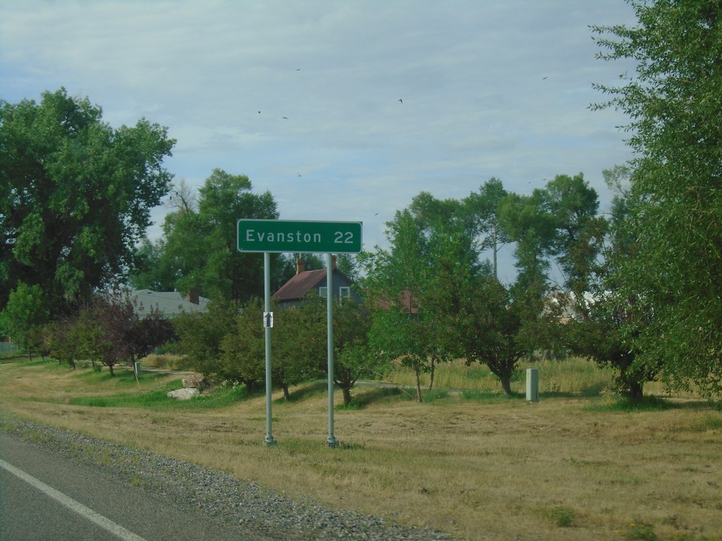
UT-16 South - Distance Marker
Distance marker on UT-16 south. Distance to Evanston (WY).
Taken 08-03-2019
 Woodruff
Rich County
Utah
United States
Woodruff
Rich County
Utah
United States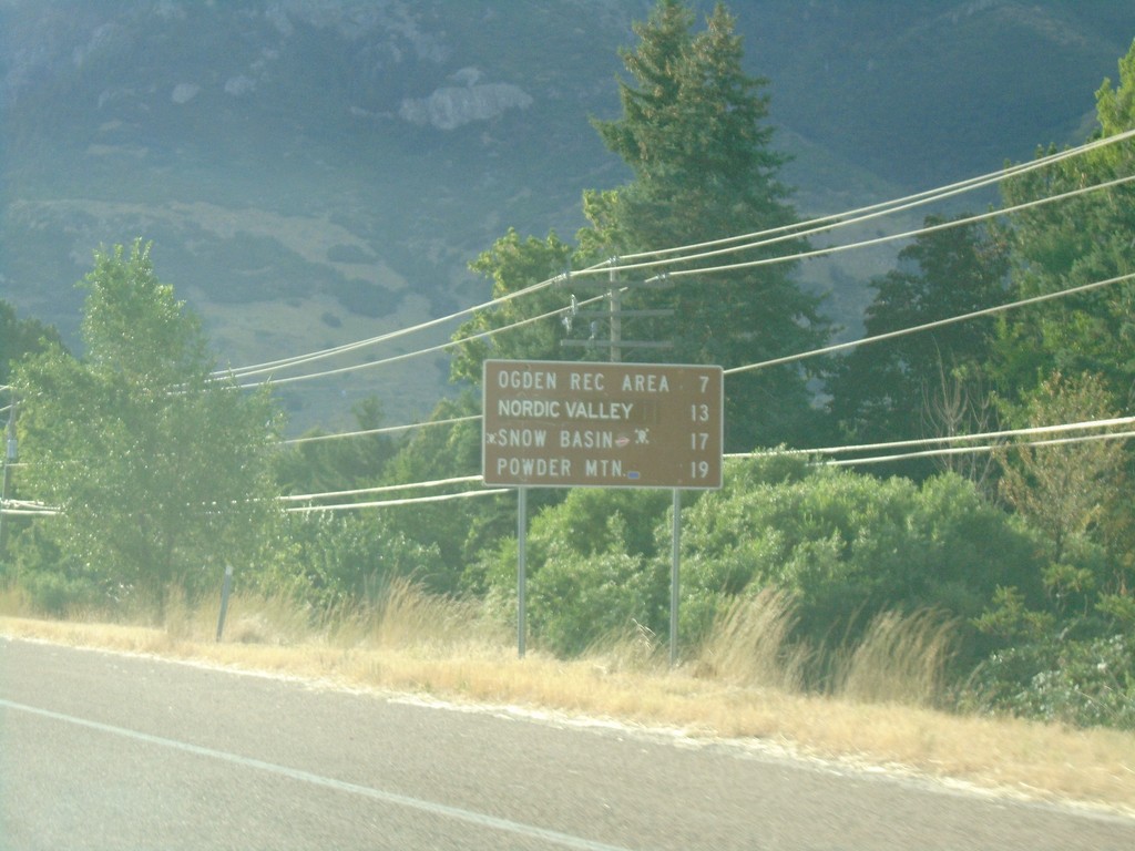
UT-39 East - Ski Areas
Distance to Ski Areas on UT-39 East. Distance to Ogden Recreation Area, Nordic Valley, Snow Basin, and Powder Mountain.
Taken 08-03-2019
 Ogden
Weber County
Utah
United States
Ogden
Weber County
Utah
United States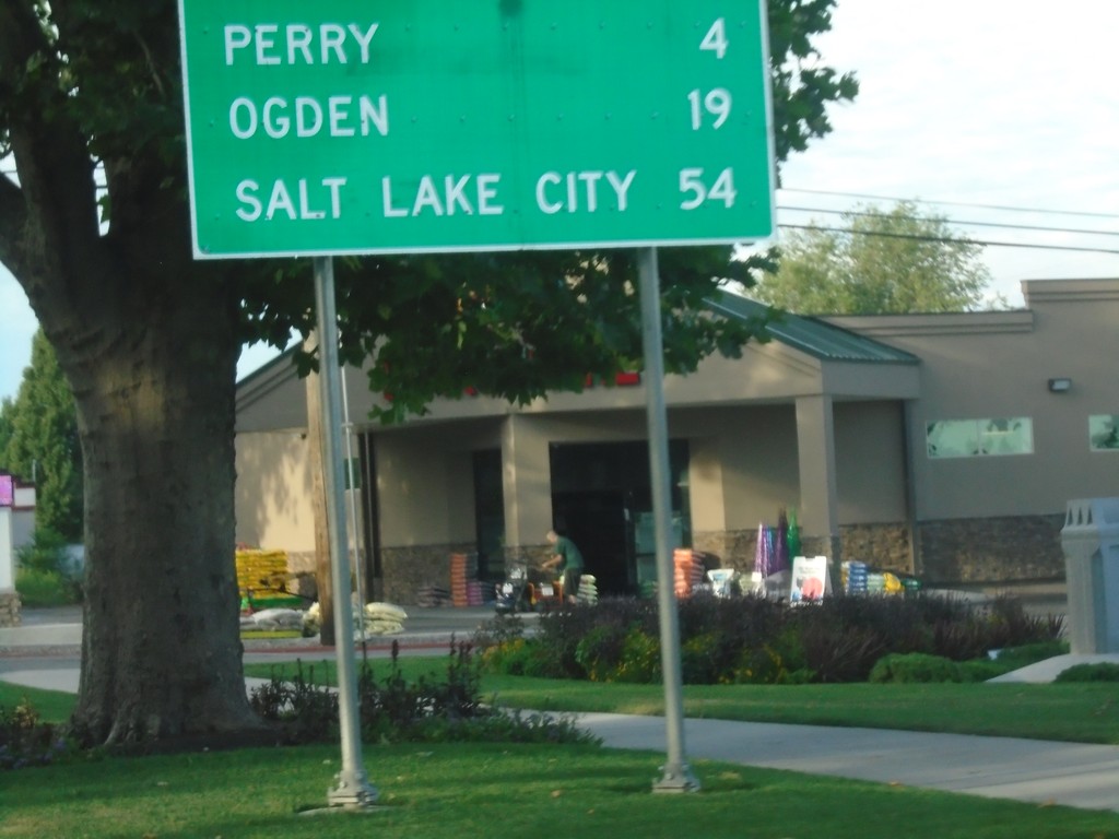
UT-13 South - Distance Marker
Distance marker on UT-13 south. Distance to Perry, Ogden, and Salt Lake City.
Taken 08-03-2019
 Brigham City
Box Elder County
Utah
United States
Brigham City
Box Elder County
Utah
United States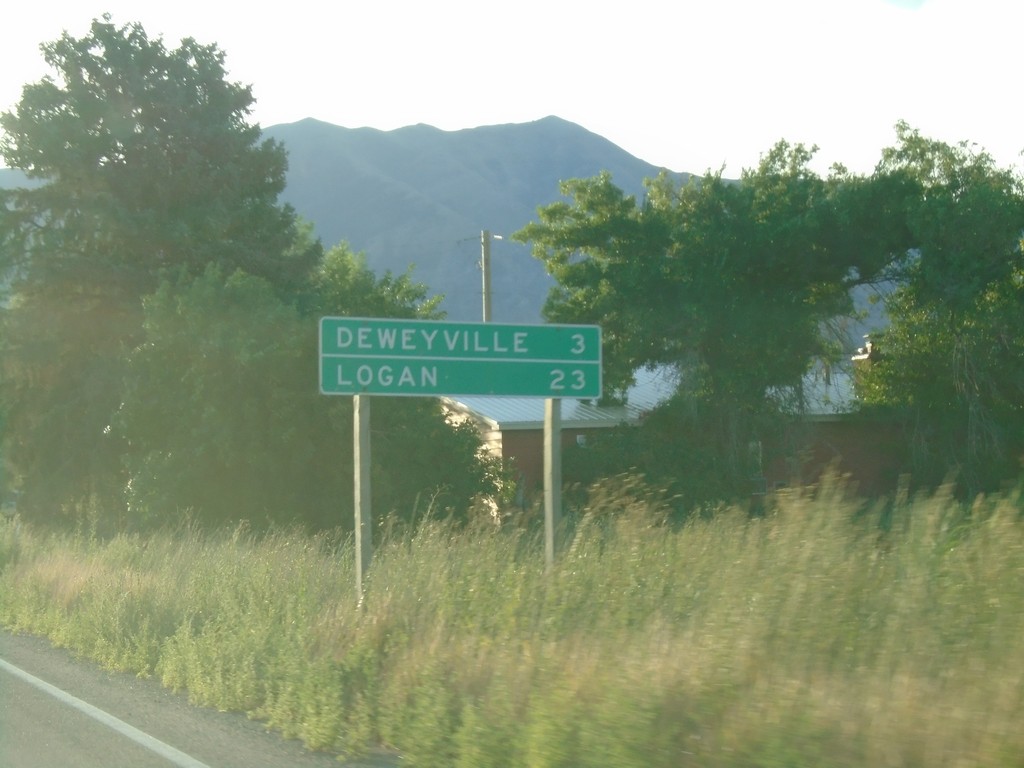
UT-102 East - Distance Marker
Distance marker on UT-102 East. Distance to Deweyville, and Logan.
Taken 08-03-2019
 Tremonton
Box Elder County
Utah
United States
Tremonton
Box Elder County
Utah
United States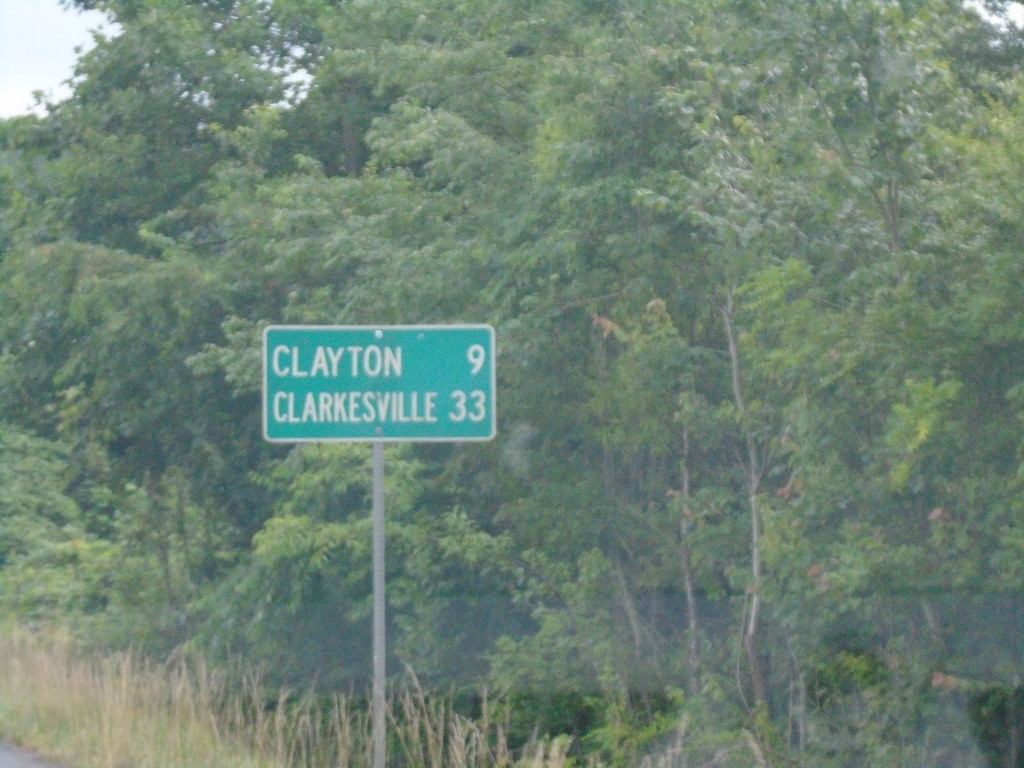
US-23 South/US-441 South - Distance Marker
Distance marker on US-23 South/US-441 South. Distance to Clayton and Clarkesville.
Taken 06-24-2019


 Dillard
Rabun County
Georgia
United States
Dillard
Rabun County
Georgia
United States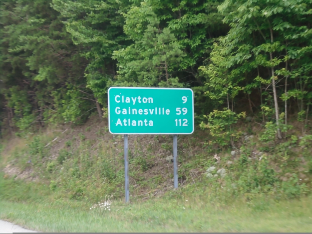
US-23 South/US-441 South - Distance Marker
Distance marker on US-23 South/US-441 South. Distance to Clayton (GA), Gainesville (GA), and Atlanta (GA).
Taken 06-24-2019
Otto
Macon County
North Carolina
United States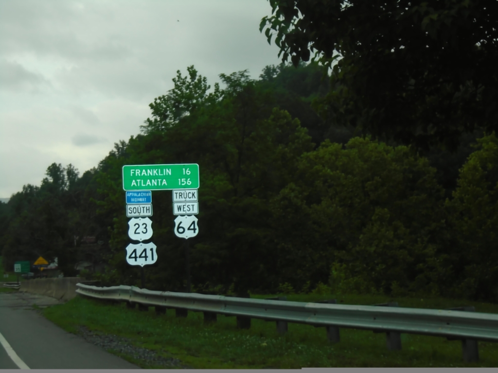
US-23 South/US-441 South/Truck US-64 West - Distance Marker
Distance Marker on US-23 South/US-441 South/Truck US-64 West. Distance to Franklin and Atlanta (GA). This route is part of the Appalachian Development Highway System.
Taken 06-24-2019
Dillsboro
Jackson County
North Carolina
United States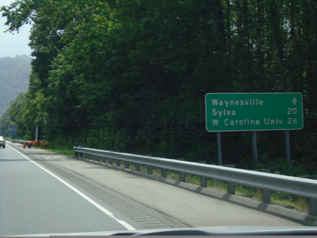
US-23 South/US-74 West - Distance Marker
Distance marker on US-23 South/US-74 West - Distance to Waynesville, Sylva, Western Carolina University.
Taken 06-24-2019
 Waynesville
Haywood County
North Carolina
United States
Waynesville
Haywood County
North Carolina
United States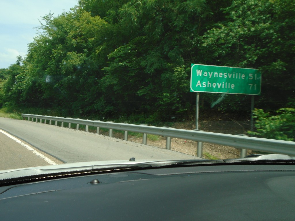
I-40 East - Distance Marker
Distance marker on I-40 east. Distance to Waynesville (NC) and Asheville (NC).
Taken 06-24-2019
 Newport
Cocke County
Tennessee
United States
Newport
Cocke County
Tennessee
United States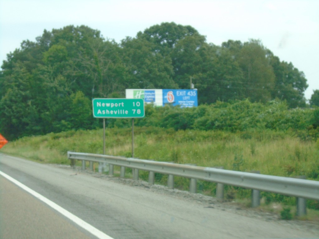
I-40 East - Distance Marker
Distance marker on I-40 East. Distance to Newport and Asheville (NC).
Taken 06-24-2019
Dandridge
Jefferson County
Tennessee
United States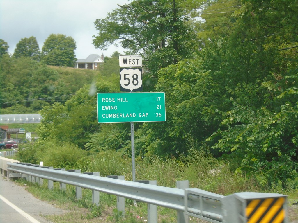
US-58 West - Distance Marker
Distance marker on US-58 west. Distance to Rose Hill, Ewing, and Cumberland Gap (TN).
Taken 06-24-2019
 Jonesville
Lee County
Virginia
United States
Jonesville
Lee County
Virginia
United States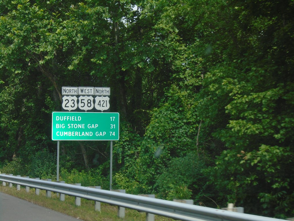
US-23 North/US-58 West/US-421 North - Distance Marker
Distance Marker on US-23 North/US-58 West/US-421 North. Distance to Duffield, Big Stone Gap, and Cumberland Gap.
Taken 06-24-2019
 Gate City
Scott County
Virginia
United States
Gate City
Scott County
Virginia
United States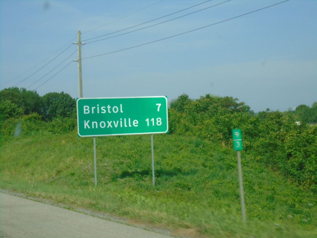
I-81 South - Distance Marker
Distance marker on I-81 south. Distance to Bristol and Knoxville (TN).
Taken 06-24-2019
 Bristol
Washington County
Virginia
United States
Bristol
Washington County
Virginia
United States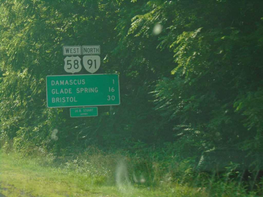
US-58 West/VA-91 North - Distance Marker
Distance Marker on US-58 West/VA-91 North. Distance to Damascus, Glade Spring, and Bristol. US-58 is the Jeb Stewart Highway.
Taken 06-23-2019
 Damascus
Washington County
Virginia
United States
Damascus
Washington County
Virginia
United States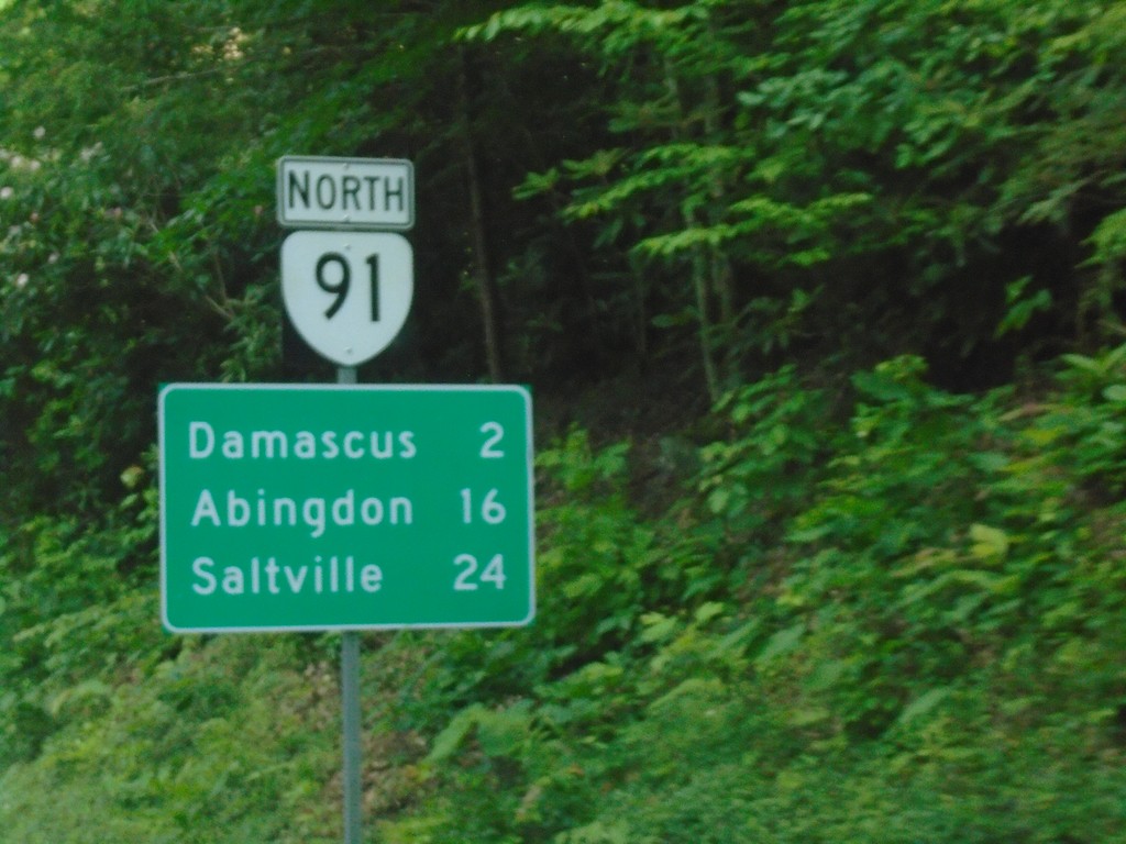
VA-91 North - Distance Marker
Distance marker on VA-91 north. Distance to Damascus, Abingdon, and Saltville.
Taken 06-23-2019
Damascus
Washington County
Virginia
United States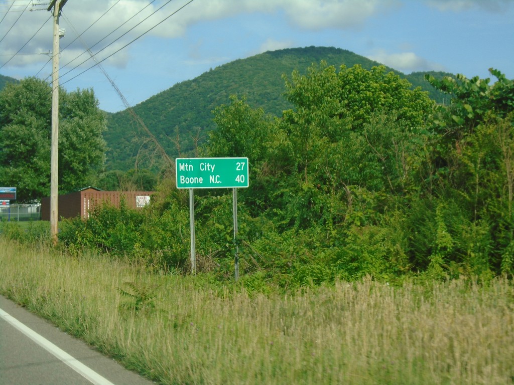
US-321 South/TN-67 - Distance Marker
Distance Marker on US-321 South/TN-67 East. Distance to Mountain City and Boone, NC.
Taken 06-23-2019

 Hampton
Carter County
Tennessee
United States
Hampton
Carter County
Tennessee
United States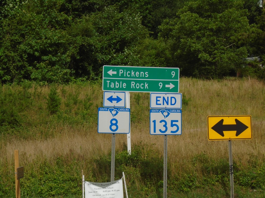
End SC-135 North at SC-8
End SC-135 North at SC-8. Turn right for SC-8 to Table Rock; left for SC-8 to Pickens.
Taken 06-23-2019

 Pickens
 County
South Carolina
United States
Pickens
Pickens County
South Carolina
United States