Signs Tagged With Distance Marker
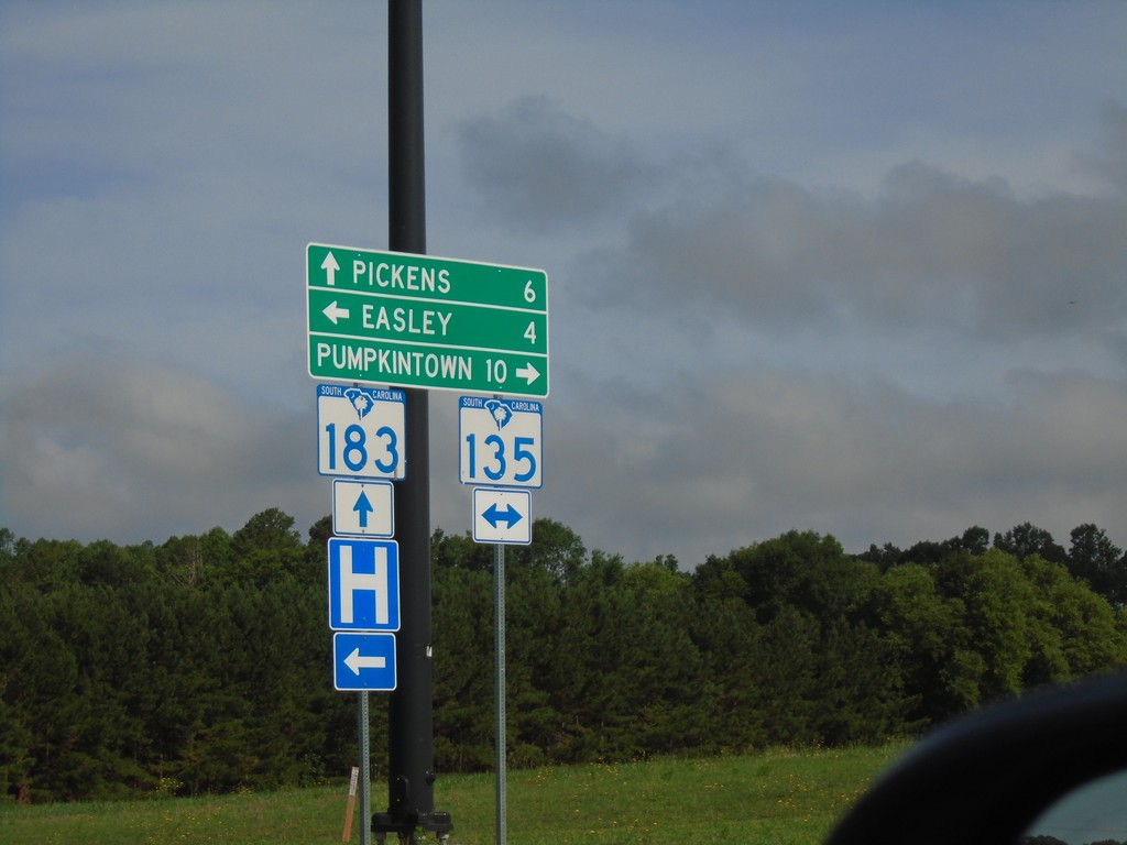
SC-183 West at SC-135
SC-183 West at SC-135 in Easley. Turn right for SC-135 North to Pumpkintown; left for SC-135 South to Easley. Continue straight on SC-183 for Pickens.
Taken 06-23-2019

 Easley
Pickens County
South Carolina
United States
Easley
Pickens County
South Carolina
United States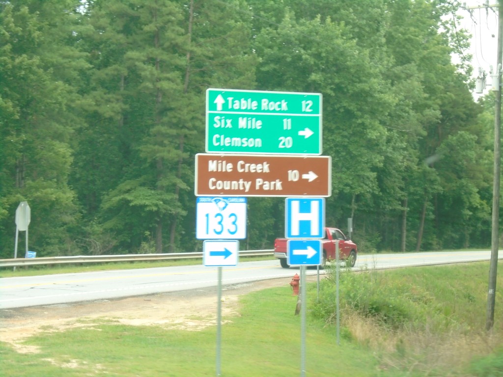
SC-11 East at SC-133
SC-11 East at SC-133 South to Six Mile, Clemson, and Mile Creek County Park. Continue east on SC-11 for Table Rock.
Taken 06-22-2019

 Sunset
Pickens County
South Carolina
United States
Sunset
Pickens County
South Carolina
United States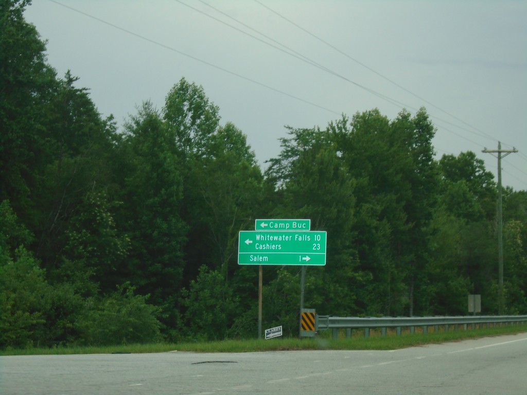
SC-11 East at SC-130 - Salem
SC-11 East at SC-130 in Salem. Turn left for SC-130 north to Camp Buc, Whitewater Falls, and Cashiers (NC). Turn right for SC-130 south to Salem.
Taken 06-22-2019
 Salem
Oconee County
South Carolina
United States
Salem
Oconee County
South Carolina
United States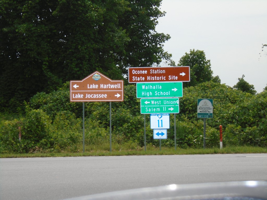
Connector from SC-183 to SC-11 at SC-11
Connector from SC-183 to SC-11 at SC-11 in Oconee County. Turn left for SC-11 west to West Union and Lake Hartwell; turn right for SC-11 east to Salem, Walhalla High School and Lake Jocassee.
Taken 06-22-2019
Walhalla
Oconee County
South Carolina
United States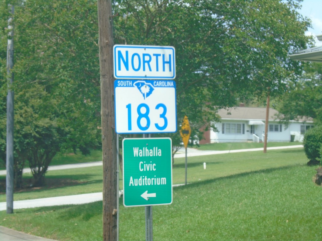
SC-183 North - Walhalla
SC-183 north in Walhalla. Turn left on North Broad St. for the Walhalla Civic Auditorium.
Taken 06-22-2019
Walhalla
Oconee County
South Carolina
United States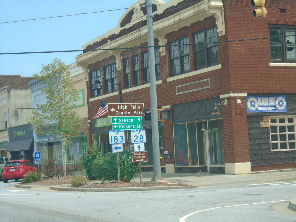
SC-28 South/SC-183 North at SC-28/SC-183 Split
SC-28 South/SC-183 North at SC-28/SC-183 split in Walhalla. Turn left for SC-183 north to Pickens and High Rock State Park; continue straight for SC-28 south to Seneca.
Taken 06-22-2019
 Walhalla
Oconee County
South Carolina
United States
Walhalla
Oconee County
South Carolina
United States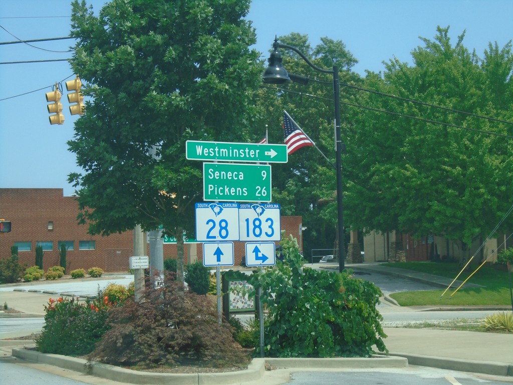
SC-28 South at SC-183 - Walhalla
SC-28 South at SC-183 in Walhalla. Turn left for SC-183 south to Westminster. Continue on SC-28 South/SC-183 North to Seneca (via SC-28) and Pickens (via SC-183).
Taken 06-22-2019
Walhalla
Oconee County
South Carolina
United States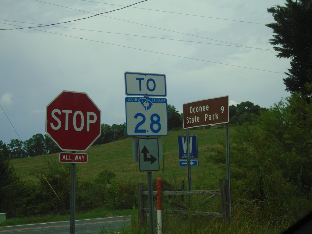
Chattoga Ridge Road at Whetstone Road
Chattoga Ridge Road at Whetstone Road. Use Chattoga Ridge Road or Whetstone Road for SC-28. Use Whetstone Road south for Oconee State Park.
Taken 06-22-2019
Mountain Rest
Oconee County
South Carolina
United States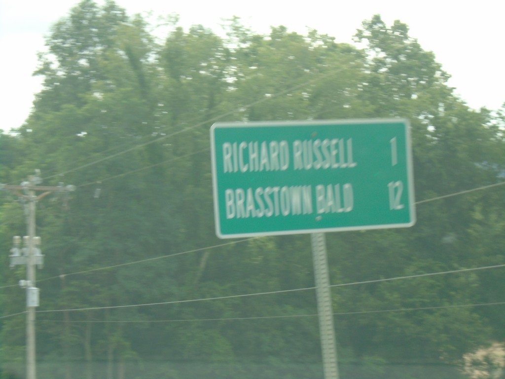
GA-180 East - Distance Marker
Distance marker on GA-180 east. Distance to Richard Russell and Brasstown Bald.
Taken 06-22-2019
 Blairsville
Union County
Georgia
United States
Blairsville
Union County
Georgia
United States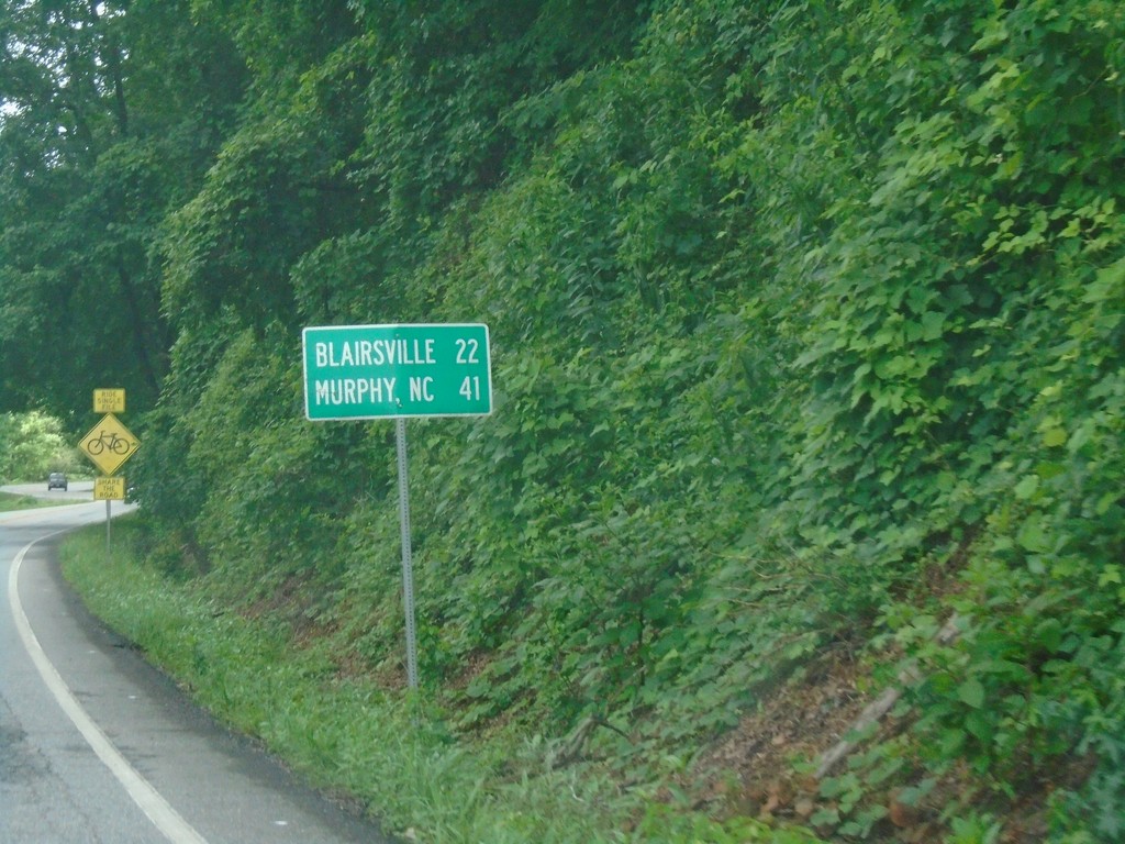
US-19/US-129/GA-11 North - Distance Marker
Distance maker on US-19/US-129/GA-11 north. Distance to Blairsville and Murphy (NC).
Taken 06-22-2019


 Cleveland
Lumpkin County
Georgia
United States
Cleveland
Lumpkin County
Georgia
United States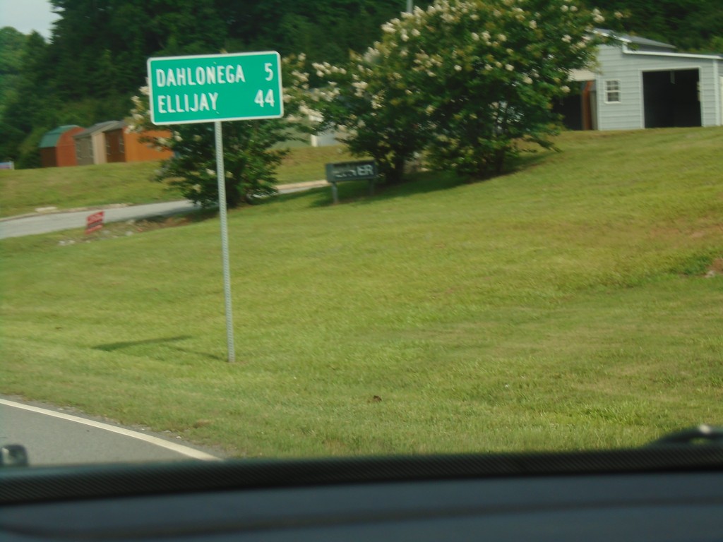
US-19/GA-60 North - Distance Marker
Distance Marker on US-19/GA-60 North. Distance to Dahlonega and Ellijay.
Taken 06-22-2019
 Dahlonega
Lumpkin County
Georgia
United States
Dahlonega
Lumpkin County
Georgia
United States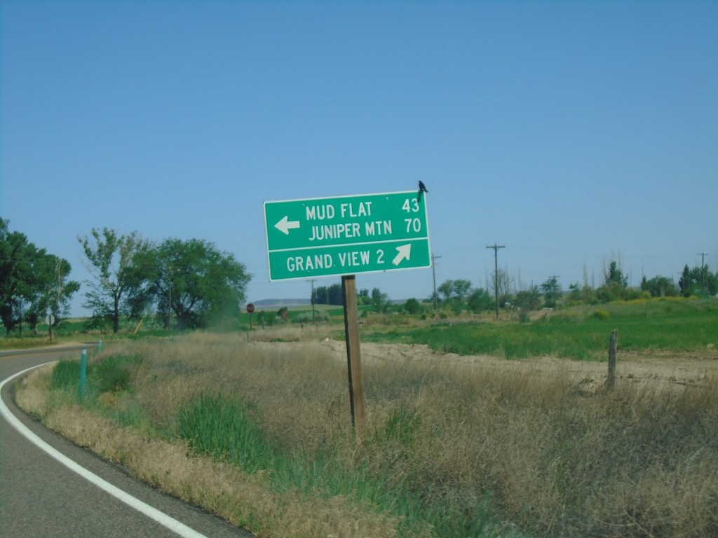
ID-78 West at Mud Flat Road
ID-78 west at Mud Flat Road to Mud Flat and Juniper Mountain. Continue west on ID-78 for Grand View.
Taken 06-15-2019
 Grand View
Owyhee County
Idaho
United States
Grand View
Owyhee County
Idaho
United States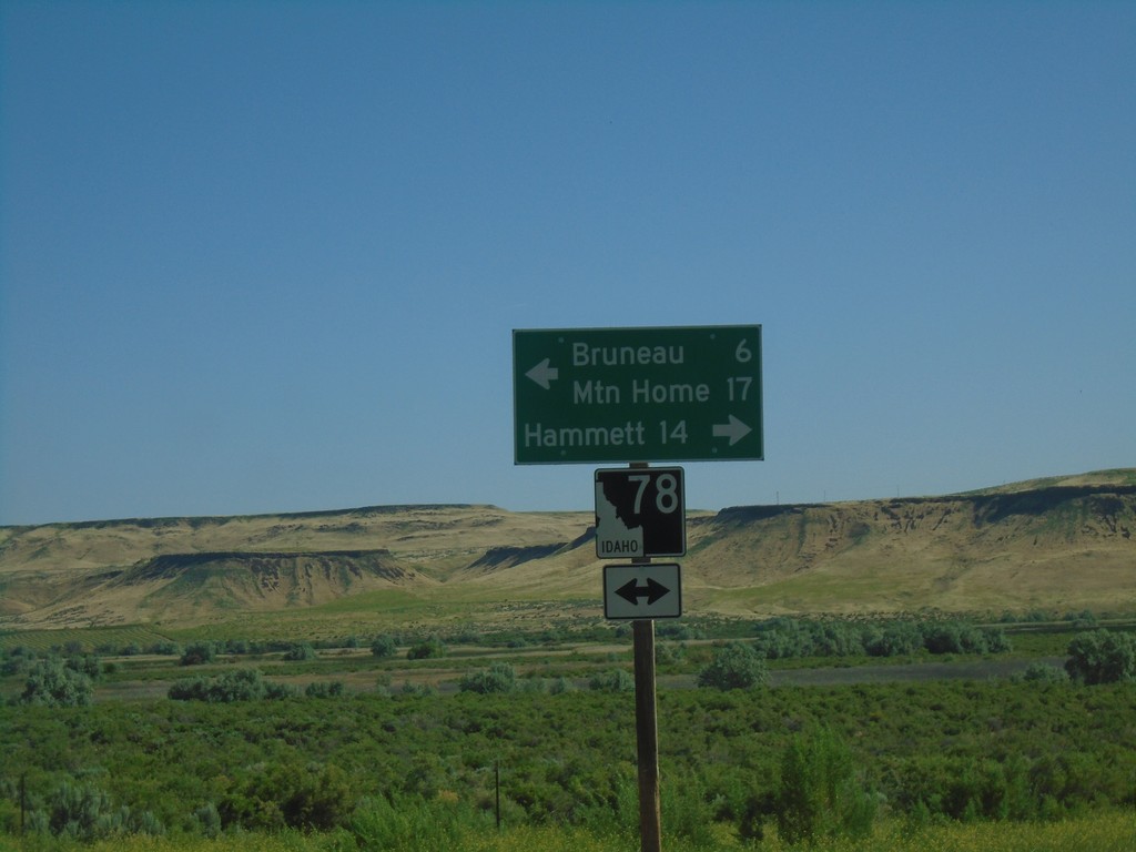
Bruneau Dunes State Park Road at ID-78
Bruneau Dunes State Park Road at ID-78 in Owyhee County. Turn right for ID-78 east to Hammett; turn left for ID-78 west to Mountain Home and Bruneau.
Taken 06-15-2019
Bruneau
Owyhee County
Idaho
United States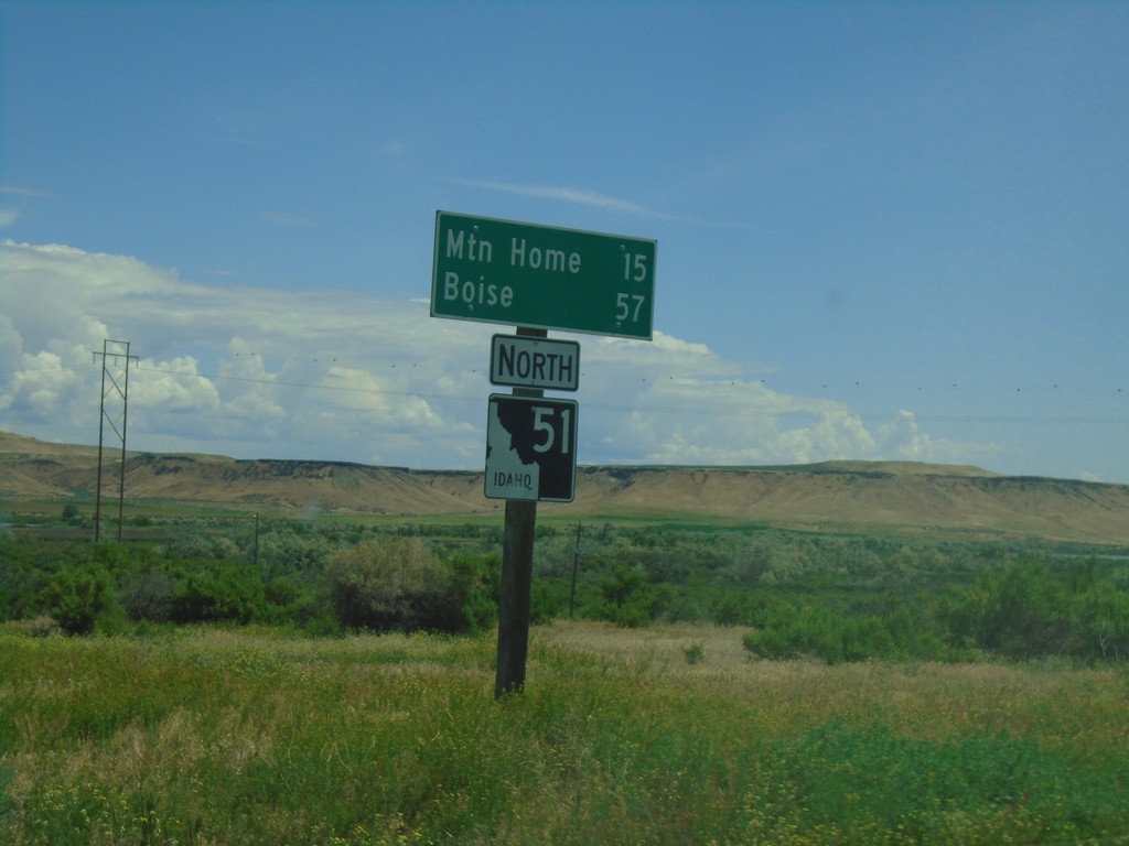
ID-51 North - Distance Marker
Distance marker on ID-51 north to Mountain Home and Boise.
Taken 06-01-2019
 Bruneau
Owyhee County
Idaho
United States
Bruneau
Owyhee County
Idaho
United States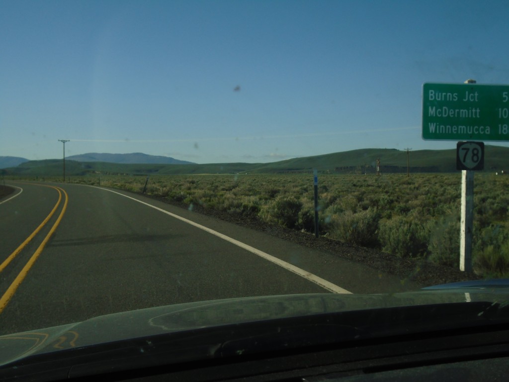
OR-78 East - Distance Marker
Distance marker on OR-78 east. Distance to Burns Jct., McDermitt (via US-95) and Winnemucca (Nevada via US-95).
Taken 04-28-2019
 Princeton
Harney County
Oregon
United States
Princeton
Harney County
Oregon
United States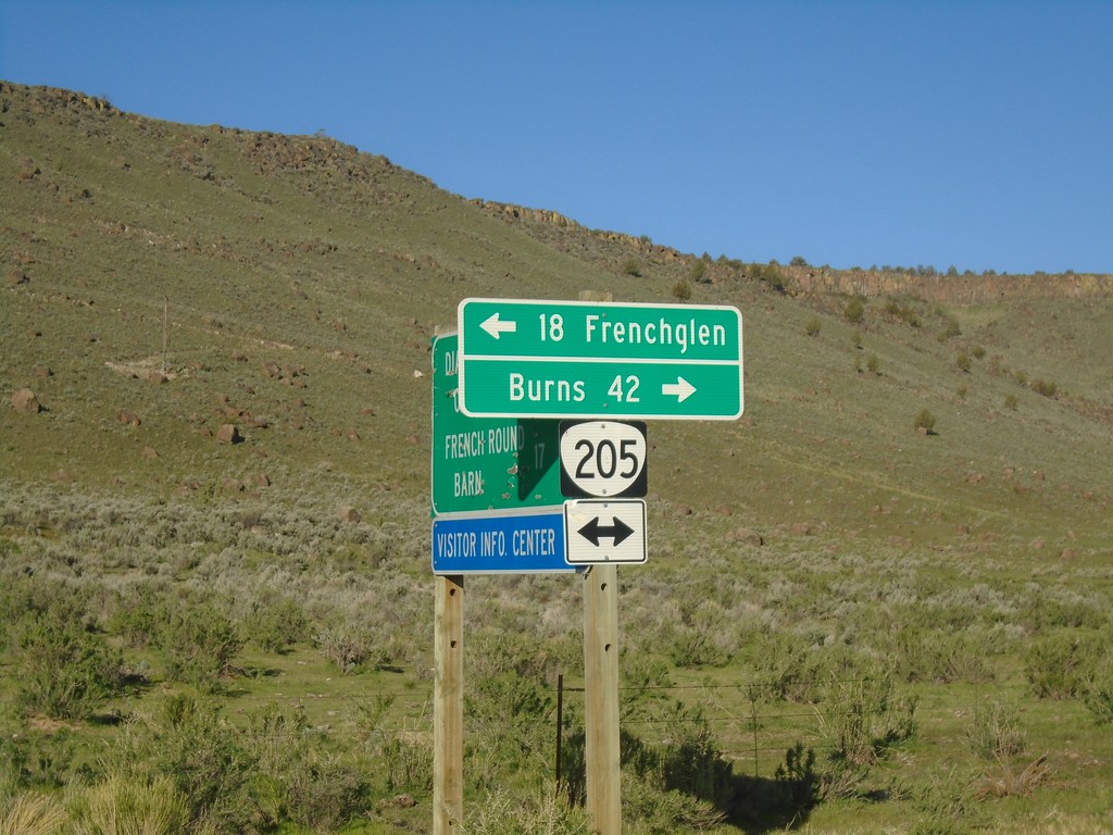
Diamond-Grain Camp Rd at OR-205
End CR-409 at OR-205 to Frenchglen and Burns
Taken 04-28-2019
 Diamond
Harney County
Oregon
United States
Diamond
Harney County
Oregon
United States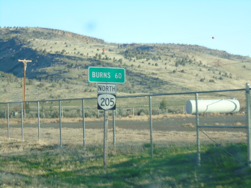
OR-205 North - Distance Marker
Distance marker on OR-205 north. Distance to Burns.
Taken 04-28-2019
Harney County
Oregon
United States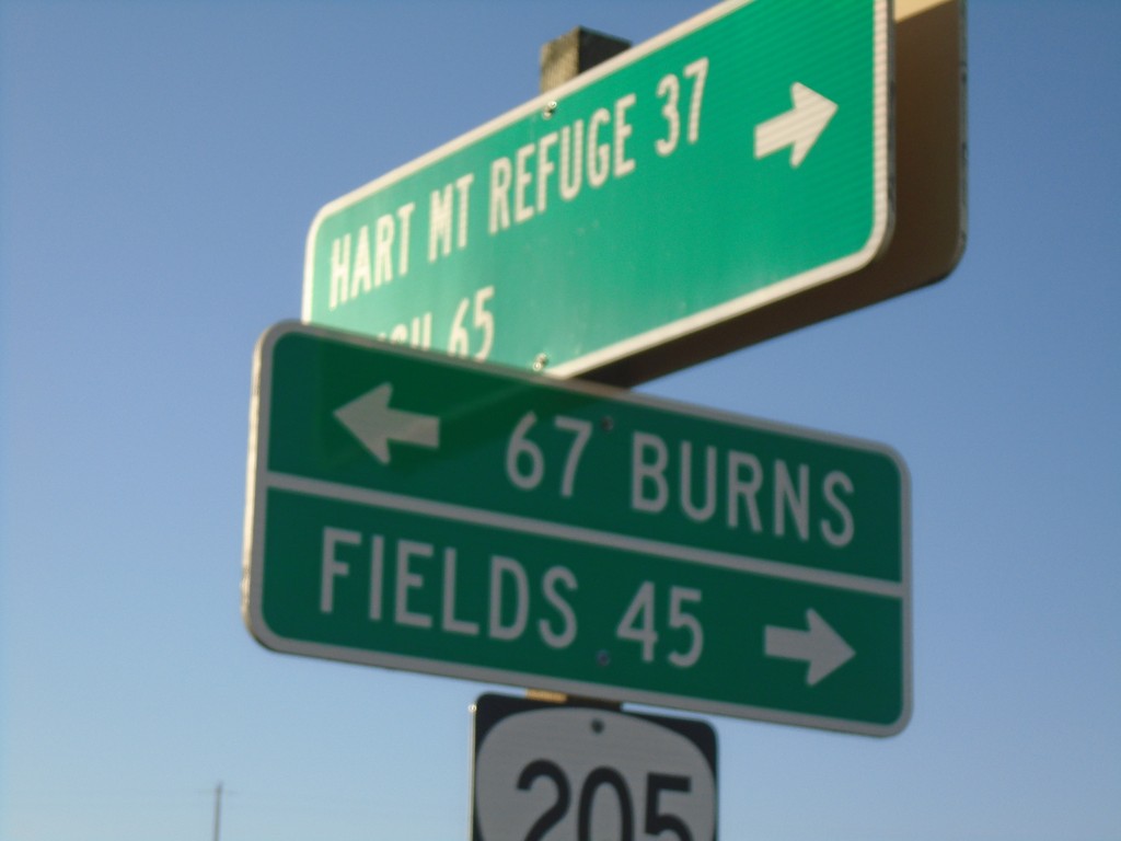
End Rock Creek Road at OR-205
End Rock Creek Road at OR-205 in Harney County. Turn right for Fields; left for Burns. Use Rock Creek Road for Hart Mountain Refuge and Plush.
Taken 04-28-2019
Harney County
Oregon
United States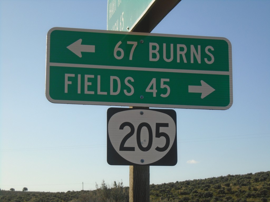
End Rock Creek Road at OR-205
End Rock Creek Road at OR-205 in Harney County. Turn right for Fields; left for Burns.
Taken 04-28-2019
Harney County
Oregon
United States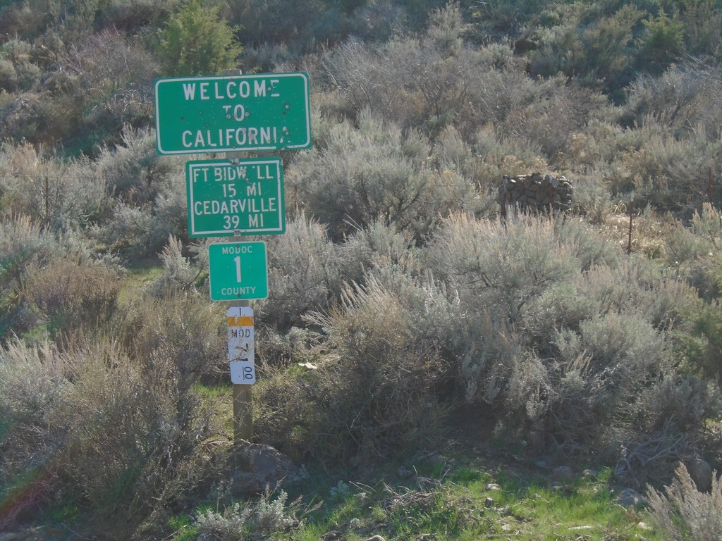
Entering California - Modoc County Highway 1
Entering California on Modoc County Highway 1 south. Distance to Fort Bidwell and Cedarville. Taken on the road between Adel, Oregon and Cedarville, California.
Taken 04-27-2019
 Adel
Modoc County
California
United States
Adel
Modoc County
California
United States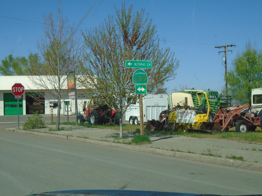
CH-1 (Main St.) at CA-299 - Cedarville
CH-1 (Main St.) at CA-299 in Cedarville. Turn left for CA-299 west to Alturas.
Taken 04-27-2019
 Alturas
Modoc County
California
United States
Alturas
Modoc County
California
United States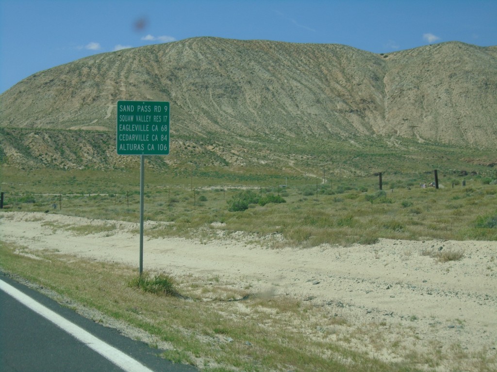
CH-447 North - Distance Marker
Distance marker on CH-447 North. Distance to Sand Pass Road, Squaw Valley Reservoir, Eagleville (California), Cedarville (California), and Alturas (California).
Taken 04-27-2019
 Gerlach
Washoe County
Nevada
United States
Gerlach
Washoe County
Nevada
United States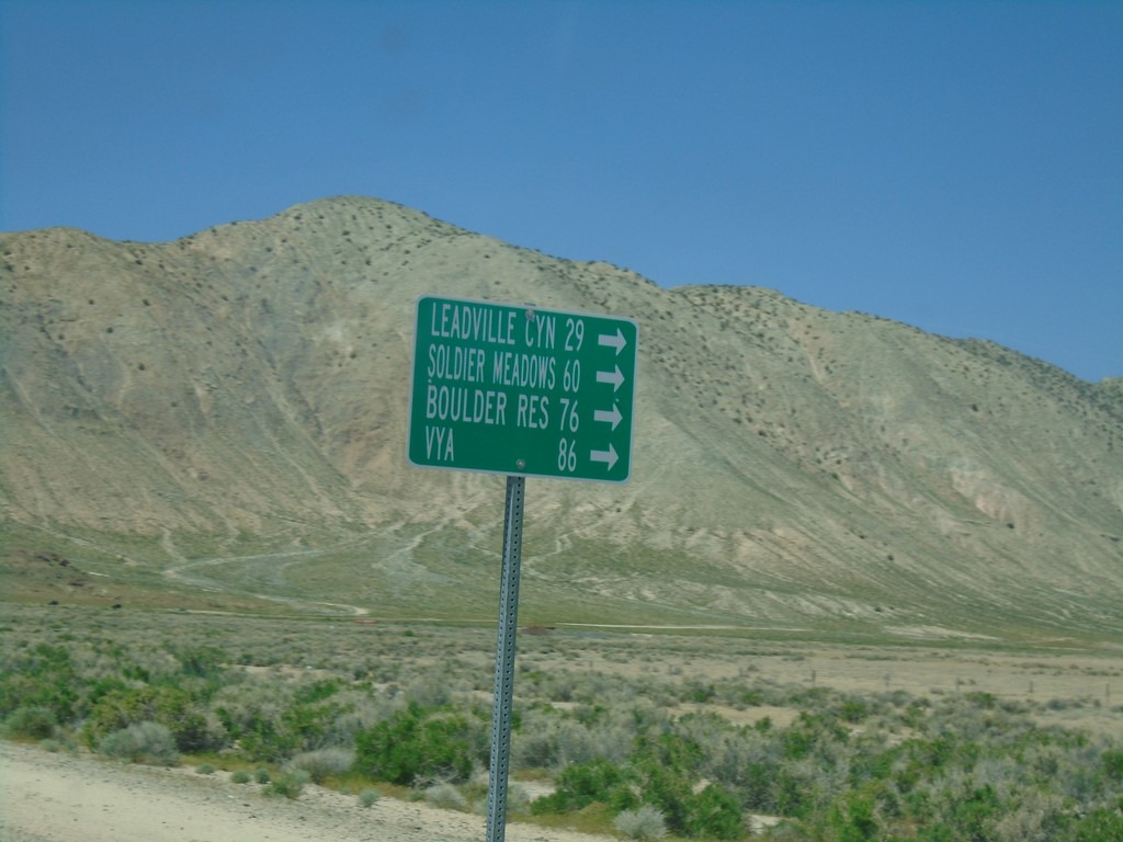
CH-447 North at CH-34
CH-447 North at CH-34 near Gerlach. Use CH-34 north for Leadville Canyon, Soldier Meadows, Boulder Reservoir, and Vya.
Taken 04-27-2019
 Gerlach
Washoe County
Nevada
United States
Gerlach
Washoe County
Nevada
United States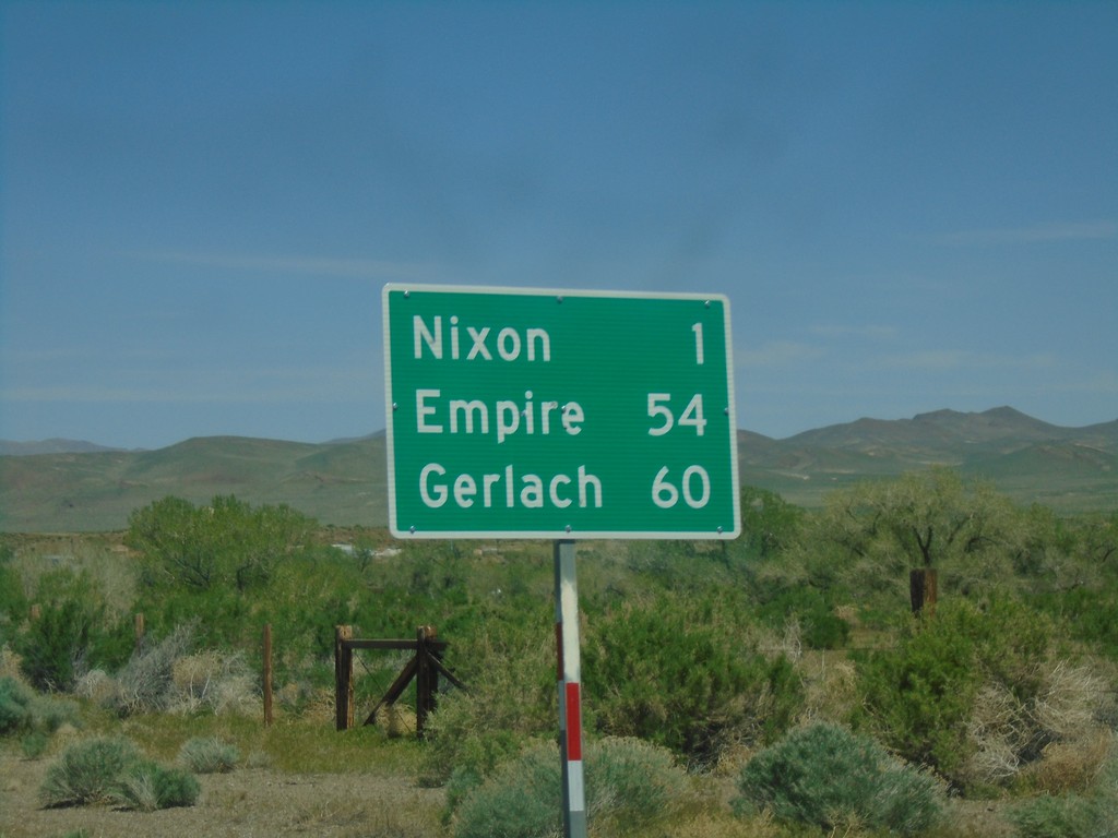
NV-447 North - Distance Marker
Distance marker on NV-447 north. Distance to Nixon, Empire and Gerlach.
Taken 04-27-2019
 Nixon
Washoe County
Nevada
United States
Nixon
Washoe County
Nevada
United States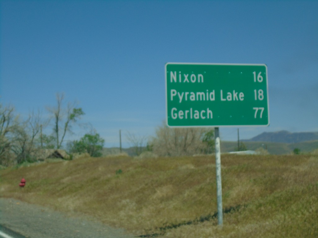
NV-447 North - Distance Marker
Distance marker on NV-447 North. Distance to Nixon, Pyramid Lake, and Gerlach.
Taken 04-27-2019
Sparks
Washoe County
Nevada
United States