Signs Tagged With Distance Marker
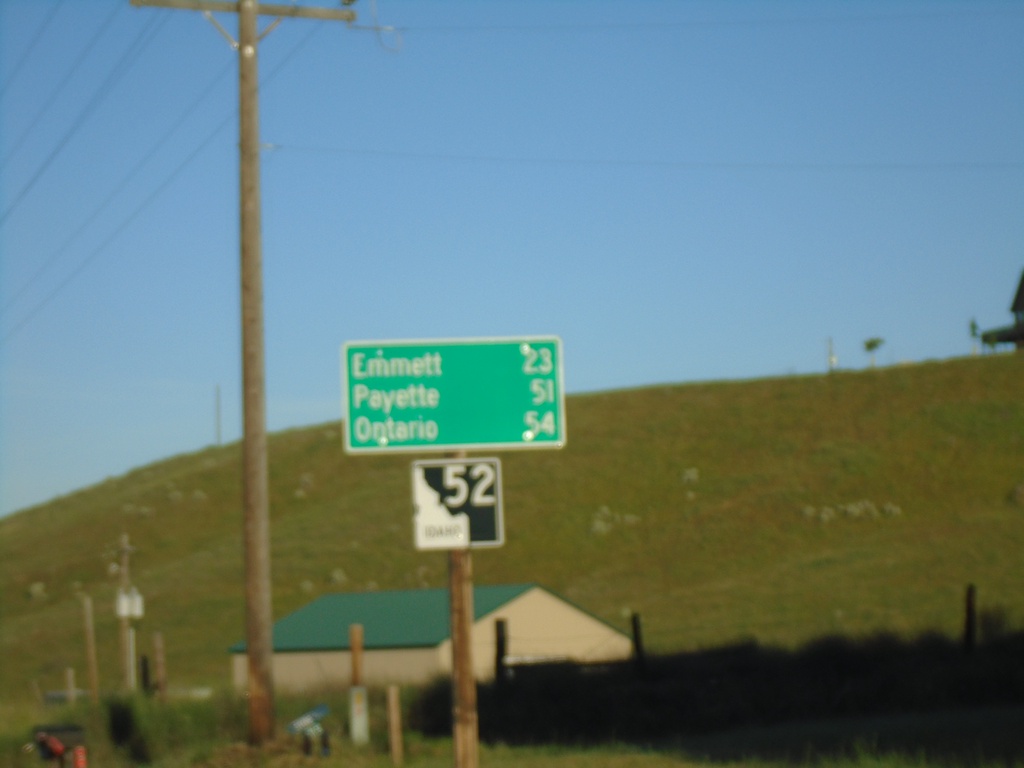
ID-52 West - Distance Marker
Distance marker on ID-52 west. Distance to Emmett, Payette, and Ontario.
Taken 06-19-2020
 Horseshoe Bend
Boise County
Idaho
United States
Horseshoe Bend
Boise County
Idaho
United States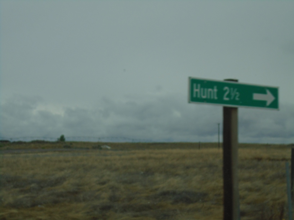
ID-25 West - Hunt Jct.
ID-25 west at Hunt Jct. Hunt is the site of the Minidoka War Relocation Center, a Japanese Internment Camp during World War 2.
Taken 05-22-2020
 Jerome
 County
Idaho
United States
Jerome
Jerome County
Idaho
United States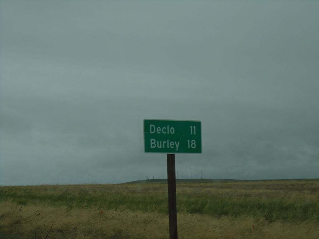
ID-81 North - Distance Marker
Distance marker on ID-81 north. Distance to Declo and Burley.
Taken 05-22-2020
 Declo
Cassia County
Idaho
United States
Declo
Cassia County
Idaho
United States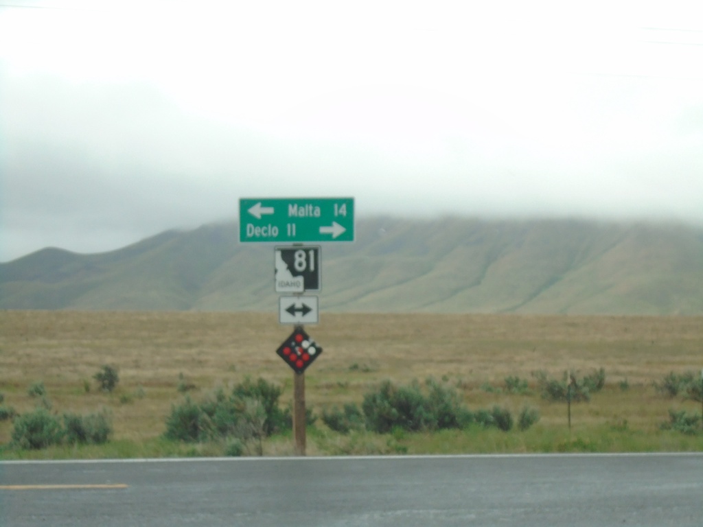
End Yale Road at ID-81
End Yale Road at ID-81. Turn left for ID-81 south to Malta; right for ID-81 north to Declo.
Taken 05-22-2020
Declo
Cassia County
Idaho
United States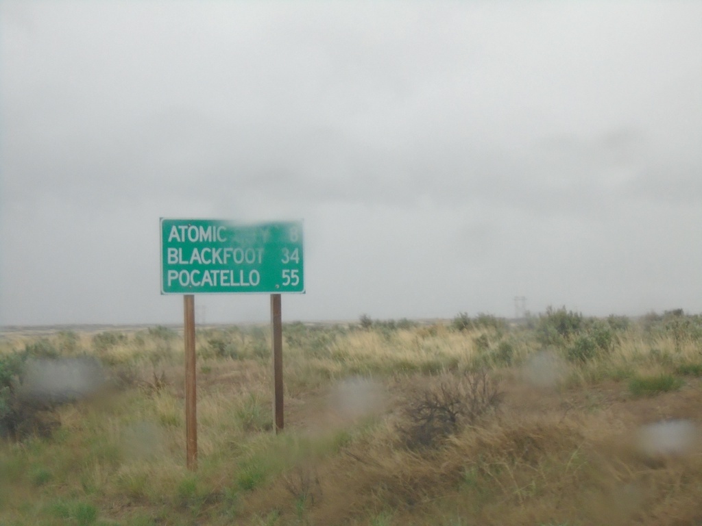
US-26 East - Distance Marker
Distance marker on US-26 east. Distance to Atomic City, Blackfoot, and Pocatello.
Taken 05-22-2020
 Blackfoot
Butte County
Idaho
United States
Blackfoot
Butte County
Idaho
United States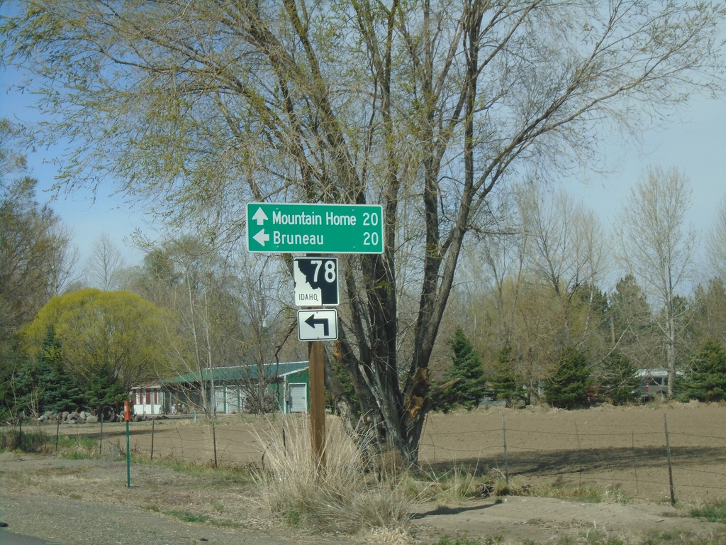
Old US-30 West Approaching ID-78
Old US-30 West approaching ID-78 in Hammett. Turn left for ID-78 west to Bruneau. Continue straight for ID-78 east to Mountain Home.
Taken 04-04-2020
 Hammett
Elmore County
Idaho
United States
Hammett
Elmore County
Idaho
United States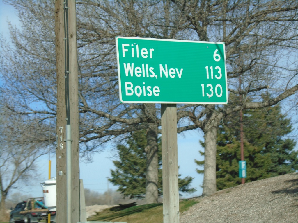
US-30 East/Bus. US-93 South - Distance Marker
Distance marker on US-30 East/Bus. US-93 South. Distance to Filer, Wells, Nev. (via US-93), and Boise.
Taken 04-04-2020

 Twin Falls
 County
Idaho
United States
Twin Falls
Twin Falls County
Idaho
United States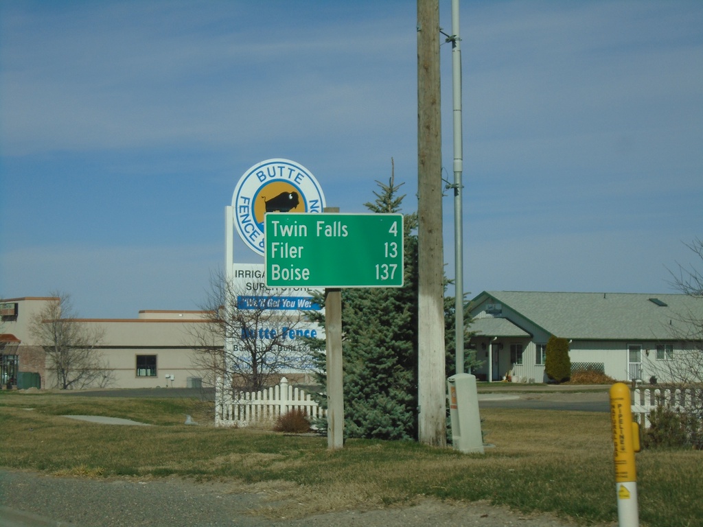
US-30 West - Distance Marker
Distance marker on US-30 west. Distance to Twin Falls, Filer, and Boise.
Taken 04-04-2020
Kimberly
Twin Falls County
Idaho
United States
ID-50 South - Distance Marker
Distance marker on ID-50 south. Distance to Kimberly and Twin Falls.
Taken 04-04-2020
 Eden
Jerome County
Idaho
United States
Eden
Jerome County
Idaho
United States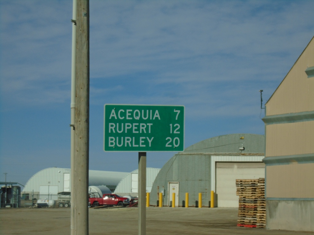
ID-24 East - Distance Marker
Distance market on ID-24 east. Distance to Acequia, Rupert, and Burley.
Taken 04-04-2020
 Minidoka
 County
Idaho
United States
Minidoka
Minidoka County
Idaho
United States
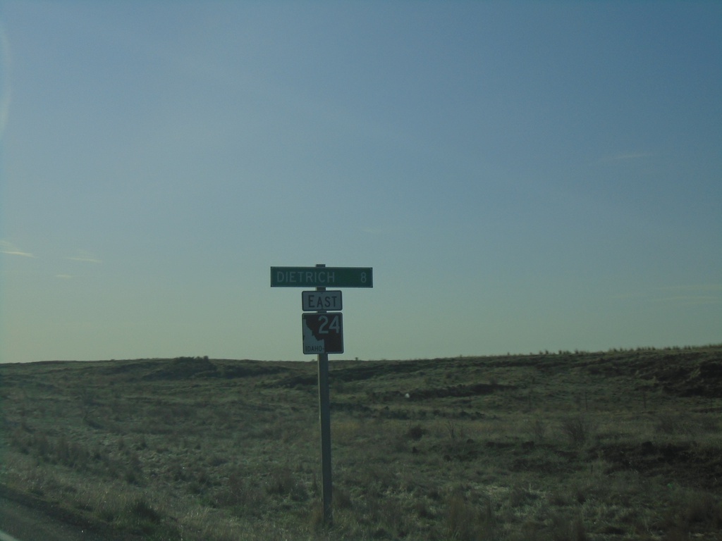
ID-24 East - Distance Marker
Distance marker on ID-24 east. Distance to Dietrich.
Taken 04-04-2020
Shoshone
Lincoln County
Idaho
United States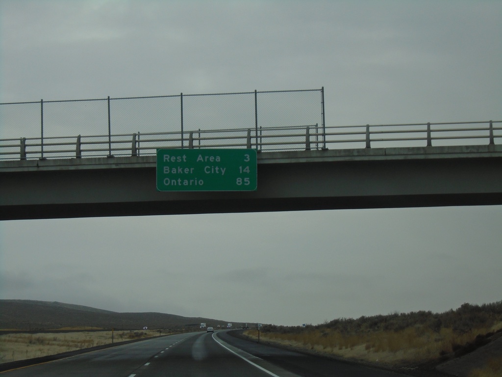
I-84 East - Distance Marker
Distance marker on I-84 east. Distance to Rest Area, Baker City, and Ontario.
Taken 12-29-2019
 Baker City
Baker County
Oregon
United States
Baker City
Baker County
Oregon
United States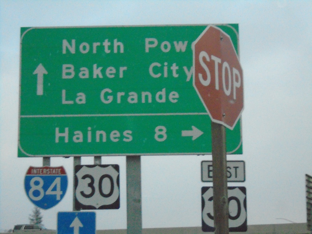
River Lane East at US-30 East And Approaching I-84
River Lane East at US-30 East to Haines. Approaching onramp for I-84. Use I-84 east to Baker City; I-84 West/US-30 West for La Grande. OR-237 North begins at the I-84 interchange. Use OR-237 for North Powder.
Taken 12-27-2019
 North Powder
Union County
Oregon
United States
North Powder
Union County
Oregon
United States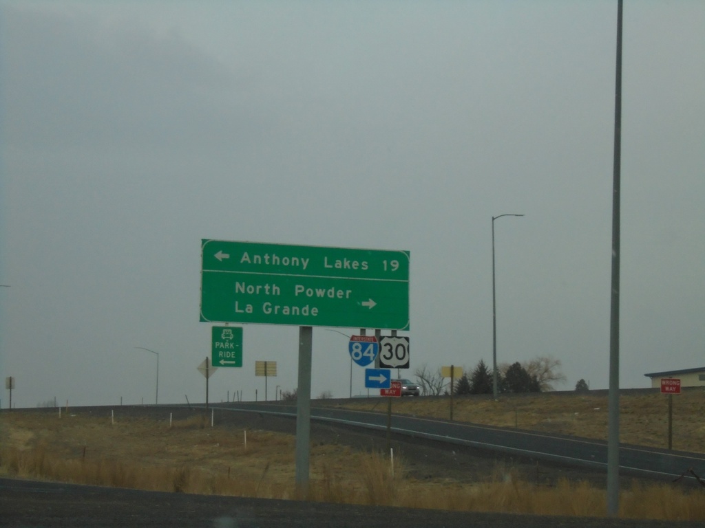
US-30 West at Anthony Lakes Jct. and I-84
US-30 West at Anthony Lakes Jct. and I-84. Turn left for Anthony Lakes (Ski Area). Turn right for North Powder I-84/US-30 west to La Grande.
Taken 12-27-2019
North Powder
Union County
Oregon
United States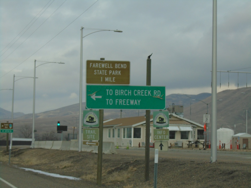
I-84 West - Exit 353 Offramp
I-84 West - Exit 353 offramp at US-30. Use US-30 west for Farewell Bend State Park. Turn left for Birch Creek Road and (I-84) Freeway.
Taken 12-27-2019
Huntington
Malheur County
Oregon
United States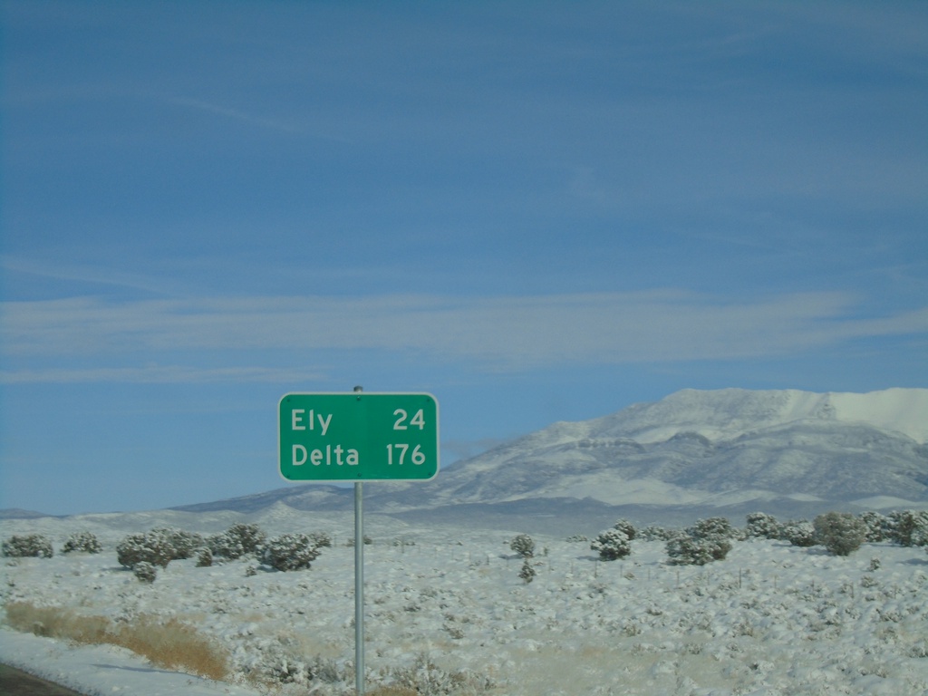
US-6 East - Distance Marker
Distance marker on US-6 east. Distance to Ely, and Delta (Utah).
Taken 11-30-2019
 Preston
White Pine County
Nevada
United States
Preston
White Pine County
Nevada
United States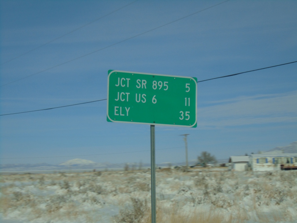
NV-318 North - Distance Marker
Distance marker on NV-318 north. Distance to SR-895, US-6, and Ely.
Taken 11-30-2019
 Lund
White Pine County
Nevada
United States
Lund
White Pine County
Nevada
United States
NV-318 North - Distance Marker
Distance marker on NV-318 north. Distance to Lund, Jct. US-6, and Ely.
Taken 11-30-2019
Lincoln County
Nevada
United States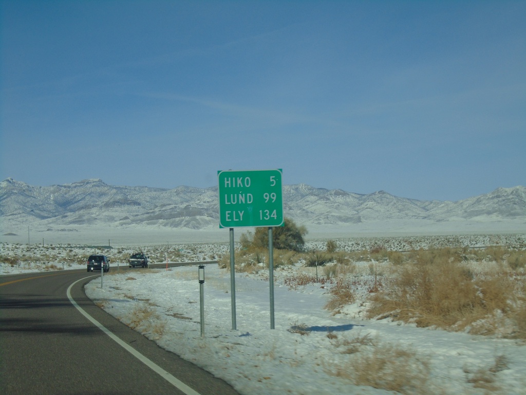
NV-318 North - Distance Marker
Distance marker on NV-318 north. Distance to Hiko, Lund, and Ely.
Taken 11-30-2019
Hiko
Lincoln County
Nevada
United States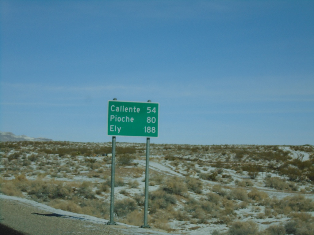
US-93 North - Distance Marker
Distance marker on US-93 north. Distance to Caliente, Pioche, and Ely.
Taken 11-30-2019
 Alamo
Lincoln County
Nevada
United States
Alamo
Lincoln County
Nevada
United States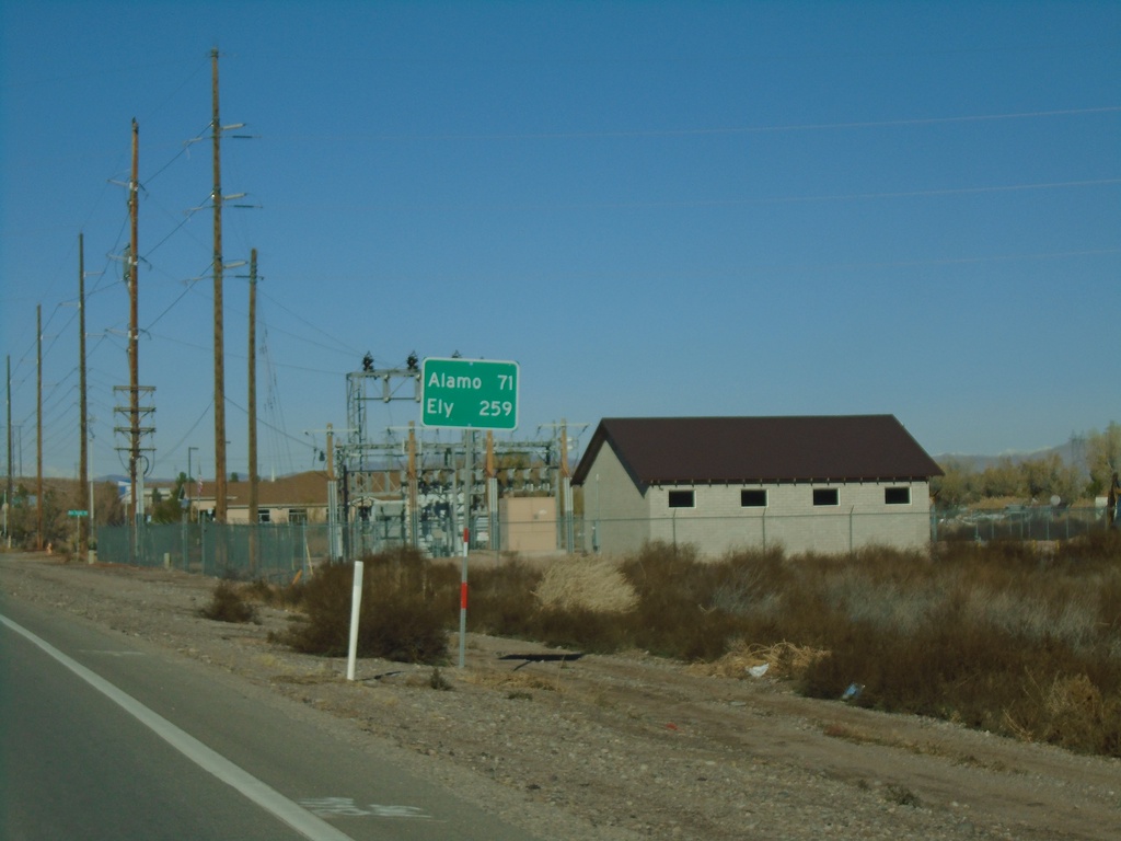
NV-168 West - Distance Marker
Distance marker on NV-168 west. Distance to Alamo and Ely (both via US-93).
Taken 11-30-2019
 Moapa
Clark County
Nevada
United States
Moapa
Clark County
Nevada
United States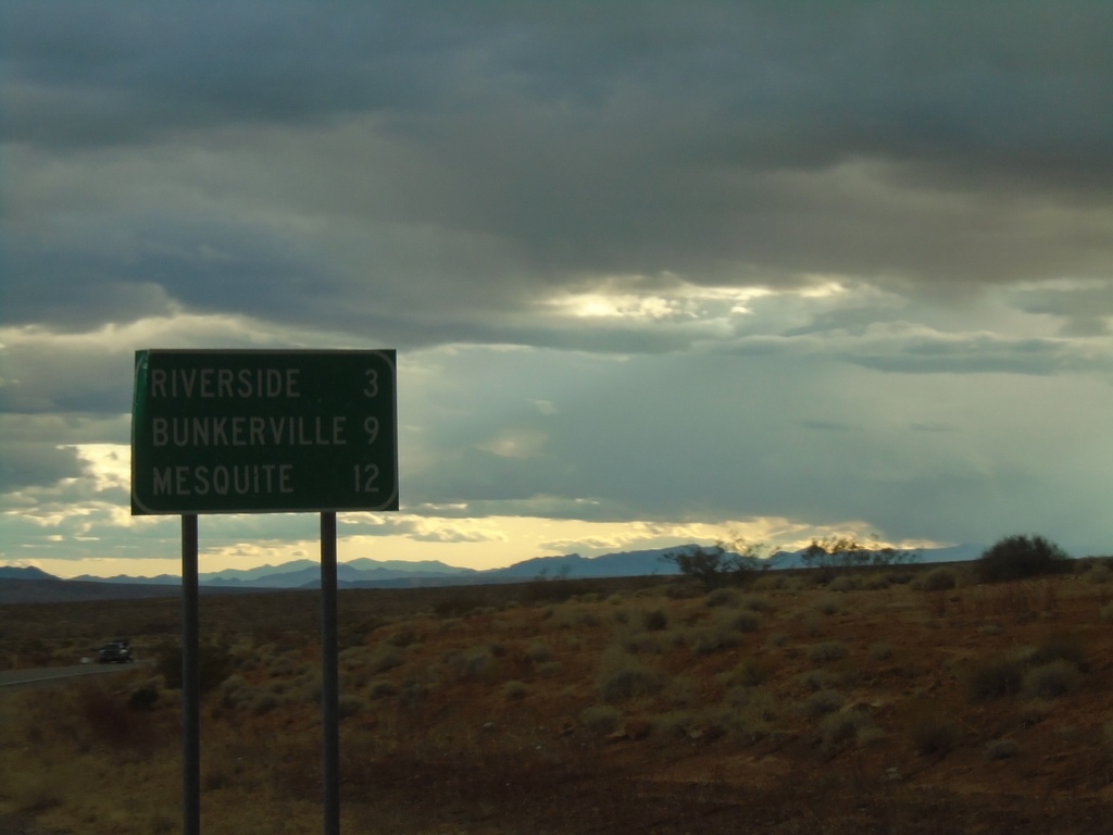
NV-170 East - Distance Marker
Distance marker on NV-170 east. Distance to Riverside, Bunkerville, and Mesquite.
Taken 11-29-2019
 Bunkerville
Clark County
Nevada
United States
Bunkerville
Clark County
Nevada
United States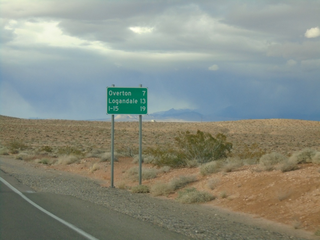
Begin NV-169 Northbound
Distance marker at beginning of NV-169 northbound. Distance to Overton, Logandale, and I-15.
Taken 11-29-2019
 Moapa Valley
Clark County
Nevada
United States
Moapa Valley
Clark County
Nevada
United States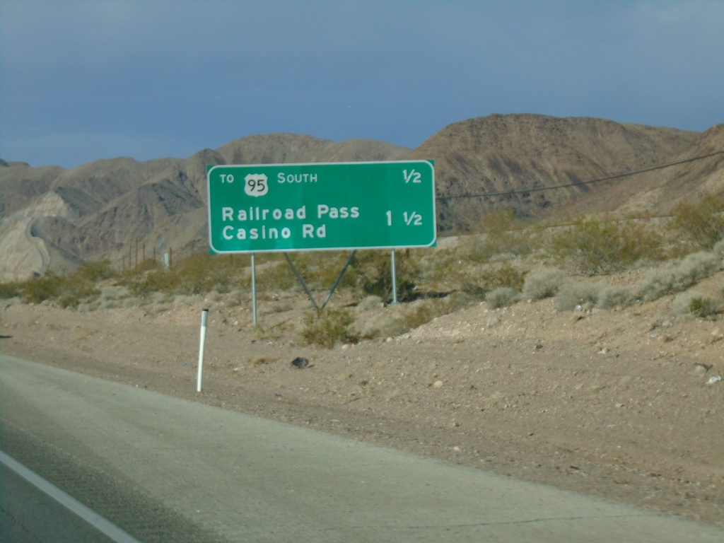
Bus. US-93 North - Distance Marker
Distance marker on Bus. US-93 north in Boulder City. Distance to US-95 South and Railroad Pass Casino Road
Taken 11-27-2019
 Boulder City
Clark County
Nevada
United States
Boulder City
Clark County
Nevada
United States