Signs Tagged With Distance Marker
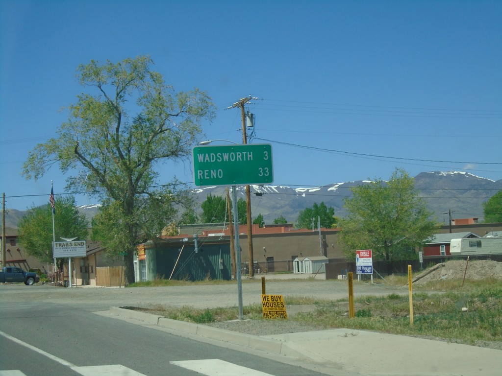
BL-80 West/NV-427 North - Distance Marker
Distance Marker on BL-80 West/NV-427 North. Distance to Wadsworth and Reno.
Taken 04-27-2019

 Fernley
Lyon County
Nevada
United States
Fernley
Lyon County
Nevada
United States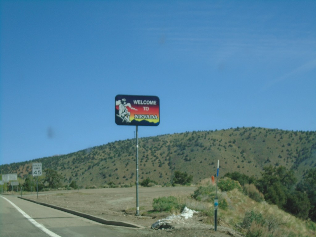
US-395 North - Welcome to Nevada
Welcome to Nevada on US-395 north. Taken at the California - Nevada state line.
Taken 04-27-2019
 Gardnerville
Douglas County
Nevada
United States
Gardnerville
Douglas County
Nevada
United States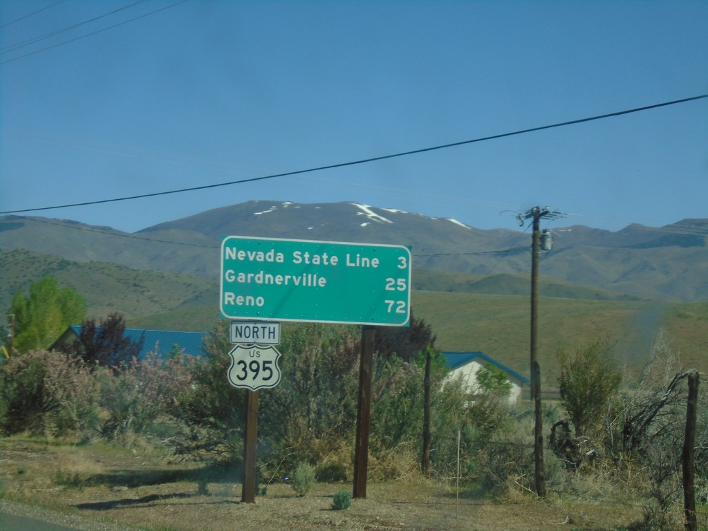
US-395 North - Distance Marker
Distance marker to Nevada State Line, Carson City, and Reno on US-395 north.
Taken 04-27-2019
Coleville
Mono County
California
United States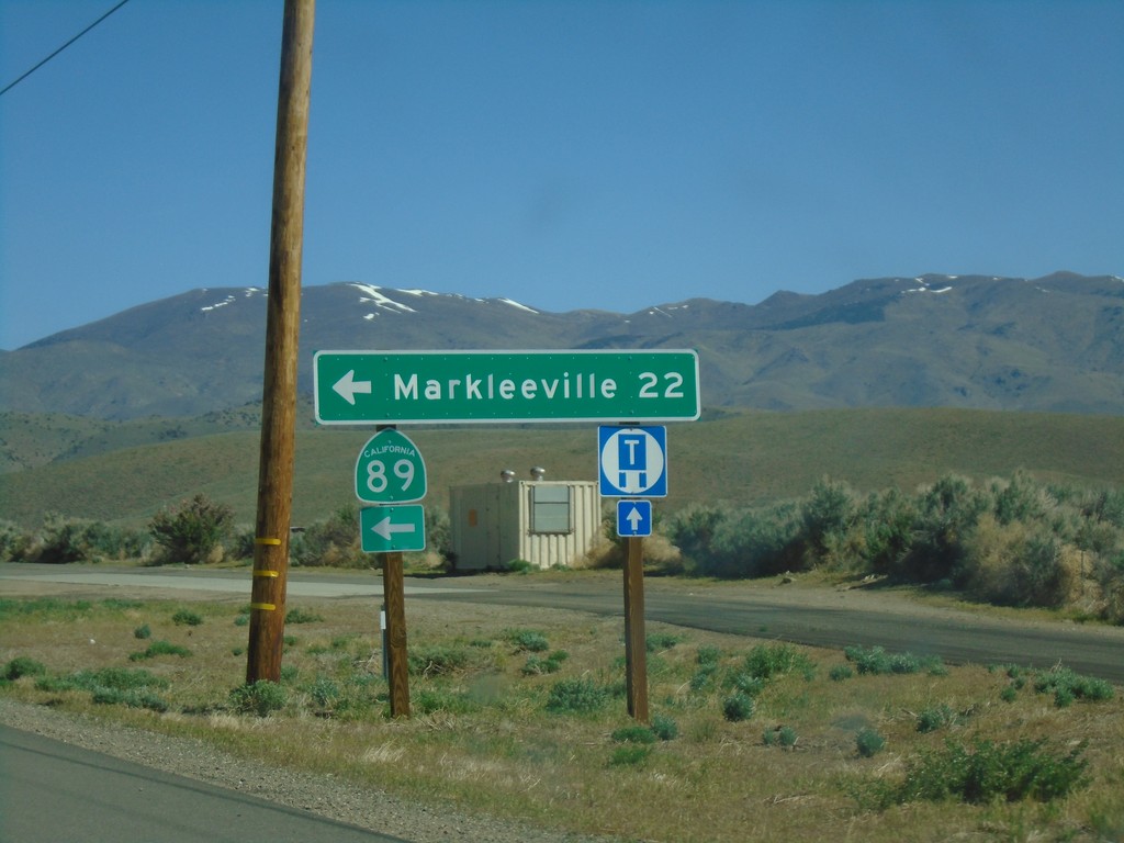
US-395 North at CA-89
US-395 North at CA-89 North. Turn left on CA-89 for Markleeville.
Taken 04-27-2019
 Coleville
Mono County
California
United States
Coleville
Mono County
California
United States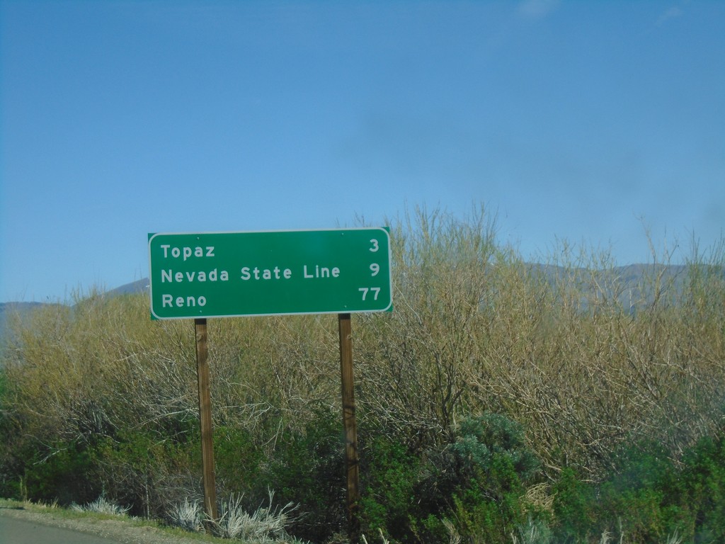
US-395 North - Distance Marker
Distance marker on US-395 north. Distance to Topaz, Nevada State Line, and Reno (Nevada).
Taken 04-27-2019
Coleville
Mono County
California
United States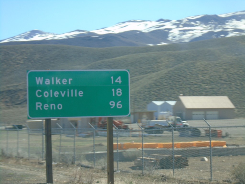
US-395 North - Distance Marker
Distance maker on US-395 north. Distance to Walker, Coleville, and Reno (Nevada).
Taken 04-27-2019
Coleville
Mono County
California
United States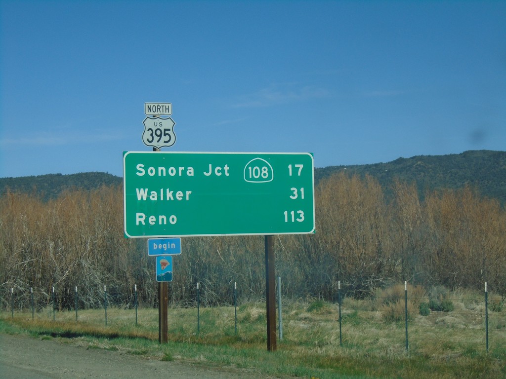
US-395 North - Distance Marker
Distance marker on US-395 north. Distance to Sonora Jct. - CA-108, Walker, and Reno (Nevada). Begin scenic route.
Taken 04-27-2019
 Bridgeport
Mono County
California
United States
Bridgeport
Mono County
California
United States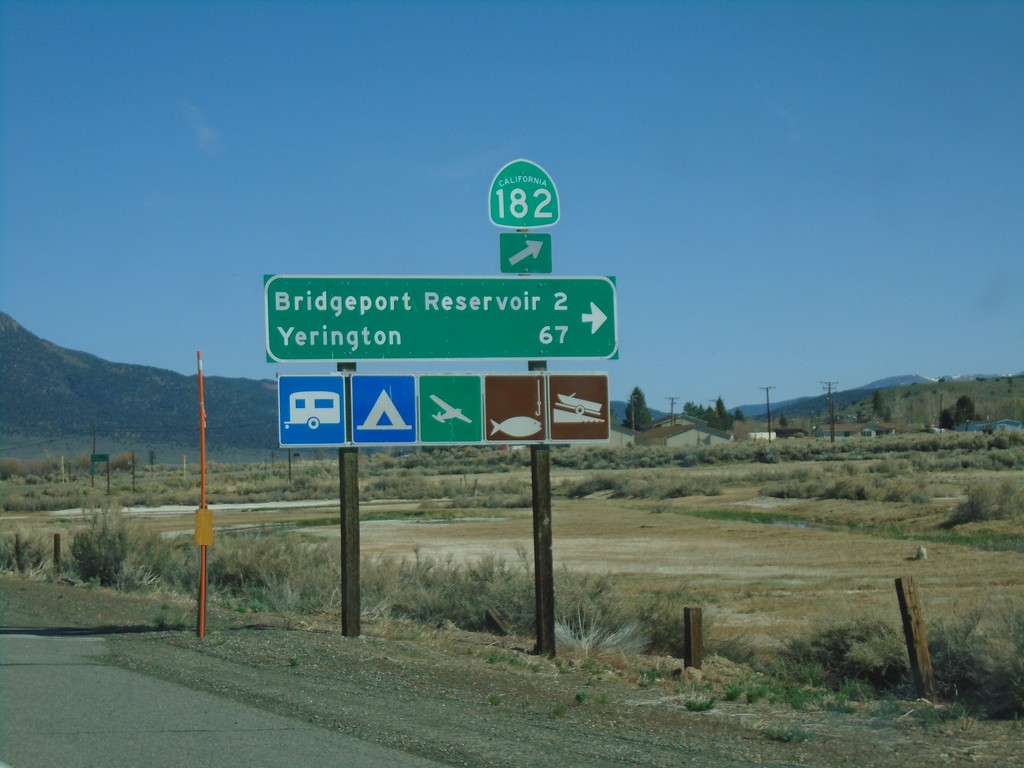
US-395 North at CA-182
US-395 north at CA-182 in Bridgeport. Turn right for Bridgeport Reservoir and Yerington (Nevada).
Taken 04-27-2019
 Bridgeport
Mono County
California
United States
Bridgeport
Mono County
California
United States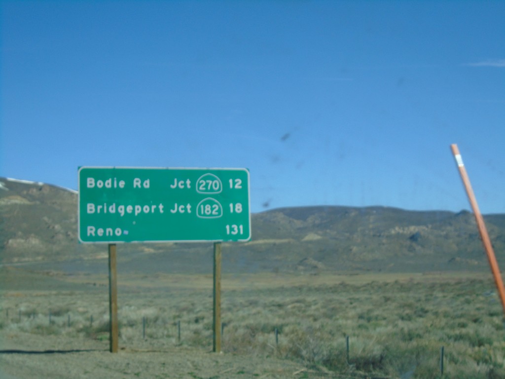
US-395 North - Distance Marker
Distance marker on US-395 north. Distance to Bodie Road - Jct. CA-270, Bridgeport - Jct. CA-182, and Reno (Nevada).
Taken 04-27-2019
 Lee Vining
Mono County
California
United States
Lee Vining
Mono County
California
United States
CA-120 West at US-395 North
CA-120 West at US-395 North in Mono County. Turn left (across the divided highway) for US-395 south to Bishop; left for US-395 north to Lee Vining. CA-120 west joins US-395 north to Lee Vining.
Taken 04-27-2019
 Lee Vining
Mono County
California
United States
Lee Vining
Mono County
California
United States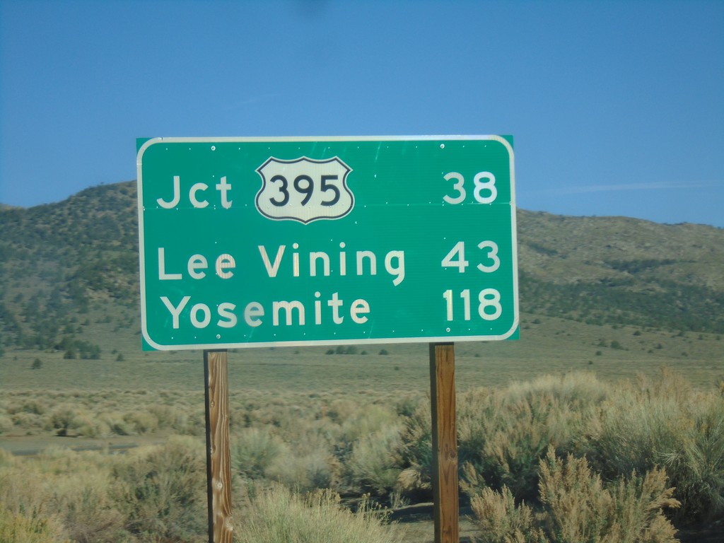
CA-120 West - Distance Marker
Distance marker on CA-120 west. Distance to Jct. US-395, Lee Vining, and Yosemite.
Taken 04-27-2019
Bishop
Mono County
California
United States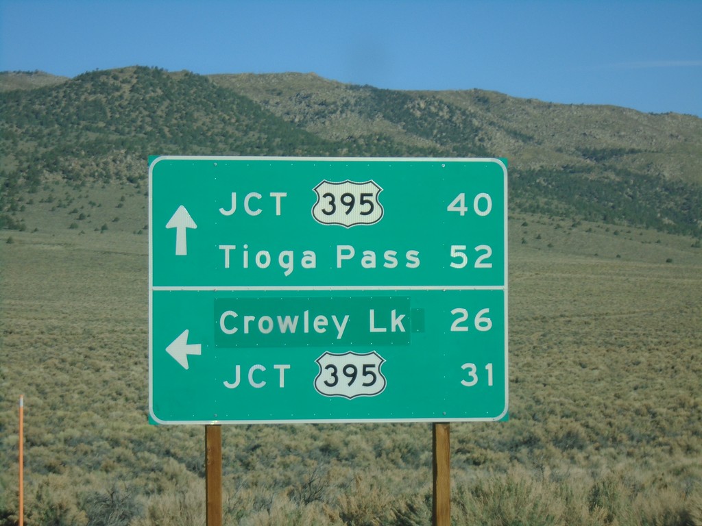
CA-120 West at Benton Crossing Road
CA-120 West at Benton Crossing Road in Mono County. Turn left for Benton Cross Road south to Crowley Lake and US-395; continue straight for CA-120 West to Tioga Pass and US-395.
Taken 04-27-2019
Benton Hot Springs
Mono County
California
United States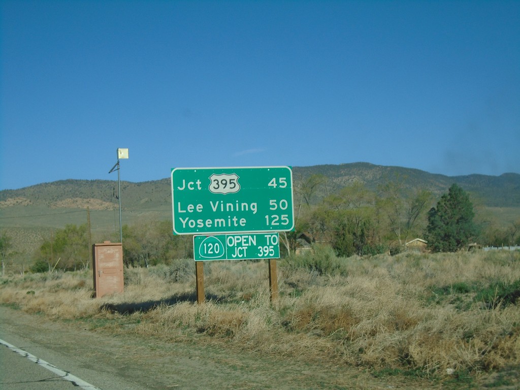
CA-120 West - Distance Marker
Distance marker on CA-120 west. Distance to US-395, Lee Vining, and Yosemite. CA-120 is open to US-395. This stretch of CA-120 is closed during the winter months.
Taken 04-27-2019
Benton
Mono County
California
United States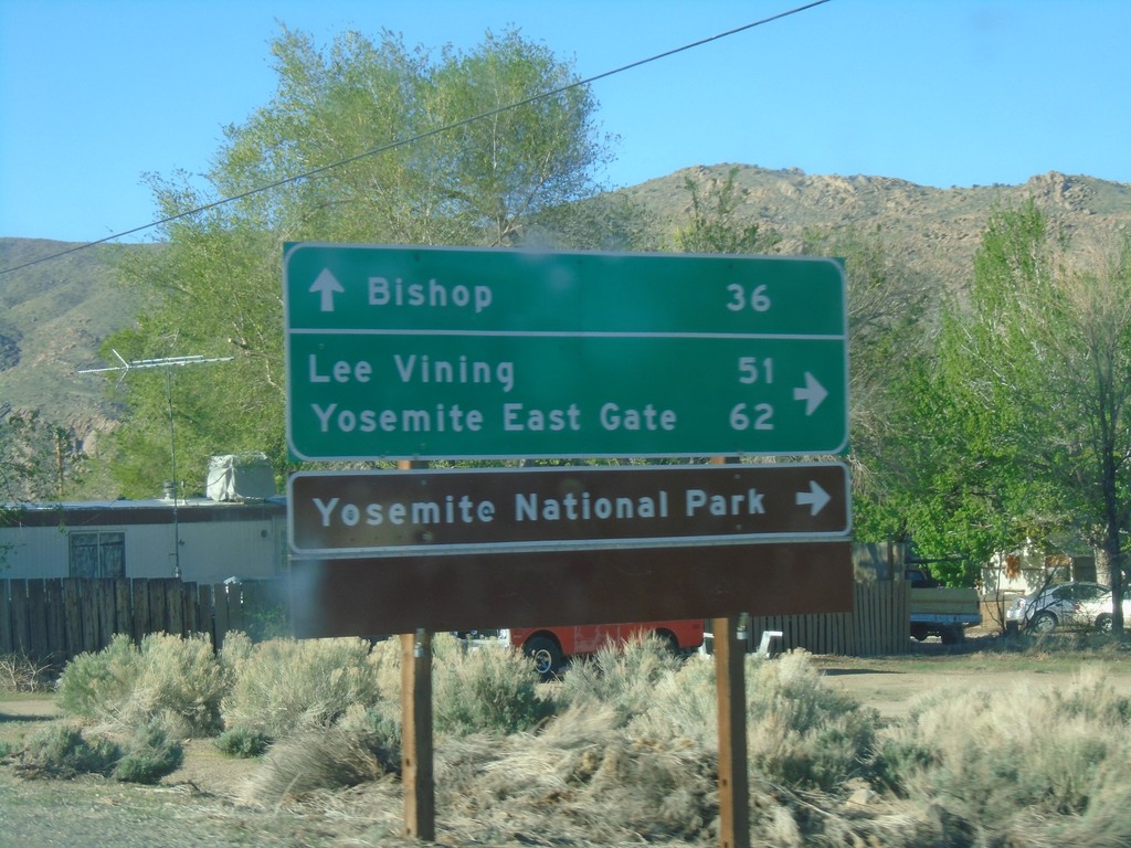
US-6 West at CA-120 West
US-6 West at CA-120 West. Use CA-120 west for Lee Vining, Yosemite East Gate, and Yosemite National Park. Continue west on US-6 for Bishop.
Taken 04-27-2019
 Benton
Mono County
California
United States
Benton
Mono County
California
United States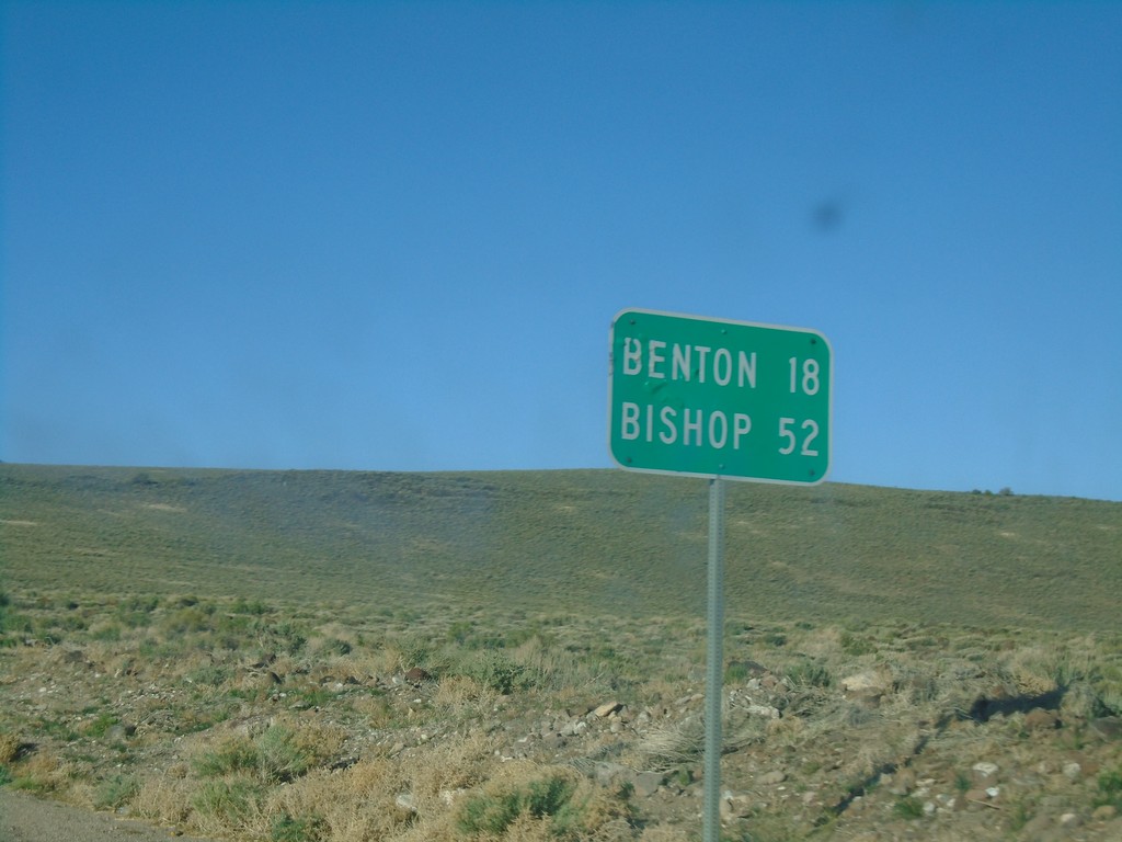
US-6 West - Distance Marker
Distance marker on US-6 west. Distance to Benton (California) and Bishop (California).
Taken 04-27-2019
Dyer
Mineral County
Nevada
United States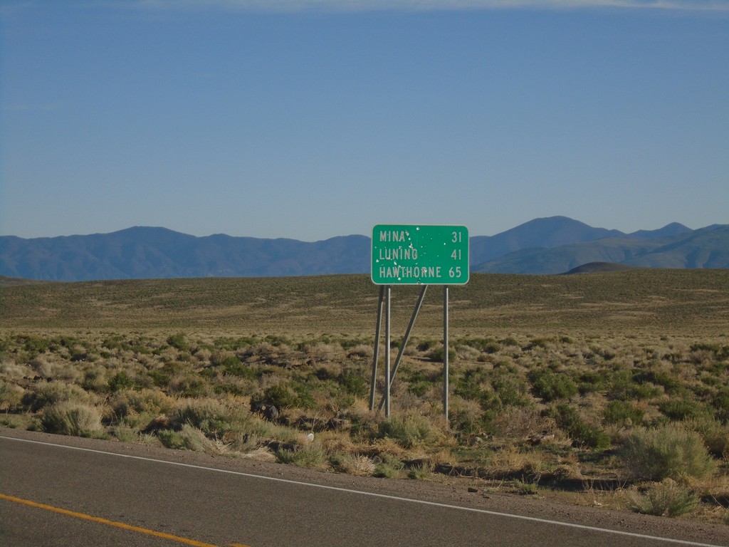
NV-360 North - Distance Marker
Distance marker on NV-360 north. Distance to Mina, Luning, and Hawthorne.
Taken 04-27-2019
 Dyer
Mineral County
Nevada
United States
Dyer
Mineral County
Nevada
United States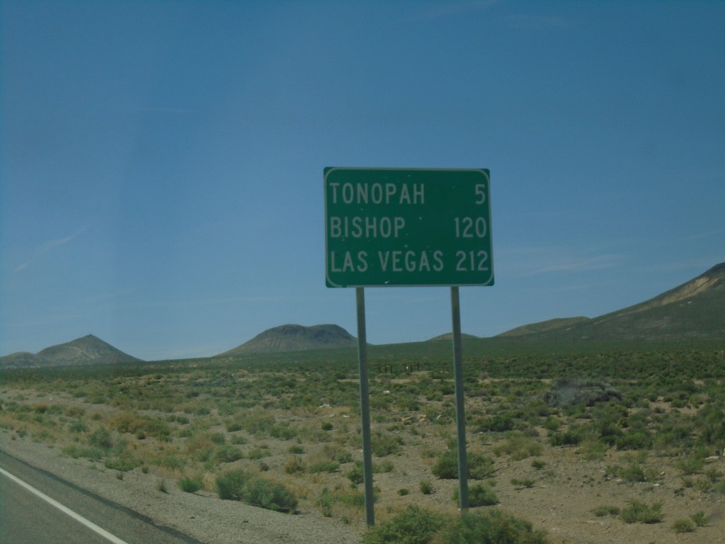
US-6 West - Distance Marker
Distance marker on US-6 west. Distance to Tonopah, Bishop (California), and Las Vegas (via US-95).
Taken 04-26-2019
Tonopah
Nye County
Nevada
United States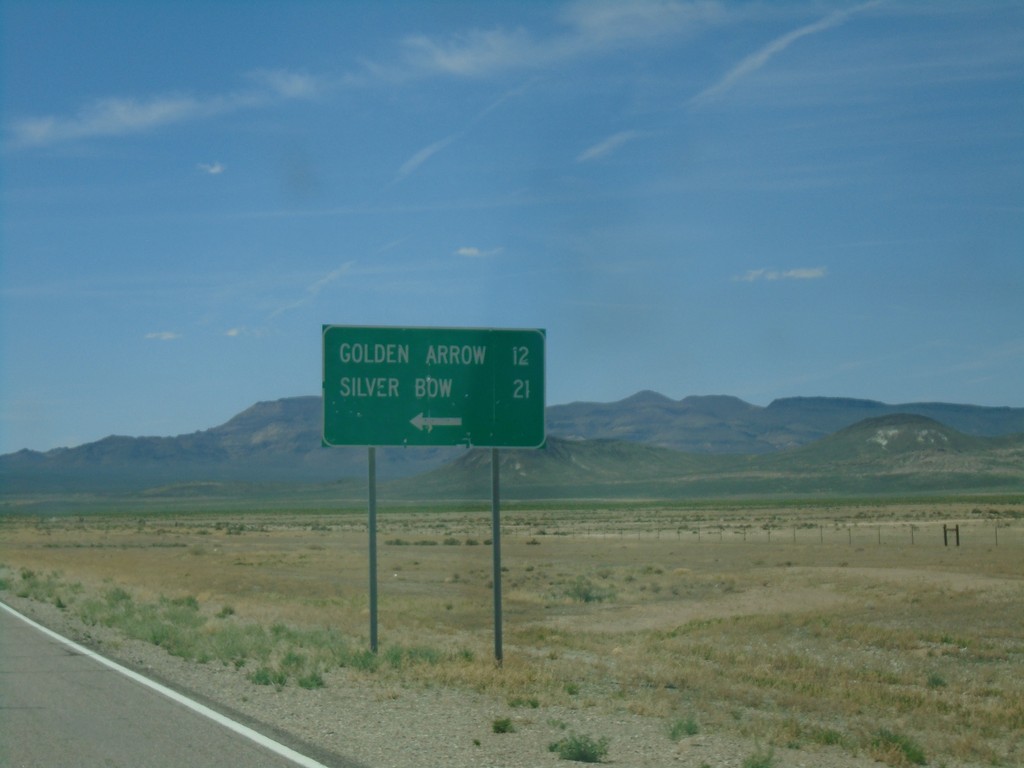
US-6 West - Silver Bow/Golden Arrow Junction
US-6 west at Sliver Bow/Golden Arrow junction.
Taken 04-26-2019
Tonopah
Nye County
Nevada
United States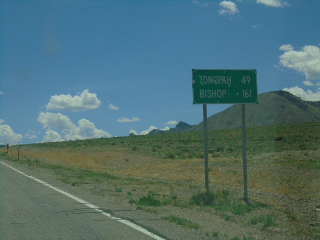
US-6 West - Distance Marker
Distance marker on US-6 west. Distance to Tonopah and Bishop (California).
Taken 04-26-2019
Warm Springs
Nye County
Nevada
United States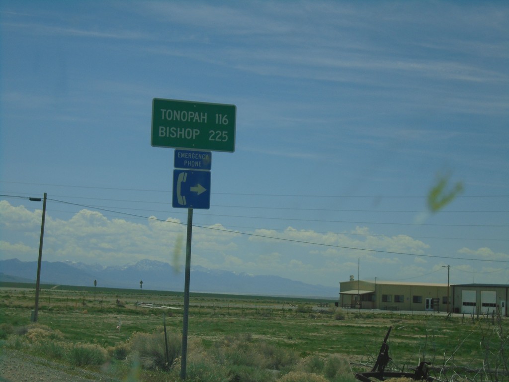
US-6 West - Distance Marker
Distance marker on US-6 west. Distance to Tonopah and Bishop (California). This is the first appearance of Bishop as a control city on US-6 westbound.
Taken 04-26-2019
Tonopah
Nye County
Nevada
United States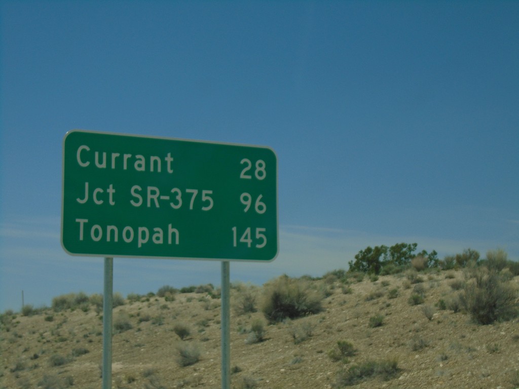
US-6 West - Distance Marker
Distance marker on US-6 West. Distance to Currant, Jct. SR-375, and Tonopah.
Taken 04-26-2019
 Lund
White Pine County
Nevada
United States
Lund
White Pine County
Nevada
United States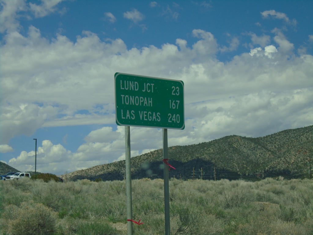
US-6 West - Distance Marker
Distance marker on US-6 west. Distance to Lund Jct., Tonopah, and Las Vegas (via NV-318).
Taken 04-26-2019
Ely
White Pine County
Nevada
United States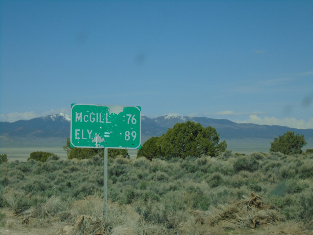
Alt. US-93 South - Distance Marker
Distance marker on Alt. US-93 South. Distance to McGill and Ely.
Taken 04-26-2019
 Elko County
Nevada
United States
Elko County
Nevada
United States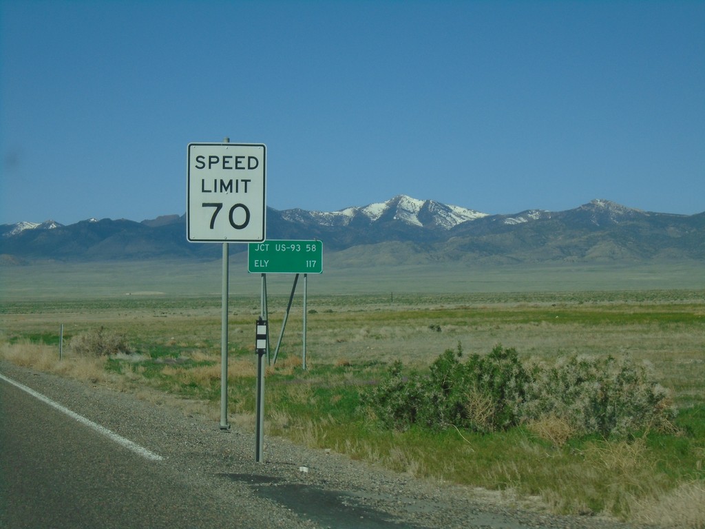
US-93 Alt South - Speed Limit 70 MPH
Speed limit 70 MPH on Alt. US-93 South leaving West Wendover. Distance marker to Jct. US-93 and Ely.
Taken 04-26-2019
West Wendover
Elko County
Nevada
United States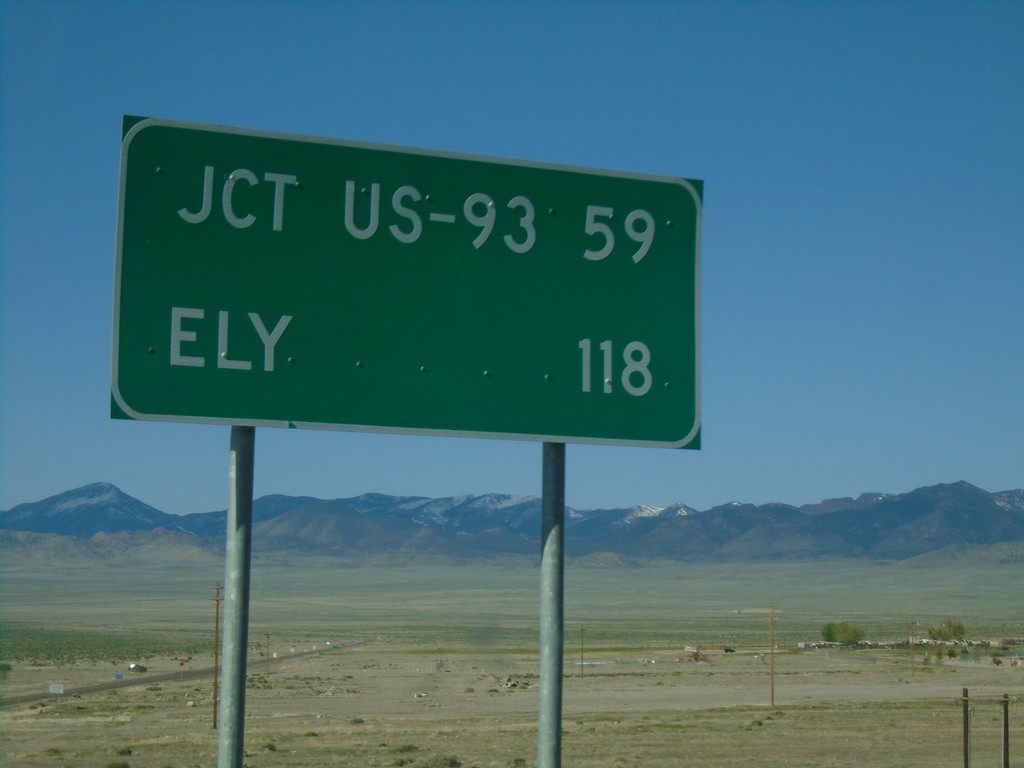
US-93 Alt. South - Distance Marker
Distance marker on US-93 Alt. South. Distance to Jct. US-93 and Ely.
Taken 04-26-2019
 West Wendover
Elko County
Nevada
United States
West Wendover
Elko County
Nevada
United States