Signs Tagged With Distance Marker
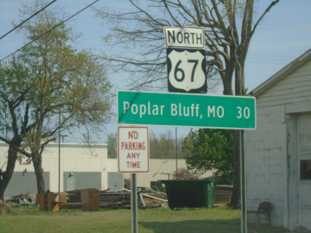
US-67 North - Distance Marker
Distance marker on US-67 North. Distance to Poplar Bluff, MO.
Taken 03-29-2026
 Corning
Clay County
Arkansas
United States
Corning
Clay County
Arkansas
United States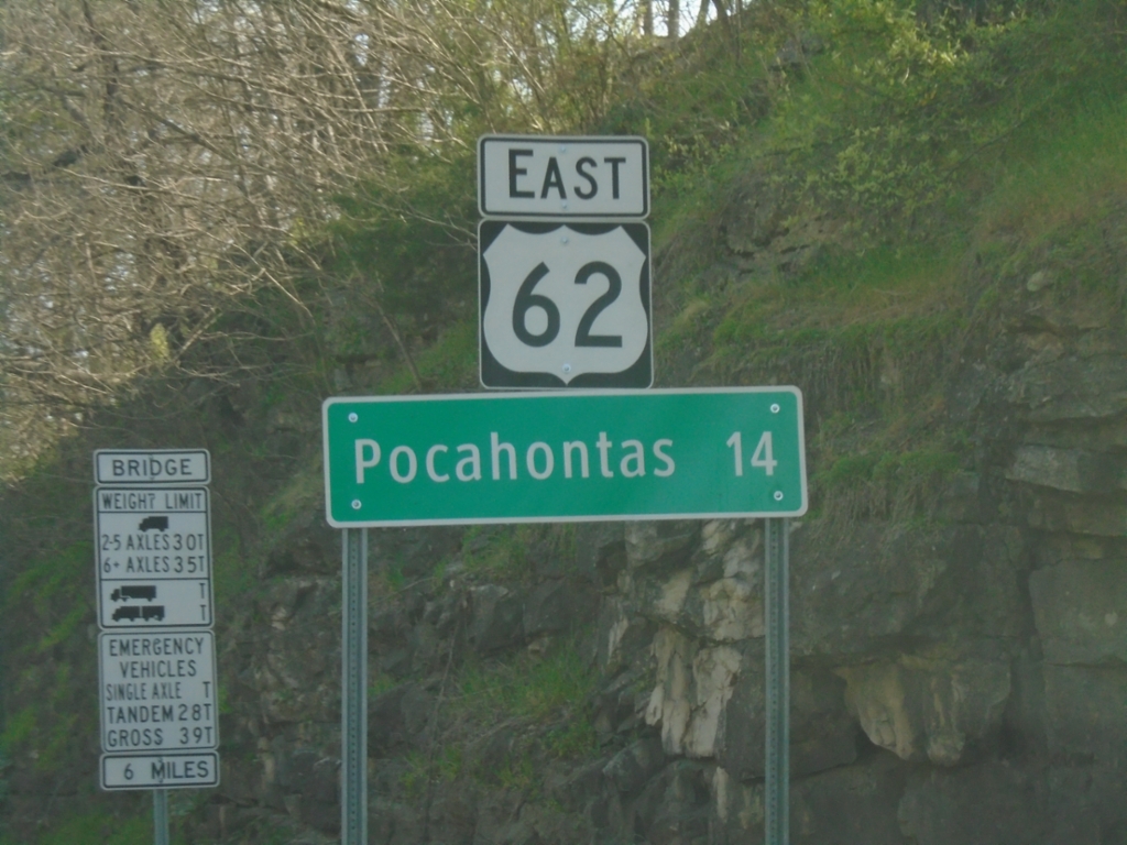
US-62 East - Distance Marker
Distance marker on US-62 East. Distance to Pocahontas.
Taken 03-29-2026
 Imboden
Lawrence County
Arkansas
United States
Imboden
Lawrence County
Arkansas
United States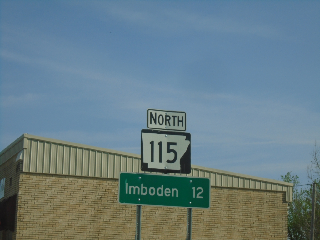
AR-115 North - Distance Marker
Distance marker on AR-115 North. Distance to Imboden.
Taken 03-29-2026
 Imboden
Lawrence County
Arkansas
United States
Imboden
Lawrence County
Arkansas
United States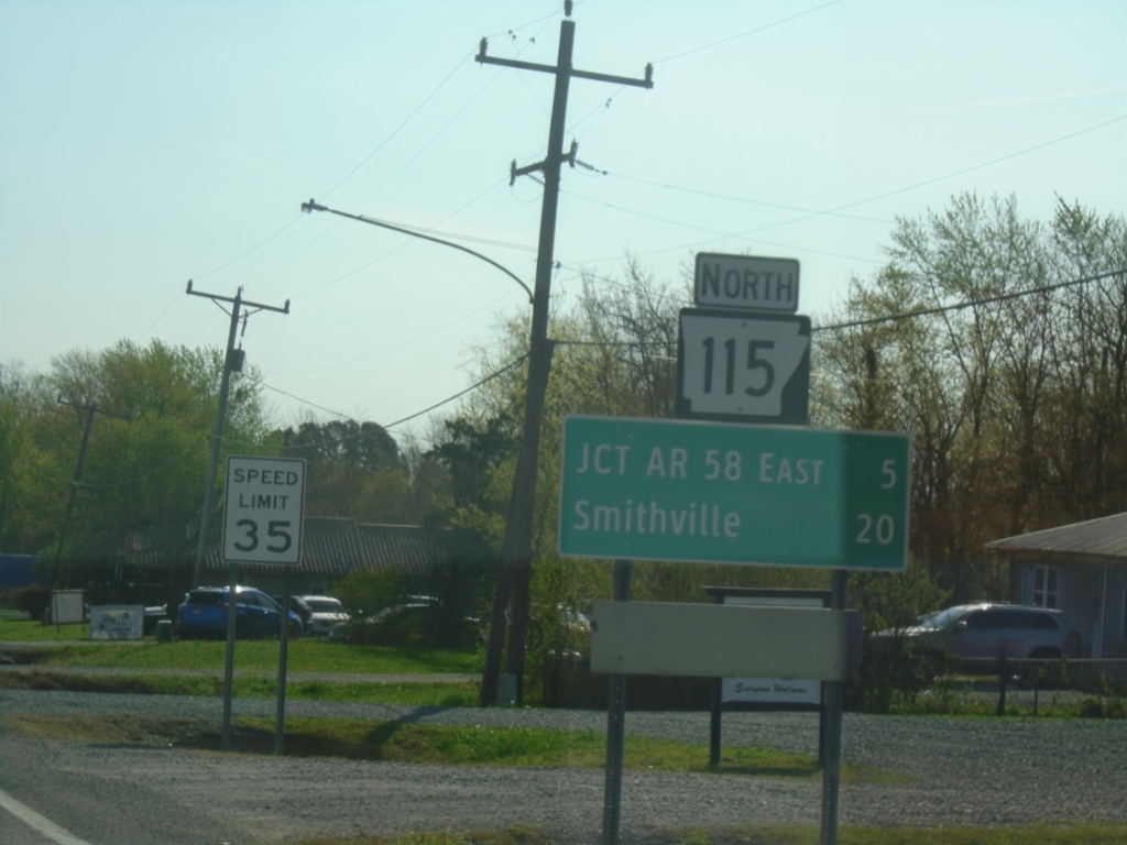
AR-115 North - Distance Marker
Distance marker on AR-115 North. Distance to Jct. AR-58 East and Smithville.
Taken 03-29-2026
Cave City
Sharp County
Arkansas
United States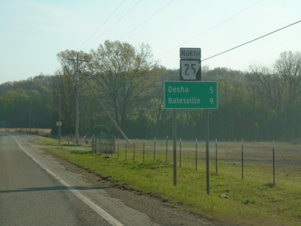
(AR-14)/AR-25 North - Distance Marker
Distance Marker on AR-14 East/AR-25 North. Distance to Desha and Batesville.
Taken 03-29-2026

 Locust Grove
Independence County
Arkansas
United States
Locust Grove
Independence County
Arkansas
United States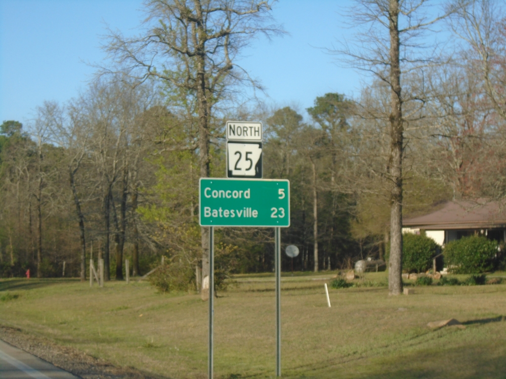
AR-25 North - Distance Marker
Distance marker on AR-25 North. Distance to Concord and Batesville.
Taken 03-28-2026
Concord
Cleburne County
Arkansas
United States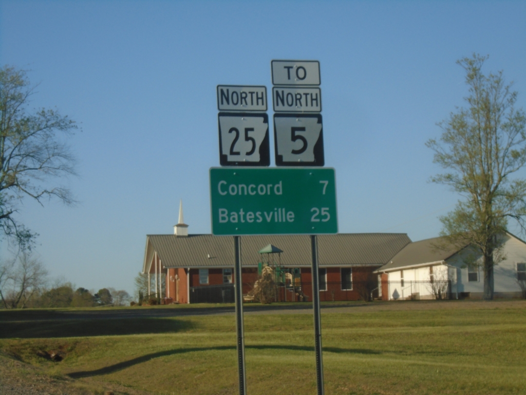
AR-25 North/To AR-5 - Distance Marker
Distance Marker on AR-25 North/To AR-5. Distance to Concord and Batesville.
Taken 03-28-2026
 Drasco
Cleburne County
Arkansas
United States
Drasco
Cleburne County
Arkansas
United States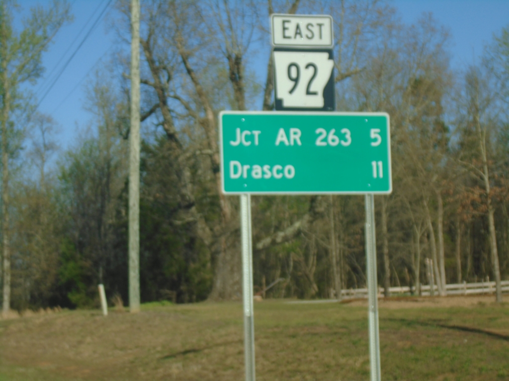
AR-92 East - Distance Marker
Distance marker on AR-92 East. Distance to Jct. AR-263 and Drasco.
Taken 03-28-2026

 Greers Ferry
Cleburne County
Arkansas
United States
Greers Ferry
Cleburne County
Arkansas
United States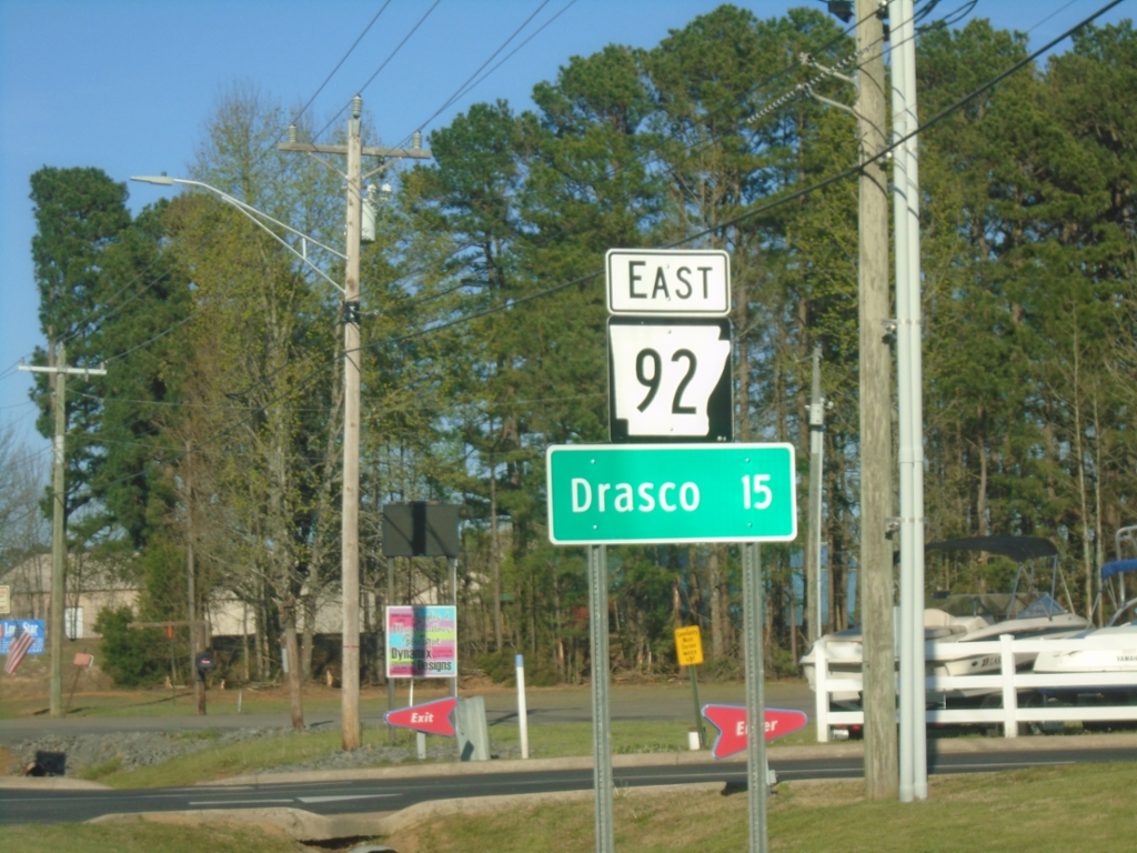
AR-92 East - Distance Marker
Distance marker on AR-92 East. Distance to Drasco.
Taken 03-28-2026
Greers Ferry
Cleburne County
Arkansas
United States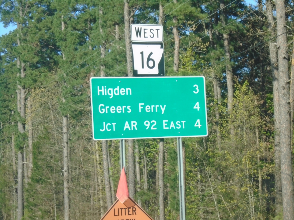
AR-16 West - Distance Marker
Distance marker on AR-16 West. Distance to Higden, Greers Ferry, and Jct. AR-92 East.
Taken 03-28-2026
 Higden
Cleburne County
Arkansas
United States
Higden
Cleburne County
Arkansas
United States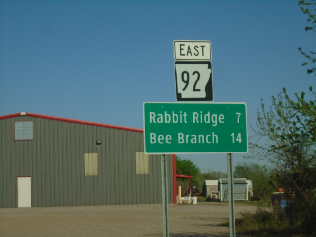
AR-92 East - Distance Marker
Distance marker on AR-92 east. Distance to Rabbit Ridge and Bee Branch.
Taken 03-28-2026
Center Ridge
Conway County
Arkansas
United States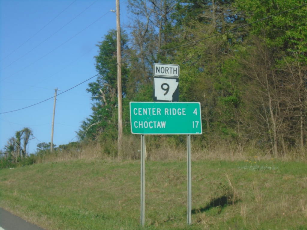
AR-9 North - Distance Marker
Distance marker on AR-9 North. Distance to Center Ridge and Choctaw.
Taken 03-28-2026
 Conway County
Arkansas
United States
Conway County
Arkansas
United States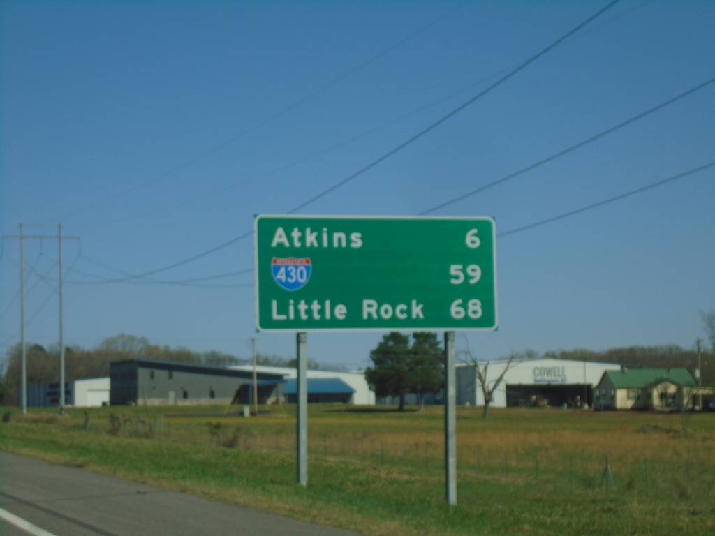
I-40 East - Distance Marker
Distance marker on I-40 east. Distance to Atkins, Jct. I-430, and Little Rock.
Taken 03-28-2026

 Pottsville
Pope County
Arkansas
United States
Pottsville
Pope County
Arkansas
United States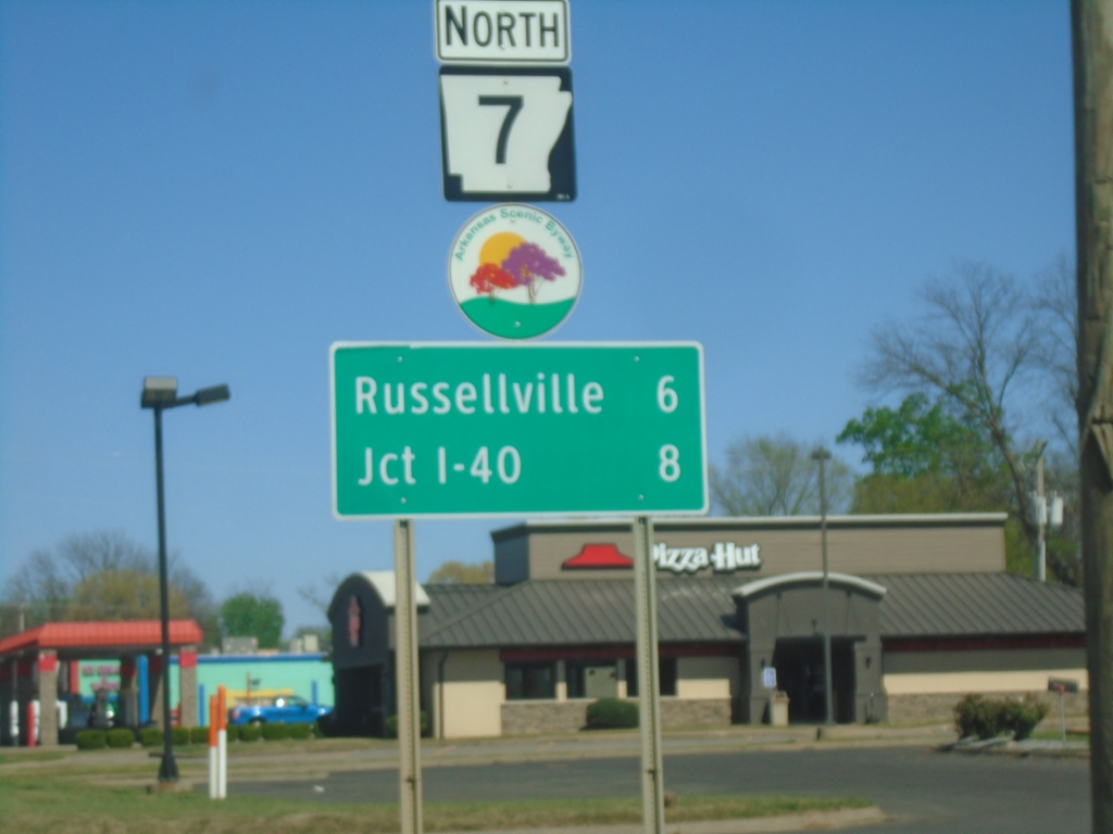
AR-7 North - Dardanelle
AR-7 North in Dardanelle. Distance to Russellville and I-40. AR-7 is part of the Arkansas Scenic 7 Byway.
Taken 03-28-2026
 Dardanelle
Yell County
Arkansas
United States
Dardanelle
Yell County
Arkansas
United States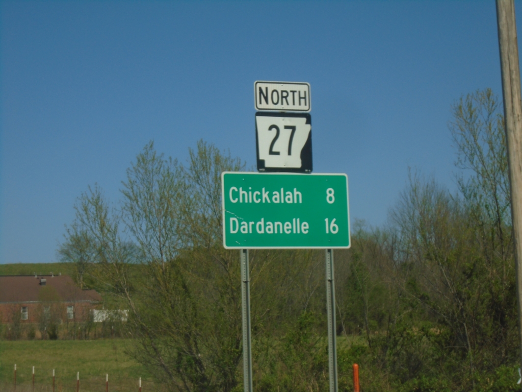
AR-27 North - Distance Marker
Distance marker on AR-27 North. Distance to Chickalah and Dardanelle.
Taken 03-28-2026
 Ranger
Yell County
Arkansas
United States
Ranger
Yell County
Arkansas
United States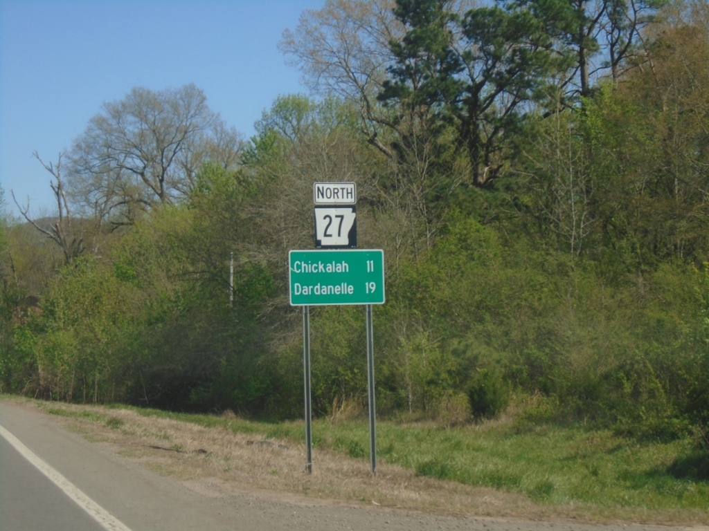
AR-27 North - Distance Marker
Distance marker on AR-27 North. Distance to Chickalah and Dardanelle.
Taken 03-28-2026
Danville
Yell County
Arkansas
United States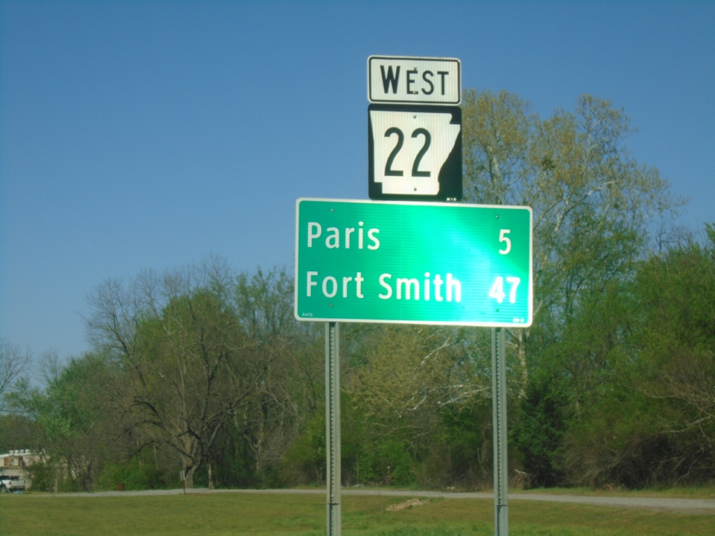
AR-22 West - Distance Marker
Distance marker on AR-22 west. Distance to Paris and Fort Smith.
Taken 03-28-2026
 Subiaco
Logan County
Arkansas
United States
Subiaco
Logan County
Arkansas
United States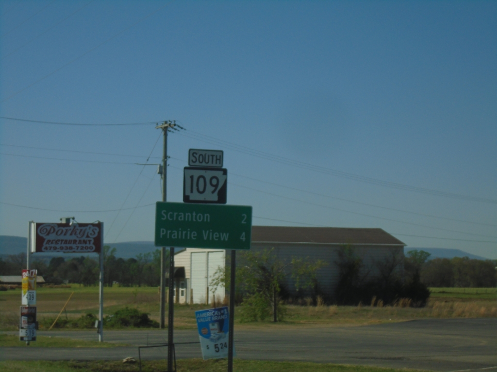
AR-109 South - Distance Marker
Distance marker on AR-109 south. Distance to Scranton and Prairie View.
Taken 03-28-2026
 Scranton
Logan County
Arkansas
United States
Scranton
Logan County
Arkansas
United States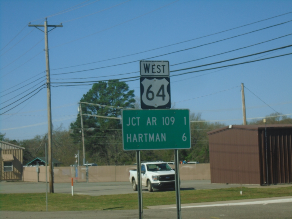
US-64 West - Distance Marker
Distance marker on US-64 West. Distance to Jct. AR-109 and Hartman.
Taken 03-28-2026
 Clarksville
Johnson County
Arkansas
United States
Clarksville
Johnson County
Arkansas
United States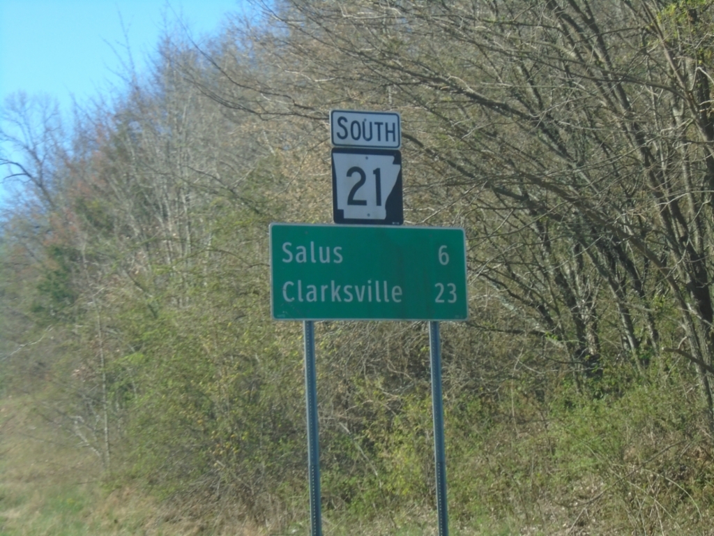
AR-21 South - Distance Marker
Distance marker on AR-21 South. Distance to Salus and Clarksville.
Taken 03-28-2026
 Fallsville
Newton County
Arkansas
United States
Fallsville
Newton County
Arkansas
United States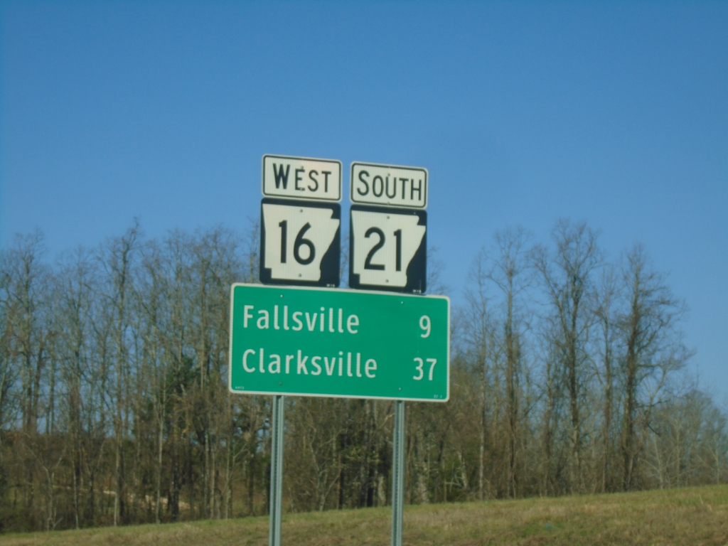
AR-16 West/AR-21 South - Distance Marker
Distance Marker on AR-16 West/AR-21 South. Distance to Fallsville and Clarksville.
Taken 03-28-2026
Newton County
Arkansas
United States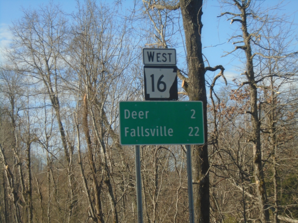
AR-16 West - Distance Marker
Distance marker on AR-16 West. Distance to Deer and Fallsville.
Taken 03-28-2026
Cowell
Newton County
Arkansas
United States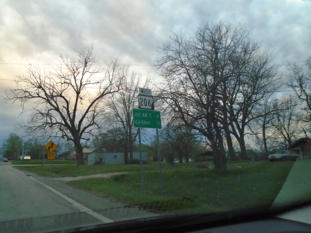
AR-206 West - Distance Marker
Distance marker on AR-206 west. Distance to Jct. AR-7 and Gaither.
Taken 03-27-2026
 Bellefonte
Boone County
Arkansas
United States
Bellefonte
Boone County
Arkansas
United States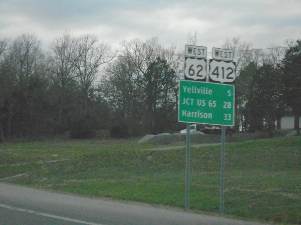
US-62/US-412 West - Distance Marker
Distance Marker on US-62/US-412 West. Distance to Yellville, Jct. US-65, and Harrison.
Taken 03-27-2026

 Flippin
Marion County
Arkansas
United States
Flippin
Marion County
Arkansas
United States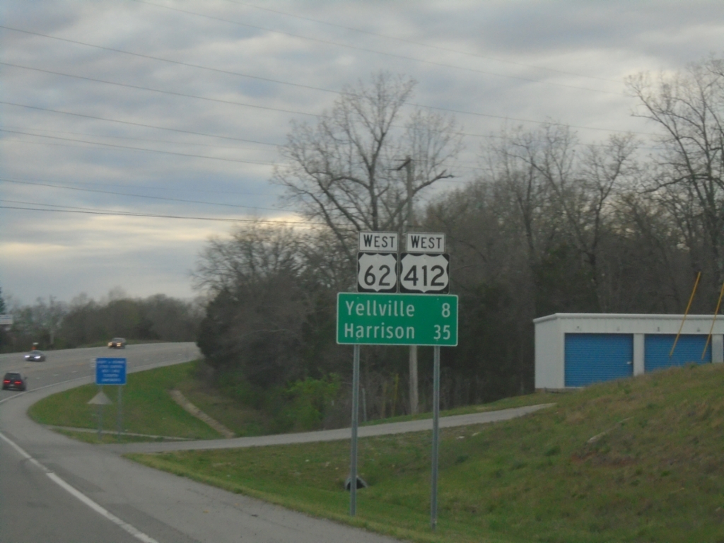
US-62/US-412 West - Distance Marker
Distance marker on US-62/US-412 West. Distance to Yellville and Harrison.
Taken 03-27-2026
Mountain Home
Baxter County
Arkansas
United States