Signs Tagged With Distance Marker
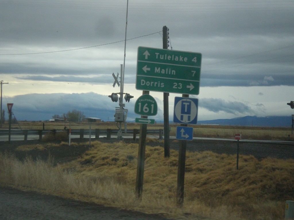
OR-39 South at CA-139 and CA-161
OR-39 south at CA-139 and CA-161. Turn right for CA-161 West to Dorris (California). Turn left on State Line Road to Malin (Oregon). Continue straight on CA-139 south to Tulelake (California). The California-Oregon state line runs along the CA-161 and State Line Road. OR-39 becomes CA-139 at the state line.
Taken 11-20-2017


 Merrill
Klamath County
Oregon
United States
Merrill
Klamath County
Oregon
United States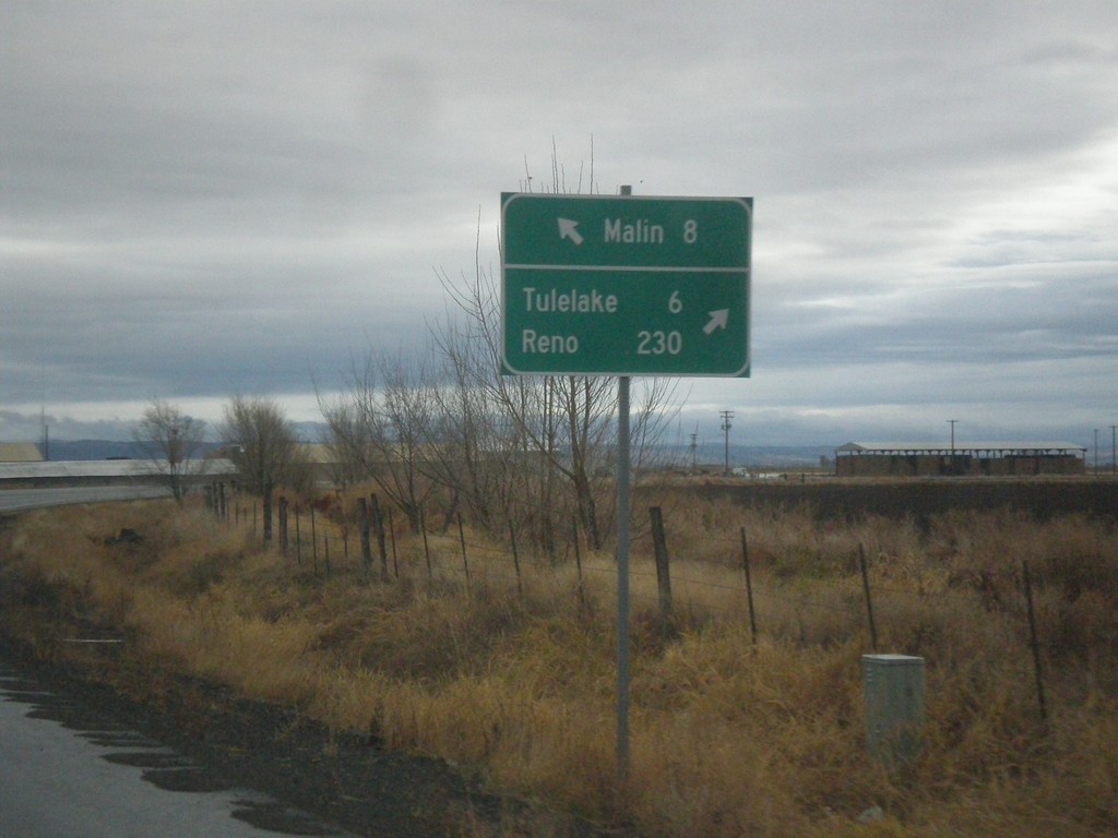
OR-39 South at Malin Jct.
OR-39 South at Malin Jct. Turn right to continue south on OR-39 for Tulelake (California) and Reno (Nevada). Continue ahead to for Malin. The Klamath Falls-Malin Highway continues towards Malin. OR-39 follows the Hatfield highway southbound.
Taken 11-20-2017
Merrill
Klamath County
Oregon
United States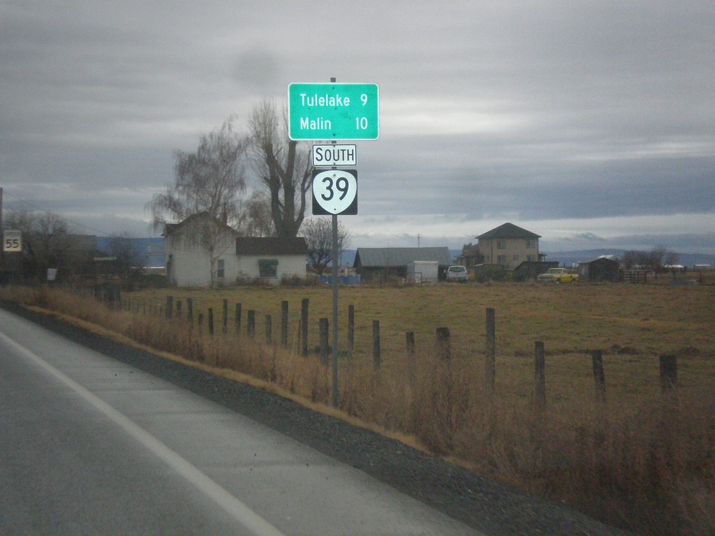
OR-39 South - Distance Marker
Distance marker on OR-39 south. Distance to Malin and Tulelake (California).
Taken 11-20-2017
Merrill
Klamath County
Oregon
United States
OR-140 East at OR-39
OR-140 East at OR-39 in Klamath County. Turn right for OR-39 south to Merrill. Turn left for OR-140 East (Unsigned)/OR-39 North to Klamath Falls and Lakeview.
Taken 11-20-2017
 Klamath Falls
Klamath County
Oregon
United States
Klamath Falls
Klamath County
Oregon
United States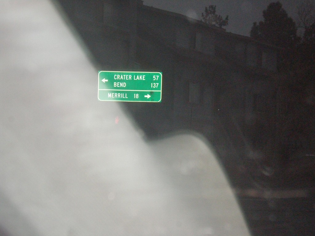
Main St. at OR-39
Main St. at OR-39 (Crater Lake Parkway) in Klamath Falls. Turn left for OR-39 north to Bend and Crater Lake (both via US-97). Turn right for OR-39 south to Merrill.
Taken 11-20-2017
Klamath Falls
Klamath County
Oregon
United States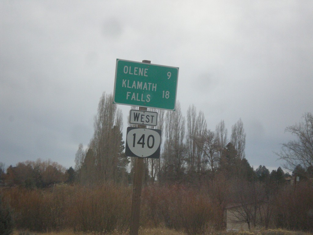
OR-140 West - Distance Marker
Distance marker on OR-140 west. Distance to Olene and Klamath Falls.
Taken 11-19-2017
Dairy
Klamath County
Oregon
United States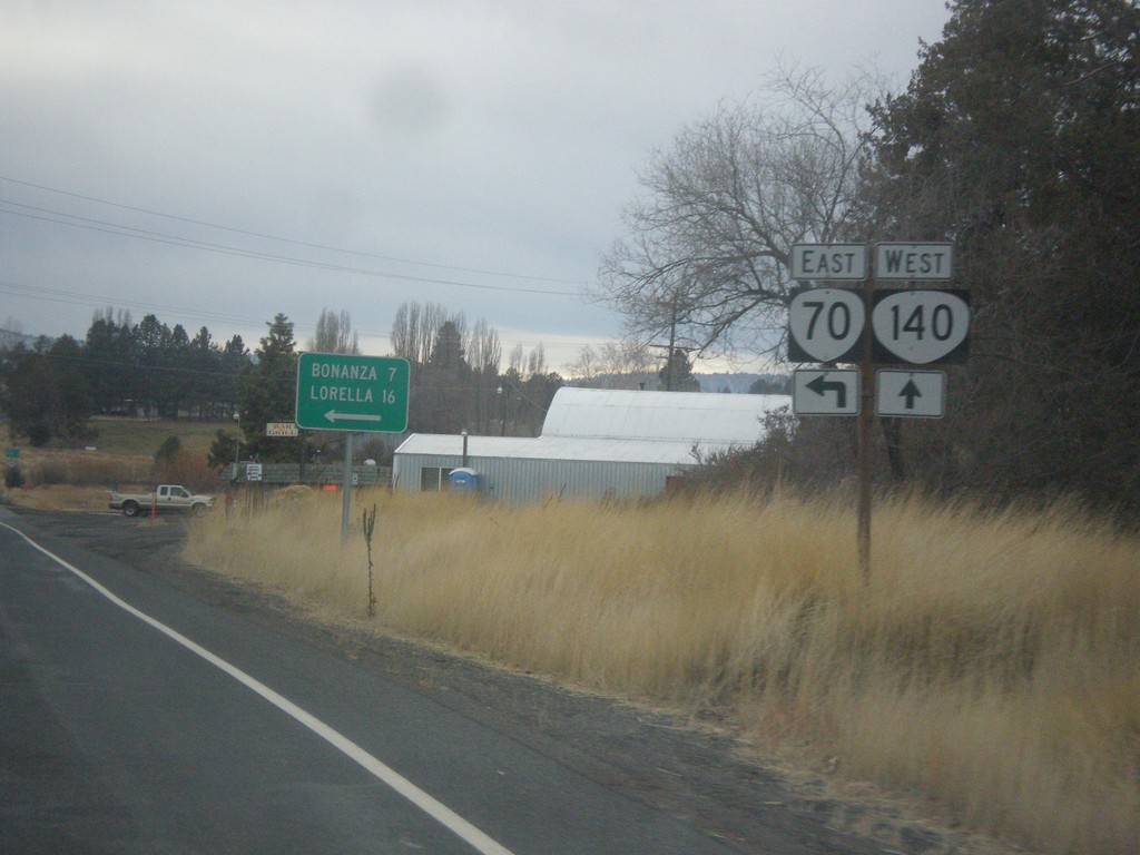
OR-140 West at OR-70
OR-140 West at OR-70 East to Bonanza and Lorella.
Taken 11-19-2017
 Dairy
Klamath County
Oregon
United States
Dairy
Klamath County
Oregon
United States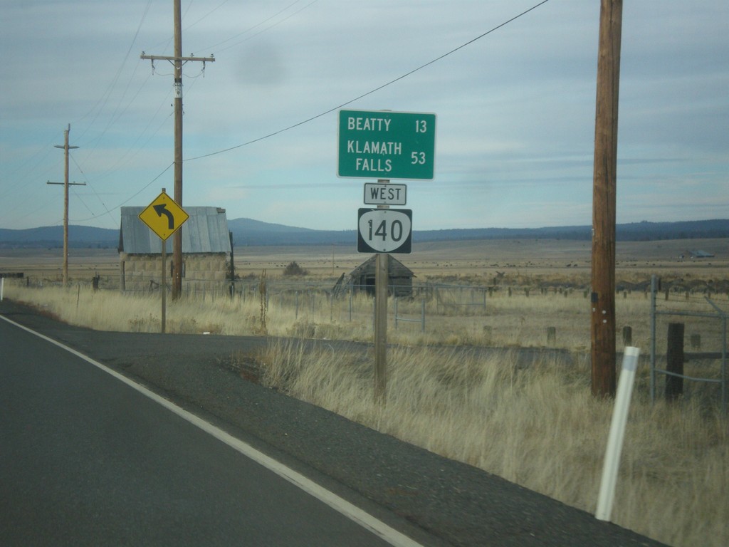
OR-140 West - Distance Marker
Distance Marker on OR-140 east leaving Bly. Distance to Beatty and Klamath Falls.
Taken 11-19-2017
Bly
Klamath County
Oregon
United States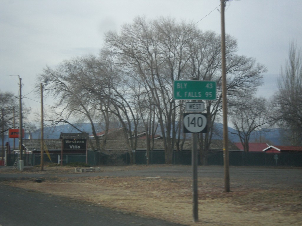
OR-140 West - Distance Marker
Distance marker on OR-140 west. Distance to Bly and Klamath Falls.
Taken 11-19-2017
Lakeview
Lake County
Oregon
United States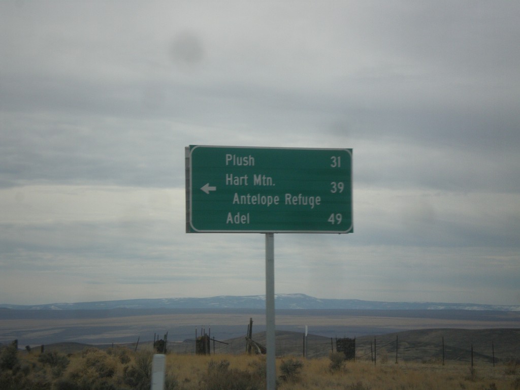
US-395 South - Hogback Road Jct.
US-395 South at Hogback Road Jct. Use Hogback Road for Plush, Hart Mountain Antelope Refuge, and Adel.
Taken 11-19-2017
 Lake County
Oregon
United States
Lake County
Oregon
United States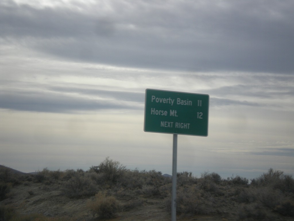
US-395 South - Horse Mountain Road
US-395 South approaching Horse Mountain Road to Horse Mountain and Poverty Basin.
Taken 11-19-2017
Lakeview
Lake County
Oregon
United States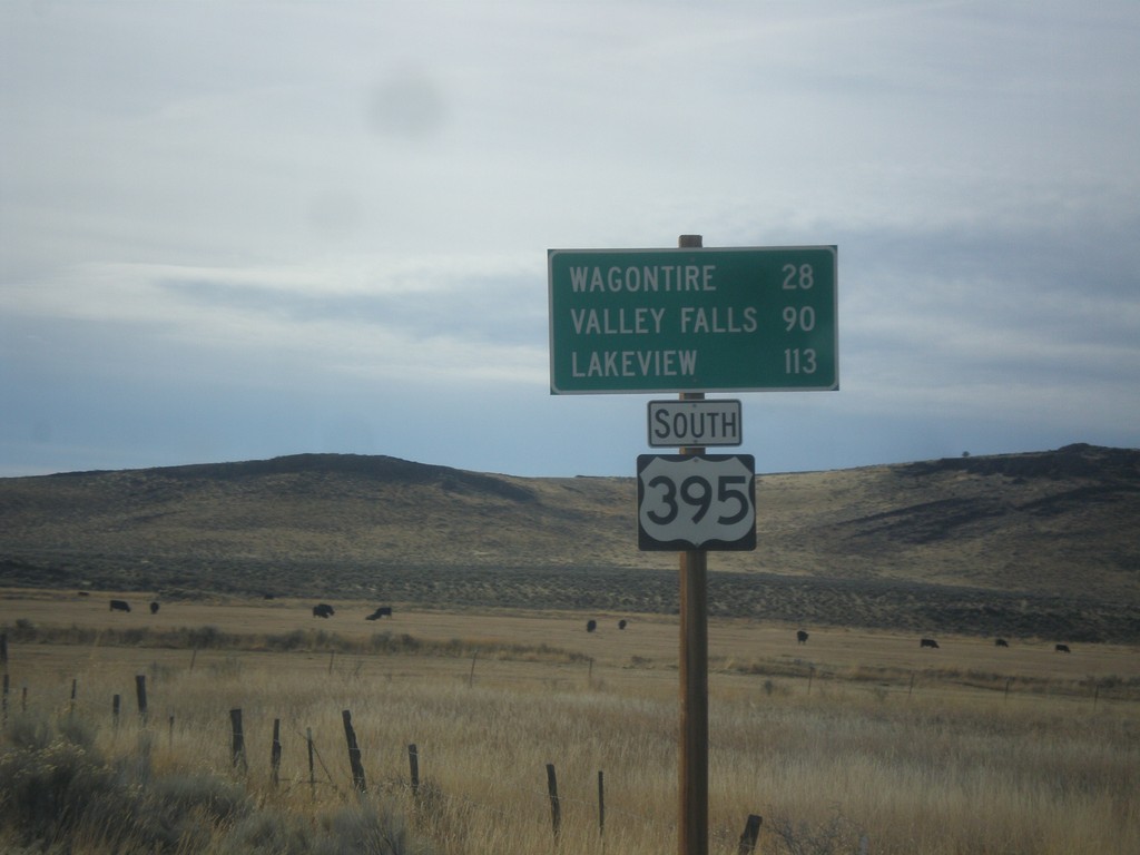
US-395 South - Distance Marker
Distance marker on US-395 south. Distance to Wagontire, Valley Falls, and Lakeview.
Taken 11-19-2017
Riley
Harney County
Oregon
United States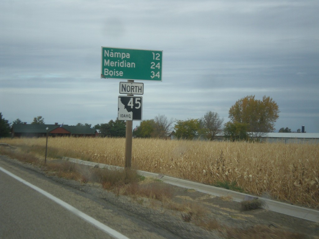
ID-45 North - Distance Marker
Distance maker on ID-45 north. Distance to Nampa, Meridian, and Boise.
Taken 10-22-2017
 Melba
Canyon County
Idaho
United States
Melba
Canyon County
Idaho
United States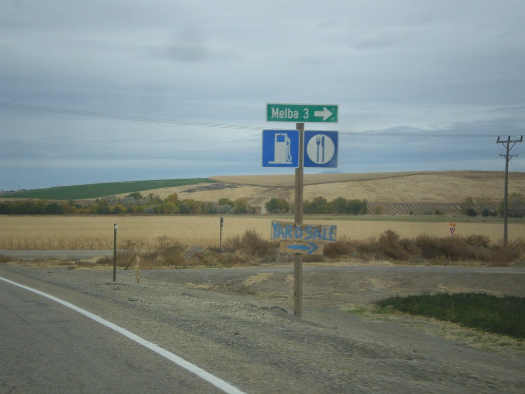
ID-45 North - Melba Junction
ID-45 north at Melba Road east to Melba.
Taken 10-22-2017
Melba
Canyon County
Idaho
United States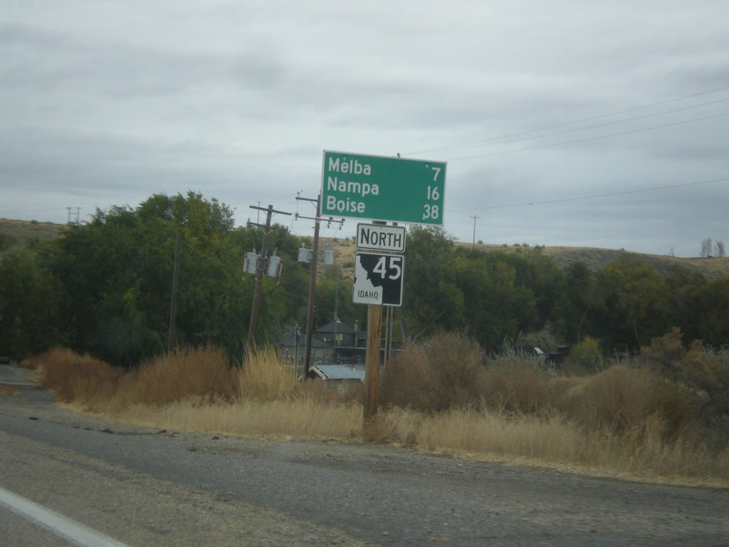
ID-45 North - Distance Marker
Distance marker on ID-45 north. Distance to Melba, Nampa, and Boise.
Taken 10-22-2017
Melba
Owyhee County
Idaho
United States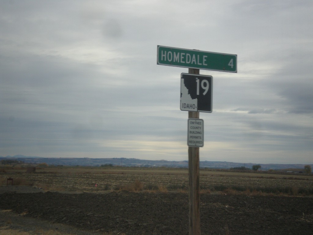
ID-19 East - Distance Marker
Distance marker on ID-19 east. Distance to Homedale.
Taken 10-22-2017
 Homedale
Owyhee County
Idaho
United States
Homedale
Owyhee County
Idaho
United States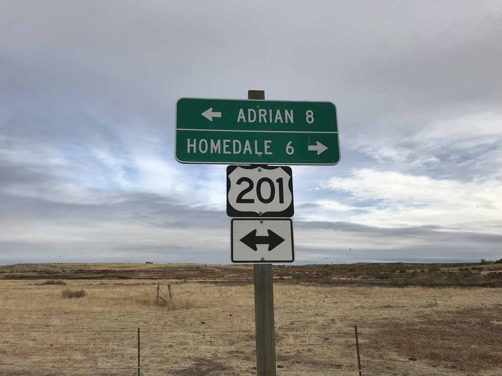
End Succor Creek Road at OR-201
End Succor Creek Road at OR-201. Use OR-201 south to Homedale (Idaho); use OR-201 north to Adrian. The OR-201 shield is incorrectly marked with a US shield.
Taken 10-22-2017
 Adrian
Malheur County
Oregon
United States
Adrian
Malheur County
Oregon
United States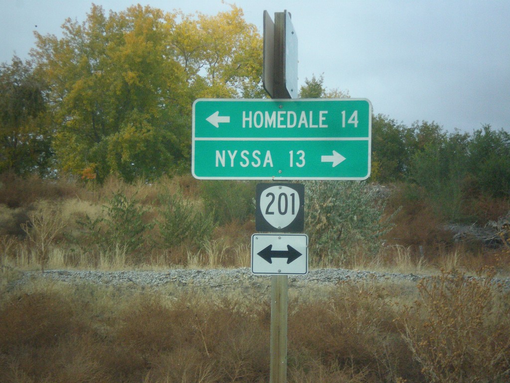
End OR-452 at OR-201
End OR-452 at OR-201 in Adrian. Turn left for OR-201 south to Homedale (Idaho); right for OR-201 north to Nyssa.
Taken 10-22-2017
 Adrian
Malheur County
Oregon
United States
Adrian
Malheur County
Oregon
United States
End OR-452 West at OR-454
End OR-452 West (unsigned) at OR-454 (unsigned). Turn right to continue west on OR-452 to Adrian. Continue straight for OR-454 West to (Big Bend Road) Caldwell (Idaho).
Taken 10-22-2017
 Adrian
Malheur County
Oregon
United States
Adrian
Malheur County
Oregon
United States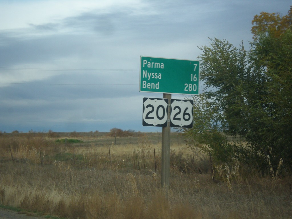
US-20/US-26 West Leaving Notus
Distance marker on US-20/US-26 west leaving Notus. Distance to Parma, Notus (Oregon), and Bend (Oregon). This is the first instance of Bend as a control city on US-20/US-26 Westbound.
Taken 10-22-2017

 Notus
Canyon County
Idaho
United States
Notus
Canyon County
Idaho
United States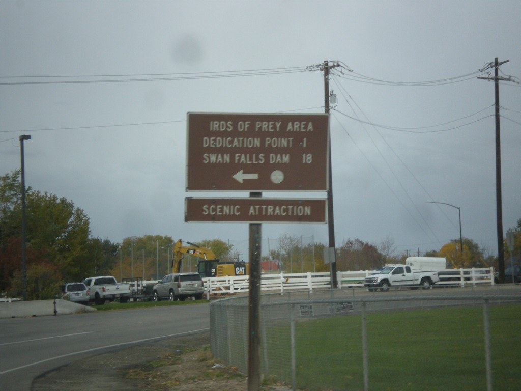
End ID-69 South at Swan Falls Road
End ID-69 South at Swan Falls Road. Turn left for Dedication Point, Birds of Prey Area and Swan Falls Dam.
Taken 10-21-2017
 Kuna
Ada County
Idaho
United States
Kuna
Ada County
Idaho
United States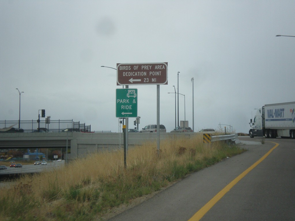
I-84 West Onramp (Exit 44) at ID-69
I-84 West onramp at ID-69. Turn left for Bird of Prey Area and Dedication Point.
Taken 10-21-2017


 Meridian
Ada County
Idaho
United States
Meridian
Ada County
Idaho
United States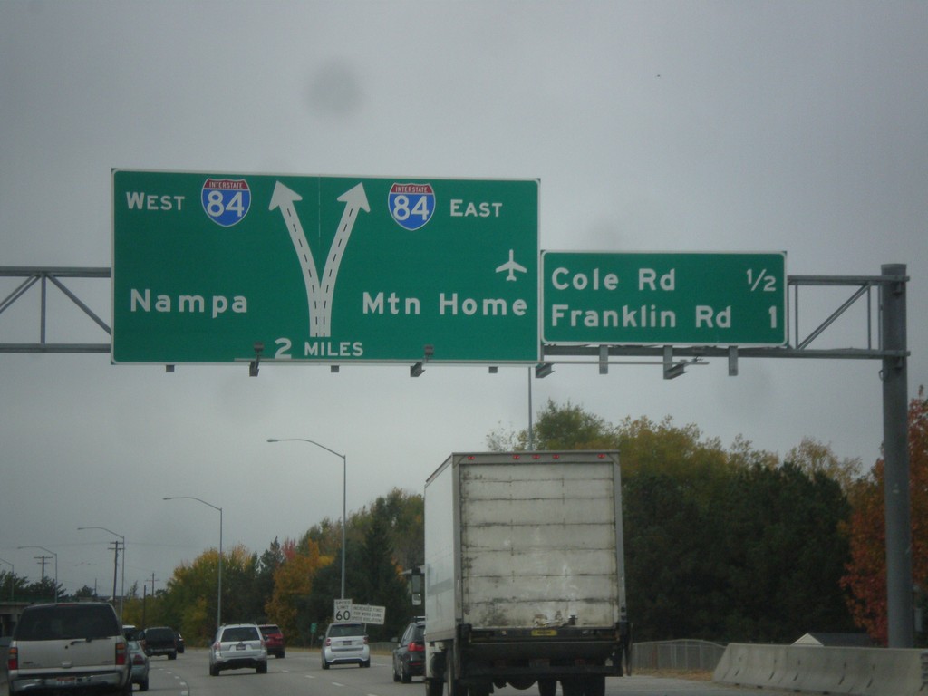
I-184 West Approaching I-84
I-184 west approaching I-84 to Nampa and Mountain Home. Also approaching Cole Road and Franklin Road interchanges. I-184 west ends at I-84.
Taken 10-21-2017
 Boise
Ada County
Idaho
United States
Boise
Ada County
Idaho
United States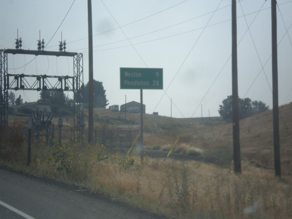
OR-11 South - Distance Marker
Distance marker on OR-11 south. Distance to Weston and Pendleton.
Taken 09-09-2017
 Milton-Freewater
Umatilla County
Oregon
United States
Milton-Freewater
Umatilla County
Oregon
United States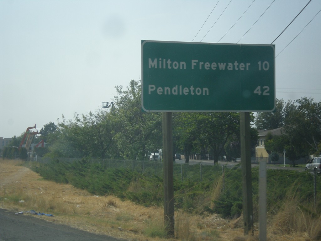
WA-125 South - Distance Marker
Distance marker on WA-125 south. Distance to Milton-Freewater (Oregon) and Pendleton (Oregon).
Taken 09-09-2017
 Walla Walla
 County
Washington
United States
Walla Walla
Walla Walla County
Washington
United States