Signs Tagged With Distance Marker
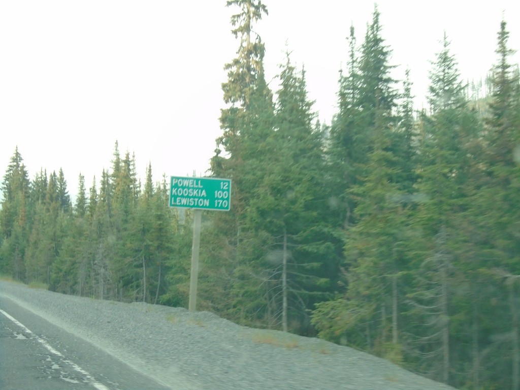
US-12 West - Distance Marker
Distance marker on US-12 west. Distance to Powell, Kooskia, and Lewiston.
Taken 08-11-2018
 Powell Junction
Idaho County
Idaho
United States
Powell Junction
Idaho County
Idaho
United States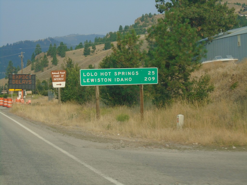
US-12 West - Distance Marker
Distance marker on US-12 west. Distance to Lolo Hot Springs and Lewiston Idaho.
Taken 08-11-2018
Lolo
Missoula County
Montana
United States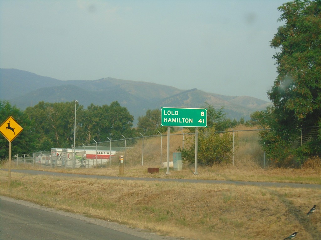
US-93 South/US-12 East - Distance Marker
Distance marker on US-93 South/US-12 East. Distance to Lolo and Hamilton.
Taken 08-11-2018
 Missoula
 County
Montana
United States
Missoula
Missoula County
Montana
United States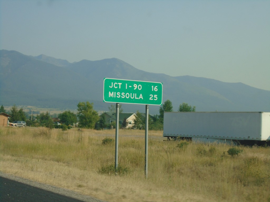
US-93 South/MT-200 East - Distance Marker
Distance Marker on US-93 South/MT-200 East. Distance to Jct I-90 and Missoula.
Taken 08-10-2018
 Arlee
Lake County
Montana
United States
Arlee
Lake County
Montana
United States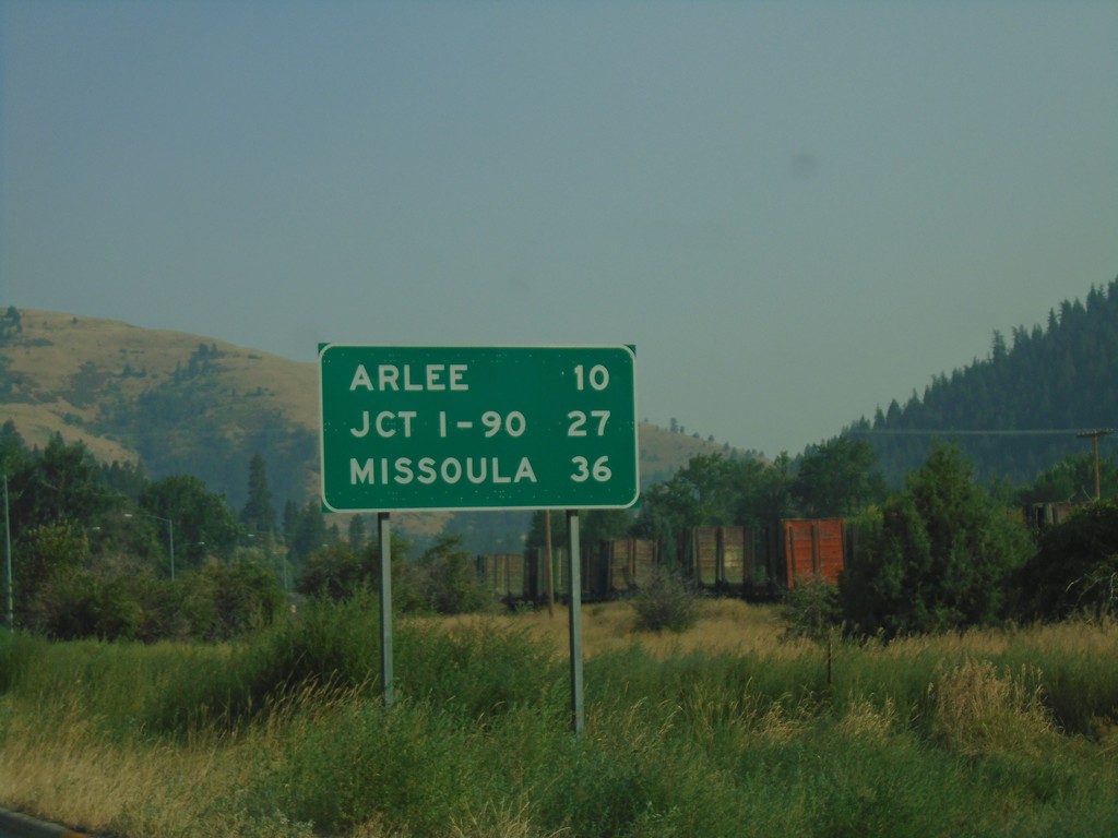
US-93 South - Distance Marker
Distance Marker on US-93 South - Arlee, Jct. I-90, Missoula.
Taken 08-10-2018
Ravalli
Lake County
Montana
United States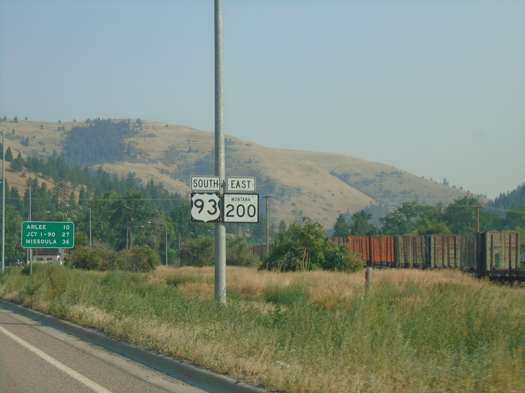
US-93 South/MT-200 East - Lake County
US-93 South/MT-200 East - Lake County
Taken 08-10-2018
Ravalli
Lake County
Montana
United States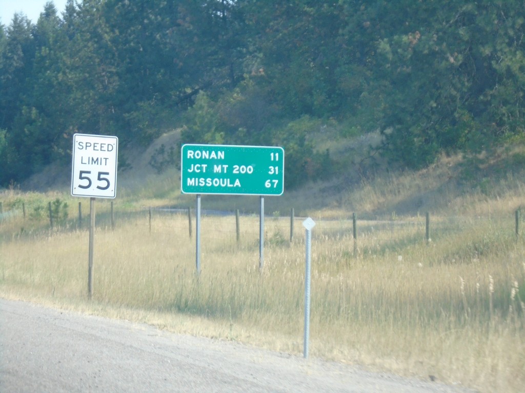
US-93 South - Distance Marker
Distance marker on US-93 south. Distance to Ronan, Jct. MT-200, and Missoula. Speed Limit 55 MPH.
Taken 08-10-2018
Polson
Lake County
Montana
United States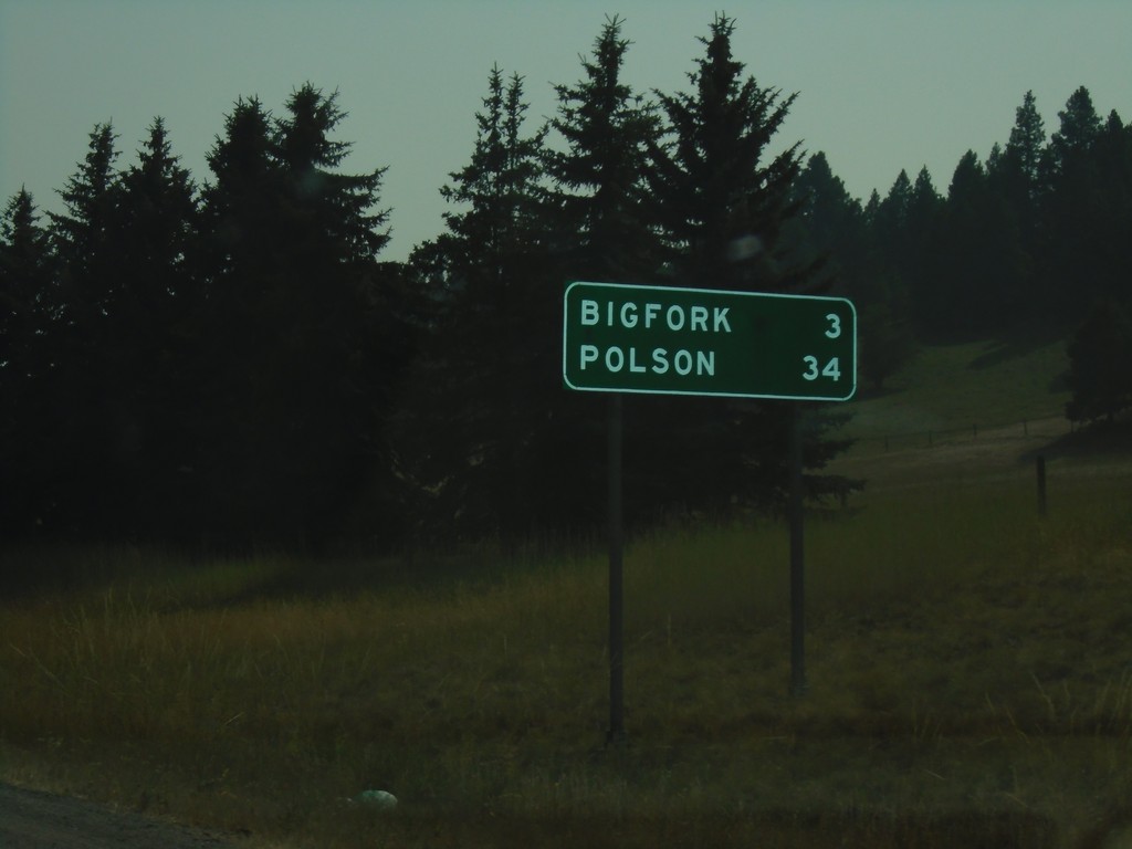
MT-35 South - Distance Marker
Distance marker on MT-35 south. Distance to Bigfork and Polson.
Taken 08-10-2018
 Bigfork
Flathead County
Montana
United States
Bigfork
Flathead County
Montana
United States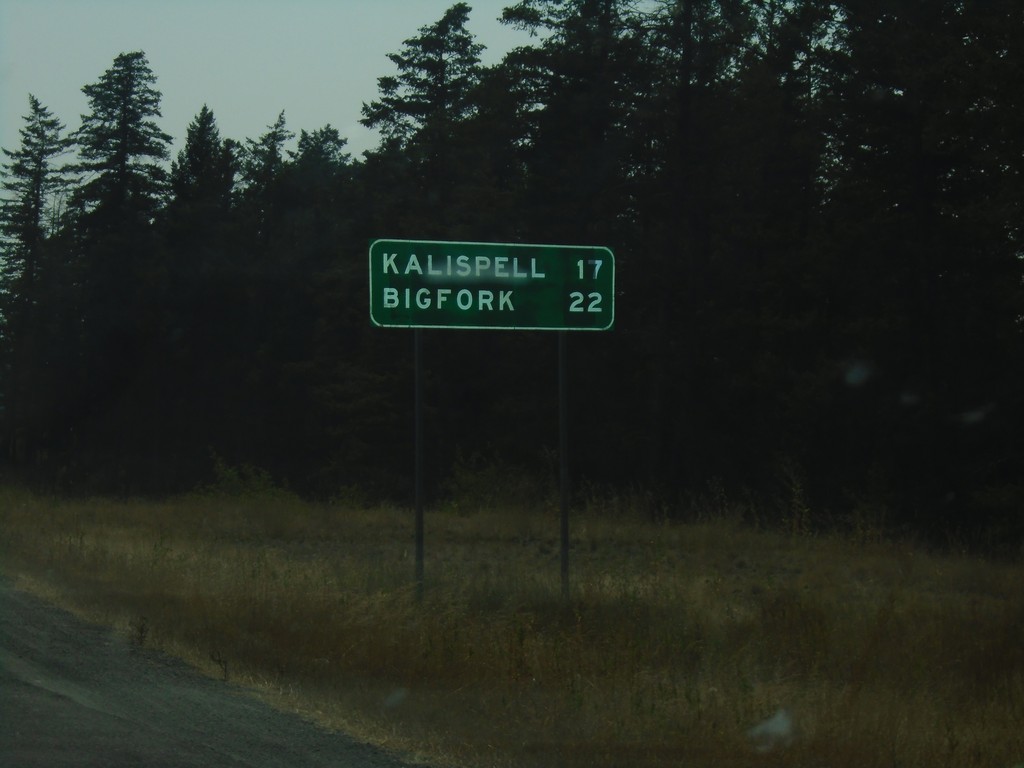
MTS-206 South - Distance Marker
Distance marker on MTS-206 south. Distance to Kalispell and Bigfork.
Taken 08-10-2018
 Columbia Falls
Flathead County
Montana
United States
Columbia Falls
Flathead County
Montana
United States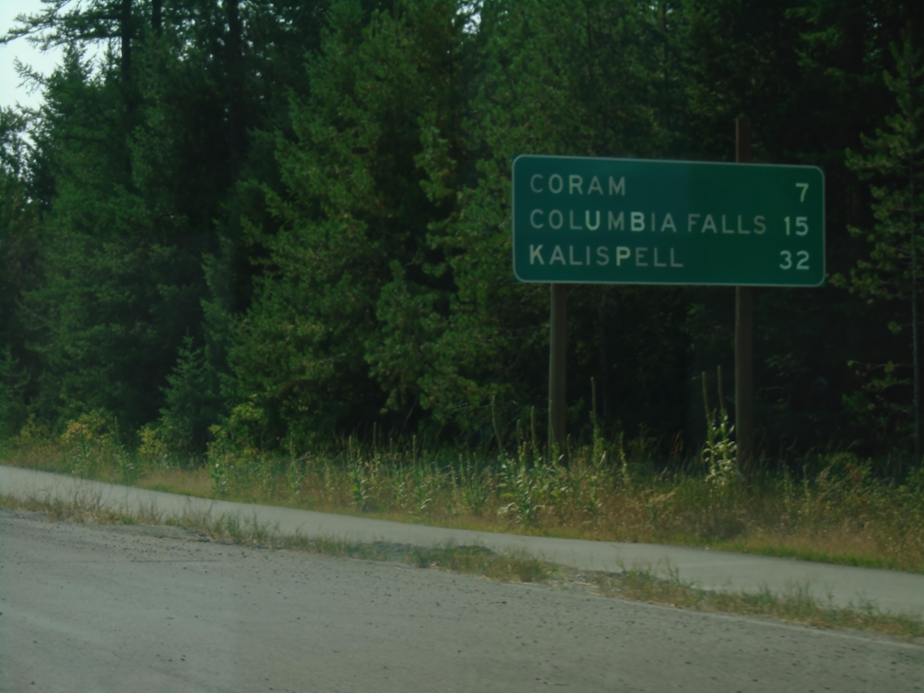
US-2 West - Distance Marker
Distance marker on US-2 west. Distance to Coram, Columbia Falls, and Kalispell.
Taken 08-10-2018
 West Glacier
Flathead County
Montana
United States
West Glacier
Flathead County
Montana
United States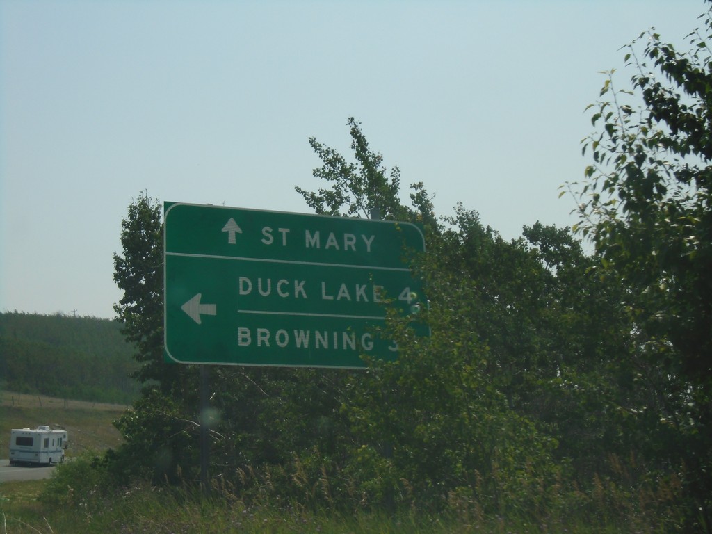
US-89 South at MTS-464
US-89 South at MTS-464. Use MTS-464 for Duck Lake and Browning; continue south on US-89 for St Mary.
Taken 08-10-2018

 Babb
Glacier County
Montana
United States
Babb
Glacier County
Montana
United States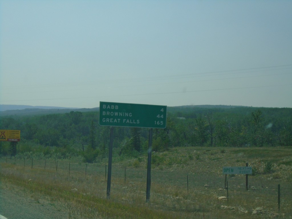
US-89 South - Distance Marker
Distance marker on US-89 south. Distance to Babb, Browning, and Great Falls.
Taken 08-10-2018
Babb
Glacier County
Montana
United States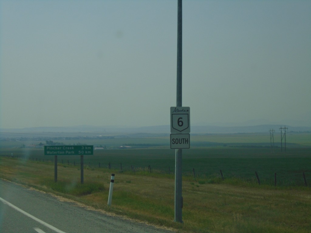
AB-6 South - Pincher Creek
AB-6 south shield in Pincher Creek.
Taken 08-10-2018
 Pincher Creek
 No. 9
Alberta
Canada
Pincher Creek
Pincher Creek No. 9
Alberta
Canada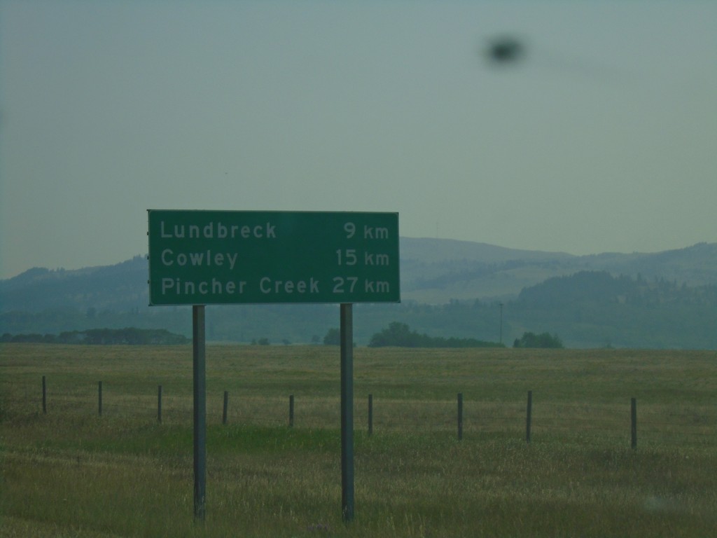
AB-3 East - Distance Marker
Distance marker on AB-3 east. Distance to Lundbreck, Cowley, and Pincher Creek.
Taken 08-10-2018
 Lundbreck
Pincher Creek No. 9
Alberta
Canada
Lundbreck
Pincher Creek No. 9
Alberta
Canada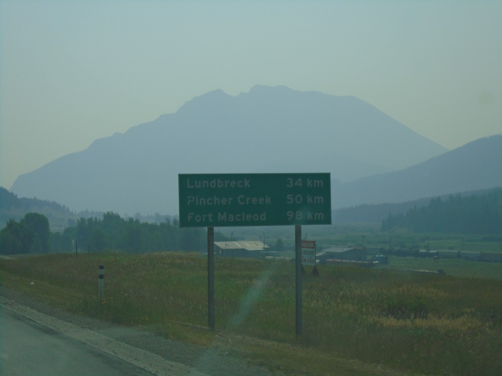
AB-3 East - Distance Marker
Distance marker on AB-3 East. Distance to Lundbreck, Pincher Creek, and Fort Macleod.
Taken 08-10-2018
Crowsnest Pass
Alberta
Canada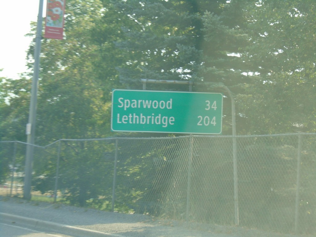
BC-3 East - Distance Marker
Distance marker on BC-3 east in Fernie. Distance to Sparwood and Lethbridge (Alberta).
Taken 08-10-2018
 Fernie
East Kootenay
British Columbia
Canada
Fernie
East Kootenay
British Columbia
Canada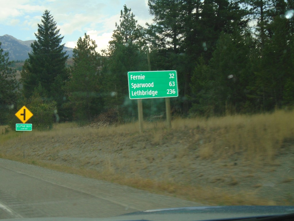
BC-3 East - Distance Marker
Distance marker on BC-3 east. Distance to Fernie, Sparwood, and Lethbridge (Alberta).
Taken 08-05-2018
Elko
East Kootenay
British Columbia
Canada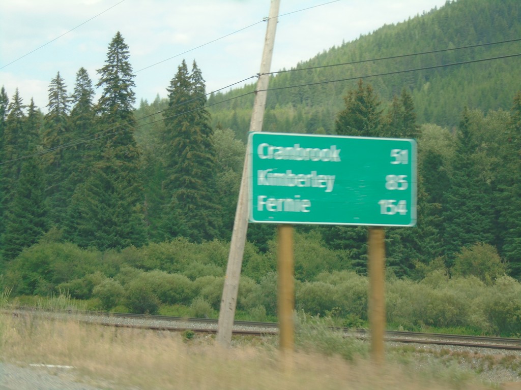
BC-3 East - Distance Marker
Distance marker on BC-3 east. Distance to Cranbrook, Kimberley, and Fernie.
Taken 08-05-2018
 Yahk
East Kootenay
British Columbia
Canada
Yahk
East Kootenay
British Columbia
Canada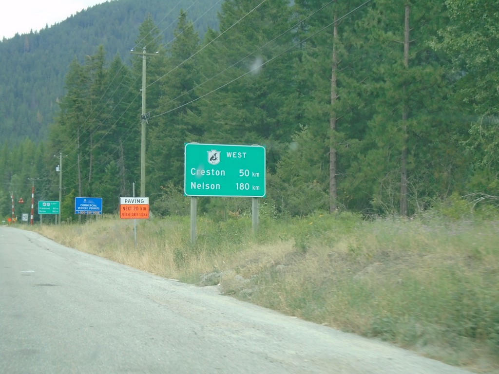
BC-95 North - Distance Marker For BC-3 West
Distance Marker For BC-3 West (Crowsnest Highway) on BC-95 north. Distance to Nelson and Creston. Many of the border crossings near the Crowsnest Highway have signs showing distance along the Crowsnest Highway.
Taken 08-05-2018
Kingsgate
Central Kootenay
British Columbia
Canada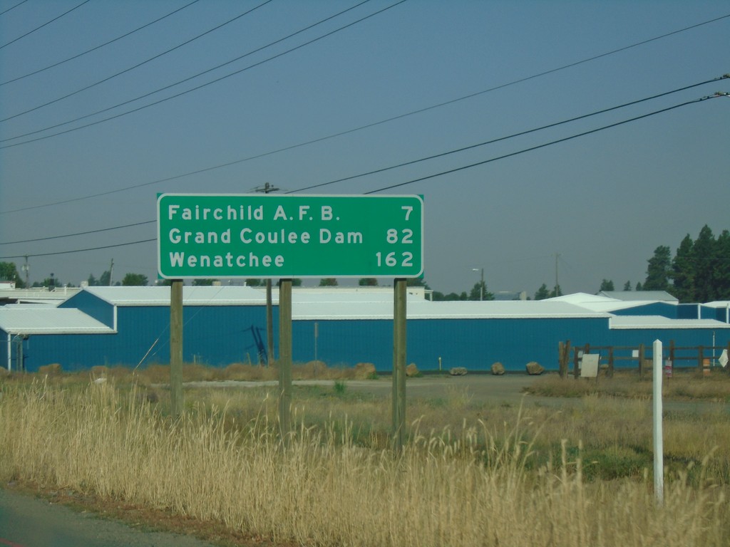
US-2 West - Distance Marker
Distance marker on US-2 west. Distance to Fairchild AFB, Grand Coulee Dam, and Wenatchee.
Taken 08-05-2018
Spokane
Spokane County
Washington
United States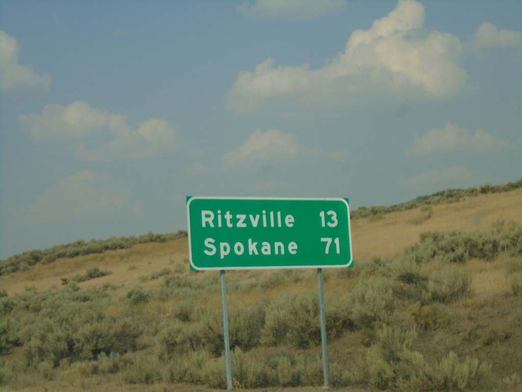
US-395 North - Distance Marker
Distance marker on US-395 north. Distance to Ritzville and Spokane.
Taken 08-04-2018
 Ritzville
Adams County
Washington
United States
Ritzville
Adams County
Washington
United States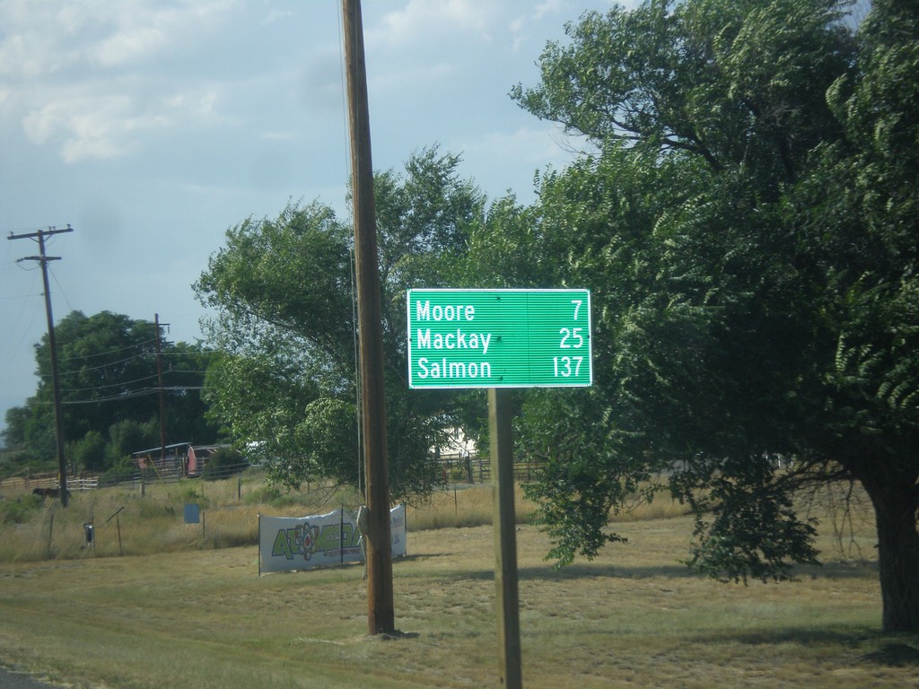
US-93 North - Distance Marker
Distance marker on US-93 north. Distance to Moore, Mackay, and Salmon.
Taken 07-21-2018
Arco
Butte County
Idaho
United States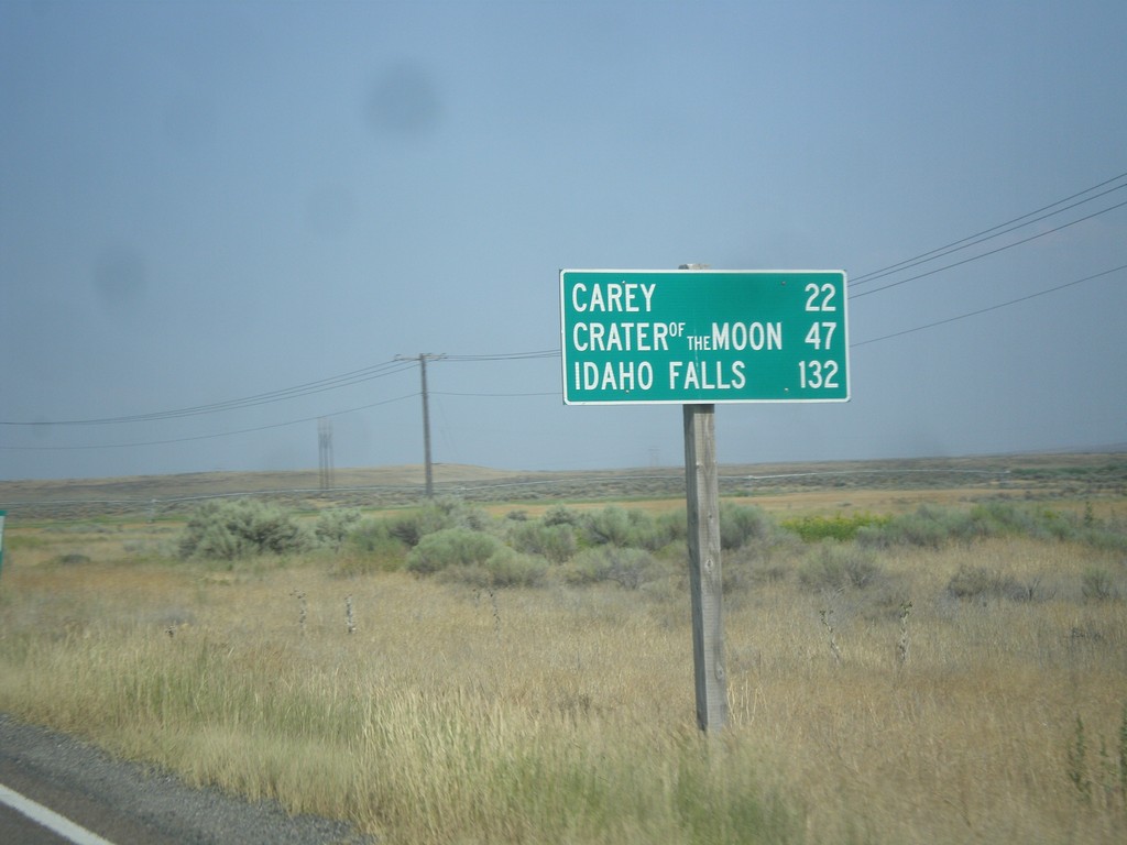
US-26 East/US-93 North - Distance Marker
Distance Marker on US-26 East/US-93 North. Distance to Carey, Craters of the Moon, and Idaho Falls.
Taken 07-21-2018
 Richfield
Lincoln County
Idaho
United States
Richfield
Lincoln County
Idaho
United States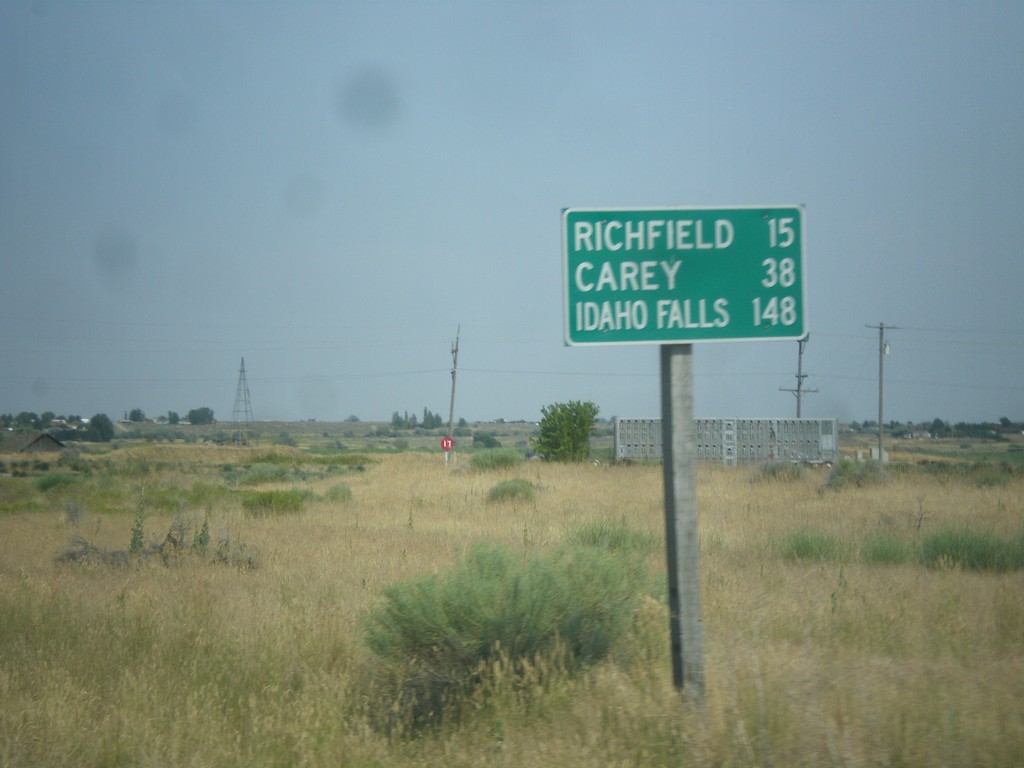
US-93 North/US-26 East - Distance Marker
Distance Marker on US-93 North/US-26 East. Distance to Richfield, Carey, and Idaho Falls.
Taken 07-21-2018
Shoshone
Lincoln County
Idaho
United States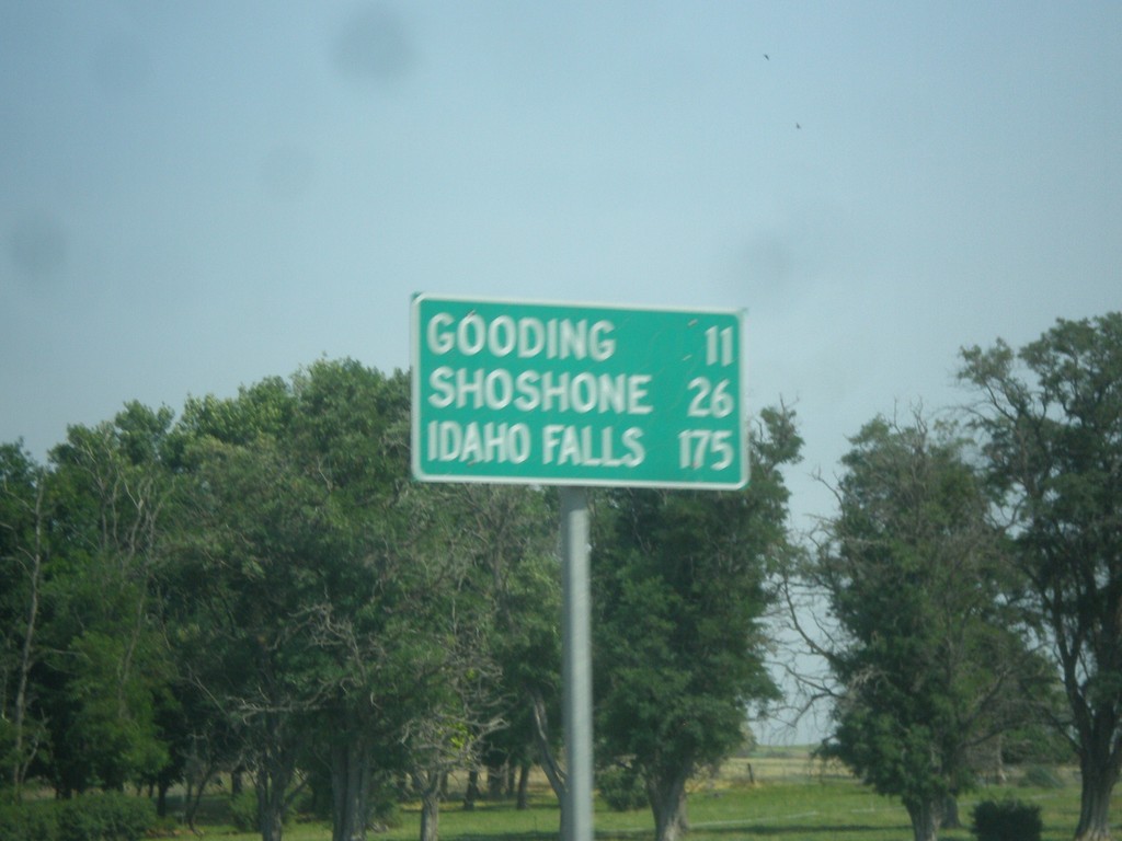
US-26 East - Distance Marker
Distance Marker on US-26 east. Distance to Gooding, Shoshone, and Idaho Falls.
Taken 07-21-2018
Bliss
Gooding County
Idaho
United States