Signs Tagged With Distance Marker
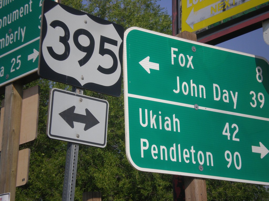
East Main St. at US-395/OR-402 in Long Creek
East Main St. at US-395/OR-402 in Long Creek. Turn left for US-395 north to Ukiah and Pendleton. Turn left for US-395 south to Fox and John Day.
Taken 09-09-2017

 Long Creek
Grant County
Oregon
United States
Long Creek
Grant County
Oregon
United States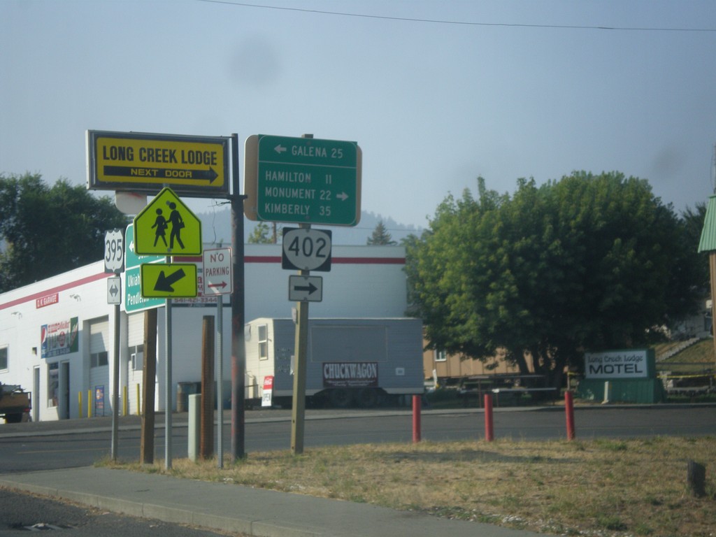
US-395 South at OR-402 West
US-395 south at OR-402 west to Hamilton, Monument, and Kimberly. Turn left for forest road east to Galena on the Middle Fork John Day River.
Taken 09-09-2017
Long Creek
Grant County
Oregon
United States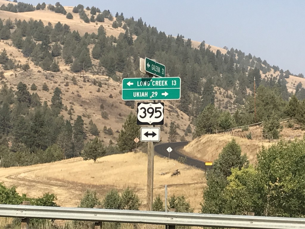
Middle Fork John Day River Road at US-395
Middle Fork John Day River Road at US-395 in Grant County. Turn left for US-395 south to Long Creek; left for US-395 north to Ukiah.
Taken 09-09-2017
Long Creek
Grant County
Oregon
United States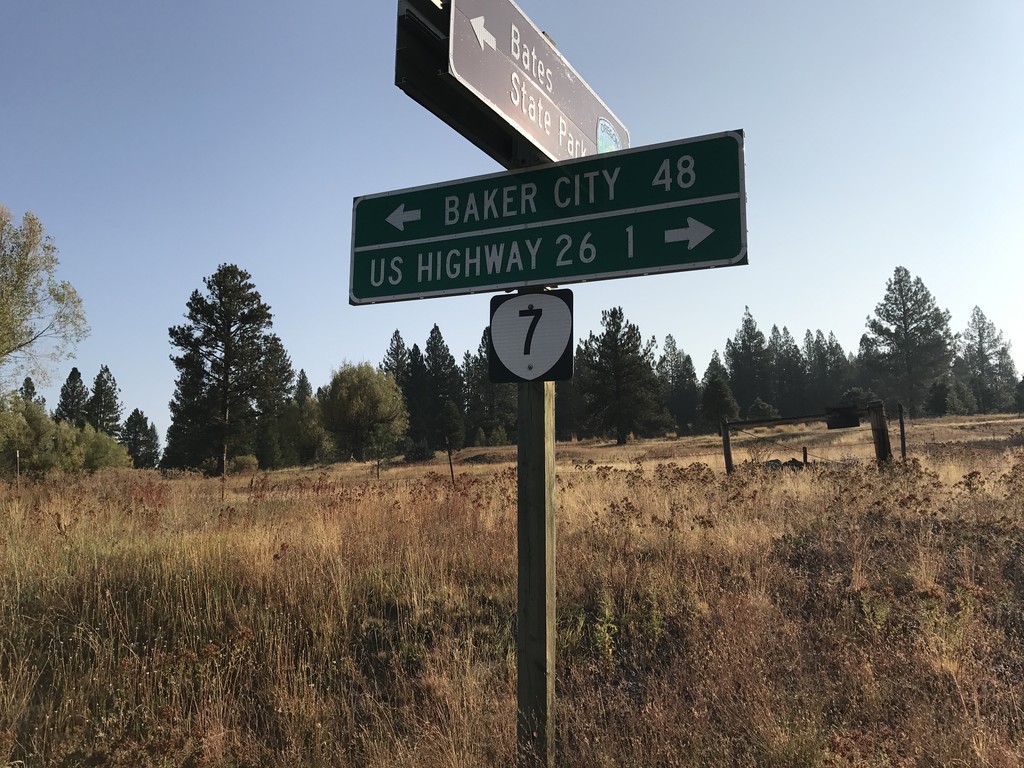
End Middle Fork John Day River Road at OR-7
End Middle Fork John Day River Road at OR-7 in Grant County. Use OR-7 west for US-26 Jct; OR-7 east for Baker City.
Taken 09-09-2017
 Austin
Grant County
Oregon
United States
Austin
Grant County
Oregon
United States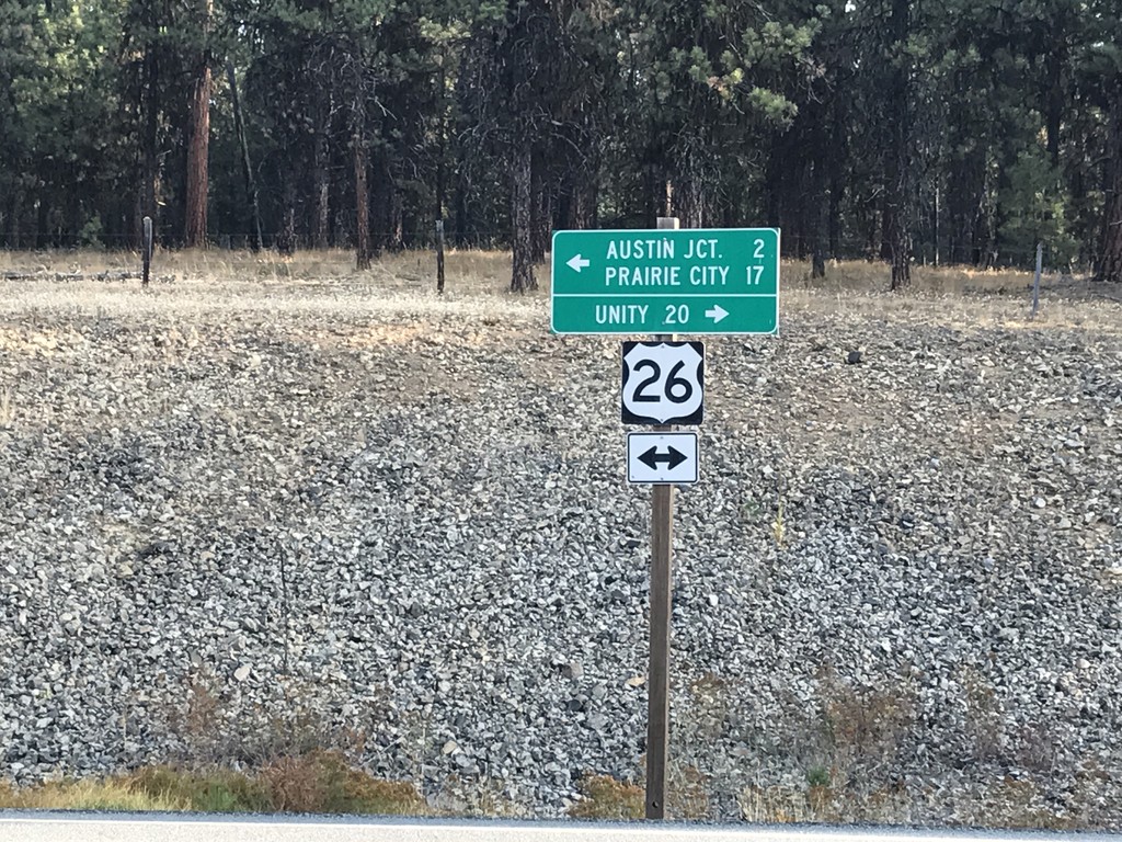
Forest Service Road at US-26
Forest Service Road at US-26 in Grant County. Turn right for US-26 east to Unity; left for US-26 west to Austin Jct. and Prairie City.
Taken 09-09-2017
 Austin
Grant County
Oregon
United States
Austin
Grant County
Oregon
United States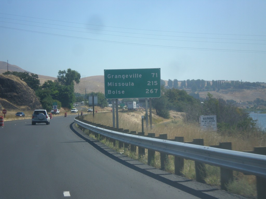
US-12 East/US-95 South - Distance Marker
Distance marker on US-95 South/US-12 East to Grangeville, Missoula (MT - via US-12), and Boise.
Taken 07-30-2017

 Lewiston
Nez Perce County
Idaho
United States
Lewiston
Nez Perce County
Idaho
United States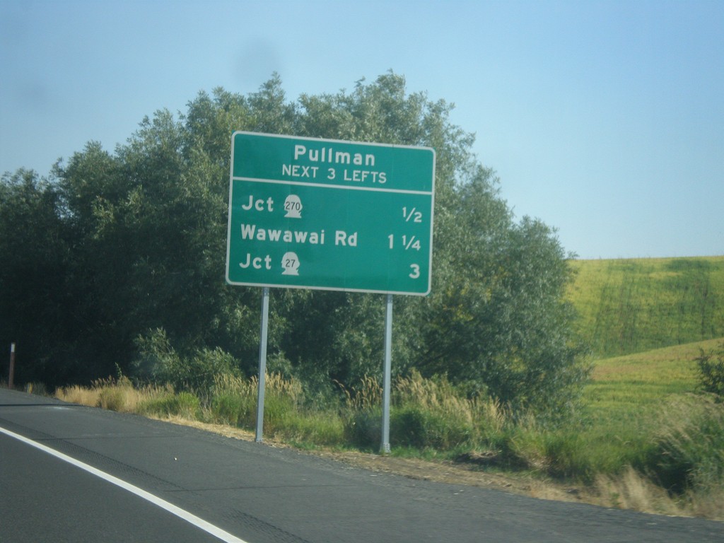
US-195 South - Pullman Access
US-195 South - Pullman. Use next three lefts for access to Pullman. WA-270 West, Wawawai Road, and WA-27 North.
Taken 07-29-2017

 Pullman
Whitman County
Washington
United States
Pullman
Whitman County
Washington
United States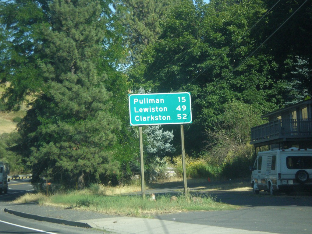
US-195 South - Distance Marker
Distance marker on US-195 south. Distance to Pullman, Lewiston (Idaho), and Clarkston.
Taken 07-29-2017
Colfax
Whitman County
Washington
United States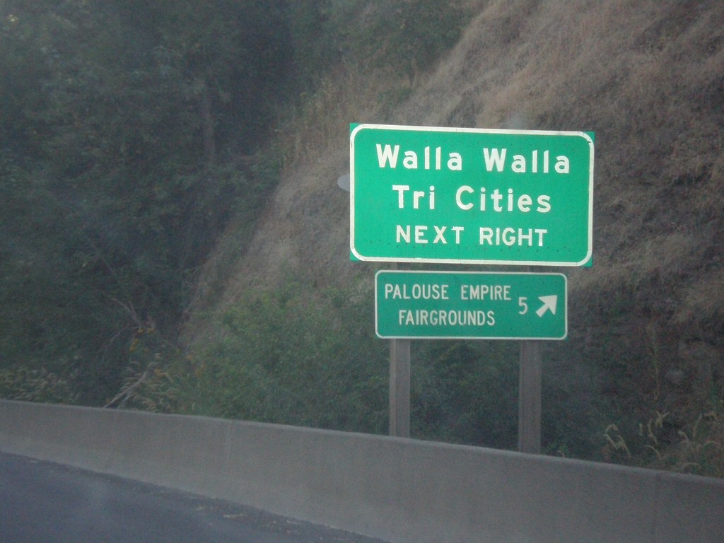
US-195 South Approaching WA-26
US-195 south approaching WA-26 west. Use WA-26 for Walla Walla and the Tri Cities. Also use WA-26 for the Palouse Empire Fairgrounds.
Taken 07-29-2017
 Colfax
Whitman County
Washington
United States
Colfax
Whitman County
Washington
United States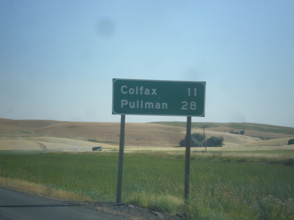
US-195 South - Distance Marker
Distance marker on US-195 south. Distance to Colfax, and Pullman.
Taken 07-29-2017
Colfax
Whitman County
Washington
United States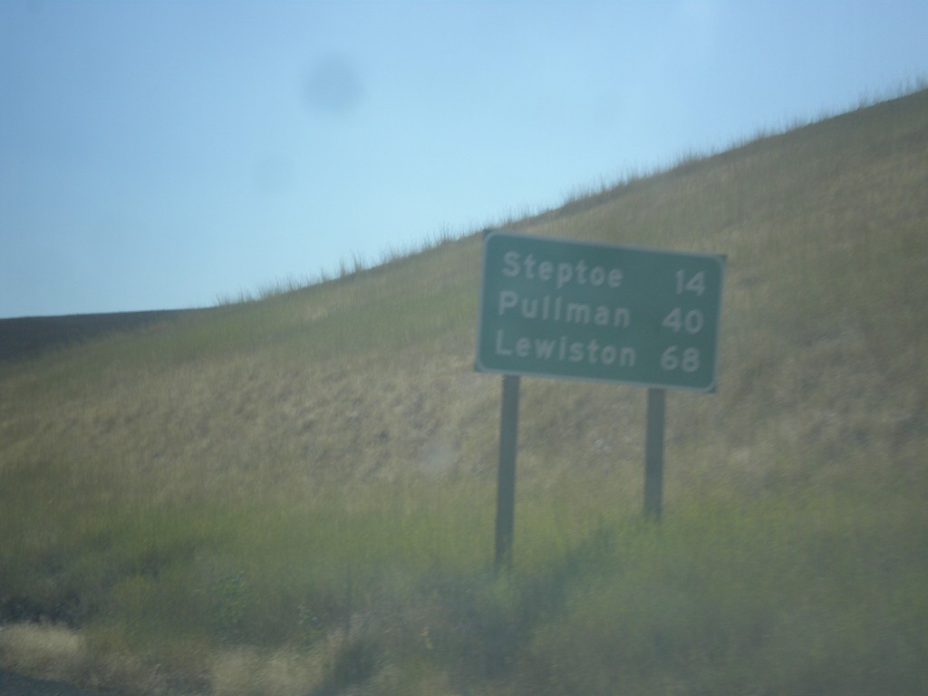
US-195 South - Distance Marker
Distance marker on US-195 South. Distance to Steptoe, Pullman, and Lewiston (Idaho).
Taken 07-29-2017
Donahue
Whitman County
Washington
United States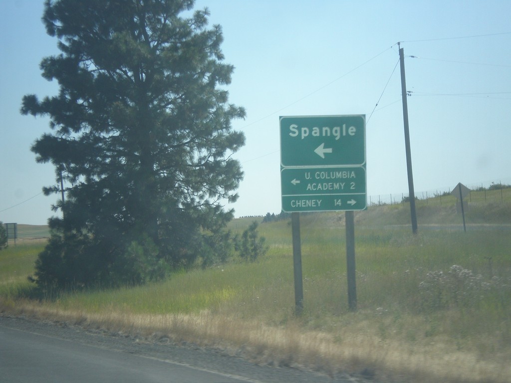
US-195 South - Spangle
US-195 South at Spangle junction. Turn left for Spangle and Upper Columbia Academy. Turn right to Cheney.
Taken 07-29-2017
Spangle
Spokane County
Washington
United States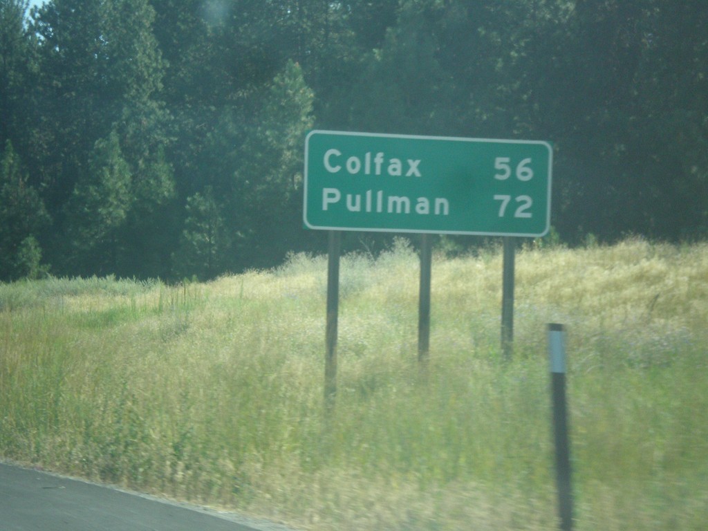
US-195 South - Distance Marker
Distance marker on US-195 south. First distance marker on US-195 southbound. Distance to Colfax and Pullman.
Taken 07-29-2017
Spokane
Spokane County
Washington
United States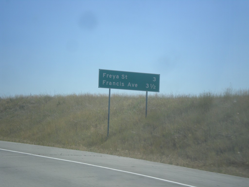
Future US-395 South - Distance Marker
Distance marker on Future US-395 south. Distance to Freya St. and Francis Ave.
Taken 07-29-2017
 Spokane
 County
Washington
United States
Spokane
Spokane County
Washington
United States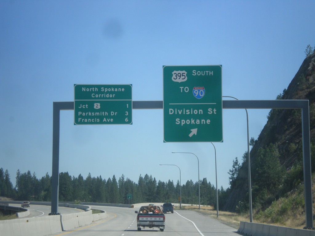
US-395 South at North Spokane Corridor
US-395 South at North Spokane Corridor. Use left lane to continue south on the freeway along the North Spokane Corridor. Use the right lane for the US-395 South/To I-90/Division St./Spokane interchange. The next three exits on the North Spokane Corridor (Future US-395) are US-2, Parksmith Drive, and Francis Ave.
Taken 07-29-2017

 Spokane
 County
Washington
United States
Spokane
Spokane County
Washington
United States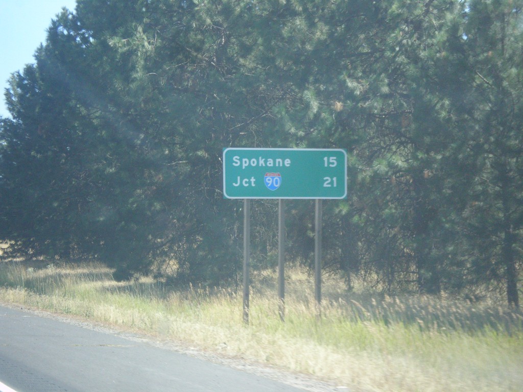
US-395 South - Distance Marker
Distance marker on US-395 south leaving Deer Park. Distance to Spokane and I-90.
Taken 07-29-2017
Deer Park
Spokane County
Washington
United States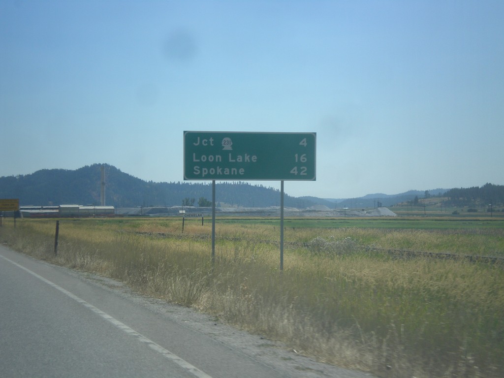
US-395 South - Distance Marker
Distance marker on US-395 south leaving Chewelah. Distance to Jct. WA-231, Loon Lake, and Spokane.
Taken 07-29-2017
 Chewelah
Stevens County
Washington
United States
Chewelah
Stevens County
Washington
United States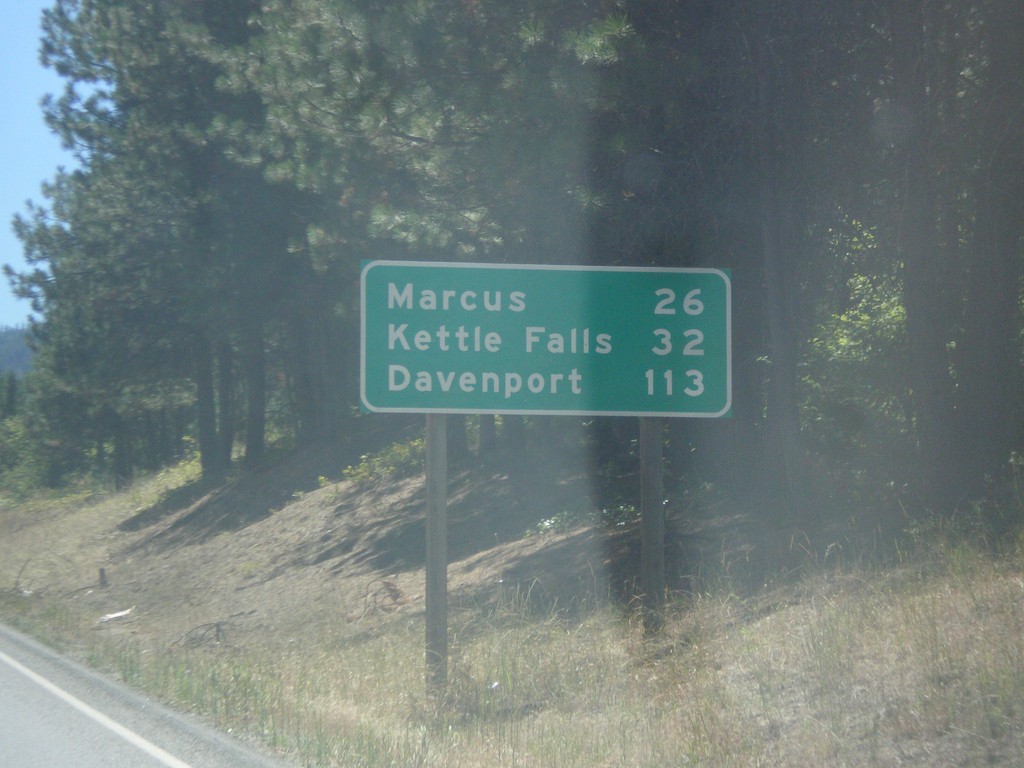
WA-25 South - Distance Marker
Distance maker on WA-25 south. Distance to Marcus, Kettle Falls, and Davenport. This is the first distance marker on WA-25 south of the US-Canada border.
Taken 07-29-2017
 Northport
Stevens County
Washington
United States
Northport
Stevens County
Washington
United States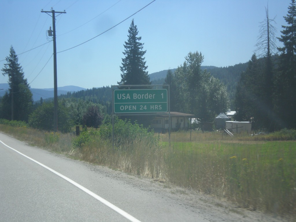
BC-22 South - Distance Marker
Distance Marker on BC-22 South. Distance to USA Border - 1 km. Border crossing at Port of Frontier is open 24 hours.
Taken 07-29-2017
 Rossland
Kootenay Boundary
British Columbia
Canada
Rossland
Kootenay Boundary
British Columbia
Canada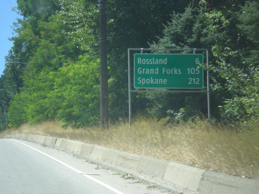
BC-22 South/BC-3B West - Distance Marker
Distance Marker on BC-22 South/BC-3B West. Distance to Rossland, Grand Forks (via BC-3B), and Spokane (Washington, via BC-22).
Taken 07-29-2017
 Trail
Kootenay Boundary
British Columbia
Canada
Trail
Kootenay Boundary
British Columbia
Canada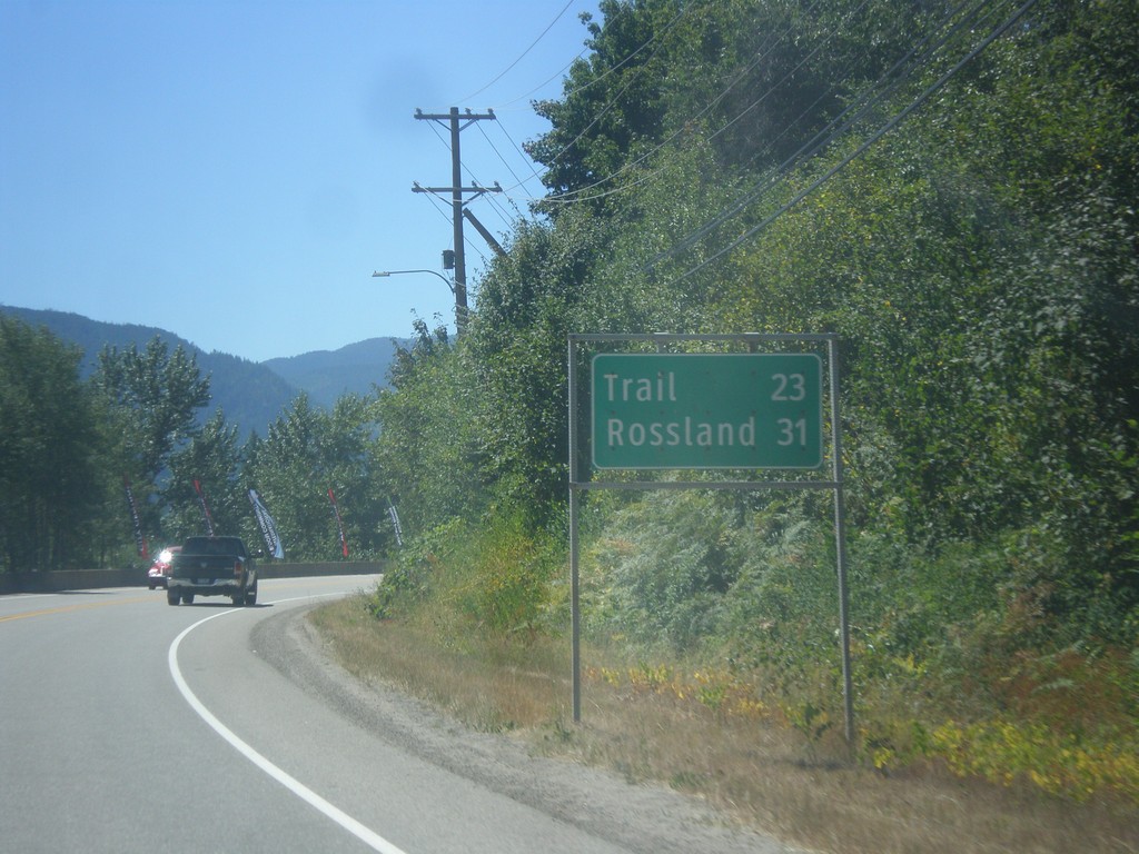
BC-22 South - Distance Marker
Distance marker on BC-22 south. Distance to Trail and Rossland.
Taken 07-29-2017
Castlegar
Central Kootenay
British Columbia
Canada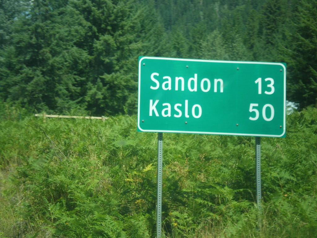
BC-31A East - Distance Marker
Distance Marker on BC-31A East. Distance to Sandon and Kaslo.
Taken 07-27-2017
 New Denver
Central Kootenay
British Columbia
Canada
New Denver
Central Kootenay
British Columbia
Canada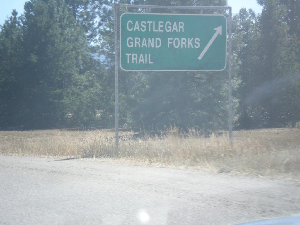
End BC-3A West at BC-3
End BC-3A West at BC-3. Use BC-3 West for Castlegar, Grand Forks, and Trail.
Taken 07-25-2017

 Castlegar
Central Kootenay
British Columbia
Canada
Castlegar
Central Kootenay
British Columbia
Canada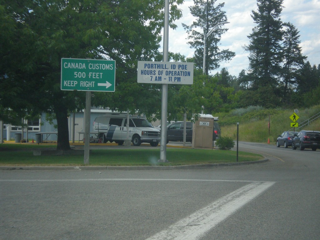
ID-1 North - Porthill Idaho Port of Entry
ID-1 North at Porthill Idaho Port of Entry. Merge right to continue into Canada.
Taken 07-23-2017
 Porthill
Boundary County
Idaho
United States
Porthill
Boundary County
Idaho
United States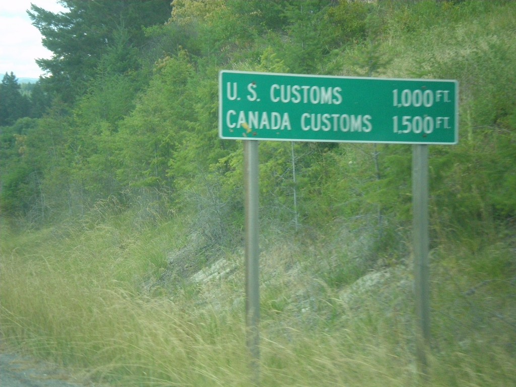
ID-1 North - Distance Marker
Distance Marker on ID-1 north at Porthill. Distance to US Customs and Canada Customs.
Taken 07-23-2017
Bonners Ferry
Boundary County
Idaho
United States