Signs Tagged With Distance Marker
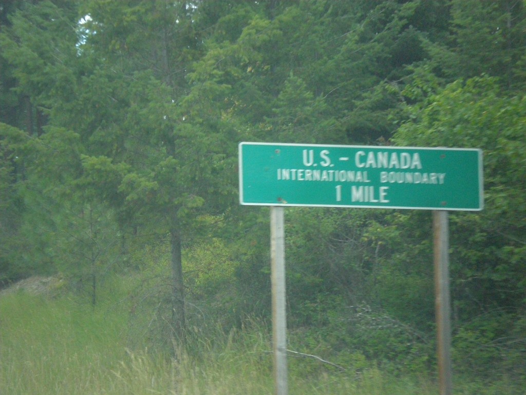
ID-1 North - US-Canada International Boundary
ID-1 North approaching US-Canada International Boundary at Porthill.
Taken 07-23-2017
 Bonners Ferry
Boundary County
Idaho
United States
Bonners Ferry
Boundary County
Idaho
United States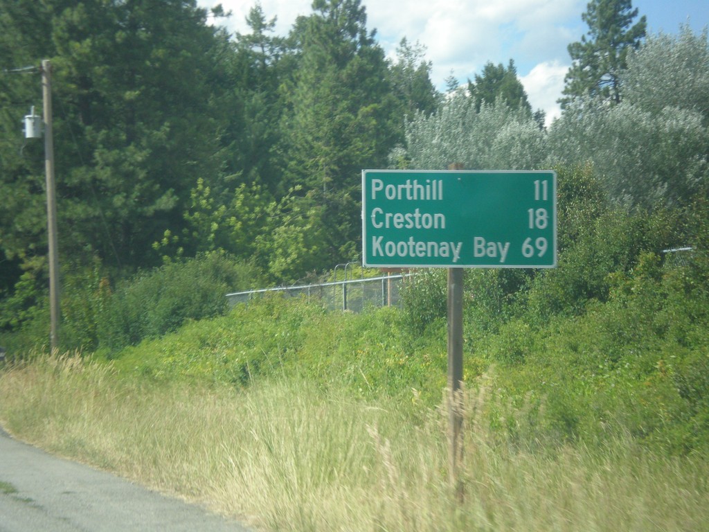
ID-1 North - Distance Marker
Distance marker on ID-1 north. Distance to Porthill, Creston (BC - Canada), and Kootenay Bay (BC- Canada). Kootenay Bay is the Kootenay Lake ferry terminal.
Taken 07-23-2017
Copeland
Boundary County
Idaho
United States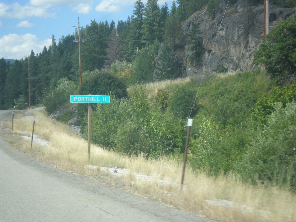
ID-1 North - Distance Marker
Distance marker on ID-1 north. Distance to Porthill. Porthill is located on the Canadian border.
Taken 07-23-2017
Bonners Ferry
Boundary County
Idaho
United States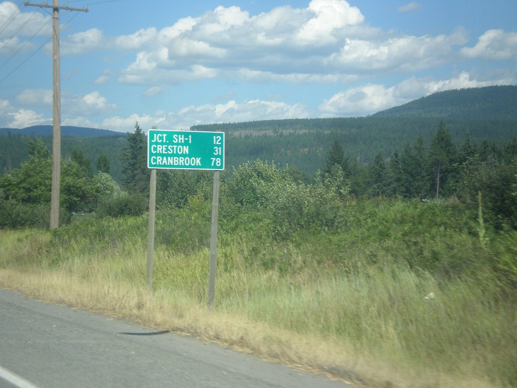
US-95 North - Distance Marker
Distance marker on US-95 north. Distance to Jct. SH-1, Creston (BC via ID-1), and Cranbrook (BC via US-95).
Taken 07-23-2017
 Bonners Ferry
Boundary County
Idaho
United States
Bonners Ferry
Boundary County
Idaho
United States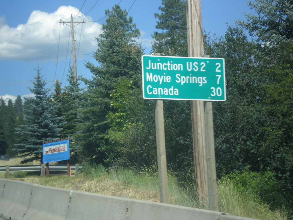
US-95 North/US-2 East - Distance Marker
Distance marker on US-95 North/US-2 East. Distance to Junction US-2, Moyie Springs (via US-2), and Canada (via US-95).
Taken 07-23-2017
 Bonners Ferry
Boundary County
Idaho
United States
Bonners Ferry
Boundary County
Idaho
United States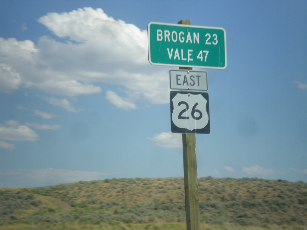
US-26 East - Distance Marker
Distance Marker on US-26 East. Distance to Brogan and Vale. The text on this sign is center aligned instead of the typical format of the place names aligned to the left and the distance aligned to the right.
Taken 07-15-2017
 Ironside
Malheur County
Oregon
United States
Ironside
Malheur County
Oregon
United States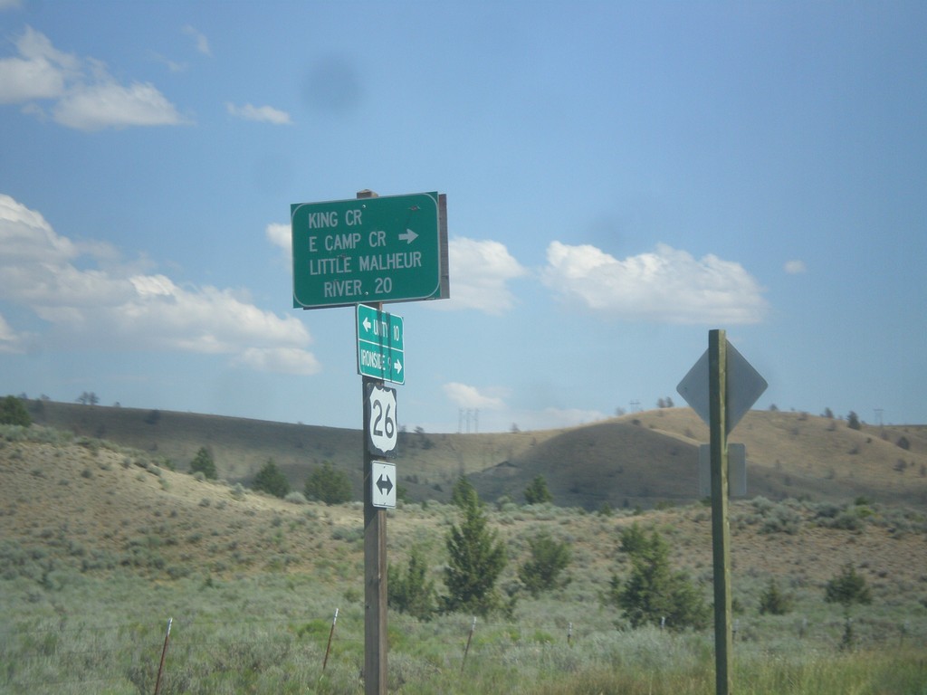
US-26 East - Camp Creek Road
US-26 East at King Creek/East Camp Creek/Little Malheur River junction.
Taken 07-15-2017
Unity
Baker County
Oregon
United States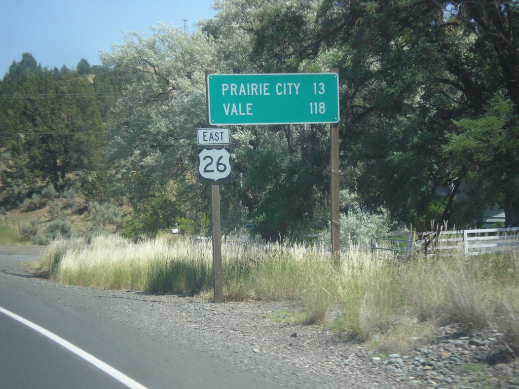
US-26 East - Distance Marker
Distance marker on US-26 east. Distance to Prairie City and Vale.
Taken 07-15-2017
John Day
Grant County
Oregon
United States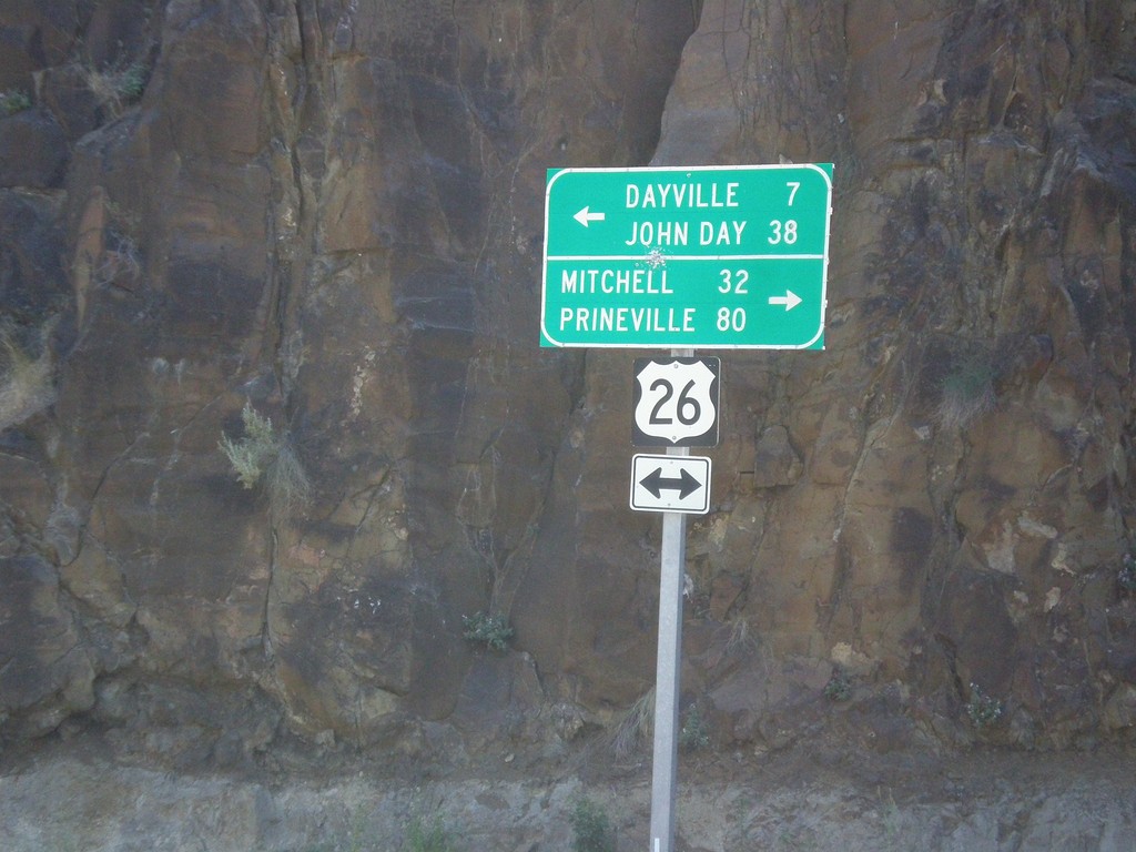
End OR-19 South at US-26
End OR-19 South at US-26 in Grant County. Turn right for US-26 West to Mitchell and Prineville (Ochoco Highway); turn left for US-26 East to Dayville and John Day (John Day Highway).
Taken 07-15-2017
 Dayville
Grant County
Oregon
United States
Dayville
Grant County
Oregon
United States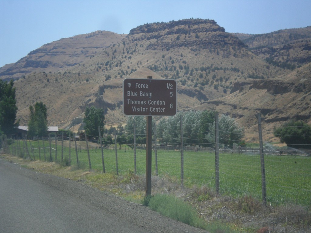
OR-19 South - John Day Fossil Beds NM Distance Marker
Distance Marker to sites in John Day Fossil Beds National Monument on OR-19 South - Foree, Blue Basin, and Thomas Condon Visitors Center.
Taken 07-15-2017
John Day
Grant County
Oregon
United States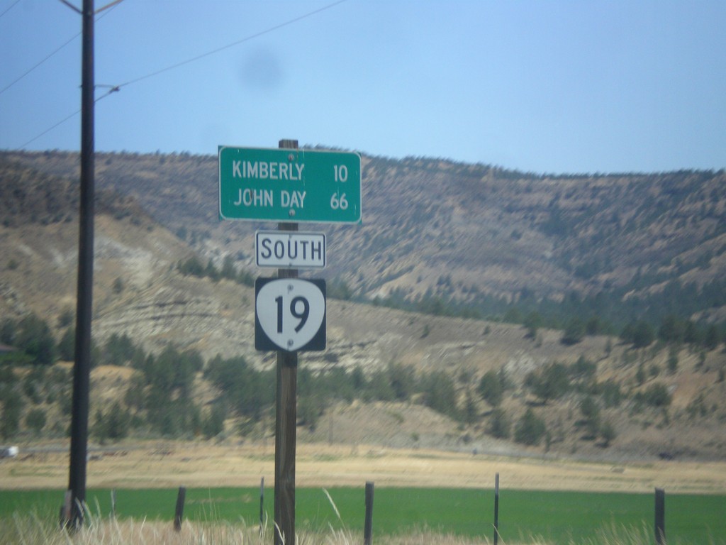
OR-19 South - Distance Marker
Distance marker on OR-19 south. Distance to Kimberly and John Day.
Taken 07-15-2017
Spray
Wheeler County
Oregon
United States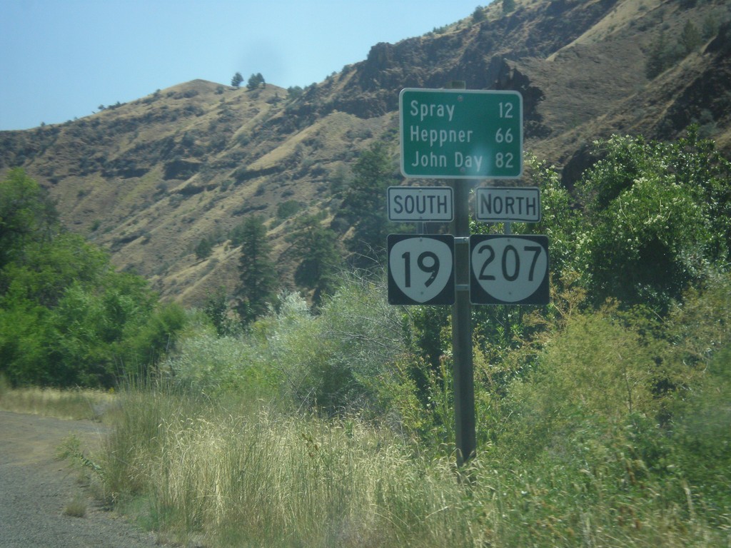
OR-19 South/OR-207 North - Distance Marker
Distance Marker on OR-19 South/OR-207 North. Distance to Spray, Heppner (via OR-207) and John Day (via OR-19).
Taken 07-15-2017
 Service Creek
Wheeler County
Oregon
United States
Service Creek
Wheeler County
Oregon
United States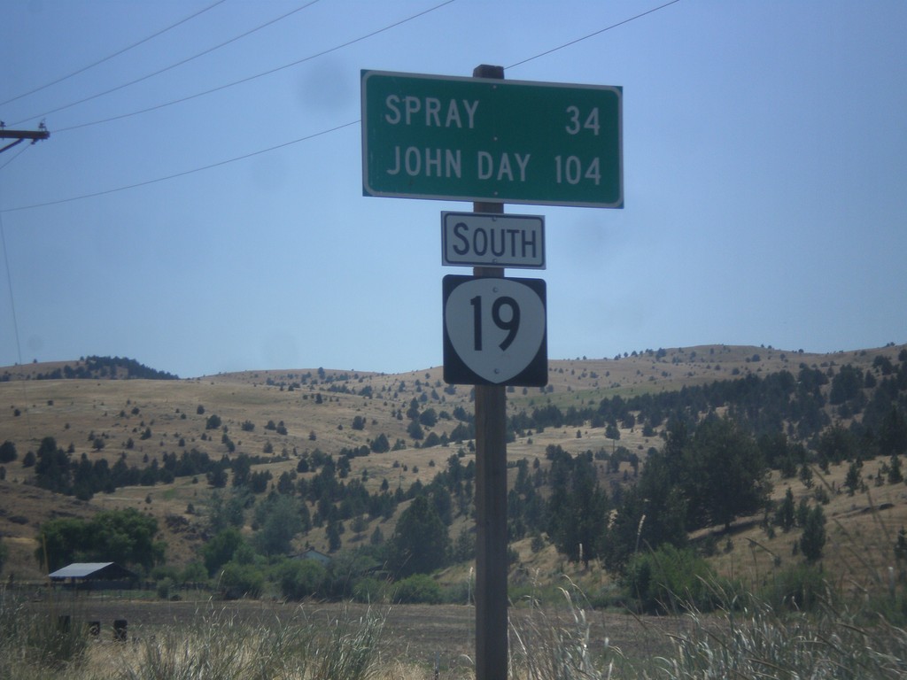
OR-19 South - Distance Marker
Distance marker on OR-19 south. Distance to Spray and John Day.
Taken 07-15-2017
Fossil
Wheeler County
Oregon
United States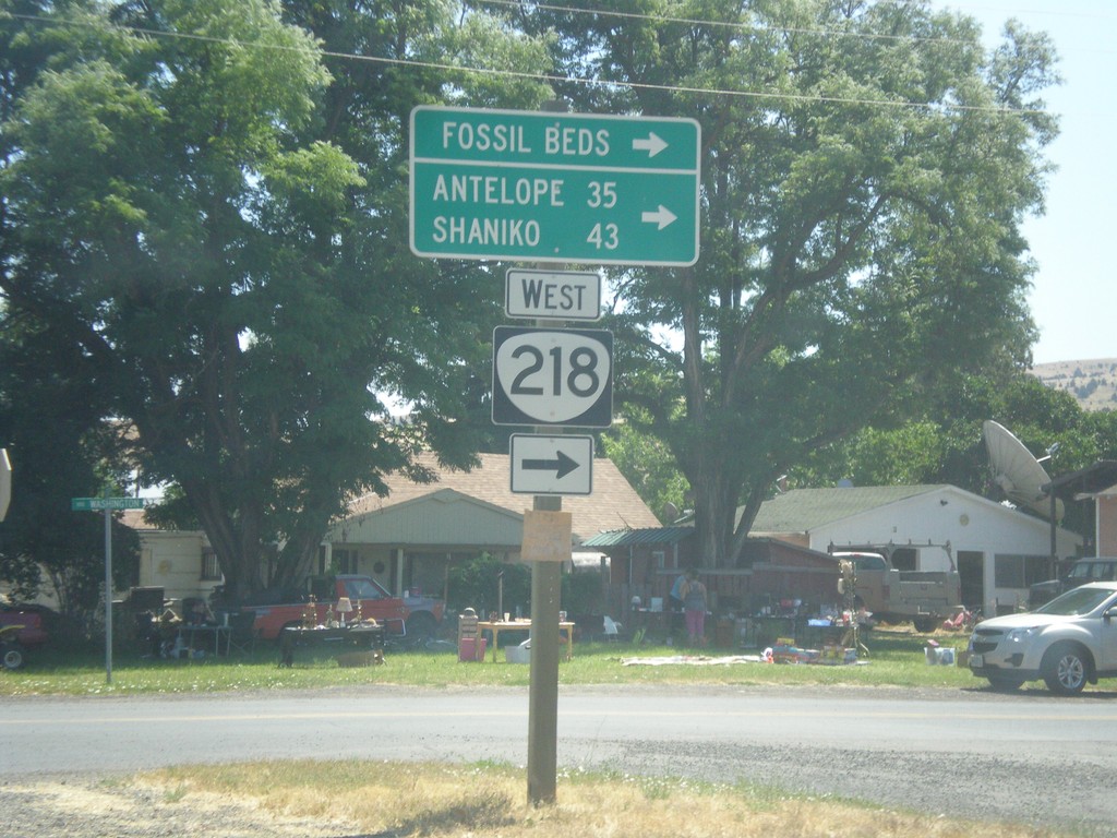
OR-19 South at OR-218 West
OR-19 South at OR-218 West in Fossil. Use OR-218 west for (John Day) Fossil Bends (Clarno Unit), Antelope, and Shaniko.
Taken 07-15-2017
 Fossil
Wheeler County
Oregon
United States
Fossil
Wheeler County
Oregon
United States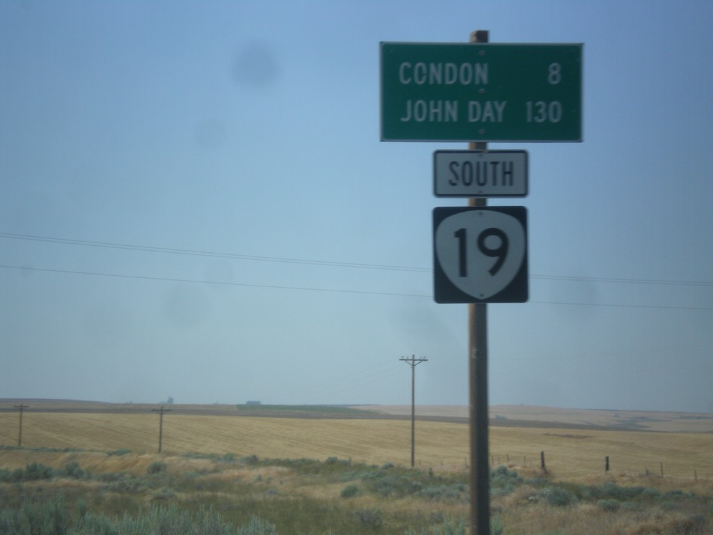
OR-19 South - Distance Marker
Distance marker on OR-19 south. Distance to Condon and John Day.
Taken 07-15-2017
Condon
Gilliam County
Oregon
United States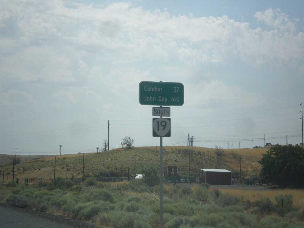
OR-19 South - Distance Marker
Distance marker on OR-19 south. Distance to Condon and John Day.
Taken 07-15-2017
Arlington
Gilliam County
Oregon
United States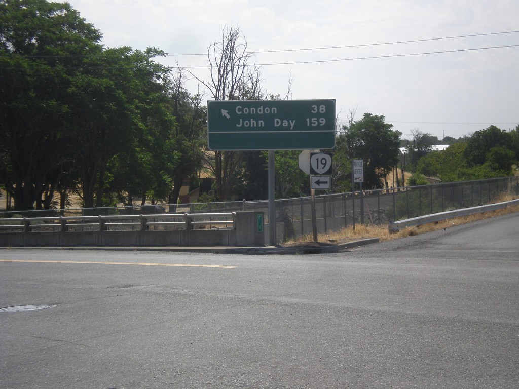
OR-19 South (Cottonwood St.) at Locust St.
OR-19 South (Cottonwood St.) at Locust St. in Arlington. Turn left to continue south on OR-19 for Condon and John Day.
Taken 07-15-2017
Arlington
Gilliam County
Oregon
United States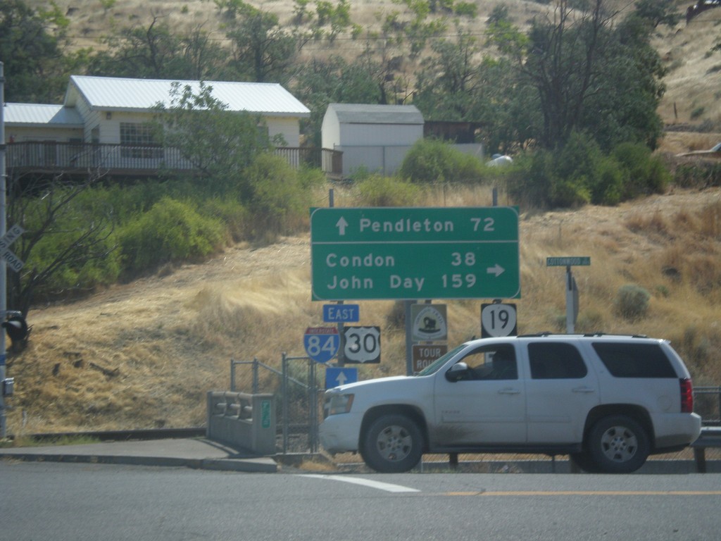
I-84 East Exit 137 Offramp at OR-19
I-84 East Exit 137 offramp at OR-19 in Arlington. Turn right on OR-19 south for Condon and John Day. Continue straight for access to I-84/US-30 East to Pendleton.
Taken 07-15-2017

 Arlington
Gilliam County
Oregon
United States
Arlington
Gilliam County
Oregon
United States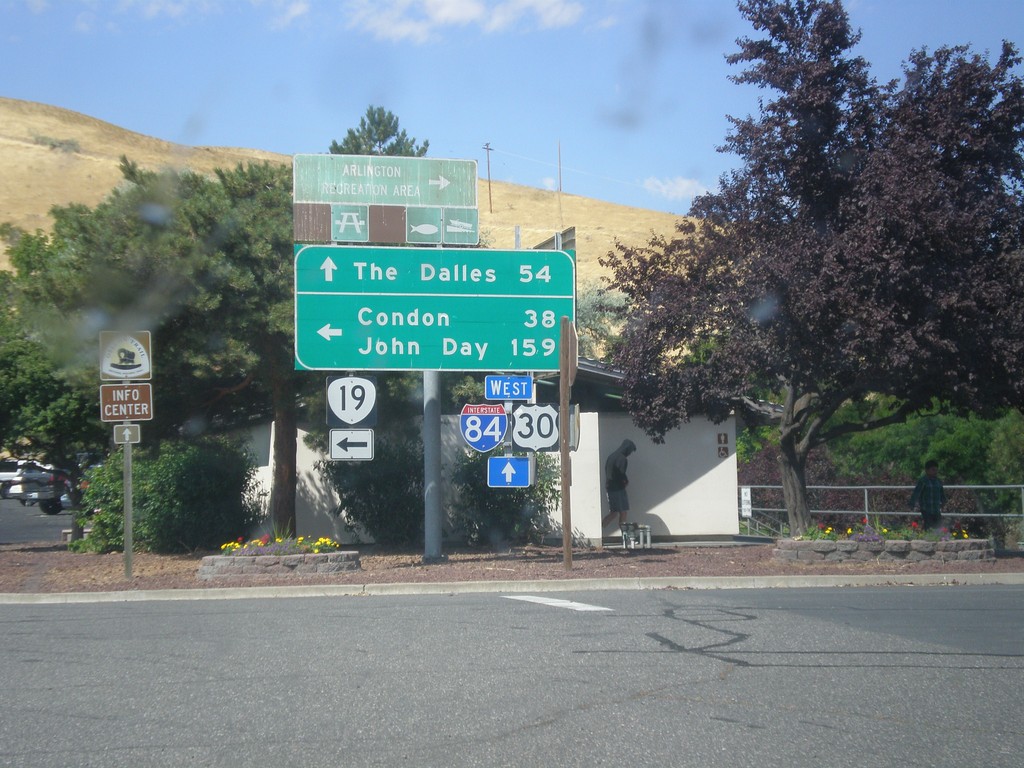
I-84 West Exit 137 Offramp at OR-19
I-84 West Exit 137 offramp at OR-19 in Arlington. Turn left on OR-19 south for Condon and John Day. Continue straight for access to I-84/US-30 West to The Dalles.
Taken 07-15-2017
Arlington
Gilliam County
Oregon
United States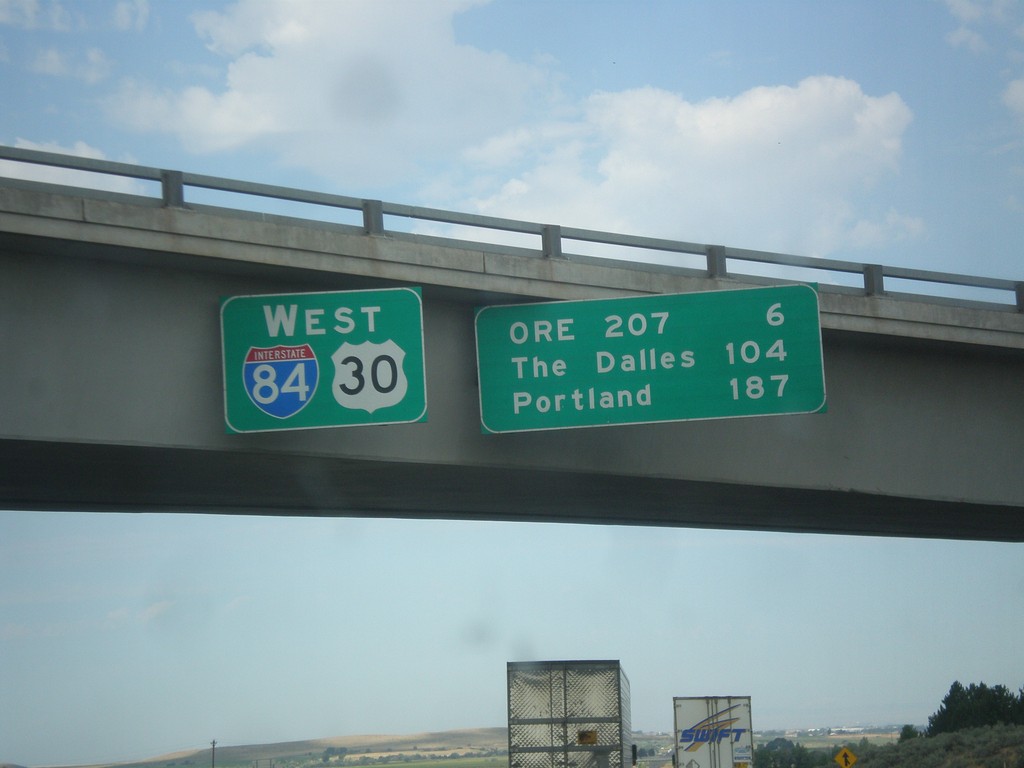
I-84/US-30 West - Distance Marker
Distance Marker on I-84/US-30 West in Stanfield. Distance to OR 207, The Dalles, and Portland.
Taken 07-15-2017
Echo
Umatilla County
Oregon
United States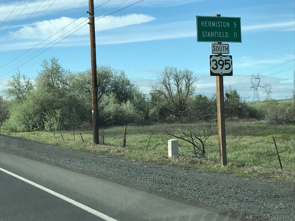
US-395 South - Distance Marker
Distance Marker on US-395 south. Distance to Hermiston and Stanfield.
Taken 04-30-2017
 Umatilla
 County
Oregon
United States
Umatilla
Umatilla County
Oregon
United States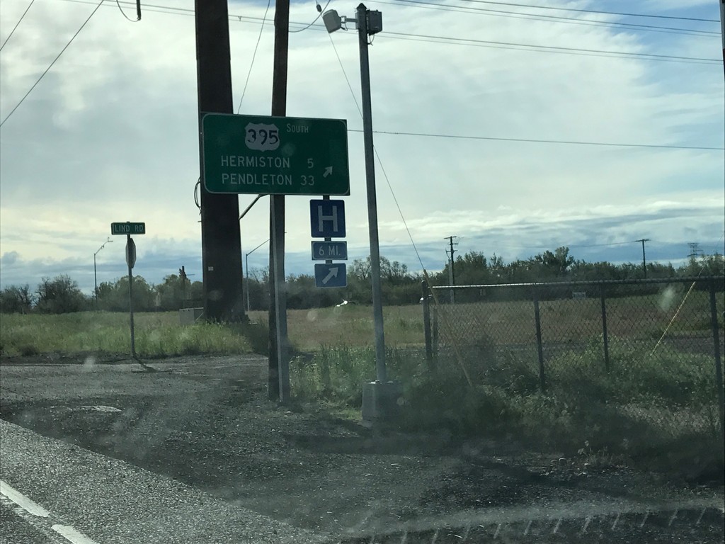
US-730 East/US-395 South at US-730/US-395 Split
US-730 East/US-395 South at US-730/US-395 Split in Umatilla. Merge right to continue south on US-395 to Hermiston and Pendleton.
Taken 04-30-2017
 Umatilla
 County
Oregon
United States
Umatilla
Umatilla County
Oregon
United States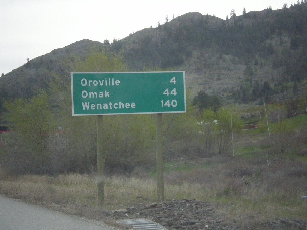
US-97 South - Distance Marker
Distance marker on US-97 south. Distance to Oroville, Omak, and Wenatchee. This is the first distance marker on US-97 in the United States.
Taken 04-29-2017
 Oroville
Okanogan County
Washington
United States
Oroville
Okanogan County
Washington
United States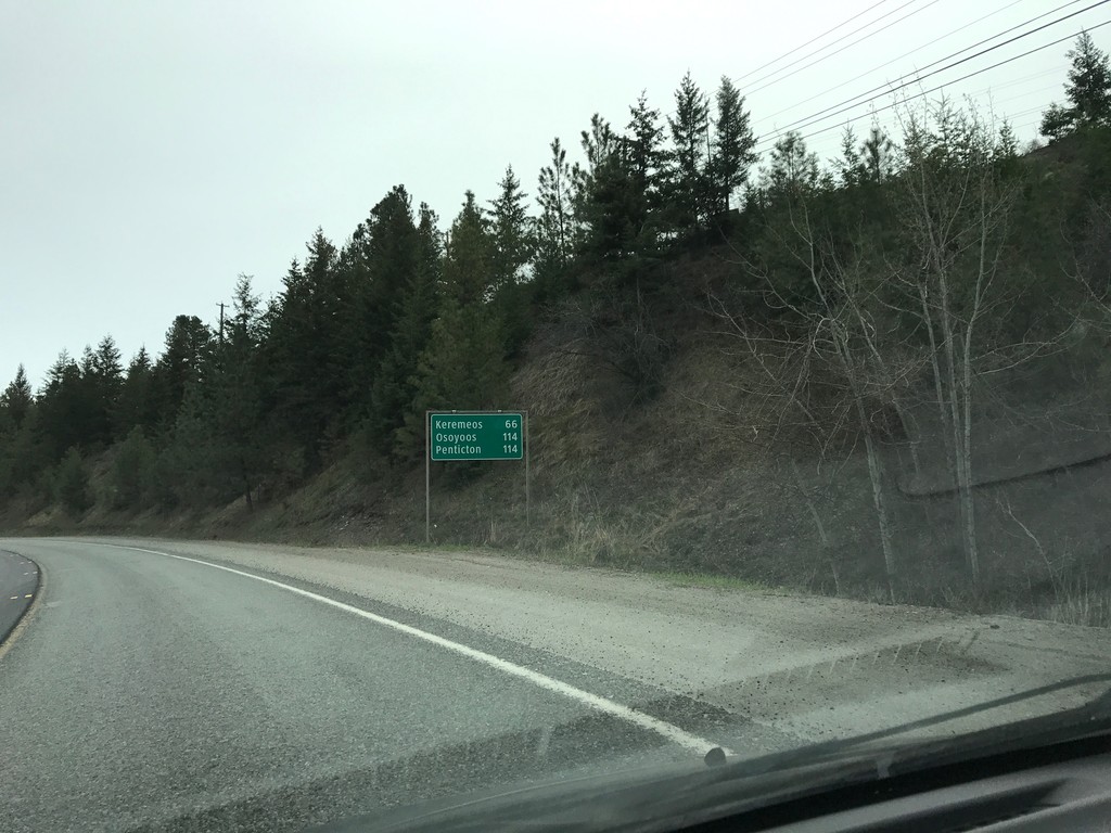
BC-3 East - Distance Marker
Distance marker on BC-3 east. Distance to Keremeos, Osoyoos, and Penticton.
Taken 04-29-2017
 Princeton
Okanagan-Similkameen
British Columbia
Canada
Princeton
Okanagan-Similkameen
British Columbia
Canada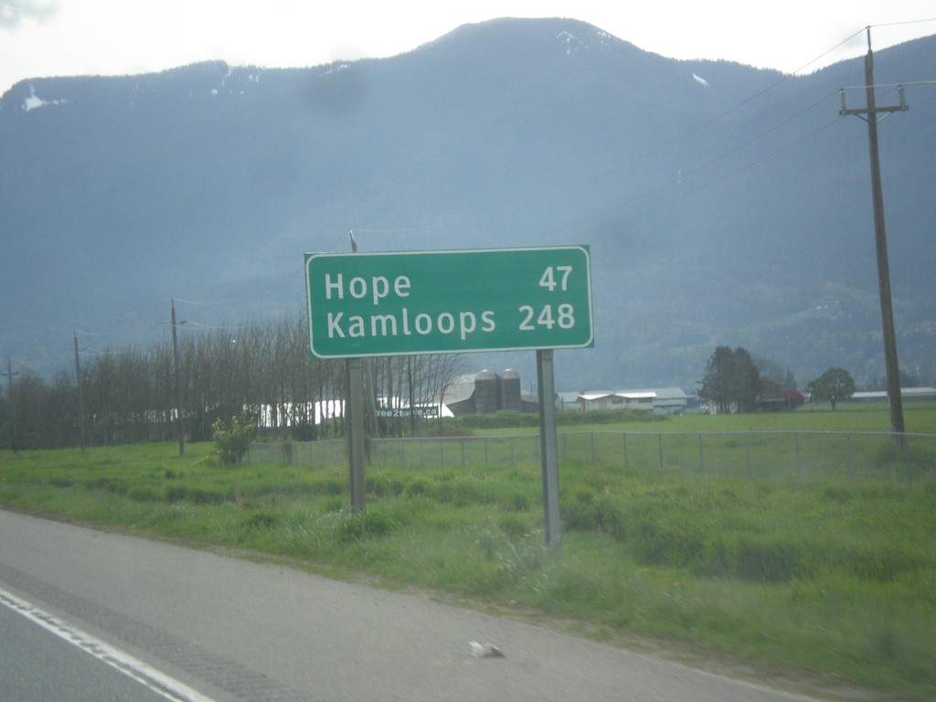
TC-1 East - Distance Marker
Distance marker on TC-1 east. Distance to Hope and Kamloops (via BC-5).
Taken 04-29-2017
 Chilliwack
Fraser Valley
British Columbia
Canada
Chilliwack
Fraser Valley
British Columbia
Canada