Signs Tagged With Distance Marker
US-97 South - Distance Marker
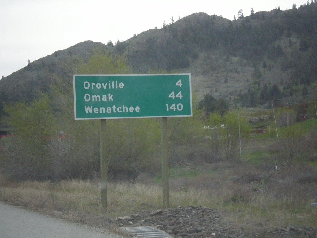
Distance marker on US-97 south. Distance to Oroville, Omak, and Wenatchee. This is the first distance marker on US-97 in the United States.
Taken 04-29-2017
 Oroville
Okanogan County
Washington
United States
Oroville
Okanogan County
Washington
United States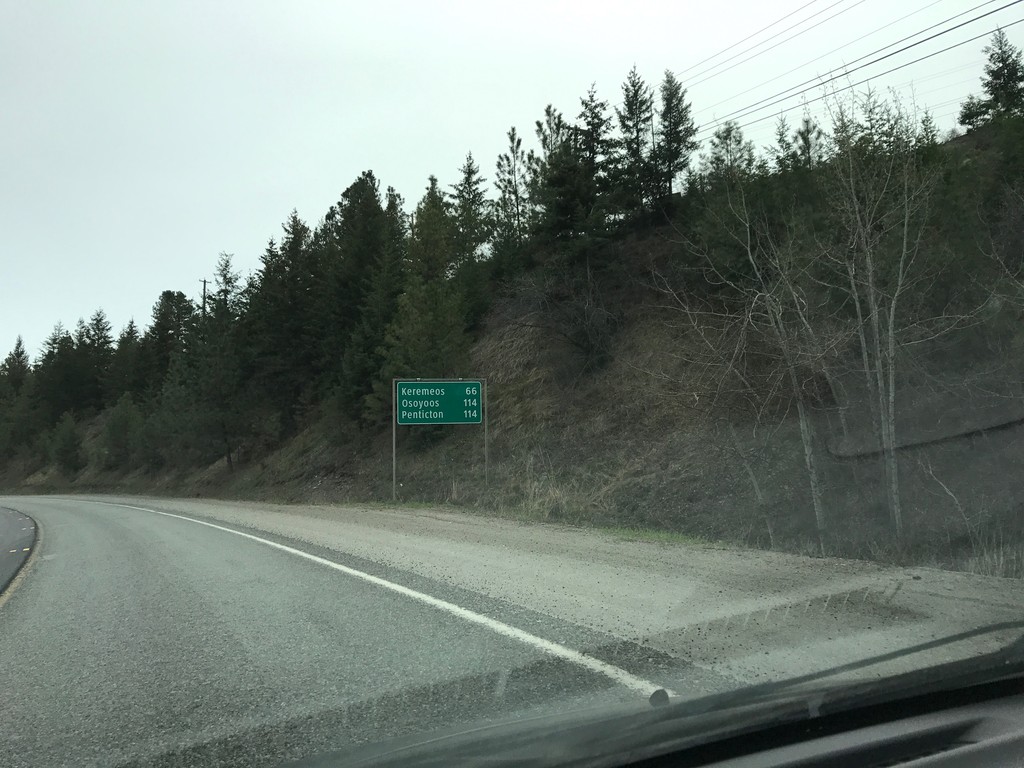
BC-3 East - Distance Marker
Distance marker on BC-3 east. Distance to Keremeos, Osoyoos, and Penticton.
Taken 04-29-2017
 Princeton
Okanagan-Similkameen
British Columbia
Canada
Princeton
Okanagan-Similkameen
British Columbia
Canada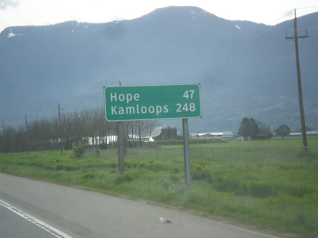
TC-1 East - Distance Marker
Distance marker on TC-1 east. Distance to Hope and Kamloops (via BC-5).
Taken 04-29-2017
 Chilliwack
Fraser Valley
British Columbia
Canada
Chilliwack
Fraser Valley
British Columbia
Canada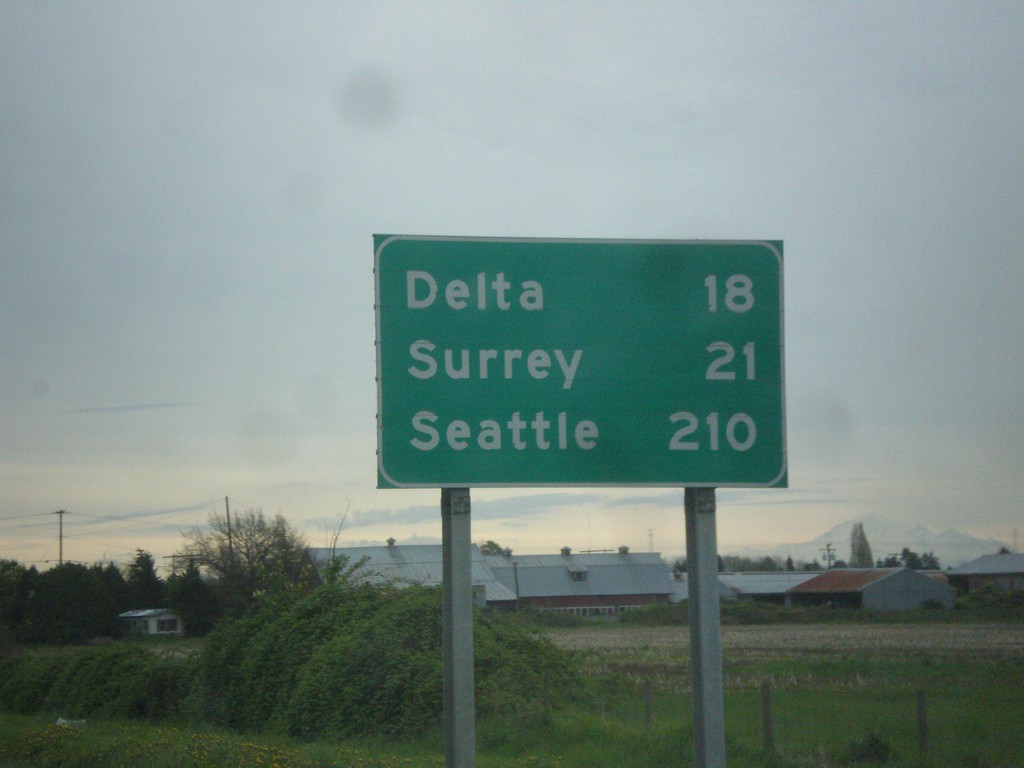
BC-91 South - Distance Marker
Distance marker on BC-91 south. Distance to Delta, Surrey, and Seattle (USA).
Taken 04-29-2017
 Richmond
Metro Vancouver
British Columbia
Canada
Richmond
Metro Vancouver
British Columbia
Canada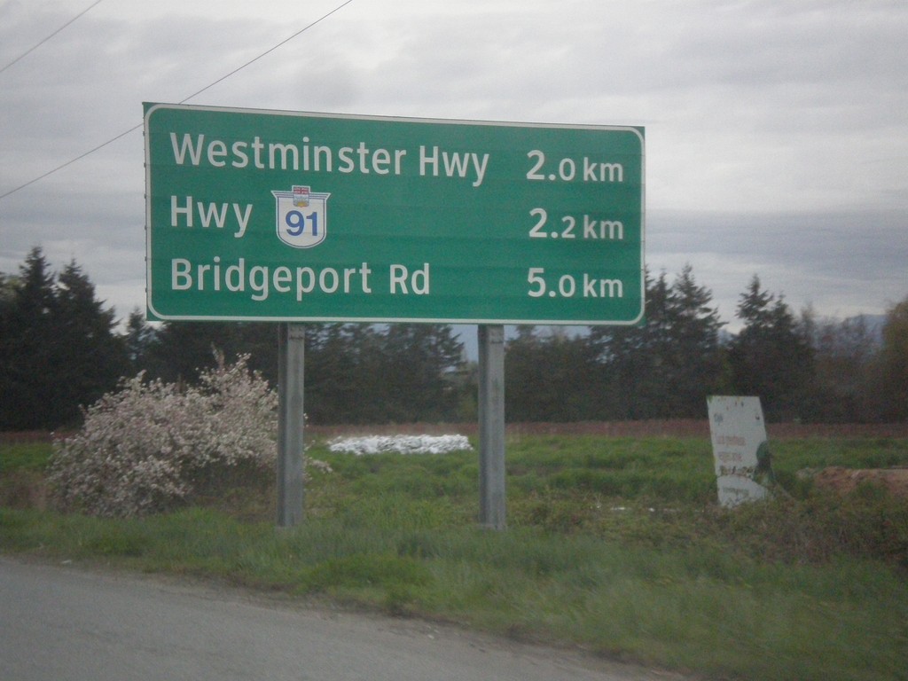
BC-99 North - Next 3 Exits
Next 3 exits on BC-99 north in Richmond: Westminster Highway, Hwy BC-91, and Bridgeport Road.
Taken 04-29-2017
 Richmond
Metro Vancouver
British Columbia
Canada
Richmond
Metro Vancouver
British Columbia
Canada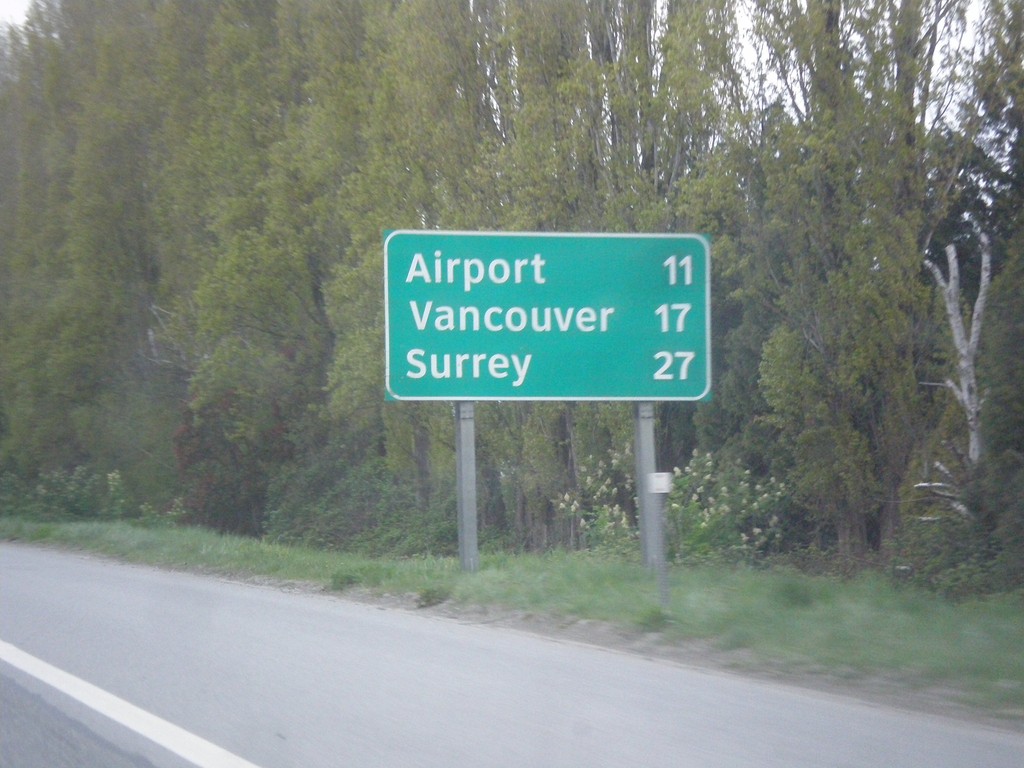
BC-99 North - Distance Marker
Distance marker on BC-99 north. Distance to (Vancouver International) Airport, Vancouver, and Surrey (via BC-91).
Taken 04-29-2017
Richmond
Metro Vancouver
British Columbia
Canada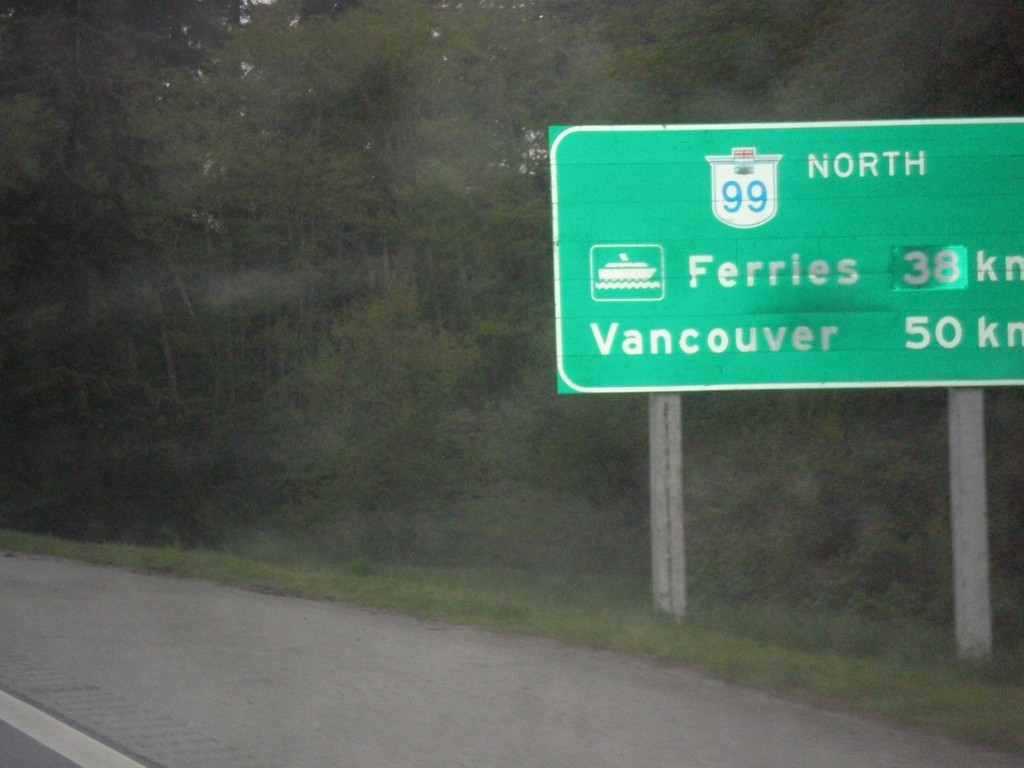
BC-99 North - Distance Marker
Distance marker on BC-99 north. Distance to (Tsawwassen) Ferries - 38km; distance to Vancouver - 50km.
Taken 04-29-2017
Surrey
Metro Vancouver
British Columbia
Canada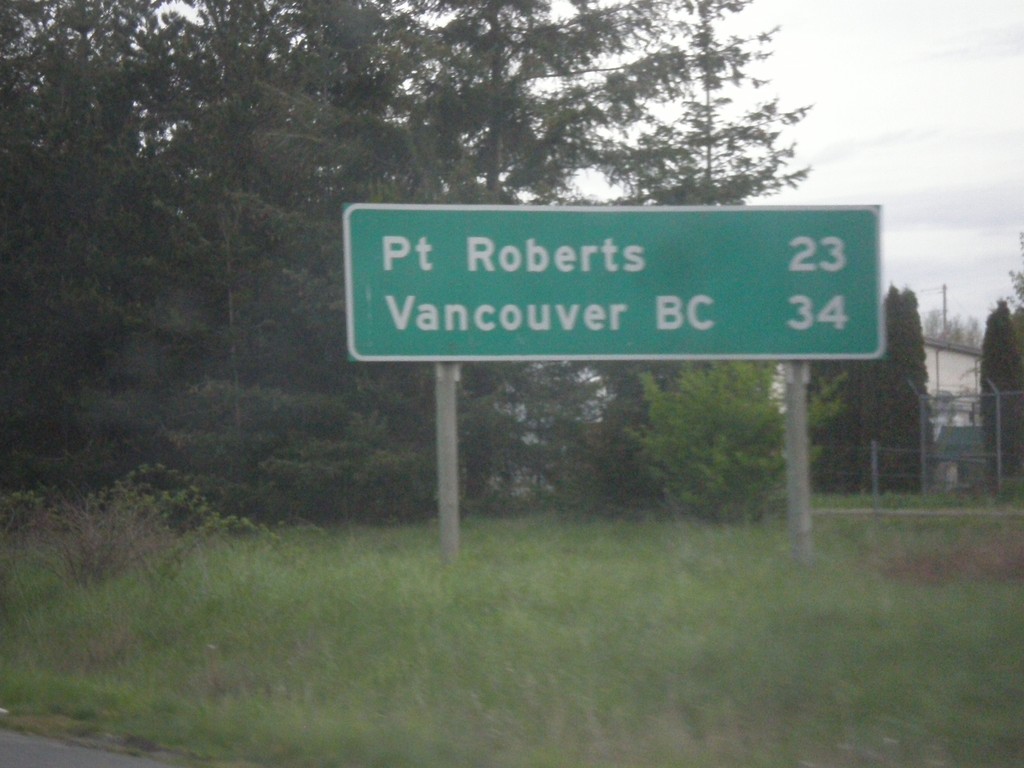
I-5 North - Distance Marker
Distance marker on I-5 north. Distance to Point Roberts and Vancouver, BC. This is the last distance marker on I-5 northbound. Point Roberts is an exclave of the United States. All traffic into Point Roberts has to go through Canada.
Taken 04-29-2017
 Blaine
Whatcom County
Washington
United States
Blaine
Whatcom County
Washington
United States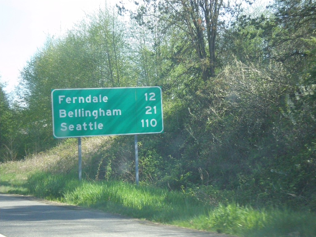
I-5 South - Distance Marker
Distance marker on I-5 south. Distance to Ferndale, Bellingham, and Seattle. This is the first exit on I-5 south of the border crossing.
Taken 04-28-2017
Blaine
Whatcom County
Washington
United States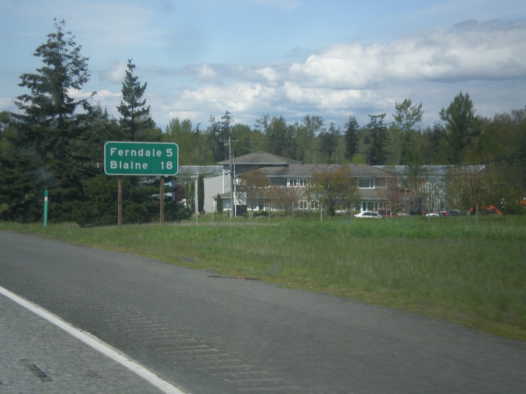
I-5 North - Distance Marker
Distance marker on I-5 north. Distance to Ferndale and Blaine. Blaine is where I-5 ends at the Canadian border.
Taken 04-28-2017
Bellingham
Whatcom County
Washington
United States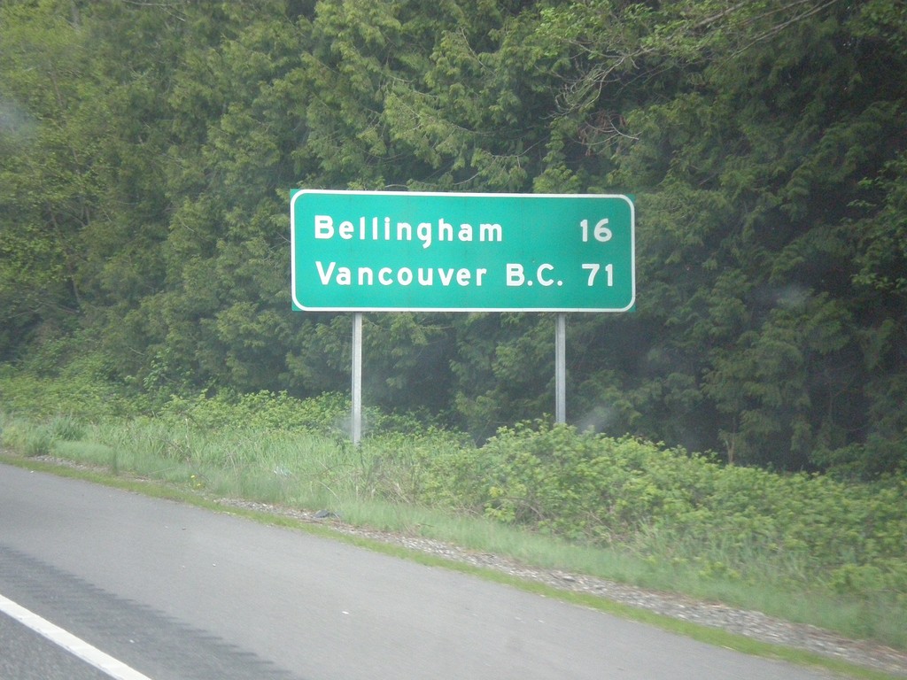
I-5 North - Distance Marker
Distance marker on I-5 north. Distance to Bellingham and Vancouver B.C.
Taken 04-28-2017
Bow
Skagit County
Washington
United States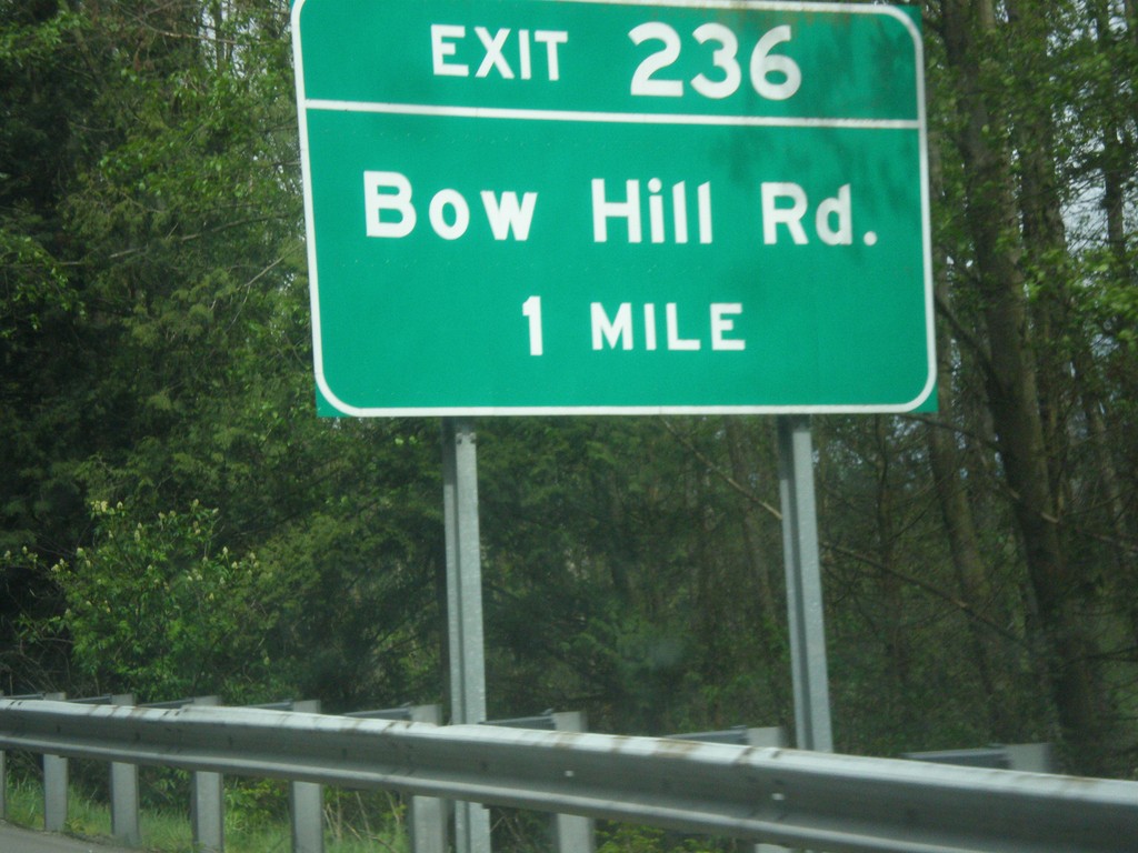
I-5 North - Exit 236
I-5 north approaching Exit 236 - Bow Hill Road.
Taken 04-28-2017
Burlington
Skagit County
Washington
United States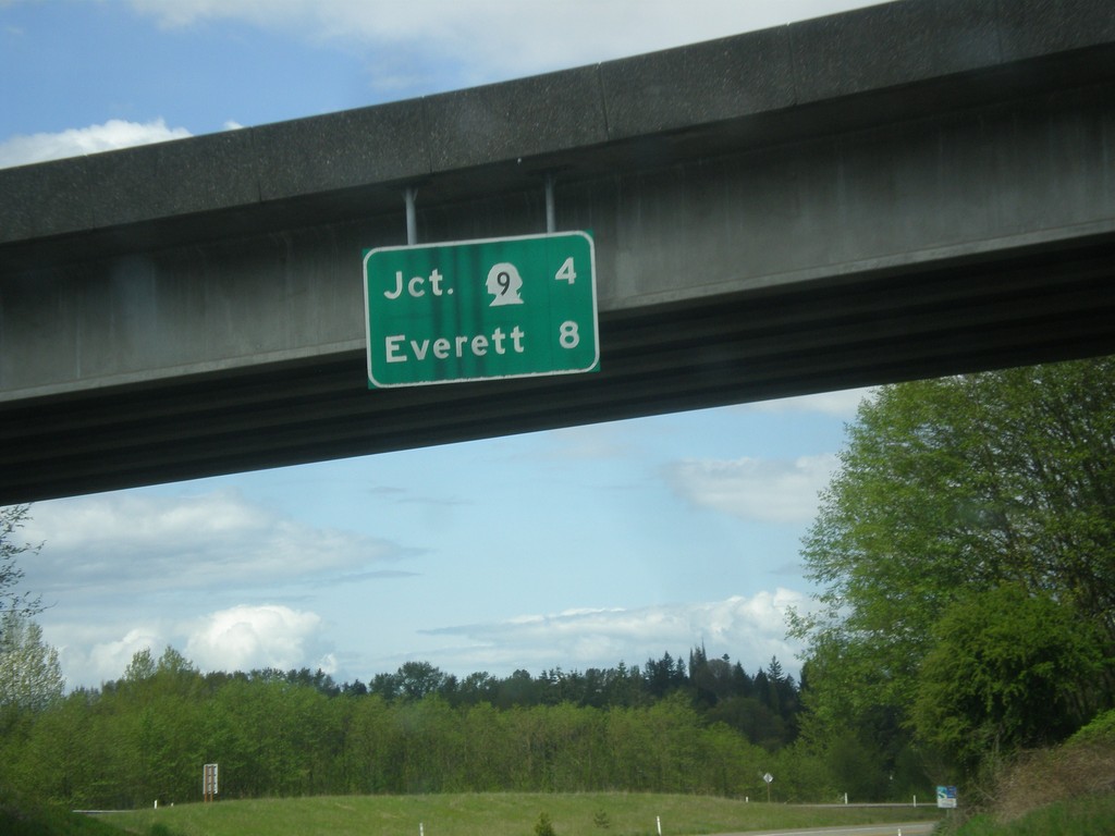
US-2 West - Distance Marker
Distance marker on US-2 west in Monroe. Distance to WA-9 and Everett.
Taken 04-28-2017

 Monroe
Snohomish County
Washington
United States
Monroe
Snohomish County
Washington
United States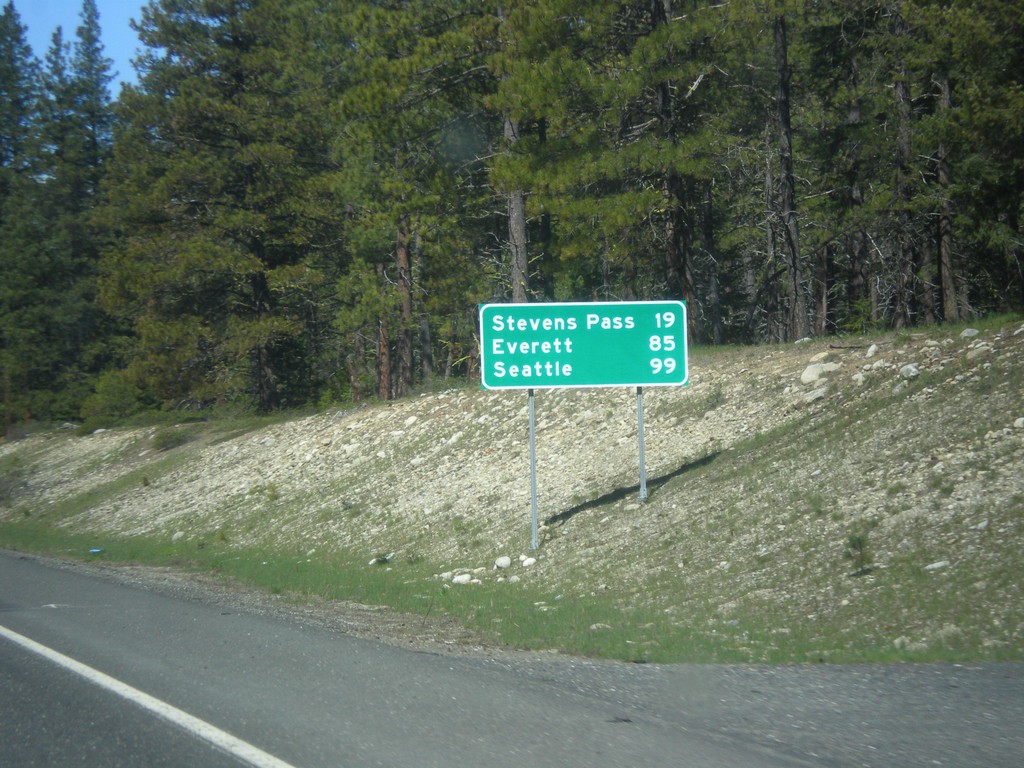
US-2 West - Distance Marker
Distance marker on US-2 west. Distance to Stevens Pass, Everett, and Seattle.
Taken 04-28-2017
Leavenworth
Chelan County
Washington
United States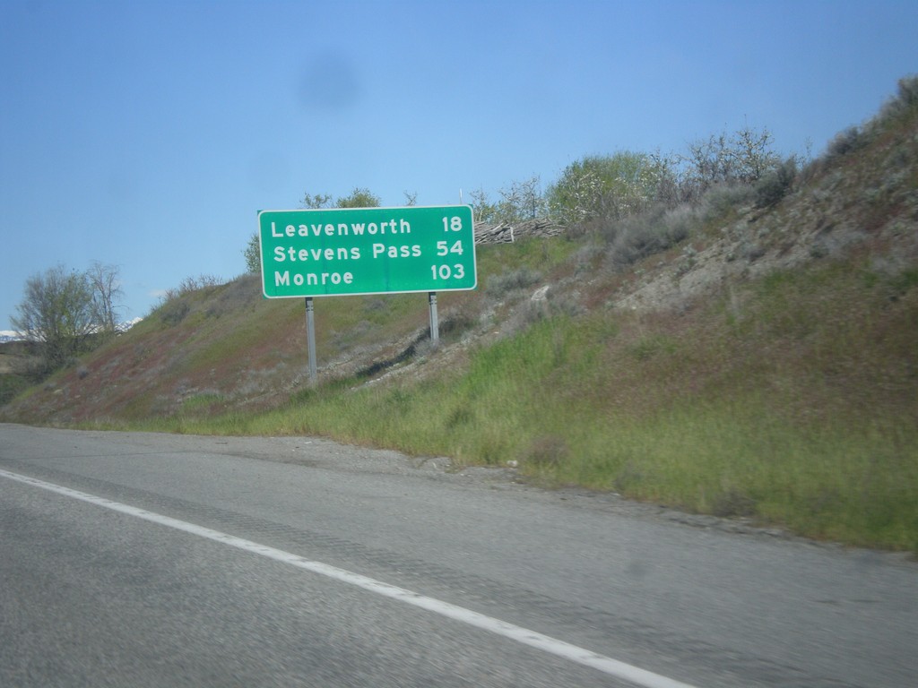
US-2 West/US-97 South - Distance Marker
Distance Marker on US-2 West/US-97 South. Distance to Leavenworth, Stevens Pass, and Monroe.
Taken 04-28-2017
Wenatchee
Chelan County
Washington
United States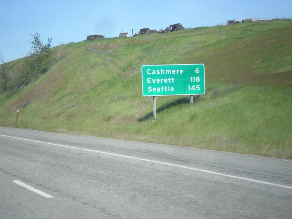
US-2 West/US-97 South - Distance Marker
Distance Marker on US-2 West/US-97 South. Distance to Cashmere, Everett, and Seattle.
Taken 04-28-2017
Wenatchee
Chelan County
Washington
United States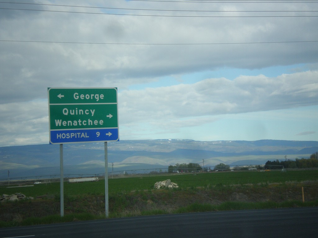
End WA-281 Spur North at WA-281
End WA-281 Spur North at WA-281. Use WA-281 north for Quincy and Wenatchee. Use WA-281 south for George.
Taken 04-28-2017
 Quincy
Grant County
Washington
United States
Quincy
Grant County
Washington
United States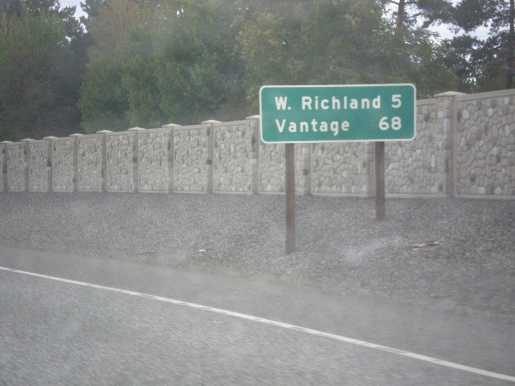
WA-240 West - Distance Marker
Distance marker on WA-240 west. Distance to West Richland and Vantage.
Taken 04-28-2017
 Richland
Benton County
Washington
United States
Richland
Benton County
Washington
United States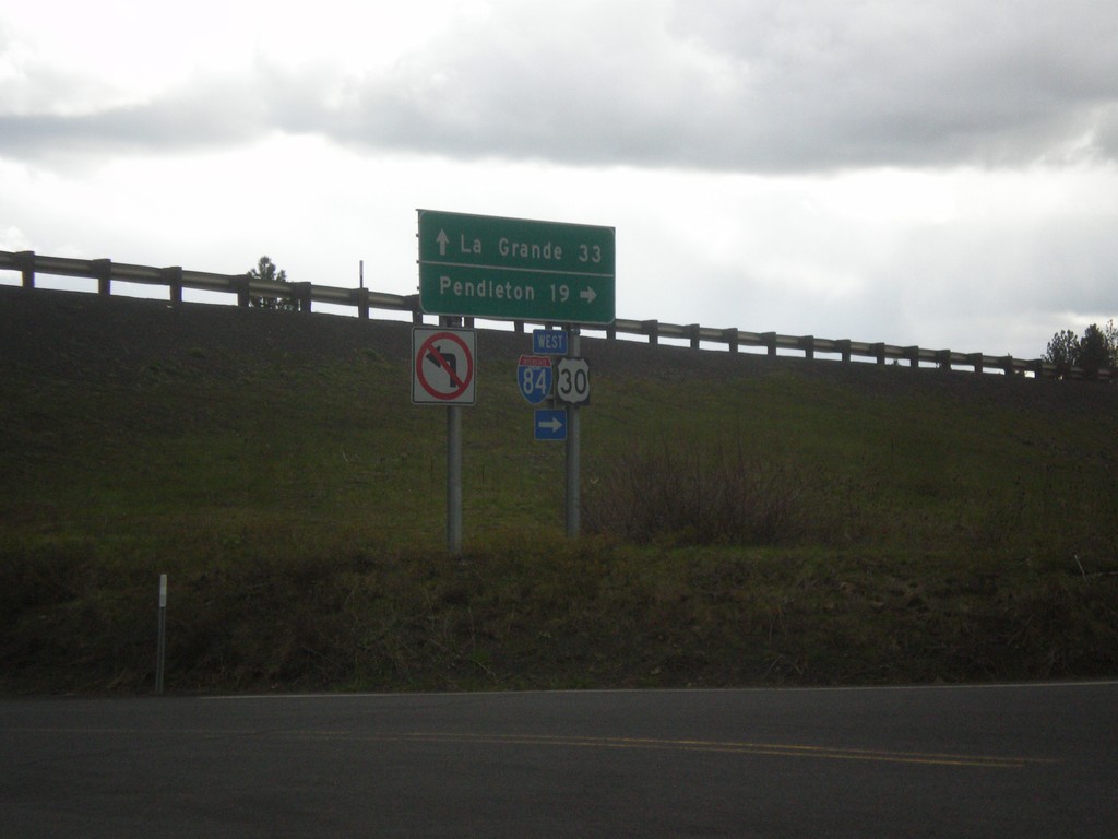
I-84 - Exit 228 Onramp
I-84 - Exit 228 onramp. Use I-84 west to Pendleton; I-84 east to La Grande.
Taken 04-27-2017

 Cayuse
Umatilla County
Oregon
United States
Cayuse
Umatilla County
Oregon
United States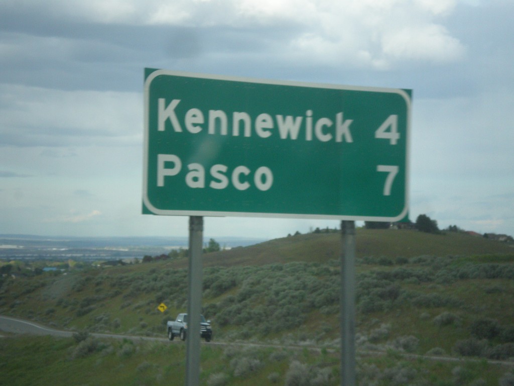
US-395 North - Distance Marker
Distance marker on US-395 north. Distance to Kennewick and Pasco.
Taken 04-27-2017
 Kennewick
Benton County
Washington
United States
Kennewick
Benton County
Washington
United States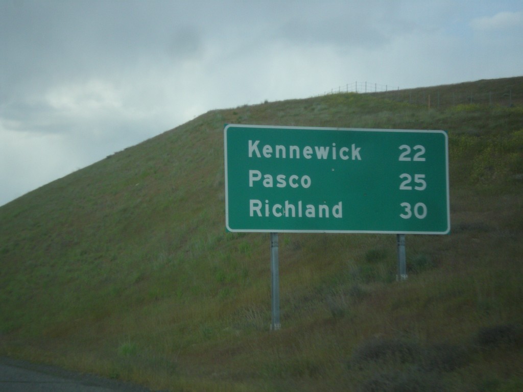
I-82 West - Distance Marker
Distance marker on I-82 west. Distance to Kennewick, Pasco, and Richland (the Tri-Cities). This is the first distance marker on I-82 westbound in Washington.
Taken 04-27-2017
 Plymouth
Benton County
Washington
United States
Plymouth
Benton County
Washington
United States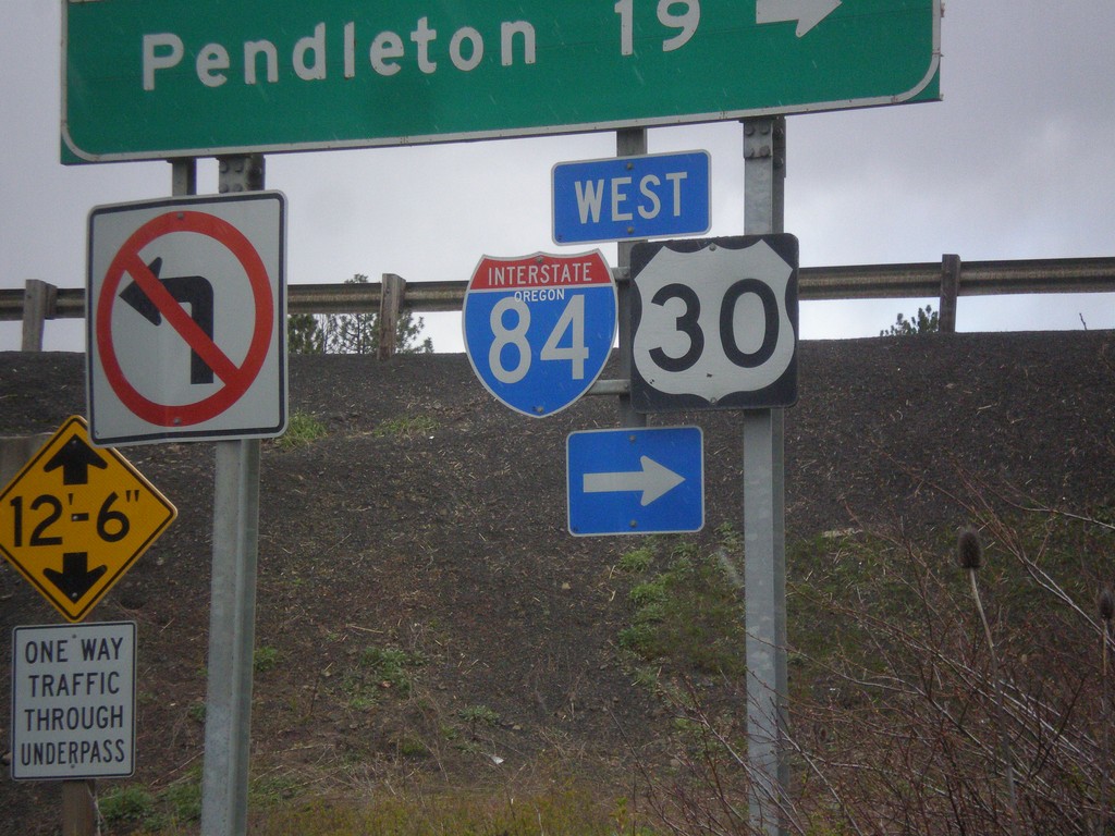
I-84 - Exit 228 Onramp
I-84 - Exit 228 onramp. Use I-84 west to Pendleton; I-84 east to La Grande. The I-84 shield has the text OREGON in it, although it does not fit well with the rest of the font. This is the first time in the last 20 years I have lived in the northwest that I have seen an interstate shield with the text OREGON in it.
Taken 04-27-2017
Cayuse
Umatilla County
Oregon
United States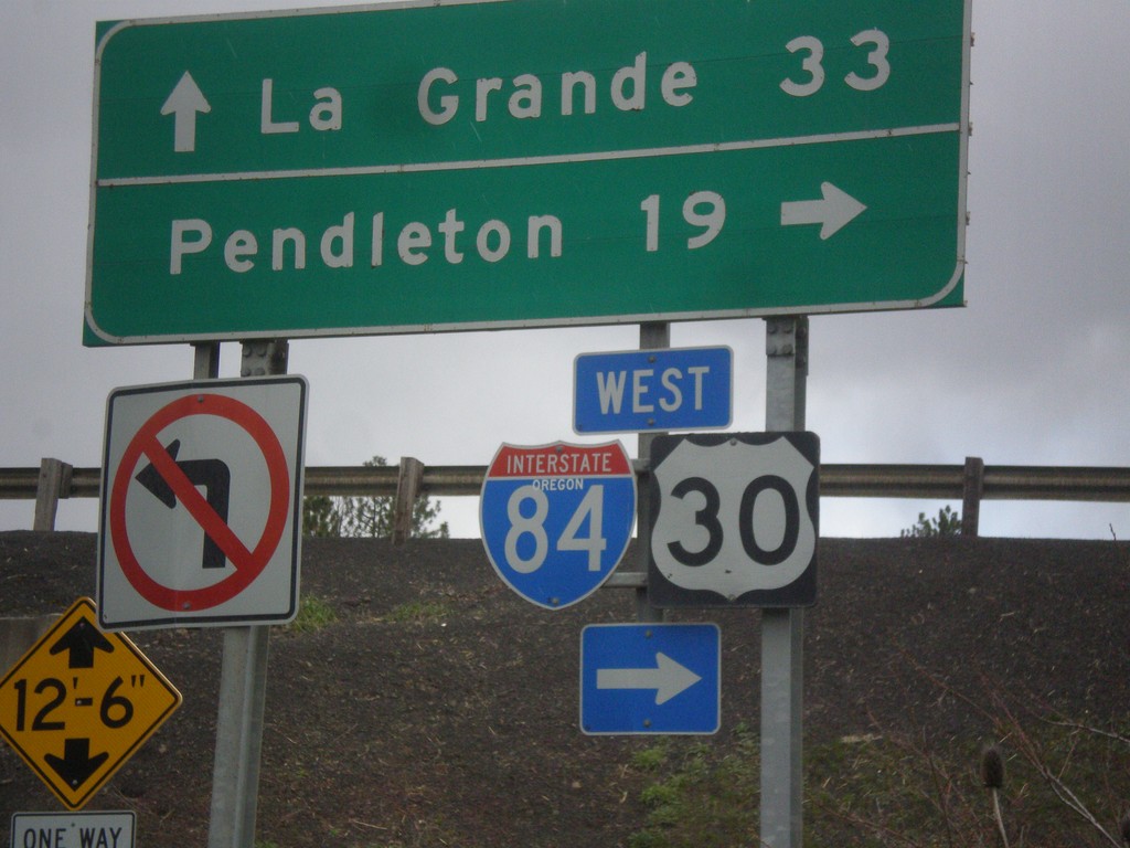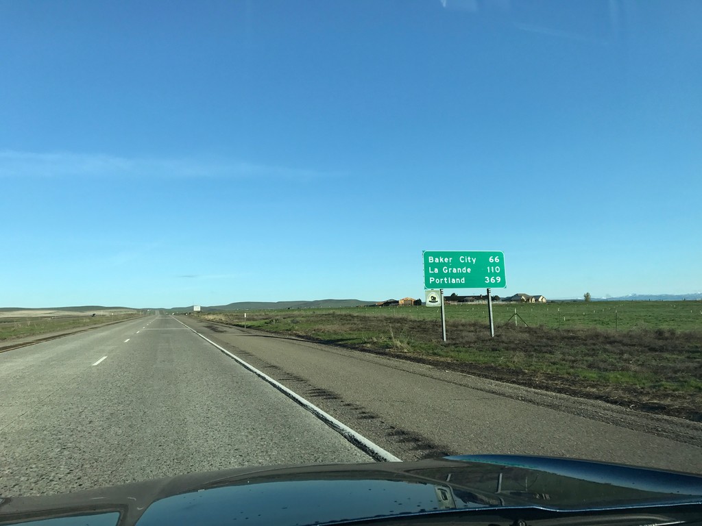
I-84 West - Distance Marker
Distance marker on I-84 west. Distance to Baker City, La Grande, and Portland.
Taken 04-15-2017
Ontario
Malheur County
Oregon
United States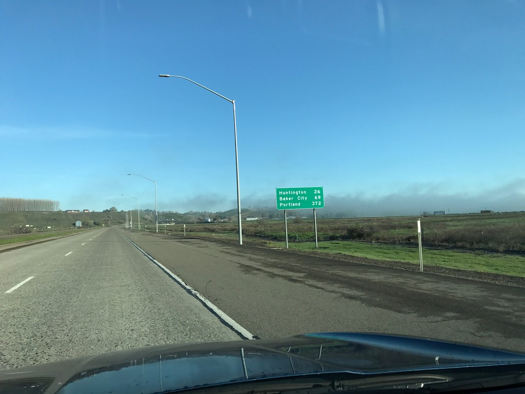
I-84 West - Distance Marker
Distance marker on I-84 west. Distance to Huntington, Baker City, and Portland.
Taken 04-15-2017
Ontario
Malheur County
Oregon
United States