Signs Tagged With Distance Marker
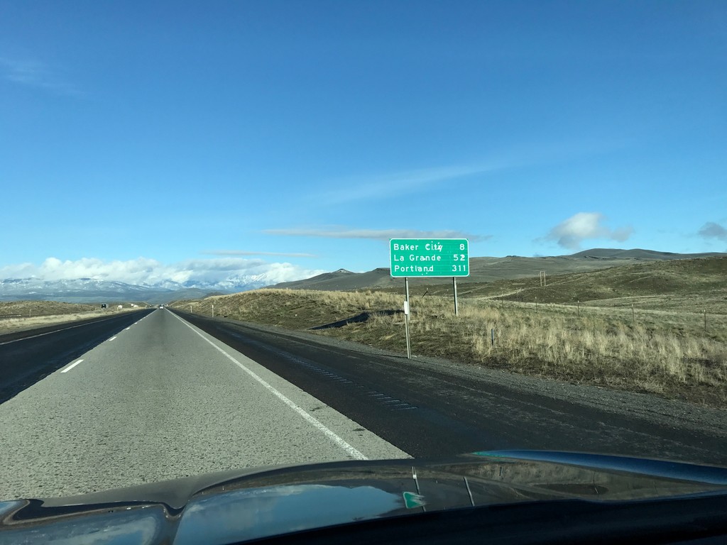
I-84 West - Distance Marker
Distance marker on I-84 west. Distance to Baker City, La Grande, and Portland.
Taken 04-15-2017

 Baker City
Baker County
Oregon
United States
Baker City
Baker County
Oregon
United States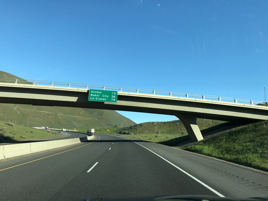
I-84 West - Distance Marker
Distance marker on I-84 west. Distance to Durkee, Baker City, and La Grande.
Taken 04-15-2017
Huntington
Baker County
Oregon
United States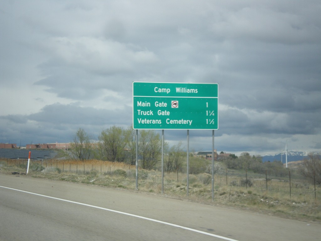
UT-68 North/UT-85 West - Camp Williams Exits
UT-68 North/UT-85 West - Camp Williams Exits. Camp Williams exits are Main Gate, Truck Gate, and Veterans Cemetery.
Taken 03-31-2017

 Saratoga Springs
Utah County
Utah
United States
Saratoga Springs
Utah County
Utah
United States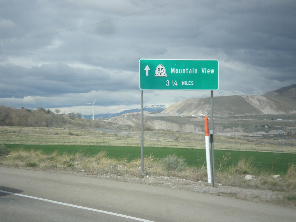
UT-68 North/UT-85 West - Mountain View
UT-68 North/UT-85 West - UT-85/Mountain View (Corridor) - 3.5 miles north.
Taken 03-31-2017
Saratoga Springs
Utah County
Utah
United States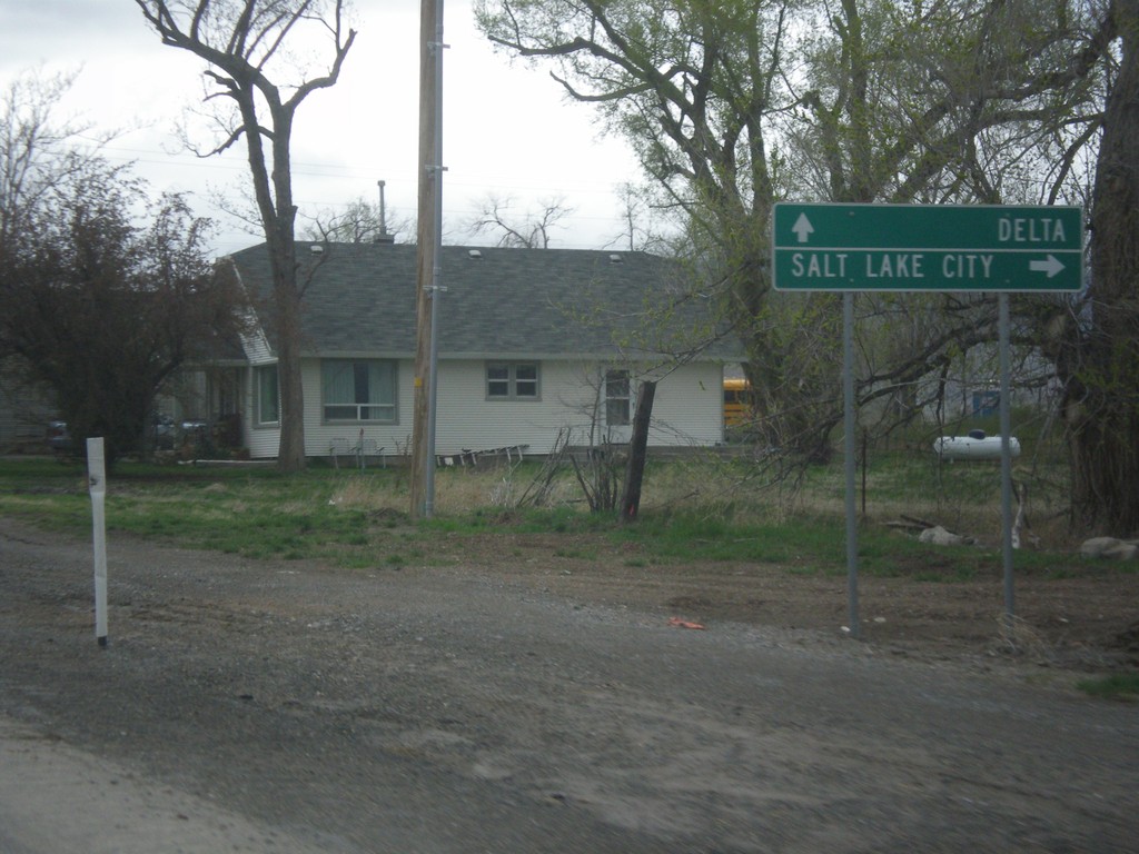
US-6 West at UT-68 North
US-6 West at UT-68 North to Salt Lake City. Continue west on US-6 for Delta.
Taken 03-31-2017
 Elberta
Utah County
Utah
United States
Elberta
Utah County
Utah
United States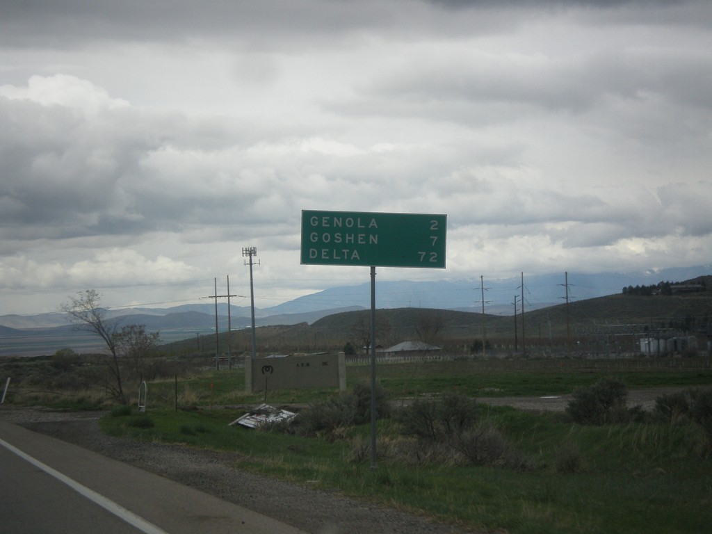
US-6 West - Distance Marker
Distance marker on US-6. Distance to Genola, Goshen, and Delta.
Taken 03-31-2017
Santaquin
Utah County
Utah
United States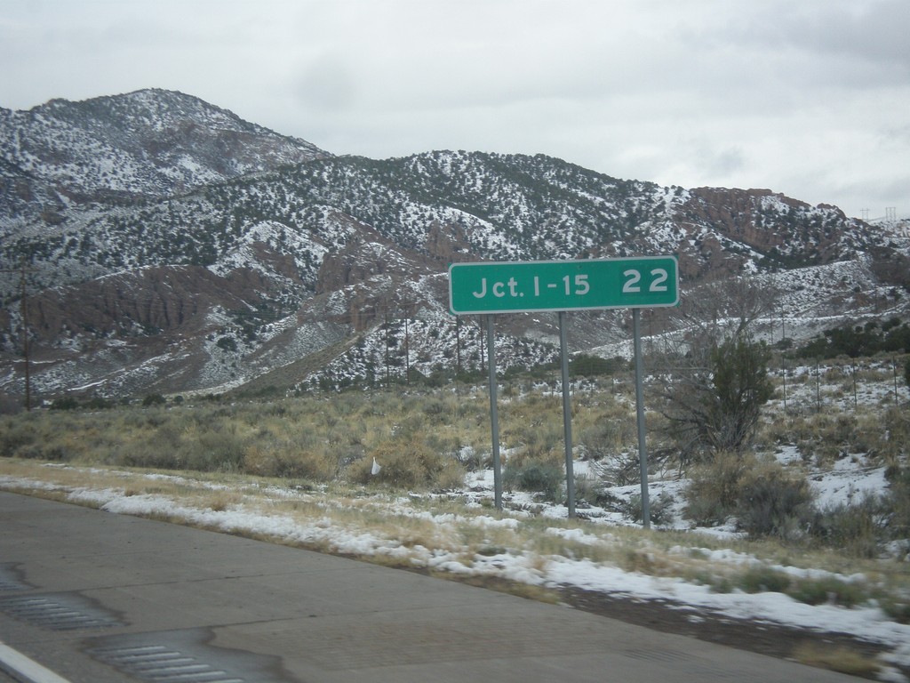
I-70 West - Distance Marker
Distance marker on I-70 west. Distance to Junction I-15.
Taken 03-31-2017
 Sevier
 County
Utah
United States
Sevier
Sevier County
Utah
United States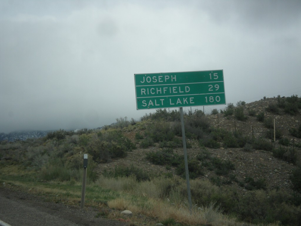
US-89 North - Distance Marker
Distance marker on US-89 north. Distance to Joseph, Richfield, and Salt Lake.
Taken 03-31-2017
 Junction
Piute County
Utah
United States
Junction
Piute County
Utah
United States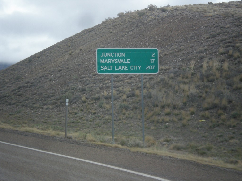
US-89 North - Distance Marker
Distance marker on US-89 north. Distance to Junction, Marysvale, and Salt Lake City.
Taken 03-31-2017
Junction
Piute County
Utah
United States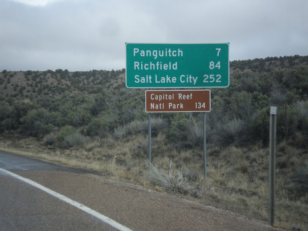
US-89 North - Distance Marker
Distance marker on US-89 north. Distance to Panguitch, Richfield, Salt Lake City, and Capitol Reef National Park.
Taken 03-31-2017
Panguitch
Garfield County
Utah
United States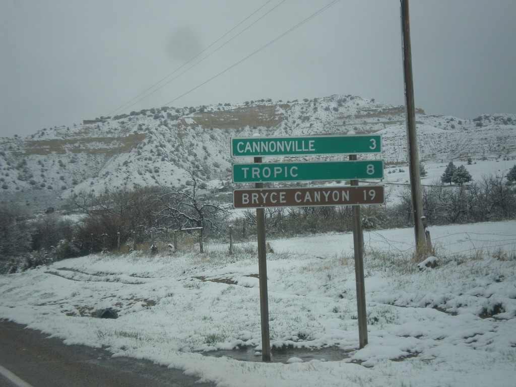
UT-12 West - Distance Marker
Distance marker on UT-12 west. Distance to Cannonville, Tropic, and Bryce Canyon (National Park).
Taken 03-31-2017
 Henrieville
Garfield County
Utah
United States
Henrieville
Garfield County
Utah
United States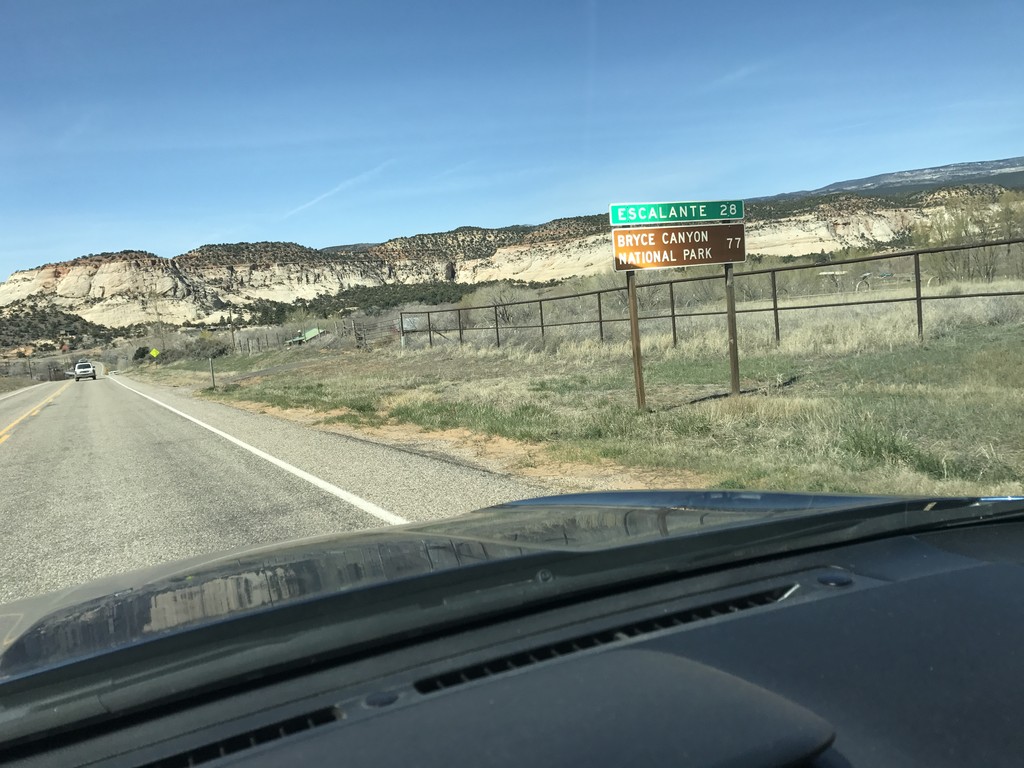
UT-12 West - Distance Marker
Distance marker on UT-12 west. Distance to Escalante, and Bryce Canyon National Park.
Taken 03-29-2017
Boulder
Garfield County
Utah
United States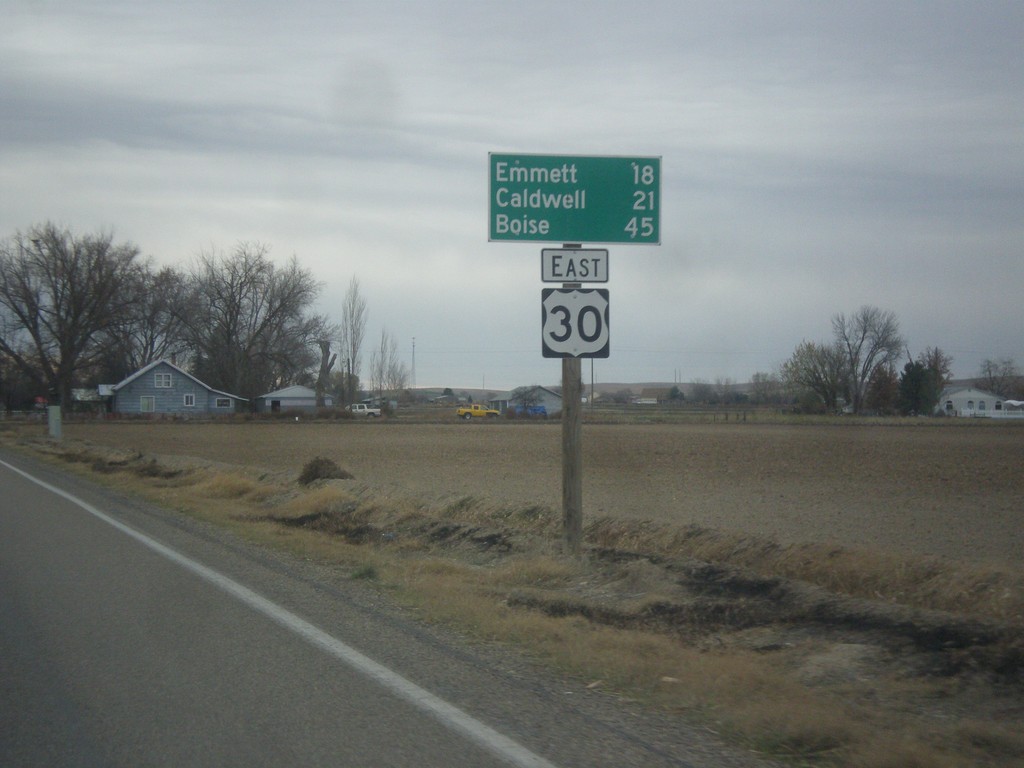
US-30 East - Distance Marker
Distance marker on US-30 east. Distance to Emmett (via ID-72), Caldwell, and Boise.
Taken 11-19-2016
New Plymouth
Payette County
Idaho
United States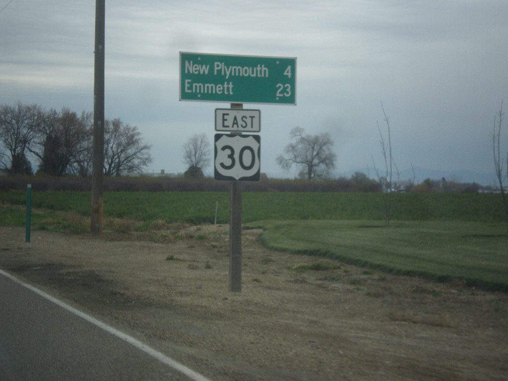
US-30 East - Distance Marker
Distance marker on US-30 east. Distance to New Plymouth and Emmett.
Taken 11-19-2016
Fruitland
Payette County
Idaho
United States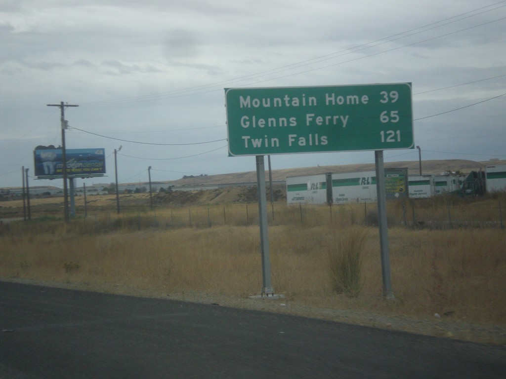
I-84 East - Distance Marker
Distance marker on I-84 east. Distance to Mountain Home, Glenns Ferry, and Twin Falls.
Taken 10-15-2016

 Boise
Ada County
Idaho
United States
Boise
Ada County
Idaho
United States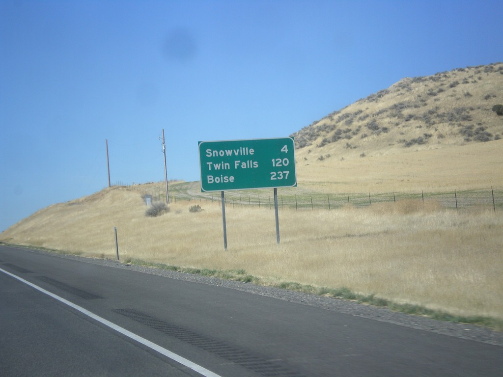
I-84 West - Distance Marker
Distance marker on I-84 west. Distance to Snowville, Twin Falls (ID), and Boise(ID).
Taken 10-09-2016
Snowville
Box Elder County
Utah
United States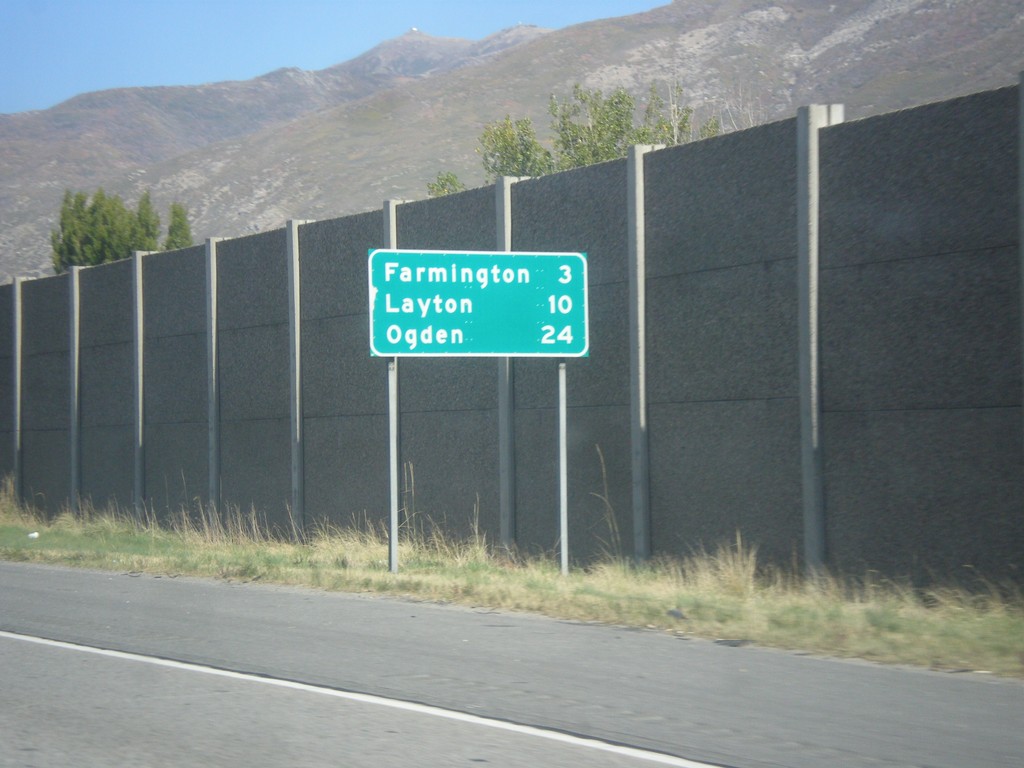
I-15 North - Distance Marker
Distance marker on I-15 north. Distance to Farmington, Layton, and Ogden.
Taken 10-09-2016
 Centerville
Davis County
Utah
United States
Centerville
Davis County
Utah
United States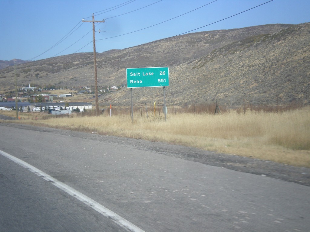
I-80 West - Distance Marker
Distance marker on I-80 west. Distance to Salt Lake and Reno (Nevada).
Taken 10-09-2016
 Park City
Summit County
Utah
United States
Park City
Summit County
Utah
United States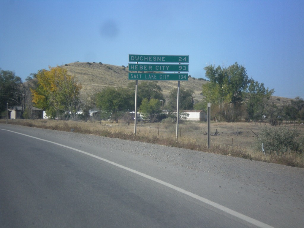
US-40 West/US-191 South - Distance Marker
Distance Marker on US-40 West/US-191 South. Distance to Duchesne, Heber City, and Salt Lake City.
Taken 10-09-2016

 Roosevelt
Duchesne County
Utah
United States
Roosevelt
Duchesne County
Utah
United States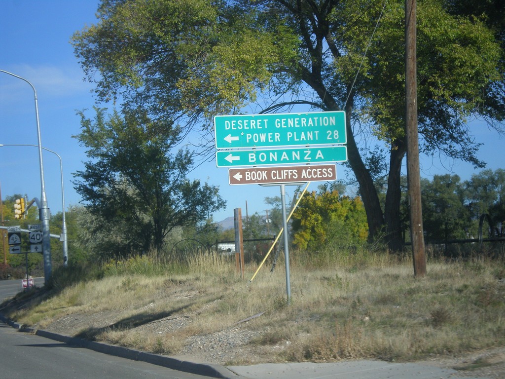
US-40 West at UT-45 Jct.
US-40 west at UT-45 south to Deseret Generation Power Plant, Bonanza, and Book Cliffs Access.
Taken 10-09-2016
 Naples
Uintah County
Utah
United States
Naples
Uintah County
Utah
United States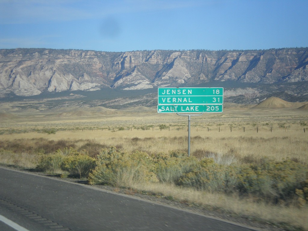
US-40 West - Distance Marker
Distance marker on US-40 west. Distance to Jensen, Vernal, and Salt Lake City. This is the first distance marker along US-40 in Utah.
Taken 10-09-2016
Uintah County
Utah
United States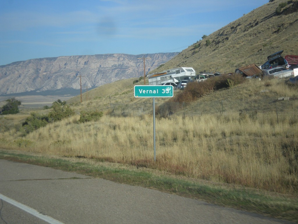
US-40 West - Distance Marker
Distance maker on US-40 west. Distance to Vernal (Utah).
Taken 10-09-2016
Dinosaur
Moffat County
Colorado
United States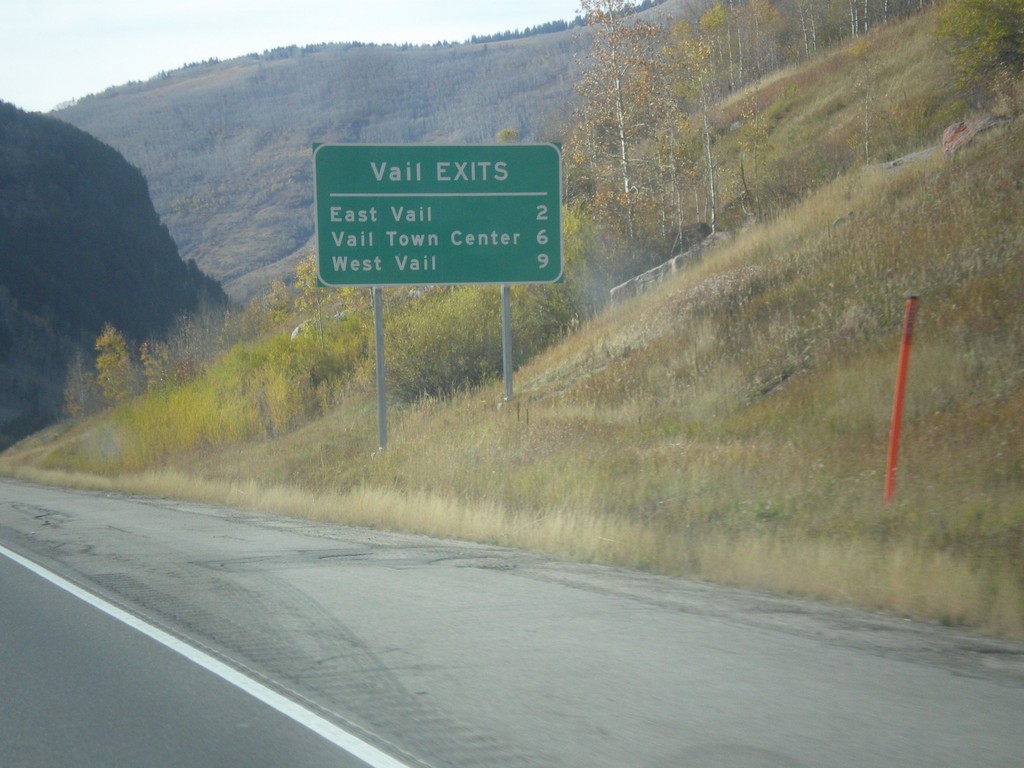
I-70 West - Vail Exits
Vail Exits on I-70 East - East Vail, Vail Town Center, and West Vail.
Taken 10-08-2016
Vail
Eagle County
Colorado
United States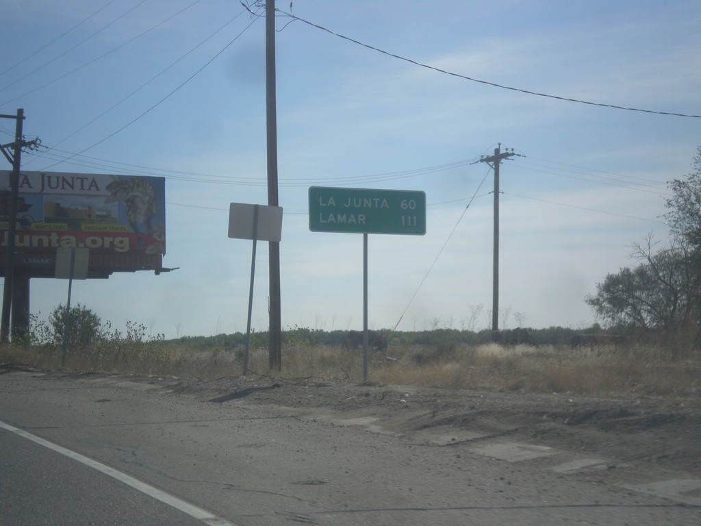
US-50 East - Distance Marker
Distance marker on US-50 east. Distance to La Junta, and Lamar.
Taken 10-08-2016

 Pueblo
 County
Colorado
United States
Pueblo
Pueblo County
Colorado
United States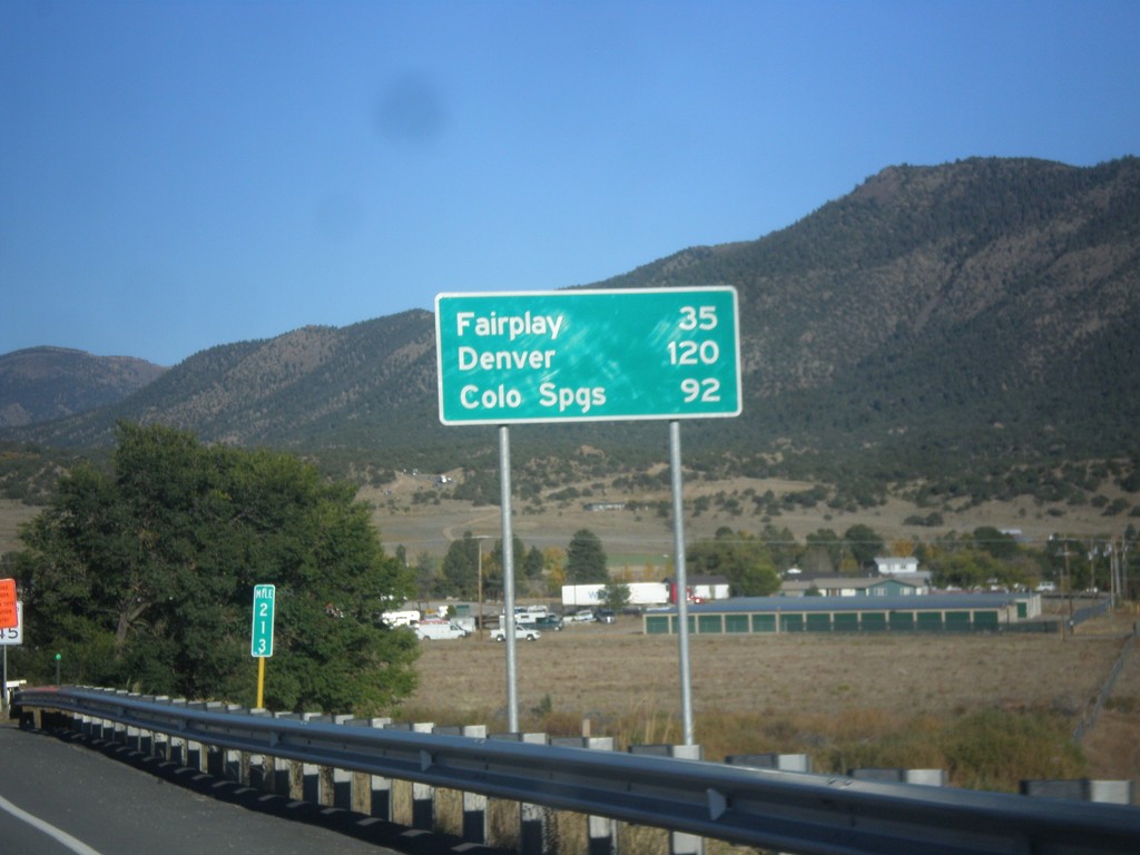
US-24 East/US-285 North - Distance Marker
Distance Marker on US-24 East/US-285 North. Distance to Fairplay and Denver (via US-285), and Colorado Springs (via US-24).
Taken 10-07-2016

 Buena Vista
Chaffee County
Colorado
United States
Buena Vista
Chaffee County
Colorado
United States