Signs Tagged With Distance Marker
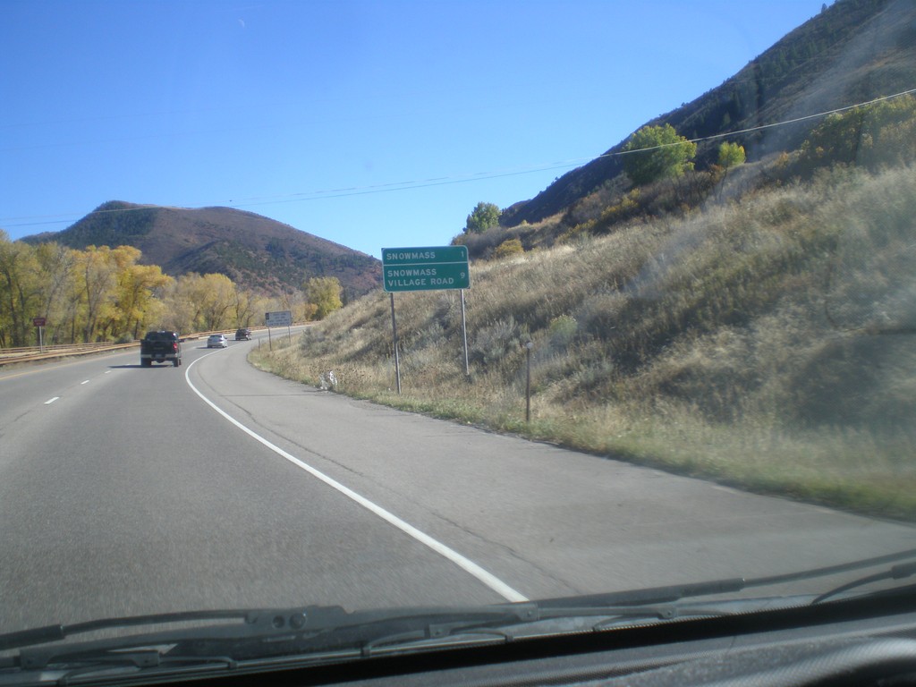
CO-82 East - Distance Marker
Distance marker on CO-82 east. Distance to Snowmass, and Snowmass Village Road.
Taken 10-07-2016
 Snowmass
Pitkin County
Colorado
United States
Snowmass
Pitkin County
Colorado
United States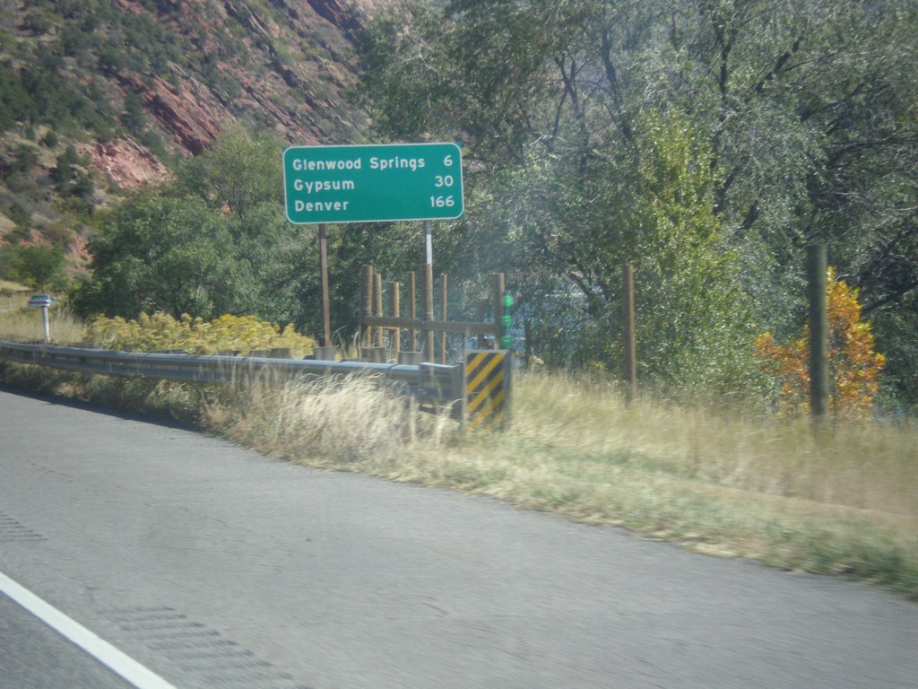
I-70 East - Distance Marker
Distance marker on I-70 east. Distance to Glenwood Springs, Gypsum, and Denver.
Taken 10-07-2016

 Glenwood Springs
Garfield County
Colorado
United States
Glenwood Springs
Garfield County
Colorado
United States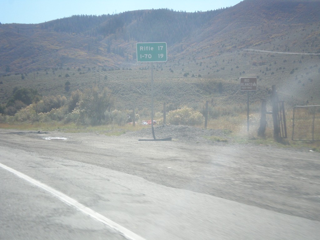
CO-13 South - Distance Marker
Distance marker on CO-13 south. Distance to Rifle and I-70.
Taken 10-07-2016
 Meeker
Garfield County
Colorado
United States
Meeker
Garfield County
Colorado
United States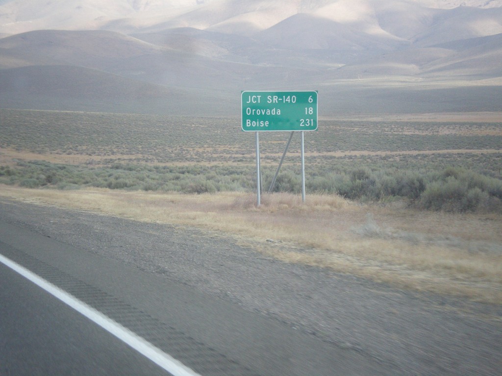
US-95 North - Distance Marker
Distance marker on US-95 north. Distance to Jct. SR-140, Orovada, and Boise (Idaho).
Taken 08-16-2016
 Winnemucca
Humboldt County
Nevada
United States
Winnemucca
Humboldt County
Nevada
United States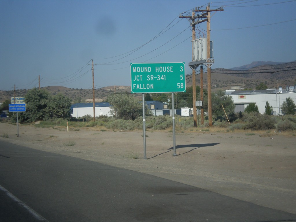
US-50 East - Distance Marker
Distance marker on US-50 east. Distance to Mound House, Jct. SR-341, and Fallon.
Taken 08-15-2016
 Carson City
Nevada
United States
Carson City
Nevada
United States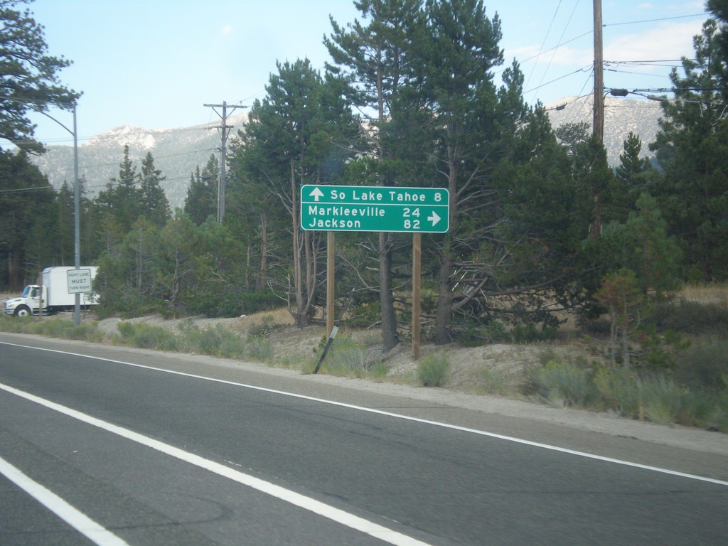
US-50 East At CA-89
US-50 east at CA-89 south to Markleeville and Jackson (via CA-88). Continue straight ahead for US-50 East/CA-89 north to South Lake Tahoe.
Taken 08-15-2016
 South Lake Tahoe
El Dorado County
California
United States
South Lake Tahoe
El Dorado County
California
United States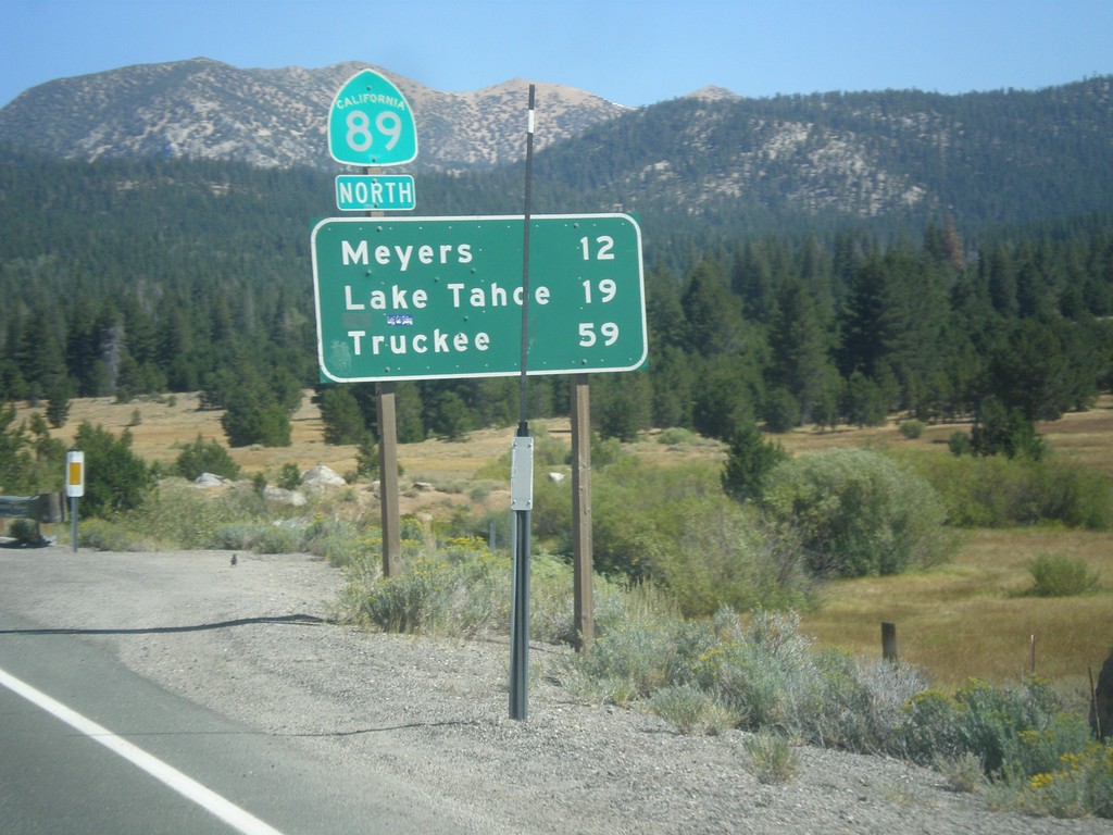
CA-89 North - Distance Marker
Distance marker on CA-89 north. Distance to Meyers, Lake Tahoe, and Truckee.
Taken 08-12-2016
Markleeville
Alpine County
California
United States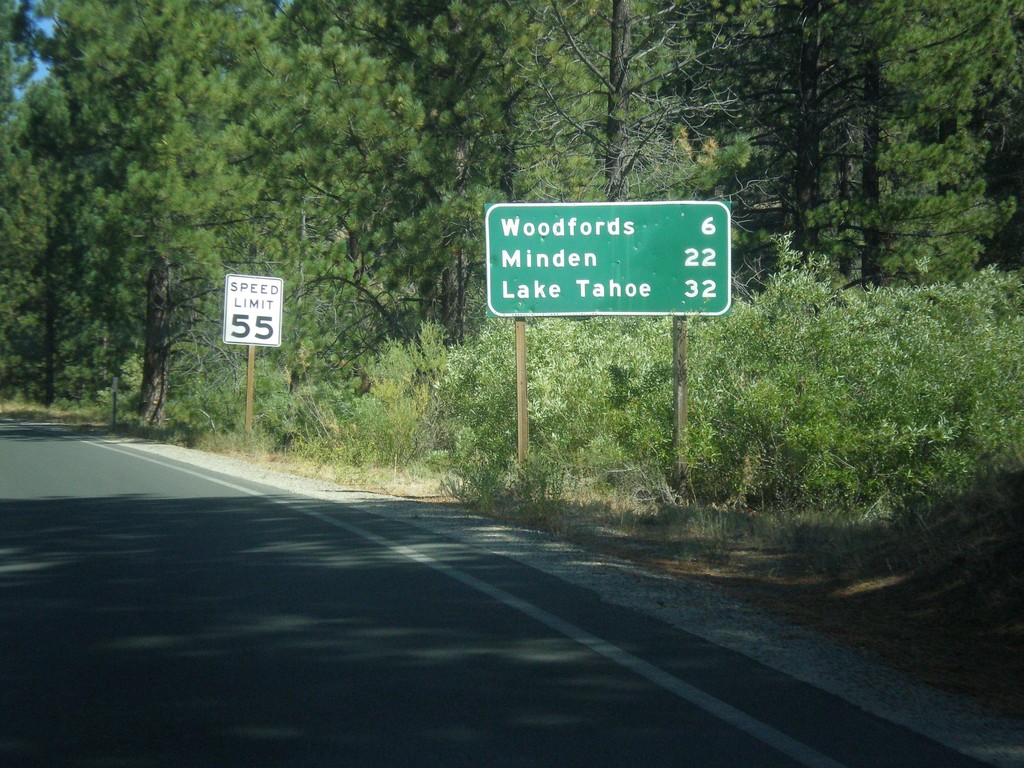
CA-89 North - Distance Marker
Distance marker on CA-89 north. Distance to Woodfords, Minden (Nevada), and Lake Tahoe.
Taken 08-12-2016
Markleeville
Alpine County
California
United States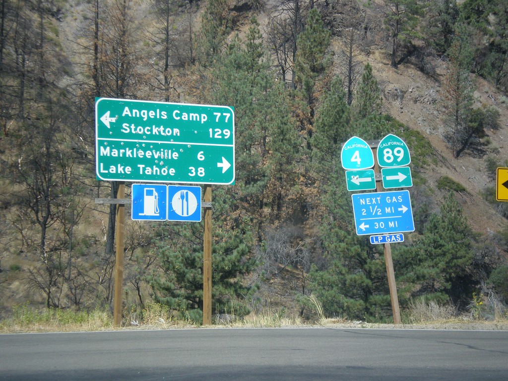
CA-89 North at CA-4
CA-89 North at CA-4. Turn left for CA-4 west to Angels Camp and Stockton (via Ebbetts Pass). Turn right for CA-89 north to Markleeville and Lake Tahoe.
Taken 08-12-2016
 Markleeville
Alpine County
California
United States
Markleeville
Alpine County
California
United States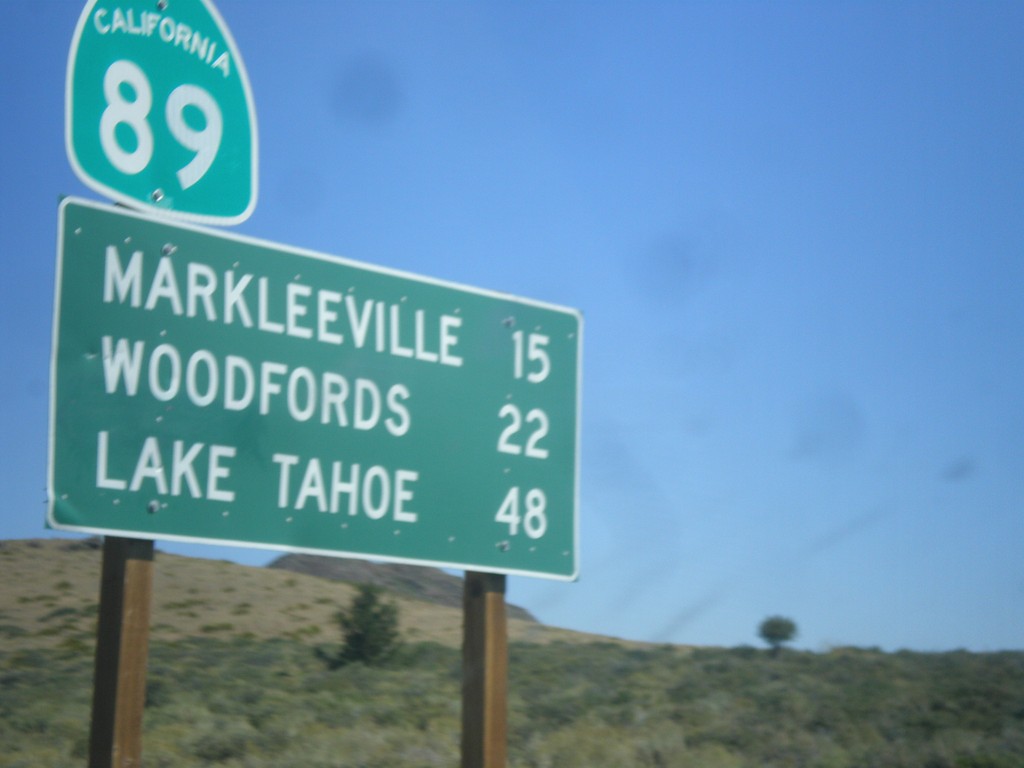
CA-89 North - Distance Marker
Distance marker on CA-89 north. Distance to Markleeville, Woodfords, and Lake Tahoe.
Taken 08-12-2016
Coleville
Mono County
California
United States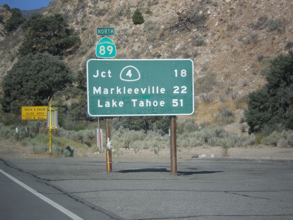
CA-89 North - Distance Marker
First distance marker on CA-89 north. Distance to CA-4 Jct., Markleeville, and Lake Tahoe.
Taken 08-12-2016
Coleville
Mono County
California
United States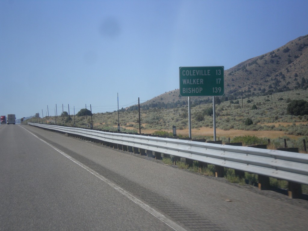
US-395 South - Distance Marker
Distance marker on US-395 south. Distance to Coleville, Walker, and Bishop. All three of these places are in California. This is the last distance marker on US-395 southbound.
Taken 08-12-2016
 Gardnerville
Douglas County
Nevada
United States
Gardnerville
Douglas County
Nevada
United States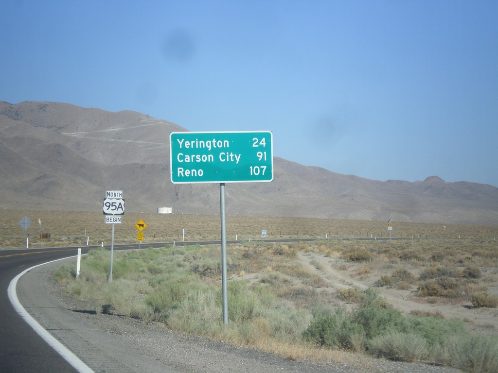
US-95 Alt. North - Distance Marker
Distance marker on US-95 Alt. north. Distance to Yerington, Carson City (via US-50), and Reno (via I-80).
Taken 08-12-2016
 Schurz
Mineral County
Nevada
United States
Schurz
Mineral County
Nevada
United States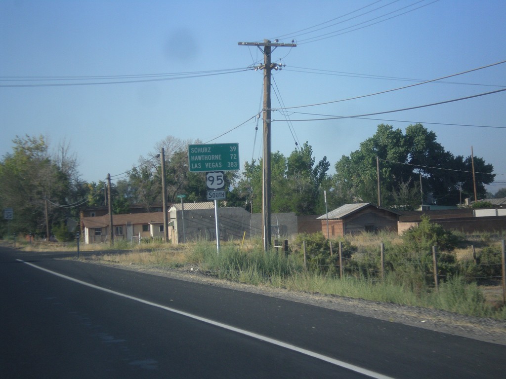
US-95 South - Distance Marker
Distance marker on US-95 south. Distance to Schurz, Hawthorne, and Las Vegas.
Taken 08-12-2016
Fallon
Churchill County
Nevada
United States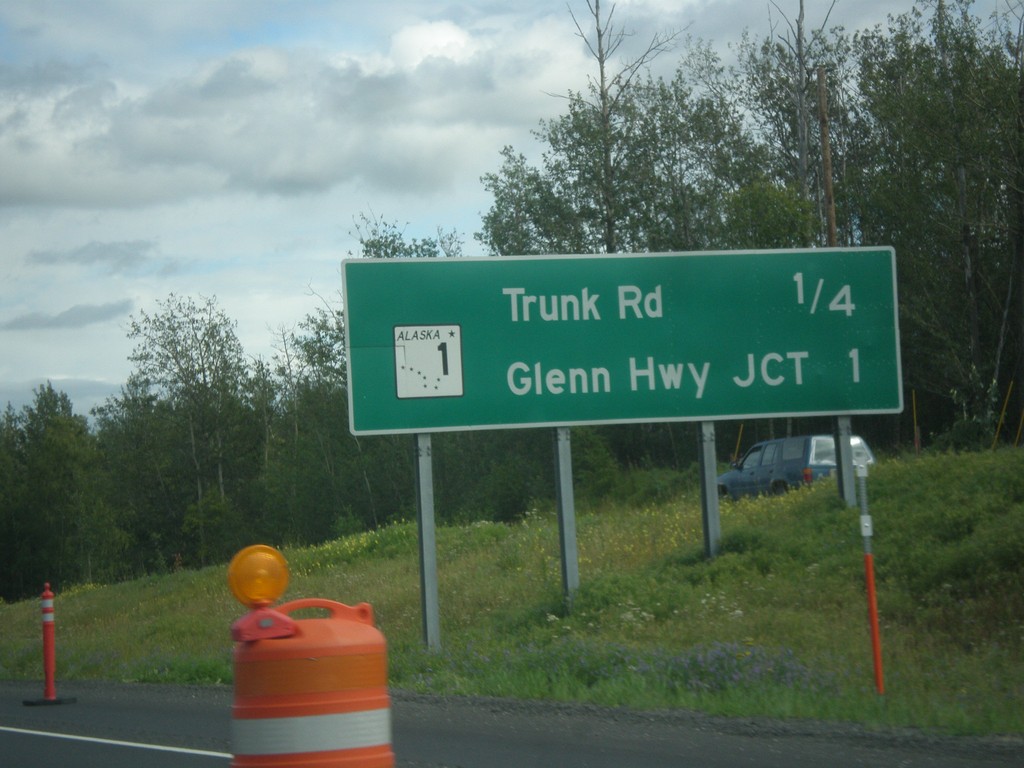
AK-3 South - Next Exits
Next exits on AK-3 south: Trunk Road and AK-1/Glenn Hwy. Jct.
Taken 07-23-2016

 Palmer
Matanuska-Susitna
Alaska
United States
Palmer
Matanuska-Susitna
Alaska
United States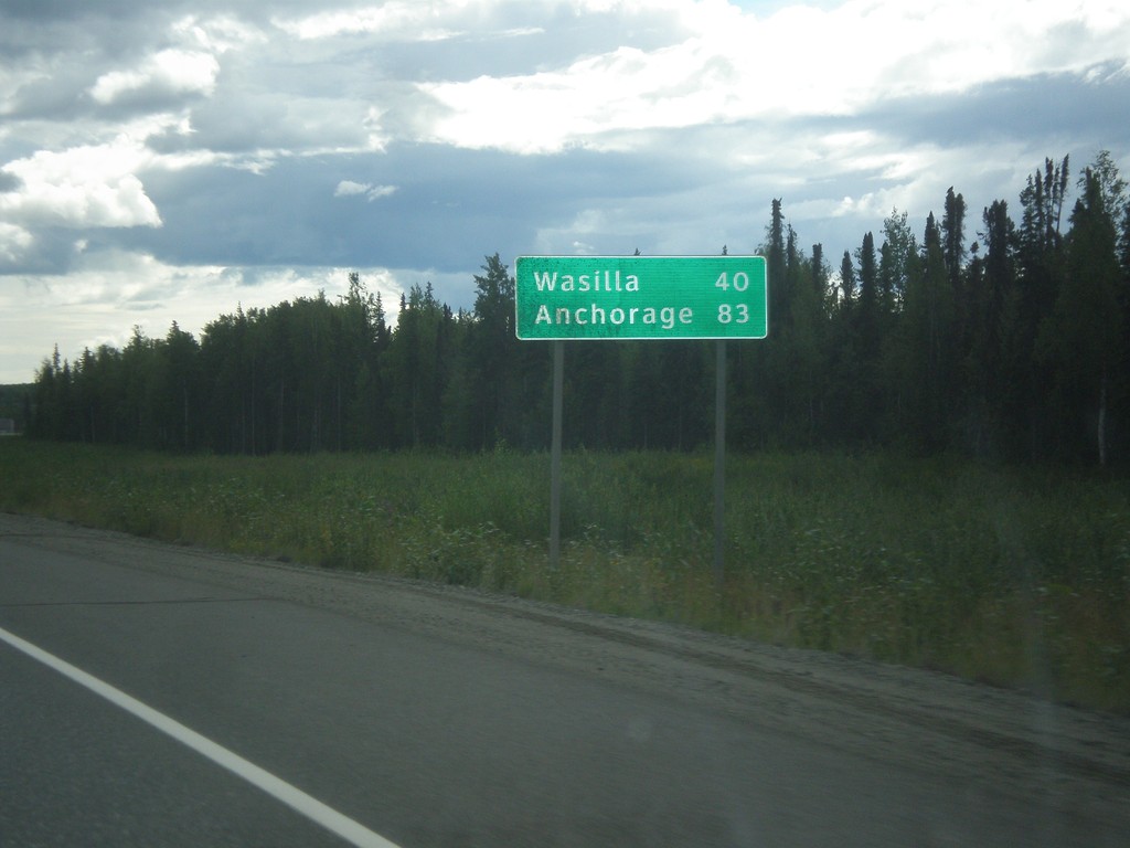
AK-3 South - Distance Marker
Distance marker on AK-3 south. Distance to Wasilla and Anchorage.
Taken 07-23-2016
Willow
Matanuska-Susitna
Alaska
United States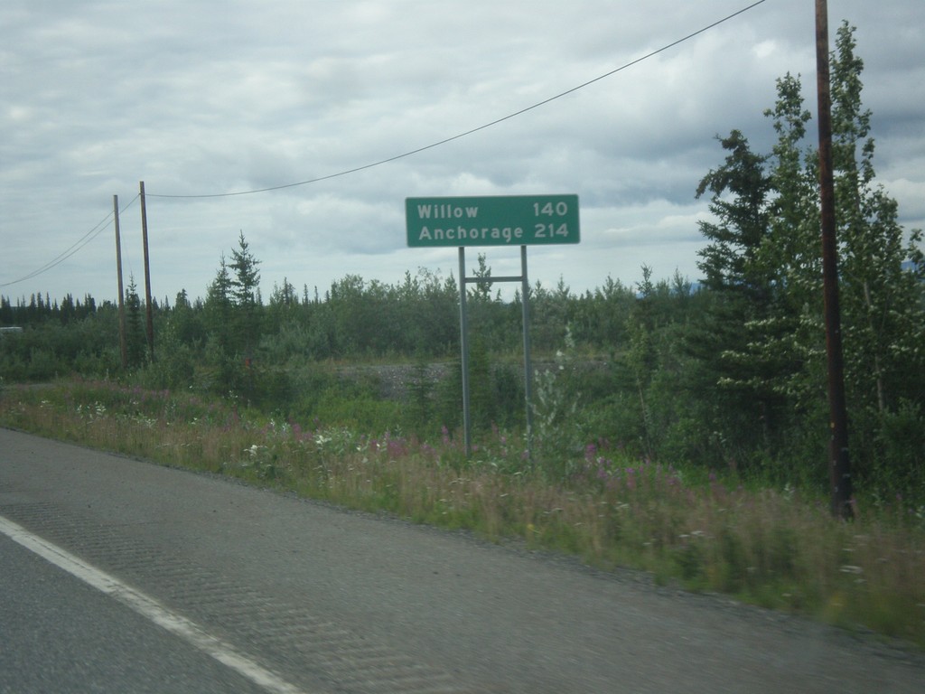
AK-3 South - Distance Marker
Distance marker on AK-3 (George Parks Highway) south. Distance to Willow and Anchorage.
Taken 07-23-2016
Cantwell
Denali Borough
Alaska
United States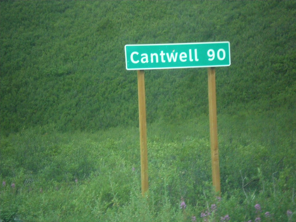
AK-8 West - Distance Marker
Distance marker on AK-8 west. Distance to Cantwell. Cantwell is where the Denali Highway ends at the Parks Highway.
Taken 07-23-2016
 Cantwell
Matanuska-Susitna
Alaska
United States
Cantwell
Matanuska-Susitna
Alaska
United States
AK-8 West - Distance Marker
Distance marker on AK-8 west. Distance to Tangle Lakes, Cantwell, and Denali National Park.
Taken 07-22-2016
Delta Junction
Copper River Census Area
Alaska
United States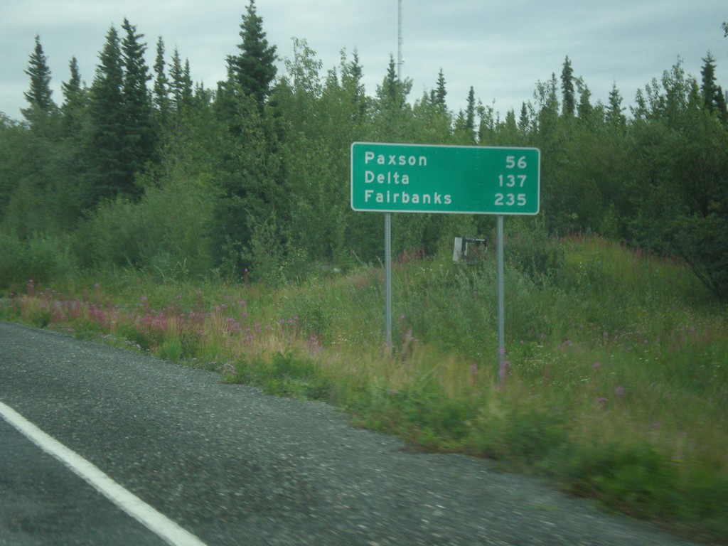
AK-4 North - Distance Marker
Distance marker on AK-4 North (Richardson Highway). Distance to Paxson, Delta, and Fairbanks.
Taken 07-22-2016
 Gakona
Copper River Census Area
Alaska
United States
Gakona
Copper River Census Area
Alaska
United States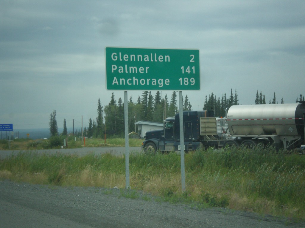
AK-1 South - Distance Marker
Distance marker on AK-1 south. Distance to Glenallen, Palmer, and Anchorage.
Taken 07-22-2016
Glennallen
Copper River Census Area
Alaska
United States
AK-4 North - Distance Marker
Distance marker on AK-4 north (Richardson Highway). Distance to Copper Center and Glenallen.
Taken 07-22-2016
Copper Center
Copper River Census Area
Alaska
United States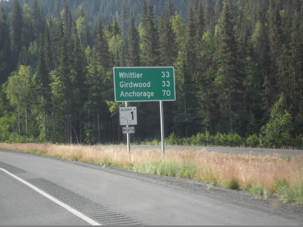
AK-1 North - Distance Marker
Distance marker and AK-1 shield along AK-1 (Seward Highway) north. Distance to Girdwood, Whittier (via Portage Glacier Highway), and Anchorage.
Taken 07-20-2016
Hope
Kenai Peninsula Borough
Alaska
United States
AK-1 North - Distance Marker
Distance marker on AK-1 north. Distance to Girdwood, Whittier (via Portage Glacier Hwy) and Anchorage.
Taken 07-20-2016
Moose Pass
Kenai Peninsula Borough
Alaska
United States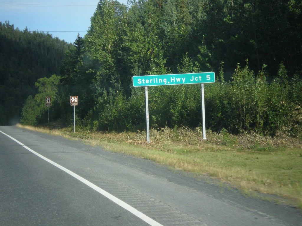
AK-9 North - Distance Marker
Distance marker on AK-9 (Seward Highway) north. Distance to Sterling Highway - 5 Miles.
Taken 07-20-2016
 Moose Pass
Kenai Peninsula Borough
Alaska
United States
Moose Pass
Kenai Peninsula Borough
Alaska
United States