Signs Tagged With Distance Marker
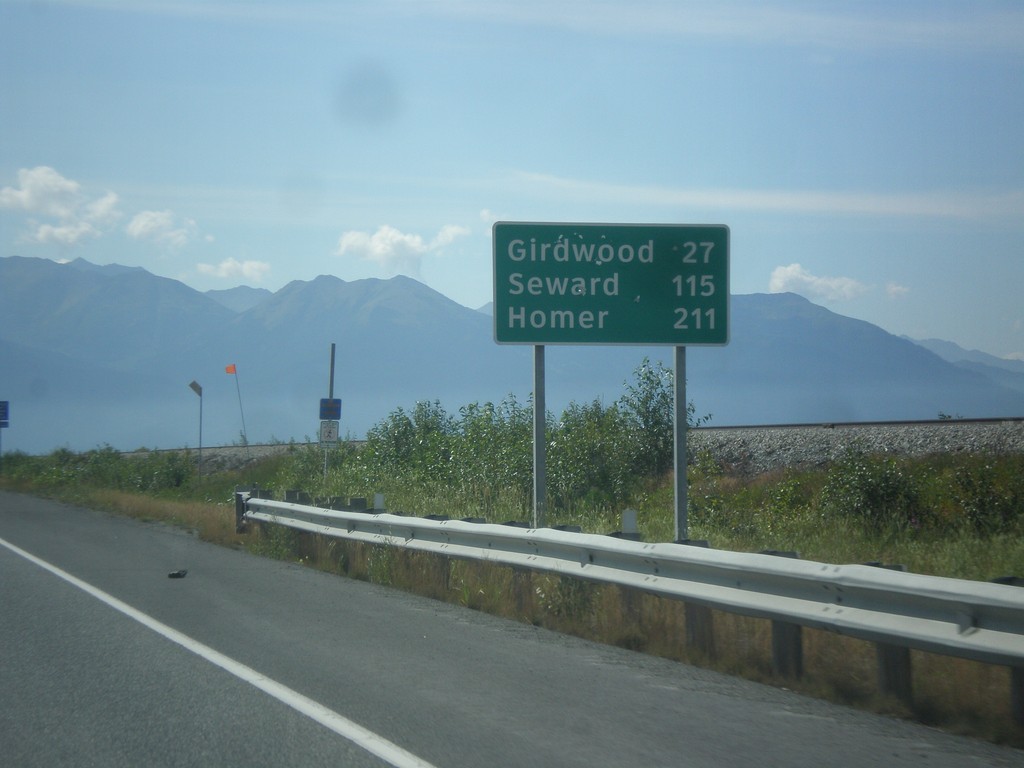
AK-1 South - Distance Marker
Distance marker on AK-1 south. Distance to Girdwood, Seward, and Homer (via Sterling Highway).
Taken 07-16-2016
 Anchorage
 Municipality
Alaska
United States
Anchorage
Anchorage Municipality
Alaska
United States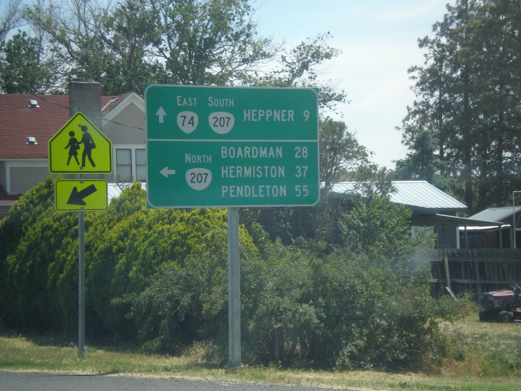
OR-74 East at OR-207
OR-74 East at OR-207. Turn left for OR-207 north to Boardman, Hermiston, and Pendleton. Continue straight for OR-74 East/OR-207 South to Heppner.
Taken 06-05-2016

 Lexington
Morrow County
Oregon
United States
Lexington
Morrow County
Oregon
United States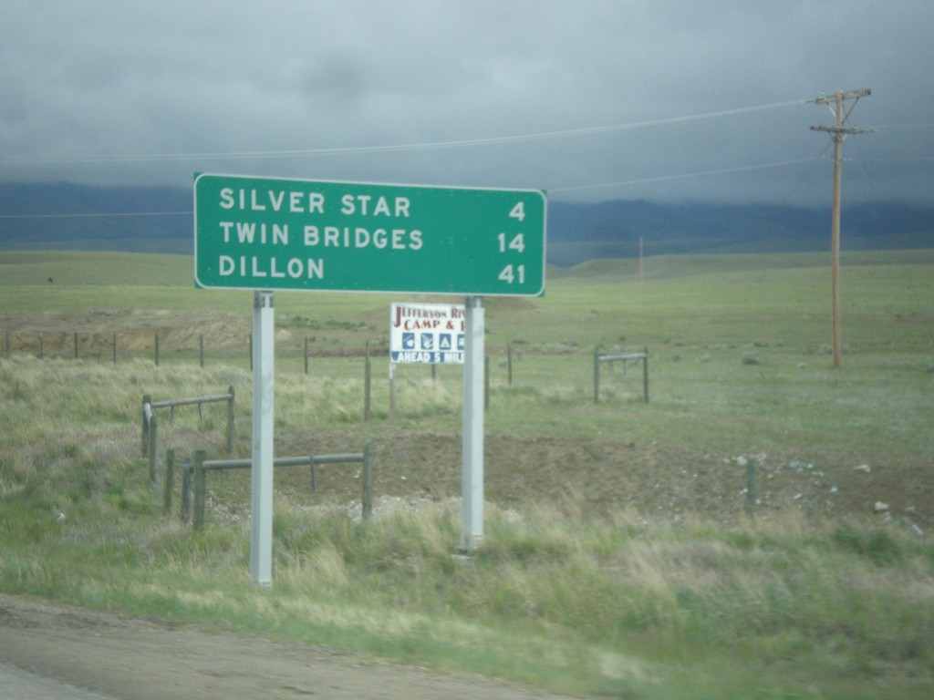
MT-41 South - Distance Marker
Distance marker on MT-41 south. Distance to Silver Star, Twin Bridges, and Dillon.
Taken 05-15-2016
 Silver Star
Madison County
Montana
United States
Silver Star
Madison County
Montana
United States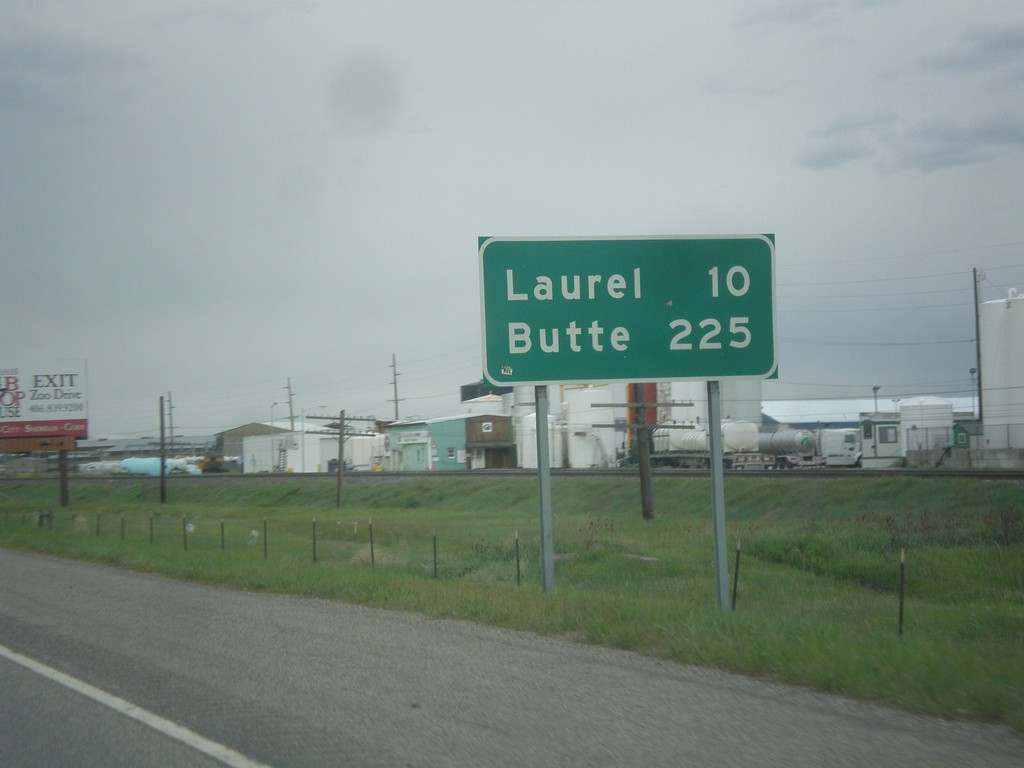
I-90 West - Distance Marker
Distance marker on I-90 west. Distance to Laurel and Butte.
Taken 05-15-2016

 Billings
Yellowstone County
Montana
United States
Billings
Yellowstone County
Montana
United States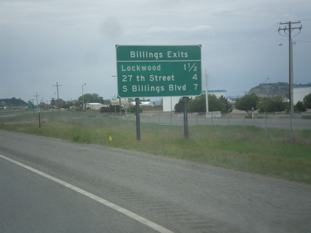
I-90 West - Billings Exits
Billings Exits on I-90 West: Lockwood, 27th St., S Billings Blvd.
Taken 05-15-2016
 Billings
Yellowstone County
Montana
United States
Billings
Yellowstone County
Montana
United States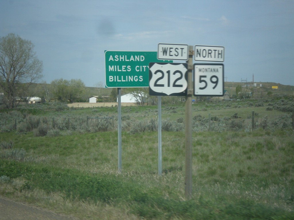
US-212 West/MT-59 North - Distance Marker
Distance Marker on US-212 West/MT-59 North. Distance to Ashland, Miles City (via MT-59), and Billings.
Taken 05-15-2016
 Broadus
Powder River County
Montana
United States
Broadus
Powder River County
Montana
United States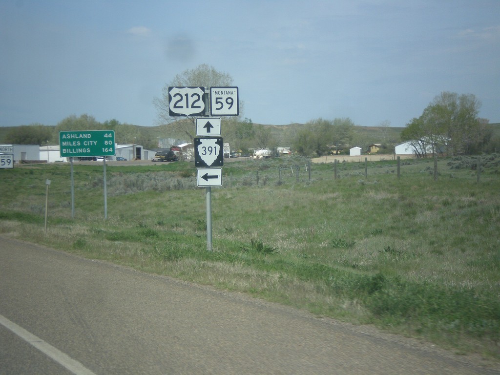
US-212 West/MT-59 North at MTS-391 South
US-212 West/MT-59 North at MTS-391 South in Broadus. Distance marker in background to Ashland, Miles City (via MT-59 North), and Billings.
Taken 05-15-2016
 Broadus
Powder River County
Montana
United States
Broadus
Powder River County
Montana
United States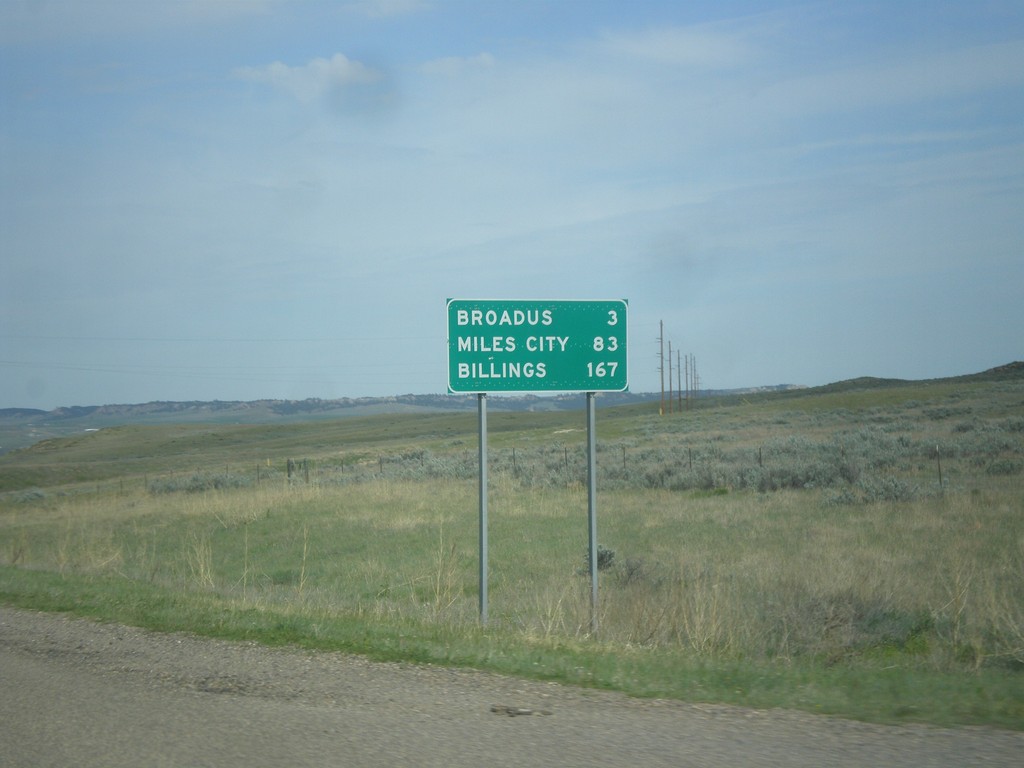
US-212 West/MT-59 North - Distance Marker
Distance marker on US-212 West/MT-59 North. Distance to Broadus, Miles City (via MT-59 north), and Billings (via US-212 west).
Taken 05-15-2016
Broadus
Powder River County
Montana
United States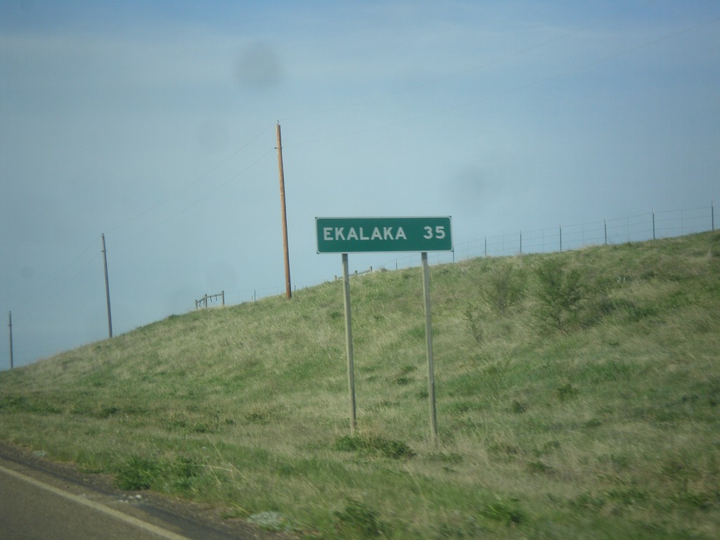
MT-7 South - Distance Marker
Distance marker on MT-7 south. Distance to Ekalaka.
Taken 05-15-2016
 Baker
Fallon County
Montana
United States
Baker
Fallon County
Montana
United States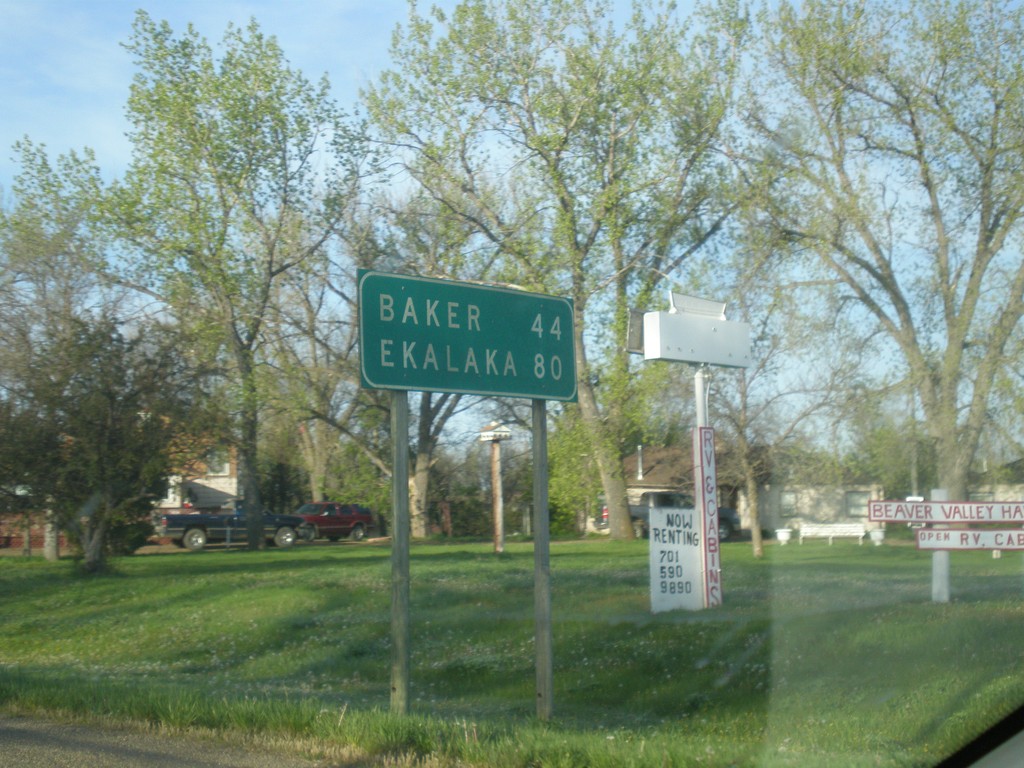
MT-7 South - Distance Marker
Distance marker on MT-7 south. Distance to Baker and Ekalaka.
Taken 05-15-2016
Wibaux
Wibaux County
Montana
United States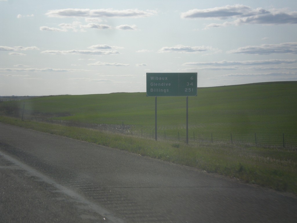
I-94 West - Distance Marker
Distance marker on I-94 west. Distance to Wibaux, Glendive, and Billings.
Taken 05-14-2016
 Wibaux
 County
Montana
United States
Wibaux
Wibaux County
Montana
United States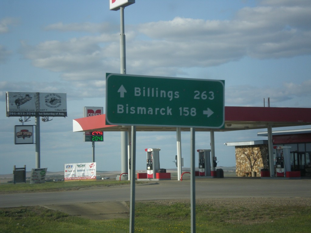
ND-16 North at I-94
ND-16 North at I-94 near Beach. Use I-94 east for Bismarck; I-94 west for Billings (Montana).
Taken 05-14-2016
 Beach
Golden Valley County
North Dakota
United States
Beach
Golden Valley County
North Dakota
United States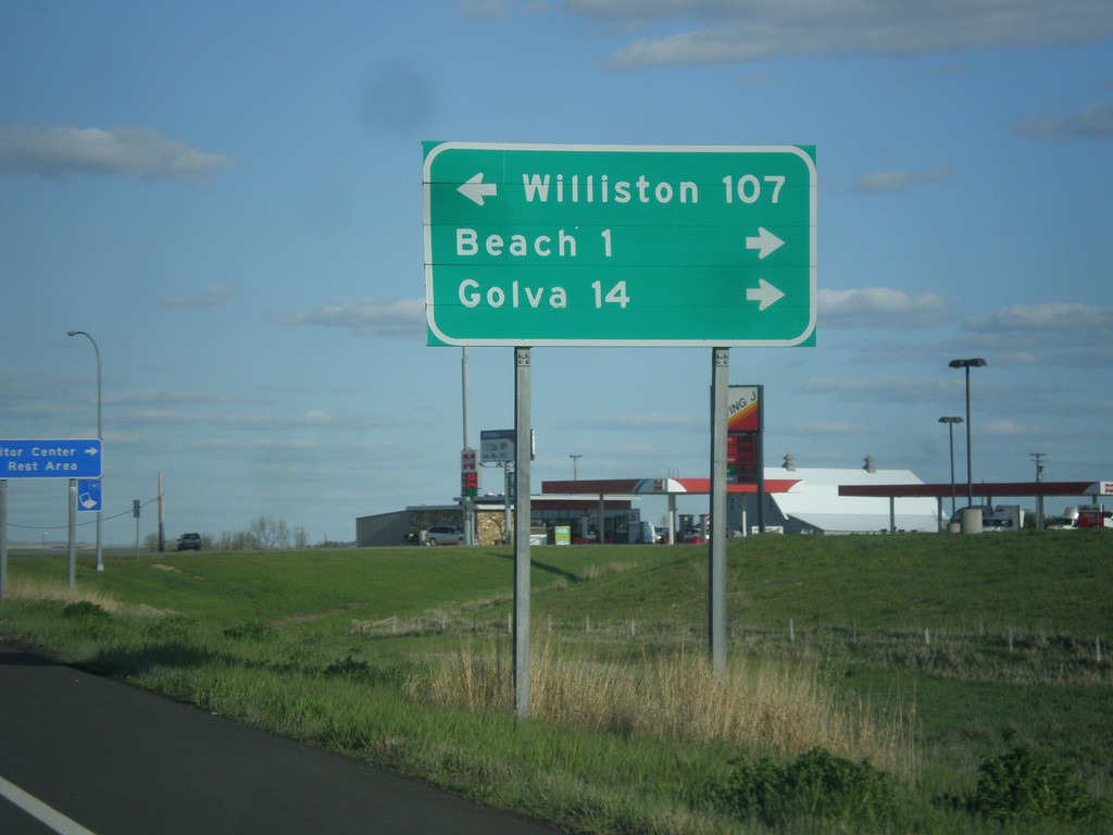
I-94 East - Exit 1 Offramp
I-94 East on Exit 1 Offramp. Turn left for ND-16 north to Williston; turn right for ND-16 south to Beach and Golva.
Taken 05-14-2016
Beach
Golden Valley County
North Dakota
United States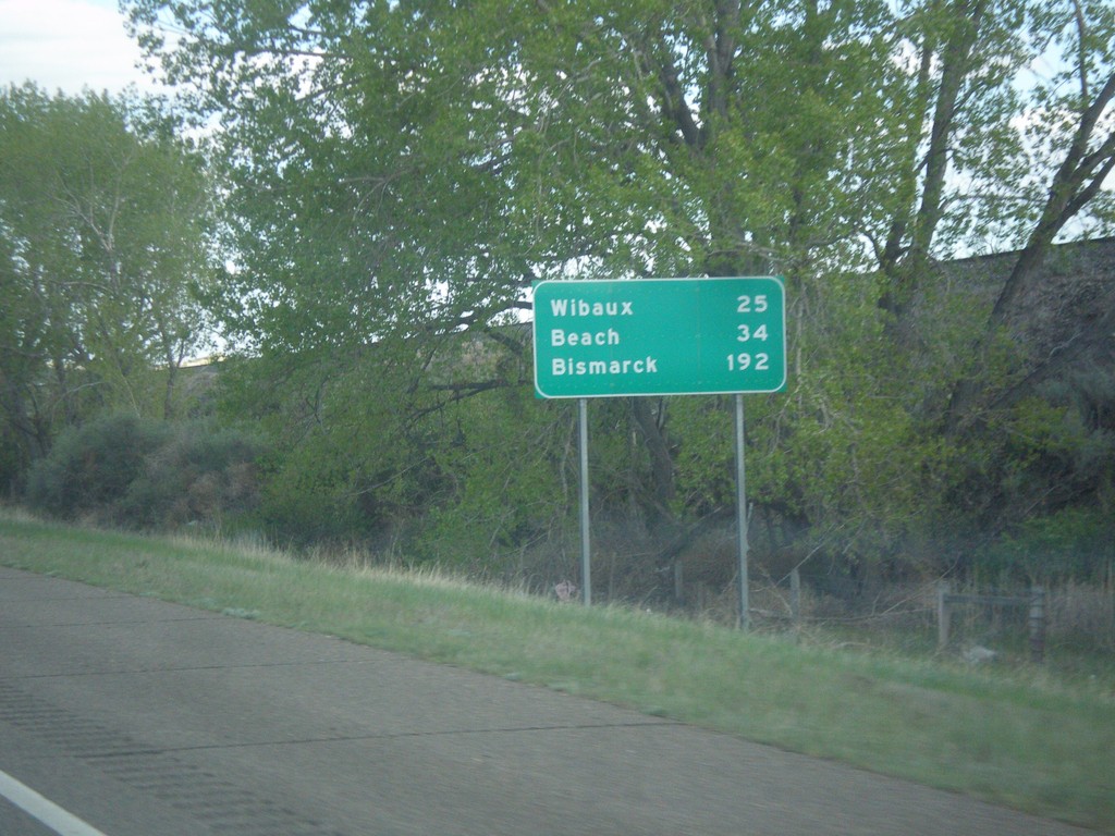
I-94 East - Distance Marker
Distance marker on I-94 east. Distance to Wibaux, Beach (ND), and Bismarck (ND).
Taken 05-14-2016
Glendive
Dawson County
Montana
United States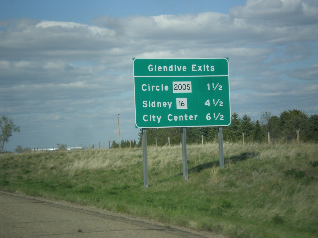
I-94 East - Glendive Exits
Glendive exits on I-94 east. MT-200S/Circle, MT-16/Sidney, and City Center.
Taken 05-14-2016

 Glendive
Dawson County
Montana
United States
Glendive
Dawson County
Montana
United States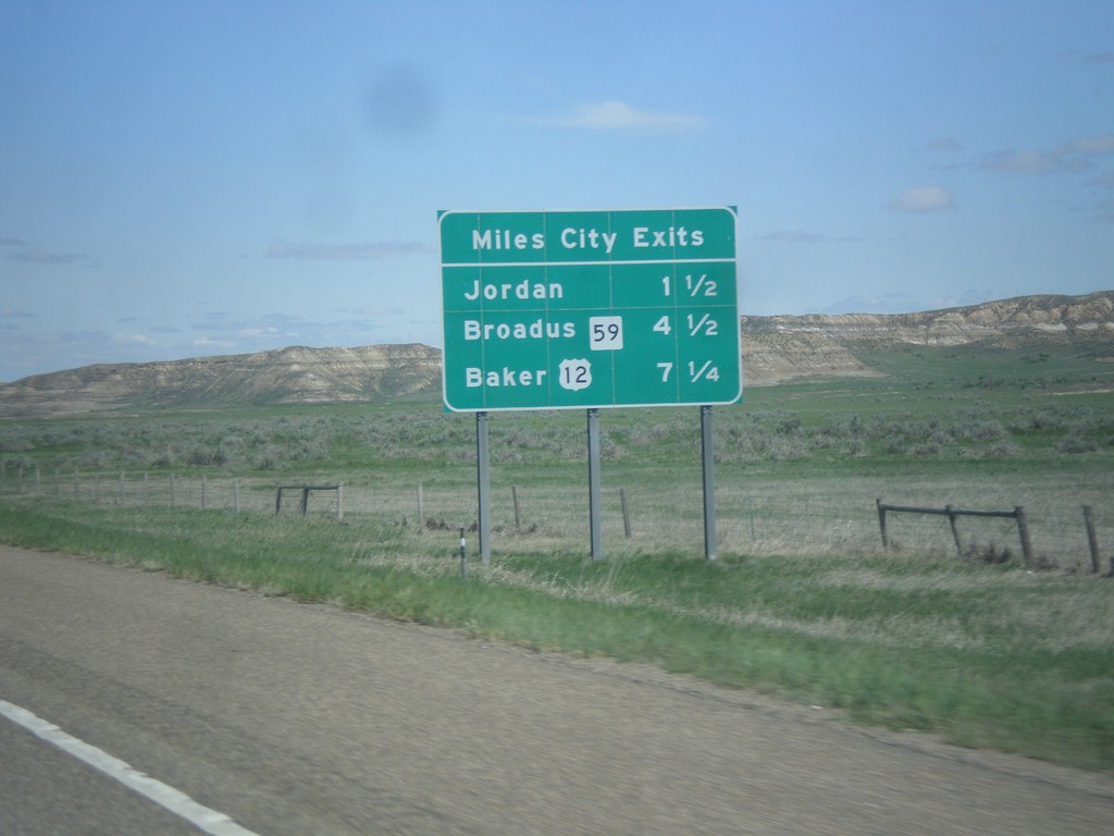
I-94 East - Miles City Exits
Miles City Exits on I-94 east. The three exits all show the destination city accessed by that exit. The first exit is to Jordan (via MT-59 north), the second exit is to Broadus (via MT-59 south), and the third exit is to Baker (via US-12 east).
Taken 05-14-2016
 Miles City
Custer County
Montana
United States
Miles City
Custer County
Montana
United States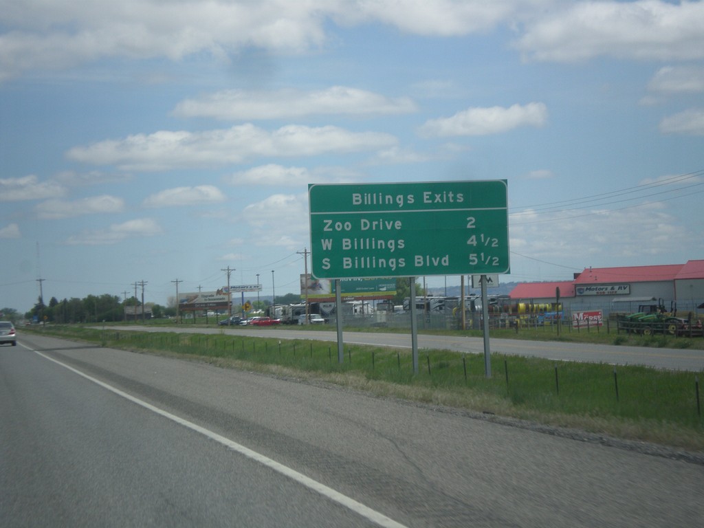
I-90 East - Billings Exits
Billings Exits on I-90 East: Zoo Drive, W Billings, South Billings Blvd.
Taken 05-14-2016
Billings
Yellowstone County
Montana
United States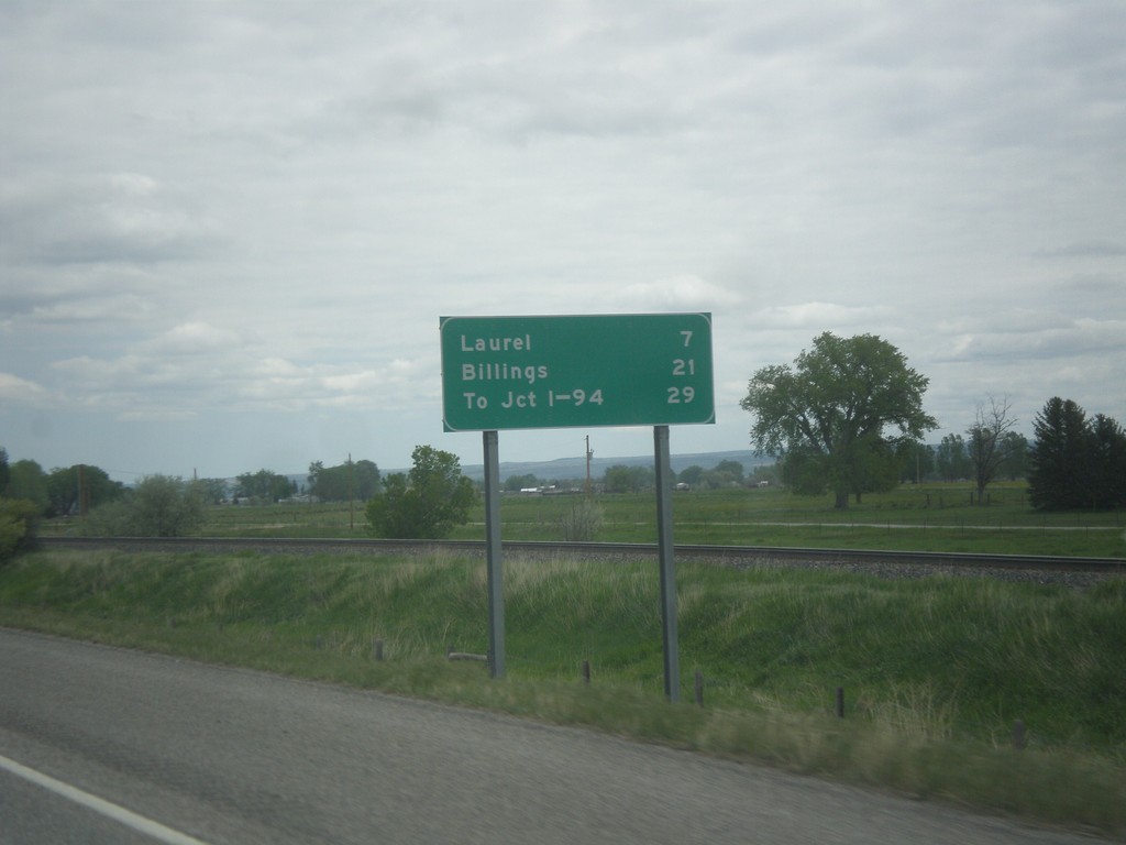
I-90 East - Distance Marker
Distance marker on I-90 east. Distance to Laurel, Billings, and To Jct. I-94.
Taken 05-14-2016
Park City
Stillwater County
Montana
United States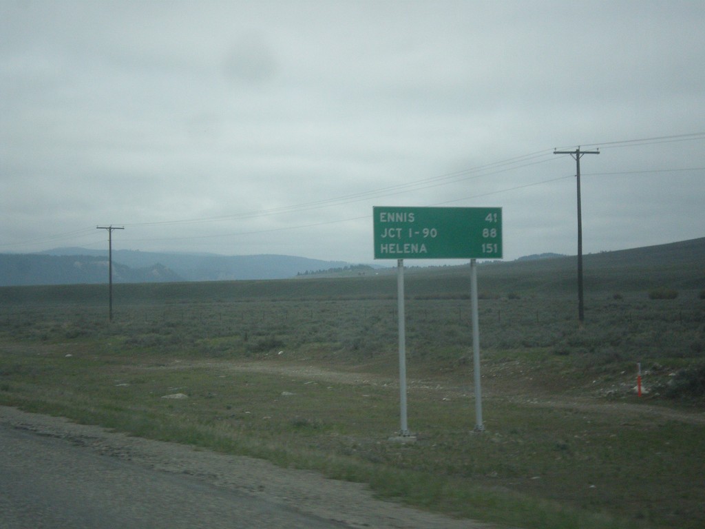
US-287 North - Distance Marker
Distance Marker on US-287 north. Distance to Ennis, Jct. I-90, and Helena.
Taken 05-14-2016

 Schusters Place
Madison County
Montana
United States
Schusters Place
Madison County
Montana
United States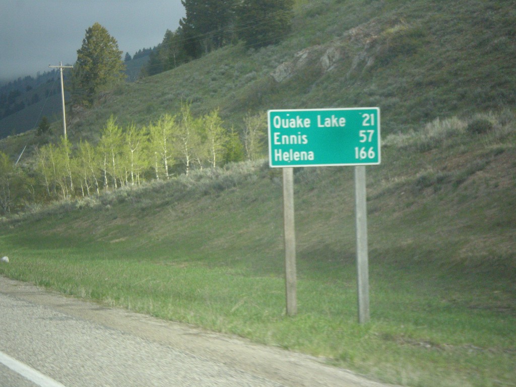
ID-87 North - Distance Marker
Distance marker on ID-87 north. Distance to Quake Lake, Ennis, and Helena. All three of these destinations are in Montana. ID-87 is a short state highway that follows the east shore of Henrys Lake, before climbing to the Continental Divide at Raynolds Pass on the Idaho-Montana line.
Taken 05-14-2016
 Island Park
Fremont County
Idaho
United States
Island Park
Fremont County
Idaho
United States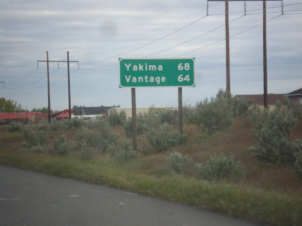
WA-240 West - Distance Marker
Distance marker on WA-240 west. Distance to Yakima and Vantage.
Taken 04-28-2016
 Richland
Benton County
Washington
United States
Richland
Benton County
Washington
United States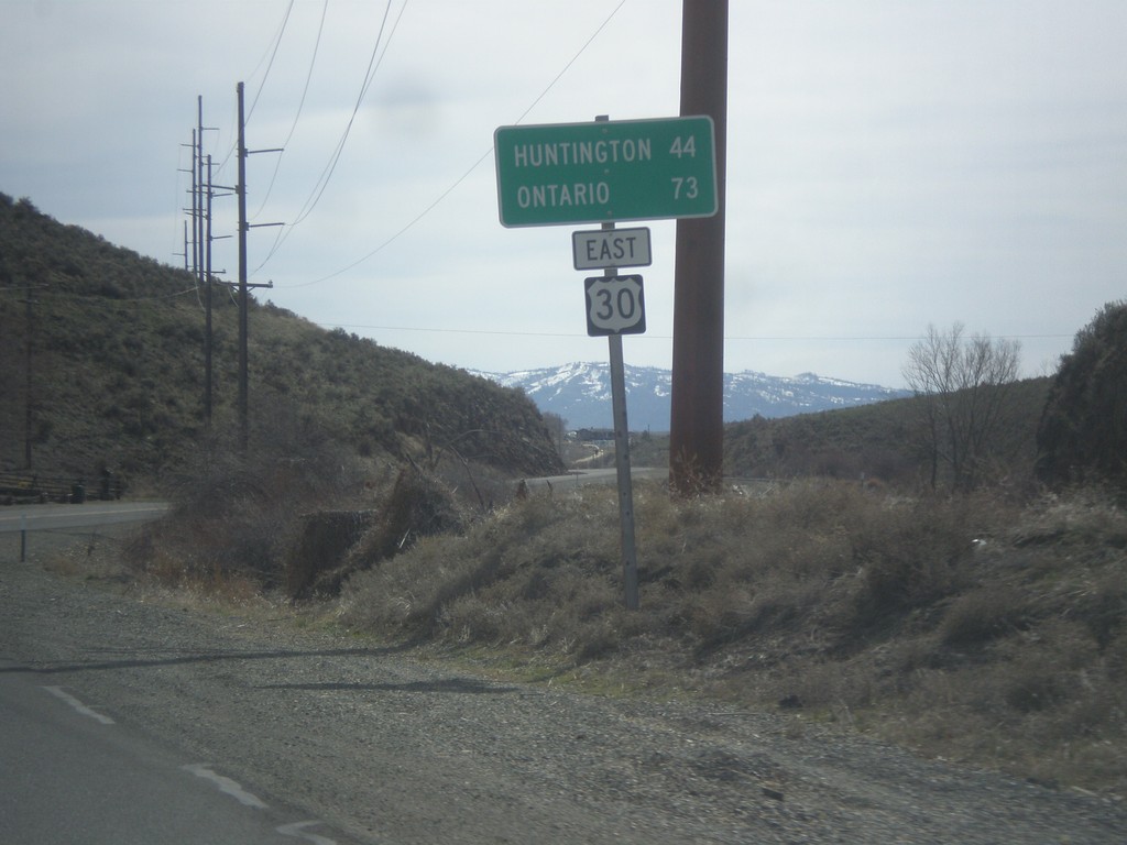
US-30 East - Distance Marker
Distance marker on US-30 east. Distance to Huntington and Ontario.
Taken 03-20-2016
 Baker City
Baker County
Oregon
United States
Baker City
Baker County
Oregon
United States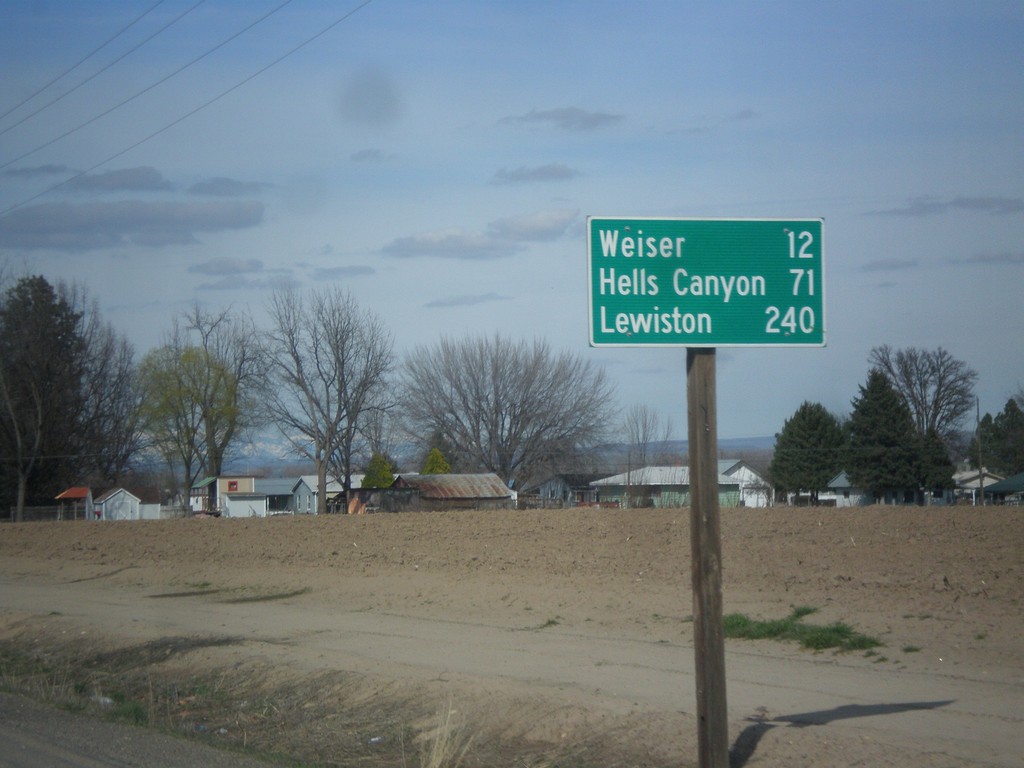
US-95 North - Distance Marker
Distance marker on US-95 north. Distance to Weiser, Hells Canyon (at Brownlee Reservoir via ID-71) and Lewiston.
Taken 03-18-2016
 Payette
 County
Idaho
United States
Payette
Payette County
Idaho
United States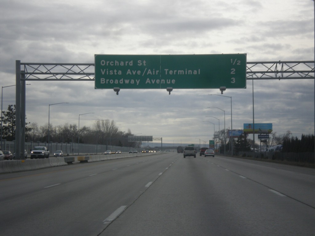
I-84 East - Boise Exits
Next 3 Boise exits on I-84 east - Orchard St., Vista Ave./Air Terminal, and Broadway Ave.
Taken 02-06-2016
 Boise
Ada County
Idaho
United States
Boise
Ada County
Idaho
United States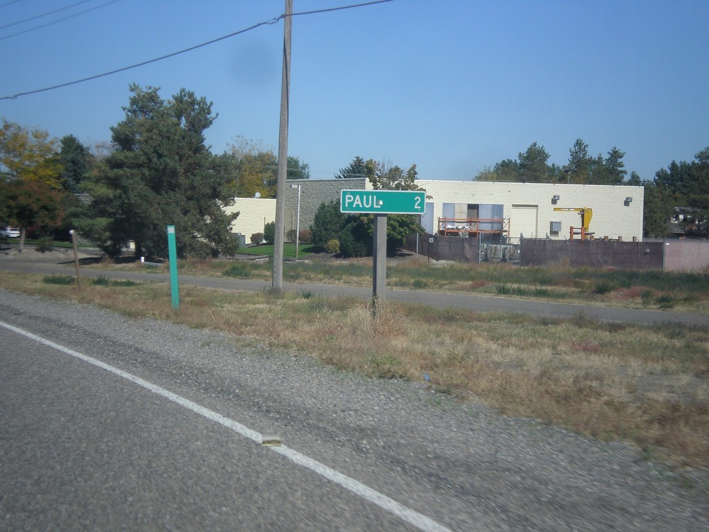
ID-27 North - Distance Marker
Distance marker on ID-27 north. Distance to Paul.
Taken 10-04-2015
Heyburn Minidoka County Idaho United States