Signs Tagged With Distance Marker
ID-33 East - Distance Marker
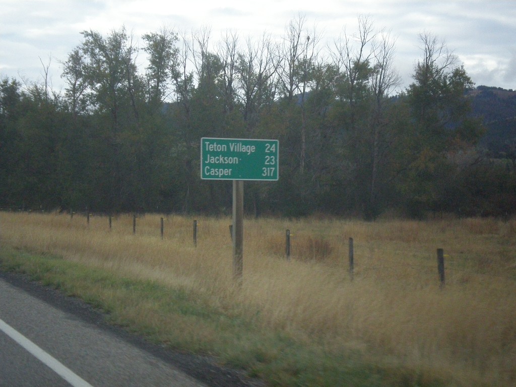
Last distance marker on ID-33 east in Idaho. Distance to Teton Village, Jackson, and Casper.
Taken 10-04-2015
 Victor
Teton County
Idaho
United States
Victor
Teton County
Idaho
United States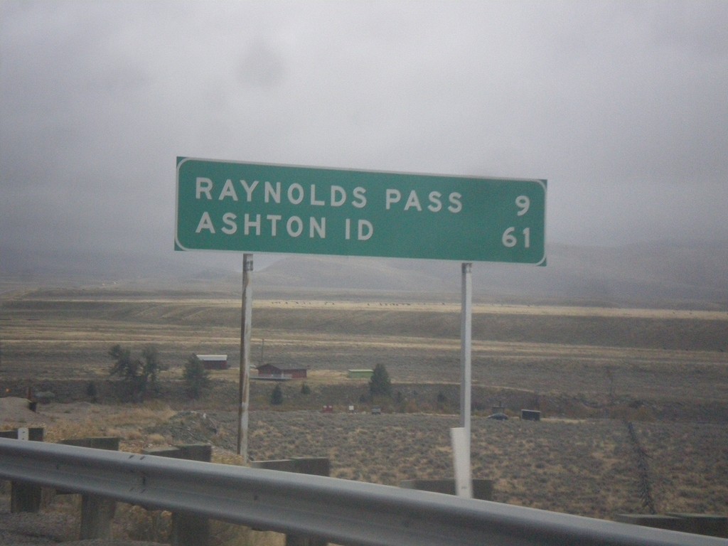
MT-87 South - Distance Marker
Distance marker on MT-87 south. Distance to Raynolds Pass (State Line - Continental Divide) and Ashton, ID.
Taken 10-03-2015
 Schusters Place
Madison County
Montana
United States
Schusters Place
Madison County
Montana
United States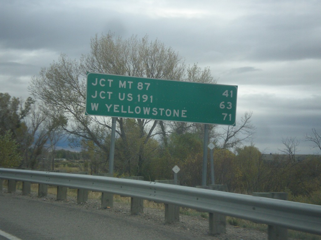
US-287 South - Distance Marker
Distance marker on US-287 south. Distance to Jct. MT-87, Jct. US-191, and West Yellowstone.
Taken 10-03-2015
 Ennis
Madison County
Montana
United States
Ennis
Madison County
Montana
United States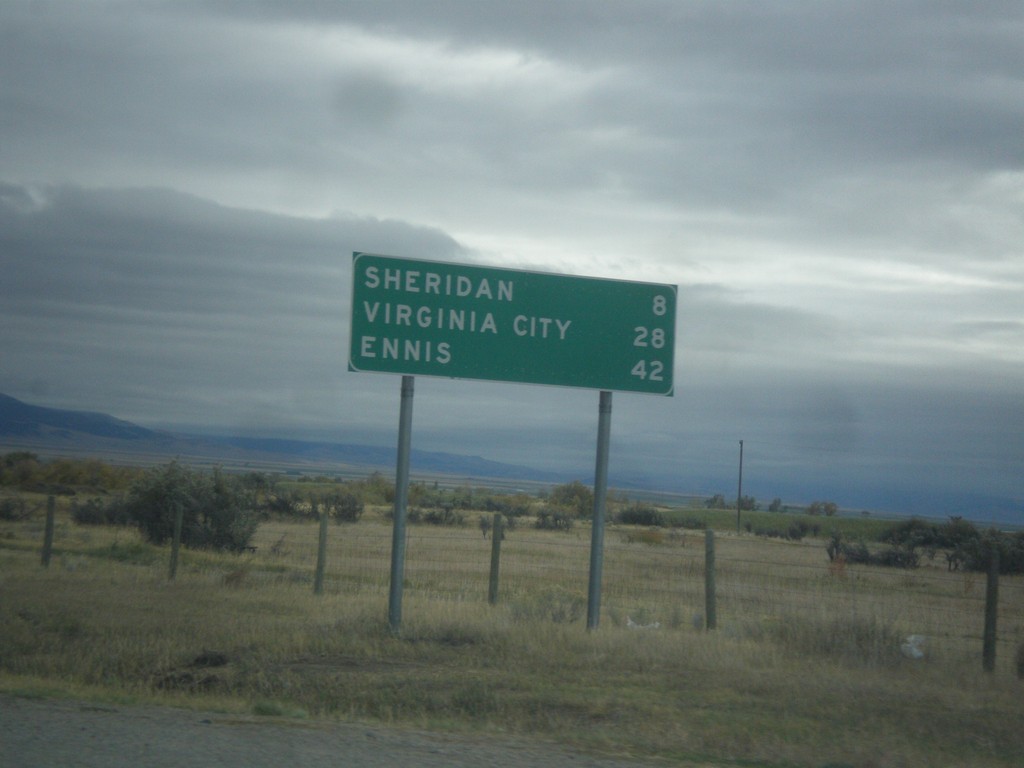
MT-287 South - Distance Marker
Distance marker on MT-287 south. Distance to Sheridan, Virginia City, and Ennis.
Taken 10-03-2015
 Twin Bridges
Madison County
Montana
United States
Twin Bridges
Madison County
Montana
United States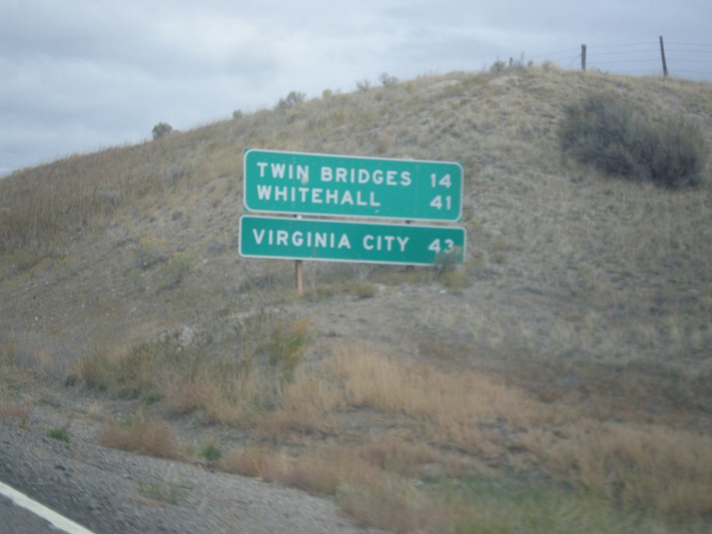
MT-41 North - Distance Marker
Distance marker on MT-41 north. Distance to Twin Bridges, Whitehall, and Virginia City (via MT-287).
Taken 10-03-2015
 Twin Bridges
Madison County
Montana
United States
Twin Bridges
Madison County
Montana
United States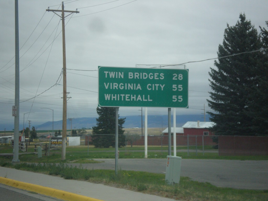
MT-41 North - Distance Marker
Distance marker on MT-41 north. Distance to Twin Bridges, Virginia City (via MT-287) and Whitehall.
Taken 10-03-2015
Dillon
Beaverhead County
Montana
United States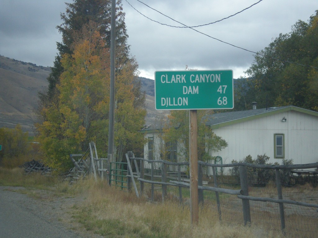
ID-29 East - Distance Marker
Distance marker on ID-29 east. Distance to Clark Canyon Dam (I-15 Jct. in Montana) and Dillon (Montana).
Taken 10-03-2015
 Leadore
Lemhi County
Idaho
United States
Leadore
Lemhi County
Idaho
United States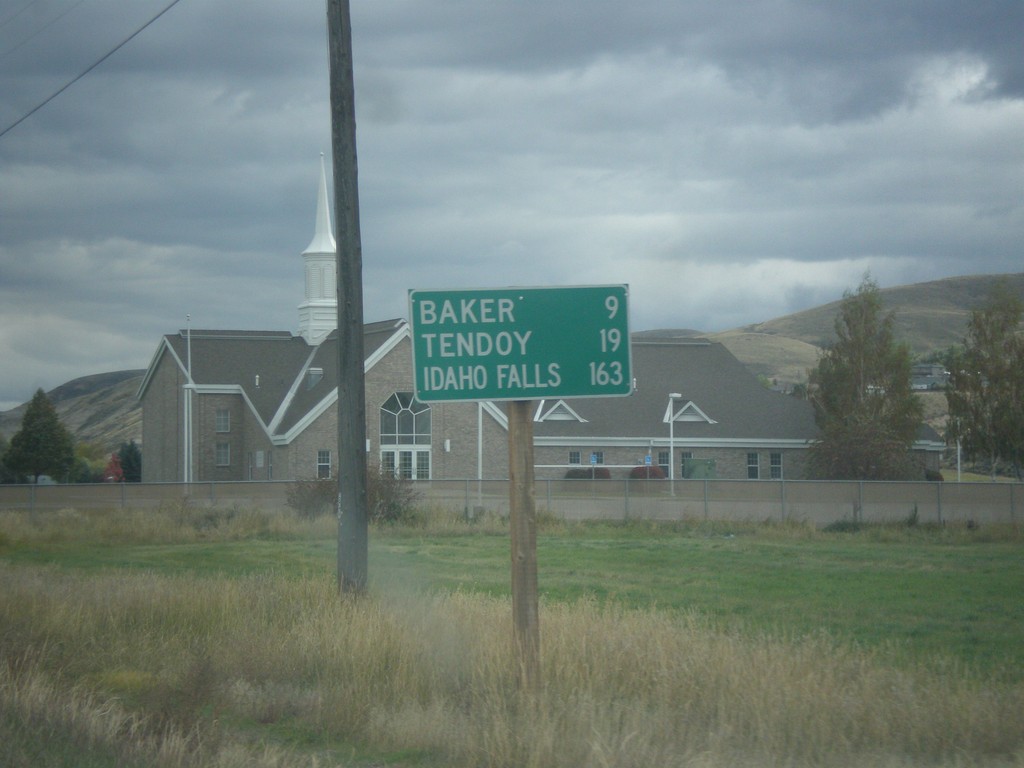
ID-28 South - Distance Marker
Distance marker on ID-28 south in Salmon. Distance to Baker, Tendoy, and Idaho Falls.
Taken 10-03-2015
 Salmon
Lemhi County
Idaho
United States
Salmon
Lemhi County
Idaho
United States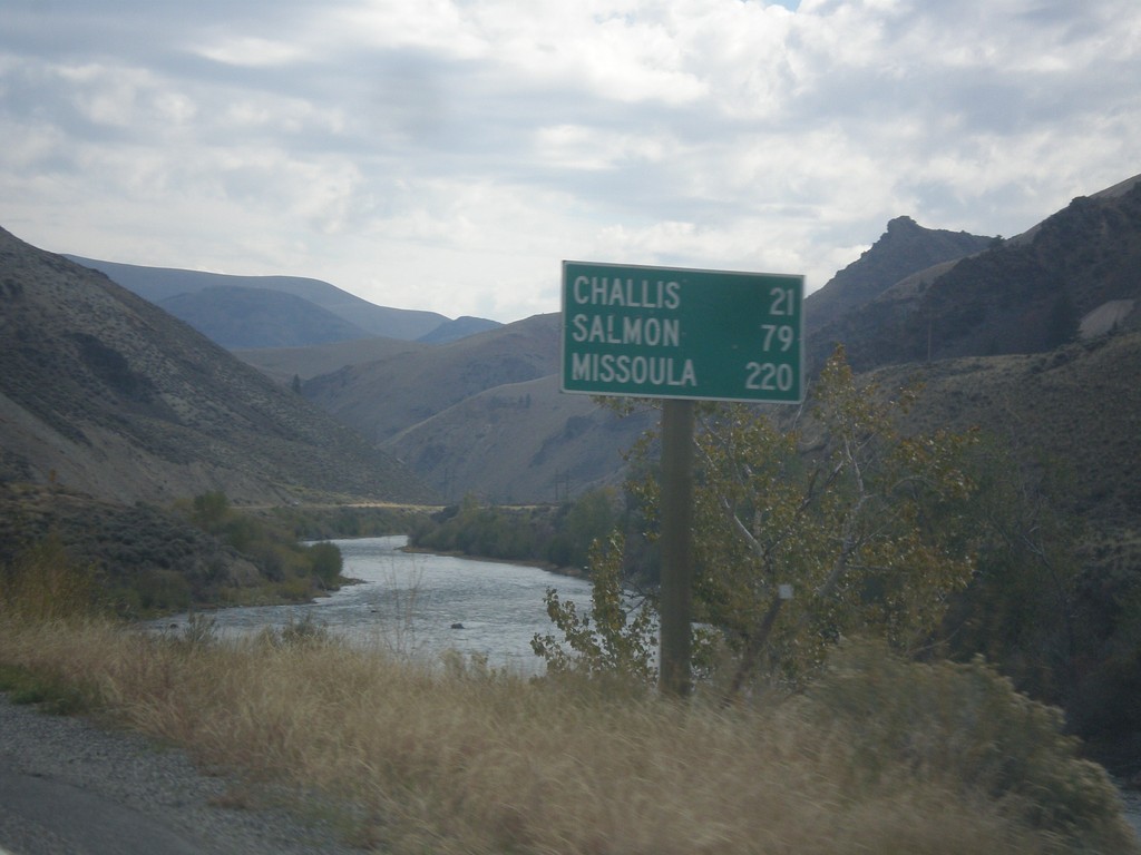
ID-75 North - Distance Marker
Distance marker on ID-75 north. Distance to Challis, Salmon, and Missoula (Montana). The Salmon River is in the background.
Taken 10-03-2015
 Clayton
Custer County
Idaho
United States
Clayton
Custer County
Idaho
United States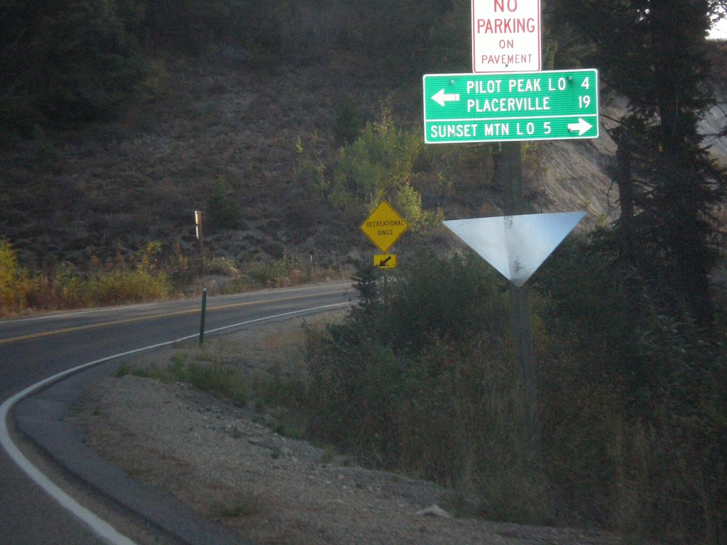
ID-21 East at Mores Creek Summit
ID-21 east at Mores Creek Summit. Turn left for Pilot Peak Lookout and Placerville; right for Sunset Mountain Lookout.
Taken 10-03-2015
 Idaho City
Boise County
Idaho
United States
Idaho City
Boise County
Idaho
United States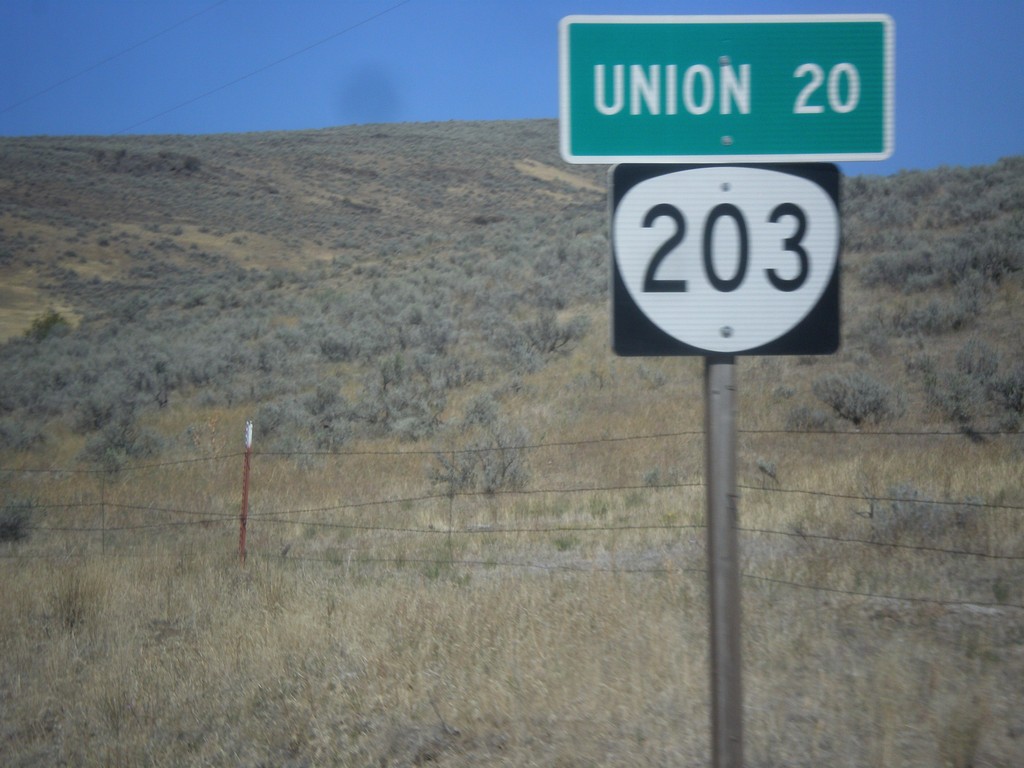
OR-203 North - Distance Marker
Distance marker on OR-203 north. Distance to Union.
Taken 09-13-2015
 Medical Springs
Union County
Oregon
United States
Medical Springs
Union County
Oregon
United States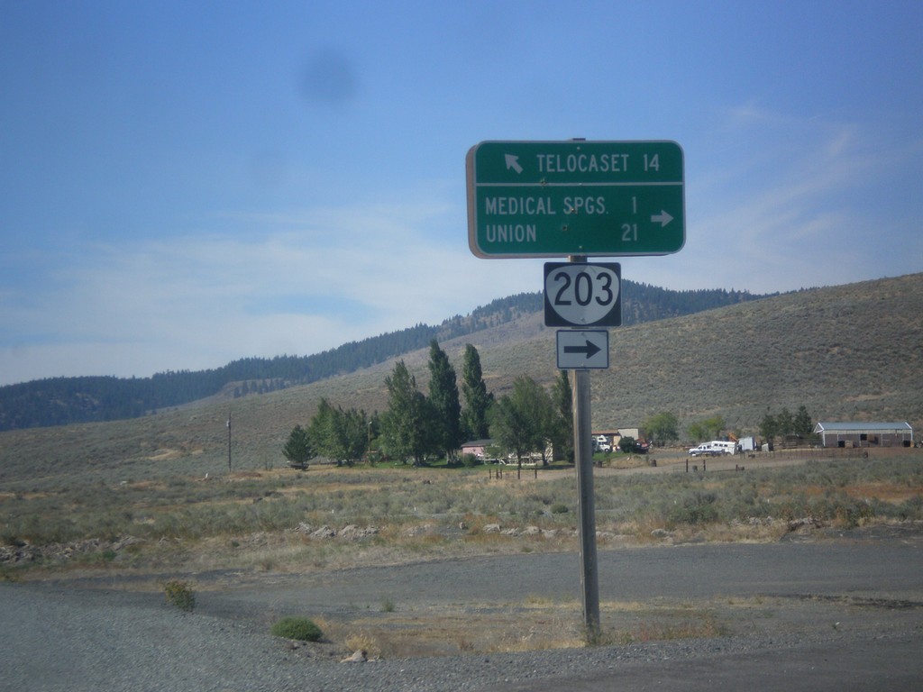
OR-203 North - Telocaset Lane
OR-203 North at Telocaset Lane to Telocaset. Turn right to continue north on OR-203 to Medical Springs and Union.
Taken 09-13-2015
Baker City
Union County
Oregon
United States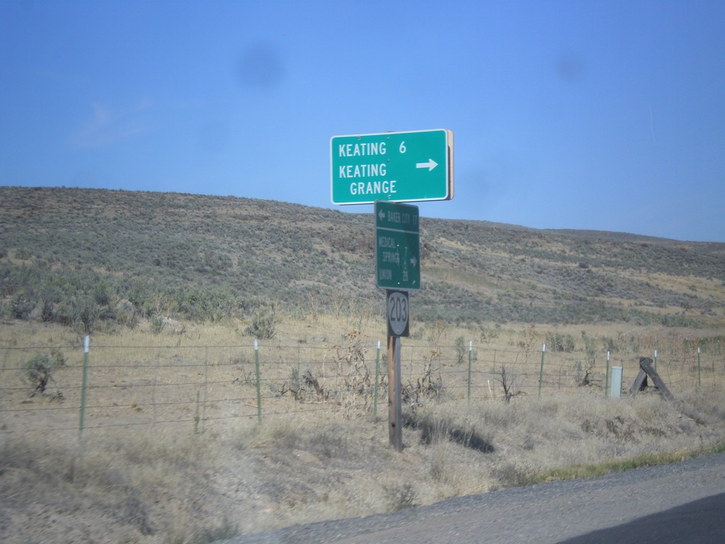
OR-203 North - Keating Jct.
OR-203 north at Miles Bridge Road to Keating and Keating Grange.
Taken 09-13-2015
Baker City
Baker County
Oregon
United States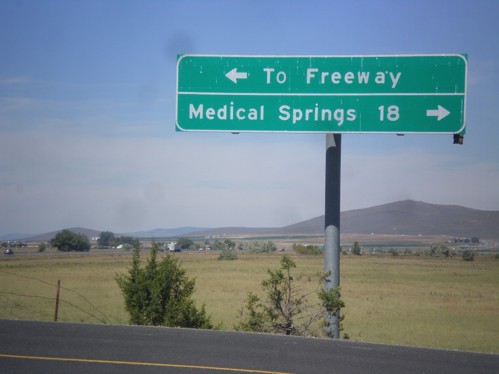
Airport Road North - OR-203 Jct.
Airport Road north at OR-203. Turn right for Medical Springs; left for (I-84) Freeway.
Taken 09-13-2015
Baker City
Baker County
Oregon
United States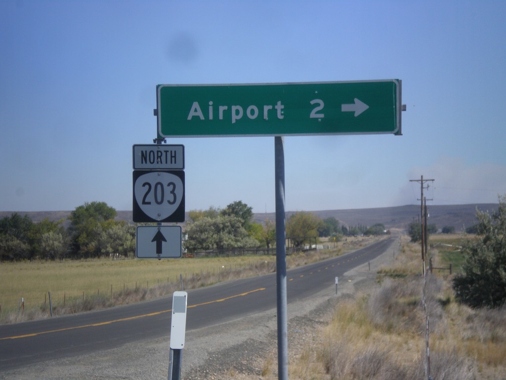
OR-203 North - Airport Road
OR-203 north at Airport Road jct.
Taken 09-13-2015
Baker City
Baker County
Oregon
United States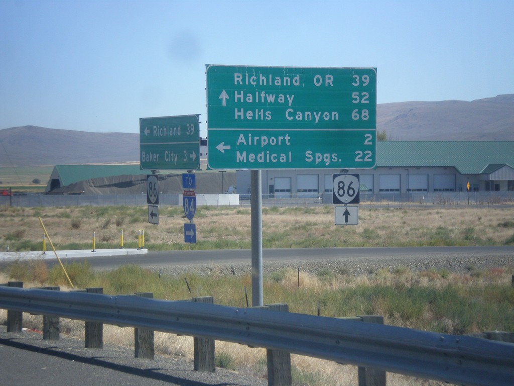
OR-86 East at West Airport Road (Medical Springs Highway)
OR-86 east West Airport Road (Medical Springs Highway) to the (Baker City) Airport and Medical Springs (via OR-203). Continue east on OR-86 for Richland, OR, Halfway and Hells Canyon. West Airport Road is a Frontage Road that extends south from the junction of OR-203 to OR-86. It is part of the Oregon State Highway system as the Medical Springs Highway but is not signed with a number.
Taken 09-13-2015
 Baker City
Baker County
Oregon
United States
Baker City
Baker County
Oregon
United States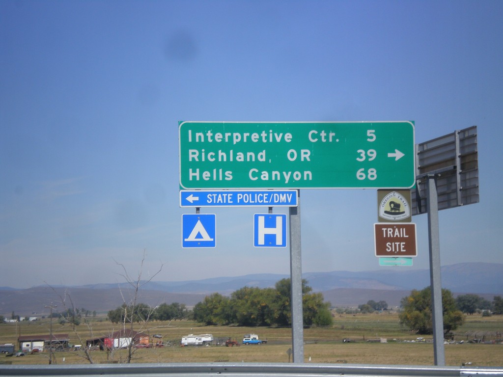
I-84 East (Exit 302) Off Ramp at OR-86
I-84 East (Exit 302) off ramp at OR-86. Turn right for OR-86 west to (Oregon Trail) Interpretive Center, Richland, OR, and Hells Canyon. Turn left for Baker City access.
Taken 09-13-2015
 Baker City
Baker County
Oregon
United States
Baker City
Baker County
Oregon
United States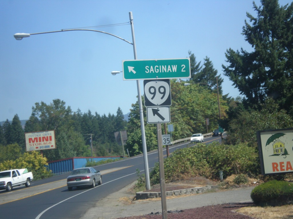
OR-99 North at Row River Road
OR-99 North at Row River Road in Cottage Grove. Merge left to continue north to OR-99 to Saginaw.
Taken 08-22-2015
 Cottage Grove
Lane County
Oregon
United States
Cottage Grove
Lane County
Oregon
United States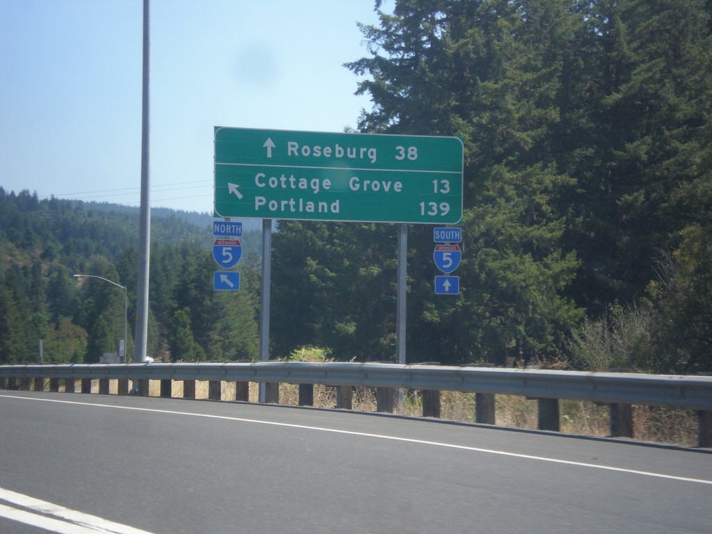
OR-38 East/OR-99 North at I-5
OR-38 East/OR-99 North at I-5. Use I-5 South to Roseburg; I-5 north to Cottage Grove and Portland. This is the eastern end of OR-38. This segment of OR-99 ends here, and re-appears in Cottage Grove.
Taken 08-22-2015

 Drain
Douglas County
Oregon
United States
Drain
Douglas County
Oregon
United States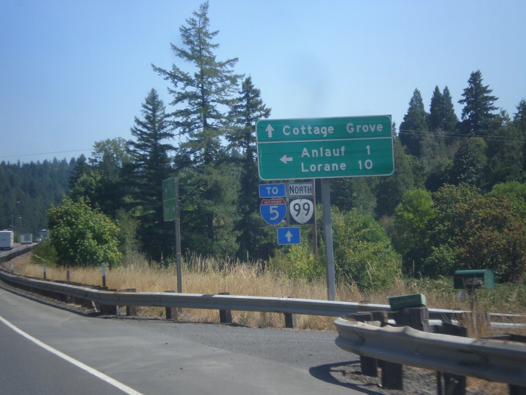
OR-38 East/OR-99 North at Curtin Road Jct.
OR-38 East/OR-99 North at Curtin Road Jct north to Anlauf and Lorane. Continue east on OR-38/OR-99 for Cottage Grove and I-5. The OR-38 shield is not displayed on this sign post, only OR-99.
Taken 08-22-2015
Drain
Douglas County
Oregon
United States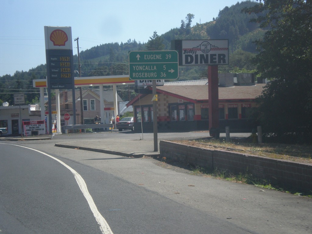
OR-38 East at OR-99
OR-38 east at OR-99 (not signed) in Drain. Turn right for OR-99 south to Yoncalla and Roseburg. Continue straight on OR-38 East/OR-99 North to Eugene. This stretch of OR-99 south of Drain was formerly the Drain-Yoncalla Highway #236.
Taken 08-22-2015
Drain
Douglas County
Oregon
United States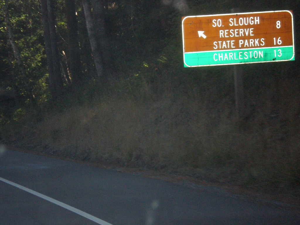
US-101 North - Beaver Hill Road
US-101 north at Beaver Hill Road to South Slough Reserve State Parks and Charleston.
Taken 08-22-2015
 Bandon
Coos County
Oregon
United States
Bandon
Coos County
Oregon
United States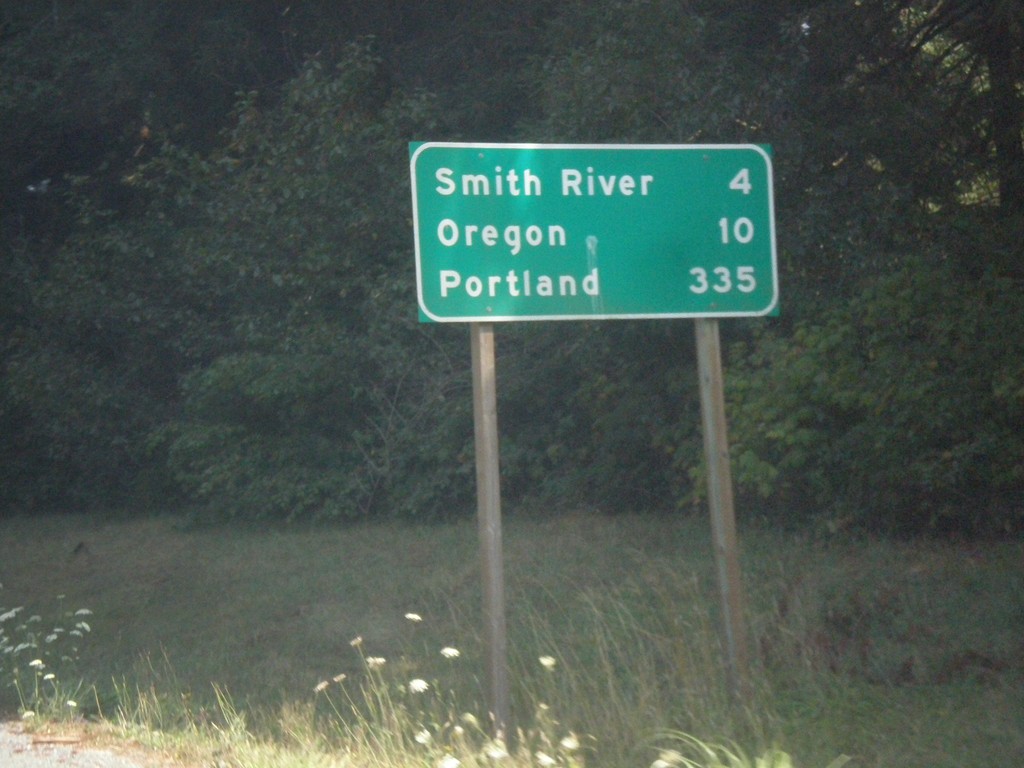
US-101 North - Distance Marker
Distance marker on US-101 north. Distance to Smith River, Oregon (state line), and Portland. Portland is not located along US-101.
Taken 08-20-2015
Smith River
Del Norte County
California
United States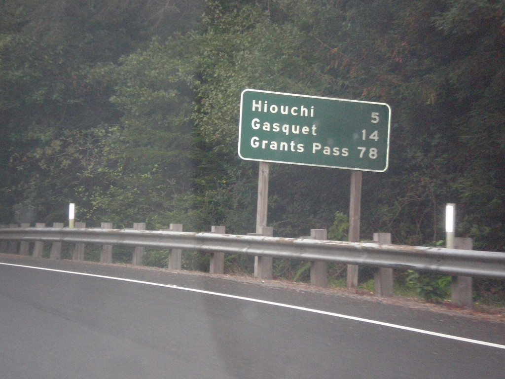
US-199 North - Distance Marker
Distance marker on US-199 north. Distance to Hiouchi, Gasquet, and Grants Pass (Oregon).
Taken 08-19-2015
 Crescent City
Del Norte County
California
United States
Crescent City
Del Norte County
California
United States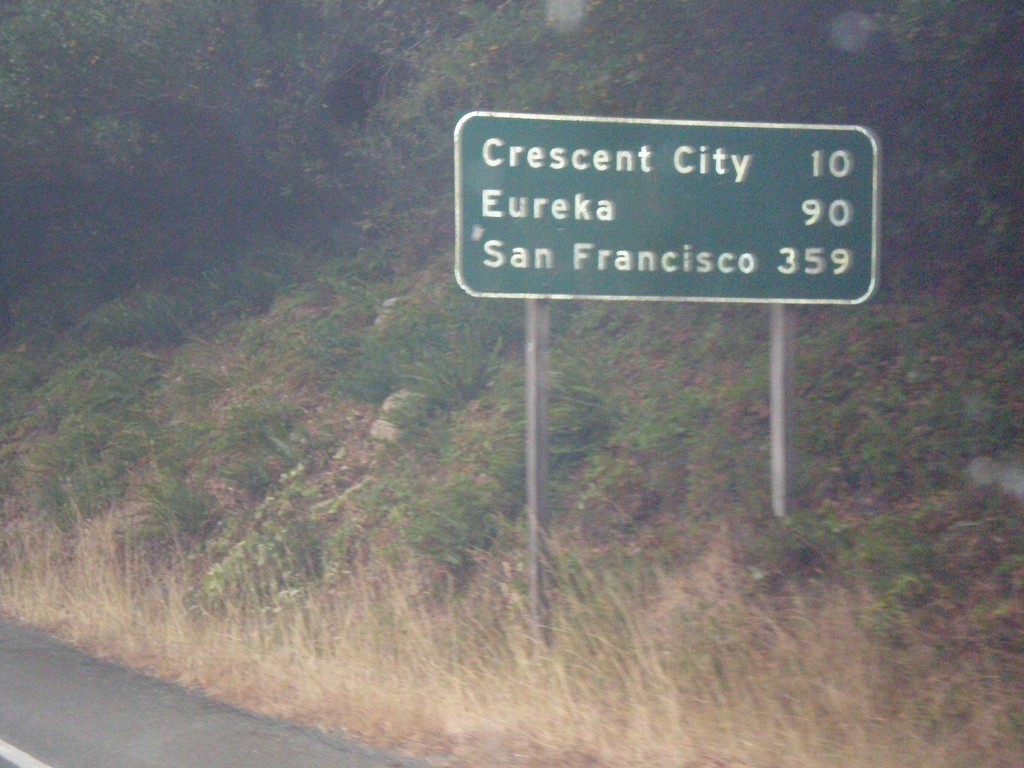
US-199 South - Distance Marker
Distance marker on US-199 south. Distance to Crescent City, Eureka, and San Francisco.
Taken 08-19-2015
Crescent City
Del Norte County
California
United States