Signs Tagged With Distance Marker
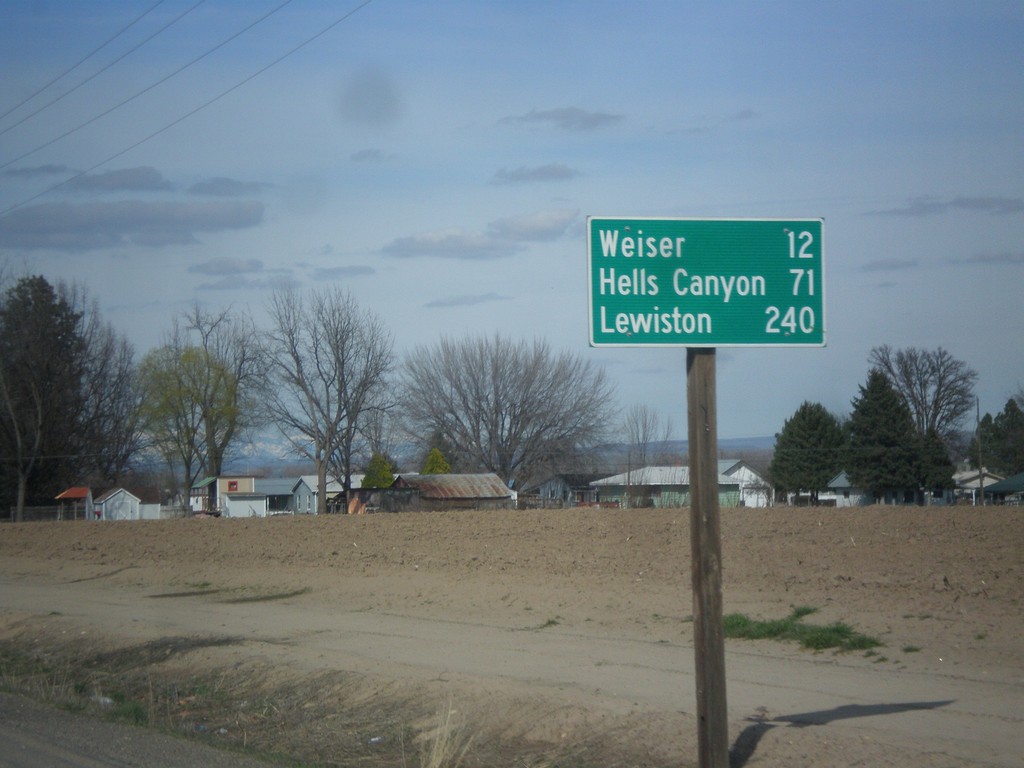
US-95 North - Distance Marker
Distance marker on US-95 north. Distance to Weiser, Hells Canyon (at Brownlee Reservoir via ID-71) and Lewiston.
Taken 03-18-2016
 Payette
 County
Idaho
United States
Payette
Payette County
Idaho
United States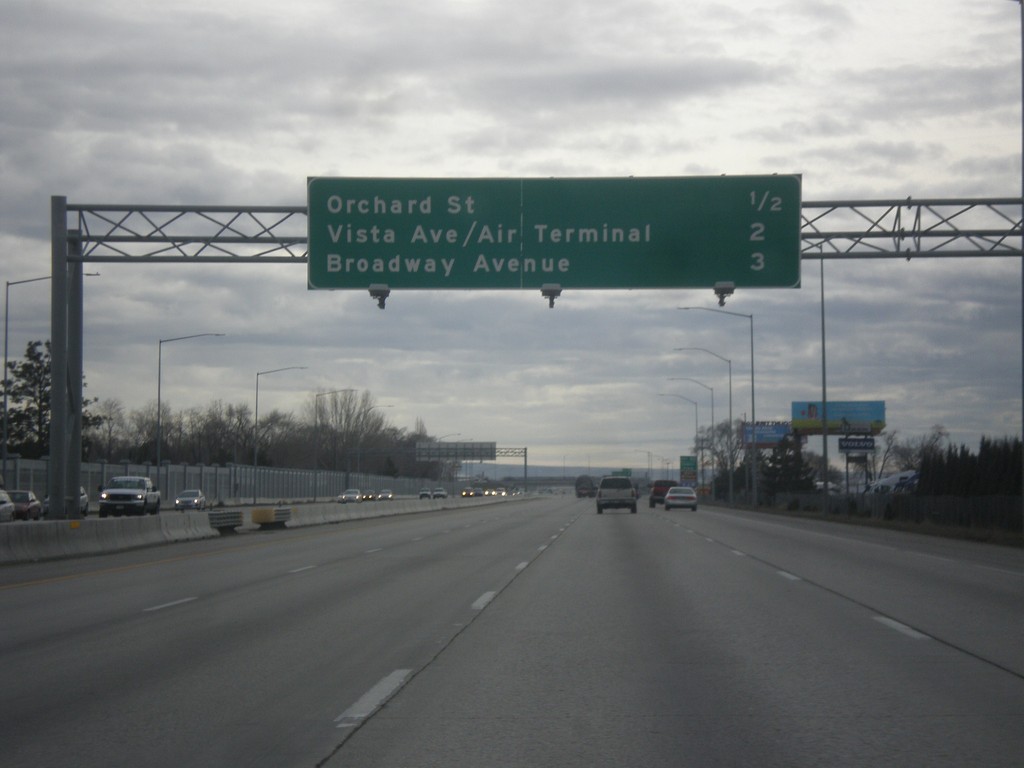
I-84 East - Boise Exits
Next 3 Boise exits on I-84 east - Orchard St., Vista Ave./Air Terminal, and Broadway Ave.
Taken 02-06-2016

 Boise
Ada County
Idaho
United States
Boise
Ada County
Idaho
United States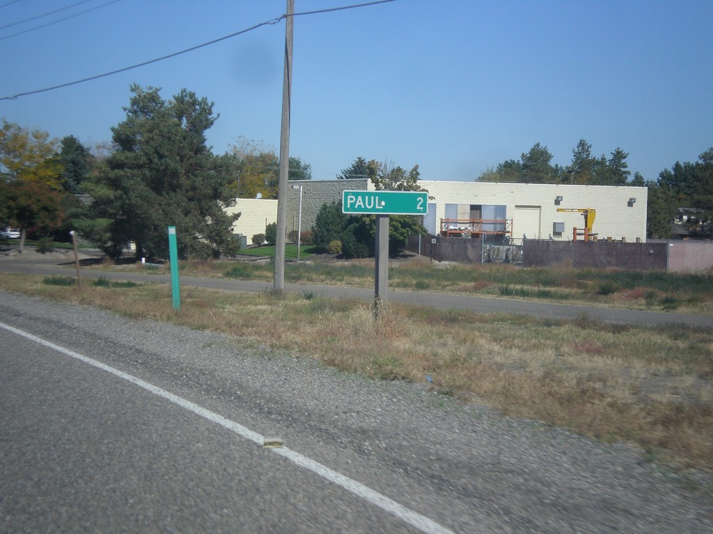
ID-27 North - Distance Marker
Distance marker on ID-27 north. Distance to Paul.
Taken 10-04-2015
Heyburn Minidoka County Idaho United States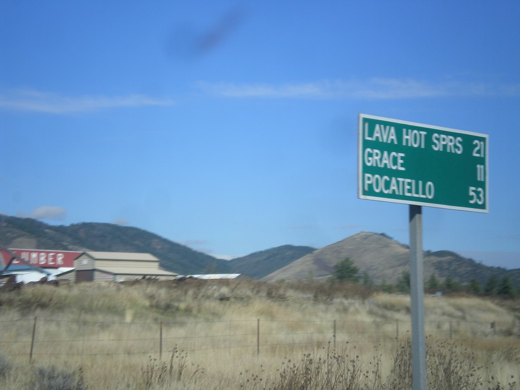
US-30 West/ID-34 South - Distance Marker
US-30 West/ID-34 South Distance Marker. Distance to Lava Hot Springs, Grace, Pocatello.
Taken 10-04-2015
 Soda Springs
Caribou County
Idaho
United States
Soda Springs
Caribou County
Idaho
United States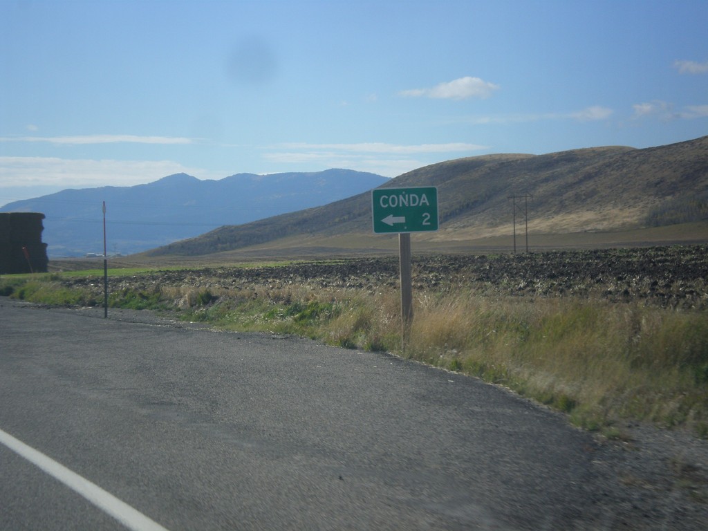
ID-34 South - Conda Jct.
ID-34 south at Conda Jct.
Taken 10-04-2015
Soda Springs
Caribou County
Idaho
United States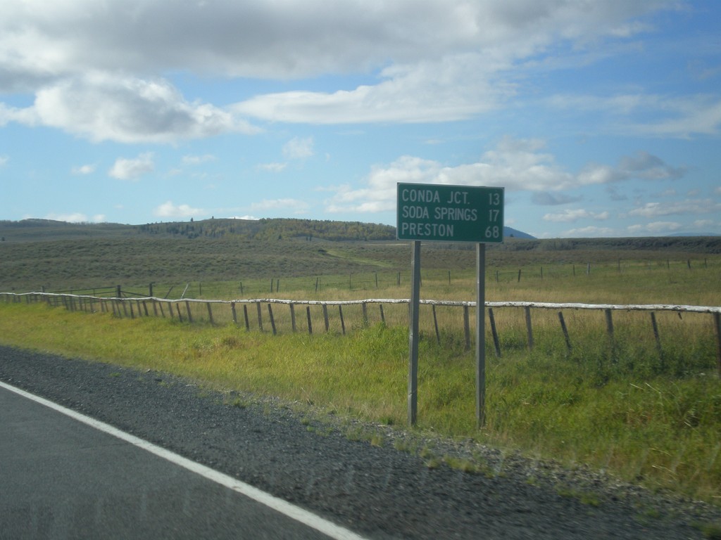
ID-34 South - Distance Marker
Distance marker on ID-34 south. Distance to Conda Jct., Soda Springs, and Preston.
Taken 10-04-2015
Soda Springs
Caribou County
Idaho
United States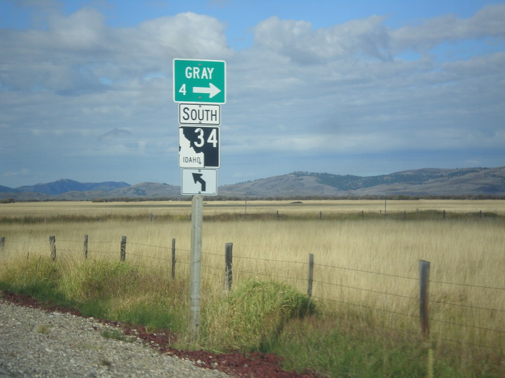
ID-34 South - Gray
ID-34 south at Grays Lake Road north to Gray.
Taken 10-04-2015
Wayan
Caribou County
Idaho
United States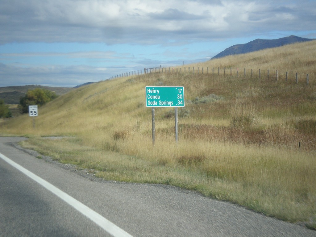
ID-34 South - Distance Marker
Distance marker on ID-34 south. Distance to Henry, Conda, and Soda Springs.
Taken 10-04-2015
Wayan
Caribou County
Idaho
United States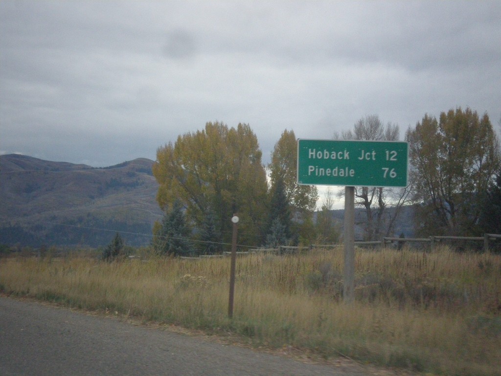
US-26 West - US-89/US-189/US-191 South - Distance Marker
Distance Marker on US-26 West - US-89/US-189/US-191 South. Distance to Hoback Jct. and Pinedale (via US-191 South).
Taken 10-04-2015


 Jackson
Teton County
Wyoming
United States
Jackson
Teton County
Wyoming
United States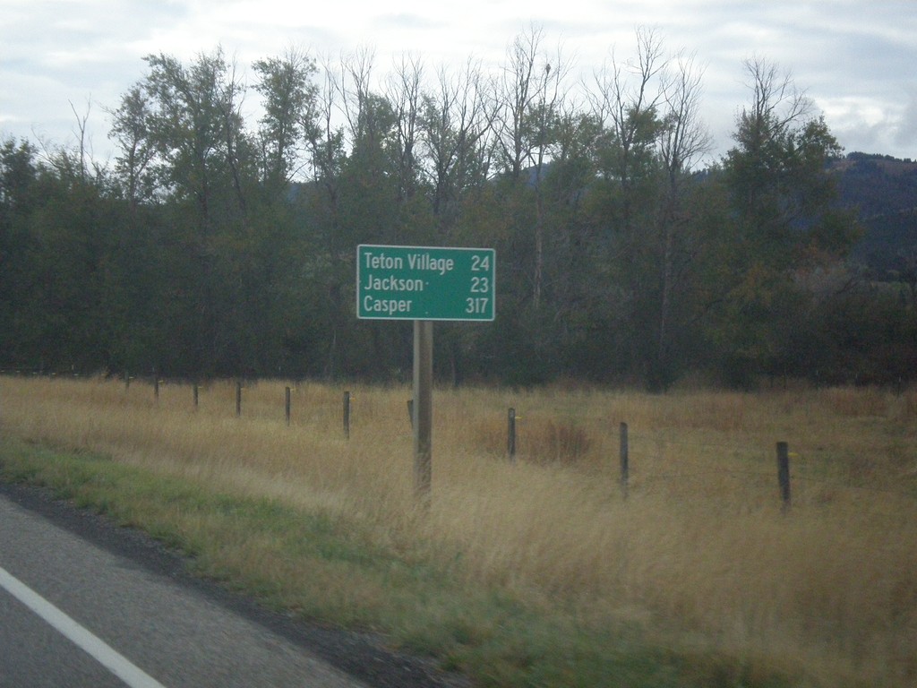
ID-33 East - Distance Marker
Last distance marker on ID-33 east in Idaho. Distance to Teton Village, Jackson, and Casper.
Taken 10-04-2015
 Victor
Teton County
Idaho
United States
Victor
Teton County
Idaho
United States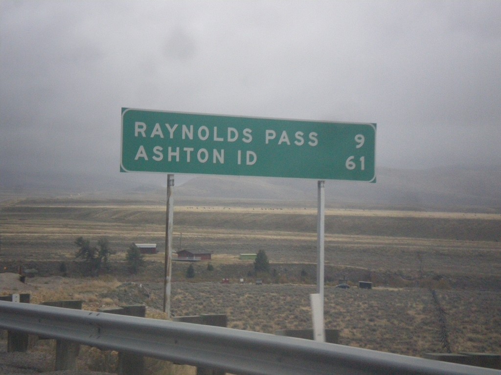
MT-87 South - Distance Marker
Distance marker on MT-87 south. Distance to Raynolds Pass (State Line - Continental Divide) and Ashton, ID.
Taken 10-03-2015
 Schusters Place
Madison County
Montana
United States
Schusters Place
Madison County
Montana
United States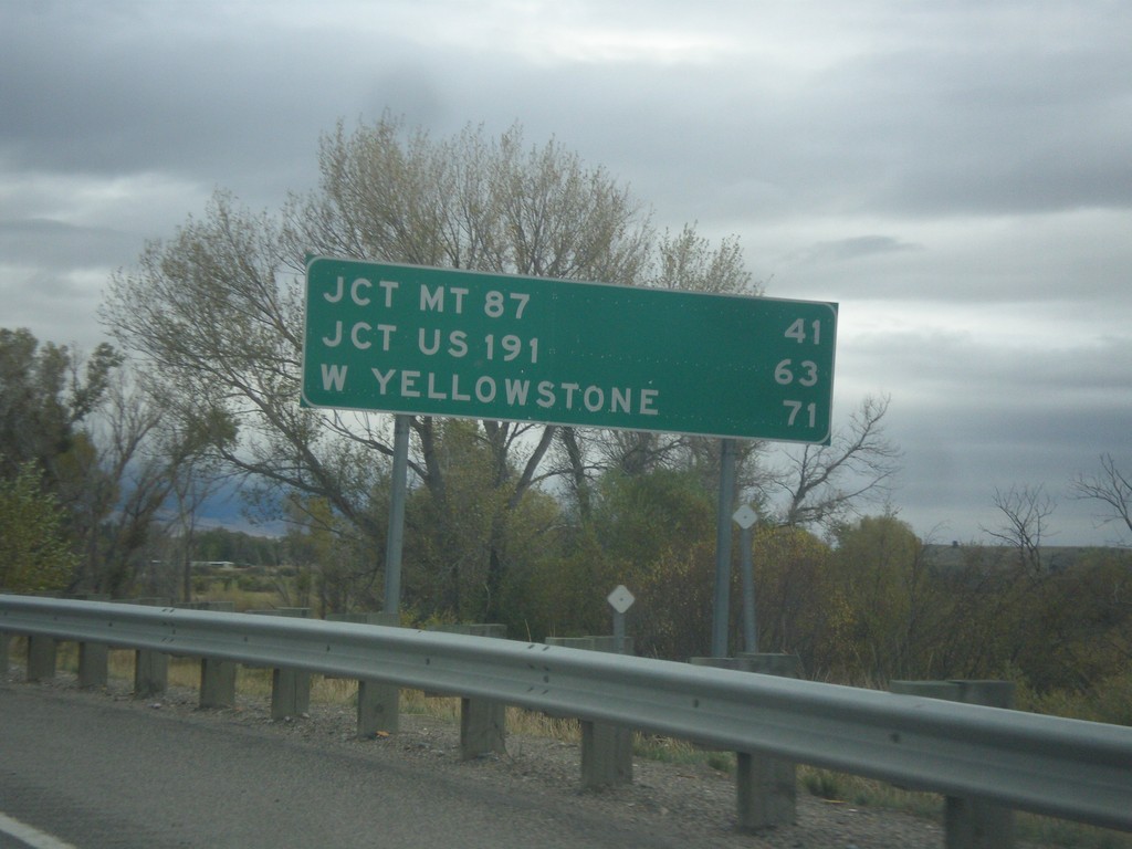
US-287 South - Distance Marker
Distance marker on US-287 south. Distance to Jct. MT-87, Jct. US-191, and West Yellowstone.
Taken 10-03-2015
 Ennis
Madison County
Montana
United States
Ennis
Madison County
Montana
United States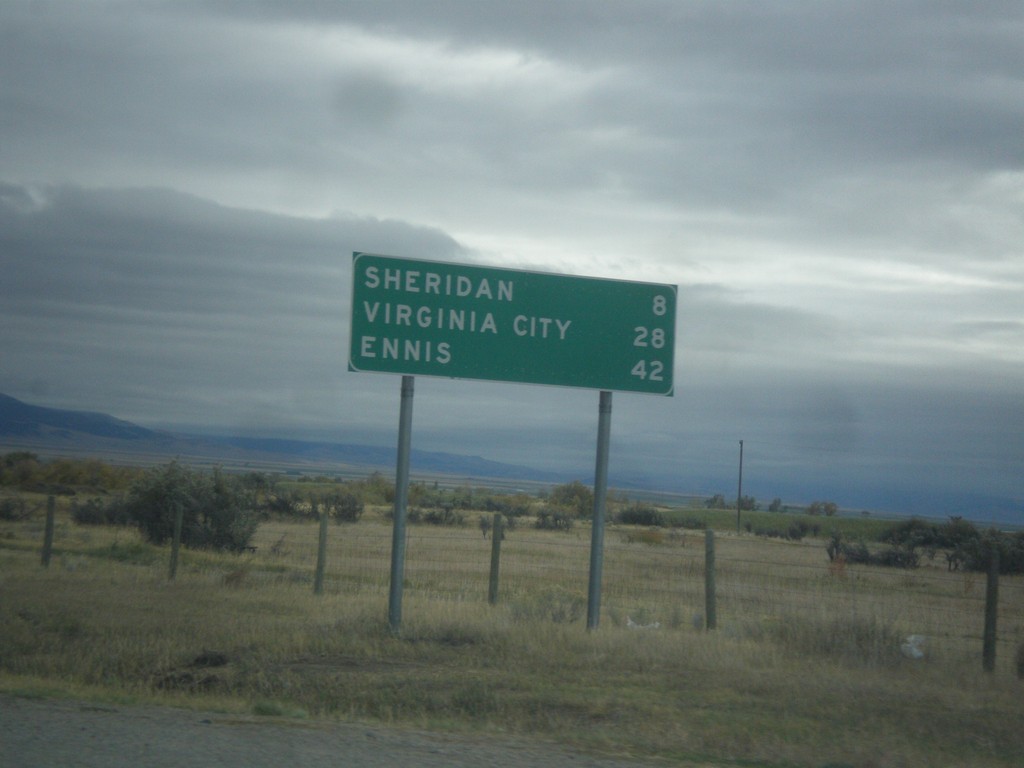
MT-287 South - Distance Marker
Distance marker on MT-287 south. Distance to Sheridan, Virginia City, and Ennis.
Taken 10-03-2015
 Twin Bridges
Madison County
Montana
United States
Twin Bridges
Madison County
Montana
United States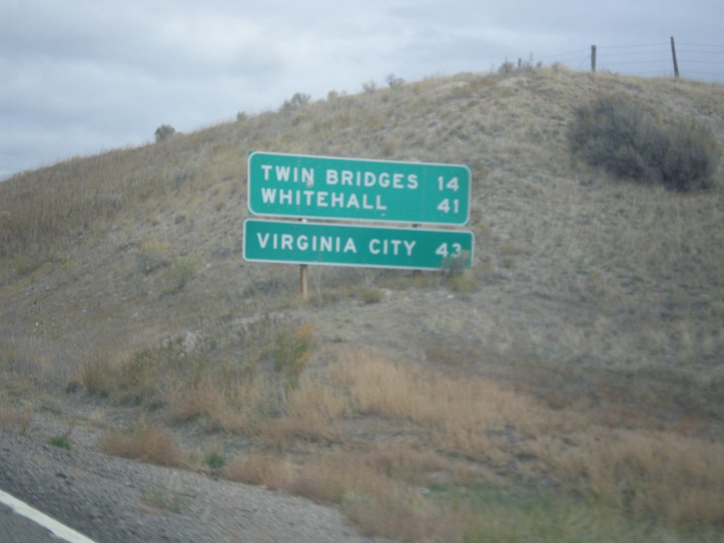
MT-41 North - Distance Marker
Distance marker on MT-41 north. Distance to Twin Bridges, Whitehall, and Virginia City (via MT-287).
Taken 10-03-2015
 Twin Bridges
Madison County
Montana
United States
Twin Bridges
Madison County
Montana
United States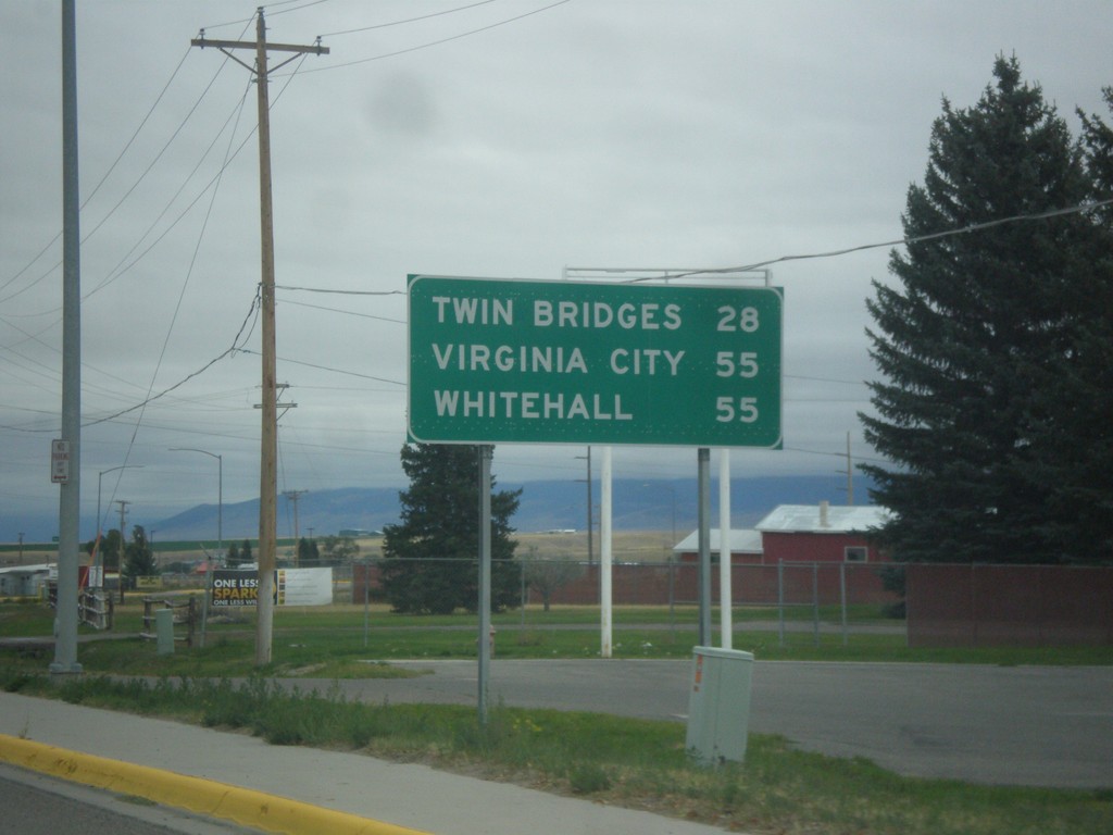
MT-41 North - Distance Marker
Distance marker on MT-41 north. Distance to Twin Bridges, Virginia City (via MT-287) and Whitehall.
Taken 10-03-2015
Dillon
Beaverhead County
Montana
United States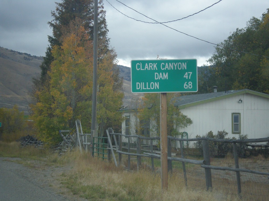
ID-29 East - Distance Marker
Distance marker on ID-29 east. Distance to Clark Canyon Dam (I-15 Jct. in Montana) and Dillon (Montana).
Taken 10-03-2015
 Leadore
Lemhi County
Idaho
United States
Leadore
Lemhi County
Idaho
United States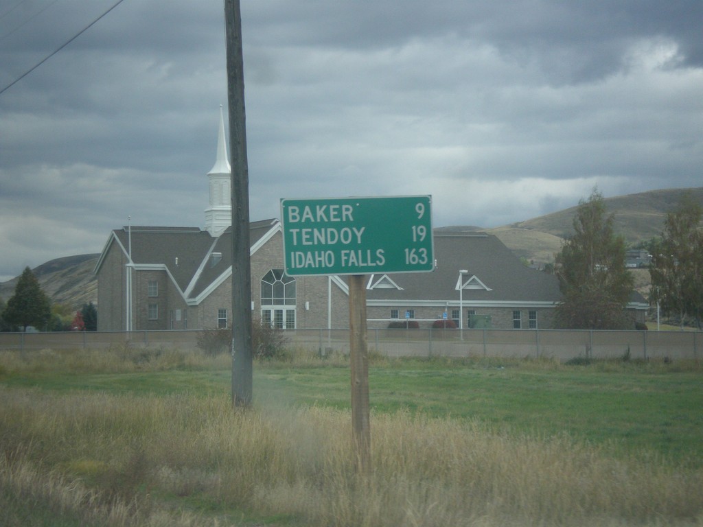
ID-28 South - Distance Marker
Distance marker on ID-28 south in Salmon. Distance to Baker, Tendoy, and Idaho Falls.
Taken 10-03-2015
 Salmon
Lemhi County
Idaho
United States
Salmon
Lemhi County
Idaho
United States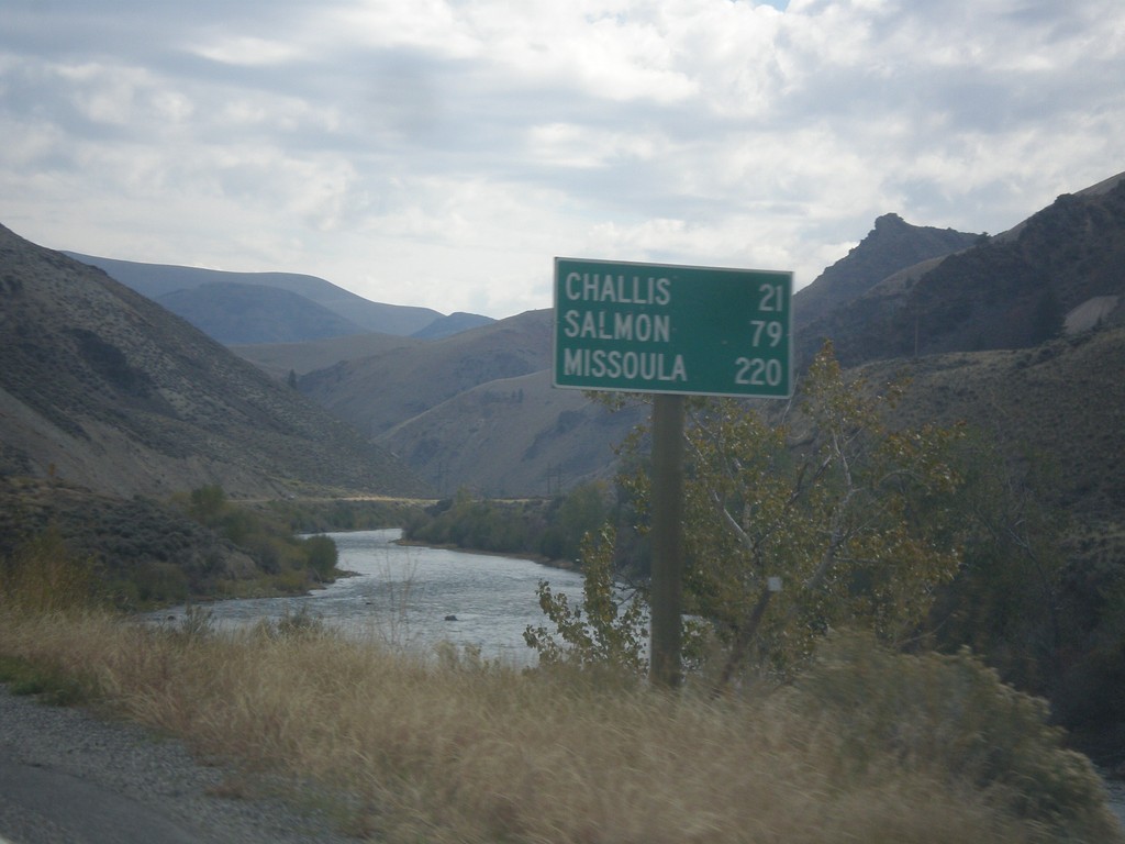
ID-75 North - Distance Marker
Distance marker on ID-75 north. Distance to Challis, Salmon, and Missoula (Montana). The Salmon River is in the background.
Taken 10-03-2015
 Clayton
Custer County
Idaho
United States
Clayton
Custer County
Idaho
United States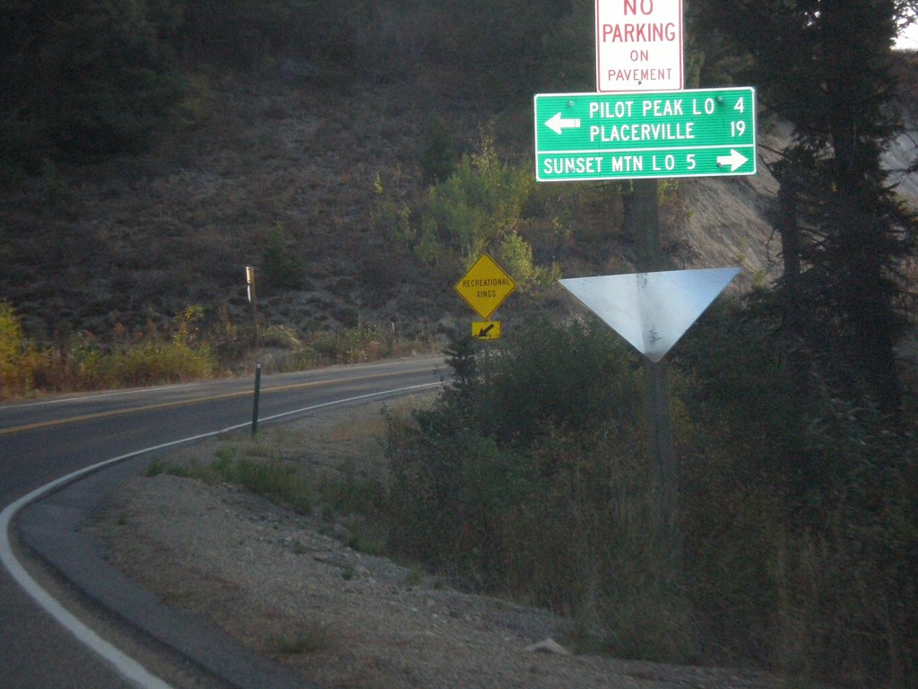
ID-21 East at Mores Creek Summit
ID-21 east at Mores Creek Summit. Turn left for Pilot Peak Lookout and Placerville; right for Sunset Mountain Lookout.
Taken 10-03-2015
 Idaho City
Boise County
Idaho
United States
Idaho City
Boise County
Idaho
United States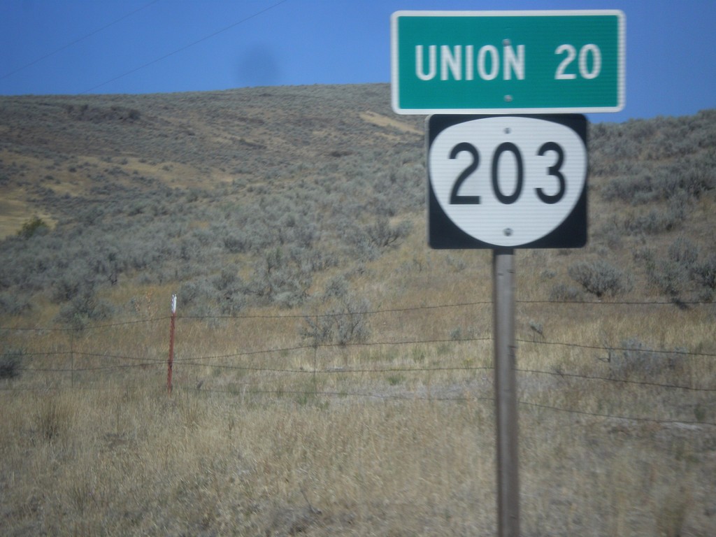
OR-203 North - Distance Marker
Distance marker on OR-203 north. Distance to Union.
Taken 09-13-2015
 Medical Springs
Union County
Oregon
United States
Medical Springs
Union County
Oregon
United States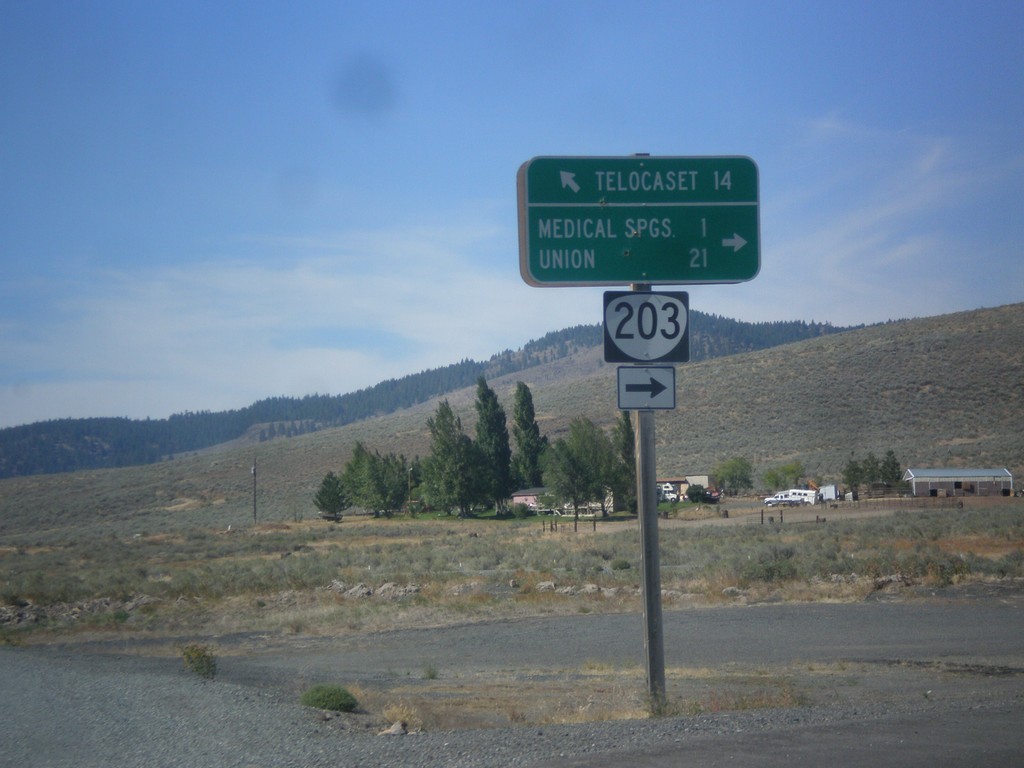
OR-203 North - Telocaset Lane
OR-203 North at Telocaset Lane to Telocaset. Turn right to continue north on OR-203 to Medical Springs and Union.
Taken 09-13-2015
Baker City
Union County
Oregon
United States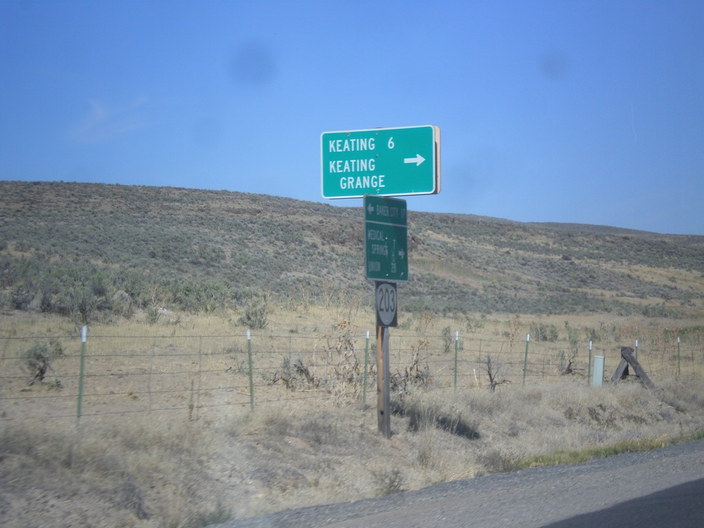
OR-203 North - Keating Jct.
OR-203 north at Miles Bridge Road to Keating and Keating Grange.
Taken 09-13-2015
Baker City
Baker County
Oregon
United States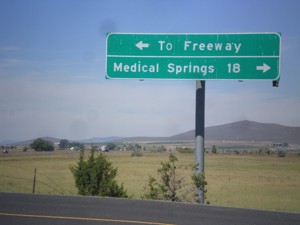
Airport Road North - OR-203 Jct.
Airport Road north at OR-203. Turn right for Medical Springs; left for (I-84) Freeway.
Taken 09-13-2015
Baker City
Baker County
Oregon
United States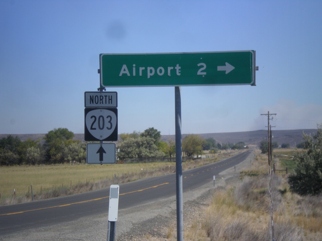
OR-203 North - Airport Road
OR-203 north at Airport Road jct.
Taken 09-13-2015
Baker City
Baker County
Oregon
United States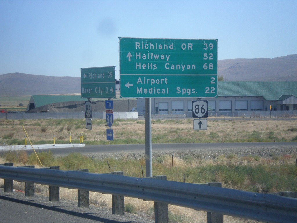
OR-86 East at West Airport Road (Medical Springs Highway)
OR-86 east West Airport Road (Medical Springs Highway) to the (Baker City) Airport and Medical Springs (via OR-203). Continue east on OR-86 for Richland, OR, Halfway and Hells Canyon. West Airport Road is a Frontage Road that extends south from the junction of OR-203 to OR-86. It is part of the Oregon State Highway system as the Medical Springs Highway but is not signed with a number.
Taken 09-13-2015
 Baker City
Baker County
Oregon
United States
Baker City
Baker County
Oregon
United States