Signs Tagged With Distance Marker
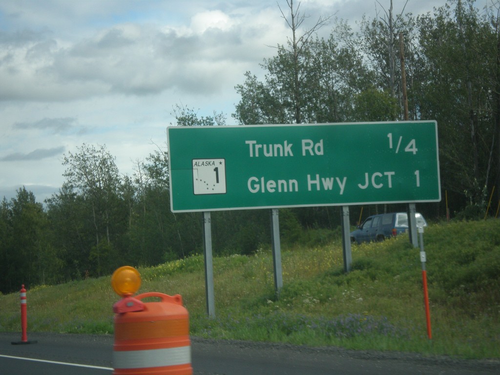
AK-3 South - Next Exits
Next exits on AK-3 south: Trunk Road and AK-1/Glenn Hwy. Jct.
Taken 07-23-2016

 Palmer
Matanuska-Susitna
Alaska
United States
Palmer
Matanuska-Susitna
Alaska
United States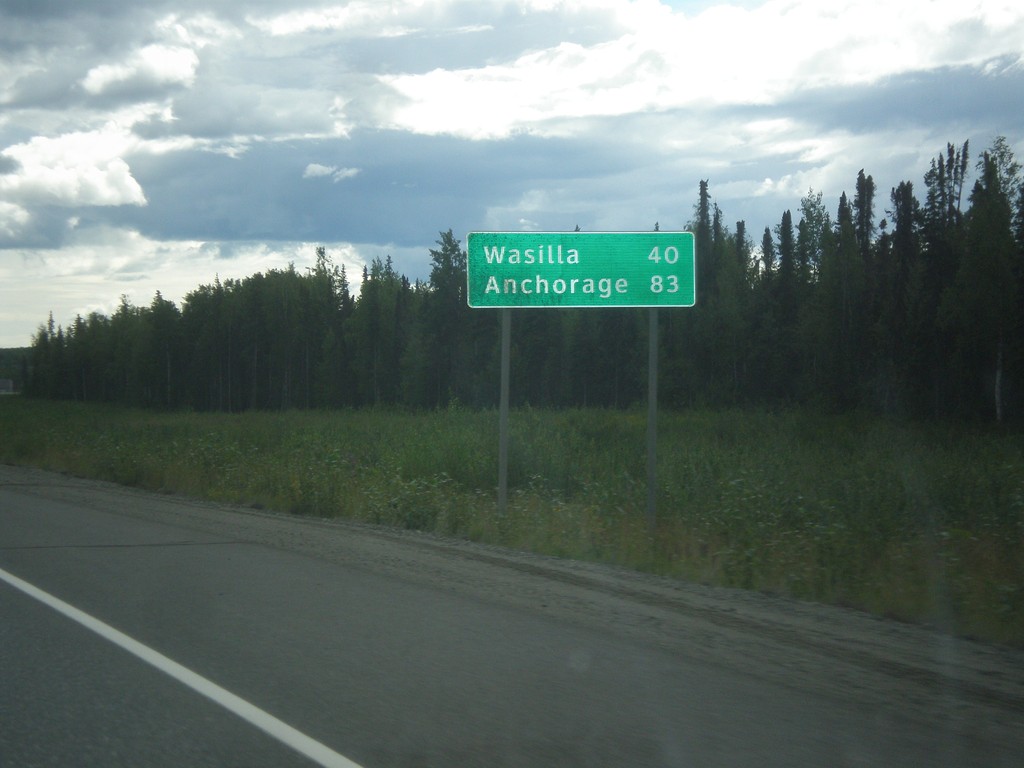
AK-3 South - Distance Marker
Distance marker on AK-3 south. Distance to Wasilla and Anchorage.
Taken 07-23-2016
Willow
Matanuska-Susitna
Alaska
United States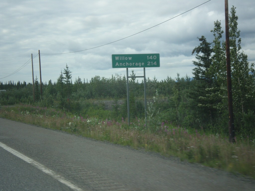
AK-3 South - Distance Marker
Distance marker on AK-3 (George Parks Highway) south. Distance to Willow and Anchorage.
Taken 07-23-2016
Cantwell
Denali Borough
Alaska
United States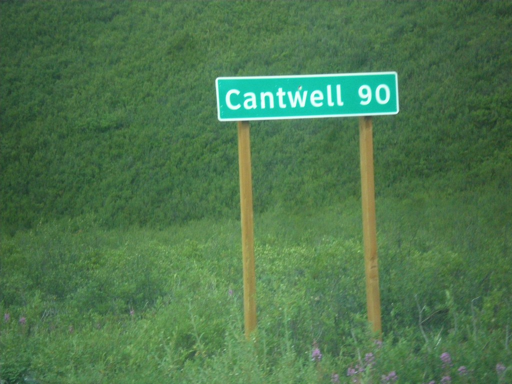
AK-8 West - Distance Marker
Distance marker on AK-8 west. Distance to Cantwell. Cantwell is where the Denali Highway ends at the Parks Highway.
Taken 07-23-2016
 Cantwell
Matanuska-Susitna
Alaska
United States
Cantwell
Matanuska-Susitna
Alaska
United States
AK-8 West - Distance Marker
Distance marker on AK-8 west. Distance to Tangle Lakes, Cantwell, and Denali National Park.
Taken 07-22-2016
Delta Junction
Copper River Census Area
Alaska
United States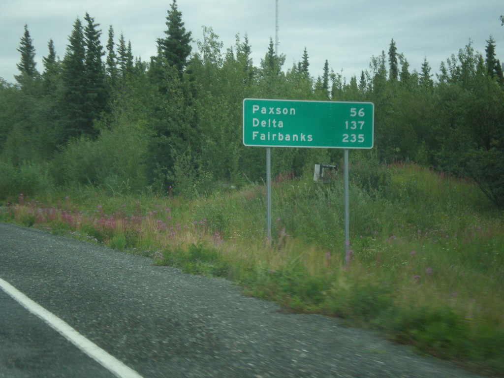
AK-4 North - Distance Marker
Distance marker on AK-4 North (Richardson Highway). Distance to Paxson, Delta, and Fairbanks.
Taken 07-22-2016
 Gakona
Copper River Census Area
Alaska
United States
Gakona
Copper River Census Area
Alaska
United States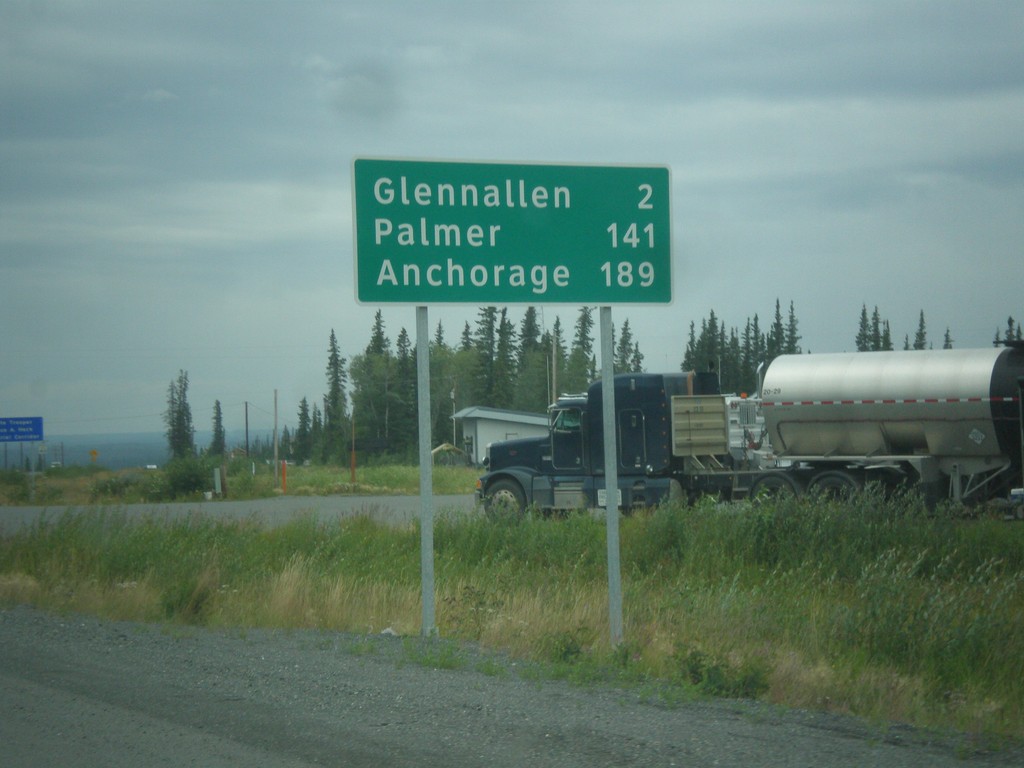
AK-1 South - Distance Marker
Distance marker on AK-1 south. Distance to Glenallen, Palmer, and Anchorage.
Taken 07-22-2016
Glennallen
Copper River Census Area
Alaska
United States
AK-4 North - Distance Marker
Distance marker on AK-4 north (Richardson Highway). Distance to Copper Center and Glenallen.
Taken 07-22-2016
Copper Center
Copper River Census Area
Alaska
United States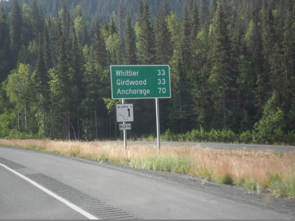
AK-1 North - Distance Marker
Distance marker and AK-1 shield along AK-1 (Seward Highway) north. Distance to Girdwood, Whittier (via Portage Glacier Highway), and Anchorage.
Taken 07-20-2016
Hope
Kenai Peninsula Borough
Alaska
United States
AK-1 North - Distance Marker
Distance marker on AK-1 north. Distance to Girdwood, Whittier (via Portage Glacier Hwy) and Anchorage.
Taken 07-20-2016
Moose Pass
Kenai Peninsula Borough
Alaska
United States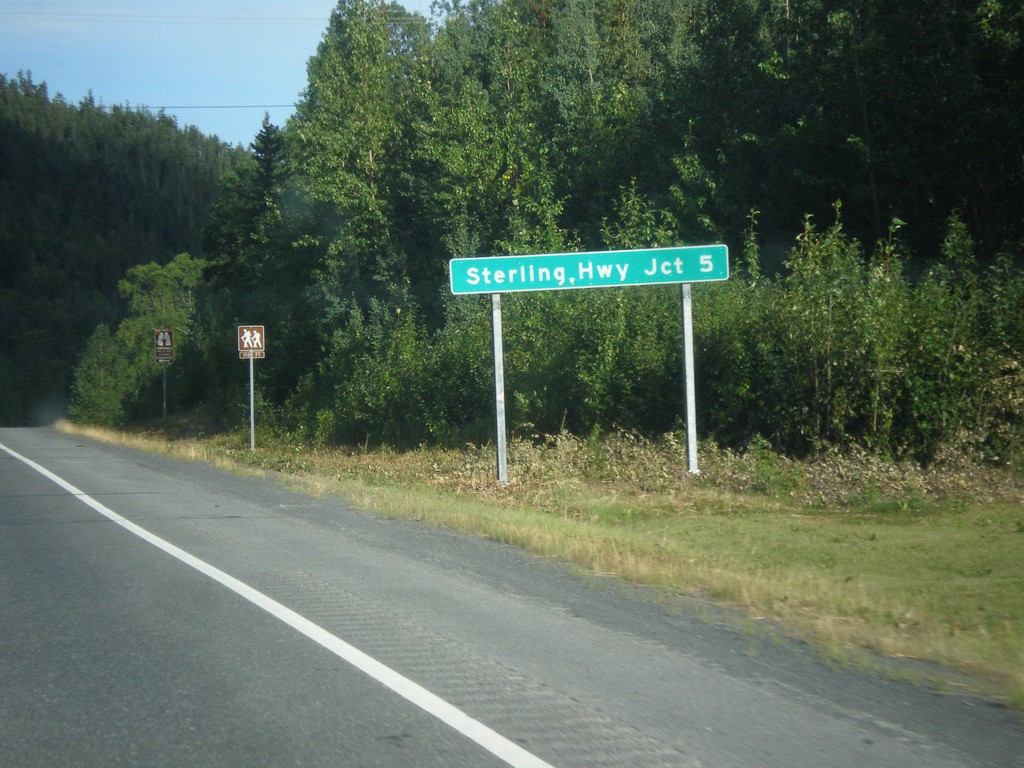
AK-9 North - Distance Marker
Distance marker on AK-9 (Seward Highway) north. Distance to Sterling Highway - 5 Miles.
Taken 07-20-2016
 Moose Pass
Kenai Peninsula Borough
Alaska
United States
Moose Pass
Kenai Peninsula Borough
Alaska
United States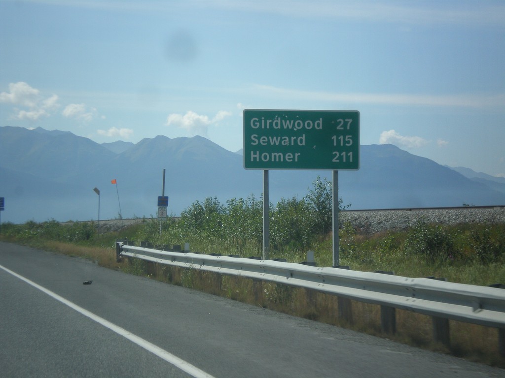
AK-1 South - Distance Marker
Distance marker on AK-1 south. Distance to Girdwood, Seward, and Homer (via Sterling Highway).
Taken 07-16-2016
Anchorage
Anchorage Municipality
Alaska
United States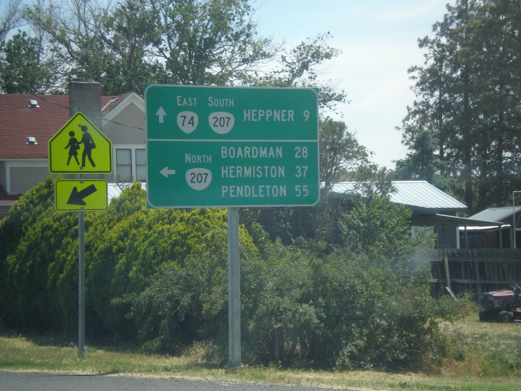
OR-74 East at OR-207
OR-74 East at OR-207. Turn left for OR-207 north to Boardman, Hermiston, and Pendleton. Continue straight for OR-74 East/OR-207 South to Heppner.
Taken 06-05-2016

 Lexington
Morrow County
Oregon
United States
Lexington
Morrow County
Oregon
United States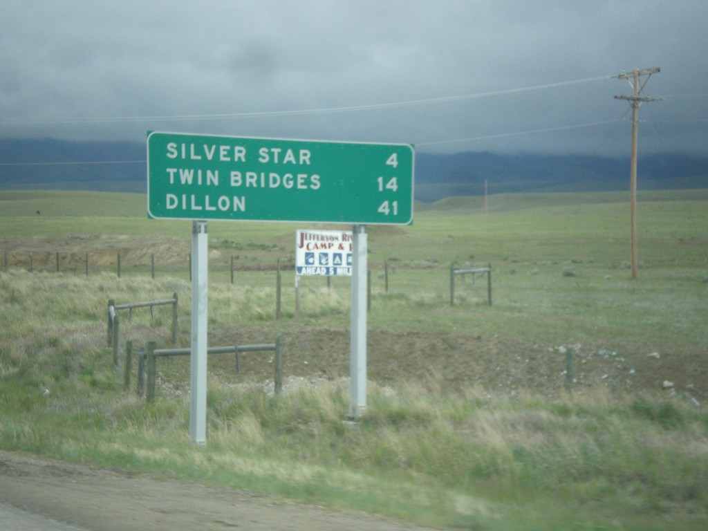
MT-41 South - Distance Marker
Distance marker on MT-41 south. Distance to Silver Star, Twin Bridges, and Dillon.
Taken 05-15-2016
 Silver Star
Madison County
Montana
United States
Silver Star
Madison County
Montana
United States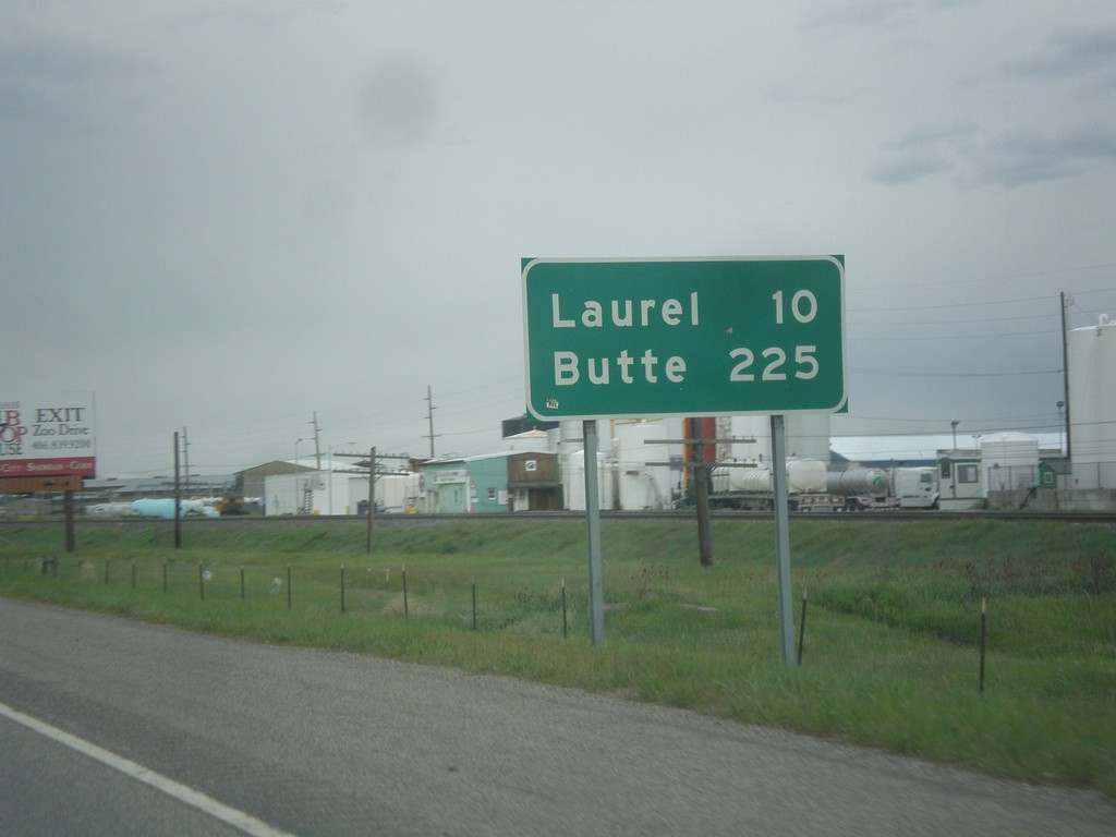
I-90 West - Distance Marker
Distance marker on I-90 west. Distance to Laurel and Butte.
Taken 05-15-2016

 Billings
Yellowstone County
Montana
United States
Billings
Yellowstone County
Montana
United States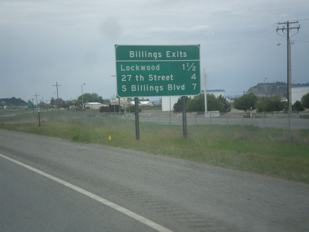
I-90 West - Billings Exits
Billings Exits on I-90 West: Lockwood, 27th St., S Billings Blvd.
Taken 05-15-2016
 Billings
Yellowstone County
Montana
United States
Billings
Yellowstone County
Montana
United States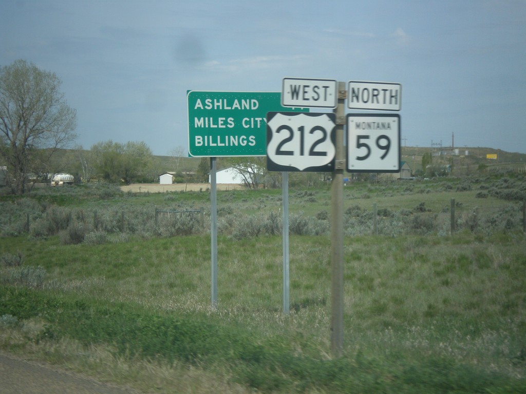
US-212 West/MT-59 North - Distance Marker
Distance Marker on US-212 West/MT-59 North. Distance to Ashland, Miles City (via MT-59), and Billings.
Taken 05-15-2016
 Broadus
Powder River County
Montana
United States
Broadus
Powder River County
Montana
United States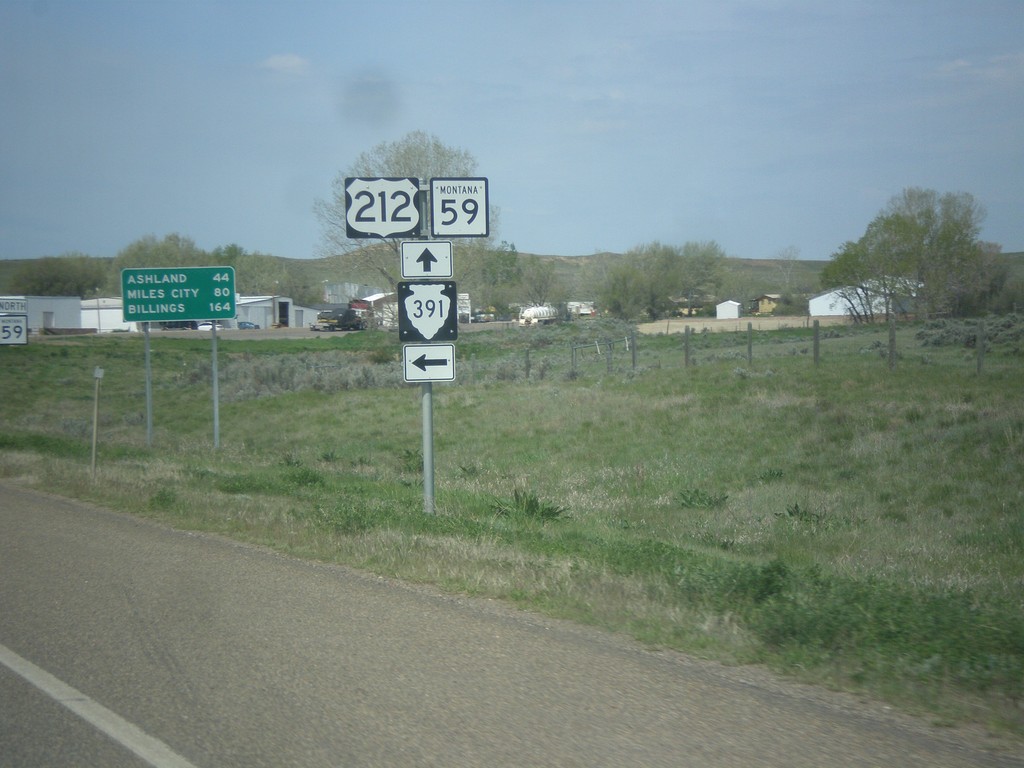
US-212 West/MT-59 North at MTS-391 South
US-212 West/MT-59 North at MTS-391 South in Broadus. Distance marker in background to Ashland, Miles City (via MT-59 North), and Billings.
Taken 05-15-2016
 Broadus
Powder River County
Montana
United States
Broadus
Powder River County
Montana
United States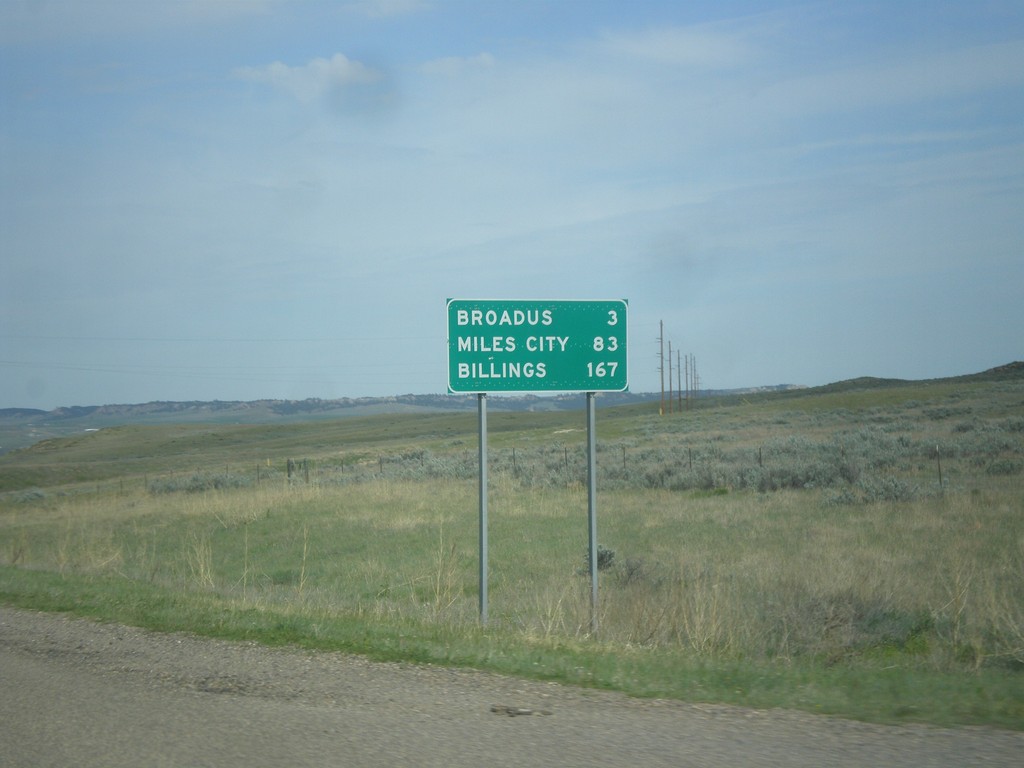
US-212 West/MT-59 North - Distance Marker
Distance marker on US-212 West/MT-59 North. Distance to Broadus, Miles City (via MT-59 north), and Billings (via US-212 west).
Taken 05-15-2016
Broadus
Powder River County
Montana
United States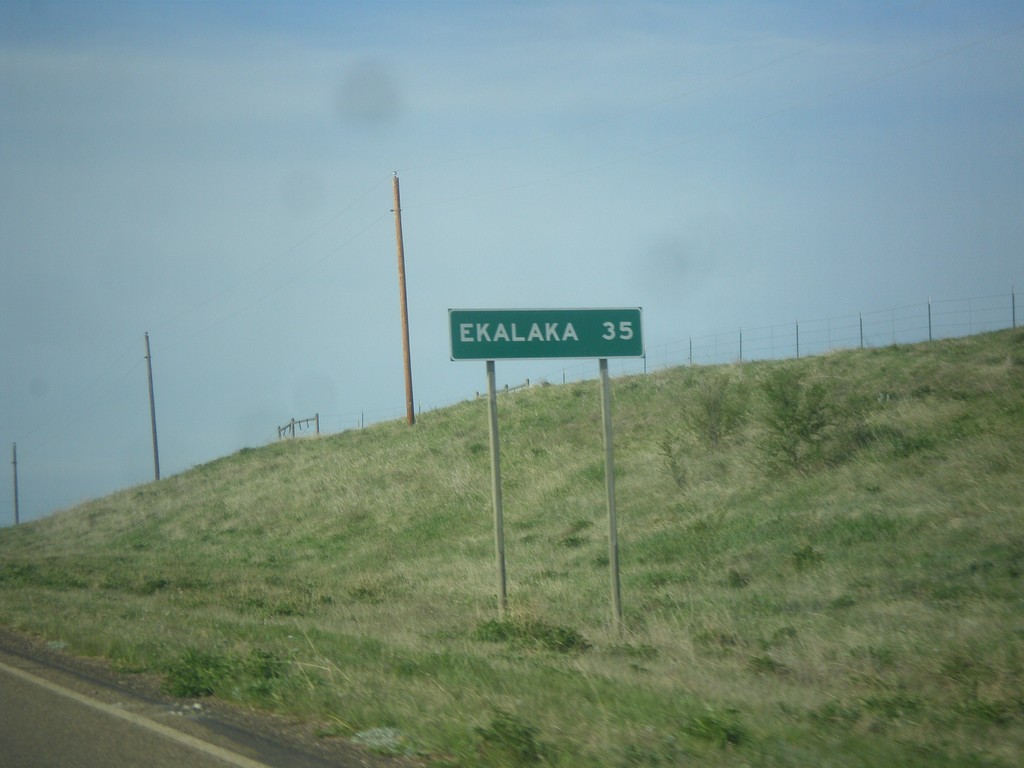
MT-7 South - Distance Marker
Distance marker on MT-7 south. Distance to Ekalaka.
Taken 05-15-2016
 Baker
Fallon County
Montana
United States
Baker
Fallon County
Montana
United States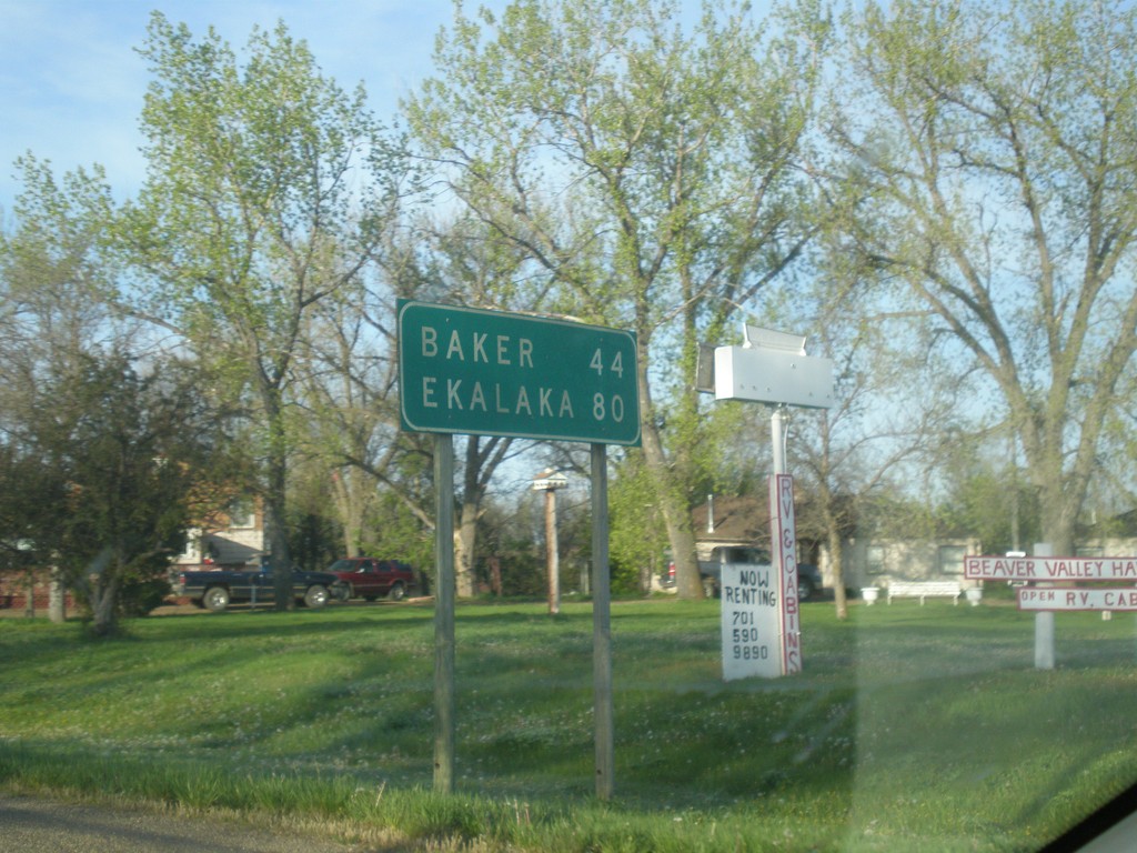
MT-7 South - Distance Marker
Distance marker on MT-7 south. Distance to Baker and Ekalaka.
Taken 05-15-2016
Wibaux
Wibaux County
Montana
United States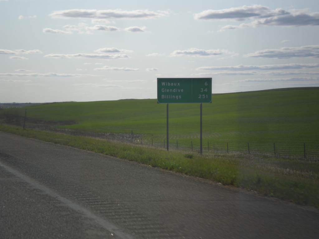
I-94 West - Distance Marker
Distance marker on I-94 west. Distance to Wibaux, Glendive, and Billings.
Taken 05-14-2016
 Wibaux
 County
Montana
United States
Wibaux
Wibaux County
Montana
United States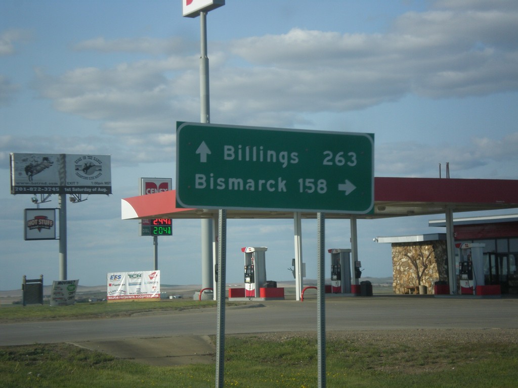
ND-16 North at I-94
ND-16 North at I-94 near Beach. Use I-94 east for Bismarck; I-94 west for Billings (Montana).
Taken 05-14-2016
 Beach
Golden Valley County
North Dakota
United States
Beach
Golden Valley County
North Dakota
United States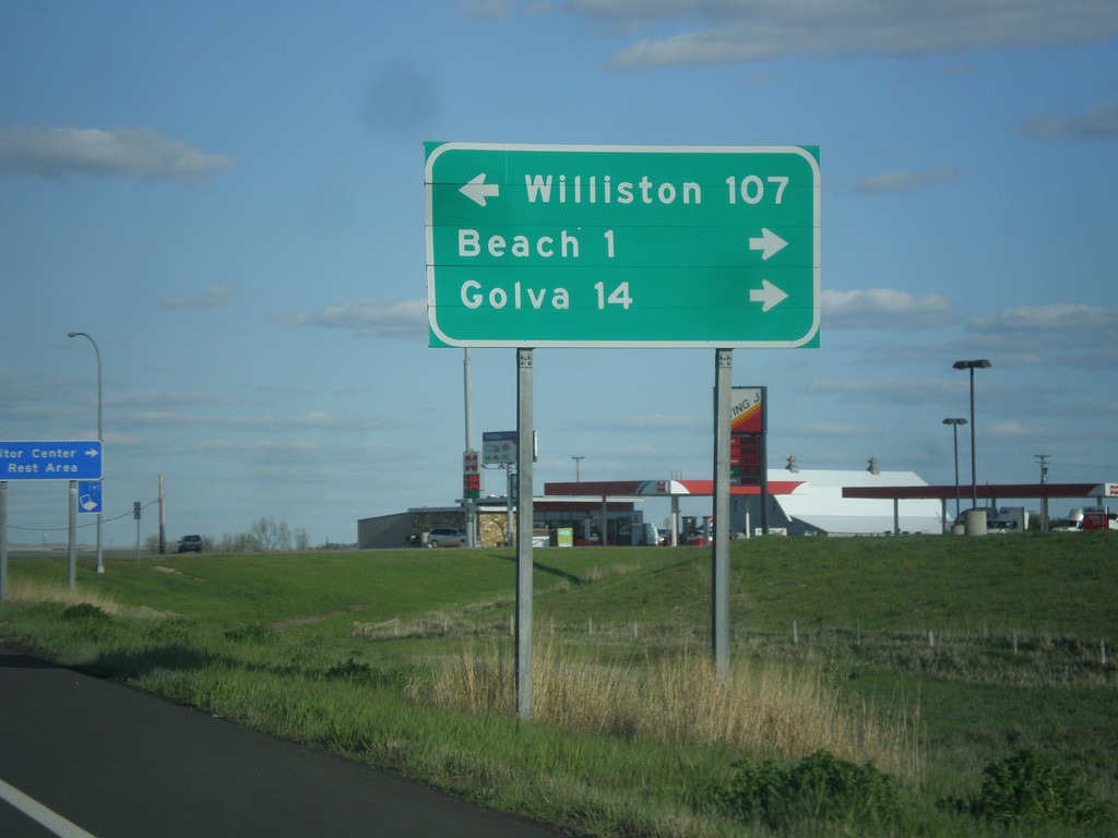
I-94 East - Exit 1 Offramp
I-94 East on Exit 1 Offramp. Turn left for ND-16 north to Williston; turn right for ND-16 south to Beach and Golva.
Taken 05-14-2016
Beach
Golden Valley County
North Dakota
United States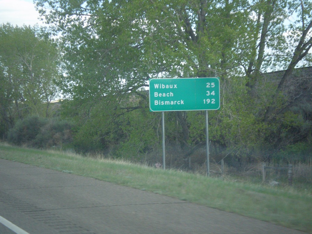
I-94 East - Distance Marker
Distance marker on I-94 east. Distance to Wibaux, Beach (ND), and Bismarck (ND).
Taken 05-14-2016
Glendive
Dawson County
Montana
United States