Signs Tagged With Distance Marker
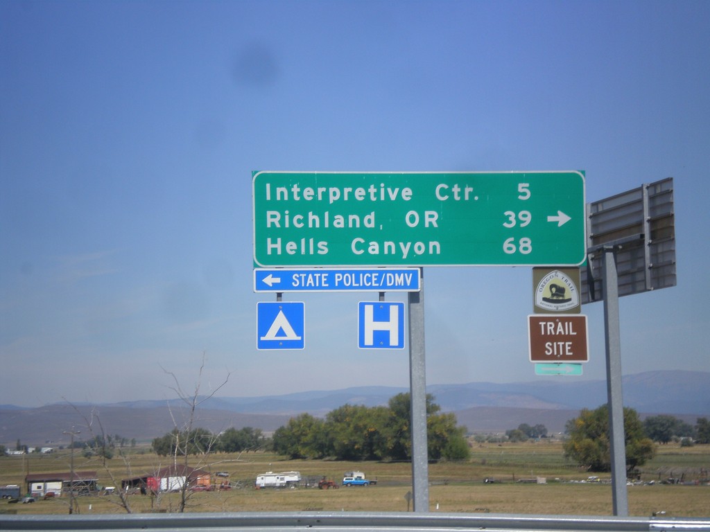
I-84 East (Exit 302) Off Ramp at OR-86
I-84 East (Exit 302) off ramp at OR-86. Turn right for OR-86 west to (Oregon Trail) Interpretive Center, Richland, OR, and Hells Canyon. Turn left for Baker City access.
Taken 09-13-2015

 Baker City
Baker County
Oregon
United States
Baker City
Baker County
Oregon
United States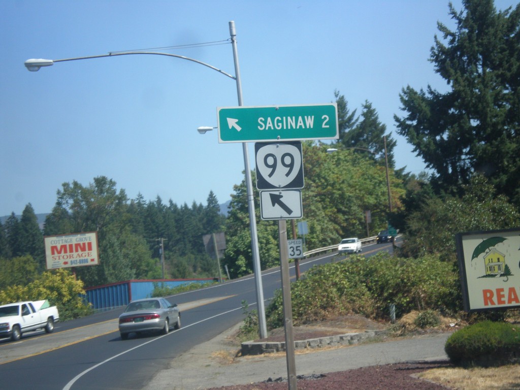
OR-99 North at Row River Road
OR-99 North at Row River Road in Cottage Grove. Merge left to continue north to OR-99 to Saginaw.
Taken 08-22-2015
 Cottage Grove
Lane County
Oregon
United States
Cottage Grove
Lane County
Oregon
United States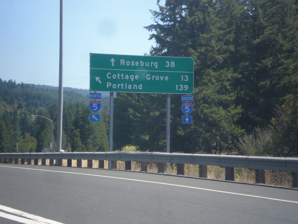
OR-38 East/OR-99 North at I-5
OR-38 East/OR-99 North at I-5. Use I-5 South to Roseburg; I-5 north to Cottage Grove and Portland. This is the eastern end of OR-38. This segment of OR-99 ends here, and re-appears in Cottage Grove.
Taken 08-22-2015

 Drain
Douglas County
Oregon
United States
Drain
Douglas County
Oregon
United States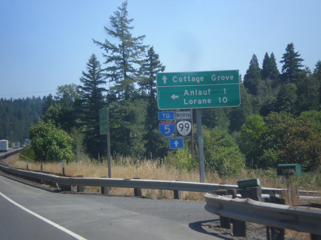
OR-38 East/OR-99 North at Curtin Road Jct.
OR-38 East/OR-99 North at Curtin Road Jct north to Anlauf and Lorane. Continue east on OR-38/OR-99 for Cottage Grove and I-5. The OR-38 shield is not displayed on this sign post, only OR-99.
Taken 08-22-2015
Drain
Douglas County
Oregon
United States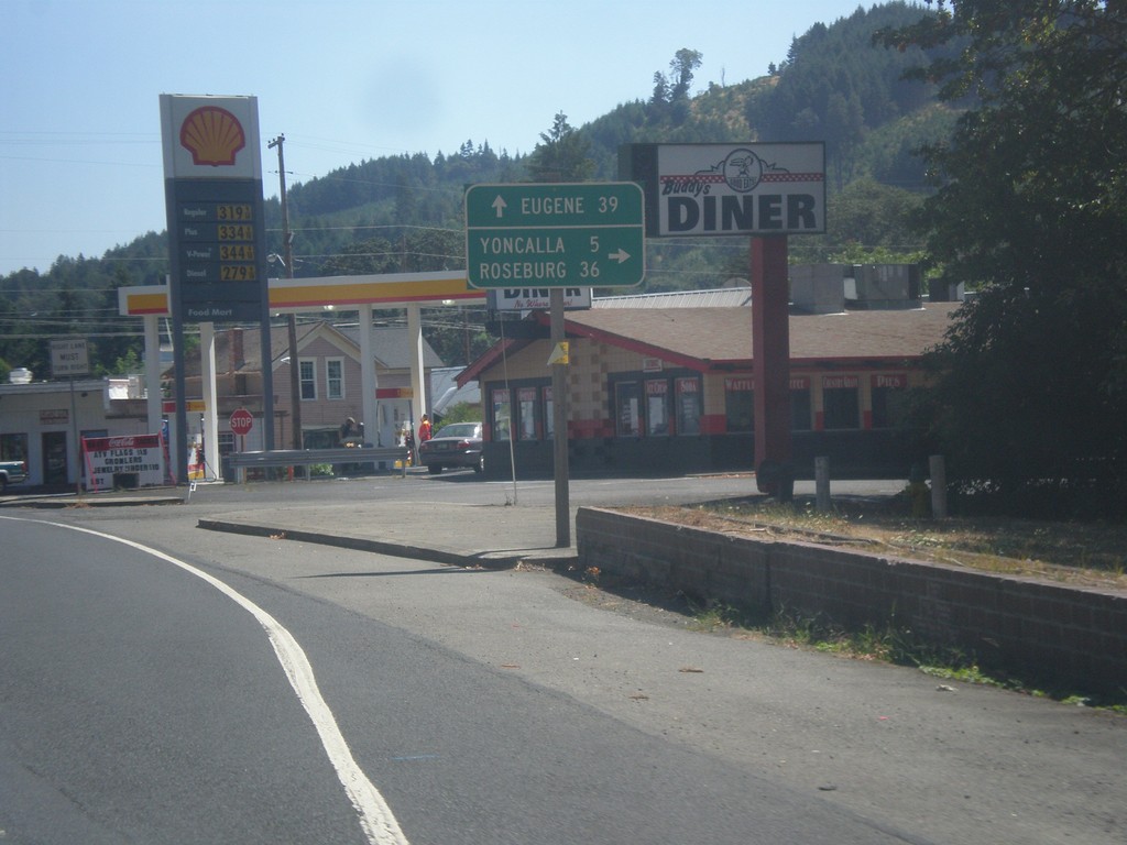
OR-38 East at OR-99
OR-38 east at OR-99 (not signed) in Drain. Turn right for OR-99 south to Yoncalla and Roseburg. Continue straight on OR-38 East/OR-99 North to Eugene. This stretch of OR-99 south of Drain was formerly the Drain-Yoncalla Highway #236.
Taken 08-22-2015
Drain
Douglas County
Oregon
United States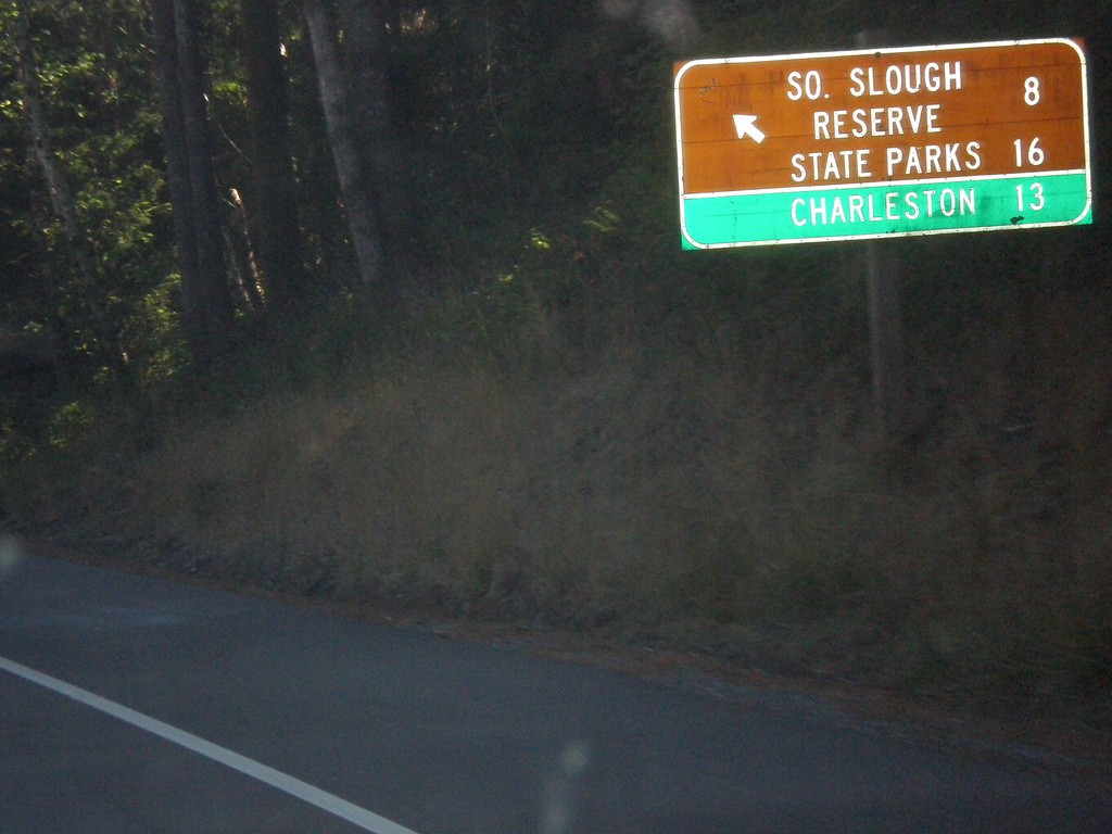
US-101 North - Beaver Hill Road
US-101 north at Beaver Hill Road to South Slough Reserve State Parks and Charleston.
Taken 08-22-2015
 Bandon
Coos County
Oregon
United States
Bandon
Coos County
Oregon
United States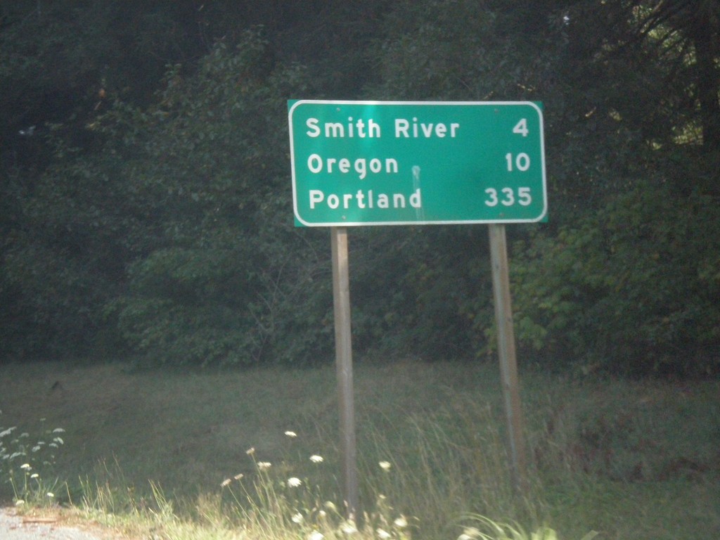
US-101 North - Distance Marker
Distance marker on US-101 north. Distance to Smith River, Oregon (state line), and Portland. Portland is not located along US-101.
Taken 08-20-2015
Smith River
Del Norte County
California
United States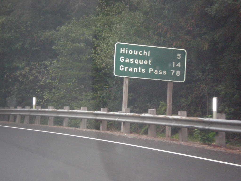
US-199 North - Distance Marker
Distance marker on US-199 north. Distance to Hiouchi, Gasquet, and Grants Pass (Oregon).
Taken 08-19-2015
 Crescent City
Del Norte County
California
United States
Crescent City
Del Norte County
California
United States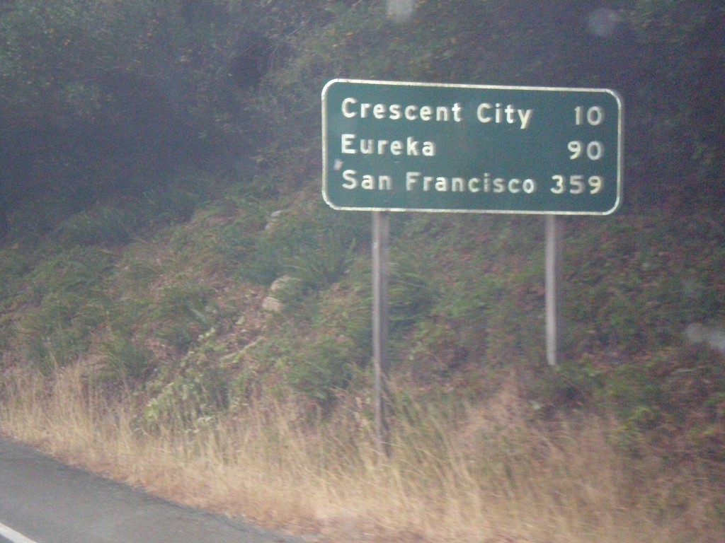
US-199 South - Distance Marker
Distance marker on US-199 south. Distance to Crescent City, Eureka, and San Francisco.
Taken 08-19-2015
Crescent City
Del Norte County
California
United States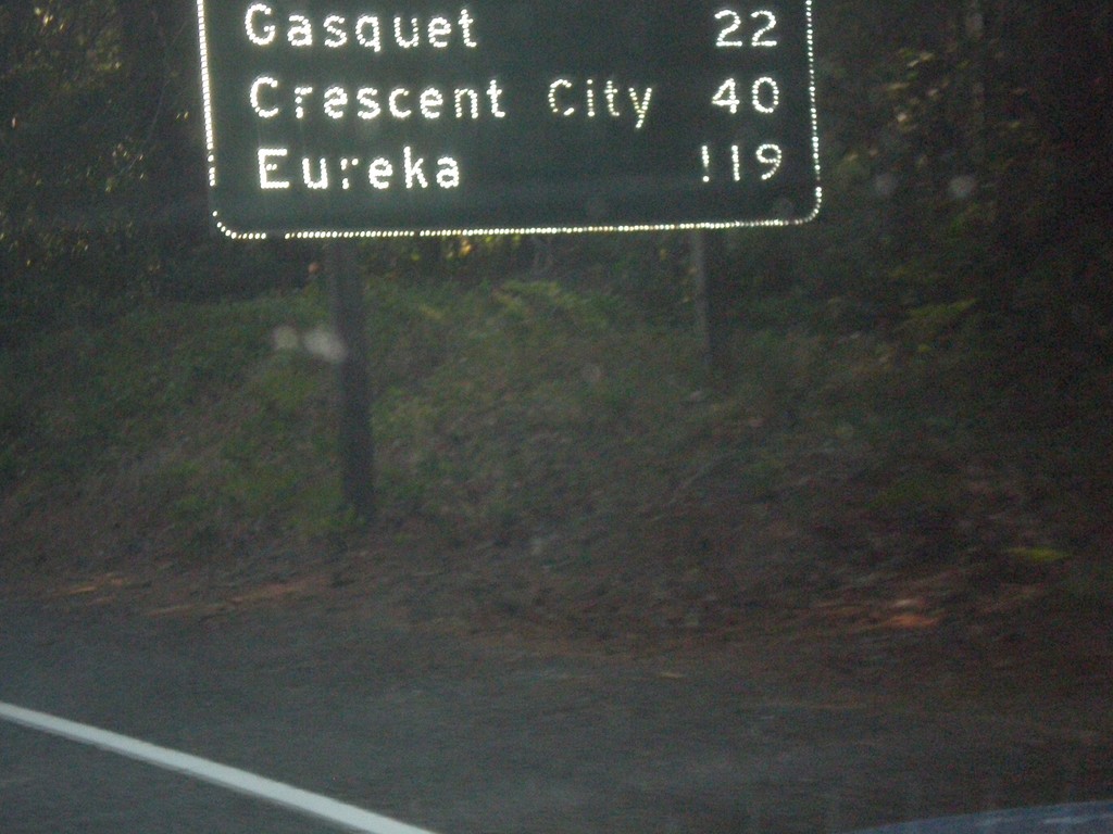
US-199 South - Distance Marker
First distance marker in California along US-199 south. Distance to Gasquet, Crescent City, and Eureka.
Taken 08-17-2015
Gasquet
Del Norte County
California
United States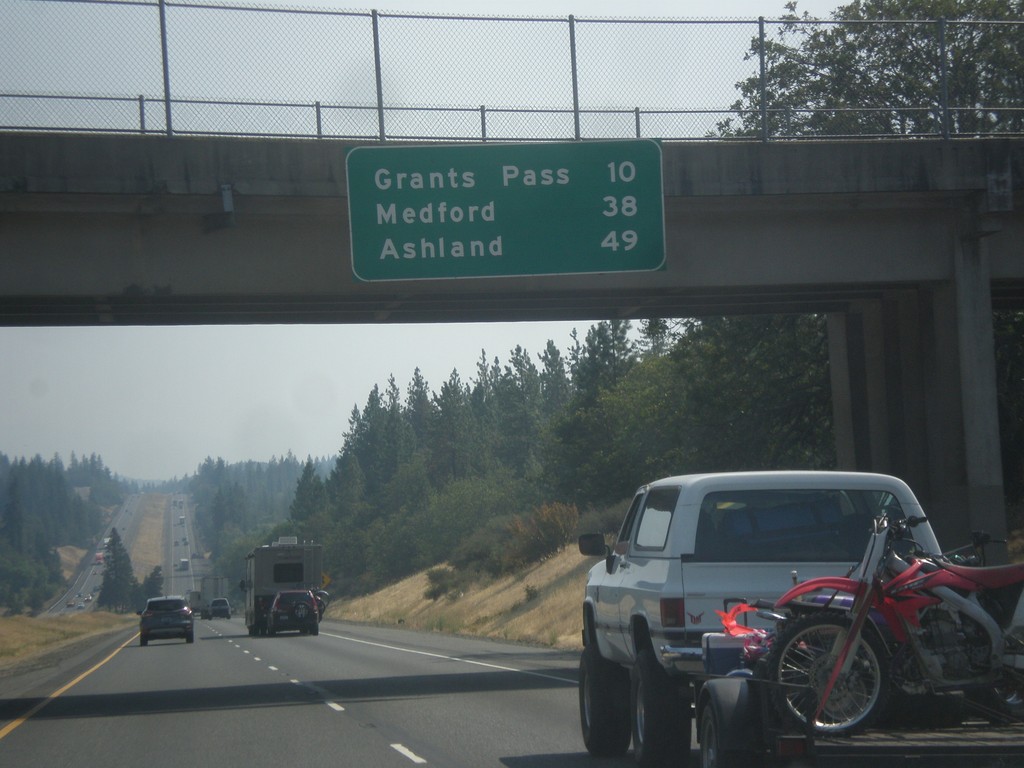
I-5 South - Distance Marker
Distance marker on I-5 south. Distance to Grants Pass, Medford, and Ashland.
Taken 08-17-2015
Grants Pass
Josephine County
Oregon
United States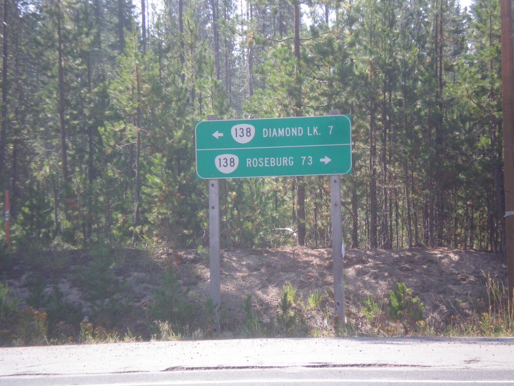
Birds Point Road at OR-138
Birds Point Road at OR-138. Birds Point Road connects the Lemolo Lake area with OR-138. Use OR-138 west to Roseburg; east to Diamond Lake.
Taken 08-17-2015
 Diamond Lake
Douglas County
Oregon
United States
Diamond Lake
Douglas County
Oregon
United States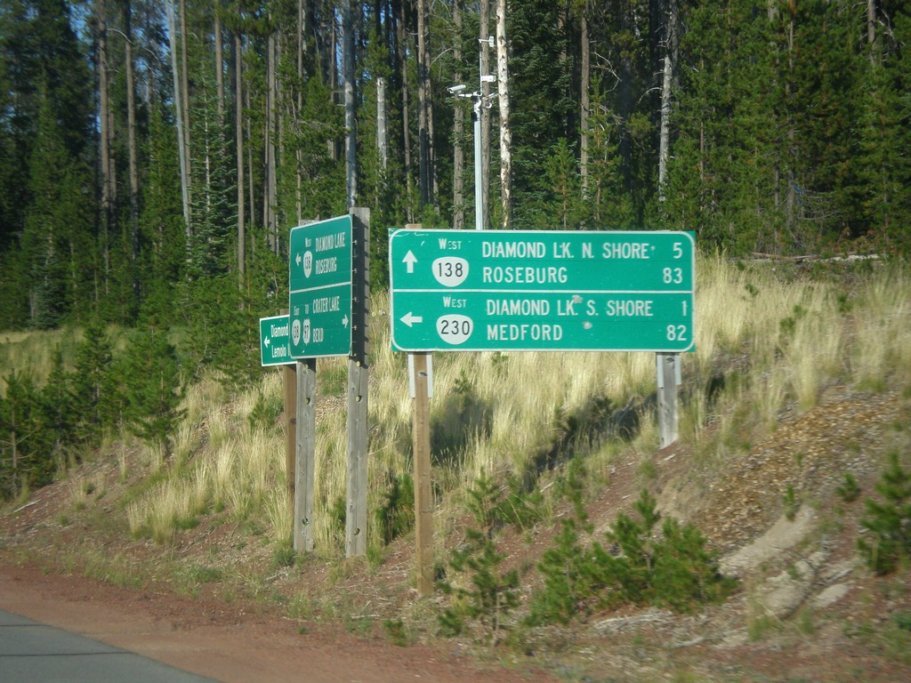
OR-138 West at OR-230
OR-138 West at OR-230 west to Diamond Lake South Shore and Medford. On the day this photograph was taken a forest fire had closed down OR-230 west, as well as the campgrounds at nearby Diamond Lake. Continue west on OR-138 for Diamond Lake North Shore and Roseburg.
Taken 08-15-2015
 Chemult
Douglas County
Oregon
United States
Chemult
Douglas County
Oregon
United States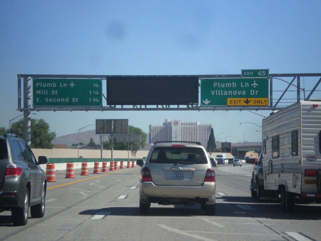
I-580/US-395 North Approaching Exit 65
I-580/US-395 north approaching Exit 65 - Plumb Lane/Villanova Drive. A distance marker showing the next three Reno exits is on the left side of the picture. The next three exits are: Plumb Lane, Mill St., and E. Second St. Use the Plumb Lane exit for the Reno-Tahoe International Airport.
Taken 06-15-2015

 Reno
Washoe County
Nevada
United States
Reno
Washoe County
Nevada
United States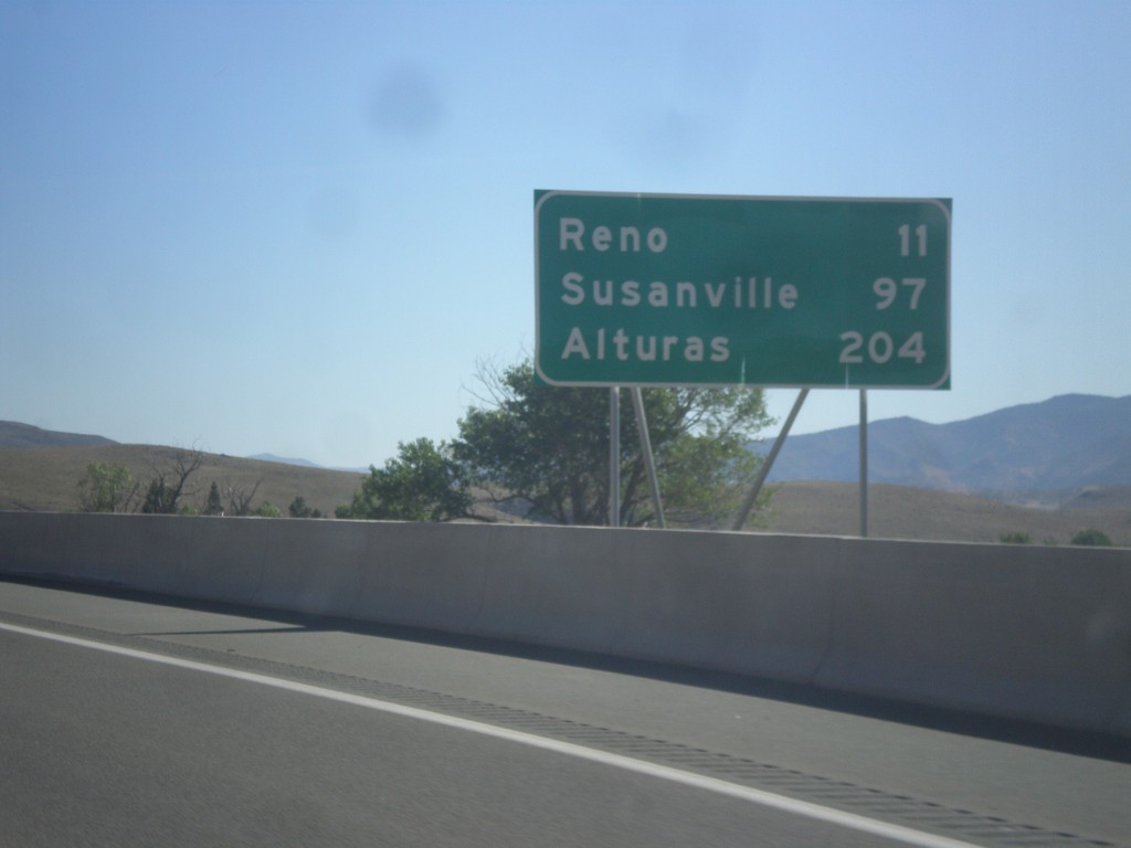
I-580/US-395 North - Distance Marker
Distance marker on I-580/US-395 North. Distance to Reno, Susanville (CA), and Alturas (CA).
Taken 06-15-2015
New Washoe City
Washoe County
Nevada
United States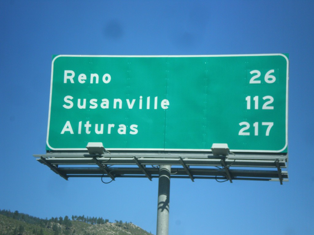
I-580/US-395 North - Distance Marker
Distance marker on I-580/US-395 North. Distance to Reno, Susanville (CA), and Alturas (CA).
Taken 06-15-2015
Carson City
Nevada
United States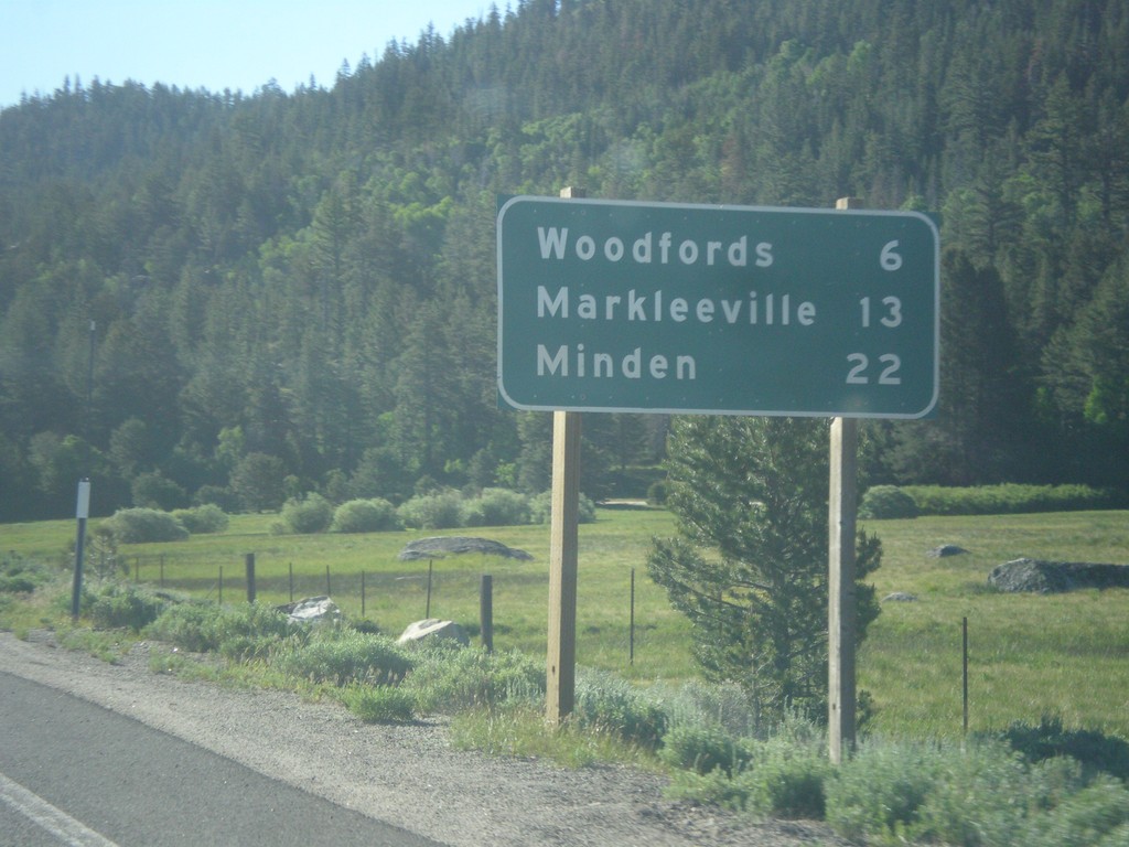
CA-88 East/CA-89 South - Distance Marker
Distance Marker on CA-88 East/CA-89 South. Distance to Woodfords, Markleeville, and Minden (Nevada).
Taken 06-15-2015

 Markleeville
Alpine County
California
United States
Markleeville
Alpine County
California
United States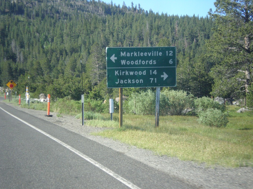
CA-89 South Approaching CA-88
CA-89 South approaching CA-88. Use CA-88 west for Kirkwood and Jackson. Use CA-89 South/CA-89 East for Markleeville and Woodfords. CA-89 south joins CA-88 east to Woodfords.
Taken 06-15-2015
Markleeville
Alpine County
California
United States
CA-89 South - Distance Marker
Distance marker on CA-89 south. Distance to CA-88 Junction.
Taken 06-15-2015
South Lake Tahoe
El Dorado County
California
United States
US-50 East - Placerville Intersections
Distance marker showing major cross streets in Placerville.
Taken 06-15-2015
 Placerville
El Dorado County
California
United States
Placerville
El Dorado County
California
United States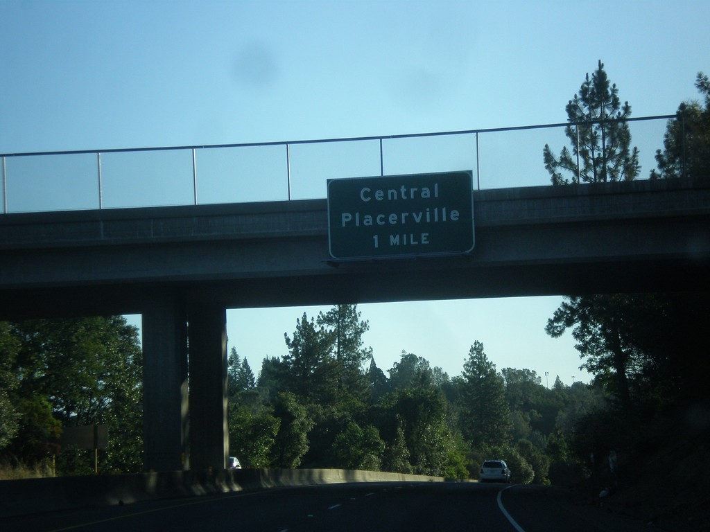
US-50 - Central Placerville
US-50 approaching Central Placerville. The US-50 freeway ends in central Placerville and becomes a city street for a few blocks through central Placerville.
Taken 06-15-2015
Placerville
El Dorado County
California
United States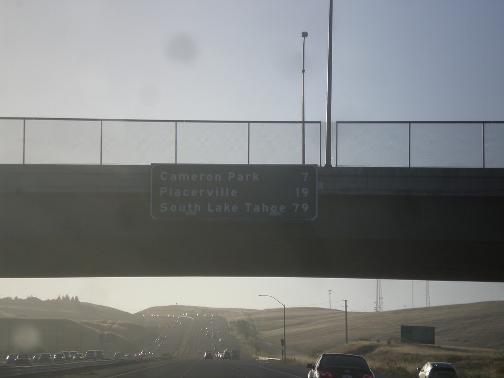
US-50 East - Distance Marker
Distance marker on US-50 east. Distance to Cameron Park, Placerville, and South Lake Tahoe.
Taken 06-15-2015
Folsom
Sacramento County
California
United States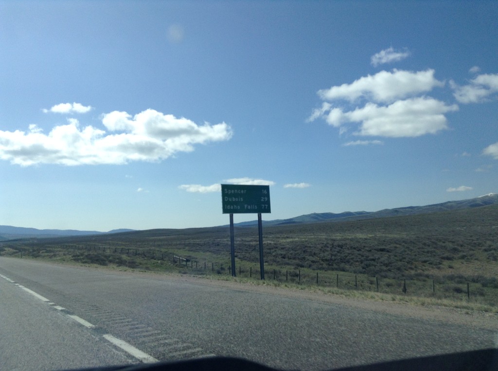
I-15 South - Distance Marker
First distance marker in Idaho along I-15 south. Distance to Spencer, Dubois, and Idaho Falls.
Taken 05-10-2015
 Humphrey
Clark County
Idaho
United States
Humphrey
Clark County
Idaho
United States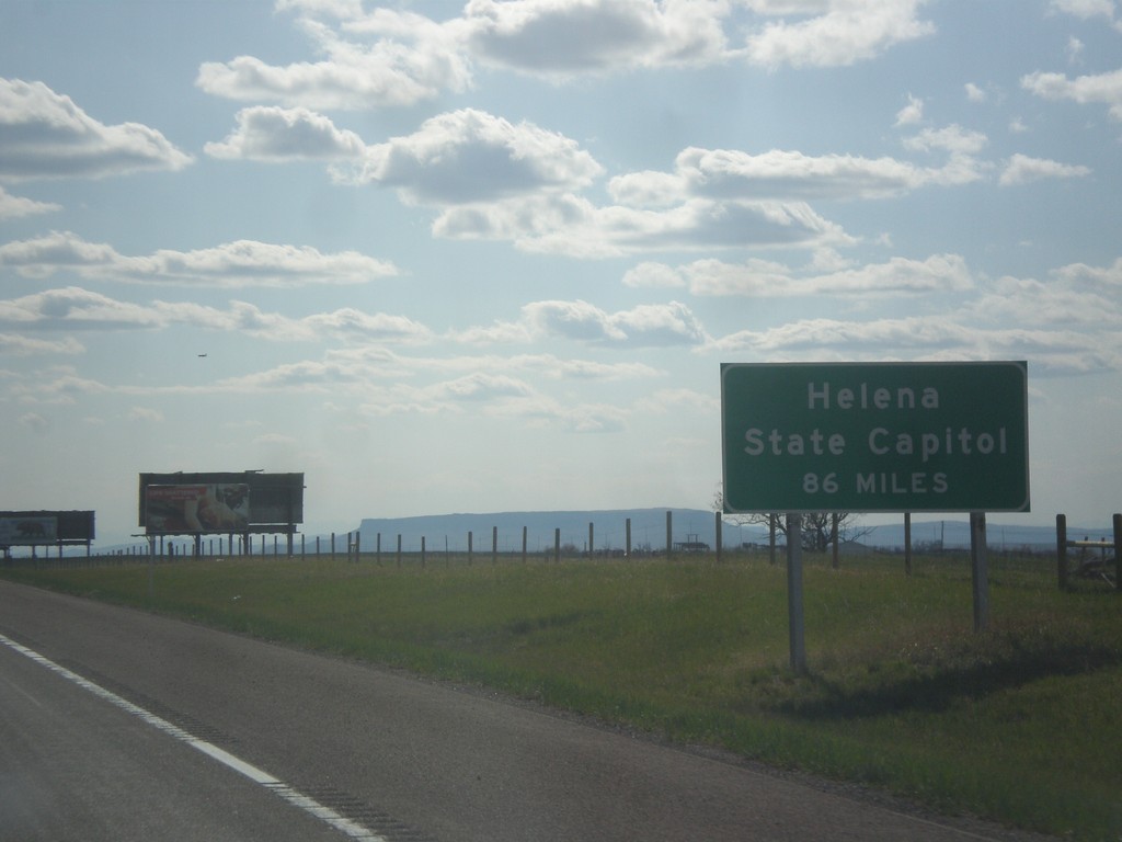
I-15 South - Helena Distance
I-15 South - Helena State Capitol distance. A similar sign is posted on I-15 leaving Butte.
Taken 05-09-2015
Great Falls
Cascade County
Montana
United States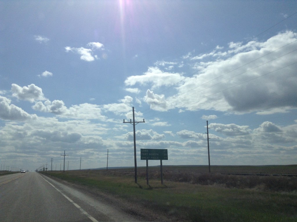
US-87 South - Distance Marker
Distance marker on US-87 south. Distance to Loma, Fort Benton, and Great Falls.
Taken 05-09-2015
 Big Sandy
Chouteau County
Montana
United States
Big Sandy
Chouteau County
Montana
United States