Signs Tagged With Distance Marker
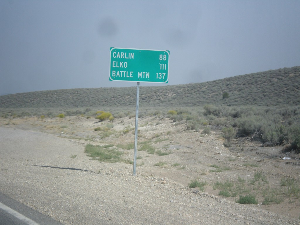
NV-278 North - Distance Marker
Distance marker on NV-278 north. Distance to Carlin, Elko, and Battle Mountain.
Taken 08-31-2014
 Eureka
 County
Nevada
United States
Eureka
Eureka County
Nevada
United States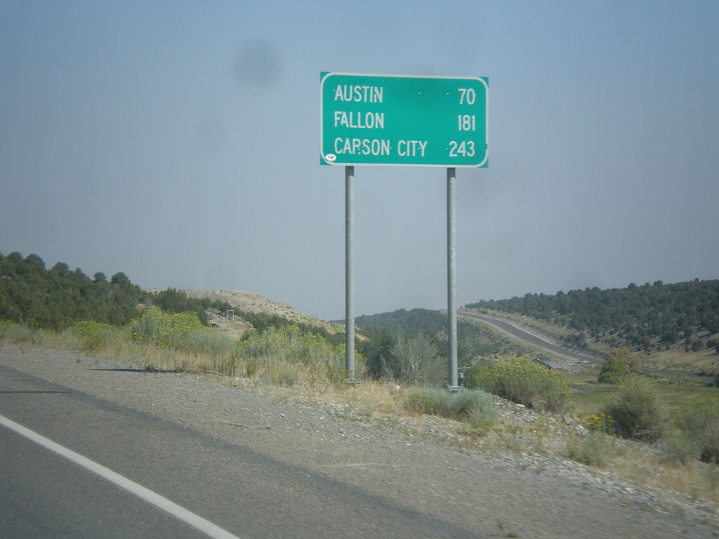
US-50 West - Distance Marker
Distance marker on US-50 west. Distance to Austin, Fallon, and Carson City.
Taken 08-31-2014
 Eureka
 County
Nevada
United States
Eureka
Eureka County
Nevada
United States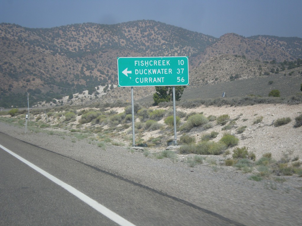
US-50 West - Duckwater Jct.
US-50 west at junction to Fishcreek, Duckwater, and Currant.
Taken 08-31-2014
Eureka
Eureka County
Nevada
United States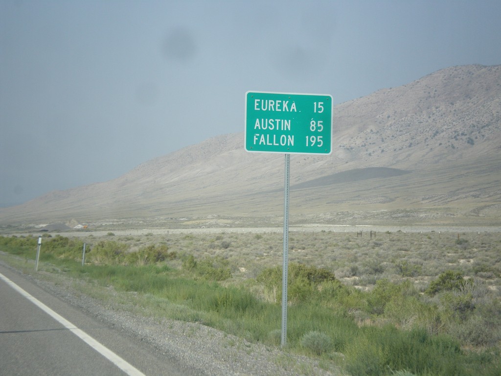
US-50 West - Distance Marker
Distance marker on US-50 west. Distance to Eureka, Austin, and Fallon.
Taken 08-31-2014
Eureka
White Pine County
Nevada
United States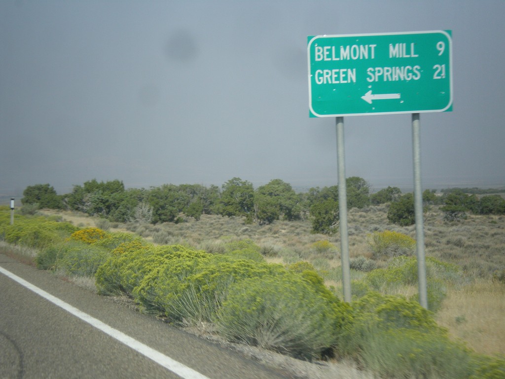
US-50 West - Belmont Mill Jct.
US-50 west at junction to Belmont Mill and Green Springs.
Taken 08-31-2014
White Pine County
Nevada
United States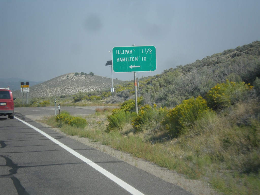
US-50 West - Illipah and Hamilton Jct.
US-50 West at Illipah and Hamilton Jct.
Taken 08-31-2014
Ely
White Pine County
Nevada
United States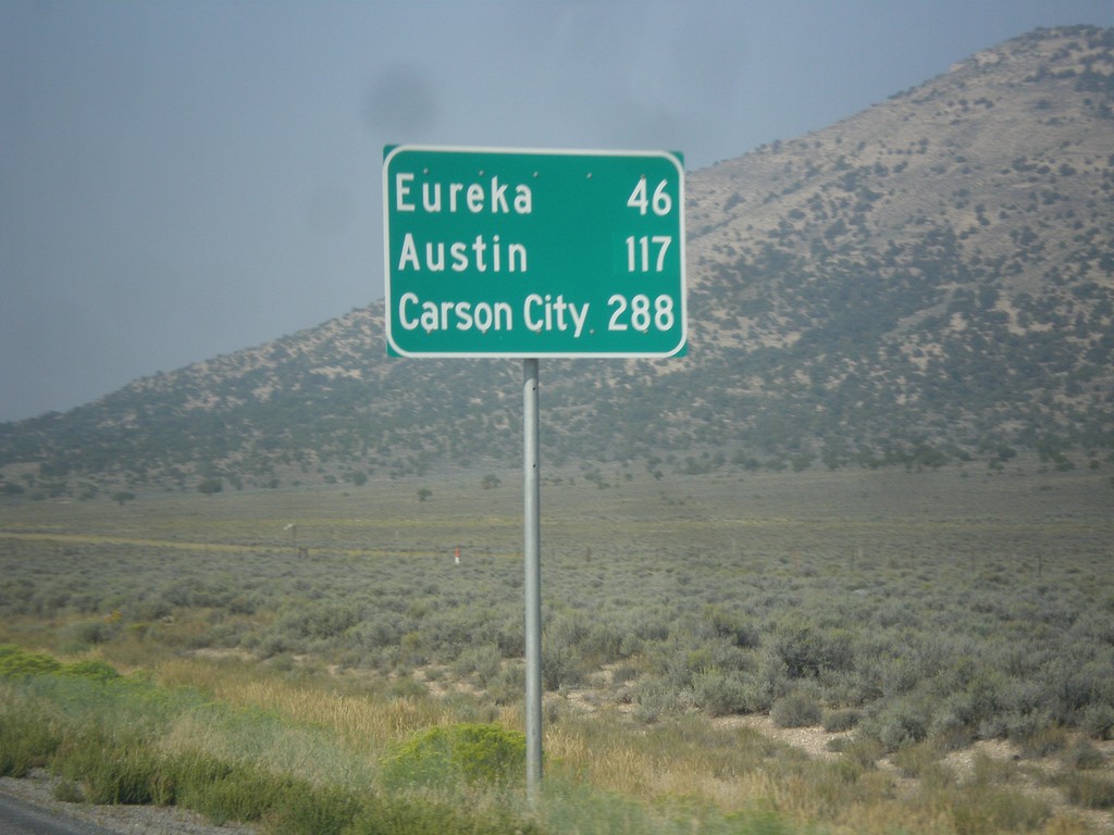
US-50 West - Distance Marker
Distance marker on US-50 west. Distance to Eureka, Austin, and Carson City.
Taken 08-31-2014
Ely
White Pine County
Nevada
United States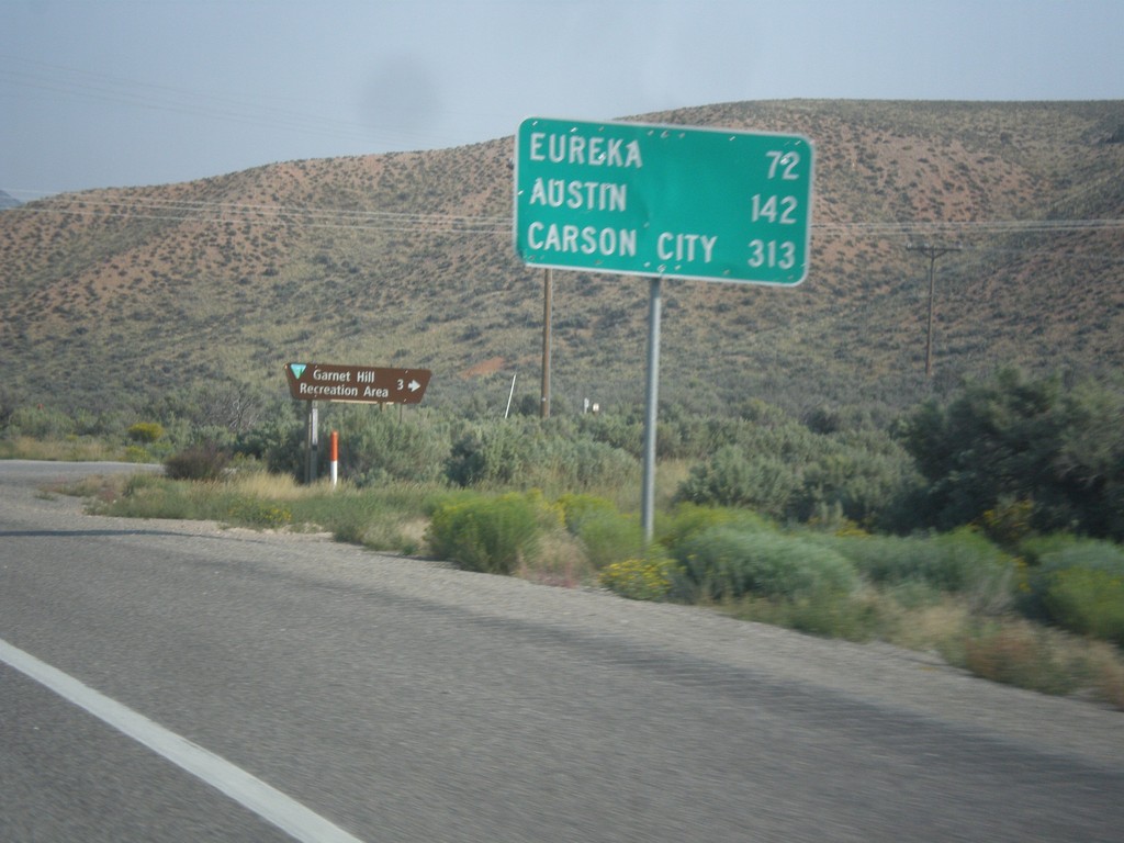
US-50 West - Distance Marker
Distance marker on US-50 west. Distance to Eureka, Austin, and Carson City.
Taken 08-31-2014
Ruth
White Pine County
Nevada
United States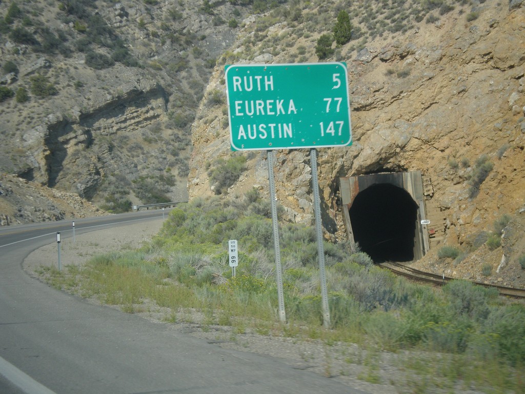
US-50 West - Distance Marker
Distance marker on US-50 west. Distance to Ruth, Eureka, and Austin.
Taken 08-31-2014
Ely
White Pine County
Nevada
United States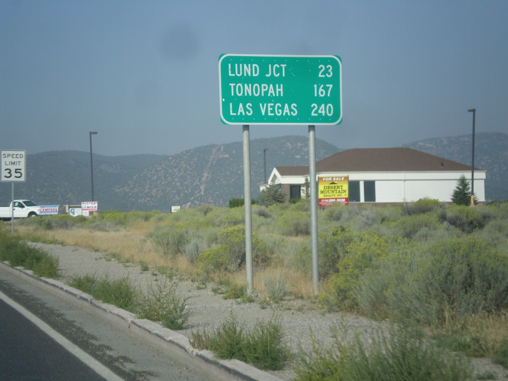
US-6 West - Distance Marker
Distance marker on US-6 west. Distance to Lund Jct., Tonopah, and Las Vegas (via NV-318).
Taken 08-31-2014
 Ely
White Pine County
Nevada
United States
Ely
White Pine County
Nevada
United States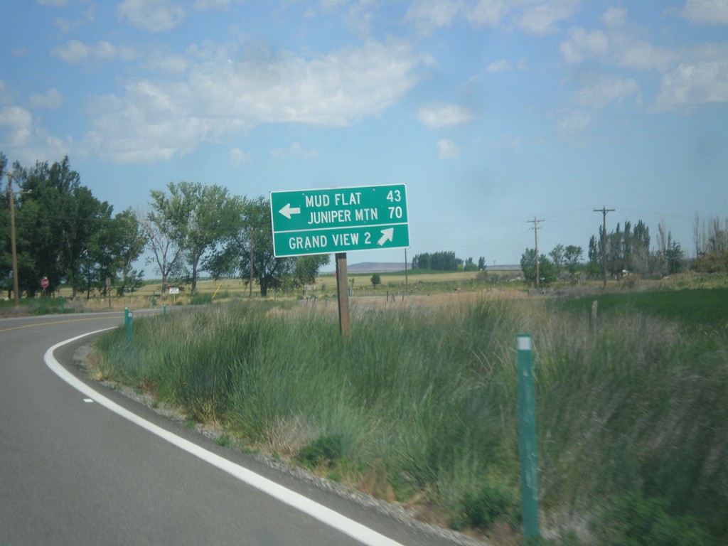
ID-78 West at Mud Flat Road
ID-78 west at Mud Flat Road to Mud Flat and Juniper Mountain. Continue west on ID-78 for Grand View. This is the beginning of the Owyhee Uplands Backcountry Byway, which follows Mud Flat Road along the south side of the Owyhee Mountains and ending in Jordan Valley, Oregon.
Taken 06-21-2014
 Grand View
Owyhee County
Idaho
United States
Grand View
Owyhee County
Idaho
United States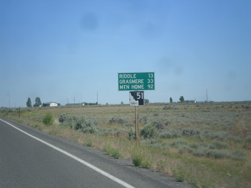
ID-51 North - Distance Marker
Distance marker on ID-51 north. Distance to Riddle, Grasmere, and Mountain Home. This is the first shield and distance marker along ID-51 after the stateline.
Taken 06-21-2014
 Owyhee
 County
Idaho
United States
Owyhee
Owyhee County
Idaho
United States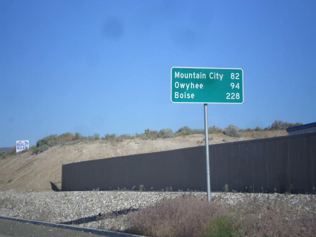
NV-225 North - Distance Marker
Distance Marker on NV-225 North to Mountain City, Owyhee, and Boise (Idaho).
Taken 06-21-2014
 Elko
Elko County
Nevada
United States
Elko
Elko County
Nevada
United States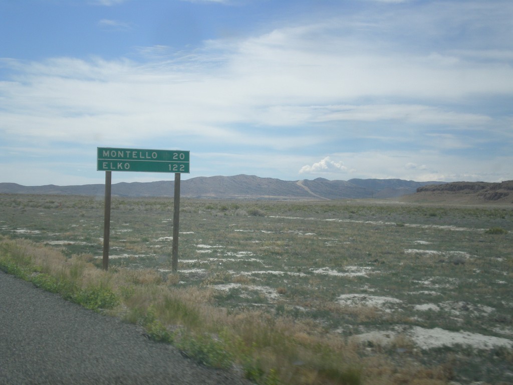
UT-30 West - Distance Marker
Distance marker on UT-30 west. Distance to Montello, and Elko. Both of those places are in Nevada.
Taken 06-21-2014
 Grouse Creek
Box Elder County
Utah
United States
Grouse Creek
Box Elder County
Utah
United States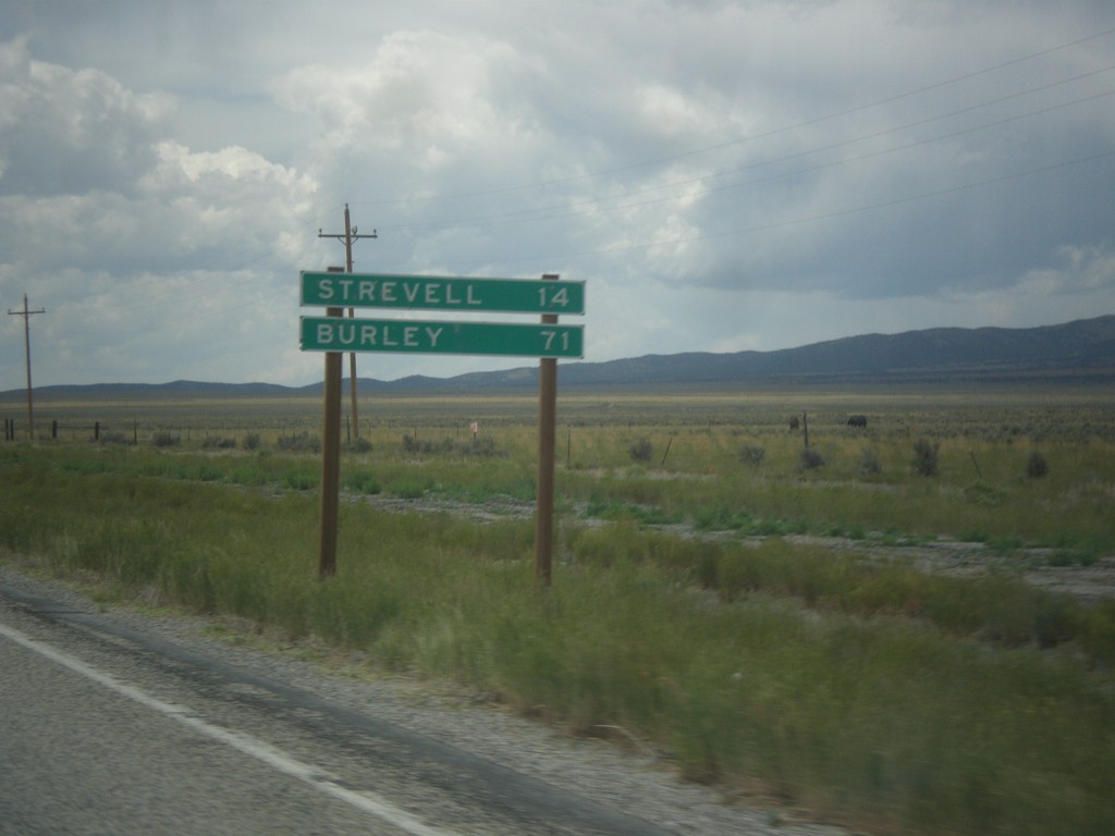
UT-30 West - Distance Marker
Distance marker on UT-30 west. Distance to Strevell, and Burley. Both of these communities are in Idaho, and both are accessed via UT-42.
Taken 06-21-2014
Snowville
Box Elder County
Utah
United States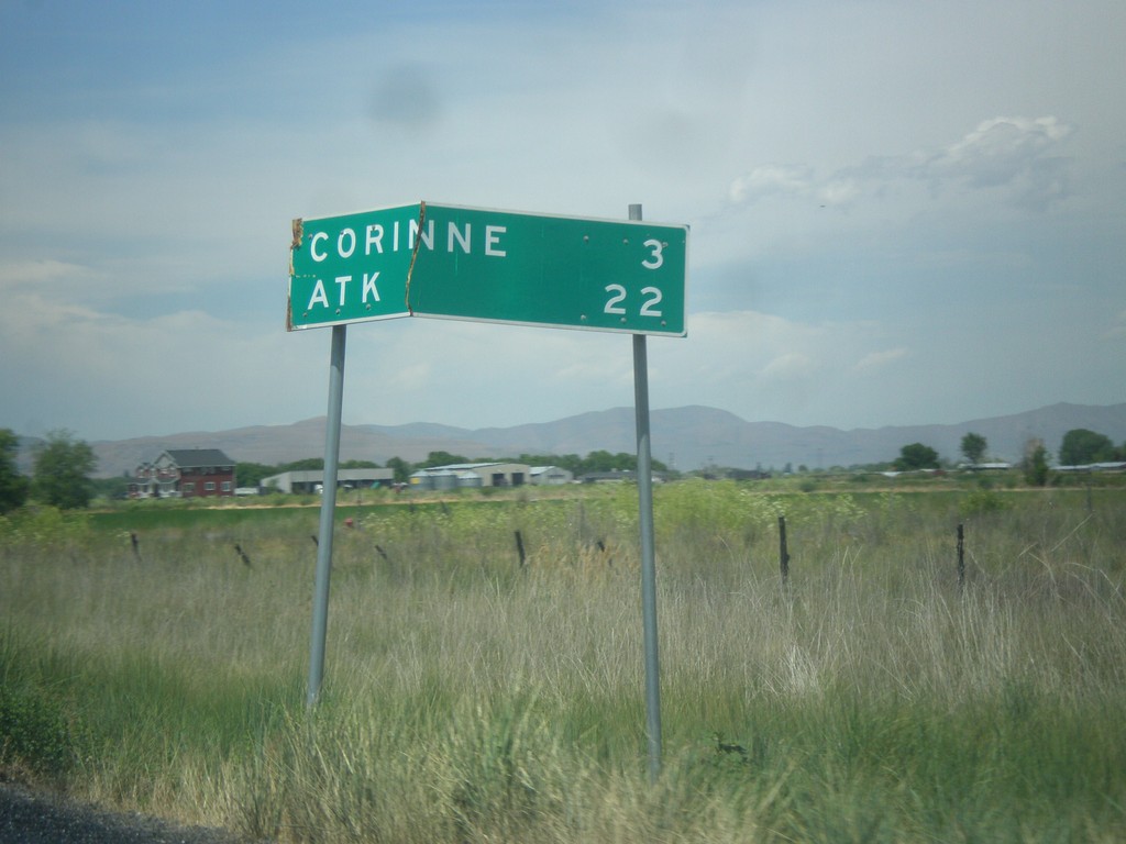
UT-13 North - Distance Marker
Distance marker on UT-13 north. Distance to Corrine, and ATK (an aerospace company).
Taken 06-21-2014
 Brigham City
Box Elder County
Utah
United States
Brigham City
Box Elder County
Utah
United States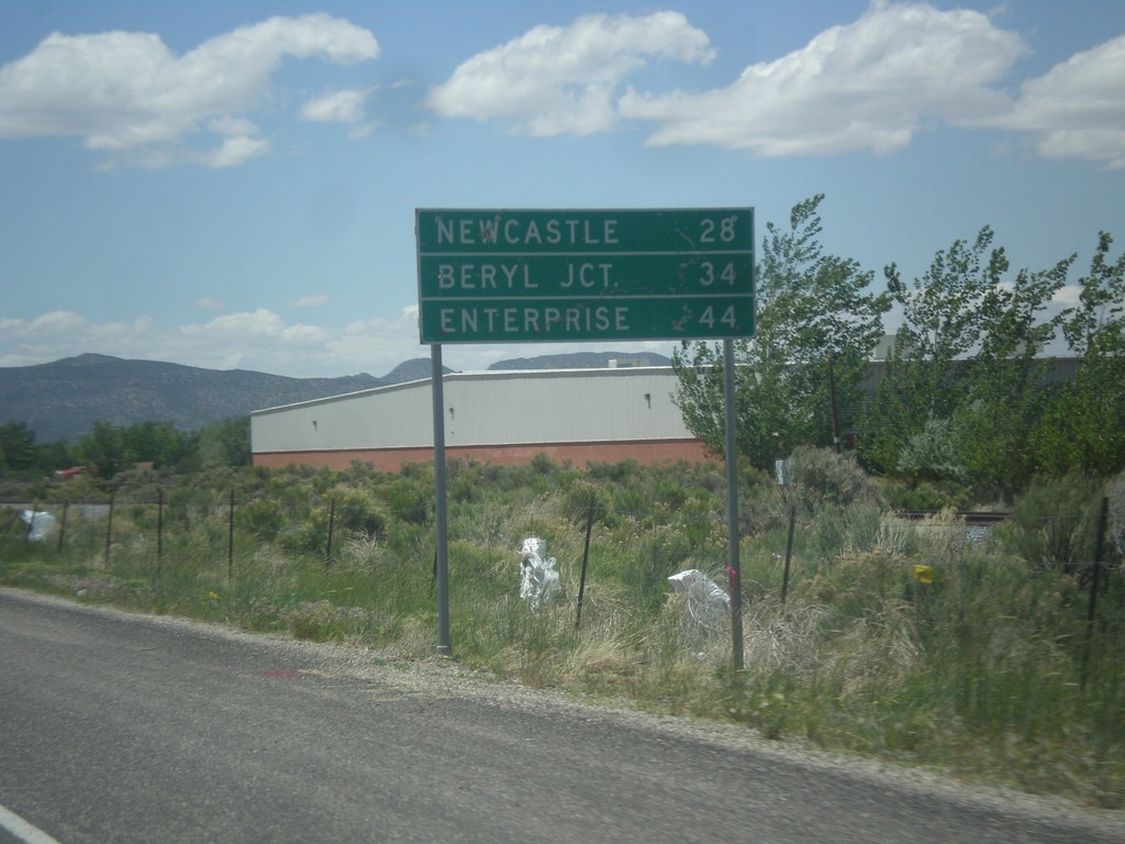
UT-56 West - Distance Marker
Distance marker on UT-56 west. Distance to Newcastle, Beryl Junction, and Enterprise.
Taken 05-21-2014
 Cedar City
Iron County
Utah
United States
Cedar City
Iron County
Utah
United States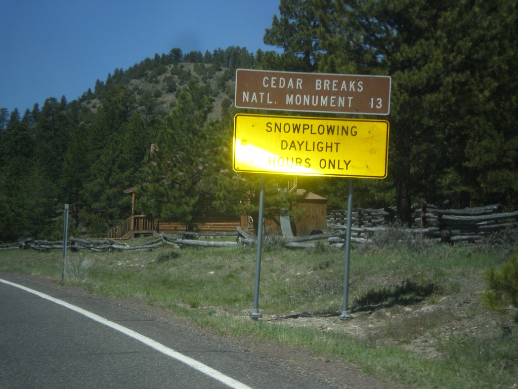
UT-143 - Distance Marker
Distance marker on UT-143 south. Distance to Cedar Breaks National Monument. Below distance marker is another sign reading Snow Plowing Daylight Hours Only.
Taken 05-21-2014
 Panguitch
Garfield County
Utah
United States
Panguitch
Garfield County
Utah
United States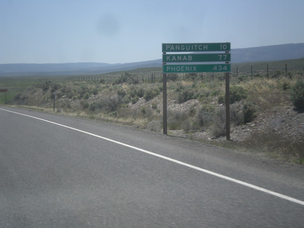
US-89 South - Distance Marker
Distance marker on US-89 south. Distance to Panguitch, Kanab, and Phoenix (Arizona).
Taken 05-19-2014
 Spry
Garfield County
Utah
United States
Spry
Garfield County
Utah
United States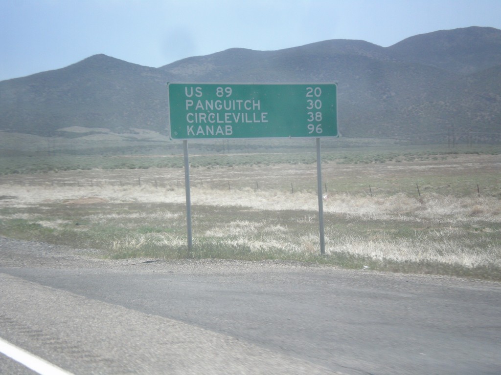
UT-20 East - Distance Marker
Distance marker on UT-20 east. Distance to US-89, Panguitch, Circleville, and Kanab.
Taken 05-19-2014
 Paragonah
Iron County
Utah
United States
Paragonah
Iron County
Utah
United States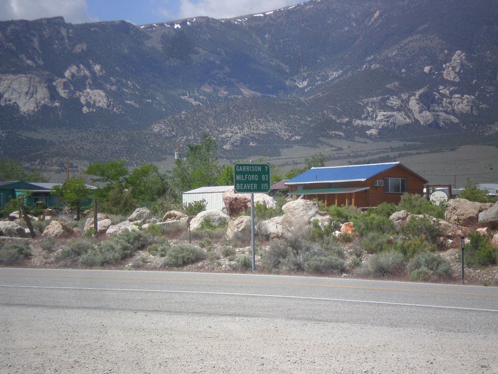
NV-487 South - Distance Marker
Distance marker on NV-487 south. Distance to Gunnison, Milford, and Beaver. All three locations are located in Utah.
Taken 05-19-2014
 Baker
White Pine County
Nevada
United States
Baker
White Pine County
Nevada
United States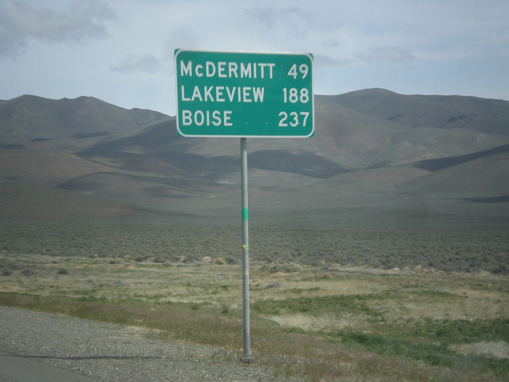
US-95 North - Distance Marker
Distance marker on US-95 north. Distance to McDermit, Lakeview (Oregon - via NV-140), and Boise (Idaho).
Taken 05-06-2014
 Winnemucca
Humboldt County
Nevada
United States
Winnemucca
Humboldt County
Nevada
United States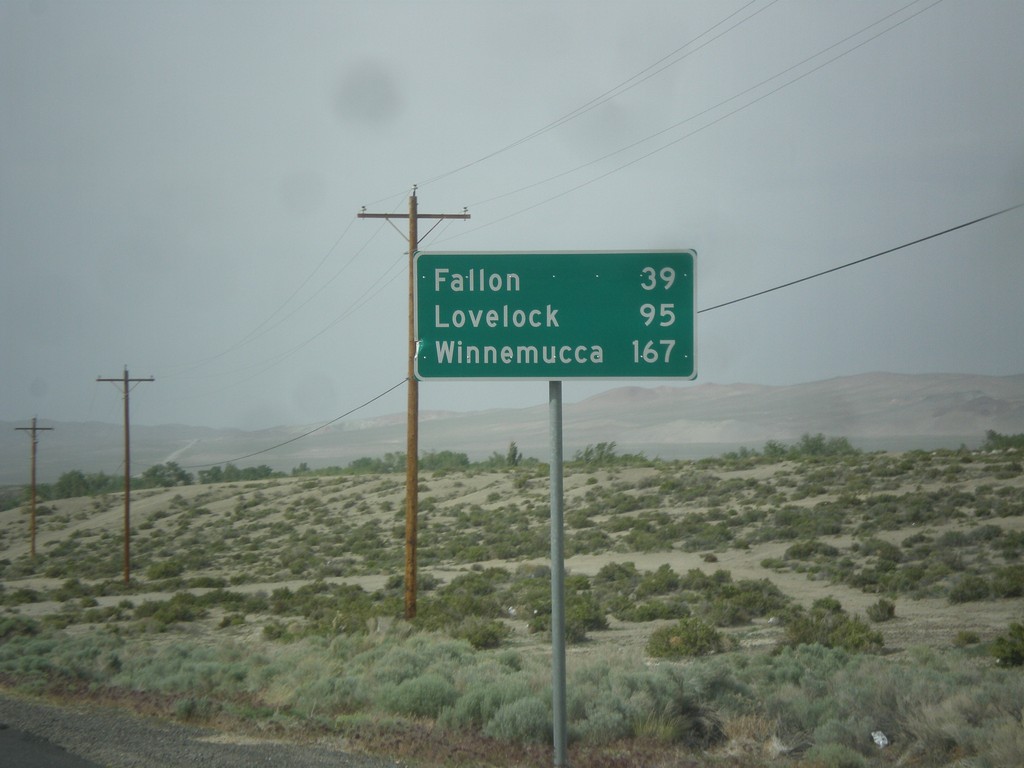
US-95 North - Distance Marker
Distance marker on US-95 north. Distance to Fallon, Lovelock, and Winnemucca. This sign was upgraded to the Clearview font since the last time I photographed it in 2006.
Taken 05-05-2014
Schurz
Mineral County
Nevada
United States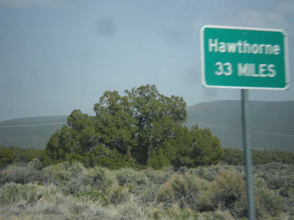
NV-359 North - Distance Marker
Distance marker on NV-359 north. Distance to Hawthorne. This sort of sign is common in Nevada where there is only one city listed as a destination.
Taken 05-05-2014
 Mina
Mineral County
Nevada
United States
Mina
Mineral County
Nevada
United States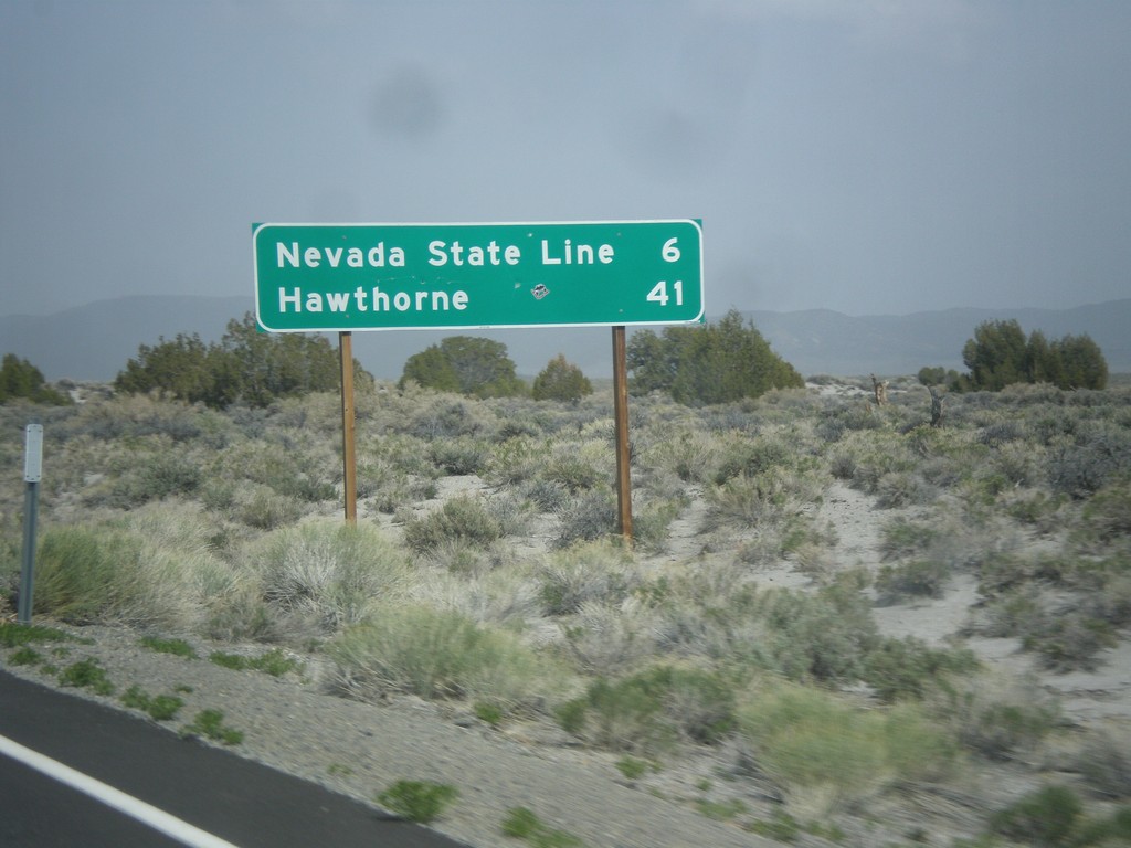
CA-167 East - Distance Marker
Distance marker on CA-167 east. Distance to Nevada State Line and Hawthorne (Nevada).
Taken 05-05-2014
 Lee Vining
Mono County
California
United States
Lee Vining
Mono County
California
United States