Signs Tagged With Distance Marker
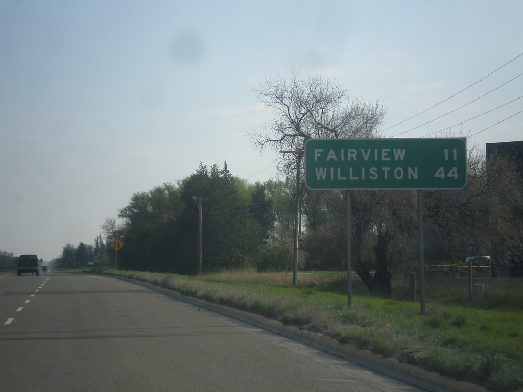
MT-200 East - Distance Marker
Distance marker on MT-200 east. Distance to Fairview and Williston (ND).
Taken 05-09-2015
 Sidney
Richland County
Montana
United States
Sidney
Richland County
Montana
United States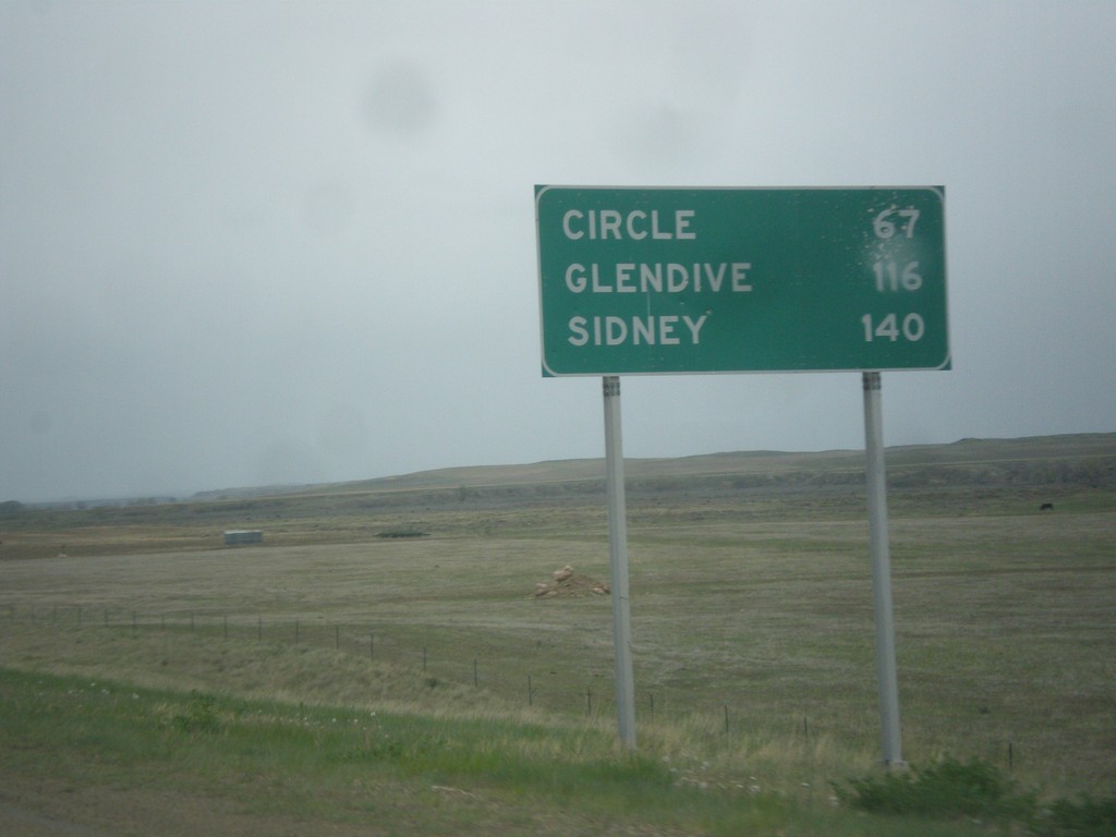
MT-200 East - Distance Marker
Distance marker on MT-200 east. Distance to Circle, Glendive (via MT-200S), and Sidney.
Taken 05-08-2015
Jordan
Garfield County
Montana
United States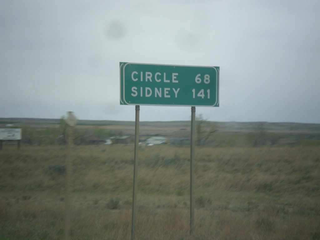
MT-200 East - Distance Marker
Distance marker on MT-200 east. Distance to Circle and Sidney.
Taken 05-08-2015
Jordan
Garfield County
Montana
United States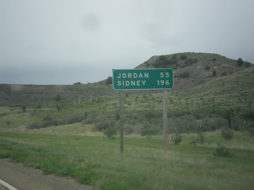
MT-200 East - Distance Marker
Distance marker on MT-200 east. Distance to Jordan and Sidney.
Taken 05-08-2015
Mosby
Petroleum County
Montana
United States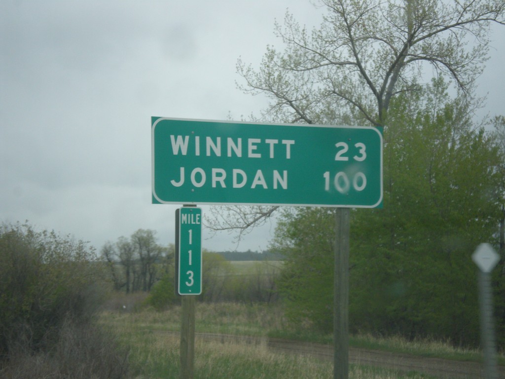
MT-200 East - Distance Marker
Distance marker on MT-200 east. Distance to Winnett and Jordan. Taken at Milepost 113.
Taken 05-08-2015
Grass Range
Fergus County
Montana
United States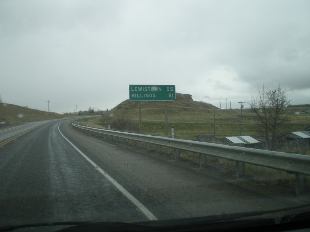
US-12 East/US-191 North - Distance Marker
Distance marker on US-12 East/US-191 North. Distance to Lewistown (via US-191) and Billings (via US-12 and MT-3).
Taken 05-08-2015

 Harlowton
Wheatland County
Montana
United States
Harlowton
Wheatland County
Montana
United States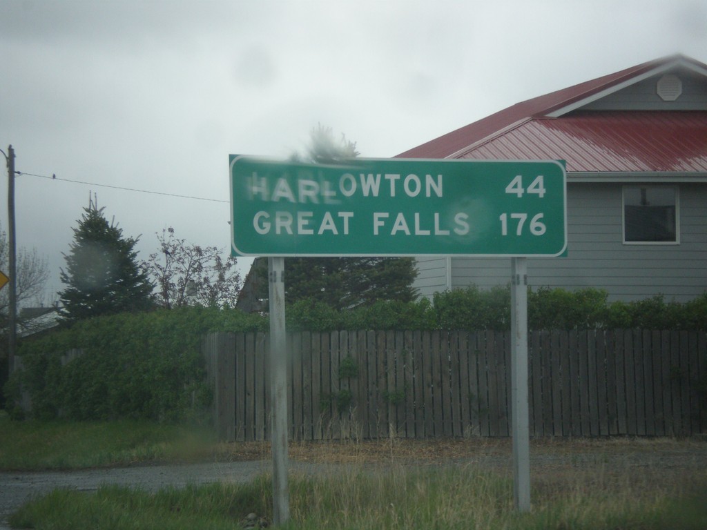
US-191 North - Distance Marker
Distance marker on US-191 north. Distance to Harlowton and Great Falls.
Taken 05-08-2015
Big Timber
Sweet Grass County
Montana
United States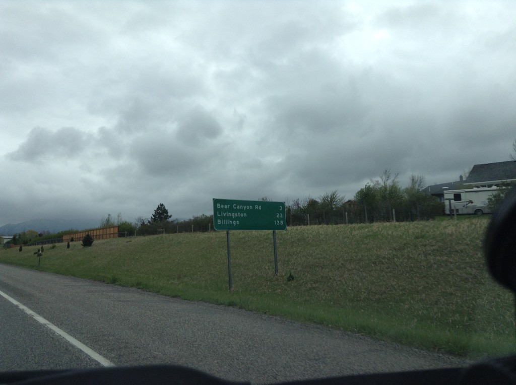
I-90 East - Distance Marker
Distance marker on I-90 east. Distance to Bear Canyon Road, Livingston, and Billings.
Taken 05-08-2015
 Bozeman
Gallatin County
Montana
United States
Bozeman
Gallatin County
Montana
United States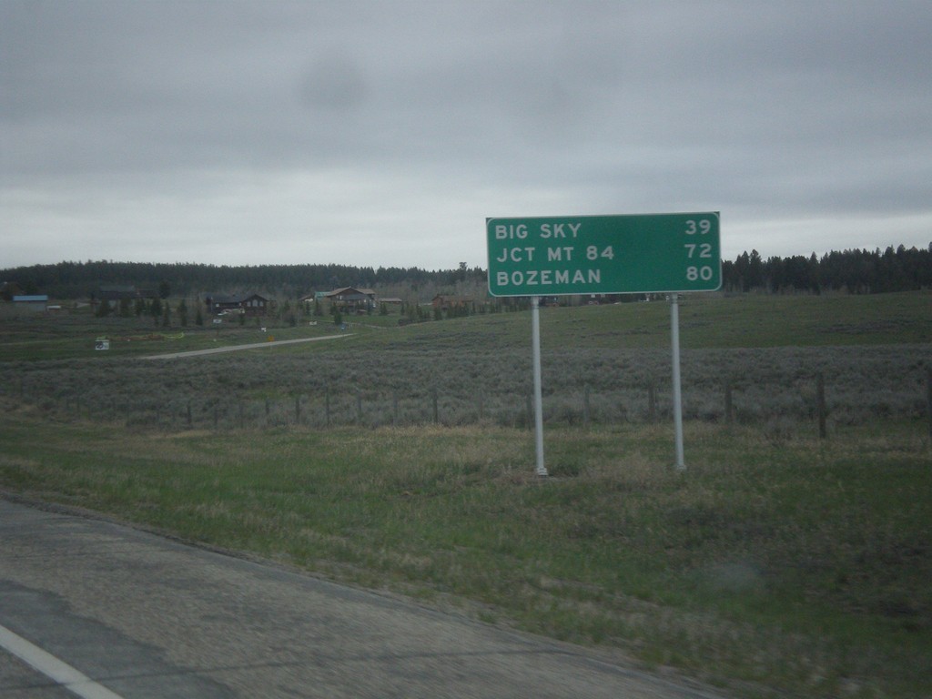
US-191 North - Distance Marker
Distance marker on US-191 north. Distance to Big Sky, Jct. MT-84, and Bozeman.
Taken 05-08-2015
West Yellowstone
Gallatin County
Montana
United States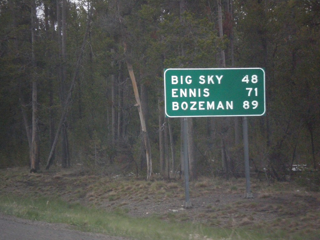
US-191/US-287 North - Distance Marker
Distance marker on US-191/US-287 North. Distance to Big Sky, Ennis (via US-287), and Bozeman.
Taken 05-08-2015
 West Yellowstone
Gallatin County
Montana
United States
West Yellowstone
Gallatin County
Montana
United States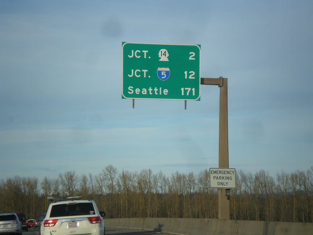
I-205 North - Distance Marker
Last distance marker on I-205 north in Oregon. Distance to WA-14, I-5, and Seattle.
Taken 02-16-2015
 Portland
Multnomah County
Oregon
United States
Portland
Multnomah County
Oregon
United States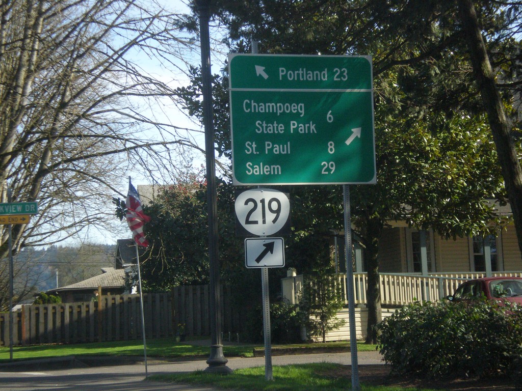
OR-99W North/OR-219 South Split in Newberg
OR-99W North/OR-219 South split in Newberg. Use OR-219 south for Champoeg State Park, St. Paul, and Salem. Continue north on OR-99W for Portland.
Taken 02-16-2015

 Newberg
Yamhill County
Oregon
United States
Newberg
Yamhill County
Oregon
United States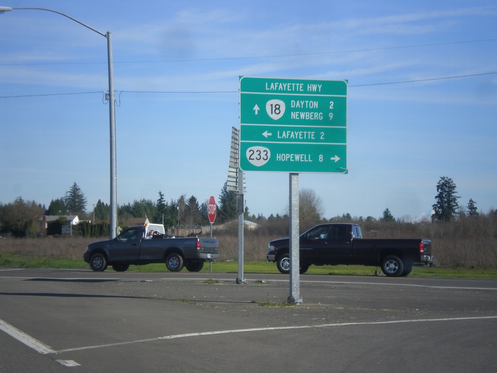
OR-18 East at OR-233 (Lafayette Highway)
OR-18 east at OR-233 (Lafayette Highway). Use OR-233 south for Hopewell. Turn north on Lafayette Highway for Lafayette. Continue east on OR-18 for Dayton and Newberg. OR-233 follows OR-18 north to OR-99W junction.
Taken 02-16-2015

 Dayton
Yamhill County
Oregon
United States
Dayton
Yamhill County
Oregon
United States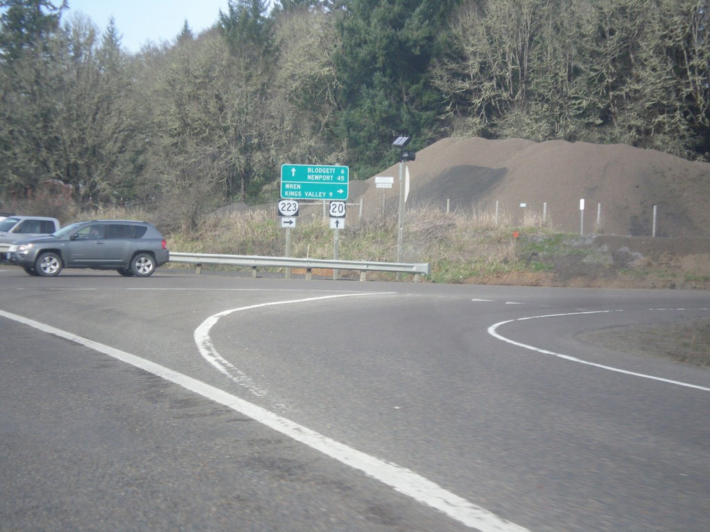
US-20 West at OR-223 North
US-20 west at OR-223 north to Wren and Kings Valley. Continue on US-20 west for Blodgett and Newport.
Taken 02-13-2015

 Philomath
Benton County
Oregon
United States
Philomath
Benton County
Oregon
United States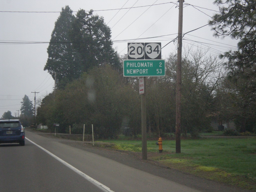
US-20/OR-34 West - Distance Marker
US-20/OR-34 West - distance marker to Philomath and Newport.
Taken 02-13-2015
 Corvallis
Benton County
Oregon
United States
Corvallis
Benton County
Oregon
United States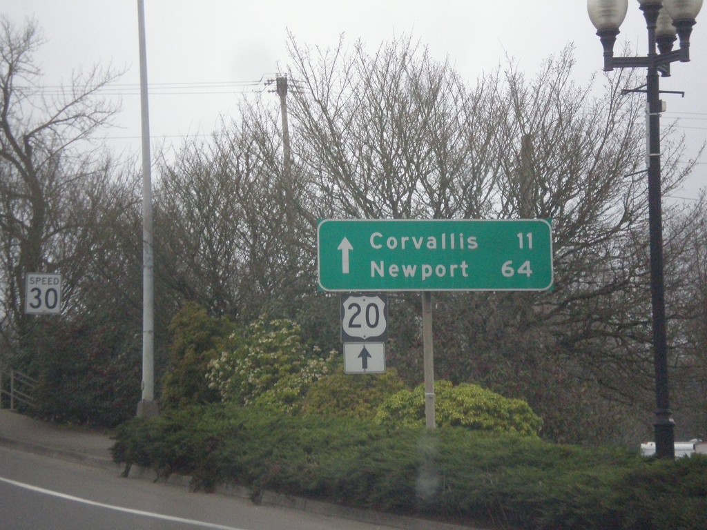
US-20 West - Albany
US-20 West approaching Willamette River bridge in Albany. Continue straight over bridge for US-20 West to Corvallis and Newport.
Taken 02-13-2015
Albany
Linn County
Oregon
United States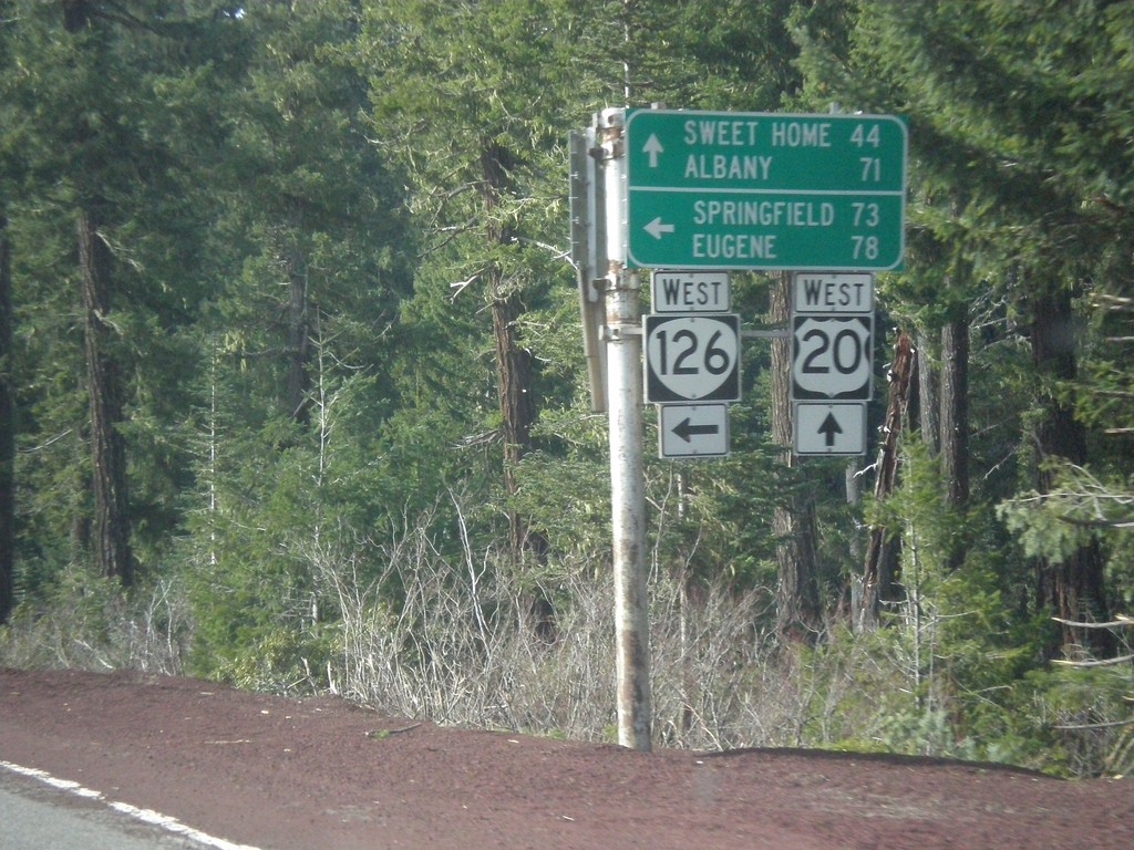
US-20/OR-126 West at US-20/OR-126 Split
US-20/OR-126 West at US-20/OR-126 split. Use OR-126 west for Springfield and Eugene. Use US-20 west for Sweet Home and Albany.
Taken 02-13-2015
 Santiam Junction
Linn County
Oregon
United States
Santiam Junction
Linn County
Oregon
United States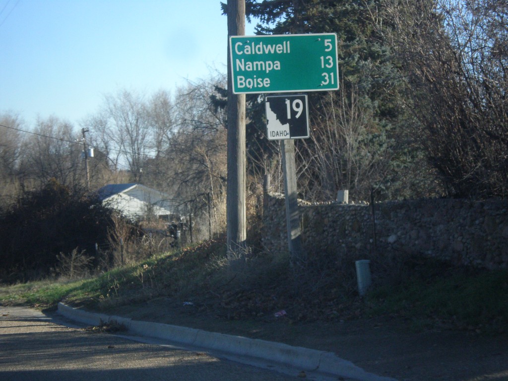
ID-19 East - Distance Marker
Distance marker on ID-19 east. Distance to Caldwell, Nampa, and Boise.
Taken 12-14-2014
 Greenleaf
Canyon County
Idaho
United States
Greenleaf
Canyon County
Idaho
United States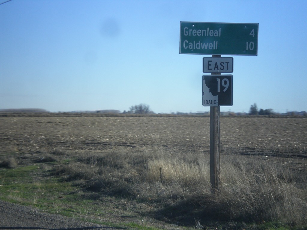
ID-19 East - Distance Marker
Distance marker on ID-19 east. Distance to Greenleaf and Caldwell.
Taken 12-14-2014
Wilder
Canyon County
Idaho
United States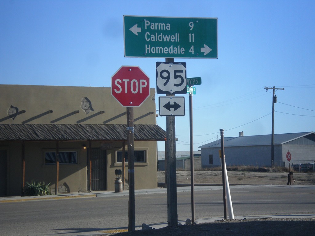
Golden Gate Ave. East at US-95
Golden Gate Ave. East at US-95 in Wilder. Turn right on US-95 south for Caldwell and Homedale. Turn left on US-95 north for Parma.
Taken 12-14-2014
 Wilder
Canyon County
Idaho
United States
Wilder
Canyon County
Idaho
United States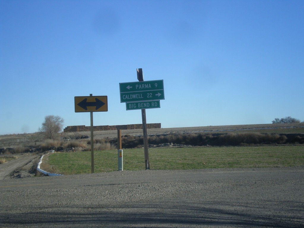
End OR-452 East at OR-454
End OR-452 East (unsigned) at OR-454 (unsigned). Turn right for OR-454 (Big Bend Road) and Caldwell (Idaho). Turn left on Big Bend Road for Parma (Idaho).
Taken 12-14-2014

 Adrian
Malheur County
Oregon
United States
Adrian
Malheur County
Oregon
United States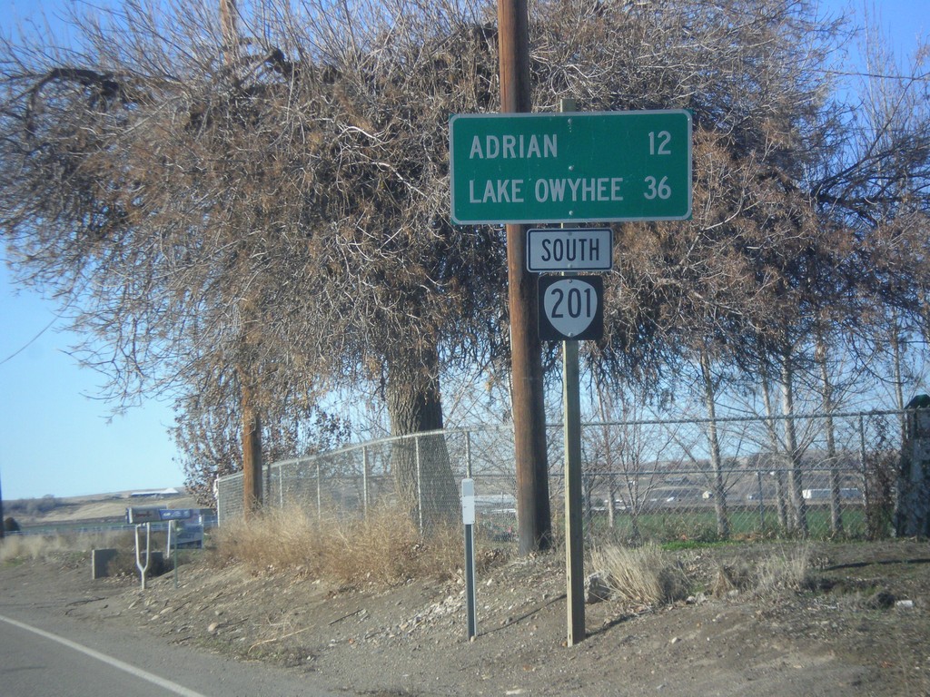
OR-201 South - Distance Marker
Distance marker on OR-201 south. Distance to Adrian and Lake Owyhee.
Taken 12-14-2014
 Nyssa
Malheur County
Oregon
United States
Nyssa
Malheur County
Oregon
United States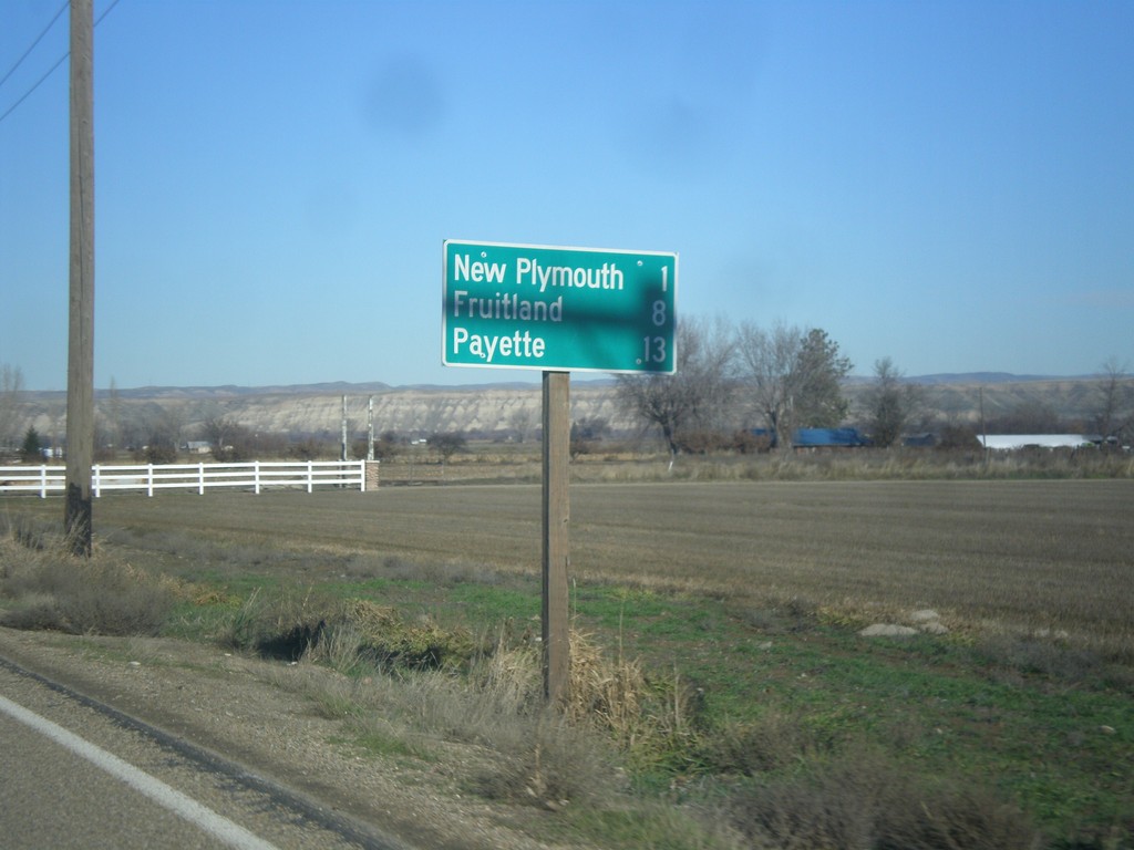
US-30 West - Distance Marker
Distance marker on US-30 west. Distance to New Plymouth, Fruitland, and Payette.
Taken 12-14-2014
 New Plymouth
Payette County
Idaho
United States
New Plymouth
Payette County
Idaho
United States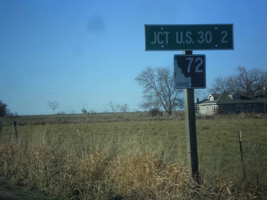
ID-72 West - Distance Marker
Distance marker on ID-72 west. Distance to US-30.
Taken 12-14-2014
 New Plymouth
Payette County
Idaho
United States
New Plymouth
Payette County
Idaho
United States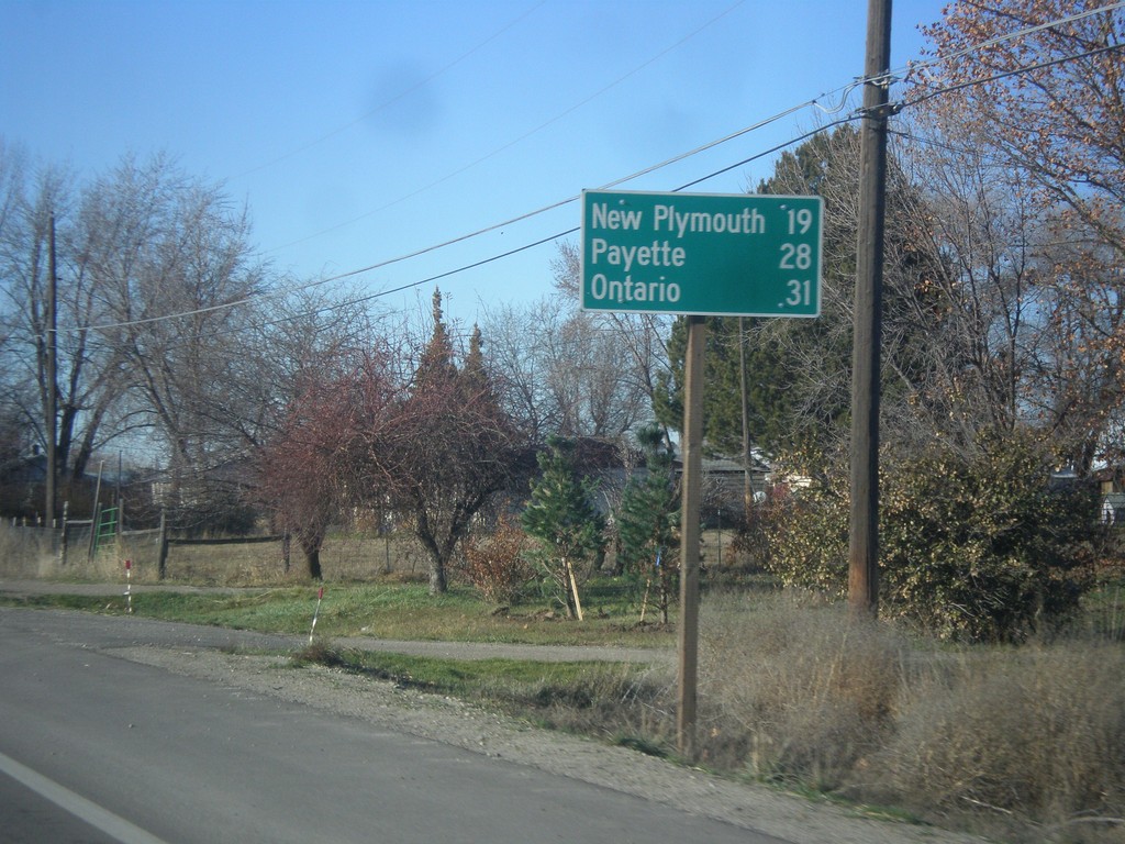
ID-52 West - Distance Marker
Distance marker on ID-52 west for New Plymouth, Payette, and Ontario (Oregon).
Taken 12-14-2014
 Emmett
Gem County
Idaho
United States
Emmett
Gem County
Idaho
United States