Signs Tagged With Distance Marker
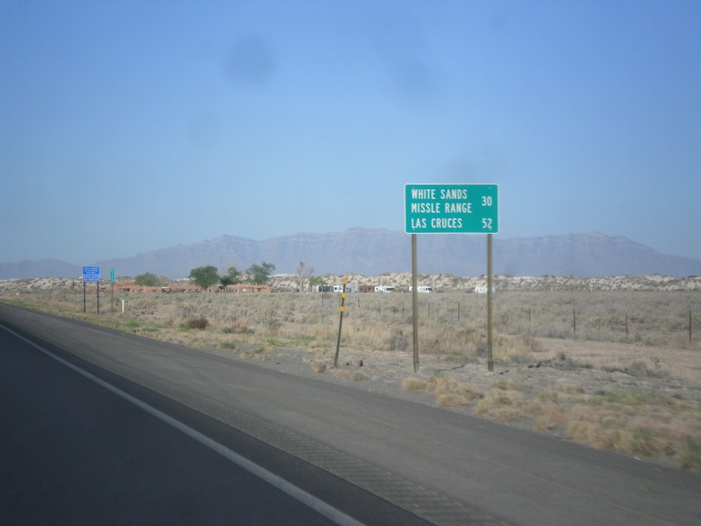
US-70 West - Distance Marker
Distance marker on US-70 west. Distance to White Sands Missile Range and Las Cruces.
Taken 04-15-2013
 Tularosa
Otero County
New Mexico
United States
Tularosa
Otero County
New Mexico
United States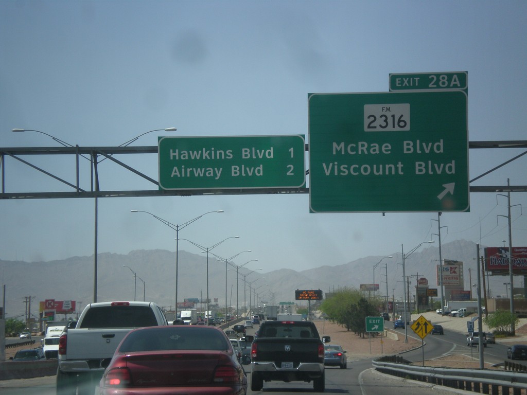
I-10 West - Exit 28A
I-10 west at Exit 28A - FM-2316/McRae Blvd./Viscount Blvd. Approaching Hawkins Blvd. and Airways Blvd.
Taken 04-15-2013

 El Paso
 County
Texas
United States
El Paso
El Paso County
Texas
United States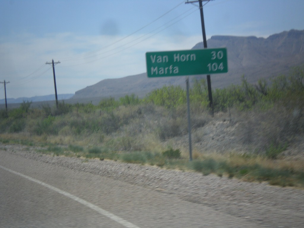
TX-54 South - Distance Marker
Distance marker on TX-54 south. Distance to Van Horn and Marfa (via US-90).
Taken 04-15-2013
 Van Horn
Culberson County
Texas
United States
Van Horn
Culberson County
Texas
United States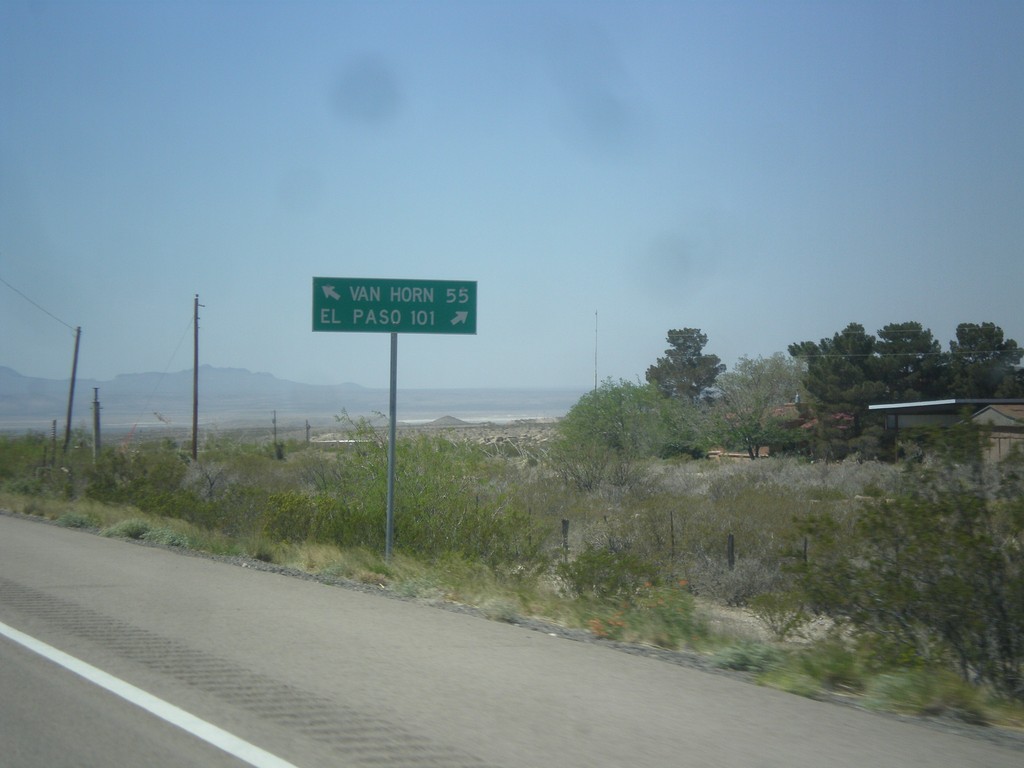
US-62/US-180 West at TX-54
US-62/US-180 west at TX-54 junction. Use TX-54 south for Van Horn; use US-62/US-180 west for El Paso.
Taken 04-15-2013

 Pine Springs
Culberson County
Texas
United States
Pine Springs
Culberson County
Texas
United States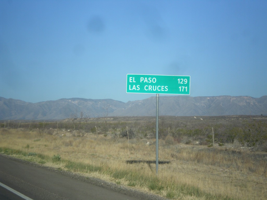
US-62/US-180 West - Distance Marker
Distance marker on US-62/US-180 west. Distance to El Paso and Las Cruces (NM). Taken just west of RM-652 and the Texas-New Mexico state line.
Taken 04-15-2013
Carlsbad
Culberson County
Texas
United States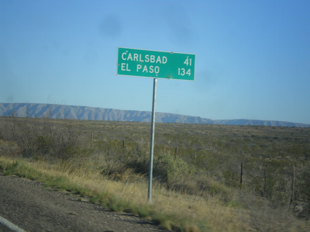
RM-652 West - Distance Marker
Distance marker on RM-652 west. Distance to Carlsbad (New Mexico) and El Paso.
Taken 04-15-2013
 Carlsbad
Culberson County
Texas
United States
Carlsbad
Culberson County
Texas
United States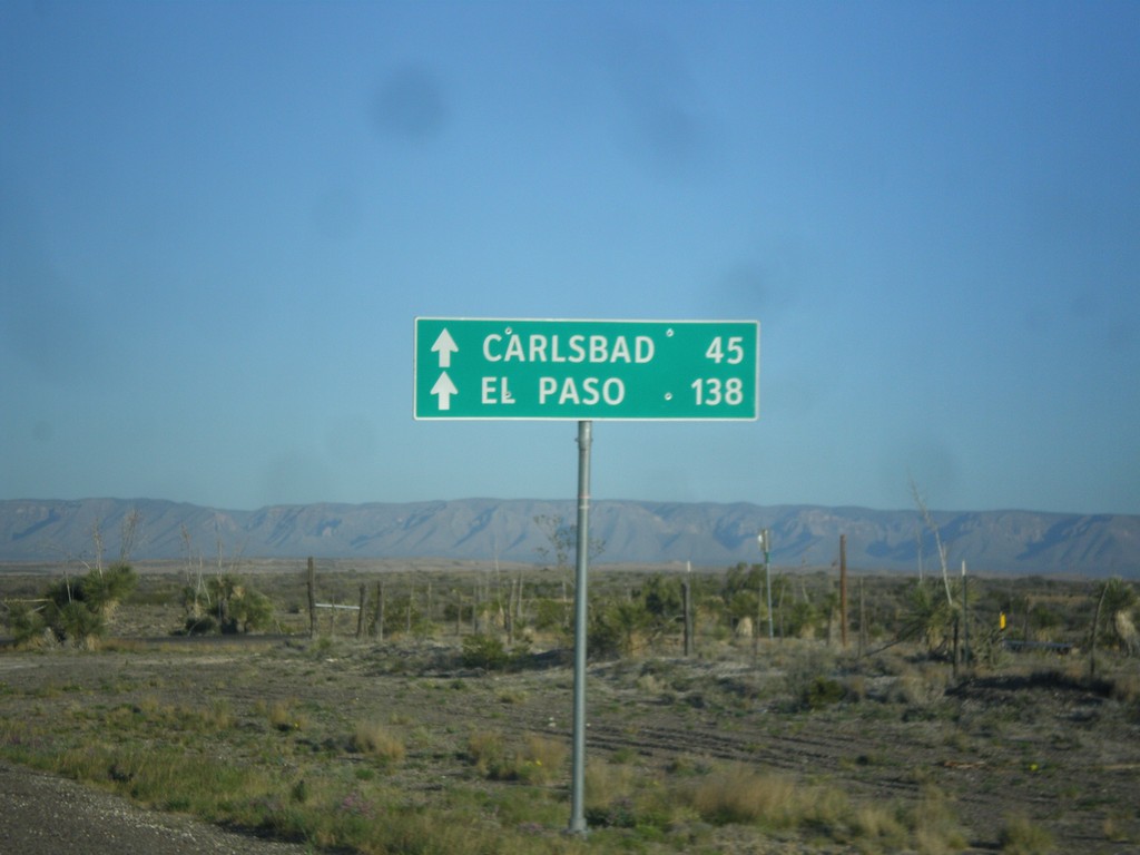
RM-652 West - Distance Marker
Distance marker on RM-652 east to Carlsbad (New Mexico) and El Paso.
Taken 04-15-2013
Carlsbad
Culberson County
Texas
United States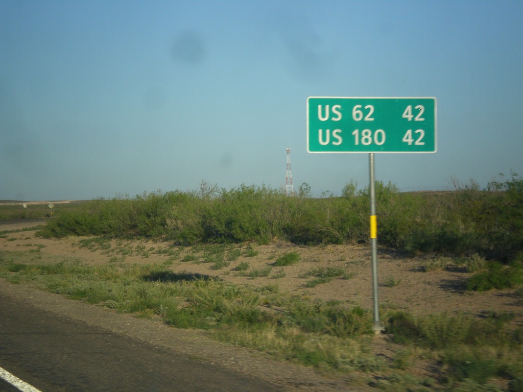
RM-652 West - Distance Marker
Distance marker on RM-652 west to US-62 and US-180.
Taken 04-15-2013
Orla
Reeves County
Texas
United States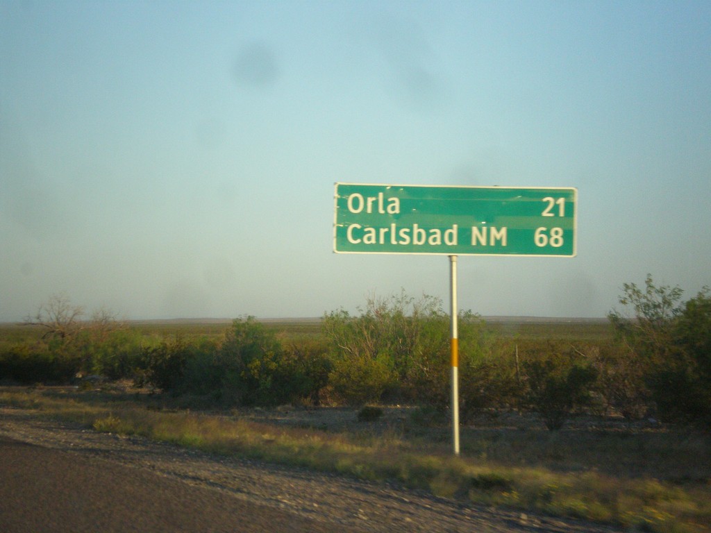
US-285 North - Distance Marker
Distance marker on US-285 north. Distance to Orla, and Carlsbad, NM.
Taken 04-15-2013
 Mentone
Loving County
Texas
United States
Mentone
Loving County
Texas
United States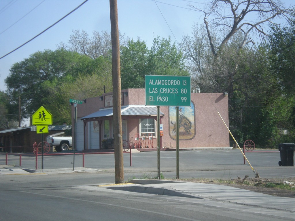
US-70 West/US-54 South - Distance Marker
Distance marker on US-70 West/US-54 South in Tularosa. Distance to Alamogordo, Las Cruces, and El Paso.
Taken 04-15-2013
 Tularosa
Otero County
New Mexico
United States
Tularosa
Otero County
New Mexico
United States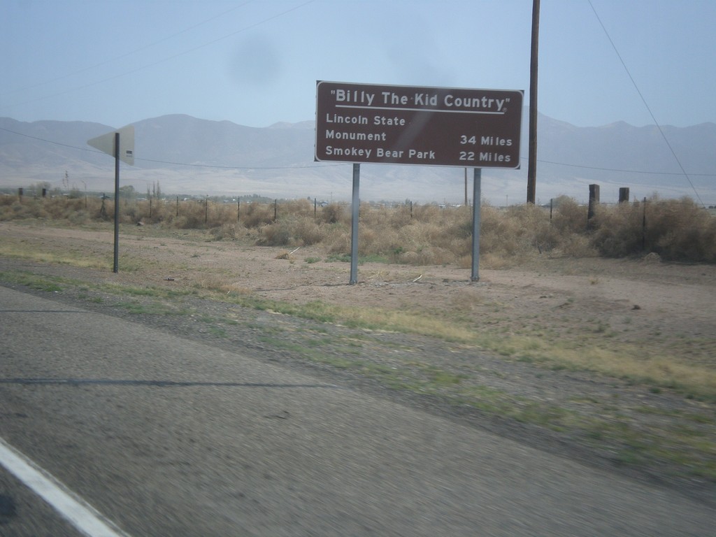
US-380 East - Billy The Kid Country
Billy The Kid Country marker on US-380 east approaching Carrizozo. Distance to Lincoln State Mounument, and Smokey Bear State Park.
Taken 04-15-2013
 Carrizozo
Lincoln County
New Mexico
United States
Carrizozo
Lincoln County
New Mexico
United States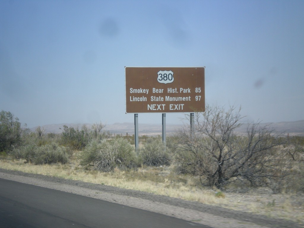
I-25 North Approaching US-380
I-25 north approaching US-380 (Exit 139). Use US-380 east for Smokey Bear Historical Park, and Lincoln State Monument.
Taken 04-15-2013
 San Antonio
Socorro County
New Mexico
United States
San Antonio
Socorro County
New Mexico
United States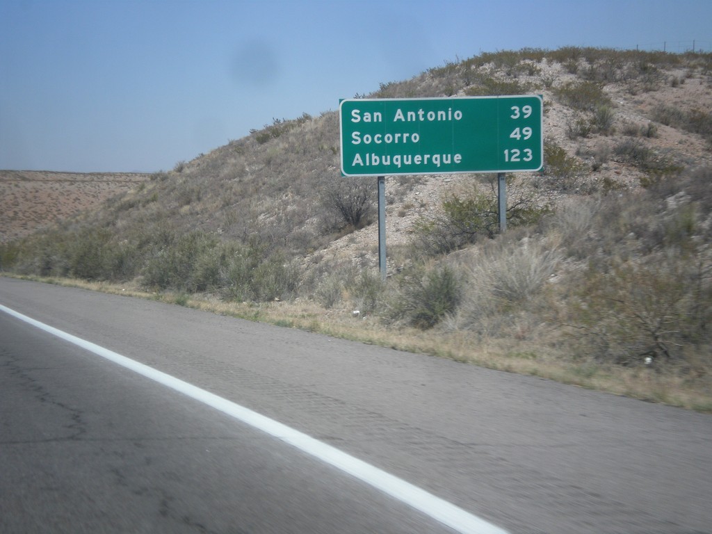
I-25 North - Distance Marker
Distance marker on I-25 north. Distance to San Antonio, Socorro, and Albuquerque.
Taken 04-15-2013
Truth or Consequences
Sierra County
New Mexico
United States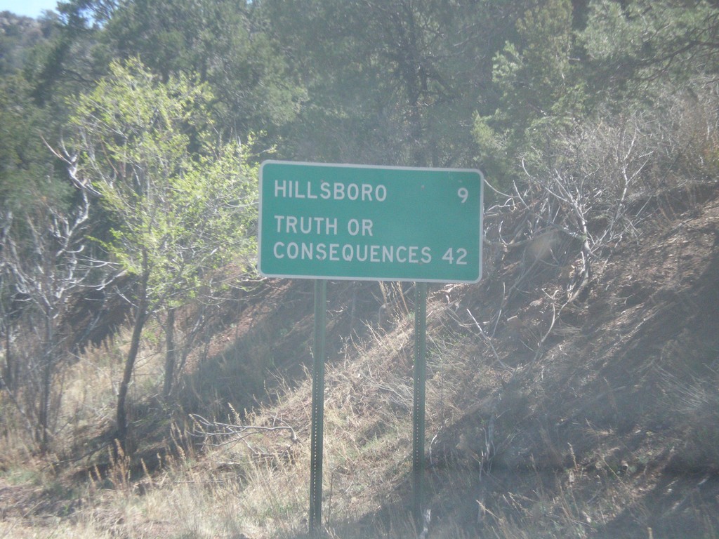
NM-152 East - Distance Marker
Distance marker on NM-152 east. Distance to Hillsboro and Truth or Consequences.
Taken 04-14-2013
 Hillsboro
Sierra County
New Mexico
United States
Hillsboro
Sierra County
New Mexico
United States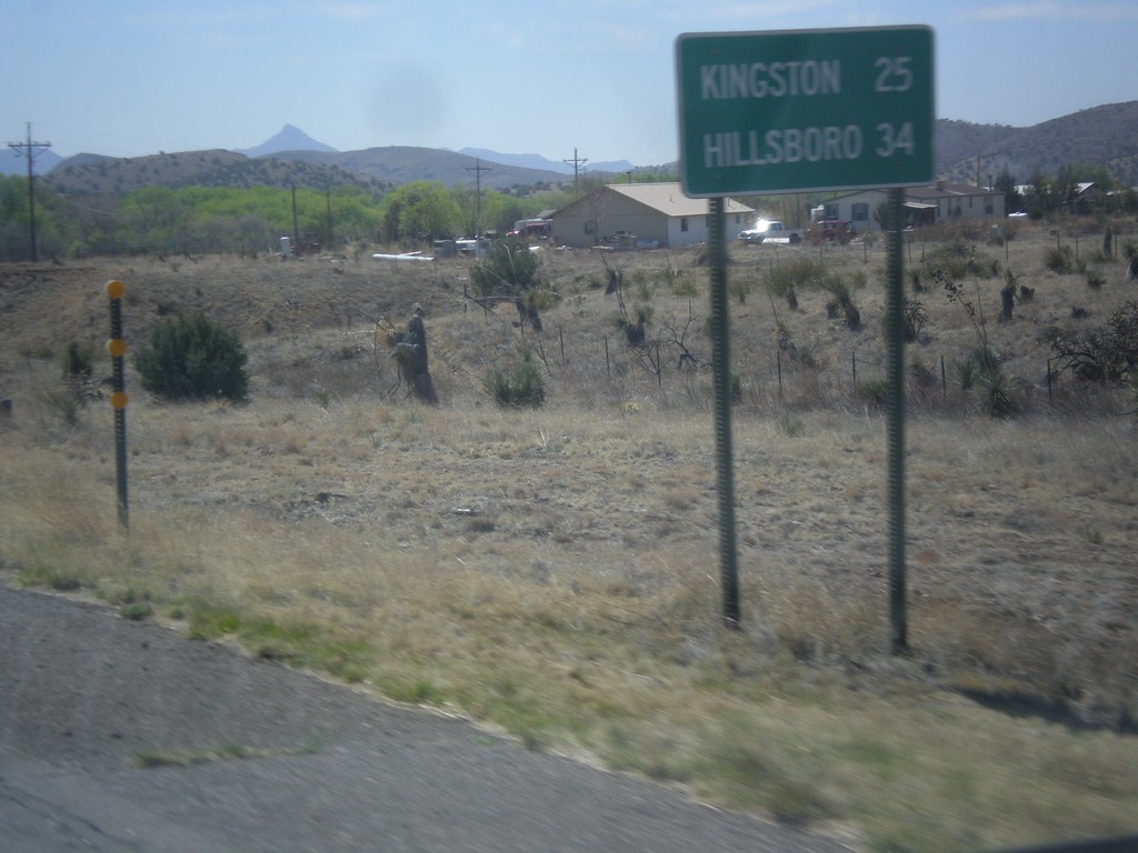
NM-152 East - Distance Marker
Distance marker on NM-152 east. Distance to Kingston and Hillsboro.
Taken 04-14-2013
Hanover
Grant County
New Mexico
United States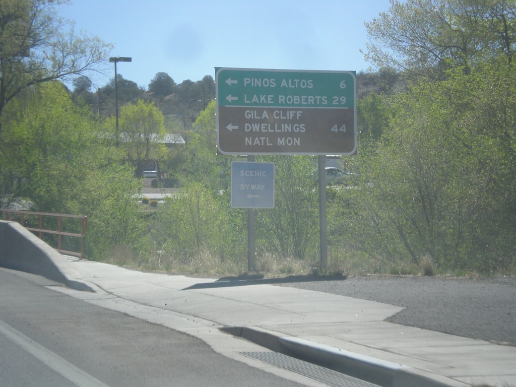
US-180 East at NM-15
US-180 east at NM-15 north to Pinos Altos, Lake Roberts, and Gila Cliff Dwellings National Monument.
Taken 04-14-2013
 Silver City
Grant County
New Mexico
United States
Silver City
Grant County
New Mexico
United States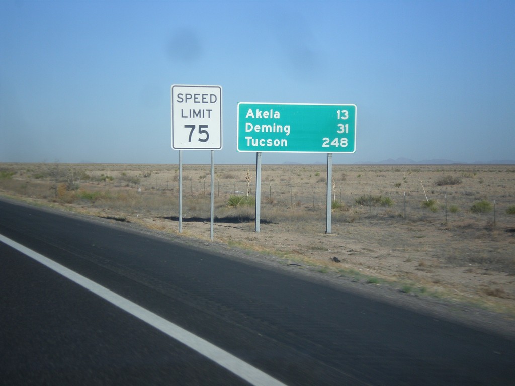
I-10 West - Distance Marker
Distance marker on I-10 west. Distance to Akela, Deming, and Tucson (Arizona).
Taken 04-14-2013
Las Cruces
Doña Ana County
New Mexico
United States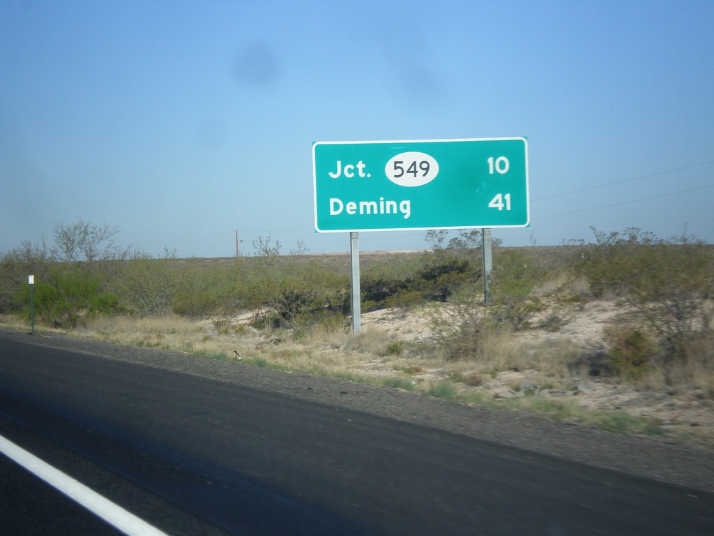
I-10 West - Distance Marker
Distance marker on I-10 west. Distance to NM-549 and Deming.
Taken 04-14-2013
Las Cruces
Doña Ana County
New Mexico
United States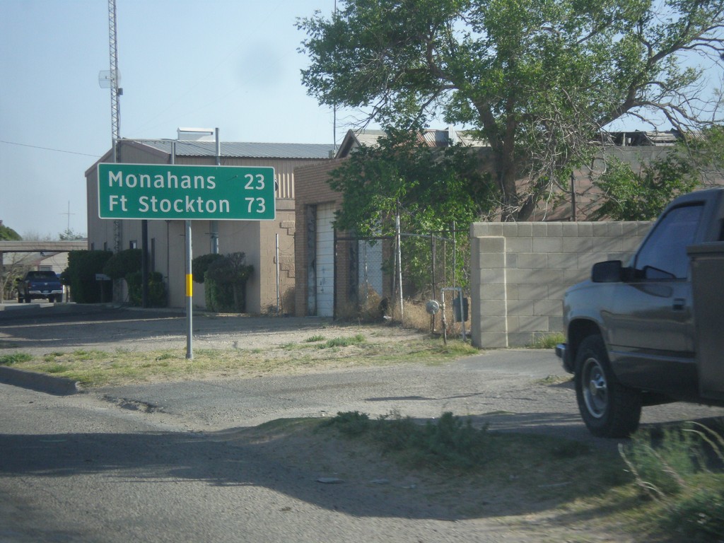
TX-18 South - Distance Marker
Distance marker on TX-18 south. Distance to Monahans and Fort Stockton.
Taken 04-14-2013
 Kermit
Winkler County
Texas
United States
Kermit
Winkler County
Texas
United States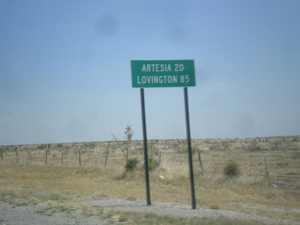
US-82 East - Distance Marker
Distance marker on US-82 east, leaving Hope, NM. Distance to Artesia, and Lovington. The text on this distance marker is centred instead of the typical left aligned.
Taken 04-14-2013
 Artesia
Eddy County
New Mexico
United States
Artesia
Eddy County
New Mexico
United States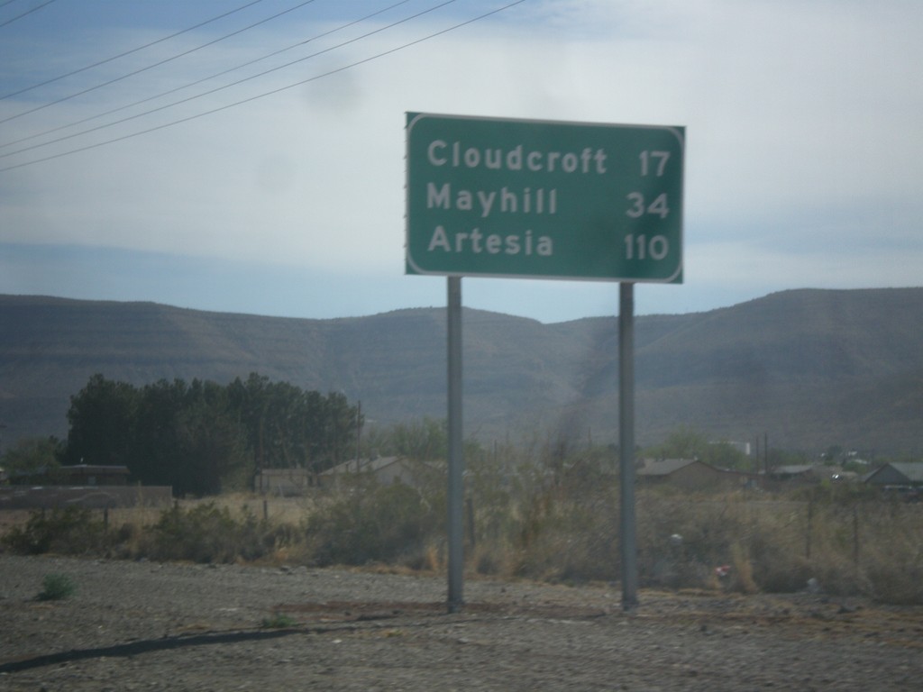
US-82 East - Distance Marker
Distance marker on US-82 east, leaving Alamogordo. Distance to Cloudcroft, Mayhill, and Artesia.
Taken 04-14-2013
Alamogordo
Otero County
New Mexico
United States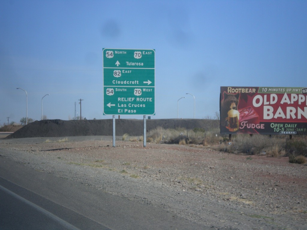
White Sands Blvd. North at US-54/US-70/US-82
White Sands Blvd. North at US-54/US-70/US-82 in Alamogordo. Turn left for US-54 South/US-70 West/Relief Route/Las Cruces/El Paso. Turn right for US-82/Cloudcroft. Continue straight for US-54 North/US-70 East/Tularosa. This is the northern end of the Alamogordo Relief Route. This is also the western terminus of US-82.
Taken 04-14-2013
Alamogordo
Otero County
New Mexico
United States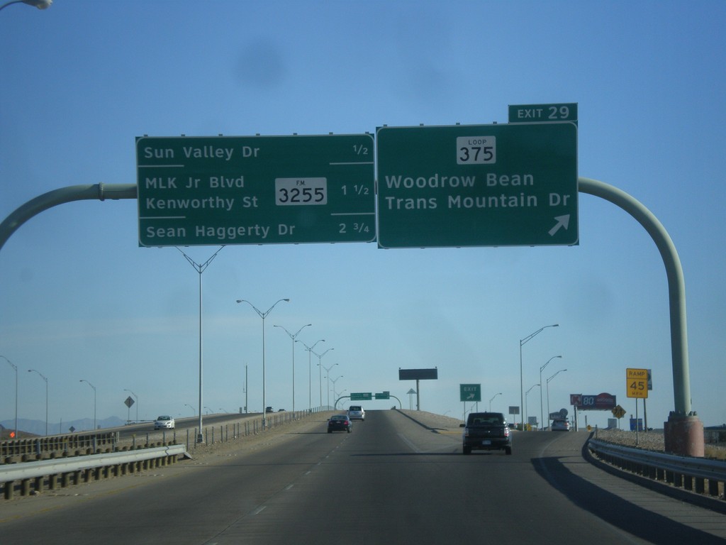
US-54 North - Exit 29
US-54 north at Exit 29 - TX-375 Loop North/Woodrow Bean Transmountain Drive. This is the northern end of the TX-375 Loop around El Paso. Approaching Sun Valley Drive, FM-3255/MLK Jr. Blvd./Kenworthy St./Sean Haggerty Drive interchanges.
Taken 04-14-2013

 El Paso
 County
Texas
United States
El Paso
El Paso County
Texas
United States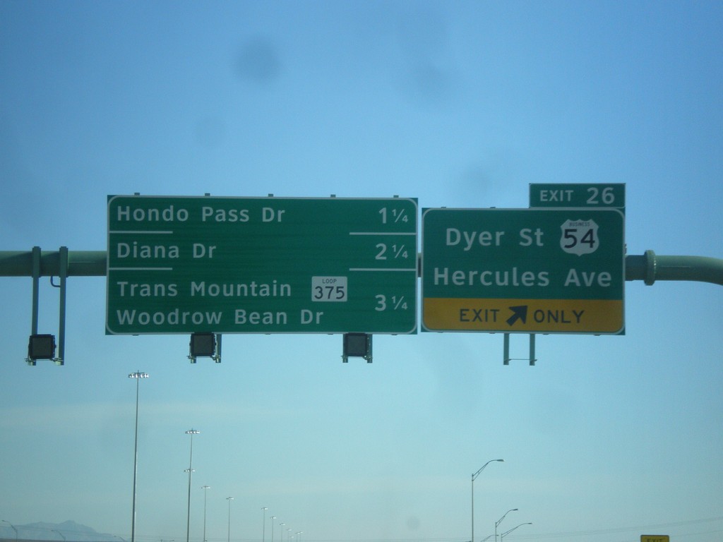
US-54 North - Exit 26
US-54 north at Exit 26 - Business US-54/Dyer St./Hercules Ave. Approaching Hondo Pass Road, Diana Drive, and TX-375 Loop/Trans Mountain Woodrow Bean Drive.
Taken 04-14-2013
 El Paso
 County
Texas
United States
El Paso
El Paso County
Texas
United States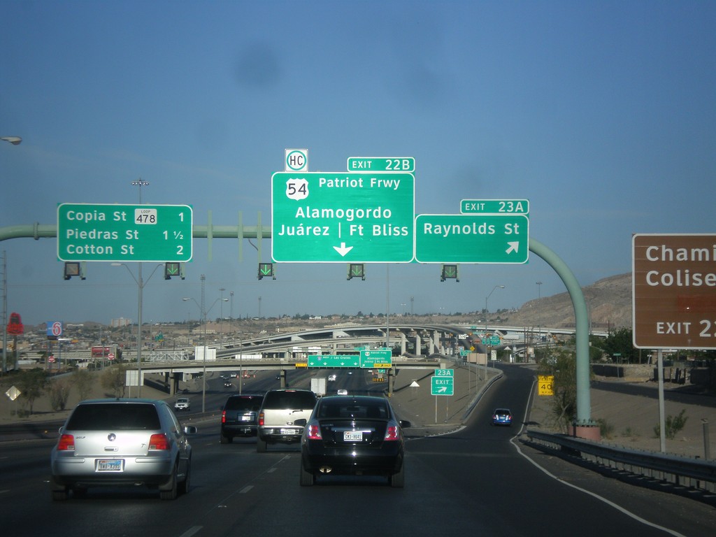
I-10 West - Exits 23A and 22B
I-10 west at Exit 23A - Raynolds St. Approaching Exit 22B - US-54/Patriot Freeway/Alamogordo/Fort Bliss/Juárez (Mexico). Also approaching Copia St., and Piedras St./Cotton St interchanges.
Taken 04-14-2013
 El Paso
 County
Texas
United States
El Paso
El Paso County
Texas
United States