Signs Tagged With Distance Marker
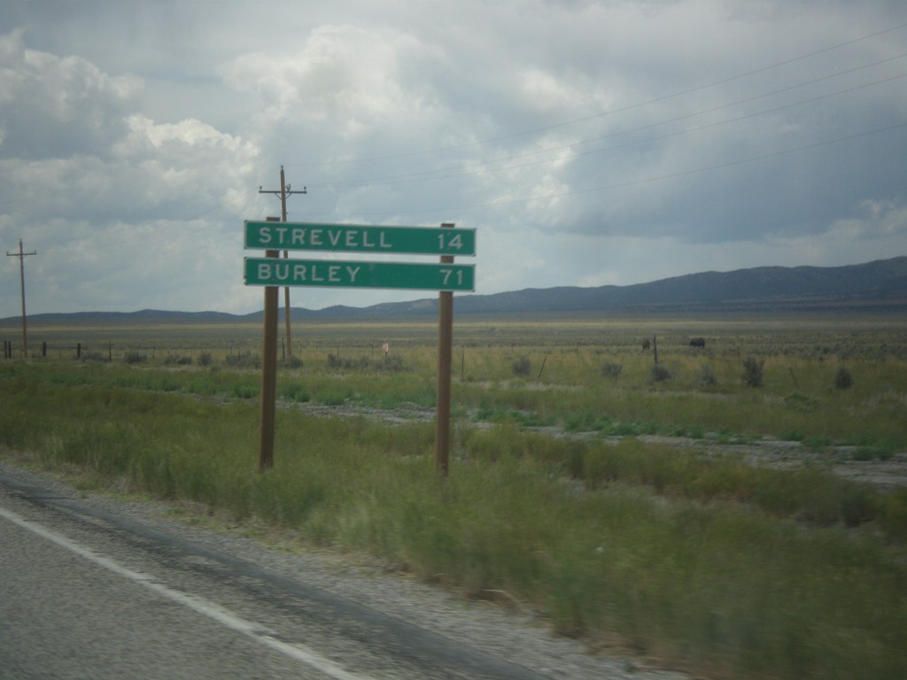
UT-30 West - Distance Marker
Distance marker on UT-30 west. Distance to Strevell, and Burley. Both of these communities are in Idaho, and both are accessed via UT-42.
Taken 06-21-2014
 Snowville
Box Elder County
Utah
United States
Snowville
Box Elder County
Utah
United States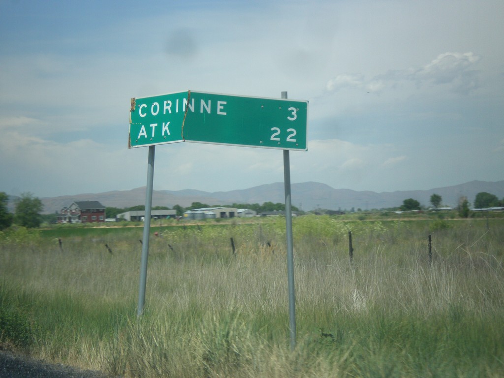
UT-13 North - Distance Marker
Distance marker on UT-13 north. Distance to Corrine, and ATK (an aerospace company).
Taken 06-21-2014
 Brigham City
Box Elder County
Utah
United States
Brigham City
Box Elder County
Utah
United States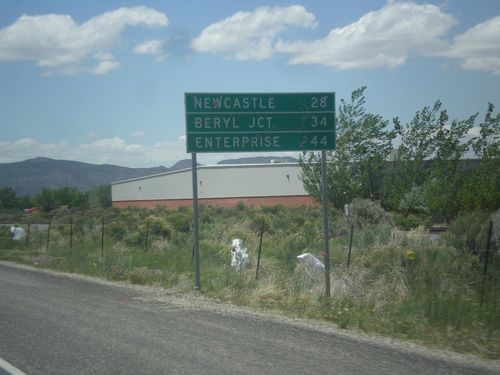
UT-56 West - Distance Marker
Distance marker on UT-56 west. Distance to Newcastle, Beryl Junction, and Enterprise.
Taken 05-21-2014
 Cedar City
Iron County
Utah
United States
Cedar City
Iron County
Utah
United States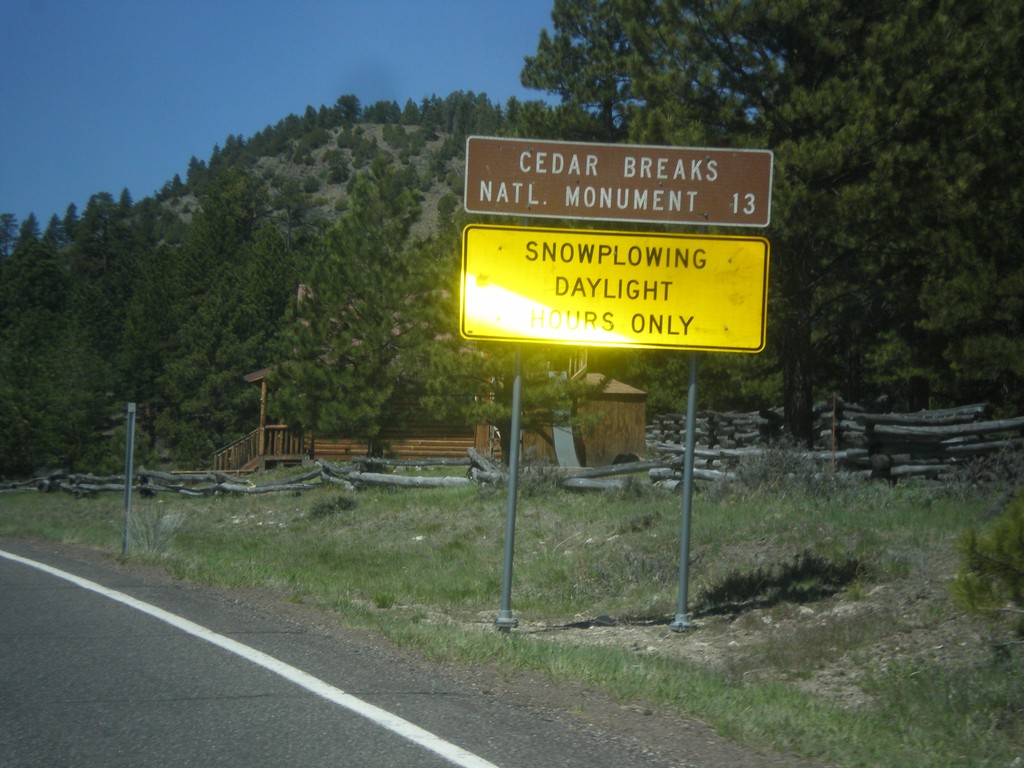
UT-143 - Distance Marker
Distance marker on UT-143 south. Distance to Cedar Breaks National Monument. Below distance marker is another sign reading Snow Plowing Daylight Hours Only.
Taken 05-21-2014
 Panguitch
Garfield County
Utah
United States
Panguitch
Garfield County
Utah
United States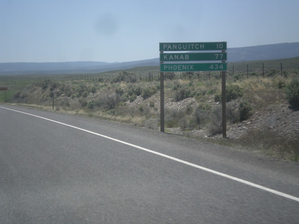
US-89 South - Distance Marker
Distance marker on US-89 south. Distance to Panguitch, Kanab, and Phoenix (Arizona).
Taken 05-19-2014
 Spry
Garfield County
Utah
United States
Spry
Garfield County
Utah
United States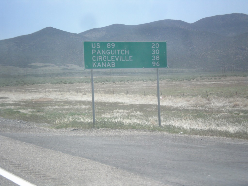
UT-20 East - Distance Marker
Distance marker on UT-20 east. Distance to US-89, Panguitch, Circleville, and Kanab.
Taken 05-19-2014
 Paragonah
Iron County
Utah
United States
Paragonah
Iron County
Utah
United States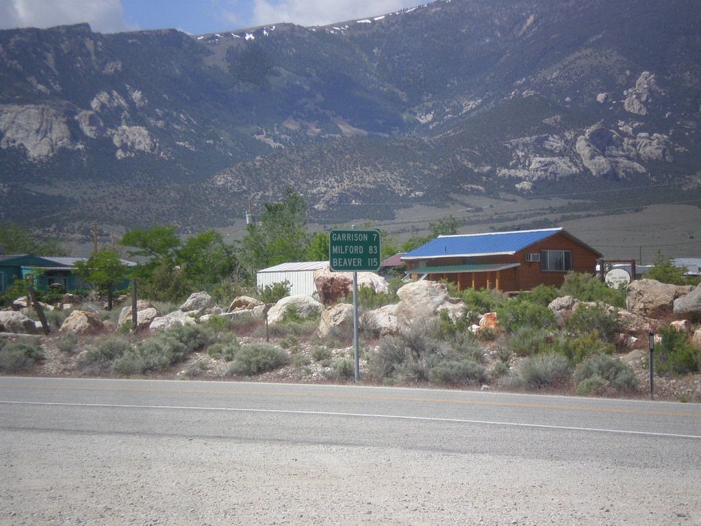
NV-487 South - Distance Marker
Distance marker on NV-487 south. Distance to Gunnison, Milford, and Beaver. All three locations are located in Utah.
Taken 05-19-2014
 Baker
White Pine County
Nevada
United States
Baker
White Pine County
Nevada
United States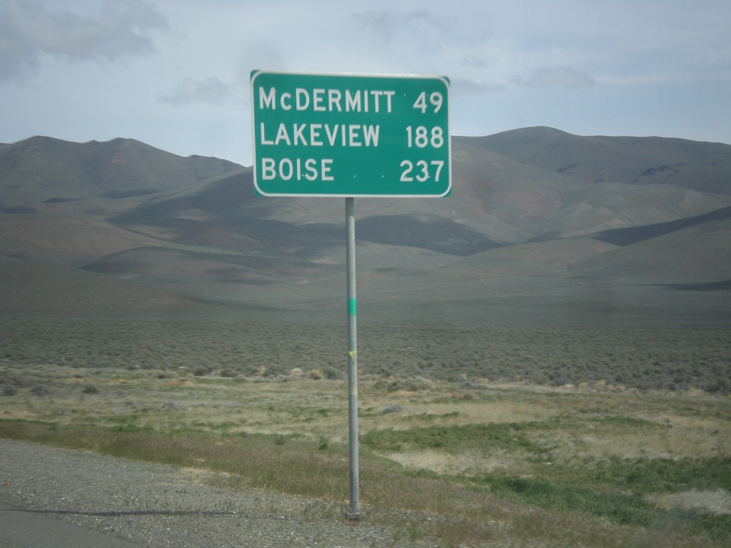
US-95 North - Distance Marker
Distance marker on US-95 north. Distance to McDermit, Lakeview (Oregon - via NV-140), and Boise (Idaho).
Taken 05-06-2014
 Winnemucca
Humboldt County
Nevada
United States
Winnemucca
Humboldt County
Nevada
United States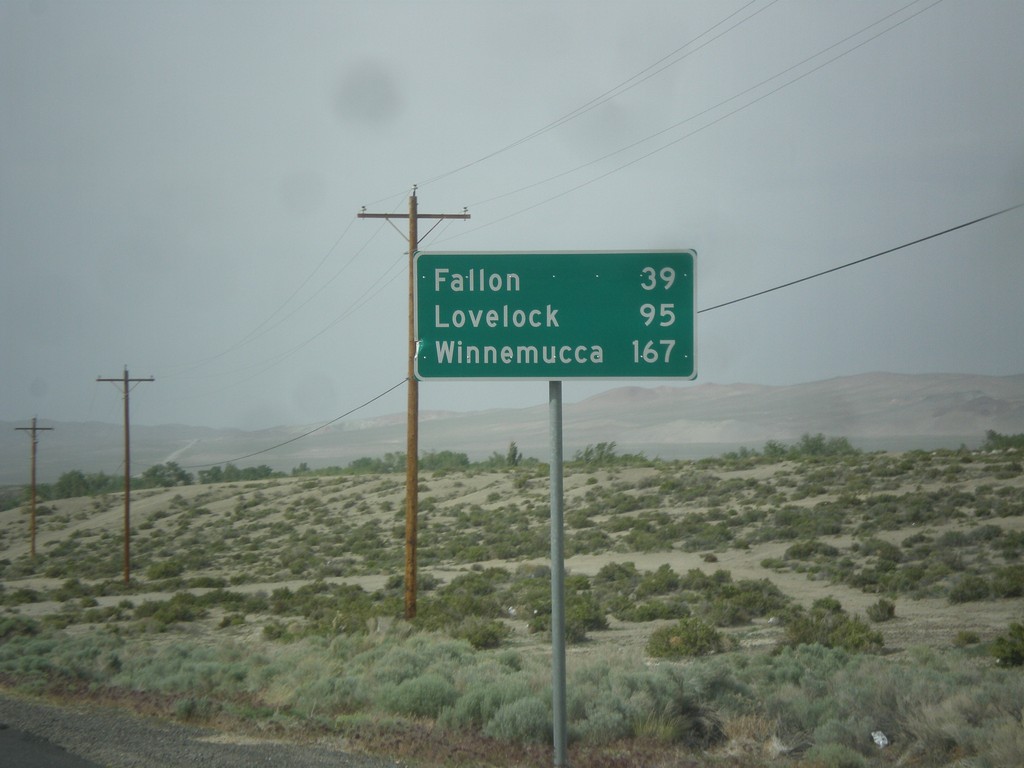
US-95 North - Distance Marker
Distance marker on US-95 north. Distance to Fallon, Lovelock, and Winnemucca. This sign was upgraded to the Clearview font since the last time I photographed it in 2006.
Taken 05-05-2014
Schurz
Mineral County
Nevada
United States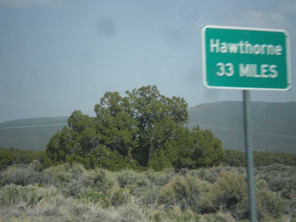
NV-359 North - Distance Marker
Distance marker on NV-359 north. Distance to Hawthorne. This sort of sign is common in Nevada where there is only one city listed as a destination.
Taken 05-05-2014
 Mina
Mineral County
Nevada
United States
Mina
Mineral County
Nevada
United States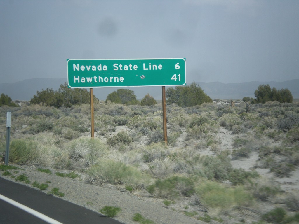
CA-167 East - Distance Marker
Distance marker on CA-167 east. Distance to Nevada State Line and Hawthorne (Nevada).
Taken 05-05-2014
 Lee Vining
Mono County
California
United States
Lee Vining
Mono County
California
United States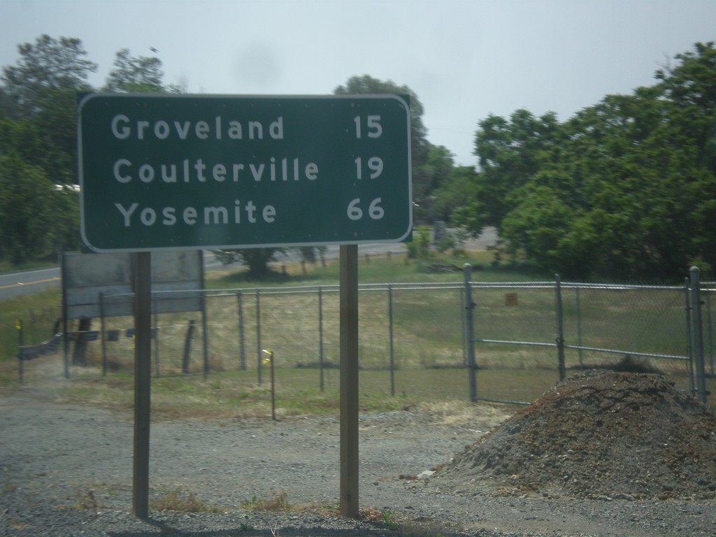
CA-49 South/CA-120 East - Distance Marker
Distance marker on CA-49 South/CA-120 East. Distance to Groveland, Coulterville, and Yosemite.
Taken 05-05-2014

 Chinese Camp
Tuolumne County
California
United States
Chinese Camp
Tuolumne County
California
United States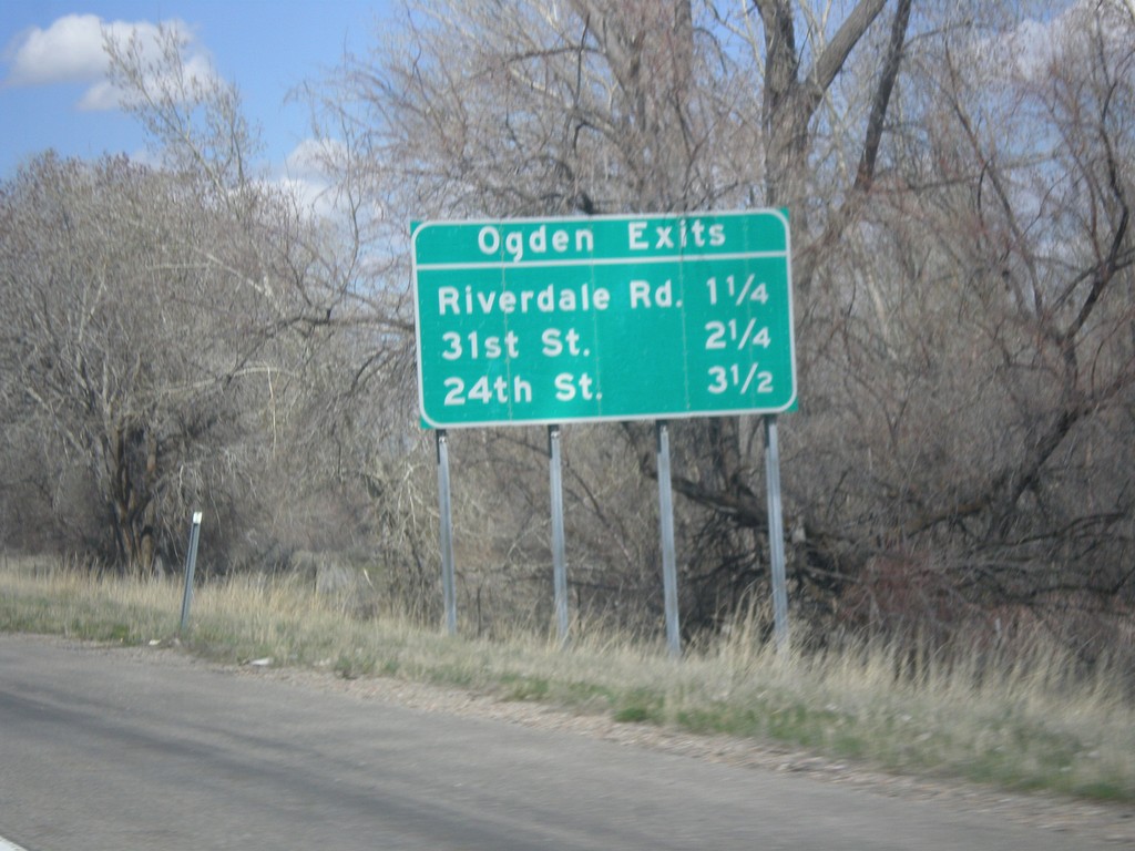
I-84 West - Ogden Exits
Ogden Exits on I-84 west. Next three exits: Riverdale Road, 31st St., and 24th St.
Taken 03-31-2014
 South Weber
Weber County
Utah
United States
South Weber
Weber County
Utah
United States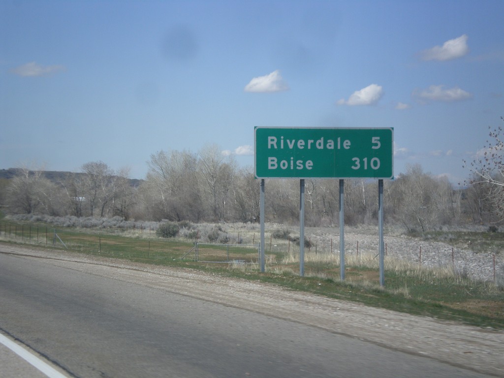
I-84 West - Distance Marker
Distance marker on I-84 west. Distance to Riverdale and Boise. This is the first appearance of Boise on a distance marker on I-84 west.
Taken 03-31-2014
South Weber
Davis County
Utah
United States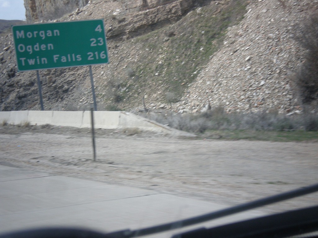
I-84 West - Distance Marker
Distance marker on I-84 west. Distance to Morgan, Ogden, and Twin Falls (Idaho).
Taken 03-31-2014
Morgan
Morgan County
Utah
United States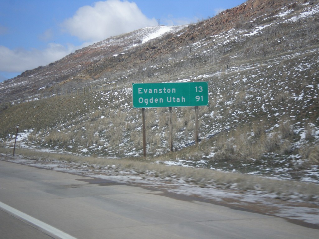
I-80 West - Distance Marker
Distance marker on I-80 west. Distance to Evanston, and Ogden, Utah (via I-84).
Taken 03-31-2014

 Evanston
Uinta County
Wyoming
United States
Evanston
Uinta County
Wyoming
United States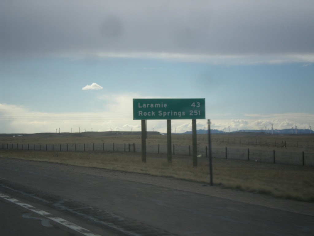
I-80 West - Distance Marker
Distance marker on I-80 west. Distance to Laramie, and Rock Springs.
Taken 03-30-2014
 Cheyenne
Laramie County
Wyoming
United States
Cheyenne
Laramie County
Wyoming
United States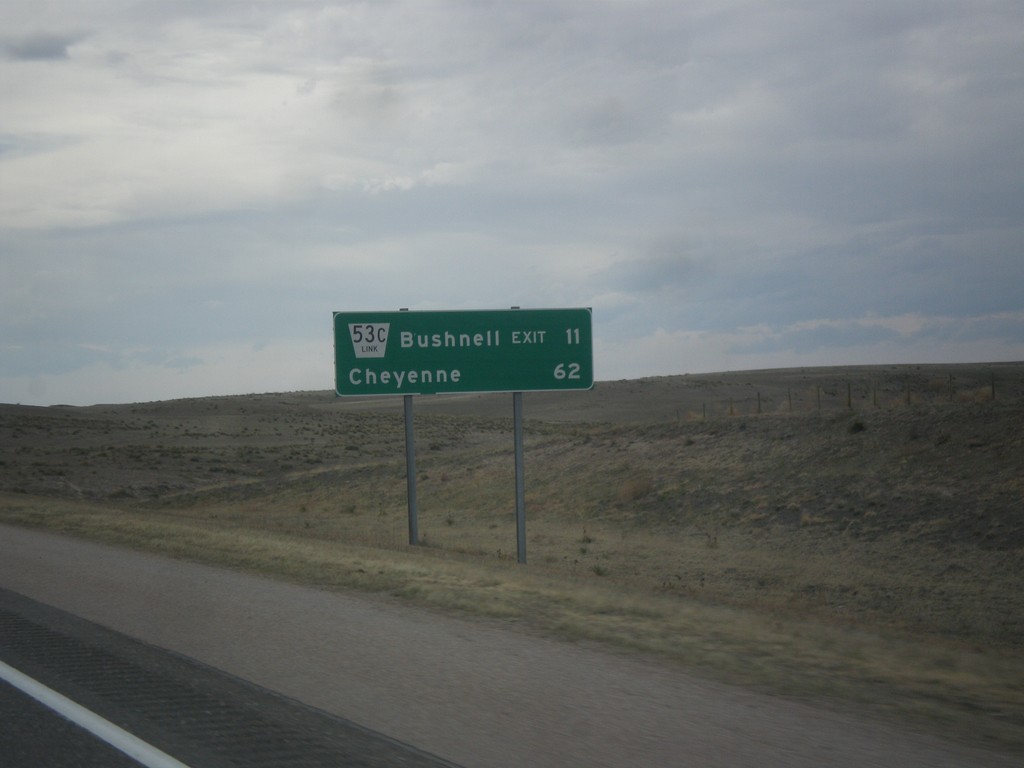
I-80 West - Distance Marker
Distance marker on I-80 west. Distance to NE-53C Link/Bushell Exit and Cheyenne (Wyoming).
Taken 03-30-2014
Kimball
Kimball County
Nebraska
United States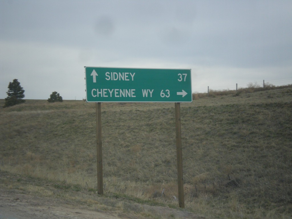
NE-71 South at I-80
NE-71 south at I-80. Use I-80 West/NE-71 South for Cheyenne, WY; I-80 East for Sidney.
Taken 03-30-2014
 Kimball
 County
Nebraska
United States
Kimball
Kimball County
Nebraska
United States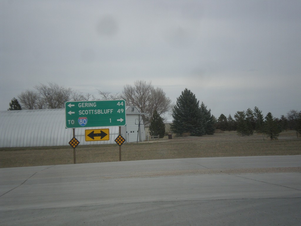
End NE-53E Link at NE-71
End NE-53E Link at NE-71. Use NE-71 north for Gering and Scottsbluff. Use NE-71 south for I-80.
Taken 03-30-2014
 Kimball
 County
Nebraska
United States
Kimball
Kimball County
Nebraska
United States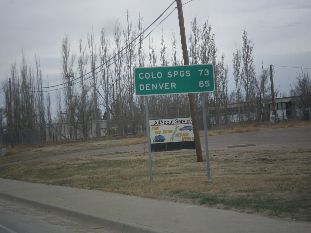
BL-70/US-24/US-40 West/US-287 North - Distance Marker
Distance marker on BL-70/US-24/US-40 West/US-287 North. Distance to Colorado Springs (via US-24) and Denver (via I-70).
Taken 03-30-2014


 Limon
Lincoln County
Colorado
United States
Limon
Lincoln County
Colorado
United States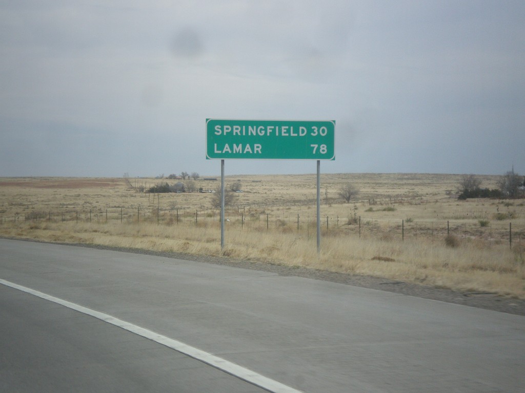
US-287/US-385 North - Distance Marker
Distance marker to Springfield and Lamar on US-287/US-385 north at the Oklahoma-Colorado stateline.
Taken 03-30-2014
 Campo
Baca County
Colorado
United States
Campo
Baca County
Colorado
United States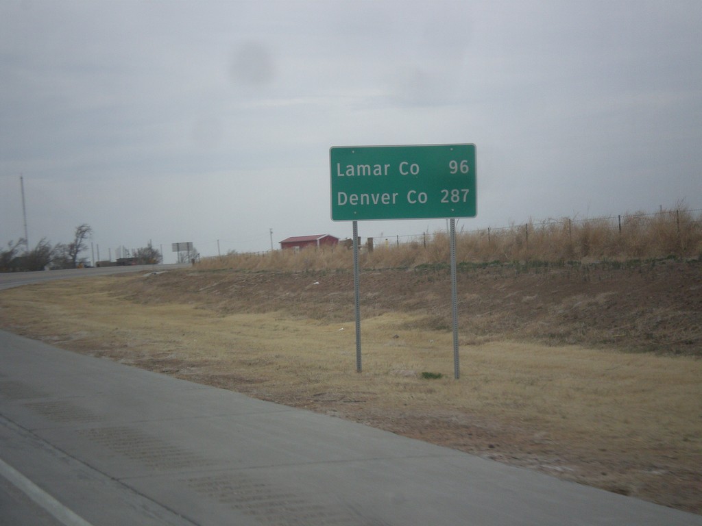
US-287/US-385 North/OK-3 East - Distance Marker
Distance marker on US-287/US-385 North/OK-3 east. Distance to Lamar, CO and Denver, CO.
Taken 03-30-2014
 Boise City
Cimarron County
Oklahoma
United States
Boise City
Cimarron County
Oklahoma
United States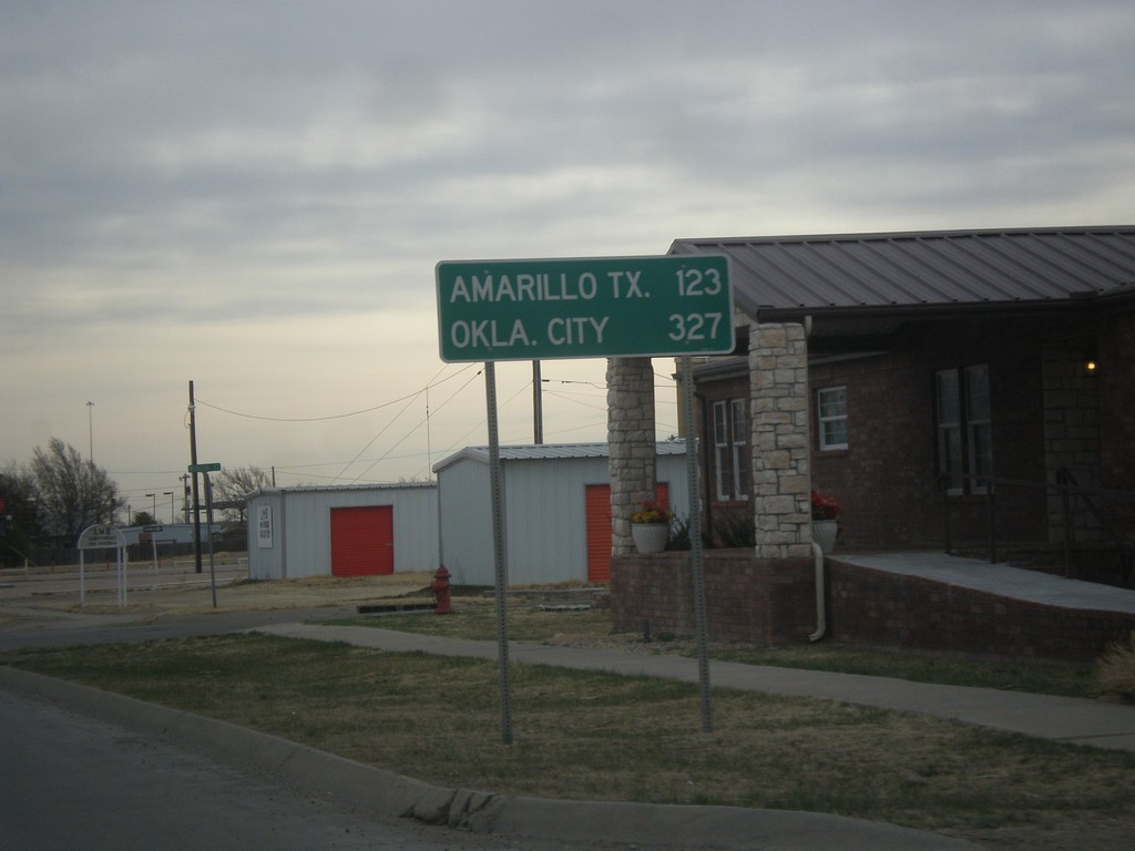
US-56/US-64/US-412/OK-3 East - Distance Marker
Distance marker on US-56/US-64/US-412/OK-3 East. Distance to Amarillo, TX and Oklahoma City.
Taken 03-30-2014


 Boise City
Cimarron County
Oklahoma
United States
Boise City
Cimarron County
Oklahoma
United States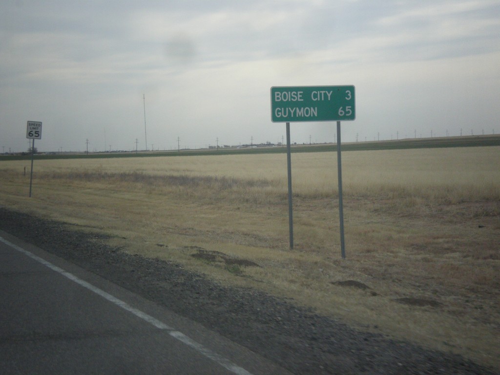
US-56/US-64/US-412 East/US-385 North - Distance Marker
Distance marker on US-56/US-64/US-412 East/US-385 North. Distance to Boise City and Guymon. Speed limit on this stretch of highway is 65 MPH.
Taken 03-30-2014
Boise City
Cimarron County
Oklahoma
United States