Signs Tagged With Distance Marker
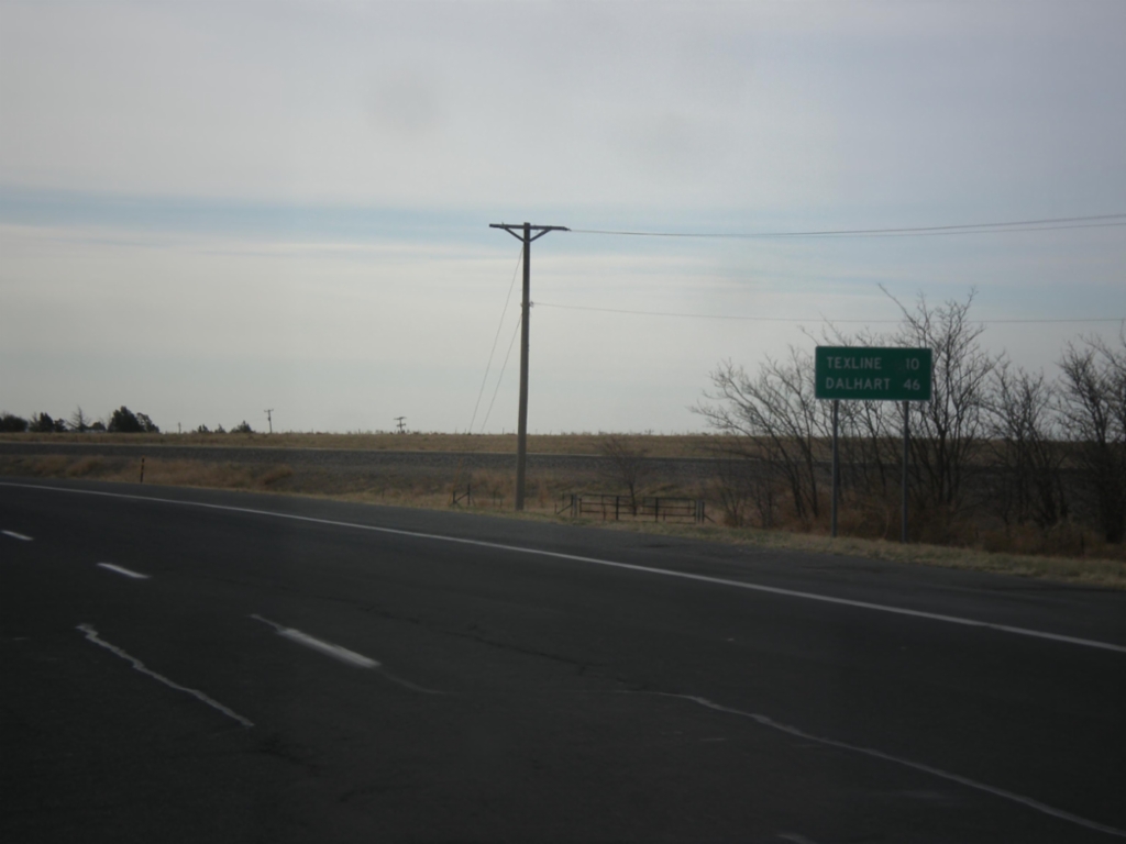
US-87 East - Distance Marker
Distance marker on US-87 east. Distance to Texline and Dalhart, both of which are in Texas. This is the last distance marker along US-87 east in New Mexico.
Taken 03-30-2014
 Clayton
Union County
New Mexico
United States
Clayton
Union County
New Mexico
United States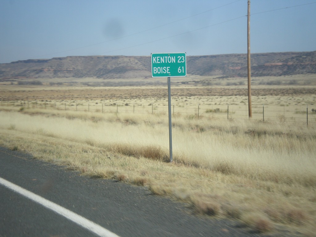
NM-456 East - Distance Marker
Distance marker on NM-456 east. Distance to Kenton, and Boise. Both destinations are in Oklahoma.
Taken 03-29-2014
 Folsom
Union County
New Mexico
United States
Folsom
Union County
New Mexico
United States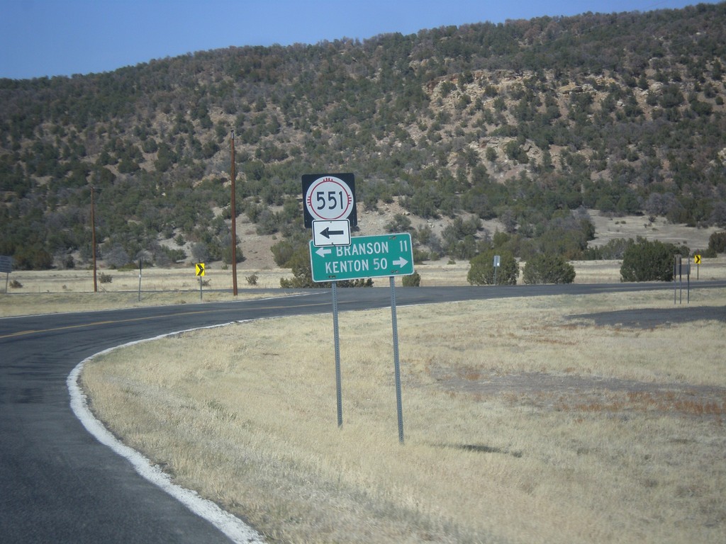
NM-456 East at NM-551 North
NM-456 east at NM-551 north to Branson (Colorado). Continue east on NM-456 for Kenton (Oklahoma).
Taken 03-29-2014
 Folsom
Union County
New Mexico
United States
Folsom
Union County
New Mexico
United States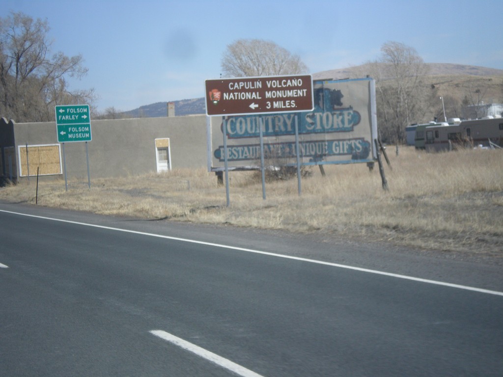
US-64/US-87 East - Capulin National Monument
US-64/US-87 east approaching NM-325. Use NM-325 north for Capulin Volcano National Monument.
Taken 03-29-2014

 Capulin
Union County
New Mexico
United States
Capulin
Union County
New Mexico
United States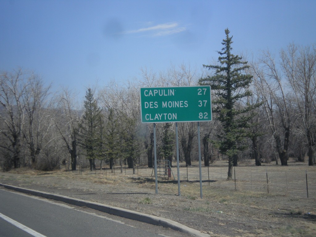
US-64/US-87 East - Distance Marker
Distance marker on US-64/US-87 East to Capulin, Des Moines, and Clayton.
Taken 03-29-2014
Raton
Colfax County
New Mexico
United States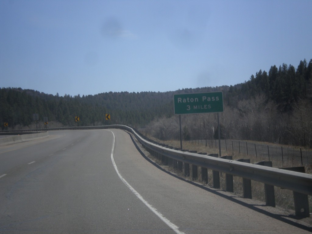
I-25 South - Raton Pass 3 Miles
Distance to top of Raton Pass on I-25 south. Raton Pass - 3 Miles.
Taken 03-29-2014
 Trinidad
Las Animas County
Colorado
United States
Trinidad
Las Animas County
Colorado
United States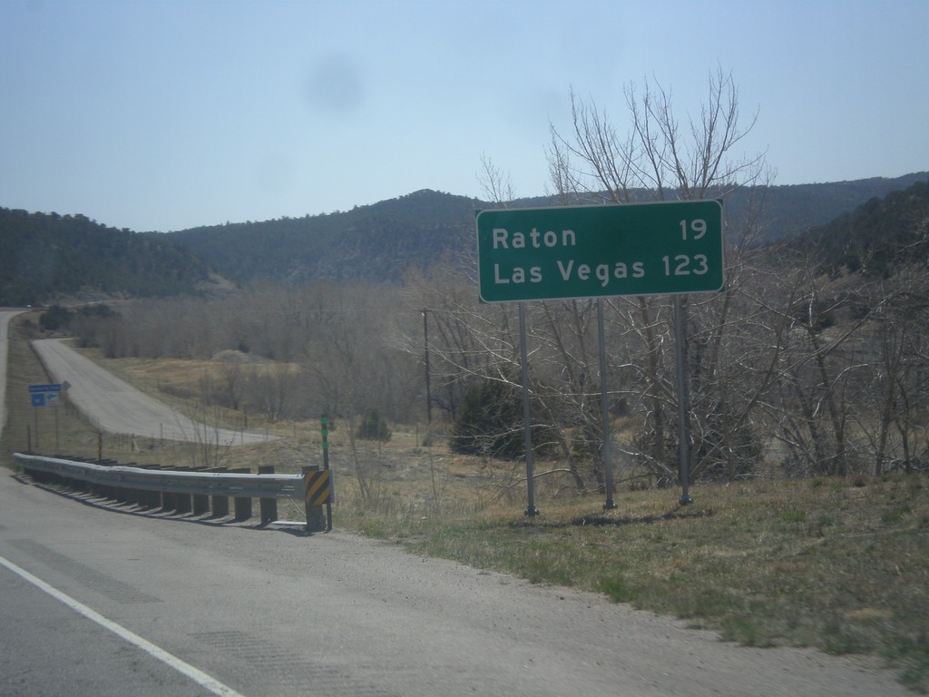
I-25 South - Distance Marker
Distance marker on I-25 south to Raton and Las Vegas. Both destination cities are in New Mexico.
Taken 03-29-2014
Trinidad
Las Animas County
Colorado
United States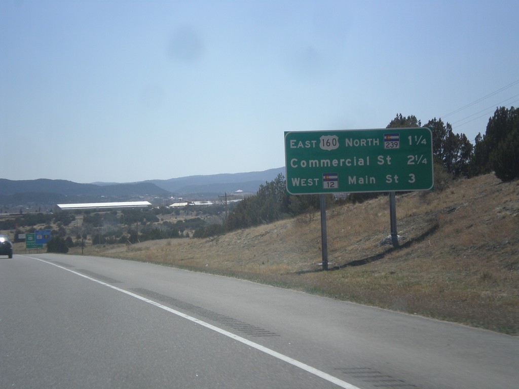
I-25 South - Trinidad Exits
Trinidad Exits on I-25 south. Trinidad Exits: US-160 East/CO-239 North, Commercial St., CO-12 West/Main St.
Taken 03-29-2014
 Trinidad
Las Animas County
Colorado
United States
Trinidad
Las Animas County
Colorado
United States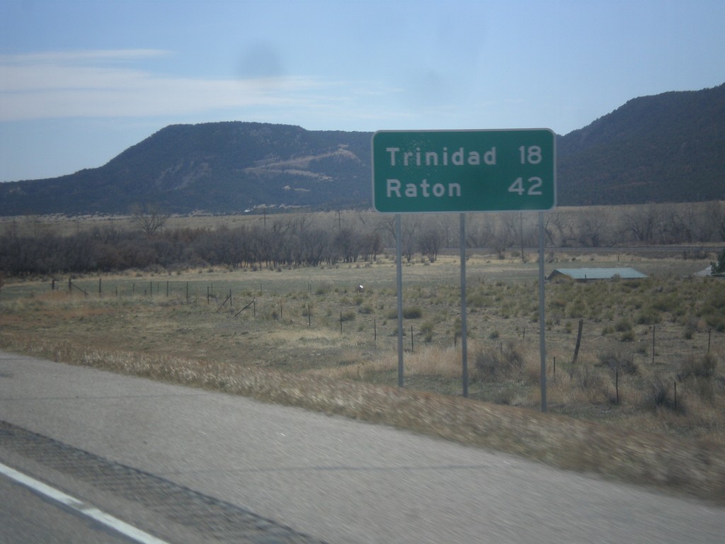
I-25 South - Distance Marker
Distance marker on I-25 south. Distance to Trinidad and Raton (New Mexico).
Taken 03-29-2014
Aguilar
Las Animas County
Colorado
United States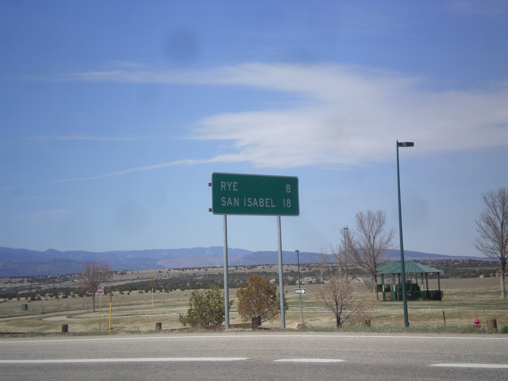
CO-165 West - Distance Marker
Distance marker on CO-165 west. Distance to Rye and San Isabel.
Taken 03-29-2014
 Colorado City
Pueblo County
Colorado
United States
Colorado City
Pueblo County
Colorado
United States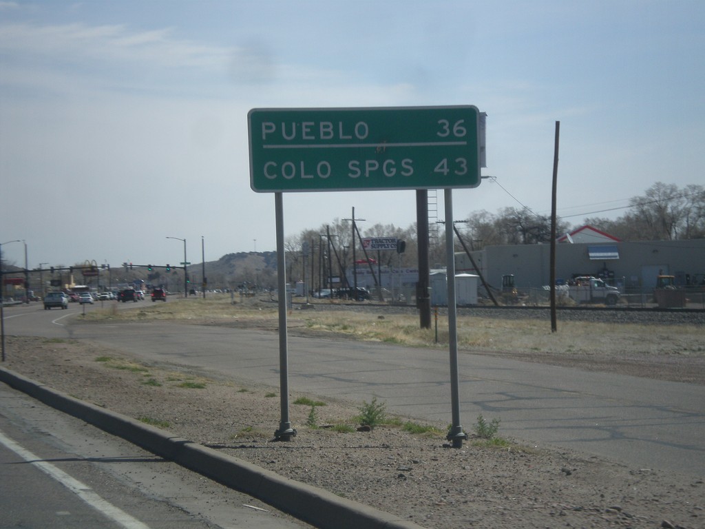
US-50 East - Distance Marker
Distance marker on US-50 east. Distance to Colorado Springs and Pueblo.
Taken 03-29-2014
 Cañon City
Fremont County
Colorado
United States
Cañon City
Fremont County
Colorado
United States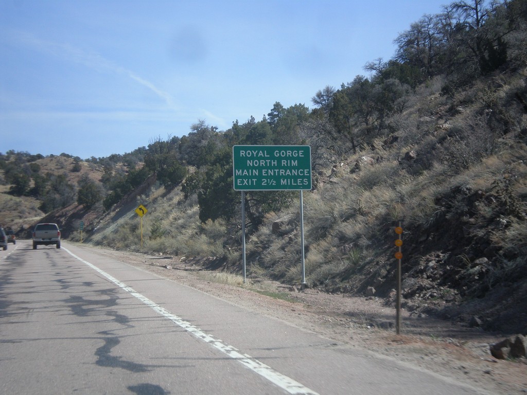
US-50 East - Royal Gorge North Rim
Distance marker on US-50 east for the Royal Gorge North Rim Main Entrance, 2.5 miles. This sign is immediately after the turn off to the South Rim of Royal Gorge.
Taken 03-29-2014
Cañon City
Fremont County
Colorado
United States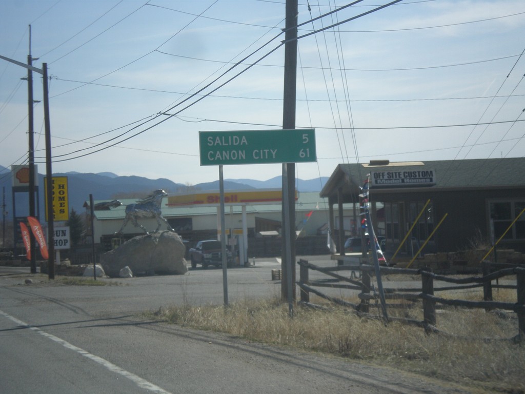
US-50 East - Distance Marker
Distance marker on US-50 east. Distance to Salida and Canon City.
Taken 03-29-2014
Salida
Chaffee County
Colorado
United States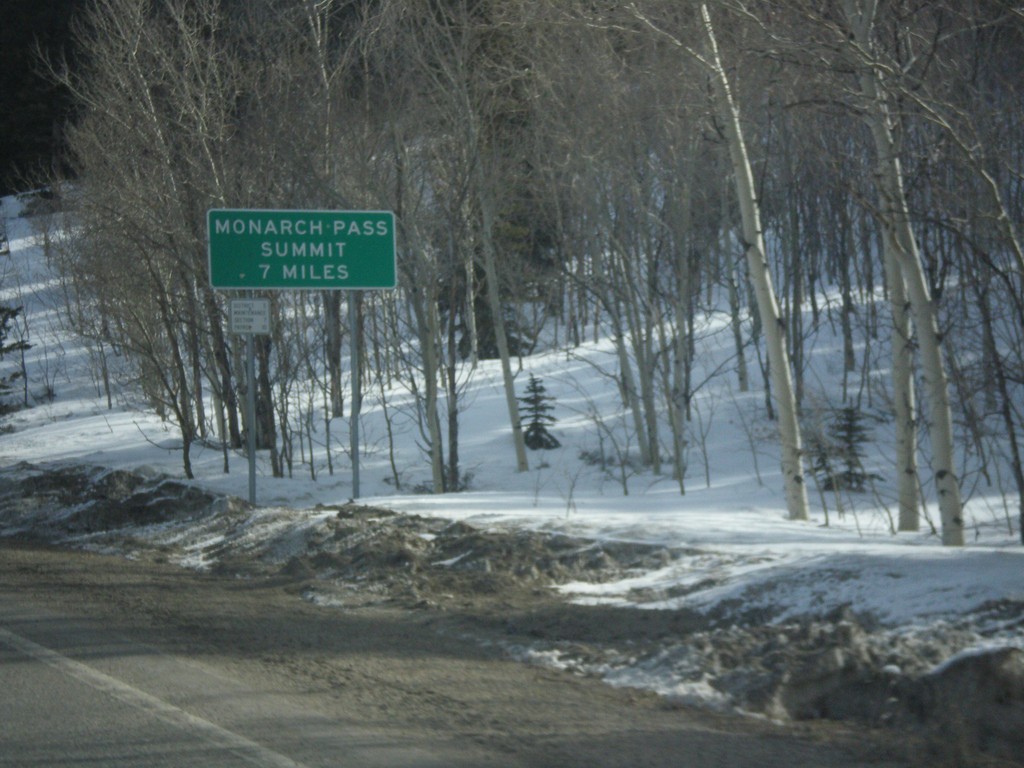
US-50 East - Monarch Pass Summit 7 Miles
Beginning climb up Monarch Pass on US-50 east. Monarch Pass Summit is 7 miles from this point.
Taken 03-29-2014
Sargents
Saguache County
Colorado
United States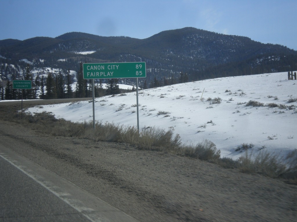
US-50 East - Distance Marker
Distance to Canon City and Fairplay on US-50 east. In the background is the highway enters Gunnison County.
Taken 03-29-2014
Sargents
Saguache County
Colorado
United States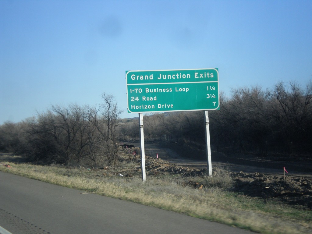
I-70 East - Grand Junction Exits
Grand Junction Exits on I-70 east. Next three exits are I-70 Business Loop, 24 Road, and Horizon Drive.
Taken 03-28-2014
 Fruita
Mesa County
Colorado
United States
Fruita
Mesa County
Colorado
United States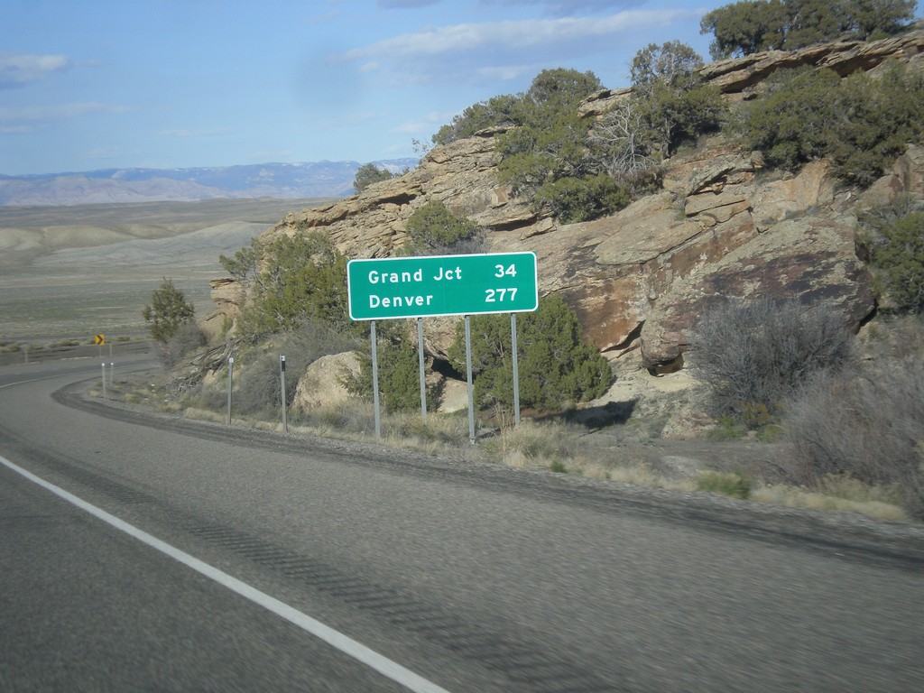
I-70 East - Distance Marker
Distance marker on I-70 west. Distance to Grand Junction and Denver. This is the last distance marker along I-70 in Utah.
Taken 03-28-2014
 Cisco
Grand County
Utah
United States
Cisco
Grand County
Utah
United States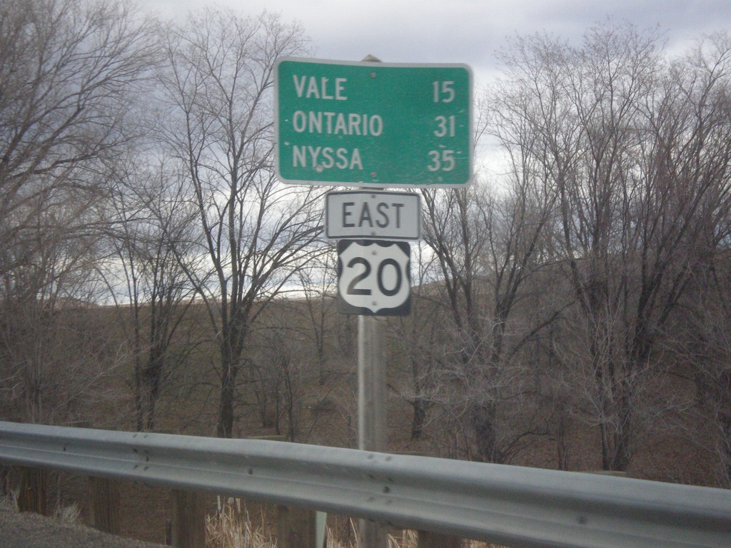
US-20 East - Distance Marker
Distance marker on US-20 east to Vale, Ontario, and Nyssa. Missing US-20 shield on sign.
Taken 02-17-2014
 Harper
Malheur County
Oregon
United States
Harper
Malheur County
Oregon
United States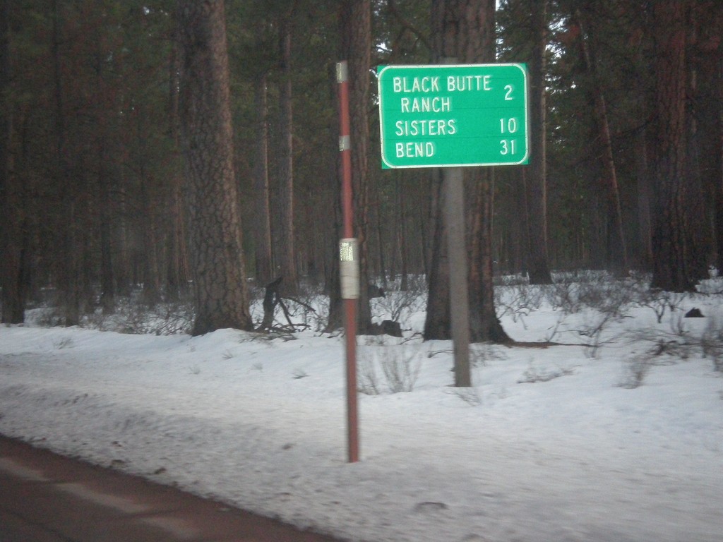
US-20/OR-126 East - Distance Marker
Distance marker on US-20/OR-126 East to Black Butte Ranch, Sisters, and Bend.
Taken 02-16-2014
 Camp Sherman
Deschutes County
Oregon
United States
Camp Sherman
Deschutes County
Oregon
United States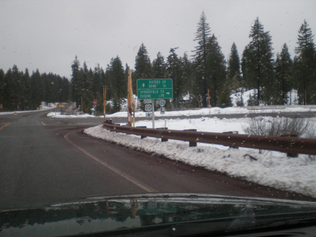
US-20 East at OR-126
US-20 east at OR-126. Turn right for OR-126 west to Eugene and Springfield. Continue east on US-20/OR-126 for Sisters and Bend. OR-126 joins US-20 over Santiam Pass to Sisters.
Taken 02-16-2014
Santiam Junction
Linn County
Oregon
United States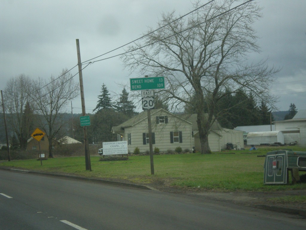
US-20 East - Distance Marker
Distance marker on US-20 east to Sweet Home and Bend.
Taken 02-16-2014
Lebanon
Linn County
Oregon
United States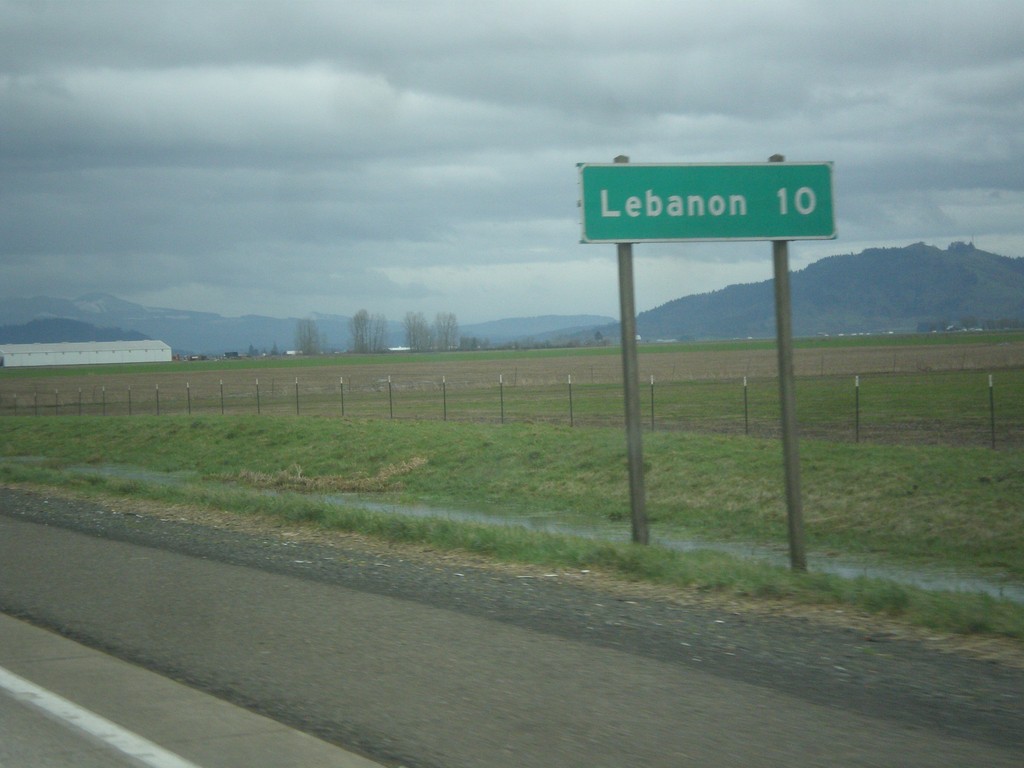
OR-34 East - Distance Marker
Distance marker on OR-34 east to Lebanon.
Taken 02-16-2014
 Tangent
Linn County
Oregon
United States
Tangent
Linn County
Oregon
United States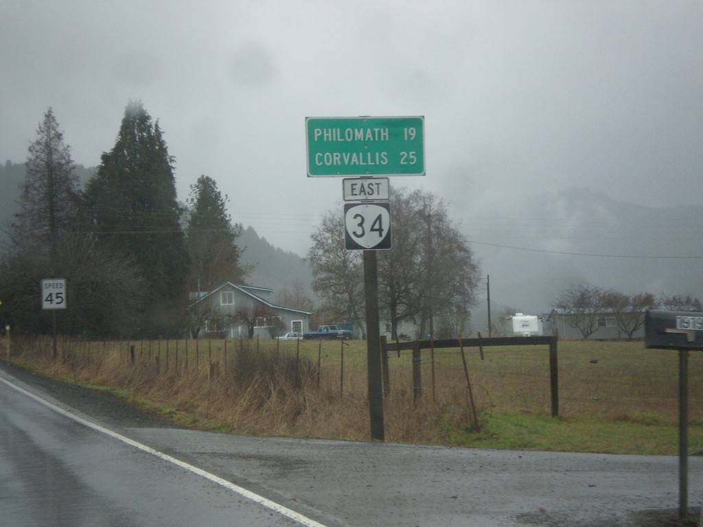
OR-34 East - Distance Marker
Distance marker on OR-34 east to Philomath and Corvallis.
Taken 02-16-2014
Alsea
Benton County
Oregon
United States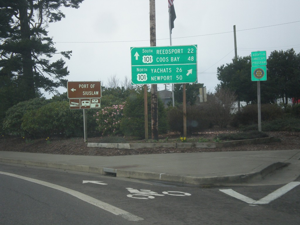
End OR-126 West at US-101
End OR-126 west at US-101. Turn right for US-101 north to Yachats and Newport; turn left for US-101 south to Reedsport and Coos Bay.
Taken 02-13-2014
 Florence
Lane County
Oregon
United States
Florence
Lane County
Oregon
United States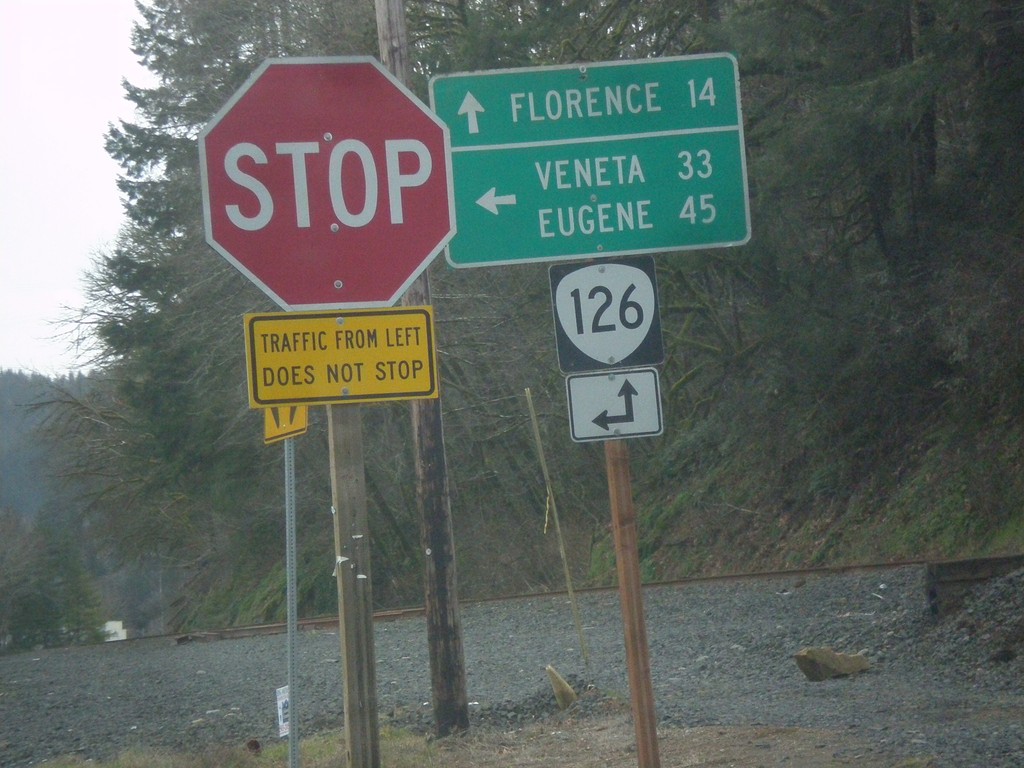
End OR-36 at OR-126
End OR-36 at OR-126. Turn left for OR-126 east to Veneta and Eugene; continue straight for OR-126 west to Florence.
Taken 02-13-2014
 Mapleton
Lane County
Oregon
United States
Mapleton
Lane County
Oregon
United States