Signs Tagged With Distance Marker
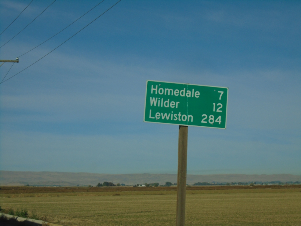
US-95 North - Distance Marker
Distance marker on US-95 north. Distance to Homedale, Wilder, and Lewiston.
Taken 10-19-2024
 Marsing
Owyhee County
Idaho
United States
Marsing
Owyhee County
Idaho
United States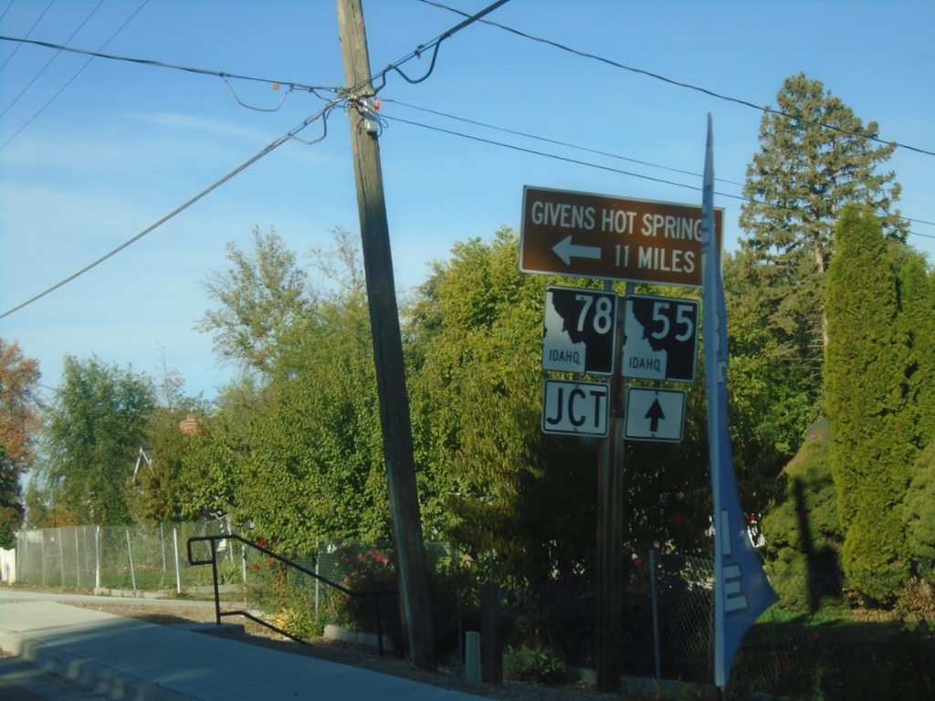
ID-55 South Approaching ID-78
ID-55 South approaching ID-78 east to Givens Hot Springs.
Taken 10-19-2024

 Marsing
Owyhee County
Idaho
United States
Marsing
Owyhee County
Idaho
United States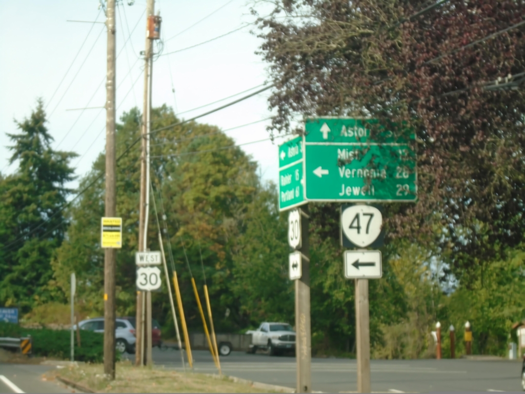
US-30 West at OR-47
US-30 West at OR-47 in Clatskanie. Use OR-47 south to Mist, Vernonia, and Jewell. Continue west on US-30 to Astoria.
Taken 09-22-2024

 Clatskanie
Columbia County
Oregon
United States
Clatskanie
Columbia County
Oregon
United States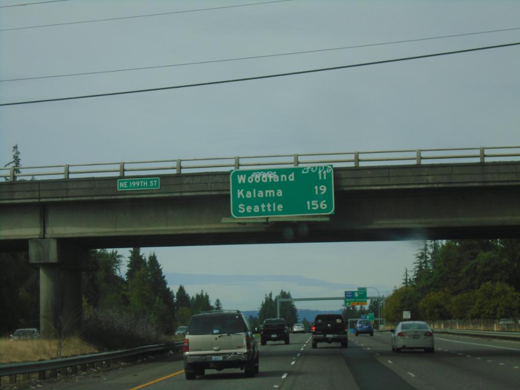
I-5 North - Distance Marker
Distance marker on I-5 north. Distance to Woodland, Kalama, and Seattle.
Taken 09-22-2024
 Ridgefield
Clark County
Washington
United States
Ridgefield
Clark County
Washington
United States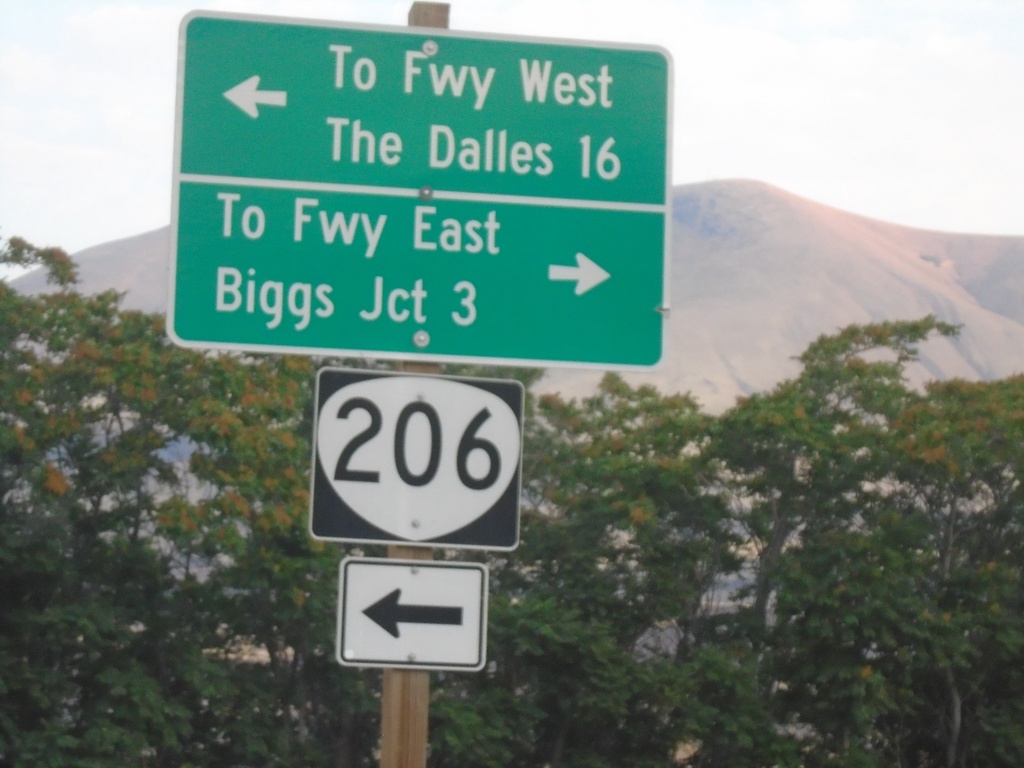
OR-206 West at Biggs-Rufus Highway
OR-206 West at Biggs-Rufus Highway. Turn left to continue on OR-206 west to Freeway West (I-84) and The Dalles. Turn right for Biggs-Rufus Highway to Freeway East (I-84) and Biggs Junction.
Taken 08-10-2024
 Wasco
Sherman County
Oregon
United States
Wasco
Sherman County
Oregon
United States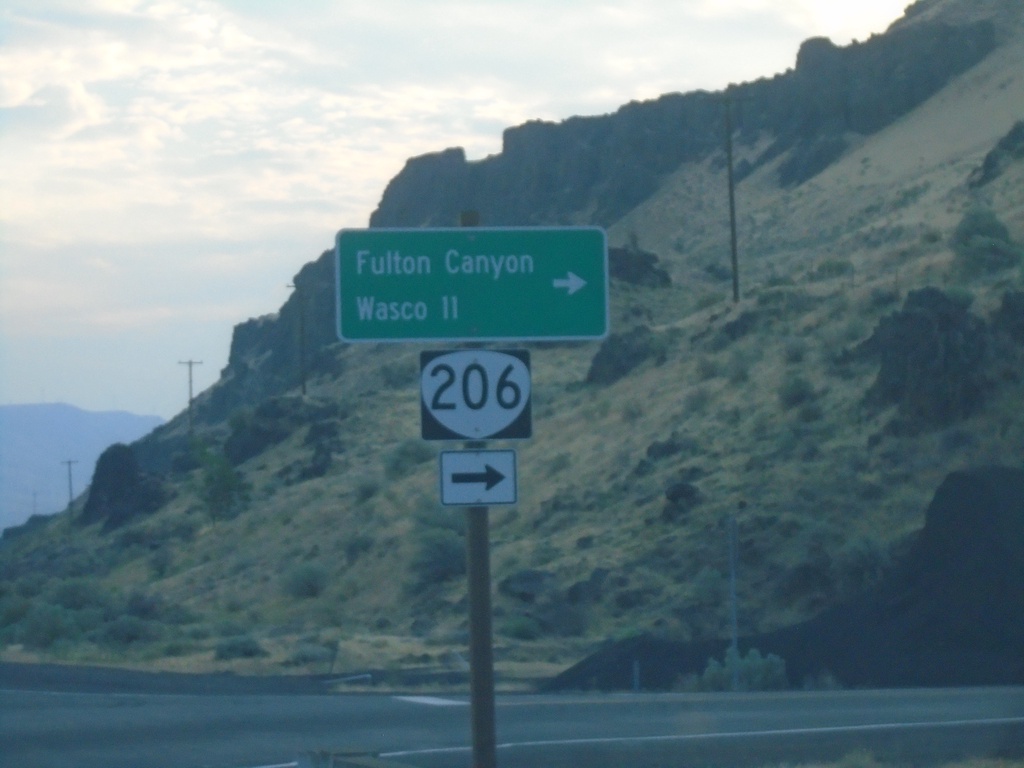
OR-206 East Approaching Biggs-Rufus Highway Junction
OR-206 East Approaching Biggs-Rufus Highway Junction. Turn right to continue east on OR-206 to Fulton Canyon and Wasco.
Taken 08-10-2024
Wasco
Sherman County
Oregon
United States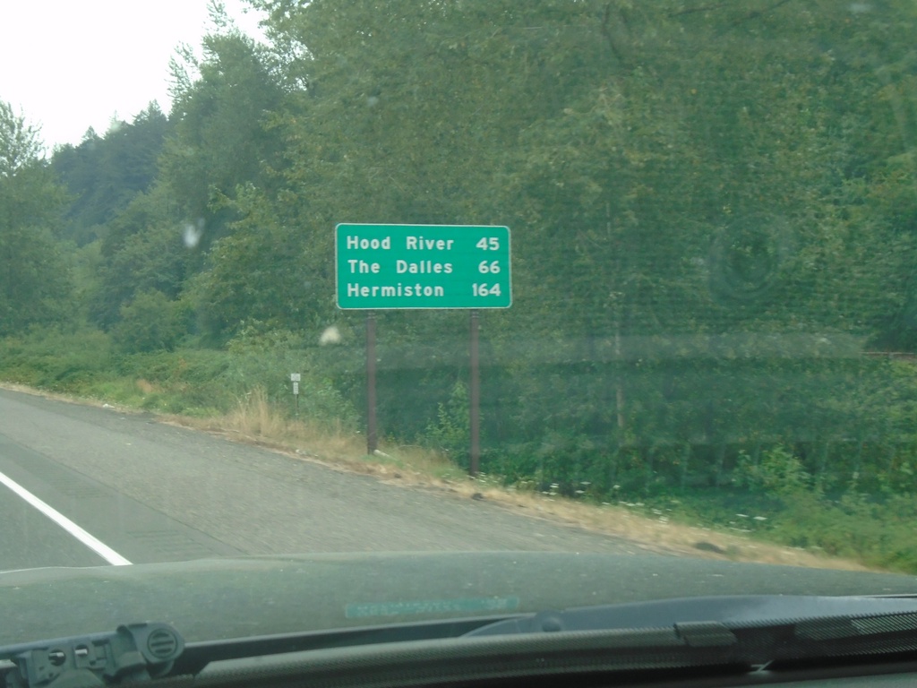
I-84 East - Distance Marker
First distance marker eastbound on I-84 after the Portland metro area. Distance to Hood River, The Dalles, and Hermiston.
Taken 08-09-2024
 Troutdale
Multnomah County
Oregon
United States
Troutdale
Multnomah County
Oregon
United States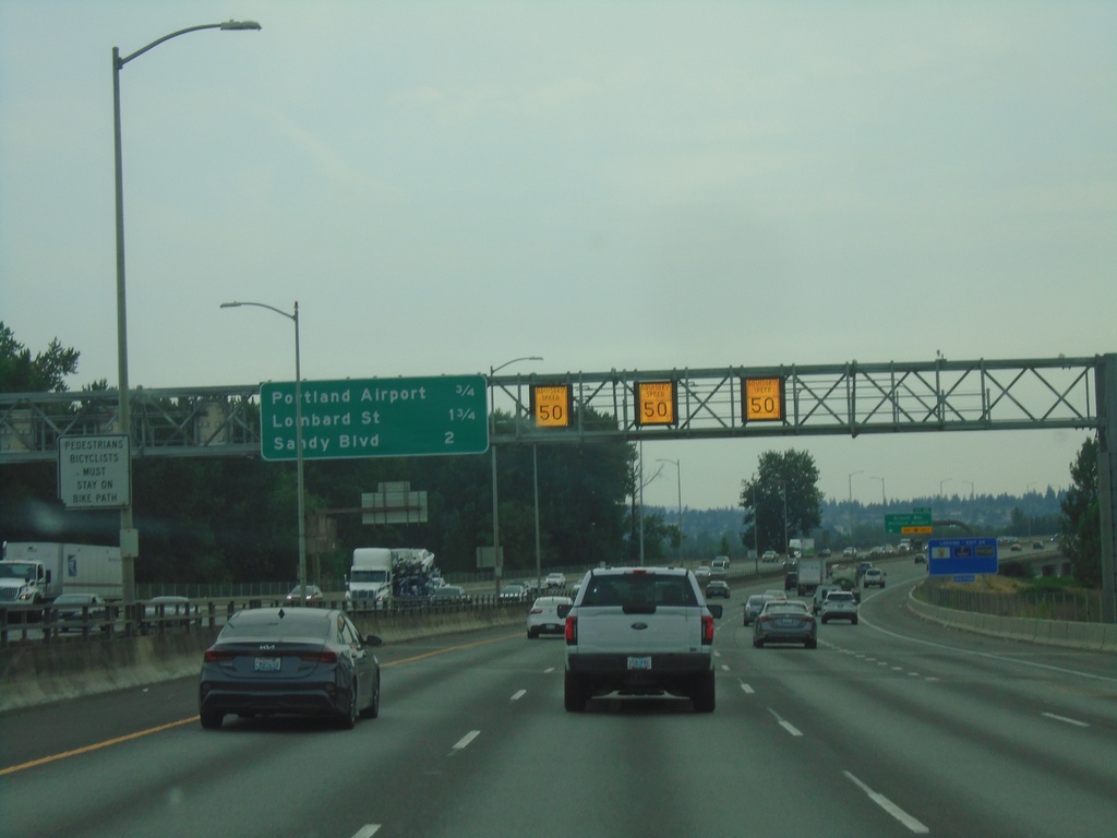
I-205 South - Distance Marker
Distance marker on I-205 south in Portland. Distance to Portland Airport, Lombard St., and Sandy Blvd. Electronic variable speed limit advisory signs showing an advised speed of 50 MPH.
Taken 08-09-2024
 Portland
Multnomah County
Oregon
United States
Portland
Multnomah County
Oregon
United States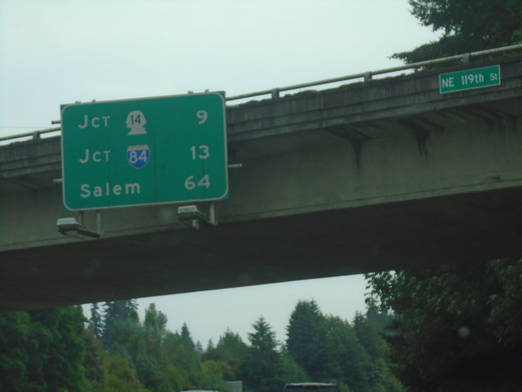
I-205 South - Distance Marker
Distance marker on I-205 south. Distance to Jct. WA-14, Jct. I-84, and Salem (Oregon).
Taken 08-09-2024
Vancouver
Clark County
Washington
United States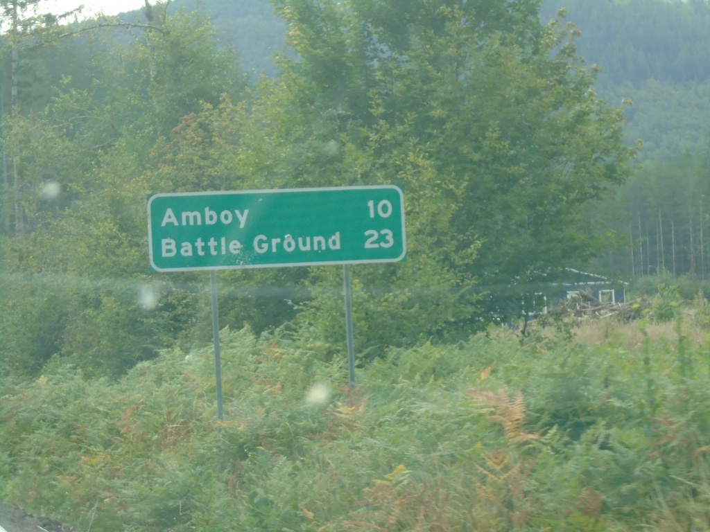
WA-503 South - Distance Marker
Distance marker on WA-503 south. Distance to Amboy and Battle Ground.
Taken 08-09-2024
 Ariel
Cowlitz County
Washington
United States
Ariel
Cowlitz County
Washington
United States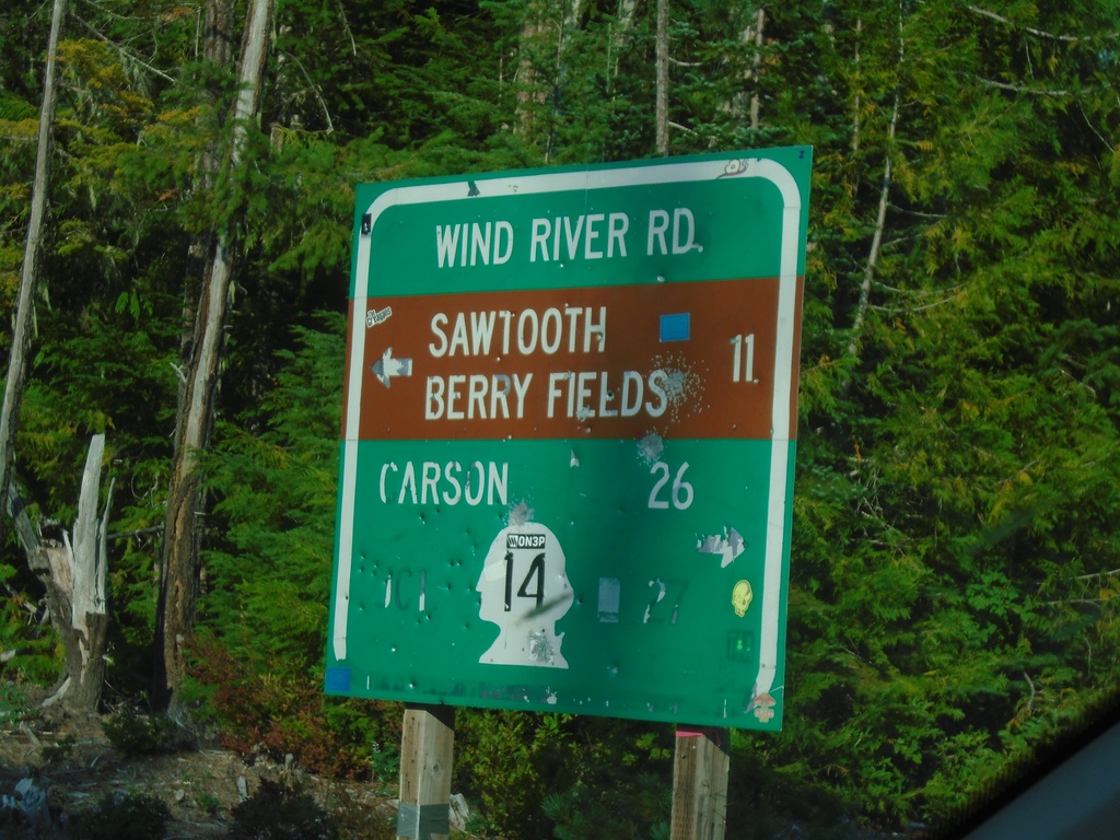
Curly Creek Road at Wind River Road
Curly Creek Road at Wind River Road. Use Wind River Road south to WA-14 and Carson. Use Wind River Road north to Sawtooth Berry Fields.
Taken 08-08-2024
 Northwoods
Skamania County
Washington
United States
Northwoods
Skamania County
Washington
United States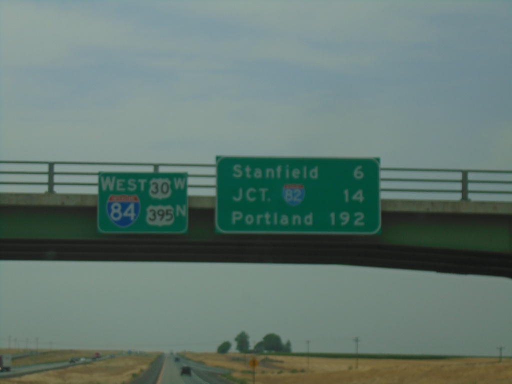
I-84/US-30 West/US-395 North - Distance Marker
Distance Marker on I-84/US-30 West/US-395 North at the overpass over Exit 193. Distance to Stanfield, Jct. I-82, and Portland.
Taken 08-08-2024
 Echo
Umatilla County
Oregon
United States
Echo
Umatilla County
Oregon
United States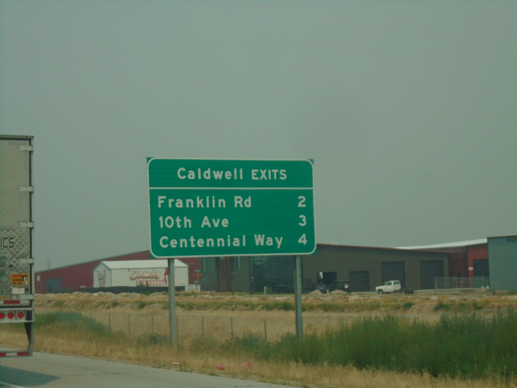
I-84 West - Caldwell Exits
Caldwell exits on I-84 west: Franklin Road, 10th Ave., Centennial Way
Taken 08-08-2024
Caldwell
Canyon County
Idaho
United States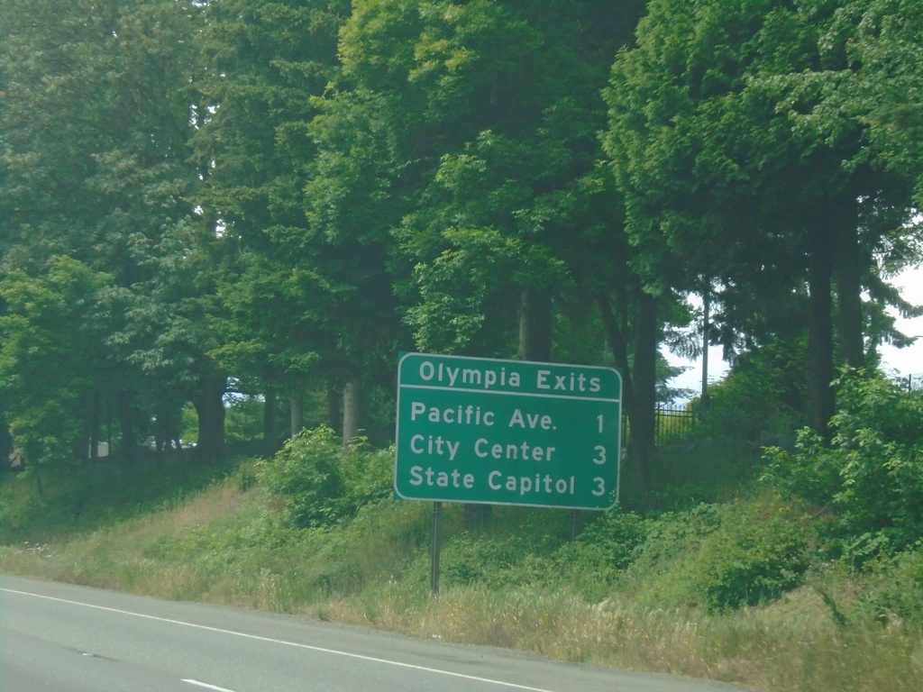
I-5 South - Olympia Exits
Olympia Exits on I-5 south. Pacific Ave., City Center, State Capitol.
Taken 06-15-2024
Lacey
Thurston County
Washington
United States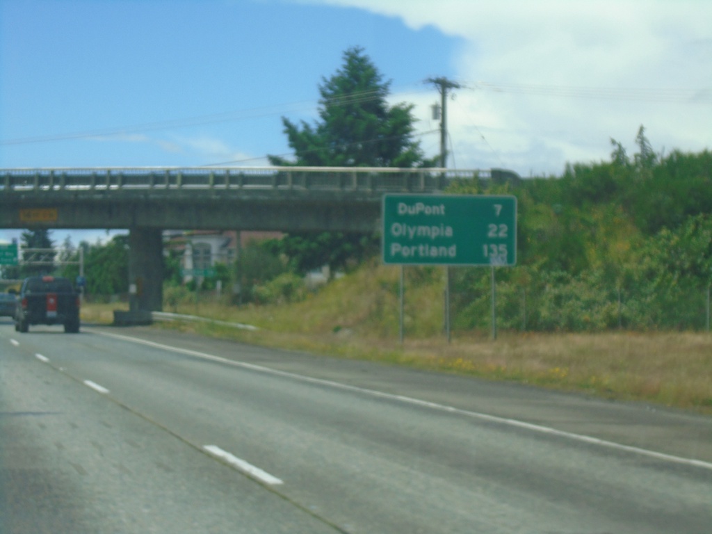
I-5 South - Distance Marker
Distance marker on I-5 south. Distance to DuPont, Olympia, and Portland (OR).
Taken 06-15-2024
Lakewood
Pierce County
Washington
United States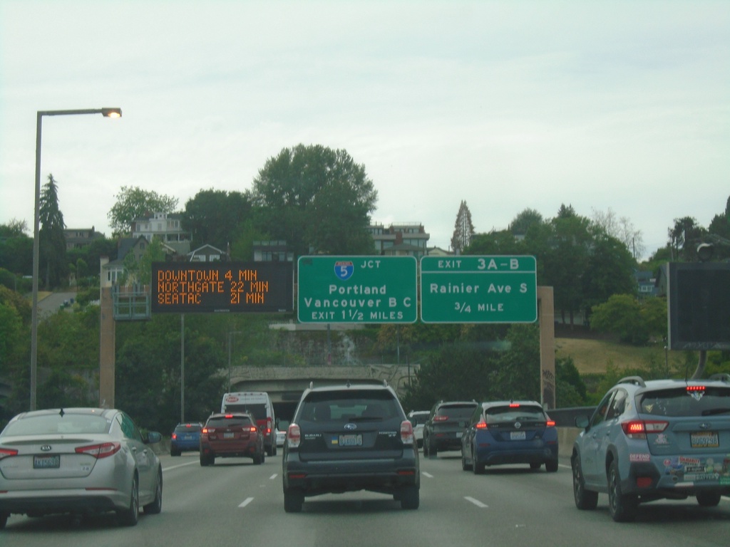
I-90 West - Exits 3A-B and I-5
I-90 West - Exits 3A-B and I-5. Use Exit 3A-B for Rainier Ave. South. Approaching I-5/Portland (Oregon)/Vancouver, BC (Canada). Electronic travel time sign showing distance to Downtown, Northgate, and SeaTac. Approaching Mount Baker Ridge Tunnel.
Taken 06-13-2024
 Seattle
King County
Washington
United States
Seattle
King County
Washington
United States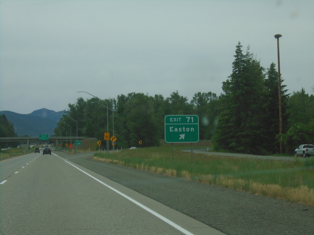
I-90 West - Exit 71
I-90 west at Exit 71 - Easton.
Taken 06-13-2024
Easton
Kittitas County
Washington
United States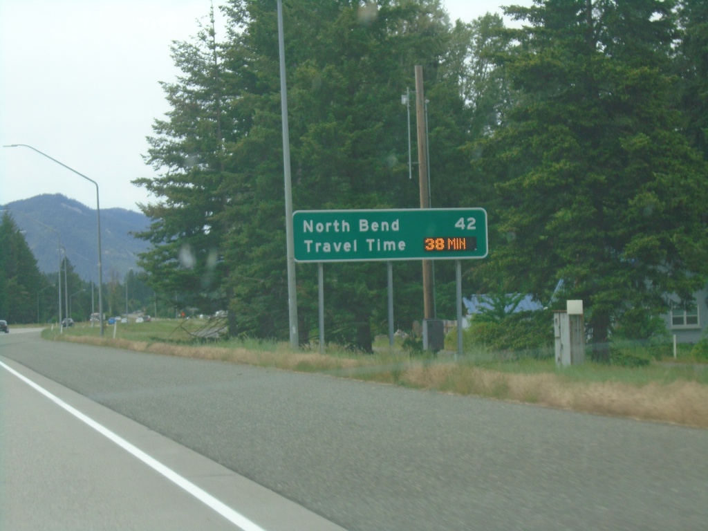
I-90 West - Distance Marker/Travel Time
Distance marker and dynamic travel time sign on I-90 west. Distance and travel time to North Bend, which is a Seattle suburb.
Taken 06-13-2024
Cle Elum
Kittitas County
Washington
United States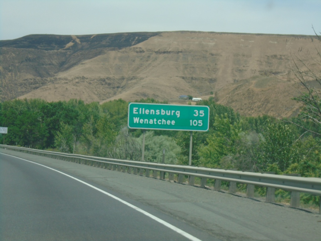
I-82 West - Distance Marker
Distance marker on I-82 west. Distance to Ellensburg and Wenatchee (via US-97 North).
Taken 06-13-2024


 Yakima
 County
Washington
United States
Yakima
Yakima County
Washington
United States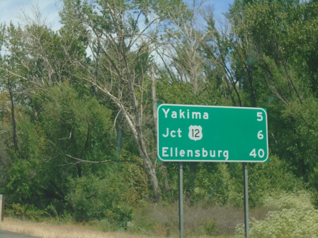
I-82 West - Distance Marker
Distance marker on I-82 west. Distance to Yakima, US-12 Junction, and Ellensburg.
Taken 06-13-2024
Union Gap
Yakima County
Washington
United States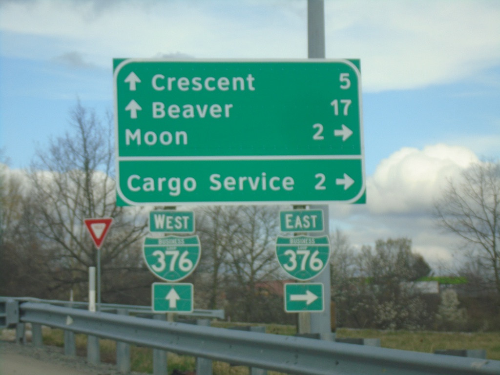
Flaugherty Run Road at BL-376
Flaugherty Run Road at BL-376. Use BL-376 East to Moon and Cargo Service. Continue over freeway for Beaver and Crescent.
Taken 04-01-2024
 Carnot-Moon
Allegheny County
Pennsylvania
United States
Carnot-Moon
Allegheny County
Pennsylvania
United States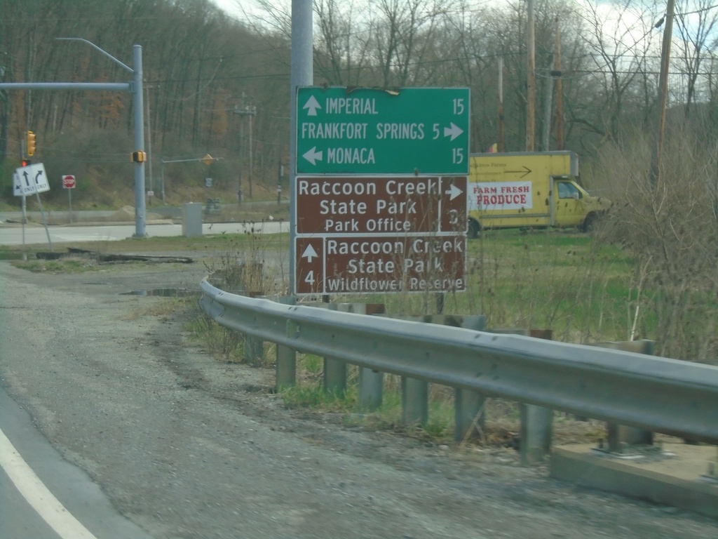
US-30 East at PA-18
US-30 East at PA-18. Use PA-18 north to Monaca; use PA-18 south to Frankfort Springs and Raccoon Creek State Park - Park Office. Continue east on US-30 for Imperial and Raccoon Creek State Park - Wildflower Reserve.
Taken 04-01-2024
 Clinton
Beaver County
Pennsylvania
United States
Clinton
Beaver County
Pennsylvania
United States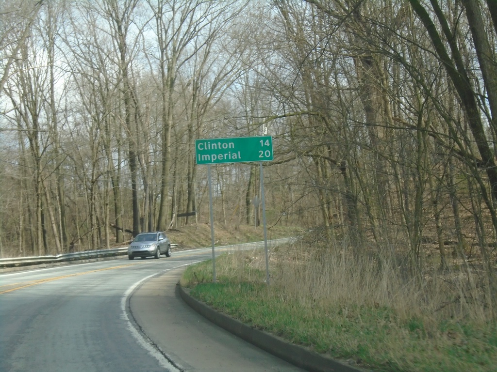
US-30 East - Distance Marker
Distance marker on US-30 east. Distance to Clinton and Imperial.
Taken 04-01-2024
Hookstown
Beaver County
Pennsylvania
United States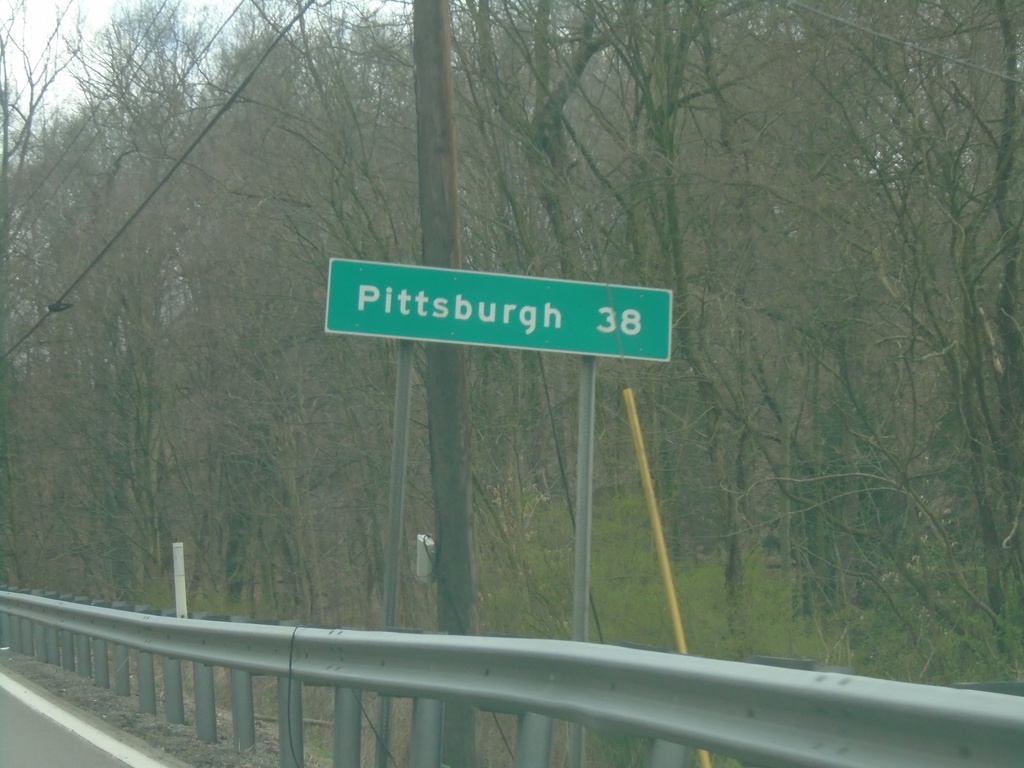
US-30 East - Distance Marker
Distance marker on US-30 East. Distance to Pittsburgh (PA).
Taken 04-01-2024
Chester
Hancock County
West Virginia
United States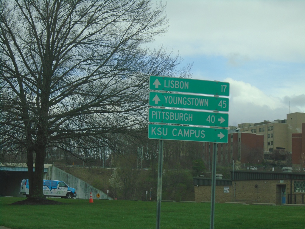
OH-7 North/OH-39 East at US-30/OH-267
OH-7 North/OH-39 East at US-30/OH-267 in East Liverpool. Use US-30/OH-39 East to Pittsburgh (PA) and KSU Campus. Use US-30 West/OH-267/OH-7 North to Youngstown and Lisbon.
Taken 04-01-2024


 East Liverpool
Columbiana County
Ohio
United States
East Liverpool
Columbiana County
Ohio
United States