Signs Tagged With Distance Marker
US-97 North - Distance Marker
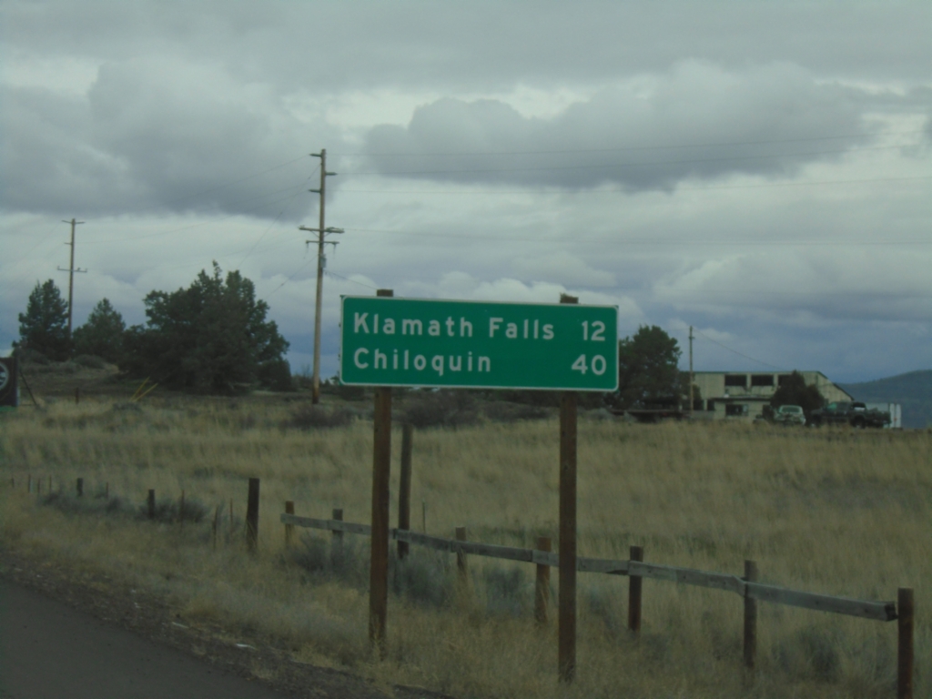
First distance marker on US-97 north in Oregon. Distance to Klamath Falls and Chiloquin.
Taken 02-15-2026
 Worden
Klamath County
Oregon
United States
Worden
Klamath County
Oregon
United States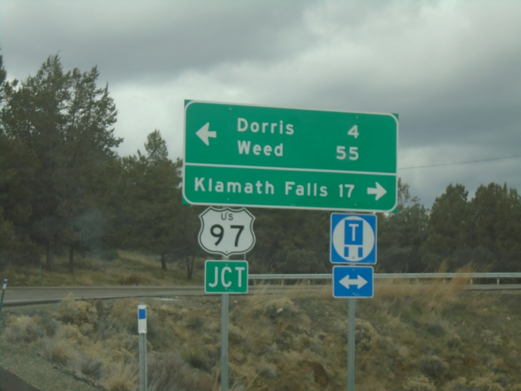
End CA-161 West at US-97
End CA-161 West at US-97 in Siskiyou County. Turn left for US-97 South to Dorris and Weed; right for US-97 North to Klamath Falls (Oregon).
Taken 02-15-2026
 Dorris
Siskiyou County
California
United States
Dorris
Siskiyou County
California
United States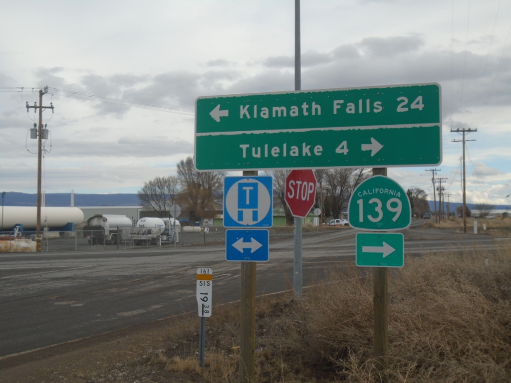
End CA-161 East at CA-139
End CA-161 East at CA-139. Turn right for CA-139 South to Tulelake; left for OR-39 North to Klamath Falls (Oregon). CA-161 runs along the stateline of Oregon and California.
Taken 02-15-2026
 Merrill
Klamath County
Oregon
United States
Merrill
Klamath County
Oregon
United States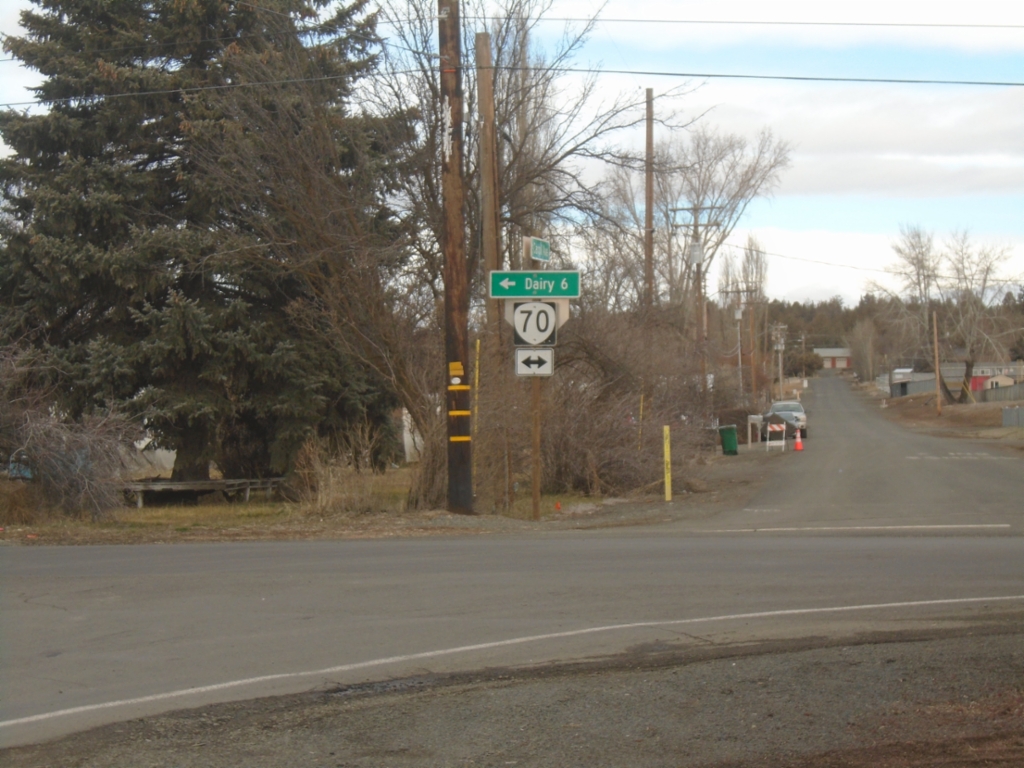
Harpold Road North at OR-70
Harpold Road North at OR-70 in Bonanza. Use OR-70 west to Dairy.
Taken 02-15-2026
 Bonanza
Klamath County
Oregon
United States
Bonanza
Klamath County
Oregon
United States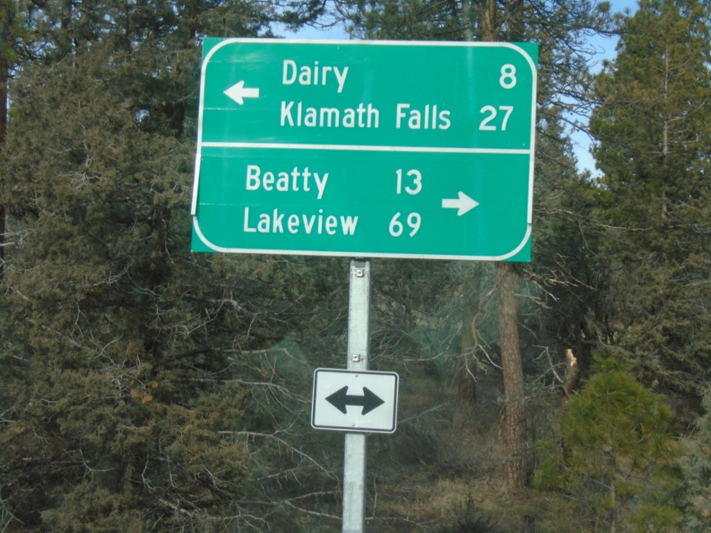
End Bly Mountain Cutoff Road at OR-140
End Bly Mountain Cutoff Road at OR-140 in Klamath County. Use OR-140 East to Beatty and Lakeview; OR-140 West to Dairy and Klamath Falls.
Taken 02-15-2026
 Bonanza
Klamath County
Oregon
United States
Bonanza
Klamath County
Oregon
United States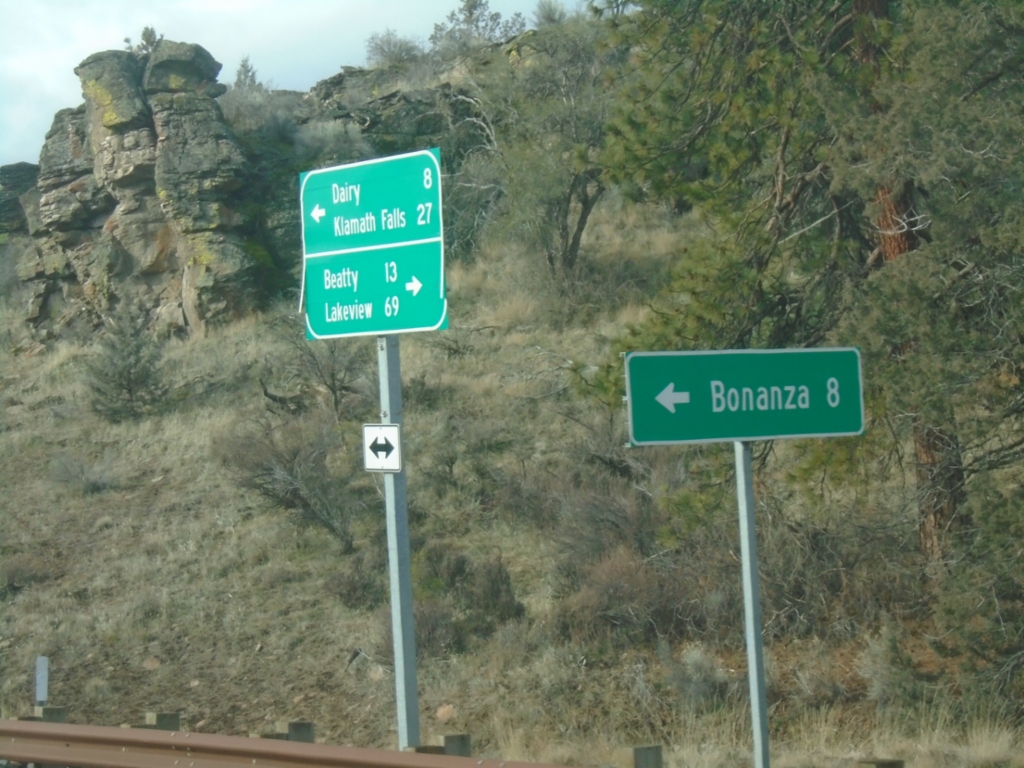
OR-140 West at Bonanza Junction
OR-140 West at Bonanza Junction.
Taken 02-15-2026
Bonanza
Klamath County
Oregon
United States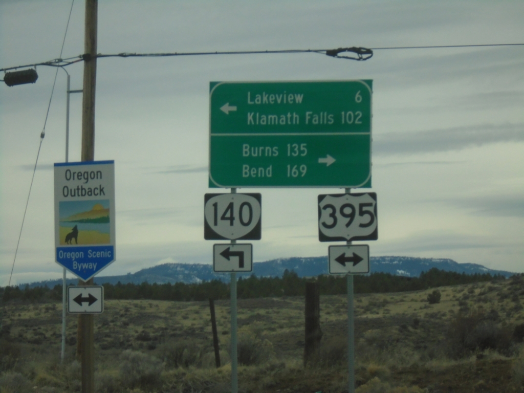
OR-140 West at US-395
OR-140 west at US-395. OR-140 west joins US-395 south into Lakeview. Use US-395 north for Burns and Bend. Use US-395 South/OR-140 West for Lakeview and Klamath Falls. US-395 is part of the Oregon Outback Scenic Byway.
Taken 02-14-2026
 Lakeview
Lake County
Oregon
United States
Lakeview
Lake County
Oregon
United States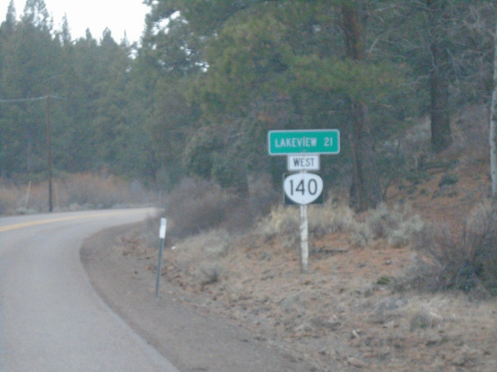
OR-140 West - Distance Marker
Distance marker on OR-140 west. Distance to Lakeview.
Taken 02-14-2026
Lake County
Oregon
United States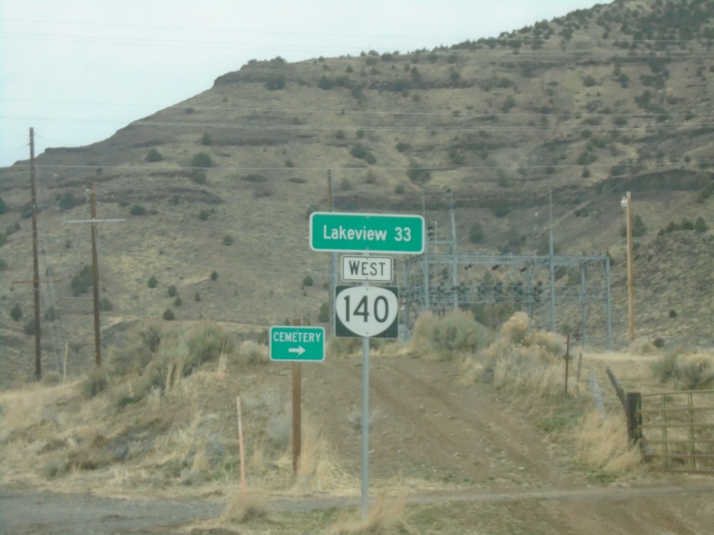
OR-140 West - Distance Marker
Distance marker on OR-140 west. Distance to Lakeview.
Taken 02-14-2026
Adel
Lake County
Oregon
United States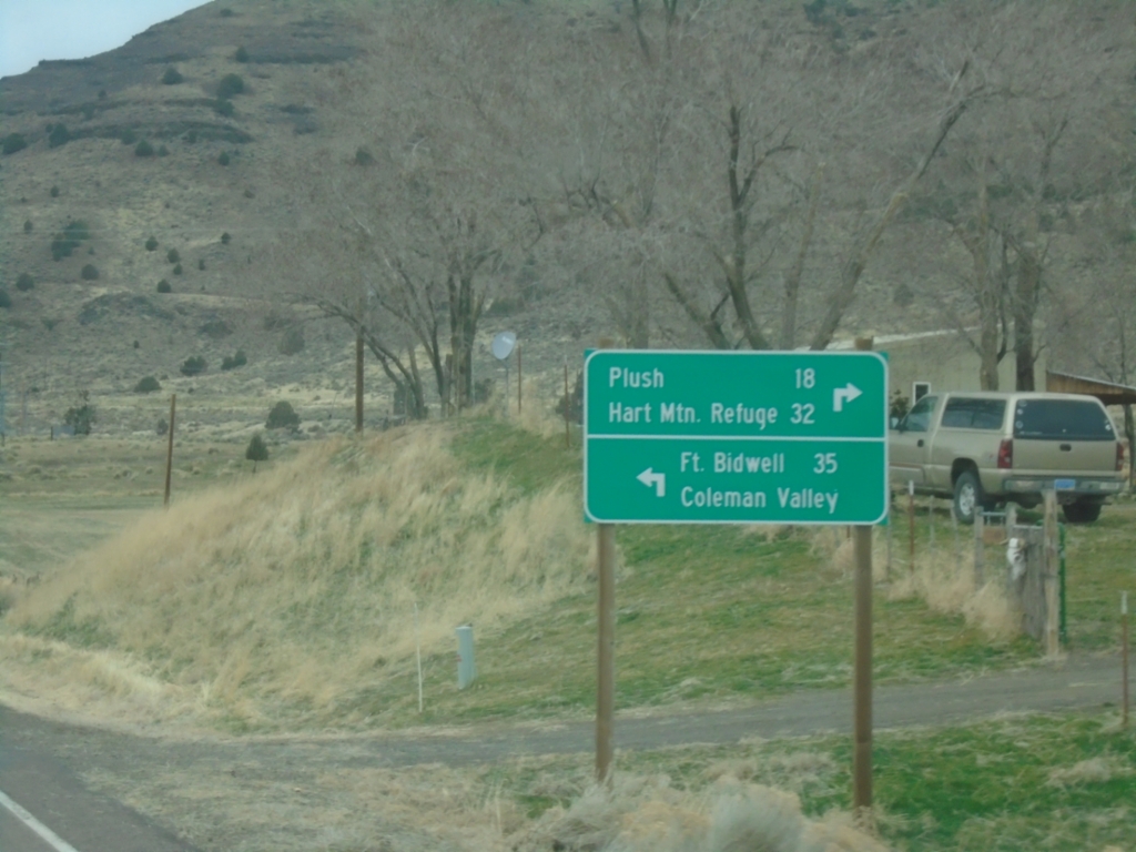
OR-140 West at Twentymile Road
OR-140 West at Twentymile Road in Adel. Turn right for Plush and Hart Mountain Refuge; turn left for Fort Bidwell (California) and Coleman Valley.
Taken 02-14-2026
Adel
Lake County
Oregon
United States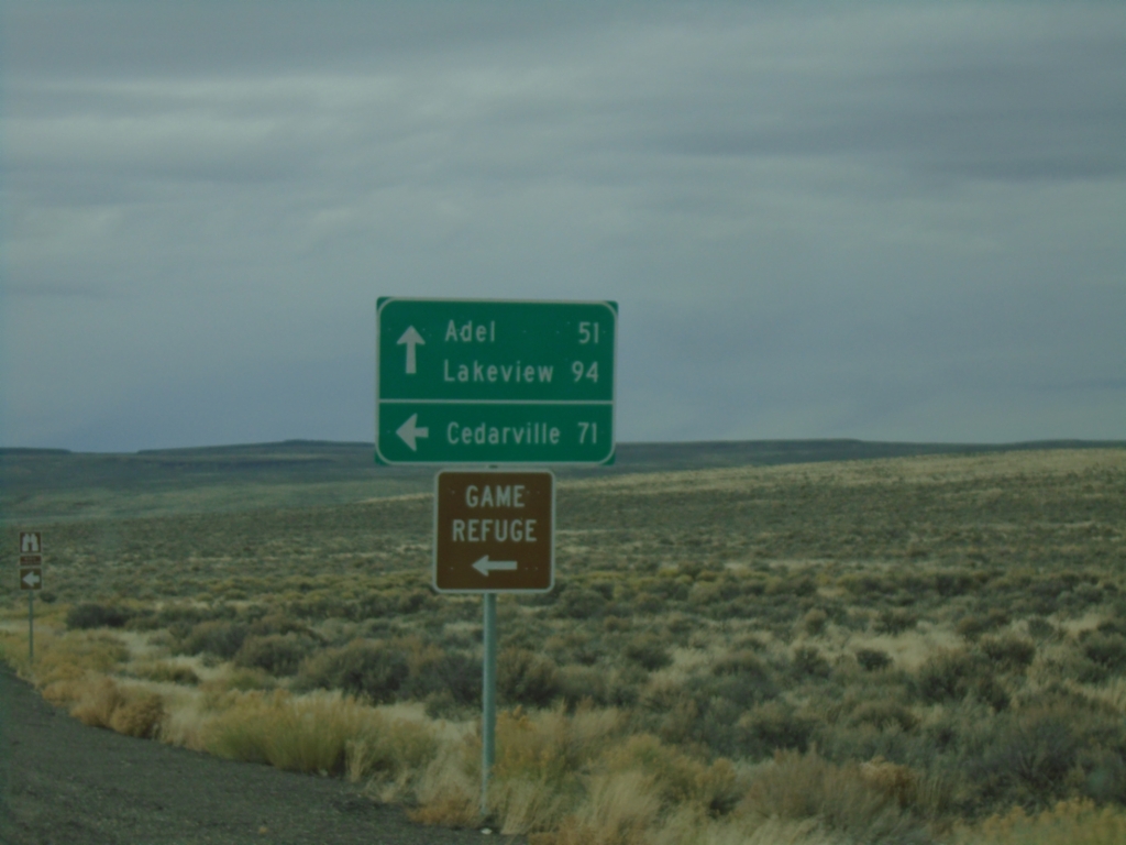
NV-140 North at County Route 8A
NV-140 North at County Route 8A to Cedarville (CA) and the Sheldon National Wildlife Refuge. Continue north on NV-140 for Adel and Lakeview - both in Oregon.
Taken 02-14-2026
 Humboldt County
Nevada
United States
Humboldt County
Nevada
United States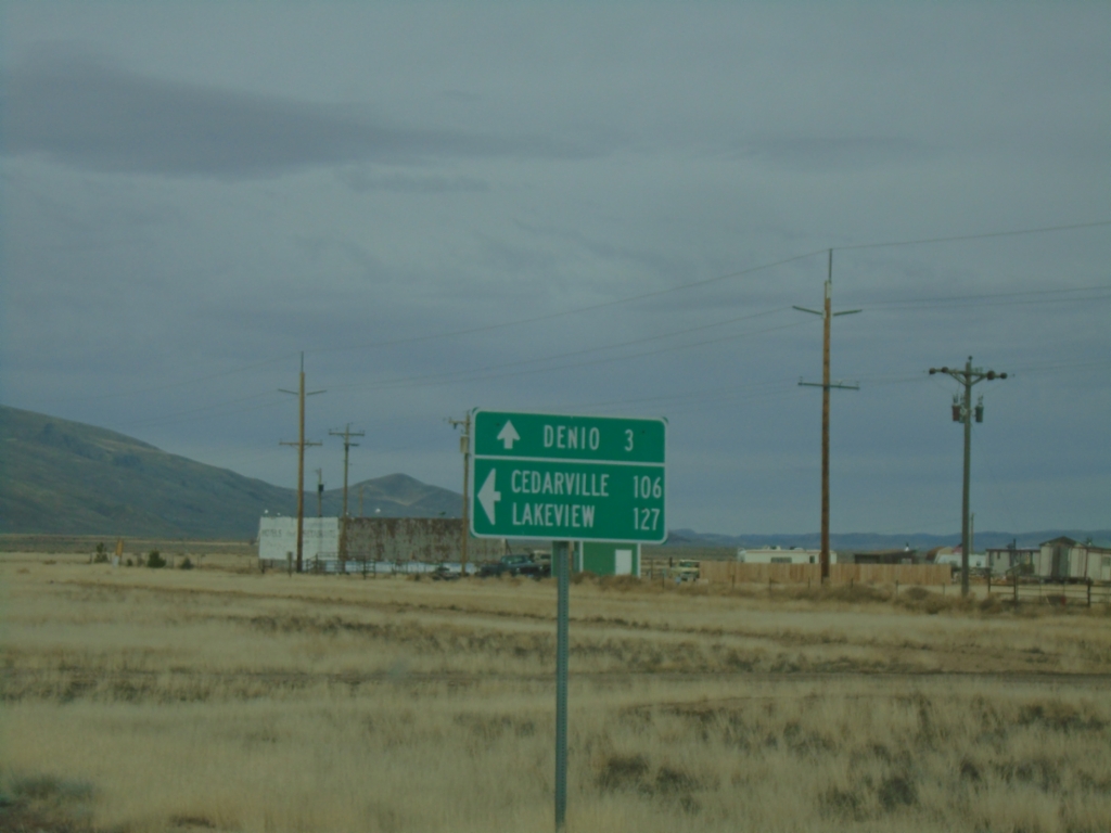
NV-140 North at NV-292 - Denio Junction
NV-140 North at NV-292 - Denio Junction. Use NV-292 north to Denio; NV-140 North to Cedarville (CA), and Lakeview (OR).
Taken 02-14-2026
 Denio
Humboldt County
Nevada
United States
Denio
Humboldt County
Nevada
United States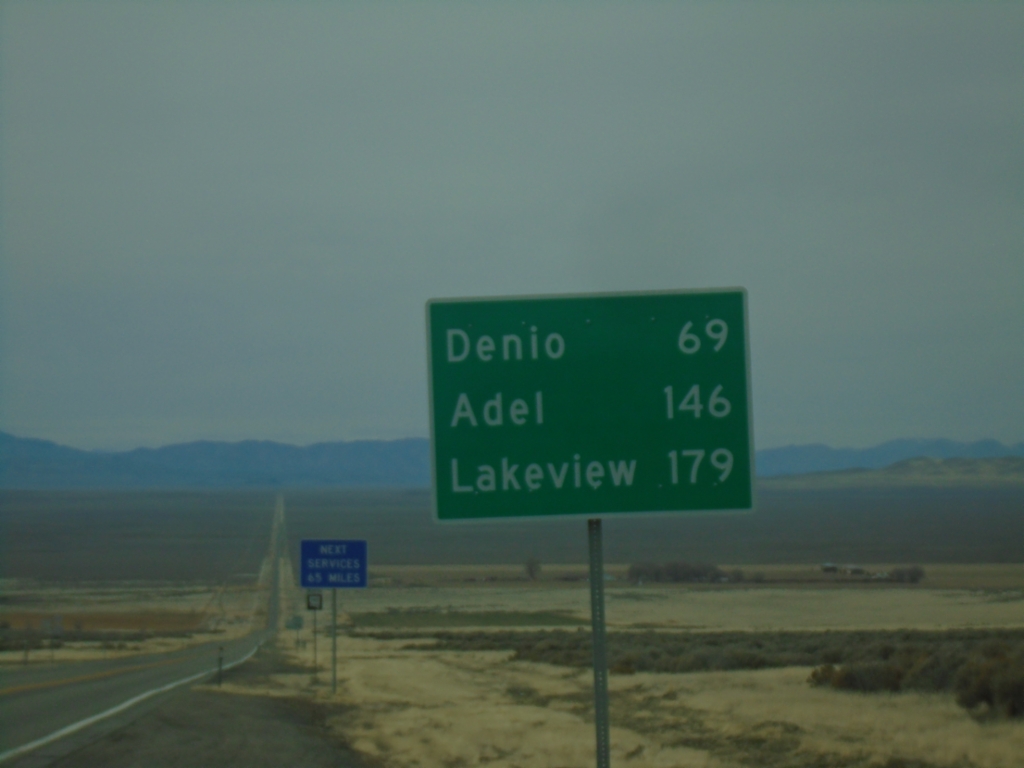
NV-140 North - Distance Marker
Distance marker on NV-140 north. Distance to Denio, Adel (OR), and Lakeview (OR).
Taken 02-14-2026
Humboldt County
Nevada
United States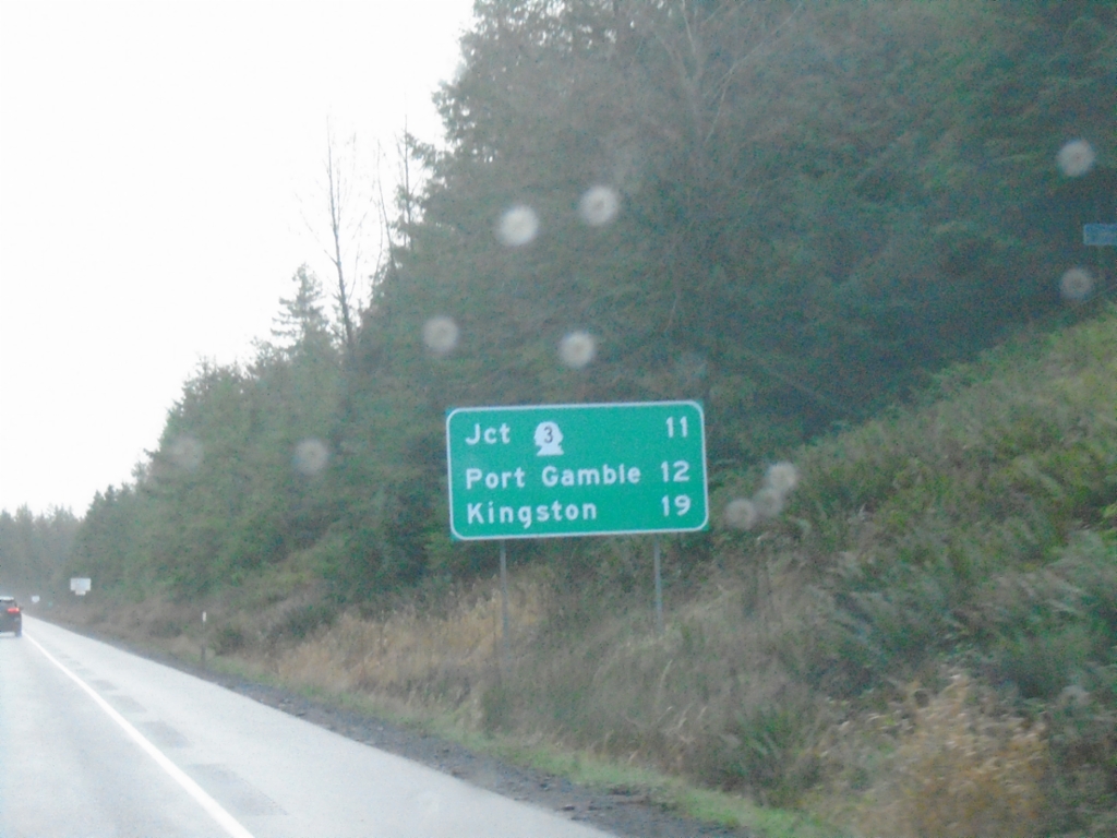
WA-104 East - Distance Marker
Distance marker on WA-104 East. Distance to WA-3, Port Gamble, and Kingston.
Taken 12-26-2025

 Quilcene
Jefferson County
Washington
United States
Quilcene
Jefferson County
Washington
United States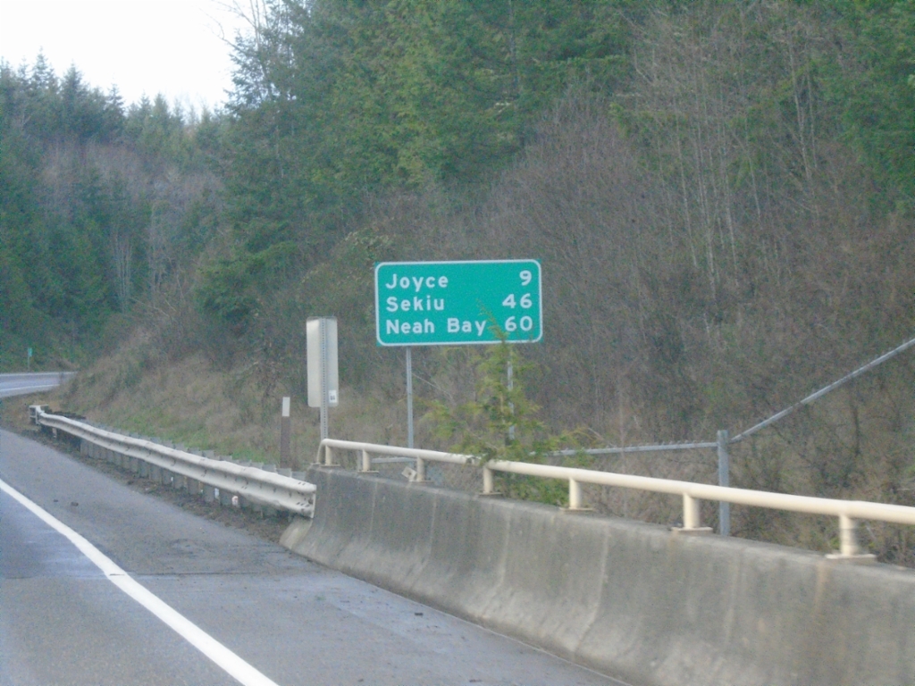
WA-112 West - Distance Marker
Distance marker on WA-112 west. Distance to Joyce, Seiku and Neah Bay.
Taken 12-23-2025
 Clallam County
Washington
United States
Clallam County
Washington
United States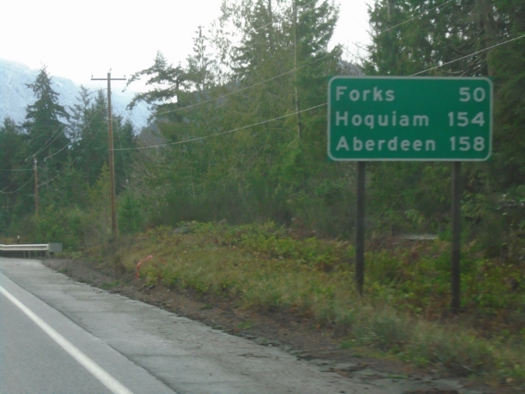
US-101 West - Distance Marker
Distance marker on US-101 west. Distance to Forks, Hoquiam, and Aberdeen.
Taken 12-23-2025
 Clallam County
Washington
United States
Clallam County
Washington
United States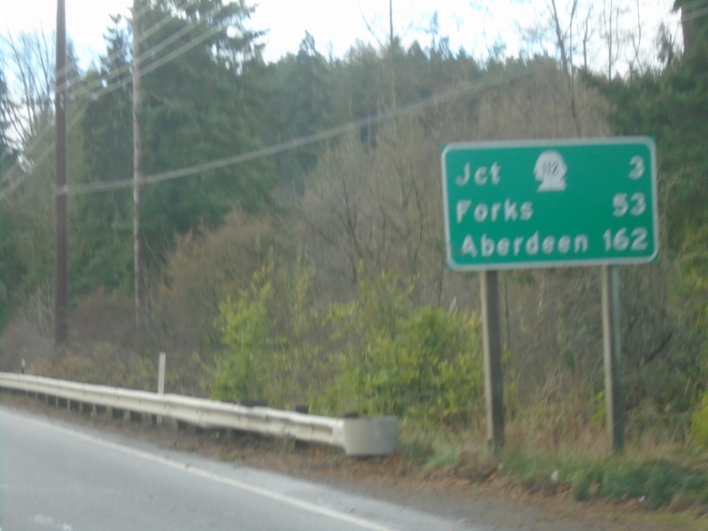
US-101 West - Distance Marker
Distance marker on US-101 west. Distance to WA-112 Junction, Forks, and Aberdeen.
Taken 12-23-2025
Port Angeles
Clallam County
Washington
United States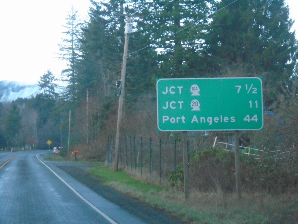
US-101 North - Distance Marker
Distance marker on US-101 north. Distance to WA-104, WA-20, and Port Angeles.
Taken 12-21-2025
 Quilcene
Jefferson County
Washington
United States
Quilcene
Jefferson County
Washington
United States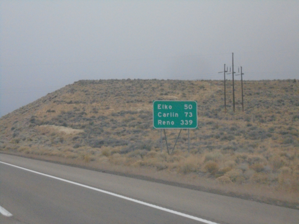
I-80 West - Distance Marker
Distance marker on I-80 west. Distance to Elko, Carlin, and Reno.
Taken 10-26-2025
 Wells
Elko County
Nevada
United States
Wells
Elko County
Nevada
United States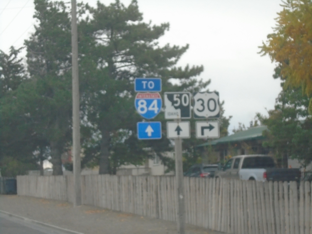
US-30 East Approaching ID-50
US-30 east approaching ID-50 to I-84.
Taken 10-25-2025


 Kimberly
Twin Falls County
Idaho
United States
Kimberly
Twin Falls County
Idaho
United States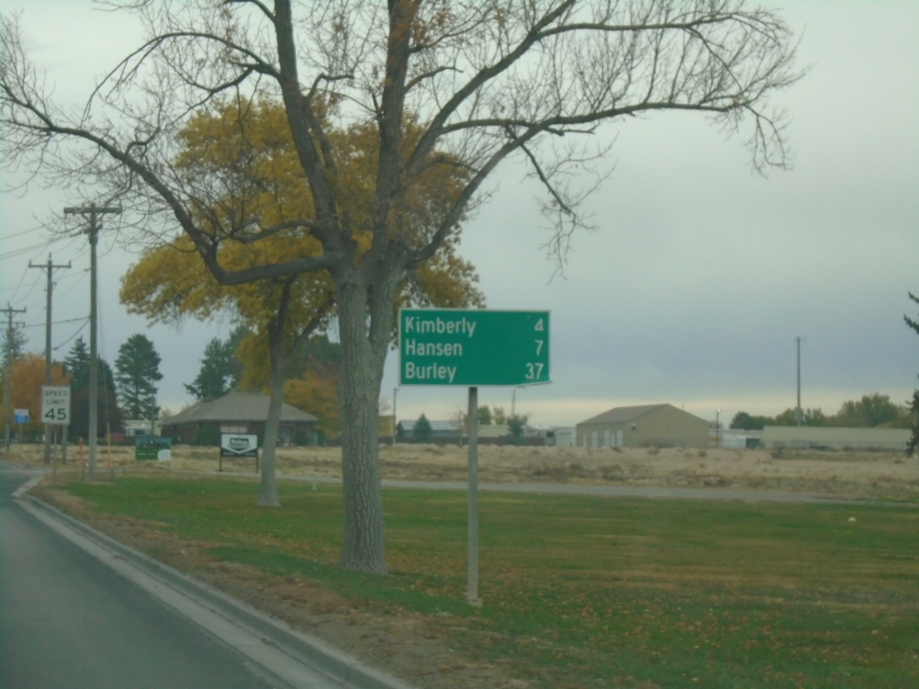
US-30 East - Distance Marker
Distance marker on US-30 east. Distance to Kimberly, Hanson, and Burley.
Taken 10-25-2025
Twin Falls
Twin Falls County
Idaho
United States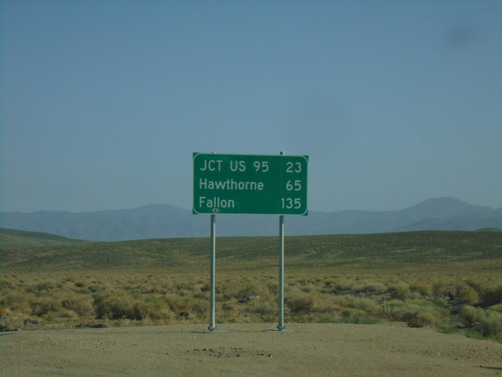
NV-360 North - Distance Marker
Distance marker on NV-360 north. Distance to Jct. US-95, Hawthorne, and Fallon.
Taken 07-22-2025
 Dyer
Mineral County
Nevada
United States
Dyer
Mineral County
Nevada
United States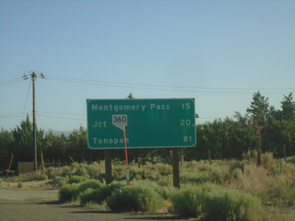
US-6 East - Distance Marker
Distance marker on US-6 east. Distance to Montgomery Pass (NV), Jct NV-360, Tonopah (NV).
Taken 07-22-2025
 Benton
Mono County
California
United States
Benton
Mono County
California
United States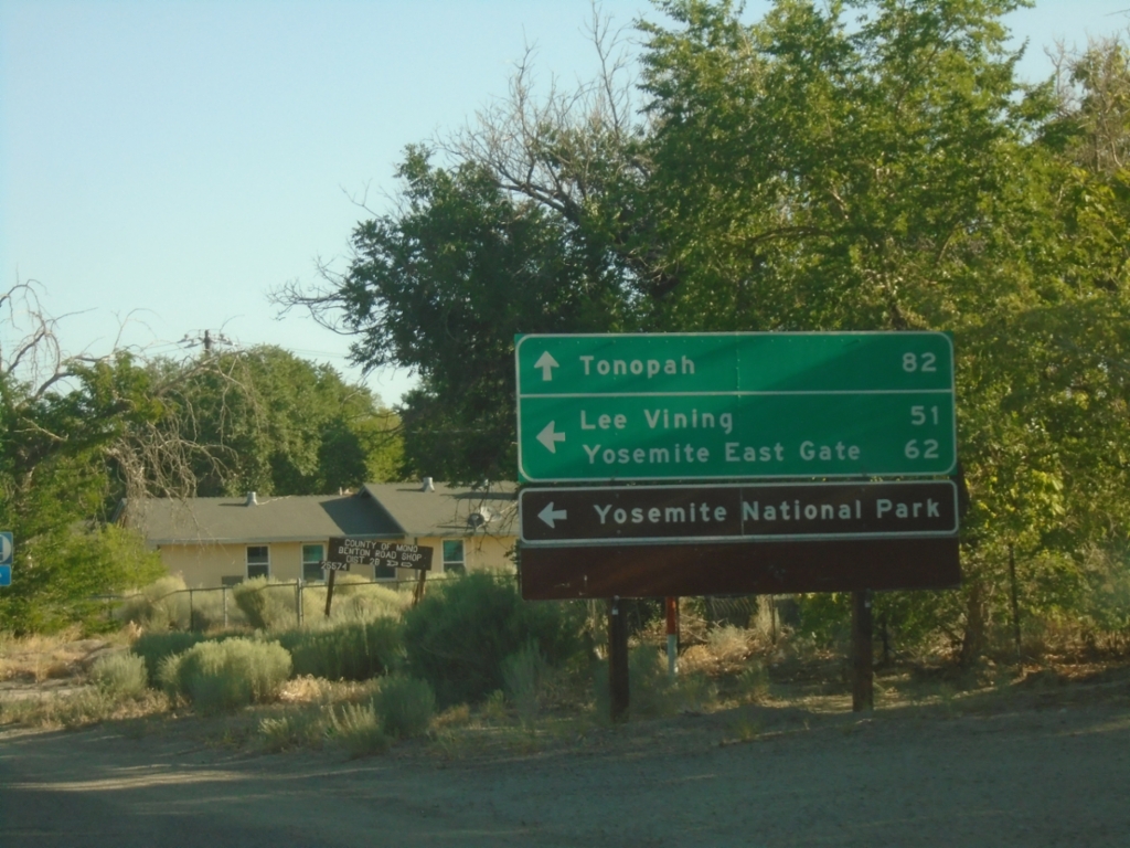
US-6 East Approaching CA-120
US-6 East approaching CA-120 west to Lee Vining, Yosemite East Gate and Yosemite National Park. Continue east on US-6 to Tonopah (Nevada).
Taken 07-22-2025
 Benton
Mono County
California
United States
Benton
Mono County
California
United States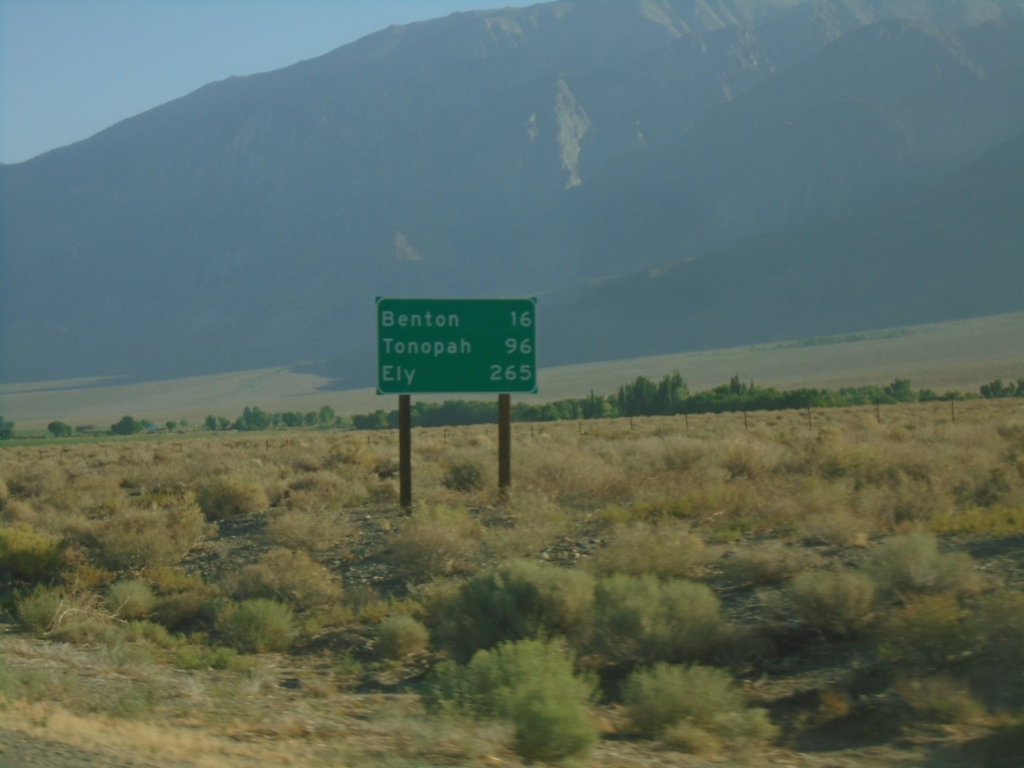
US-6 East - Distance Marker
Distance marker on US-6 east. Distance to Benton, Tonopah (NV), and Ely (NV).
Taken 07-22-2025
Bishop
Mono County
California
United States