Signs Tagged With Distance Marker
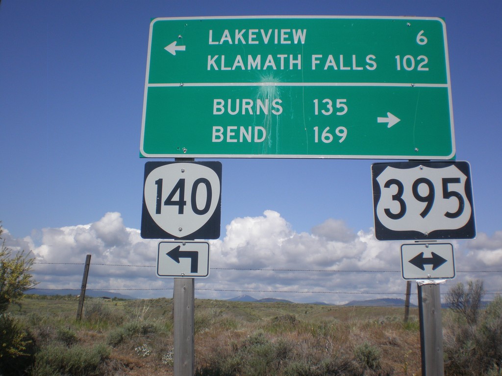
OR-140 West at US-395
OR-140 west at US-395. OR-140 west joins US-395 south into Lakeview. Use US-395 north for Burns and Bend. Use US-395 South/OR-140 West for Lakeview and Klamath Falls.
Taken 05-28-2012

 Lakeview
Lake County
Oregon
United States
Lakeview
Lake County
Oregon
United States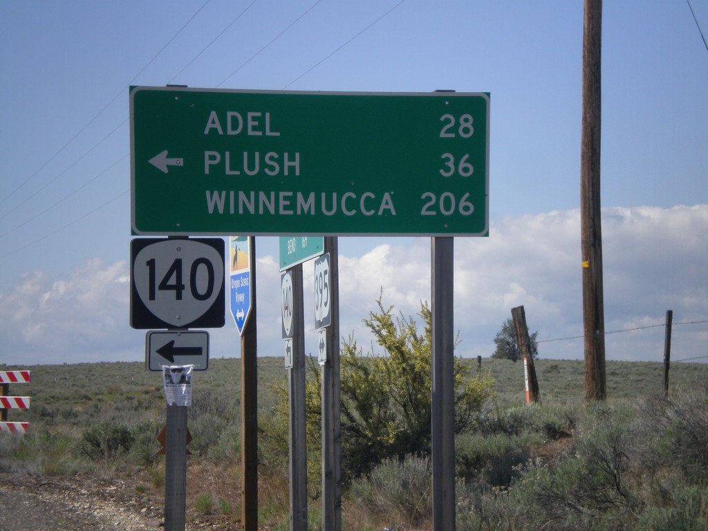
US-395 South OR-140
US-395 South at OR-140. Use OR-140 east for Adel, Plush, and Winnemucca (Nevada). OR-140 west joins US-395 into Lakeview.
Taken 05-28-2012
Lakeview
Lake County
Oregon
United States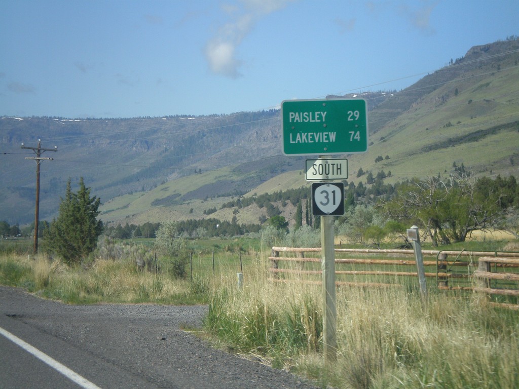
OR-31 South - Distance Marker
Distance marker on OR-31 south, leaving Summer Lake, Oregon. Distance to Paisley and Lakeview.
Taken 05-28-2012
 Summer Lake
Lake County
Oregon
United States
Summer Lake
Lake County
Oregon
United States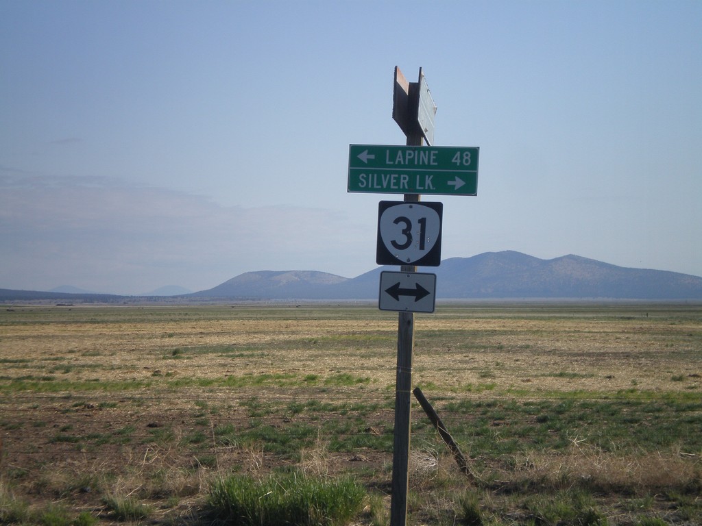
End Silver Lake Marsh Road at OR-31
End Silver Lake Marsh Road at OR-31. Turn right on OR-31 for Silver Lake. Turn left on OR-31 for La Pine.
Taken 05-28-2012
Silver Lake
Lake County
Oregon
United States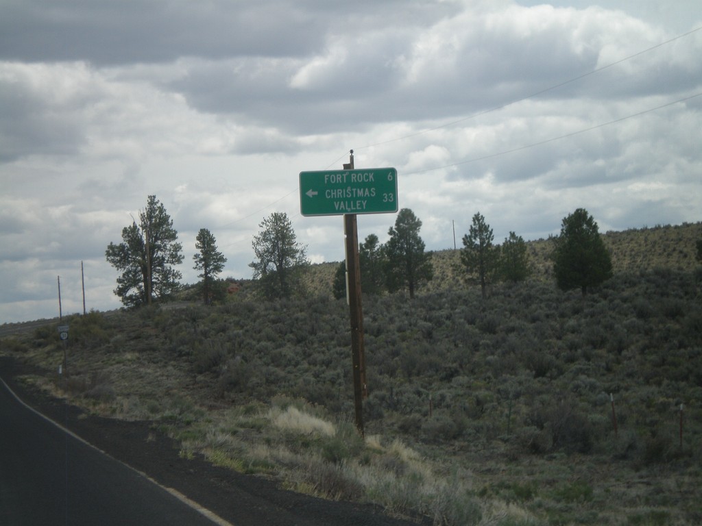
OR-31 South at Fort Rock Jct.
OR-31 south at Fort Rock/Christmas Valley Jct.
Taken 05-27-2012
Fort Rock
Lake County
Oregon
United States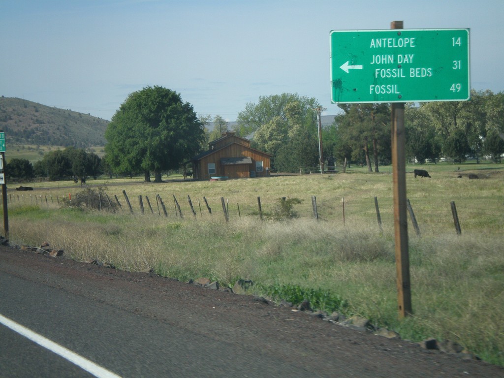
US-97 South at OR-293
US-97 south at OR-293. Use OR-293 east to Antelope, John Day Fossil Beds, and Fossil.
Taken 05-27-2012

 Madras
Jefferson County
Oregon
United States
Madras
Jefferson County
Oregon
United States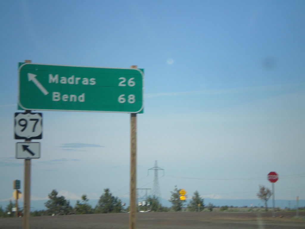
US-97 South at US-197
US-97 south at US-197. Use US-97 south for Madras and Bend. The northbound destination sign for US-197 was knocked over and lying on the ground.
Taken 05-27-2012
 Maupin
Wasco County
Oregon
United States
Maupin
Wasco County
Oregon
United States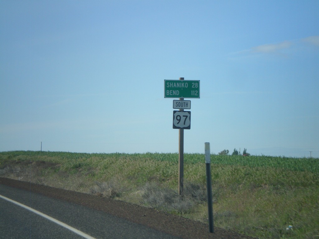
US-97 South - Distance Marker
Distance marker on US-97 south. Distance to Shaniko and Bend.
Taken 05-27-2012
Grass Valley
Sherman County
Oregon
United States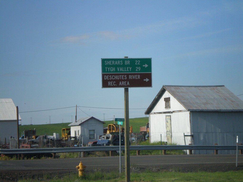
US-97 South at OR-216
US-97 south at OR-216. Use OR-216 west for Sherars Bridge, Tygh Valley, and Deschutes River Recreation Area.
Taken 05-27-2012
 Grass Valley
Sherman County
Oregon
United States
Grass Valley
Sherman County
Oregon
United States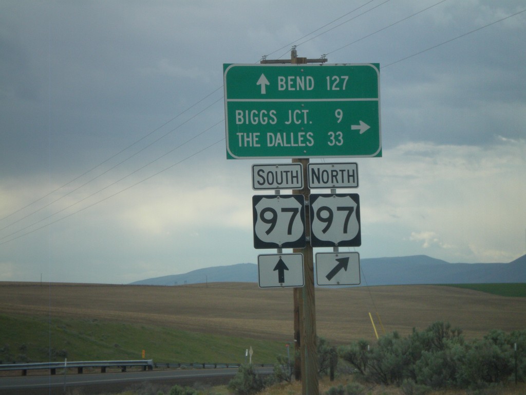
OR-206 West at US-97
OR-206 west at US-97 onramp. Turn right for US-97 north to Biggs Junction and The Dalles. Continue over the highway for US-97 southbound ramp to Bend.
Taken 05-26-2012
 Wasco
Sherman County
Oregon
United States
Wasco
Sherman County
Oregon
United States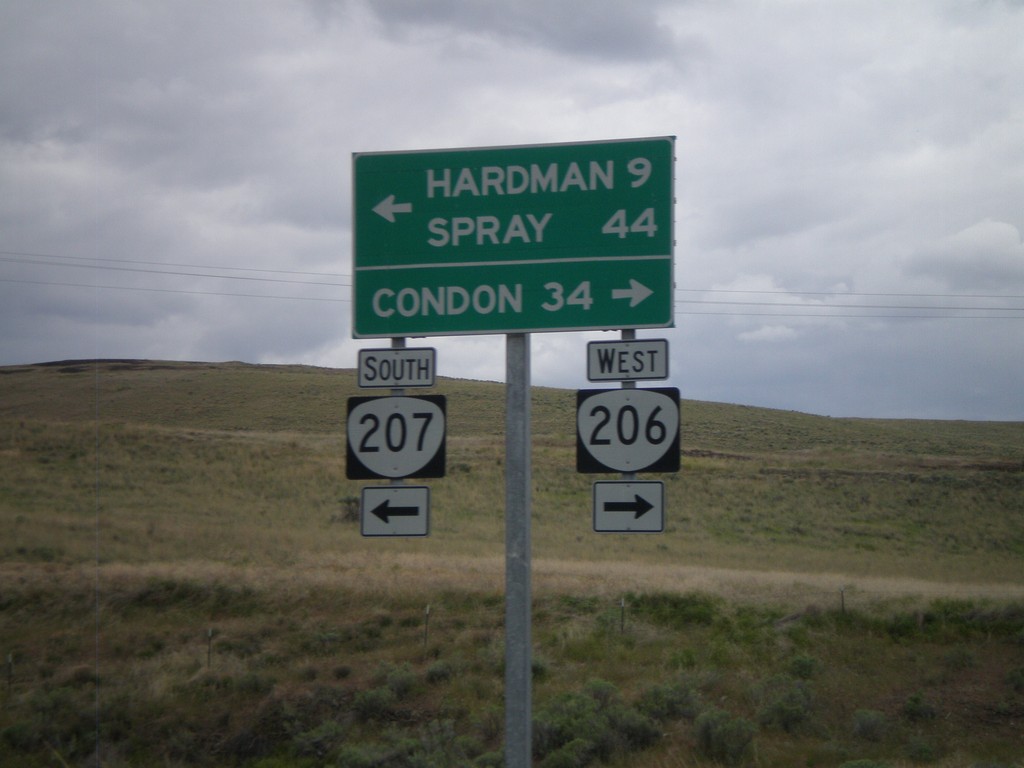
OR-206 West/OR-207 West at Split
OR-206 West/OR-207 West at OR-206/OR-207 split. Turn right for OR-206 west to Condon. Turn left for OR-207 west to Hardman and Spray.
Taken 05-26-2012
 Heppner
Morrow County
Oregon
United States
Heppner
Morrow County
Oregon
United States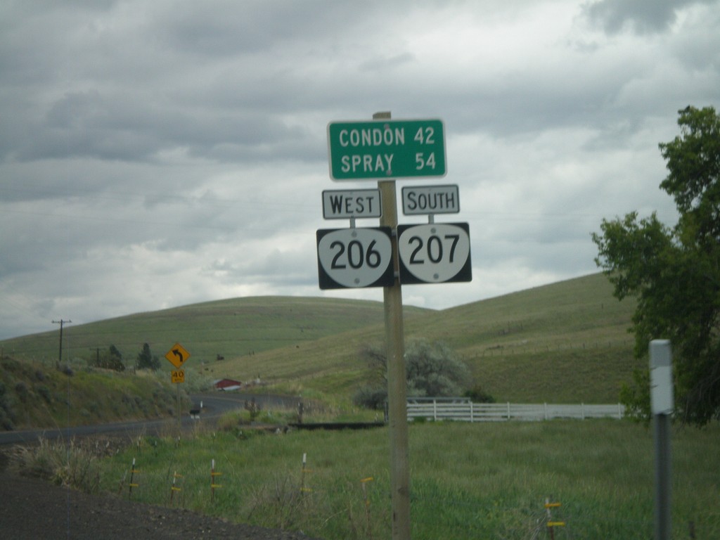
Distance Marker on OR-206/OR-207
Distance marker on OR-206 West/OR-207 South to Condon and Spray.
Taken 05-26-2012
Heppner
Morrow County
Oregon
United States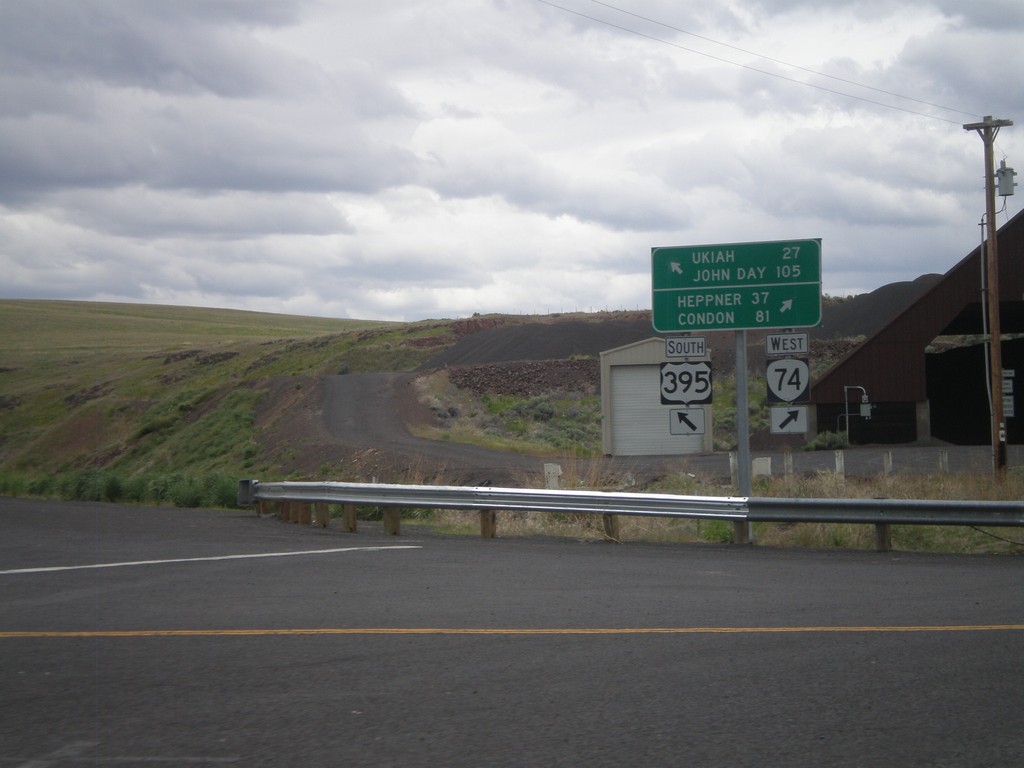
US-395 South at OR-74
US-395 south at OR-74. Turn right for OR-74 west to Heppner and Condon. Merge left for US-395 south to Ukiah and John Day.
Taken 05-26-2012
 Pilot Rock
Umatilla County
Oregon
United States
Pilot Rock
Umatilla County
Oregon
United States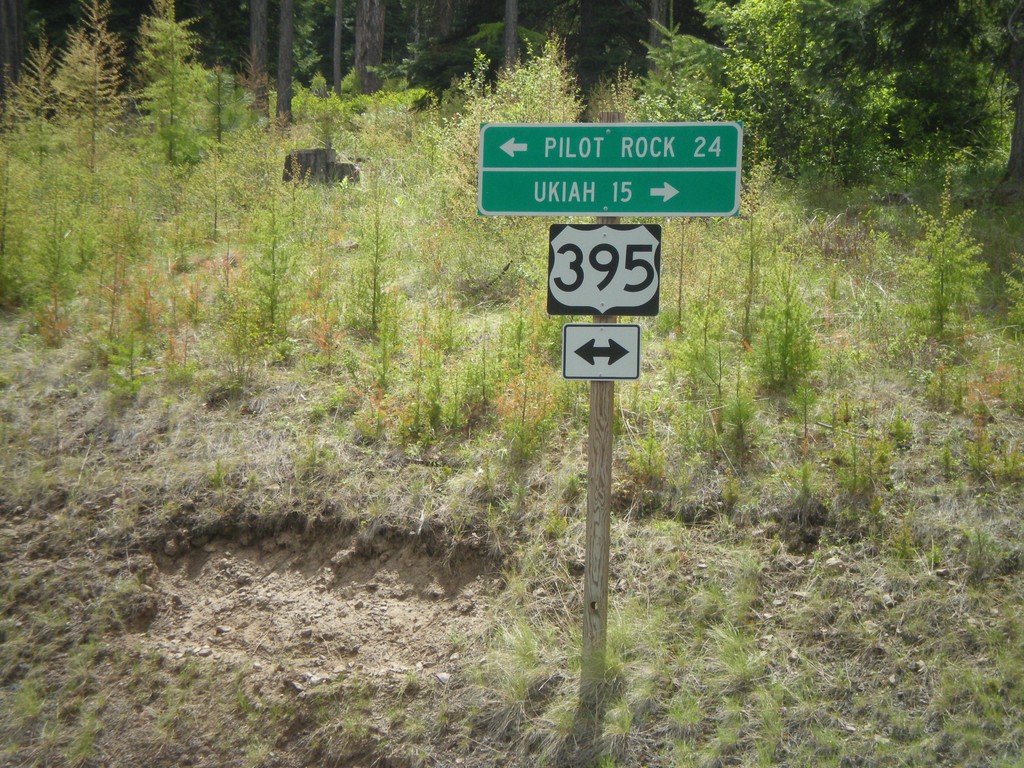
US-395 Jct. at Battle Mountain State Park
US-395 junction at Battle Mountain State Park entrance road. Turn right for US-395 south to Ukiah; left for US-395 north to Pilot Rock.
Taken 05-26-2012
Gurdane
Umatilla County
Oregon
United States
End OR-244 West at US-395
End OR-244 west at US-395. Turn right for US-395 north to Pendleton. Turn left for US-395 south to Long Creek and John Day.
Taken 05-26-2012
 Ukiah
Umatilla County
Oregon
United States
Ukiah
Umatilla County
Oregon
United States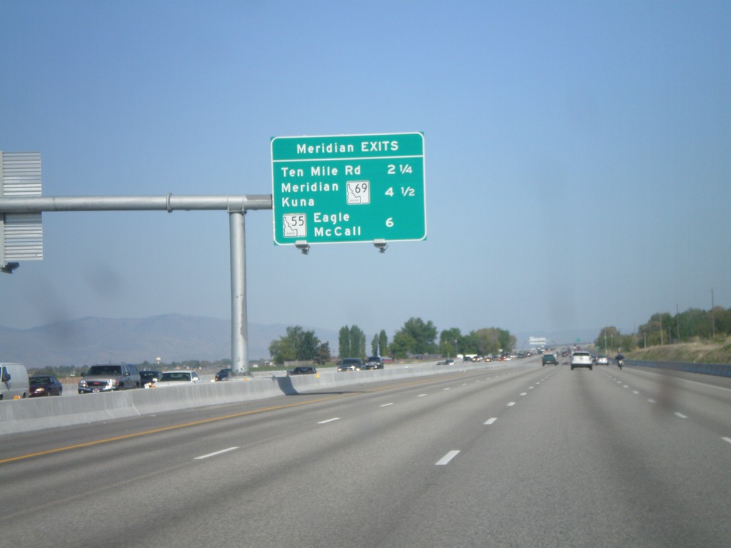
I-84 East - Meridian Exits
Meridian exits on I-84 east. Approaching Ten Mile Road, ID-69, and ID-55 junction.
Taken 05-07-2012


 Nampa
Canyon County
Idaho
United States
Nampa
Canyon County
Idaho
United States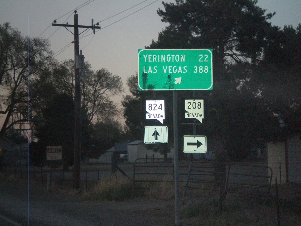
NV-208 North at NV-824
NV-208 north at NV-824 in Smith Valley. Turn right to continue on NV-208 towards Yerrington and Las Vegas.
Taken 05-06-2012

 Smith Valley
Lyon County
Nevada
United States
Smith Valley
Lyon County
Nevada
United States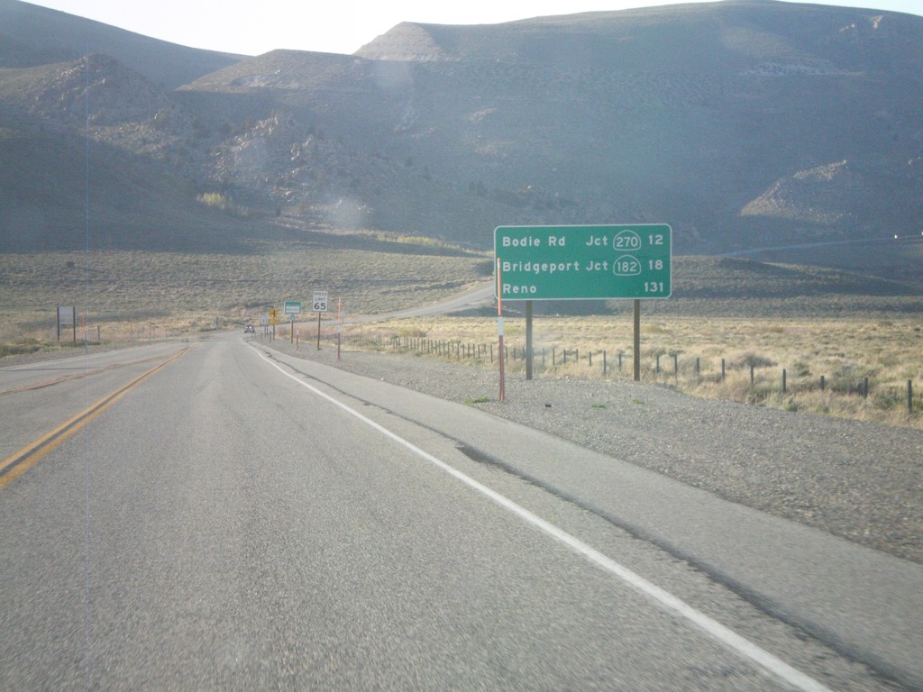
US-395 North - Distance Marker
Distance marker on US-395 north. Distance to Bodie Road - Jct. CA-270, Bridgeport - Jct. CA-182, and Reno (Nevada).
Taken 05-06-2012

 Lee Vining
Mono County
California
United States
Lee Vining
Mono County
California
United States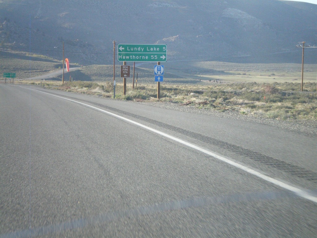
US-395 North at CA-167
US-395 north at CA-167 east to Hawthorne (Nevada). Turn left for Lundy Lake.
Taken 05-06-2012
 Mono City
Mono County
California
United States
Mono City
Mono County
California
United States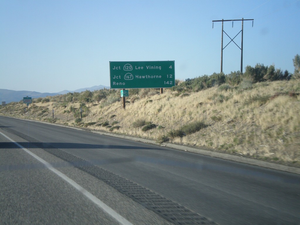
US-395 North - Distance Marker
Distance marker on US-395 north. Distance to Jct. CA-120 in Lee Vining, Jct. CA-160 to Hawthorne, and Reno.
Taken 05-06-2012
 Lee Vining
Mono County
California
United States
Lee Vining
Mono County
California
United States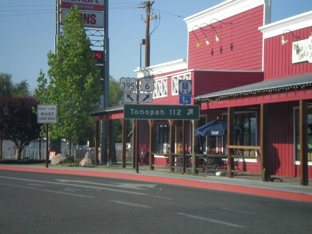
US-395 North at US-6
US-395 north at US-6 in Bishop. Use US-6 east for Tonopah (Nevada). This is the western terminus of US-6. The eastern end of US-6 is Provincetown, MA.
Taken 05-06-2012
 Bishop
Inyo County
California
United States
Bishop
Inyo County
California
United States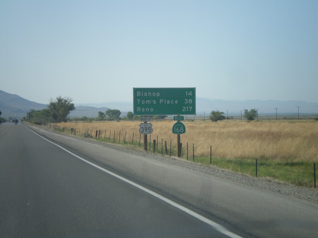
US-395 North/CA-168 West - Distance Marker
Distance marker on US-395 North/CA-168 West. Distance to Bishop, Tom’s Place, and Reno.
Taken 05-06-2012
 Big Pine
Inyo County
California
United States
Big Pine
Inyo County
California
United States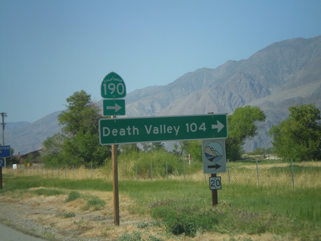
US-395 North at CA-136 (To CA-190)
US-395 north at CA-136 north to CA-190. Use CA-136 east for Death Valley. The logo at the bottom of the sign, with the number 20 written on it, is for the Eastern Sierra Scenic Byway. Site number 20 refers to the Highest to Lowest and Desert’s Edge interpretive site.
Taken 05-06-2012

 Lone Pine
Inyo County
California
United States
Lone Pine
Inyo County
California
United States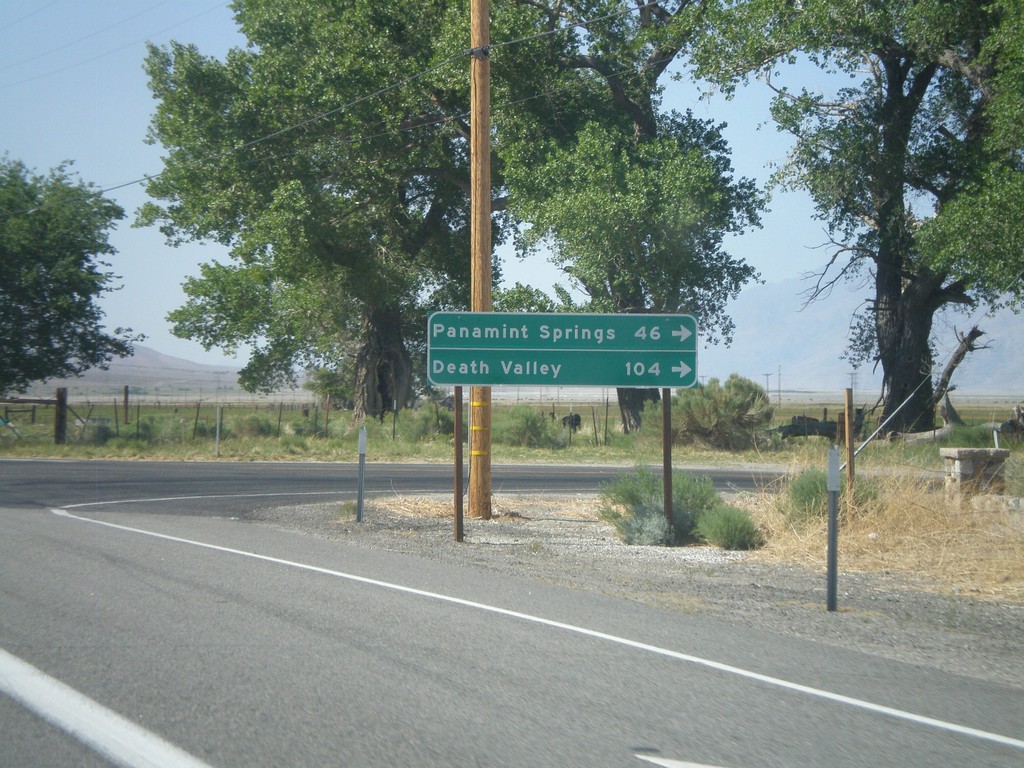
US-395 North at CA-190 East
US-395 north at CA-190 east. Use CA-190 east for Death Valley and Panamint Springs.
Taken 05-06-2012
Olancha
Inyo County
California
United States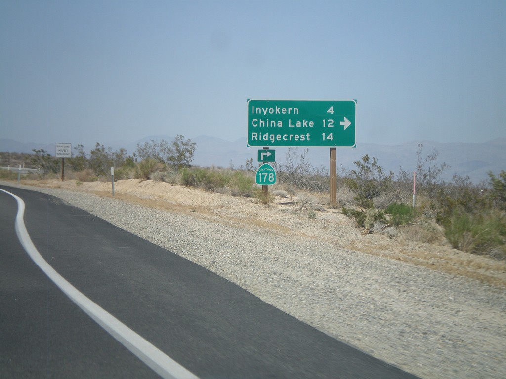
CA-14 North/CA-178 East at CA-178 East
CA-14 North/CA-178 East at CA-178 East junction. Turn right for CA-178 east to Inyokern, China Lake, and Ridgecrest. CA-178 leaves US-395 here.
Taken 05-06-2012

 Inyokern
Kern County
California
United States
Inyokern
Kern County
California
United States