Signs Tagged With Distance Marker
I-25 North - Distance Marker
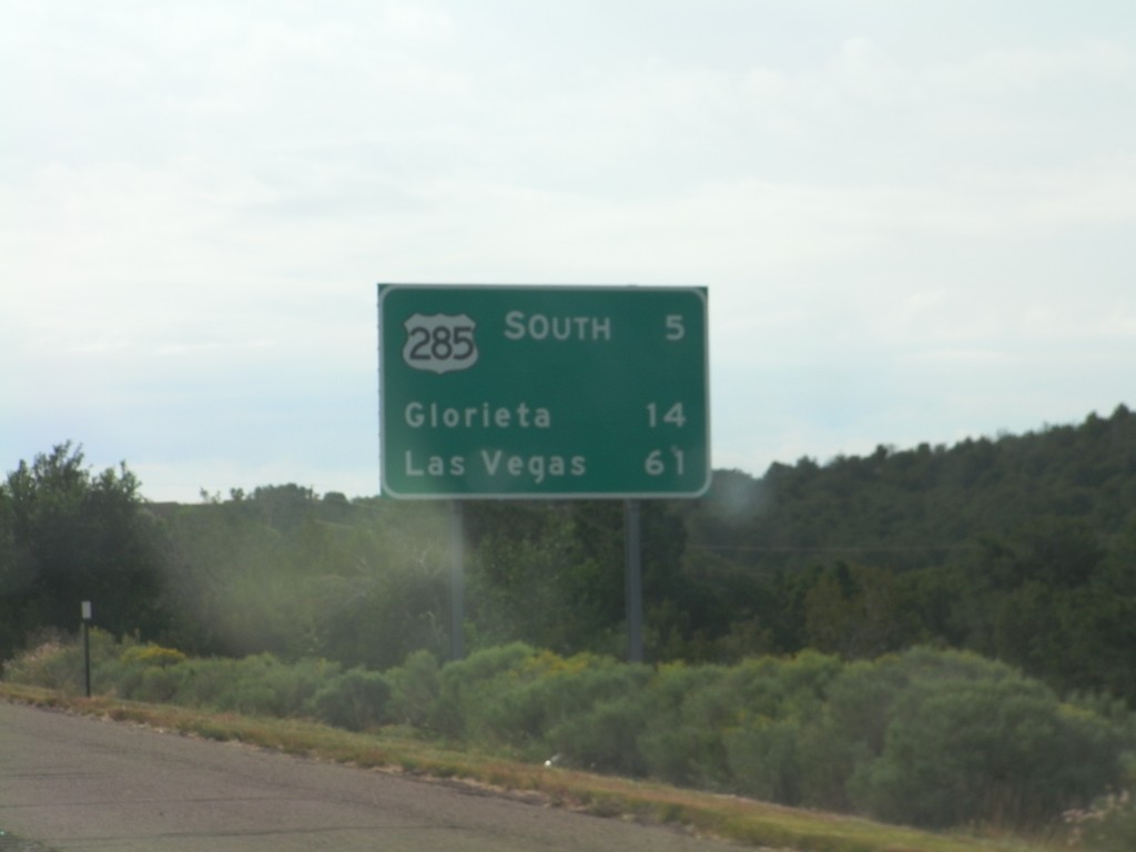
Distance marker on I-25 north, leaving Santa Fe. Distance to US-285 Jct., Glorieta, and Las Vegas.
Taken 10-04-2011


 Santa Fe
 County
New Mexico
United States
Santa Fe
Santa Fe County
New Mexico
United States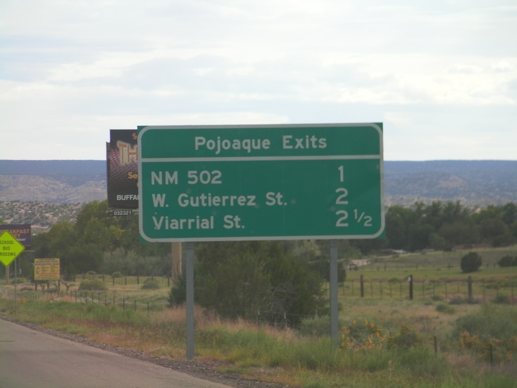
Pojoaque Exits - US-84/US-285 South
Pojoaque Exits on US-84/US-285 South: NM-502, W. Gutierrez St., Viarrial St. The later two exits are actually intersections controlled by traffic signals.
Taken 10-03-2011
Santa Fe
Santa Fe County
New Mexico
United States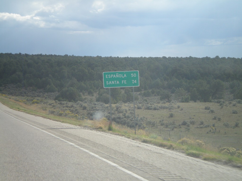
US-84 South - Distance Marker
Distance marker on US-84 south to Española and Santa Fe.
Taken 10-02-2011
Abiquiu
Rio Arriba County
New Mexico
United States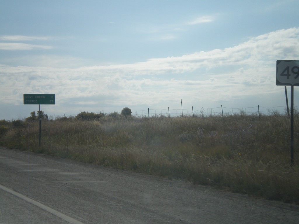
US-491 South - Distance Marker
Distance marker on US-491 south just past the CO-141 junction. Distance to Dove Creek and Cortez.
Taken 10-02-2011
 Dove Creek
Dolores County
Colorado
United States
Dove Creek
Dolores County
Colorado
United States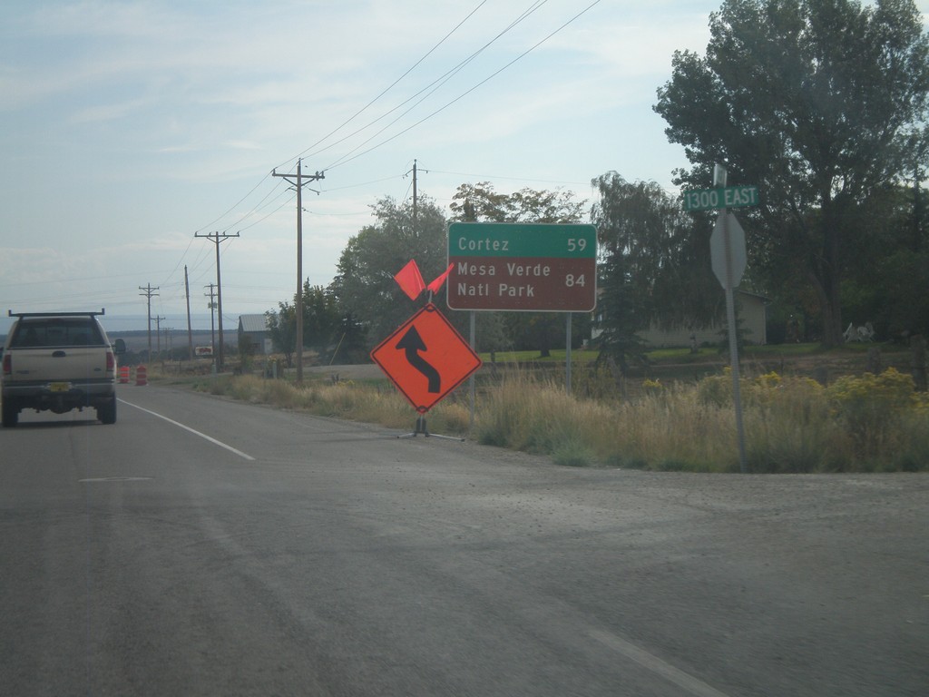
US-491 South - Distance Marker
Distance marker on US-491 south. Distance to Cortez and Mesa Verde National Park (both in Colorado). Taken on the east side of Monticello.
Taken 10-02-2011
Monticello
San Juan County
Utah
United States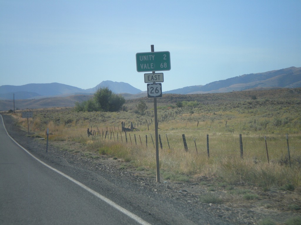
US-26 East - Distance Marker
Distance marker on US-26 east to Unity and Vale.
Taken 09-04-2011
 Unity
Baker County
Oregon
United States
Unity
Baker County
Oregon
United States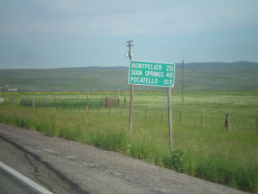
US-30 West - Distance Marker
First distance marker on US-30 west in Idaho. Distance to Montpelier, Soda Springs, and Pocatello.
Taken 07-05-2011
 Montpelier
Bear Lake County
Idaho
United States
Montpelier
Bear Lake County
Idaho
United States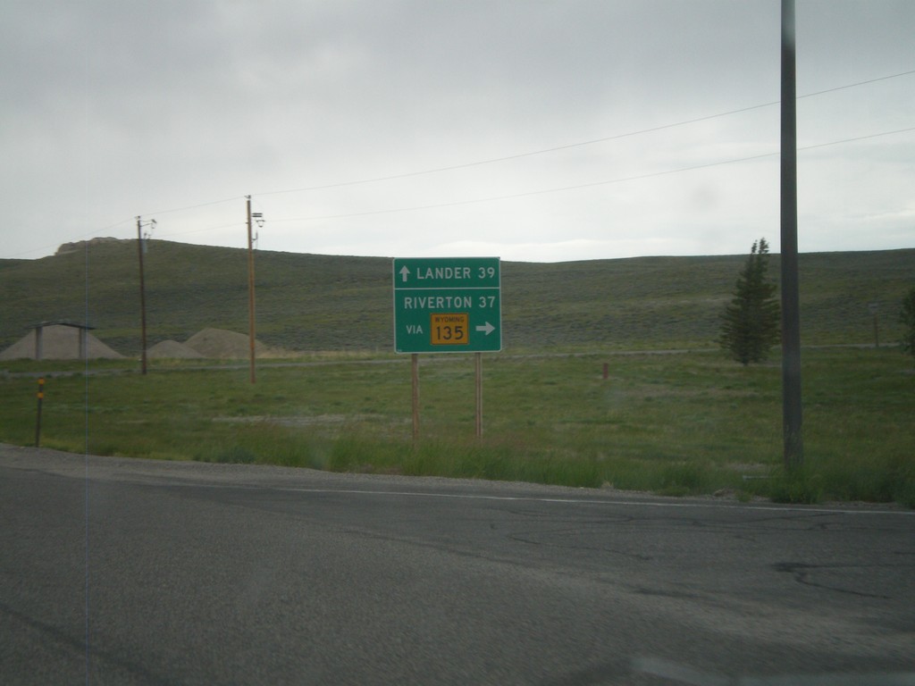
US-287/WY-789 North at WY-135
US-287/WY-789 North at WY-135 junction. Use WY-135 north for Riverton, continue on US-287/WY-789 for Lander. Taken in the community of Sweetwater Station.
Taken 07-04-2011


 Sweetwater Station
Fremont County
Wyoming
United States
Sweetwater Station
Fremont County
Wyoming
United States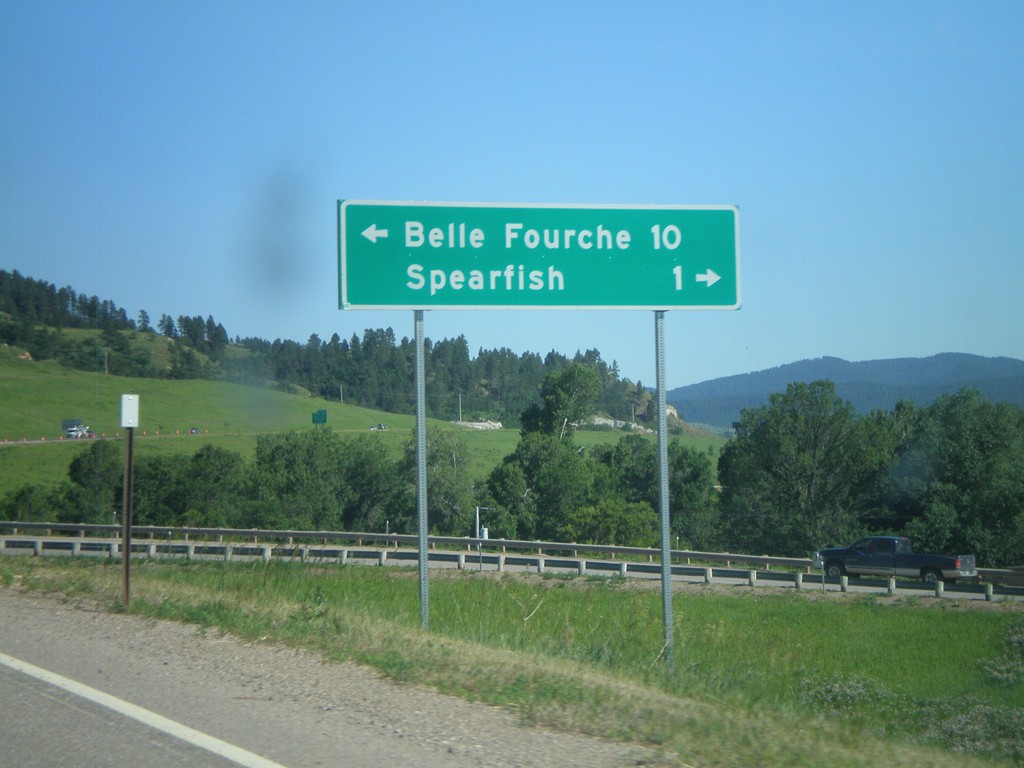
I-90/US-14 East at US-85
I-90/US-14 East (Exit 10) at US-85. Turn left for US-85 North to Belle Fourche. Turn right for BL-90 to Spearfish.
Taken 07-03-2011


 Spearfish
Lawrence County
South Dakota
United States
Spearfish
Lawrence County
South Dakota
United States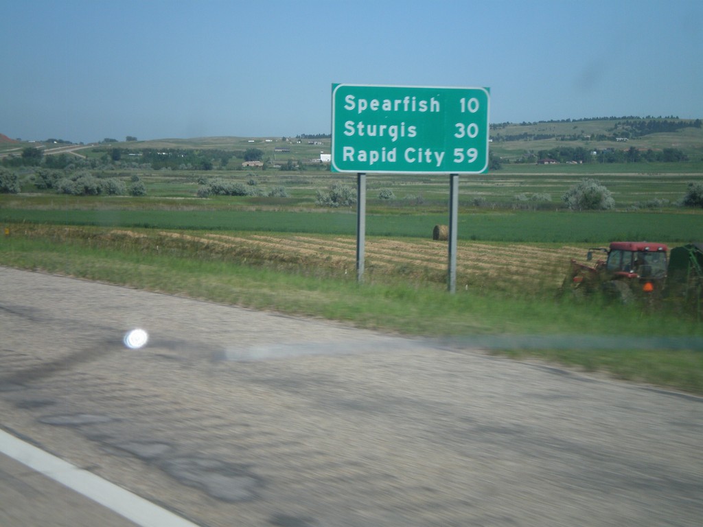
I-90 East - Distance Marker
First distance marker on I-90 east in South Dakota. Distance to Spearfish, Sturgis, and Rapid City.
Taken 07-03-2011
Spearfish
Lawrence County
South Dakota
United States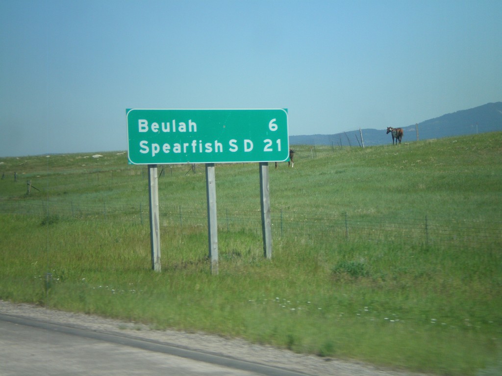
I-90 East - Distance Marker
Distance marker on I-90 east to Beulah, and Spearfish, SD. Taken just east of WY-111 junction.
Taken 07-03-2011
Beulah
Crook County
Wyoming
United States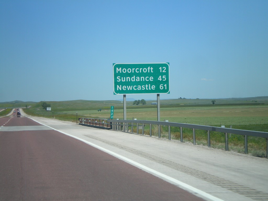
I-90 East - Distance Marker
Distance marker on I-90/US-14/US-16 east in Campbell County, Wyoming. Distance to Moorcroft, Sundance, and Newcastle (via US-16).
Taken 07-03-2011
 Rozet
Campbell County
Wyoming
United States
Rozet
Campbell County
Wyoming
United States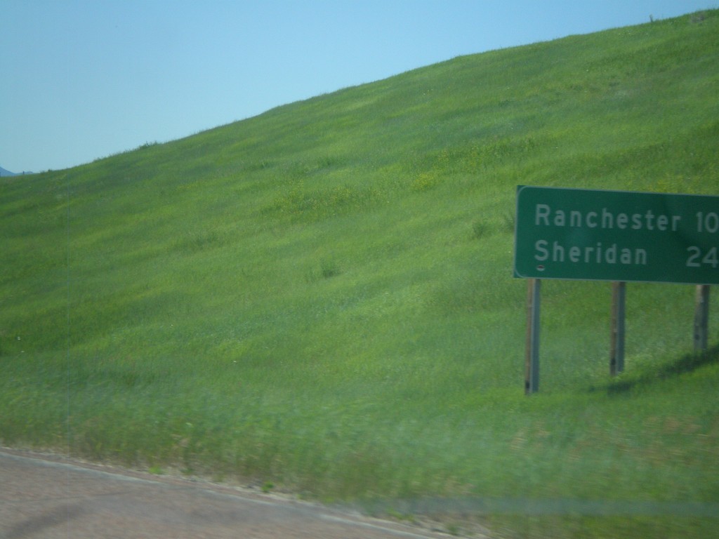
I-90 East - Distance Marker
First distance marker in Wyoming along I-90 East/US-87 South. Distance to Ranchester and Sheridan.
Taken 07-03-2011
 Parkman
Sheridan County
Wyoming
United States
Parkman
Sheridan County
Wyoming
United States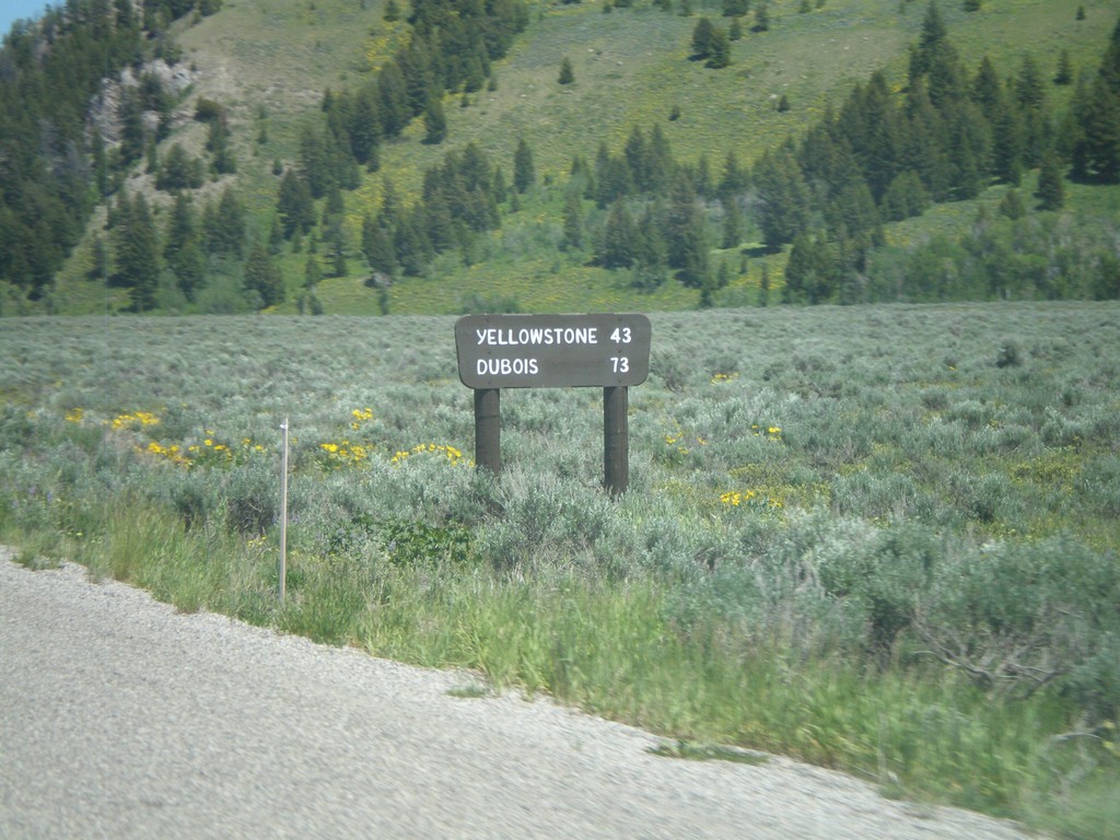
US-26 East/US-191 North - Distance Marker
Distance marker on US-26 East/US-191 North to Yellowstone and Dubois. The sign is a wooden style common inside both Grand Teton and Yellowstone National Park. This marker is just inside Grand Teton National Park.
Taken 07-02-2011
 Jackson
Teton County
Wyoming
United States
Jackson
Teton County
Wyoming
United States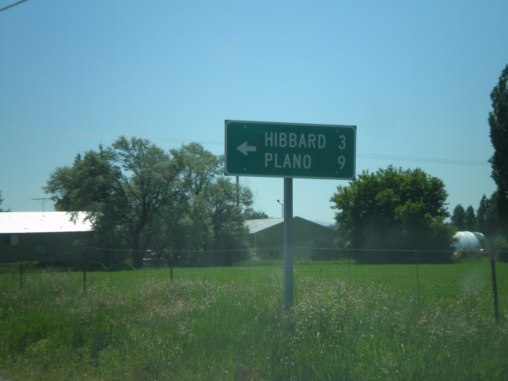
ID-33 East at N 3000 West
ID-33 east at N 3000 West to Hibbard and Plano.
Taken 07-02-2011
 Rexburg
Madison County
Idaho
United States
Rexburg
Madison County
Idaho
United States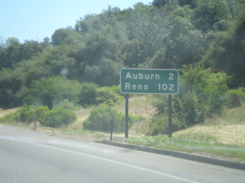
I-80 East - Distance Marker
Distance marker on I-80 east to Auburn and Reno.
Taken 06-13-2011
 Newcastle
Placer County
California
United States
Newcastle
Placer County
California
United States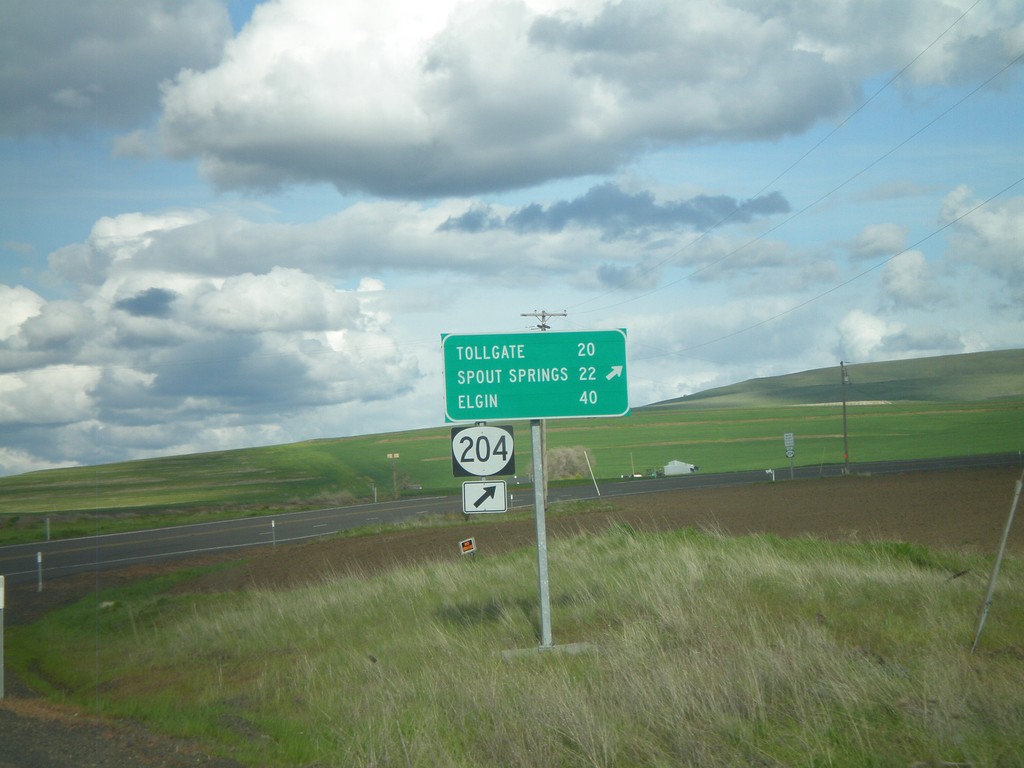
OR-204 East at Winn Road
OR-204 east at Winn Road. Merge right to continue on OR-204 for Tollgate, Spout Springs, and Elgin.
Taken 04-28-2011
 Weston
Umatilla County
Oregon
United States
Weston
Umatilla County
Oregon
United States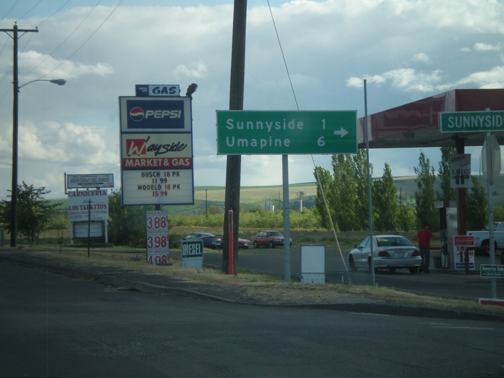
OR-11 South at Sunnyside Road
OR-11 south at Sunnyside Road. Turn right on Sunnyside Road for Sunnyside and Umapine.
Taken 04-28-2011
 Milton-Freewater
Umatilla County
Oregon
United States
Milton-Freewater
Umatilla County
Oregon
United States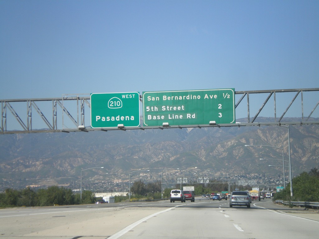
CA-210 West - Next 3 Exits
Next 3 CA-210 exits: San Bernardino Ave., 5th St., and Base Line Road. Continue west on CA-210 for Pasadena.
Taken 02-28-2011
 Redlands
San Bernardino County
California
United States
Redlands
San Bernardino County
California
United States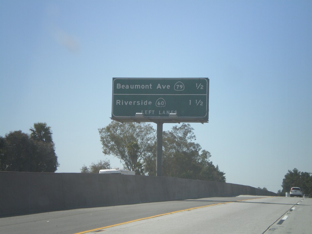
I-10 West - Next 2 Beaumont Exits
Next 2 exits on I-10 west in Beaumont: CA-79/Beaumont Ave and Riverside/CA-60.
Taken 02-28-2011


 Beaumont
Riverside County
California
United States
Beaumont
Riverside County
California
United States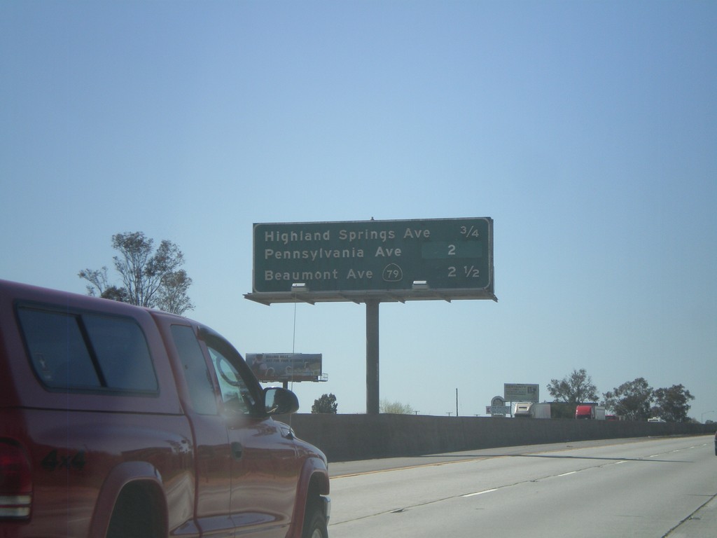
I-10 West - Banning/Beaumont Exits
Banning and Beaumont exits on I-10 west - Highland Springs Ave., Pennsylvania Ave., and CA-79/Beaumont Ave.
Taken 02-28-2011
Banning
Riverside County
California
United States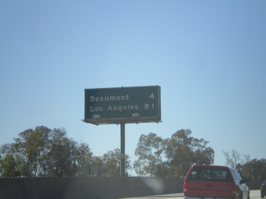
I-10 West - Distance Marker
Distance marker on I-10 west to Beaumont, and Los Angeles.
Taken 02-28-2011
Banning
Riverside County
California
United States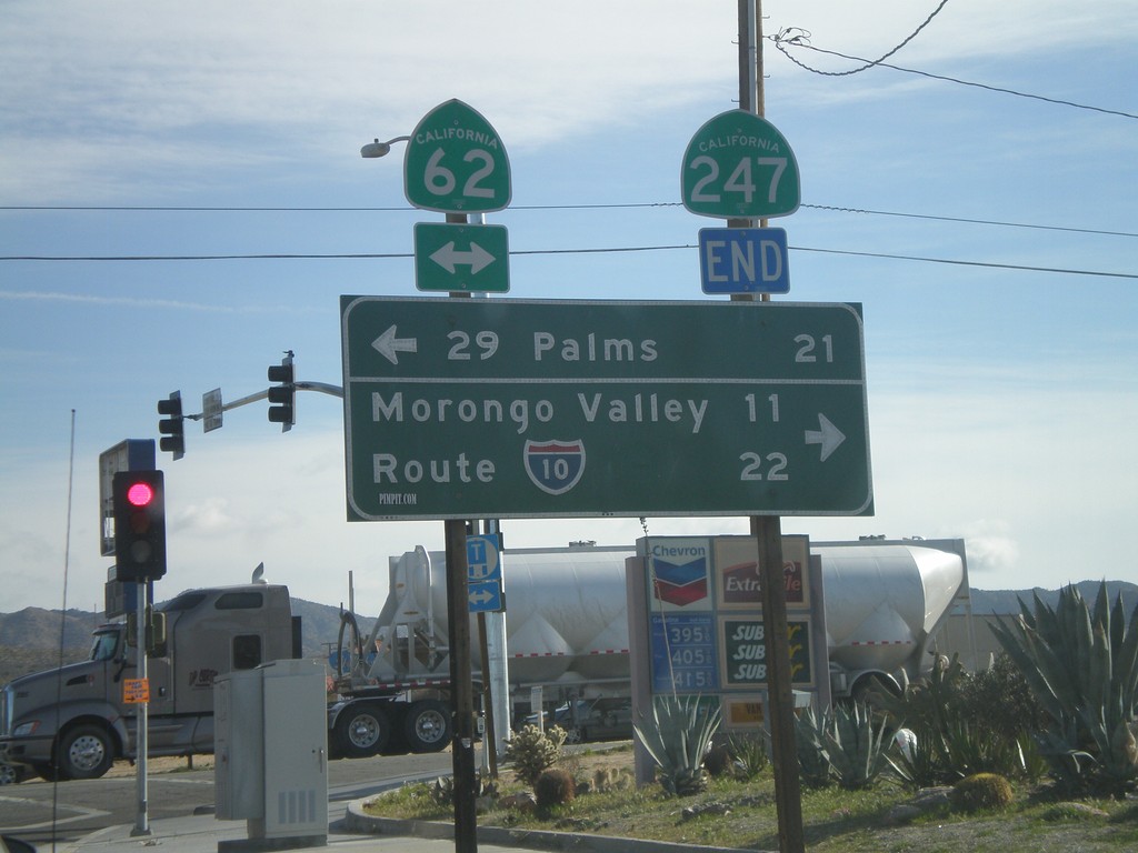
End CA-247 South at CA-62
End CA-247 south at CA-62. Use CA-62 east for 29 Palms; use CA-62 east for I-10 and Morongo Valley.
Taken 02-25-2011

 Yucca Valley
San Bernardino County
California
United States
Yucca Valley
San Bernardino County
California
United States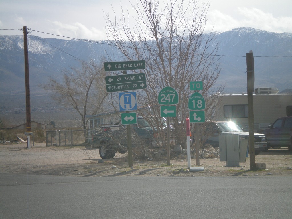
CA-247 South at CA-18
CA-247 south at CA-18. This is not the true junction with CA-18, which lies a little to the south and east. Use CA-18 west for Victorville; use CA-18 east for Big Bear Lake; use CA-247 south for 29 Palms.
Taken 02-25-2011
 Lucerne Valley
San Bernardino County
California
United States
Lucerne Valley
San Bernardino County
California
United States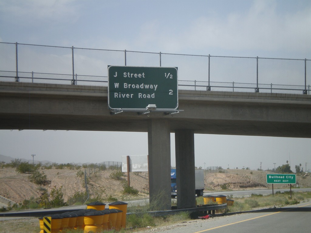
I-40 West - Needles Exits
Needles Exits on I-40 west. The next two exits are J St. and West Broadway/River Road. Sign in background directs Bullhead City (Arizona) traffic to use the J St. exit.
Taken 02-25-2011

 Needles
San Bernardino County
California
United States
Needles
San Bernardino County
California
United States