Signs Tagged With Distance Marker
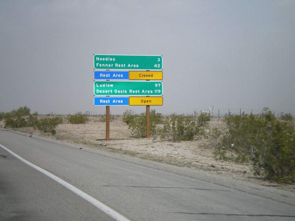
I-40 West - Mojave Desert Services
Services in the Mojave Desert along I-40 west between here and Newberry Springs. Both Needles and Ludlow have services. Also, distance to the next Rest Areas and their status.
Taken 02-25-2011
 Needles
San Bernardino County
California
United States
Needles
San Bernardino County
California
United States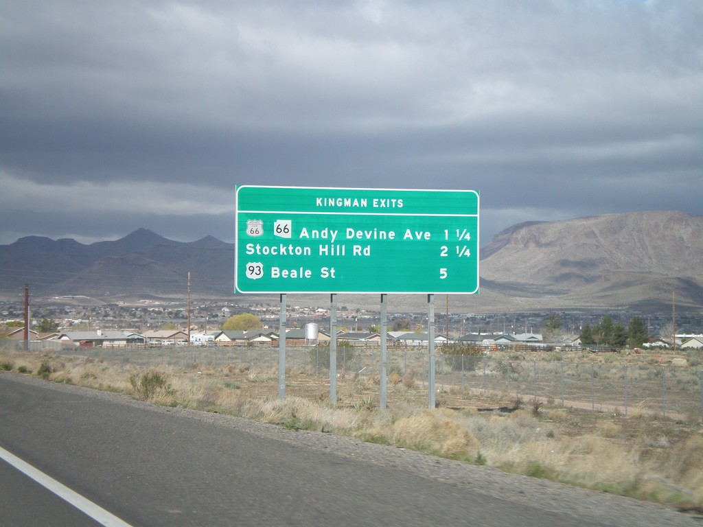
I-40 West - Kingman Exits
Kingman exits on I-40 west: Historic Loop US-66/AZ-66/Andy Devine Ave., Stockton Hill Road, US-93 Beale St.
Taken 02-25-2011


 Kingman
Mohave County
Arizona
United States
Kingman
Mohave County
Arizona
United States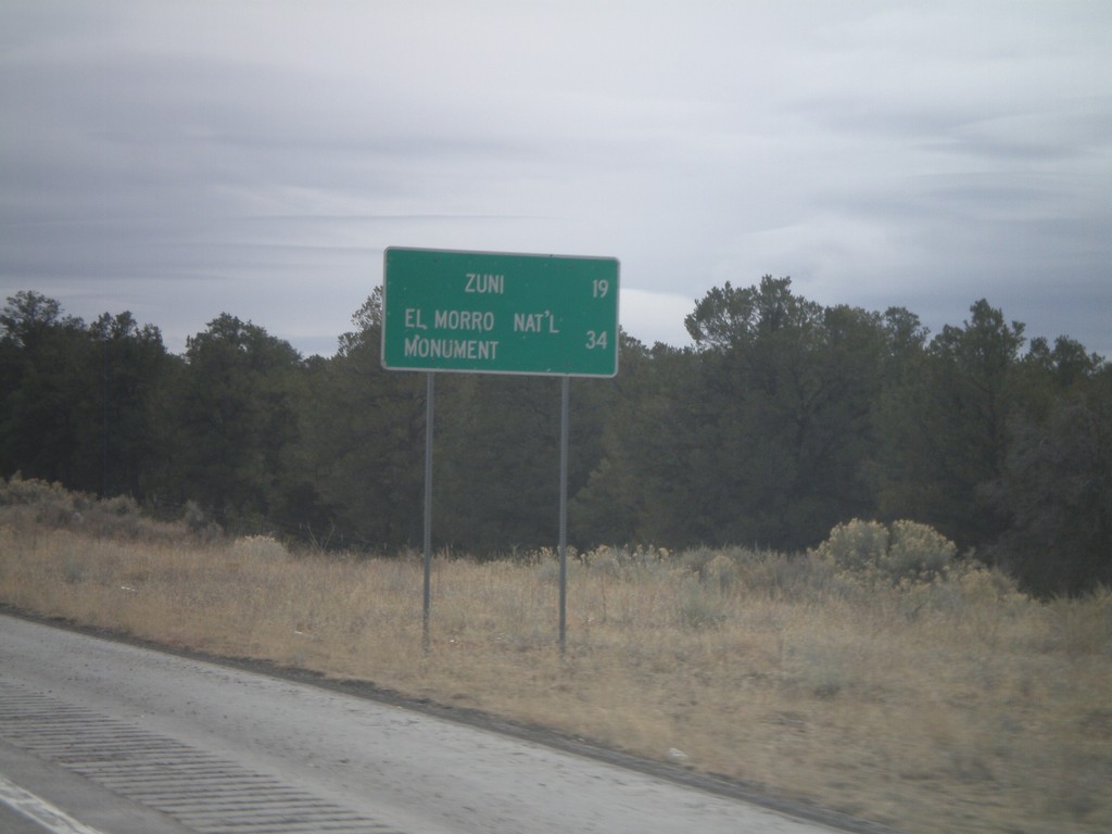
NM-602 South - Distance Marker
Distance marker on NM-602 south to Zuni, and El Morro National Monument.
Taken 02-24-2011
 Vanderwagen
McKinley County
New Mexico
United States
Vanderwagen
McKinley County
New Mexico
United States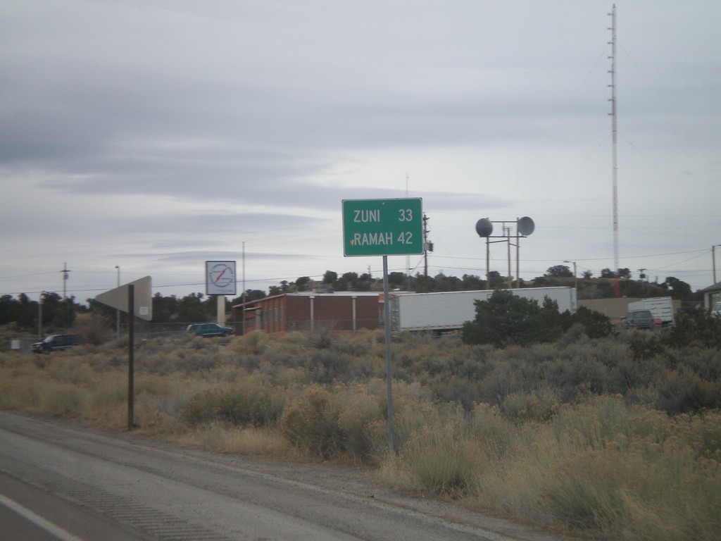
NM-602 South - Distance Marker
Distance marker on NM-602 south to Zuni, and Ramah.
Taken 02-24-2011
Gallup
McKinley County
New Mexico
United States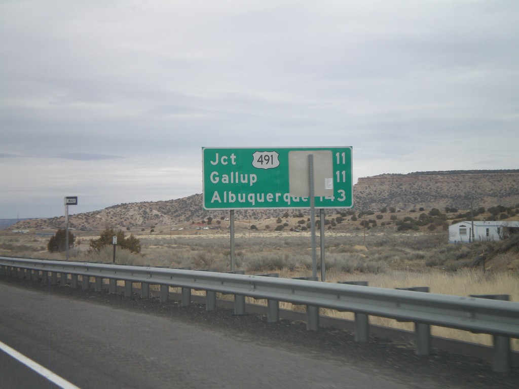
Distance Marker on I-40 East
Distance marker on I-40 east. Distance to US-491, Gallup, and Albuquerque.
Taken 02-24-2011
 Gallup
McKinley County
New Mexico
United States
Gallup
McKinley County
New Mexico
United States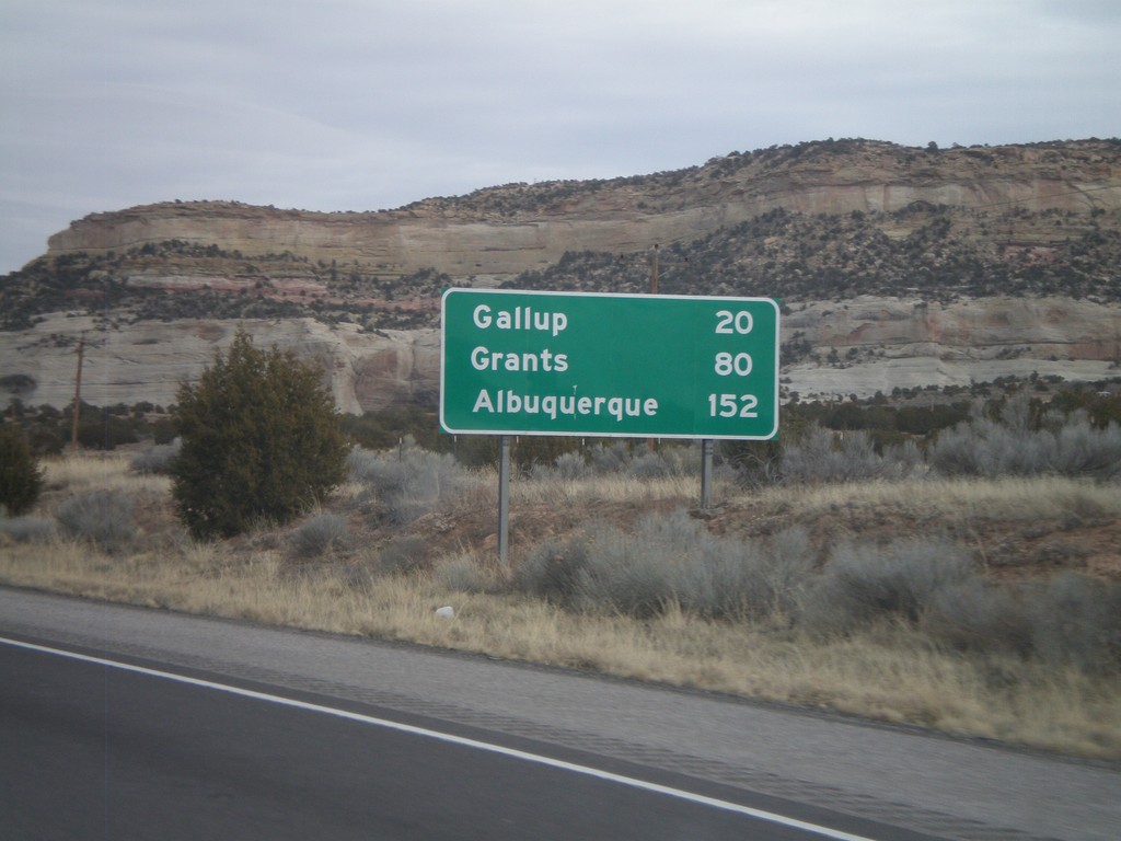
I-40 East - Distance Marker
First distance marker inside New Mexico on I-40 eastbound. Distance to Gallup, Grants, and Albuquerque.
Taken 02-24-2011
Gallup
McKinley County
New Mexico
United States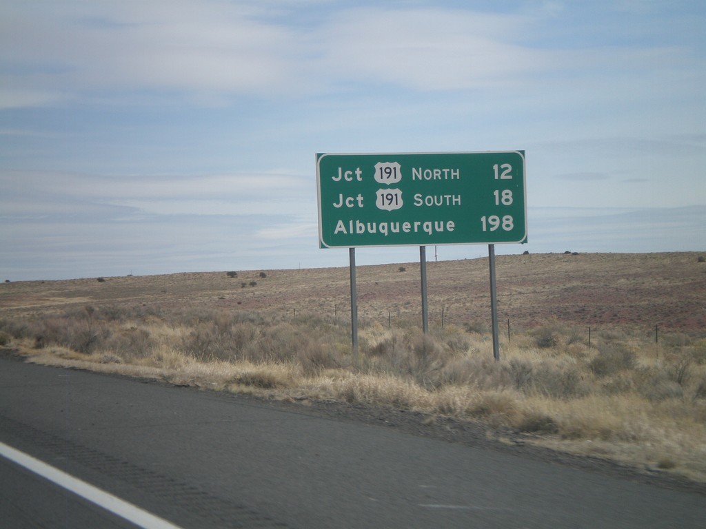
I-40 East - Distance Marker
Distance marker on I-40 east to Jct. US-191 North, Jct. US-191 South, and Albuquerque.
Taken 02-24-2011
 Chambers
Apache County
Arizona
United States
Chambers
Apache County
Arizona
United States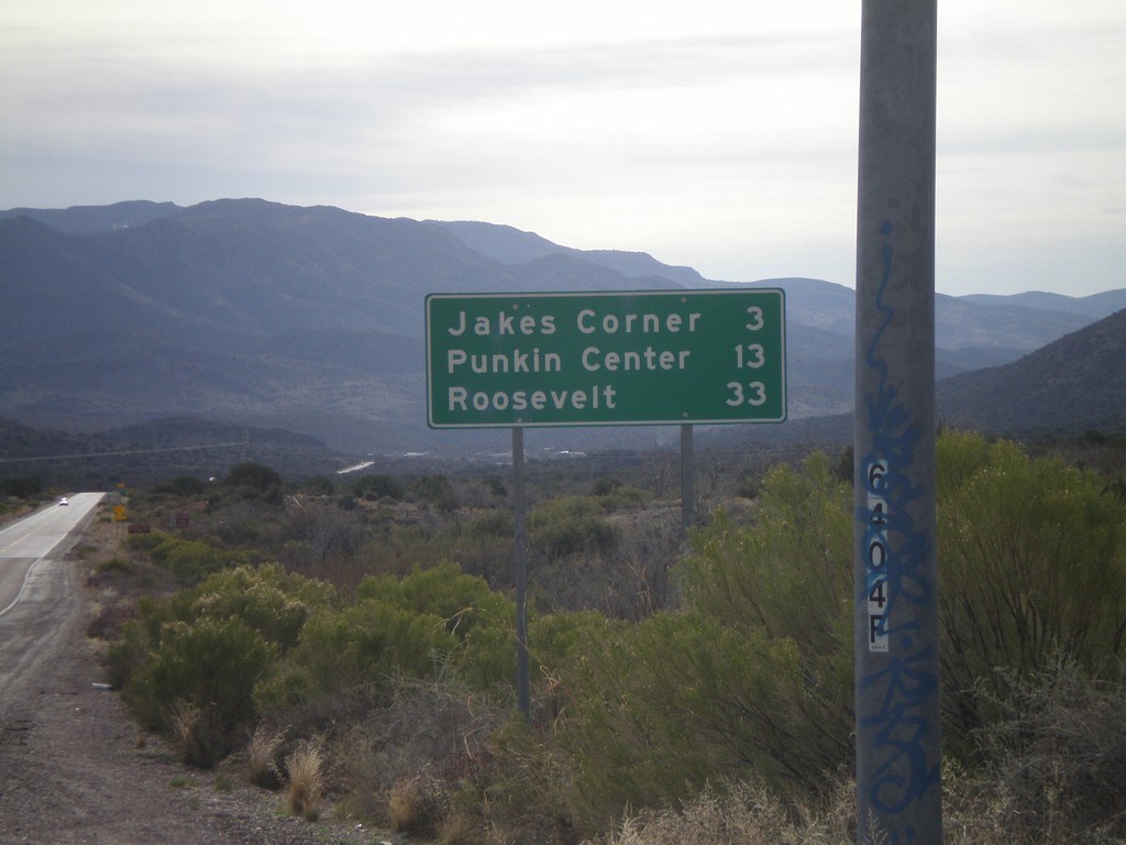
AZ-188 South - Distance Marker
Distance marker on AZ-188 south to Jakes Corner, Punkin Center, and Roosevelt.
Taken 02-24-2011
 Payson
Gila County
Arizona
United States
Payson
Gila County
Arizona
United States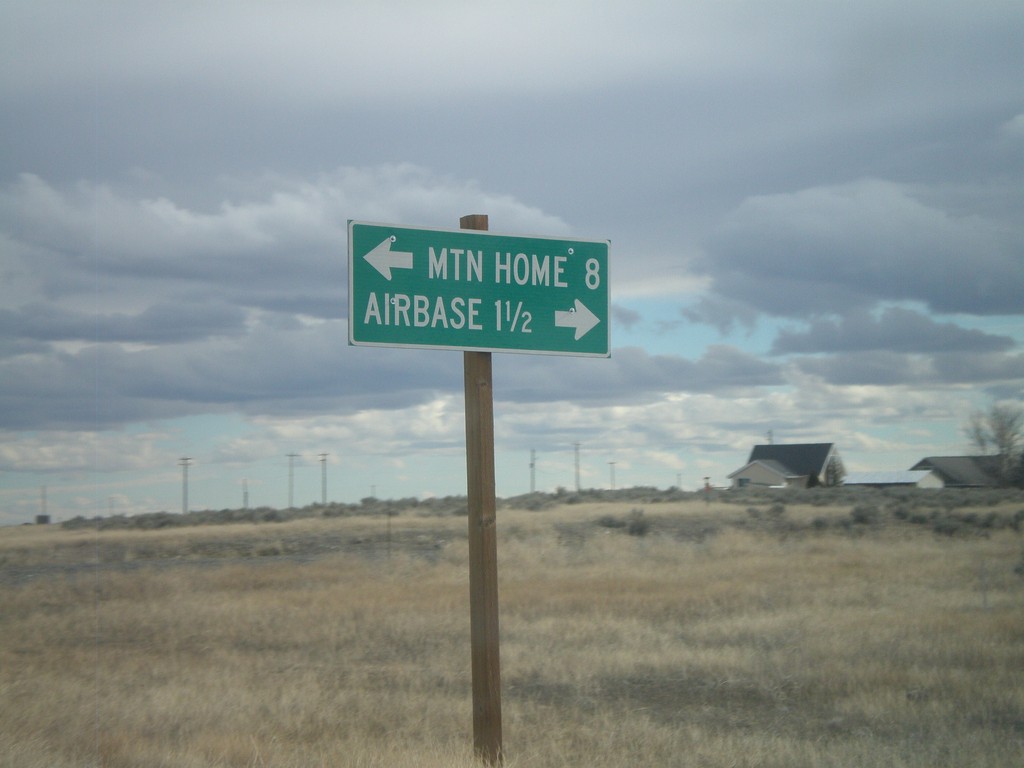
End ID-167 East at ID-67
End ID-167 east at ID-67. Use ID-67 west for the Airbase (Mountain Home AFB). Use ID-67 east for Mountain Home.
Taken 02-07-2011

 Mountain Home Air Force Base
Elmore County
Idaho
United States
Mountain Home Air Force Base
Elmore County
Idaho
United States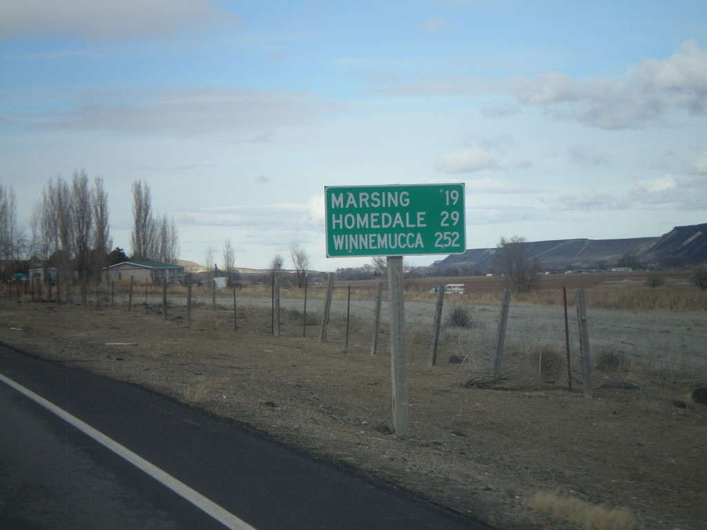
ID-78 West - Distance Marker
Distance marker on ID-78 west to Marsing, Homedale, and Winnemucca (Nevada).
Taken 02-07-2011
 Melba
Owyhee County
Idaho
United States
Melba
Owyhee County
Idaho
United States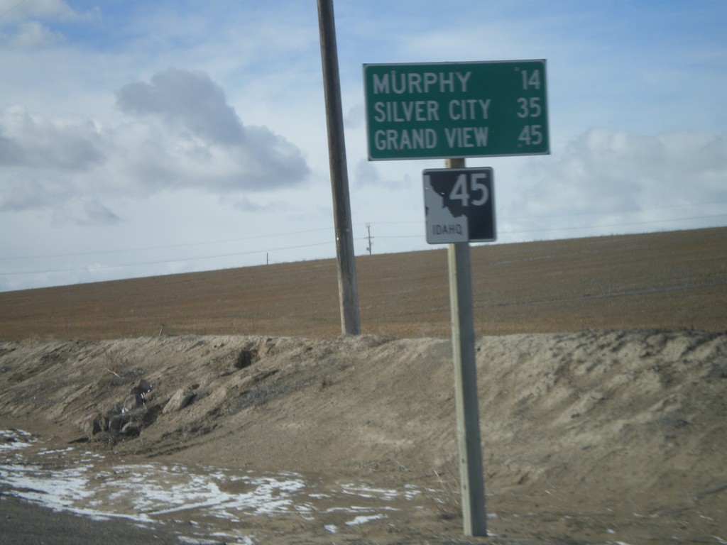
ID-45 South - Distance Marker
Distance marker on ID-45 south to Murphy, Silver City, and Grand View.
Taken 02-07-2011
 Melba
Canyon County
Idaho
United States
Melba
Canyon County
Idaho
United States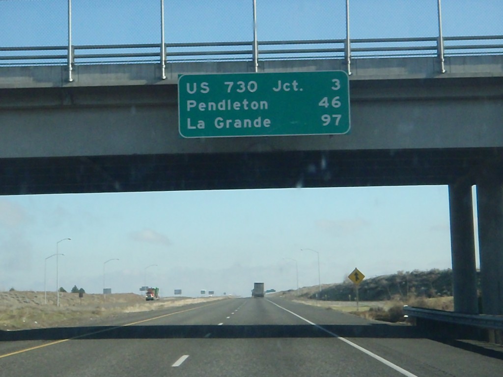
I-84 East - Distance Marker
Distance marker at Boardman Interchange. Distance to US-730 Jct., Pendleton, and La Grande.
Taken 01-19-2011

 Boardman
Morrow County
Oregon
United States
Boardman
Morrow County
Oregon
United States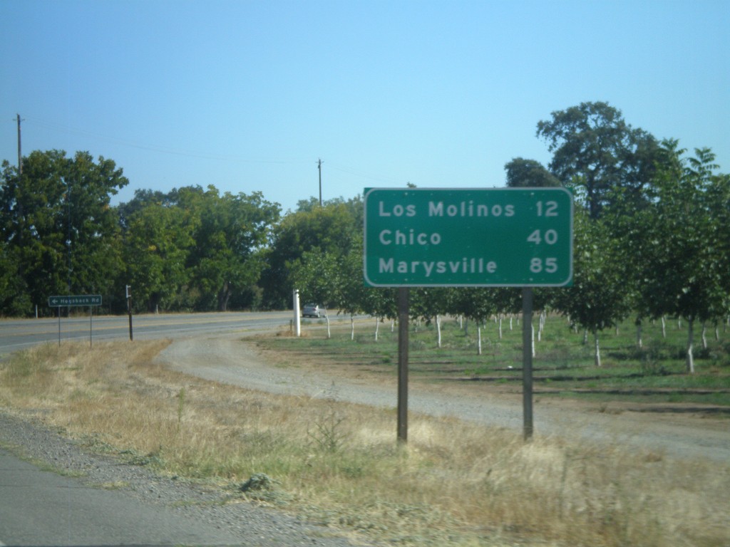
CA-99 South - Distance Marker
Distance marker on CA-99 south to Los Molinos, Chico, and Marysville.
Taken 09-25-2010
 Red Bluff
Tehama County
California
United States
Red Bluff
Tehama County
California
United States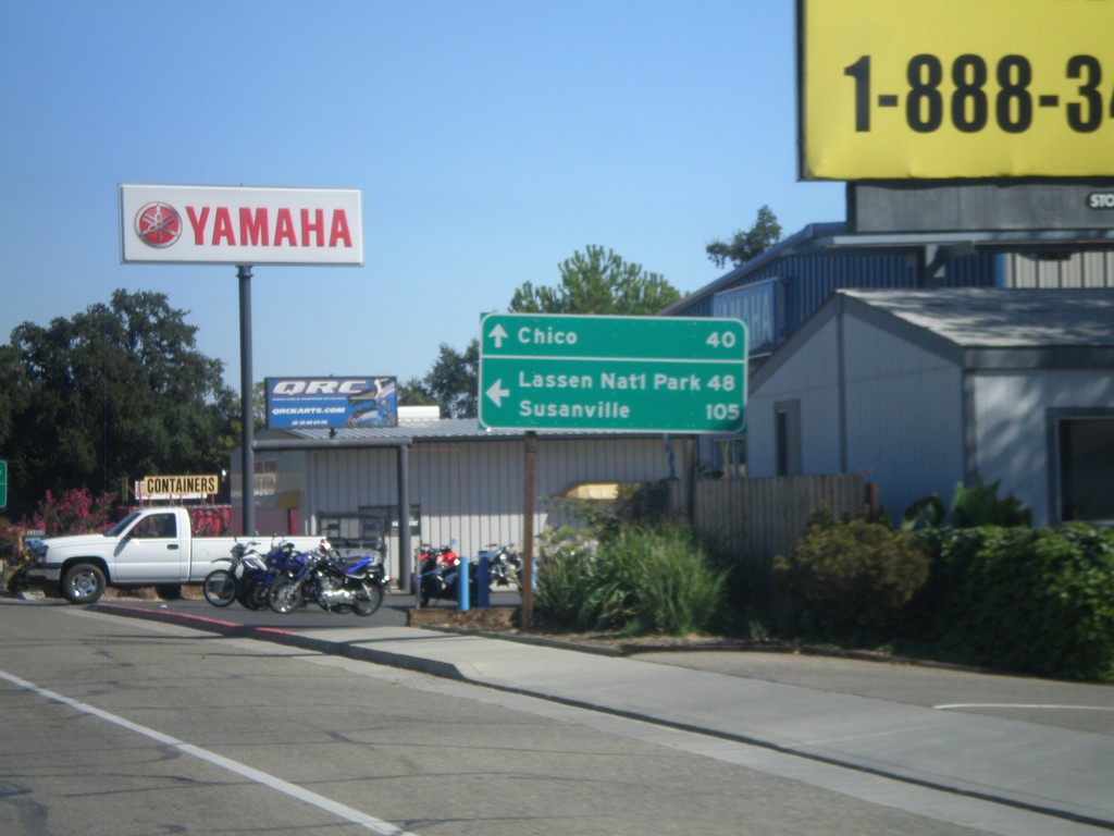
CA-36 East at CA-99
CA-36 east at CA-99. Use CA-36 east for Lassen National Park and Susanville. Continue south on CA-99 for Chico.
Taken 09-25-2010
 Red Bluff
Tehama County
California
United States
Red Bluff
Tehama County
California
United States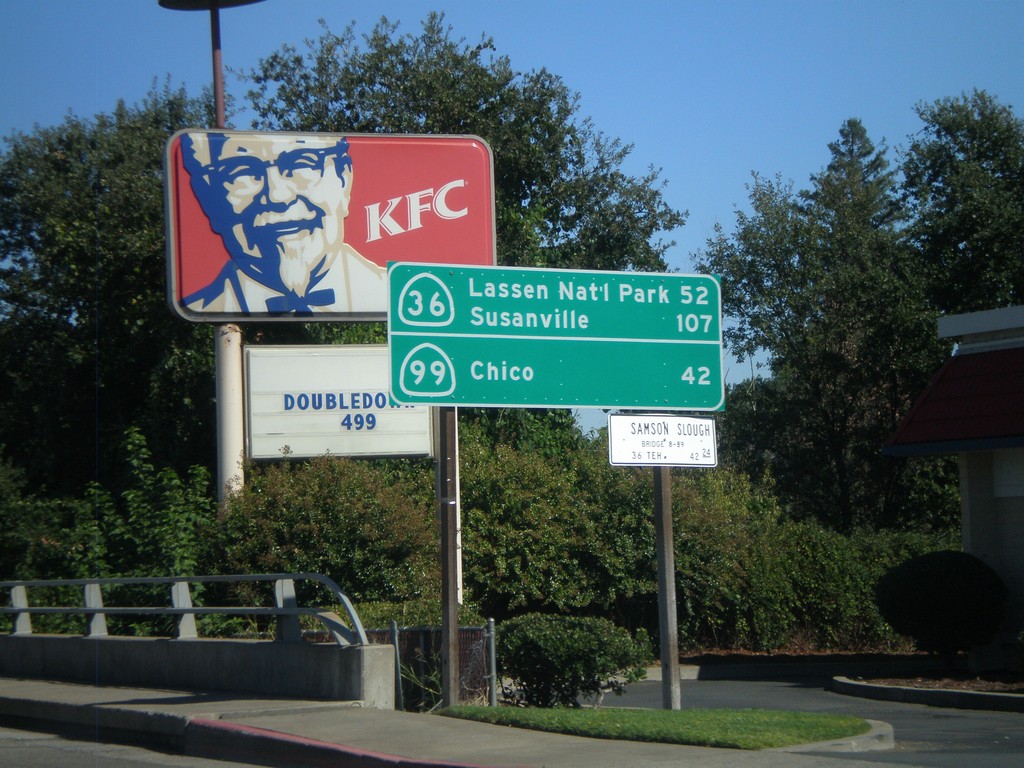
CA-36 East - Distance Marker
Distance marker on CA-36 east to Lassen Park and Susanville, via CA-36. Distance to Chico via CA-99.
Taken 09-25-2010
Red Bluff
Tehama County
California
United States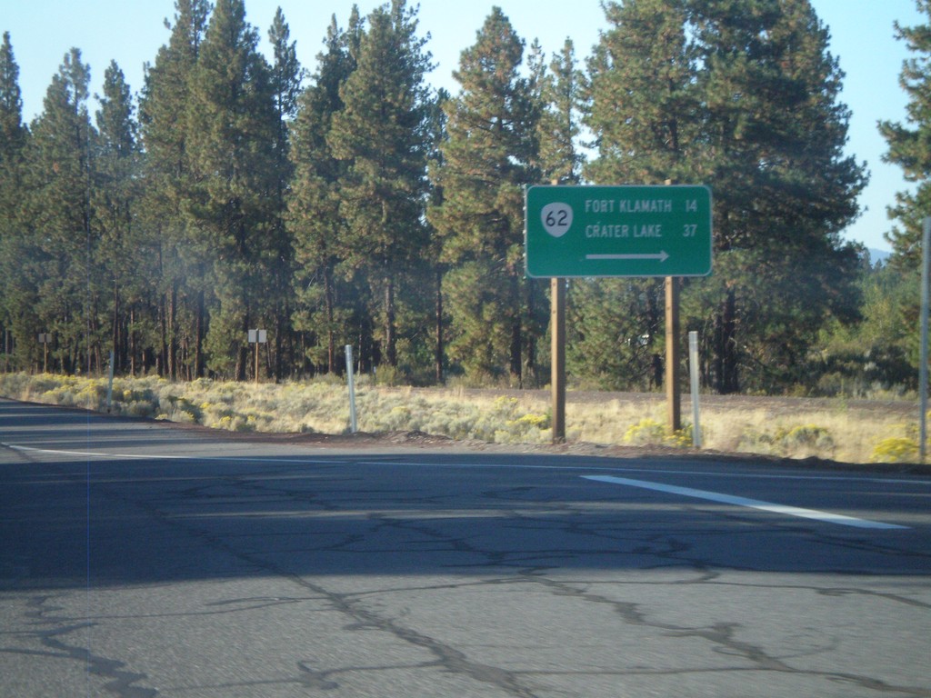
US-97 South at OR-62
US-97 south at OR-62 to Fort Klamath and Crater Lake.
Taken 09-25-2010

 Chiloquin
Klamath County
Oregon
United States
Chiloquin
Klamath County
Oregon
United States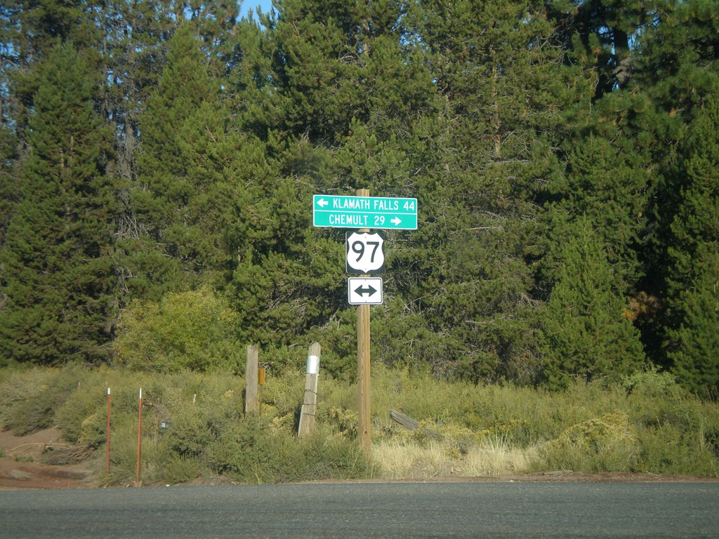
Silver Lake Road at US-97
Silver Lake Road at US-97. Use US-97 south for Klamath Falls. Use US-97 north for Chemult.
Taken 09-25-2010
Chiloquin
Klamath County
Oregon
United States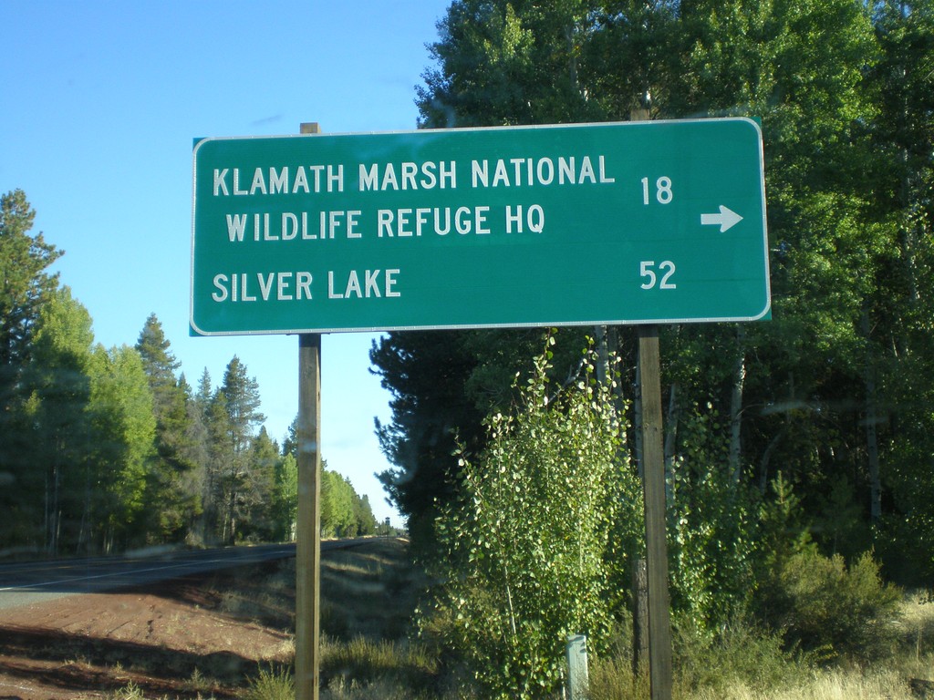
US-97 North - Silver Lake Road
US-97 north at Silver Lake Road. Use Silver Lake Road for Klamath Marsh National Wildlife Refuge HQ and Silver Lake.
Taken 09-25-2010
Chiloquin
Klamath County
Oregon
United States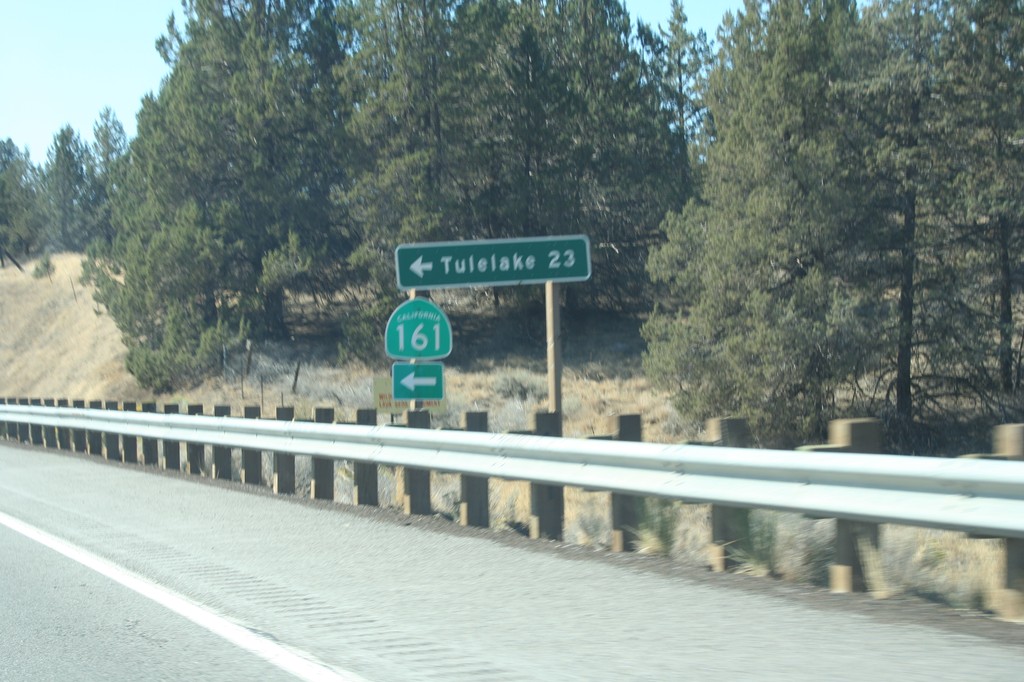
US-97 South at CA-161
US-97 south at CA-161 east to Tulelake. Tulelake is 23 miles east of here.
Taken 09-25-2010
 Dorris
Siskiyou County
California
United States
Dorris
Siskiyou County
California
United States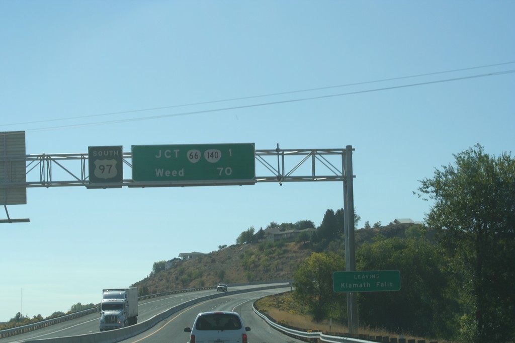
US-97 South Overhead
Distance marker on US-97 south for Weed, and OR-66/OR-140 junction. Leaving the city of Klamath Falls.
Taken 09-25-2010

 Klamath Falls
Klamath County
Oregon
United States
Klamath Falls
Klamath County
Oregon
United States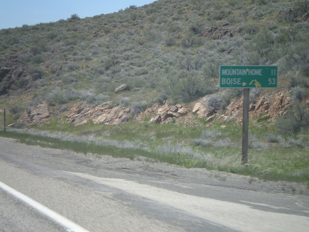
US-20 West - Distance Marker
Distance marker on US-20 west to Mountain Home and Boise.
Taken 05-02-2010
 Mountain Home
Elmore County
Idaho
United States
Mountain Home
Elmore County
Idaho
United States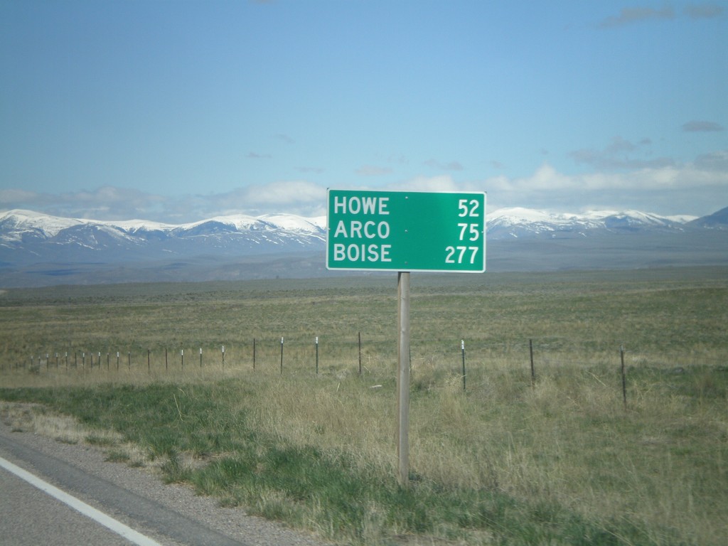
ID-22 West - Distance Marker
Distance marker on ID-22 west to Howe, Arco, and Boise.
Taken 05-02-2010
 Dubois
Clark County
Idaho
United States
Dubois
Clark County
Idaho
United States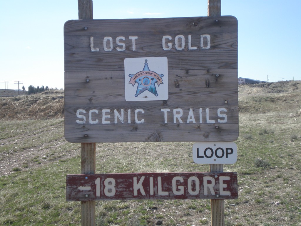
Lost Gold Scenic Trails Loop - Spencer
Lost Gold Scenic Trails Loop in Spencer on Idamon Road. Use Idamon Road for Kilgore.
Taken 05-02-2010
Spencer Clark County Idaho United States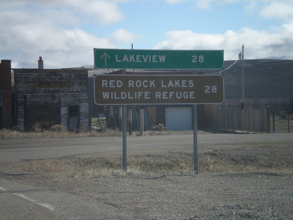
Distancer Marker in Monida
Distance Marker to Lakeview and Red Rock Lakes Wildlife Refuge in Monida.
Taken 05-02-2010
Lima Beaverhead County Montana United States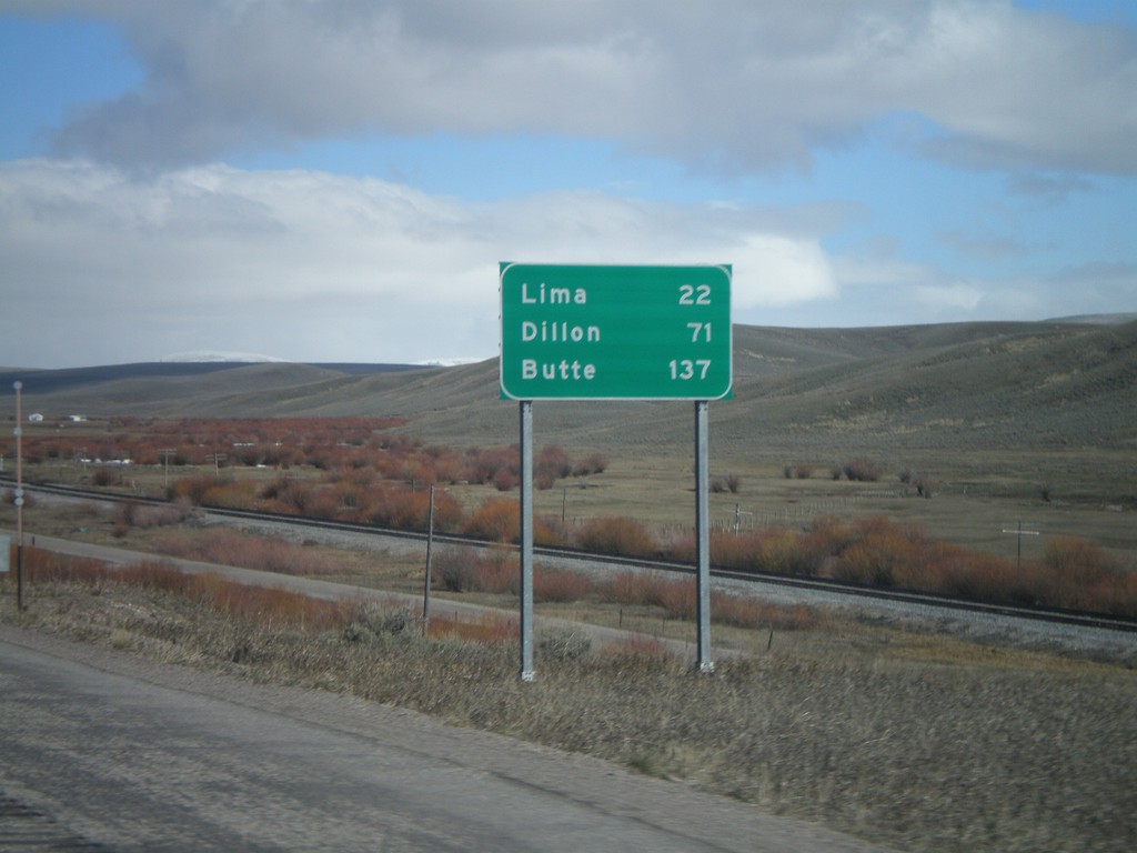
I-15 North - Distance Marker
Distance marker on I-15 north to Lima, Dillon, and Butte. All destinations are located within Montana. This is just north of Exit 190.
Taken 05-02-2010
 Humphrey
Clark County
Idaho
United States
Humphrey
Clark County
Idaho
United States