Signs Tagged With Distance Marker
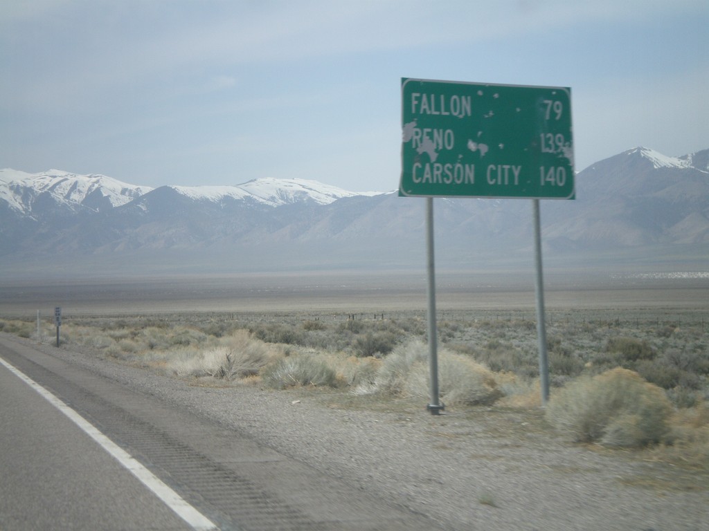
US-50 West - Distance Marker
Distance marker on US-50 west to Fallon, Reno, and Carson City.
Taken 04-15-2010
 Fallon
Churchill County
Nevada
United States
Fallon
Churchill County
Nevada
United States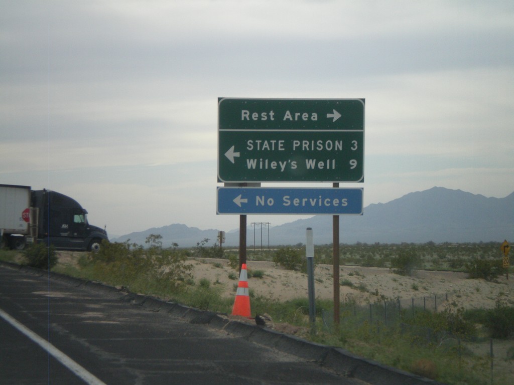
I-10 West - Exit 222 Offramp
I-10 west at Exit 222 offramp - Wiley’s Well. Turn south for Wiley’s Well Road, north for Rest Area.
Taken 03-22-2010
 Blythe
Riverside County
California
United States
Blythe
Riverside County
California
United States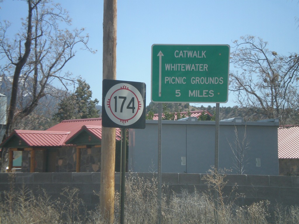
NM-174 East
NM-174 east at US-180. Use NM-174 east for the Catwalk, and Whitewater Picnic Grounds.
Taken 03-21-2010

 Mogollon
Catron County
New Mexico
United States
Mogollon
Catron County
New Mexico
United States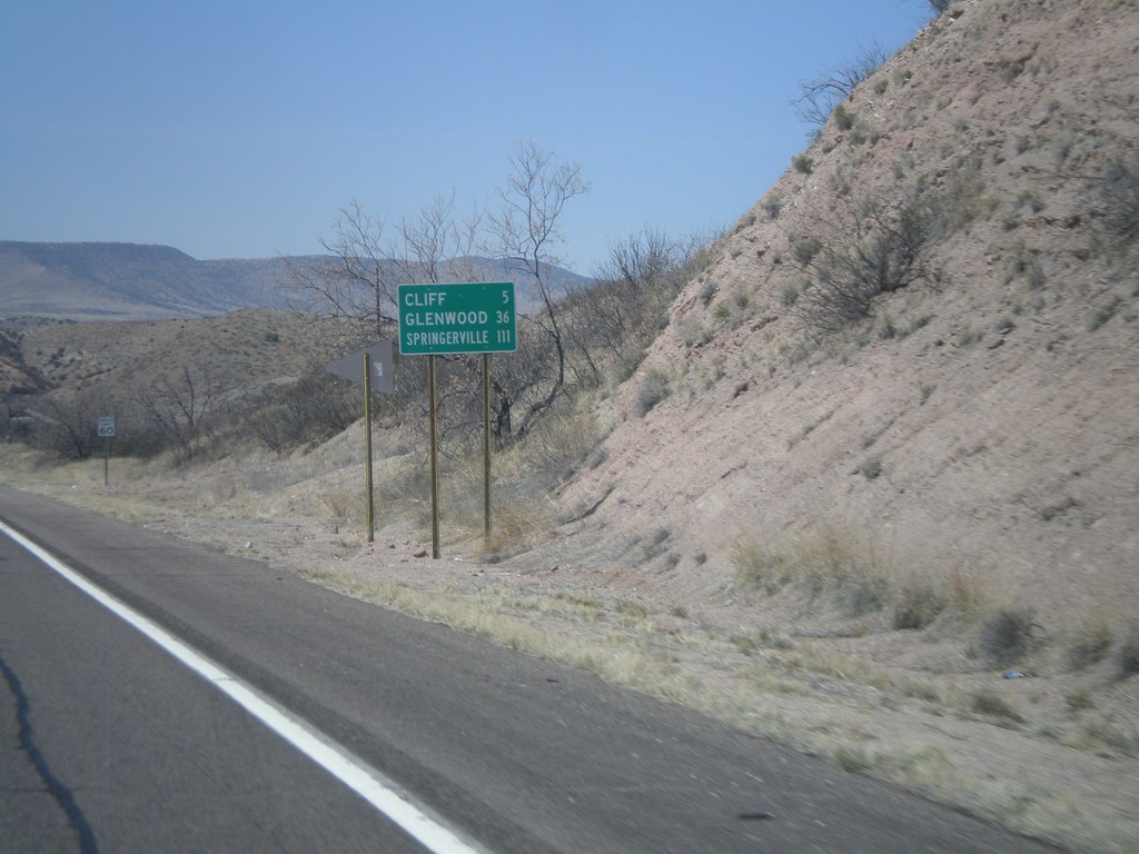
US-180 West - Distance Marker
Distance marker on US-180 west to Cliff, Glenwood, and Springerville (AZ).
Taken 03-21-2010
Gila
Grant County
New Mexico
United States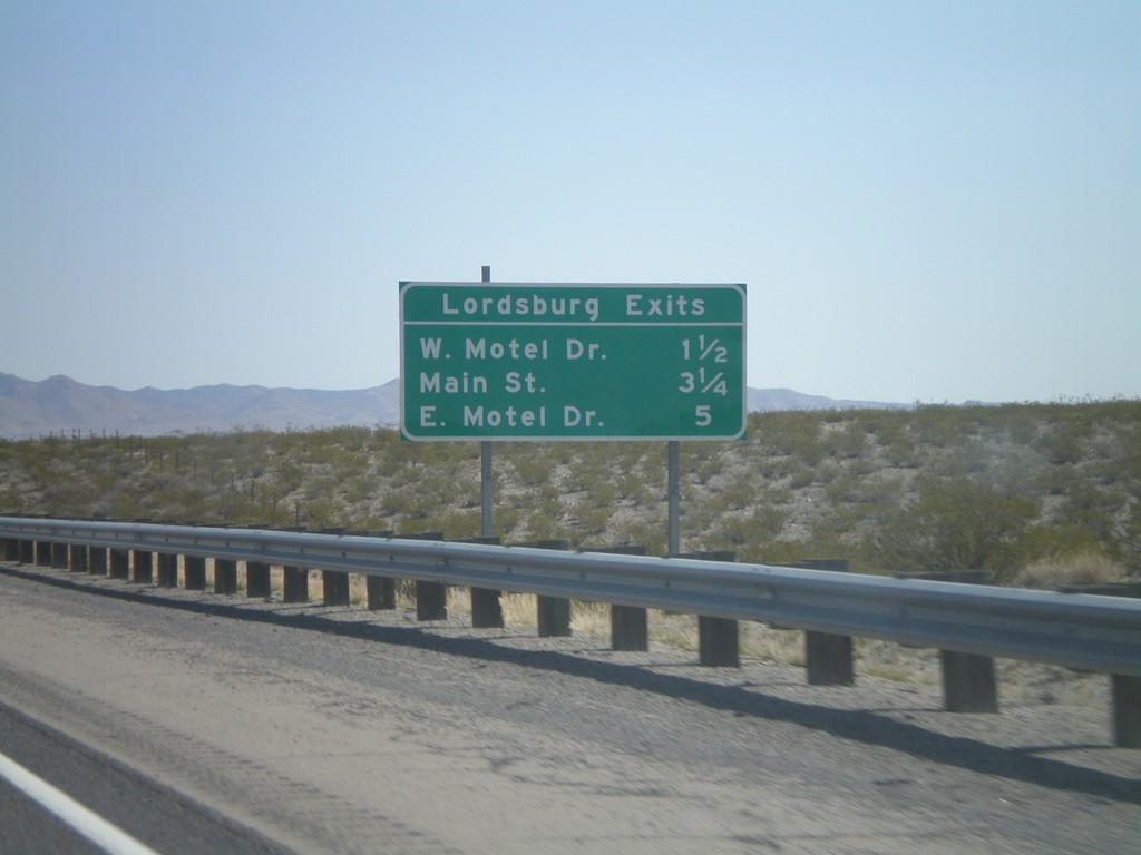
I-10 East - Lordsburg Exits
Lordsburg Exits on I-10 East - W. Motel Drive, Main St., and E. Motel Drive.
Taken 03-21-2010
Lordsburg
Hidalgo County
New Mexico
United States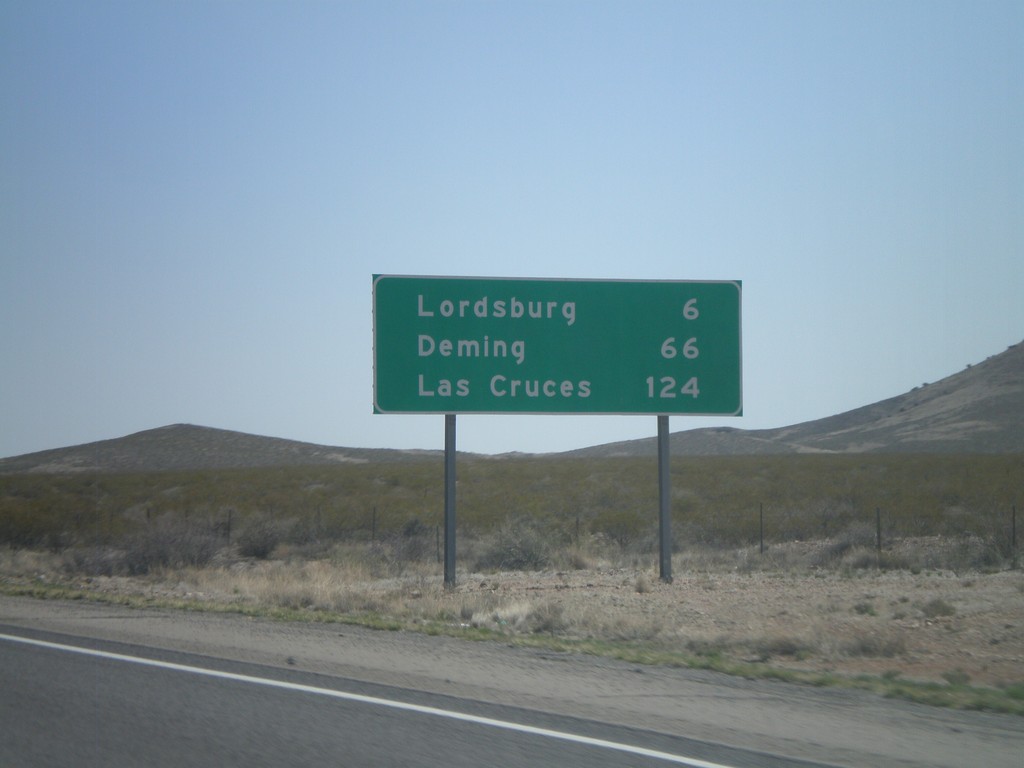
I-10 East - Distance Marker
Distance marker on I-10 east to Lordsburg, Deming, and Las Cruces. The control city in western New Mexico along I-10 is Las Cruces. In Arizona the control city is El Paso.
Taken 03-21-2010
Lordsburg
Hidalgo County
New Mexico
United States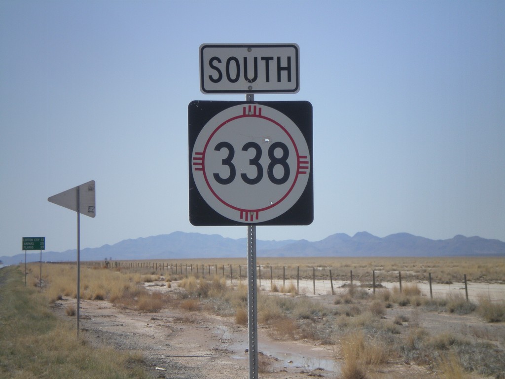
NM-338 South
NM-338 south. In the background there is a distance marker to Cotton City, Animas, and Playas.
Taken 03-21-2010
 Animas
Hidalgo County
New Mexico
United States
Animas
Hidalgo County
New Mexico
United States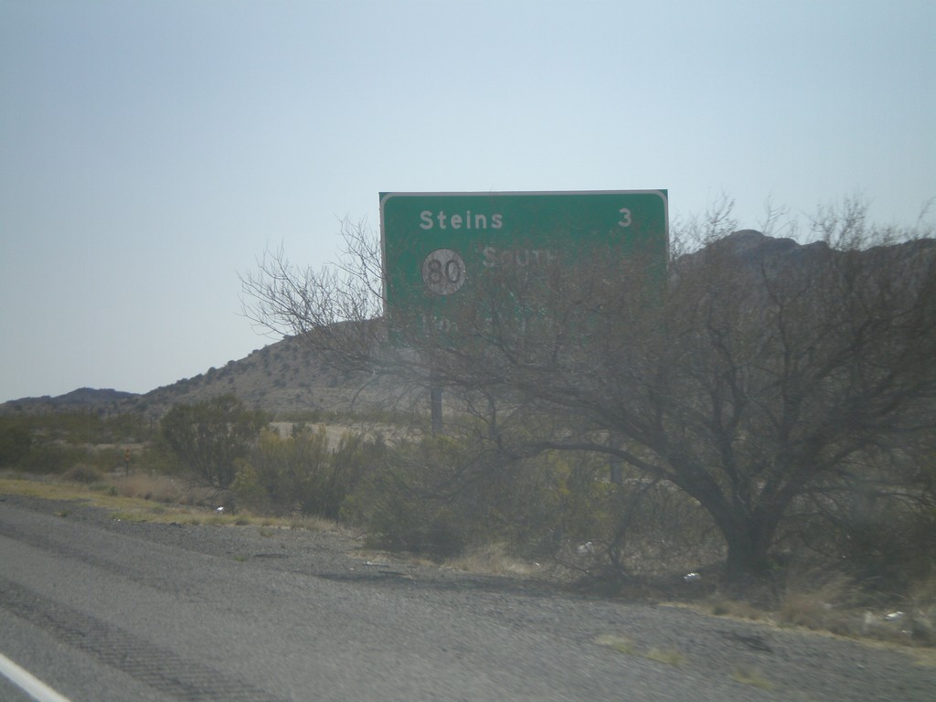
I-10 East - Distance Marker
Distance marker on I-10 east. Distance to Steins, NM-80, and Lordsburg. This is the first distance marker along I-10 in New Mexico.
Taken 03-21-2010
Steins
Hidalgo County
New Mexico
United States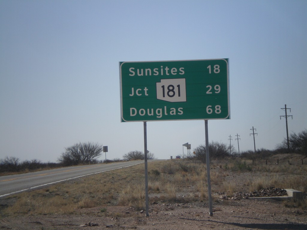
US-191 South - Distance Marker
Distance marker on US-191 south to Sunsites, AZ-181, and Douglas.
Taken 03-21-2010
 Cochise
 County
Arizona
United States
Cochise
Cochise County
Arizona
United States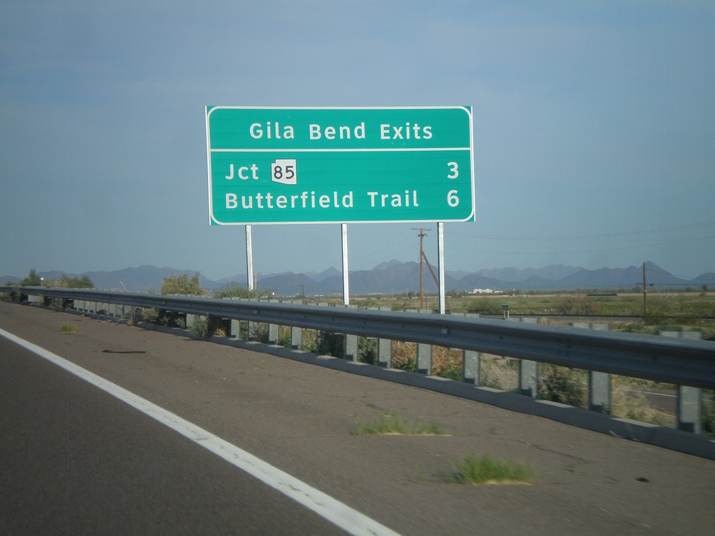
I-8 East - Gila Bend Exits
Gila Bend exits on I-8 east - Jct. AZ-85 and Butterfield Trail.
Taken 03-20-2010
 Gila Bend
Maricopa County
Arizona
United States
Gila Bend
Maricopa County
Arizona
United States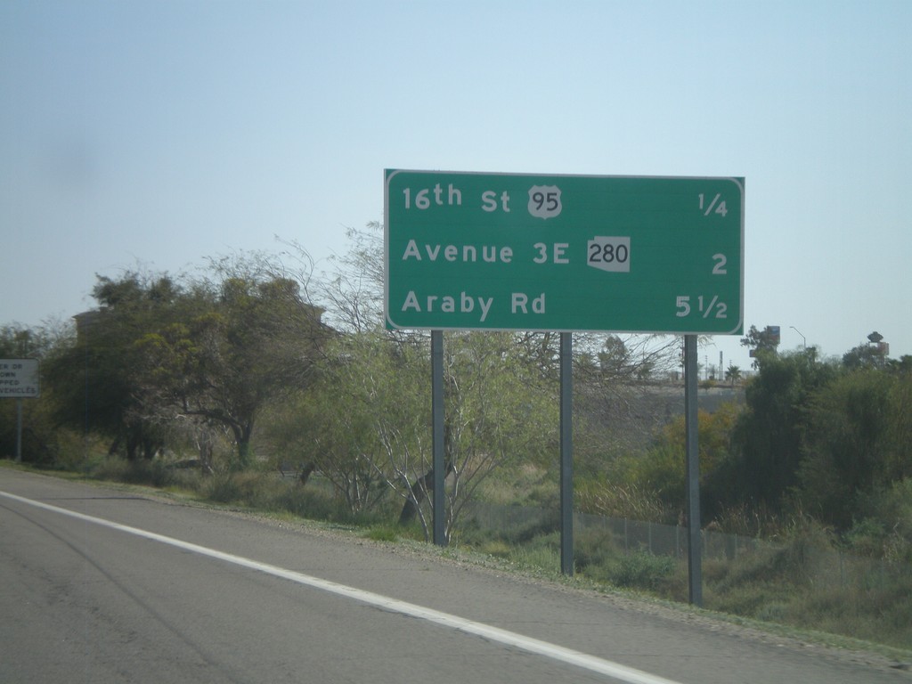
I-8 East - Distance Marker
Upcoming exits on I-8 east - 16th St./US-95, Ave 3E/AZ-280, Araby Road.
Taken 03-20-2010
Yuma
Yuma County
Arizona
United States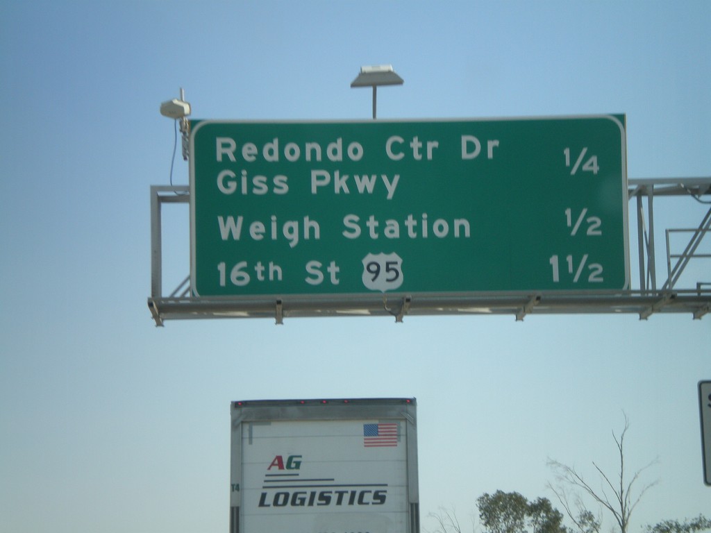
I-8 East - Yuma Exits
Upcoming exits on I-8 east in Yuma - Redondo Center Drive/Giss Parkway, Weigh Station, 16th St./US-95.
Taken 03-20-2010
Yuma
Yuma County
Arizona
United States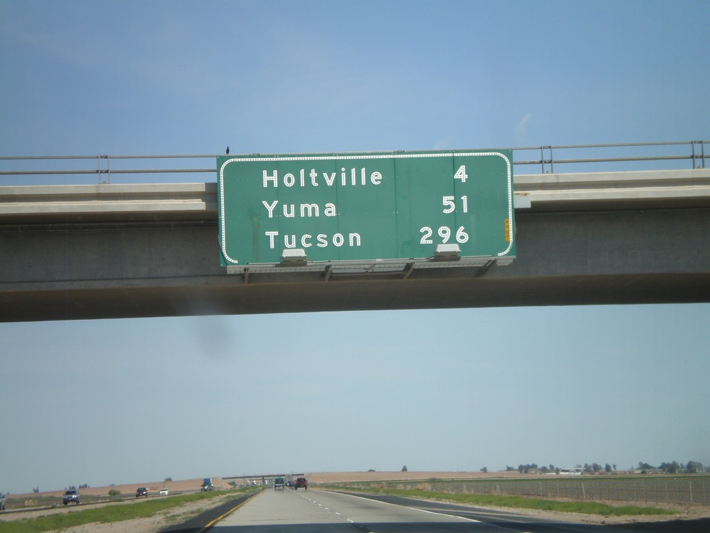
I-8 East - Distance Marker
Distance marker on I-8 east. Distances to Holtville, Yuma, and Tucson.
Taken 03-20-2010
El Centro
Imperial County
California
United States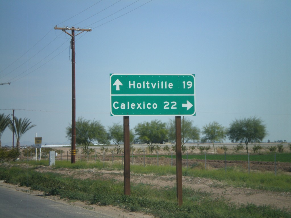
CA-78 East/CA-111 South at Split
CA-78 East/CA-111 South at Split. Use CA-111 south for Calexico. Use CA-78 east for Holtville.
Taken 03-20-2010

 Brawley
Imperial County
California
United States
Brawley
Imperial County
California
United States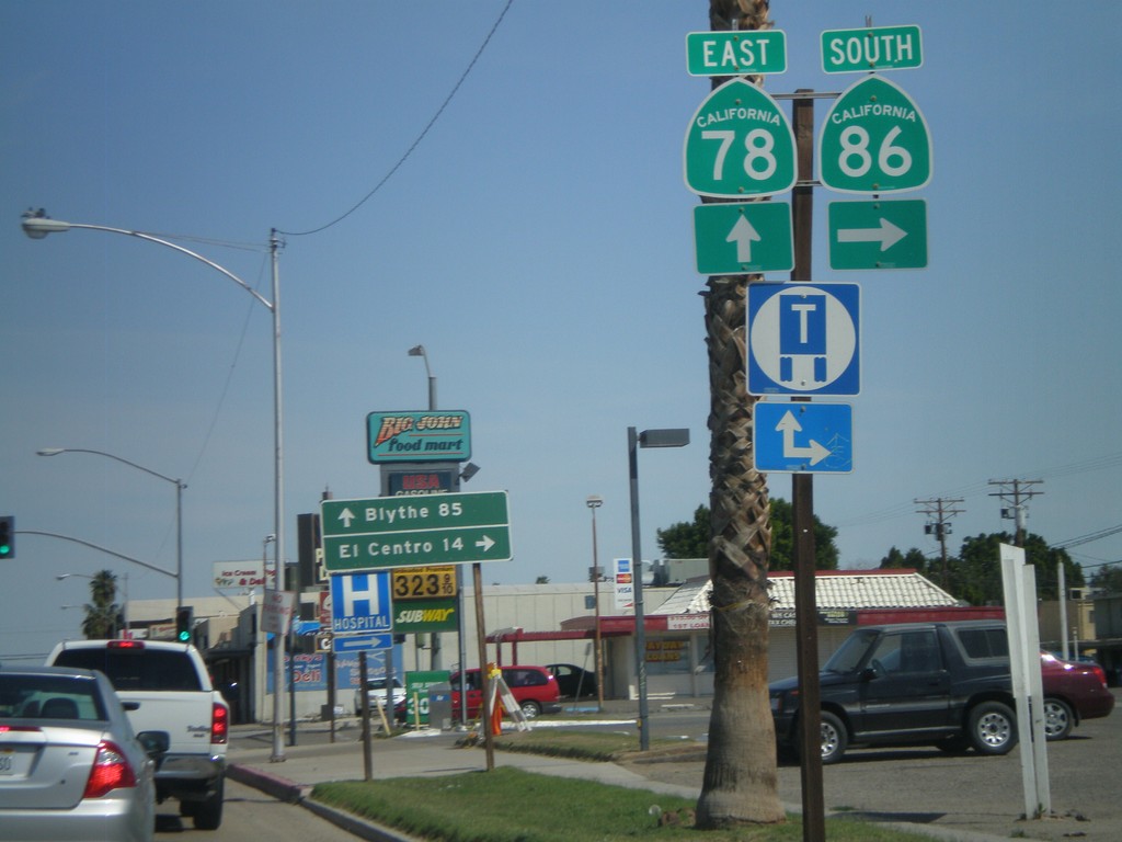
CA-78 East/CA-86 South at Split
CA-78 East/CA-86 South at Split. Turn right for CA-86 south to El Centro. Continue east on CA-78 for Blythe.
Taken 03-20-2010
 Brawley
Imperial County
California
United States
Brawley
Imperial County
California
United States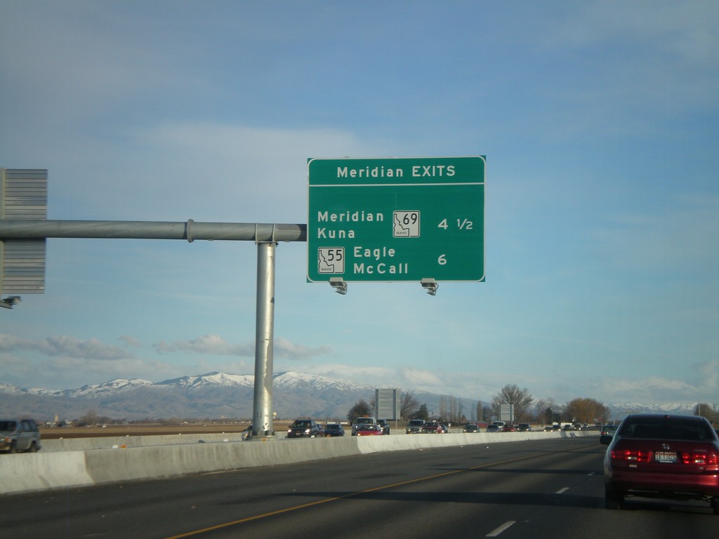
I-84 East - Meridian Exits
Meridian exits on I-84 east. Approaching ID-69, and ID-55 junction.
Taken 01-18-2010


 Nampa
Canyon County
Idaho
United States
Nampa
Canyon County
Idaho
United States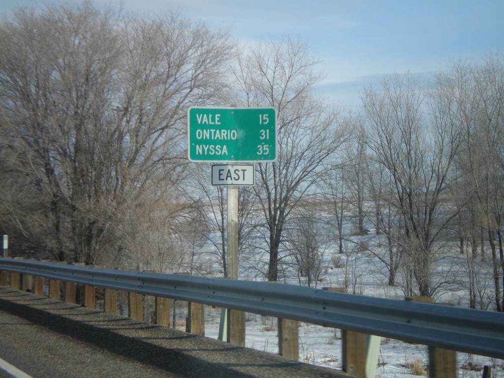
US-20 East - Distance Marker
Distance marker on US-20 east to Vale, Ontario, and Nyssa. Missing US-20 shield on sign.
Taken 01-18-2010
 Harper
Malheur County
Oregon
United States
Harper
Malheur County
Oregon
United States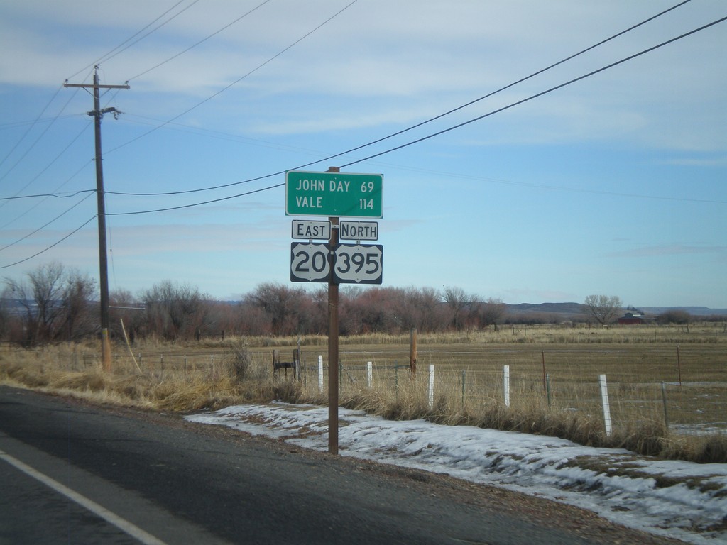
US-20 East/US-395 North - Distance Marker
Distance marker on US-20 East/US-395 north to John Day and Vale.
Taken 01-18-2010
 Burns
Harney County
Oregon
United States
Burns
Harney County
Oregon
United States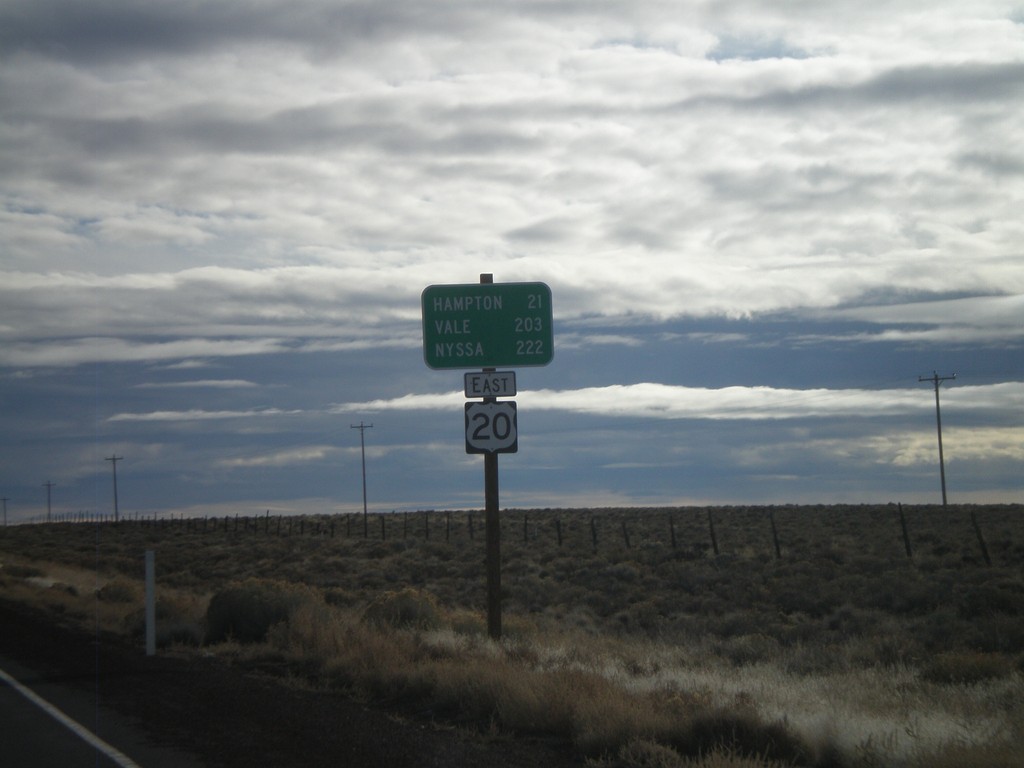
US-20 East - Brothers
Distance marker on US-20 east outside of Brothers. Distance to Hampton, Vale, and Nyssa.
Taken 01-18-2010
Brothers
Deschutes County
Oregon
United States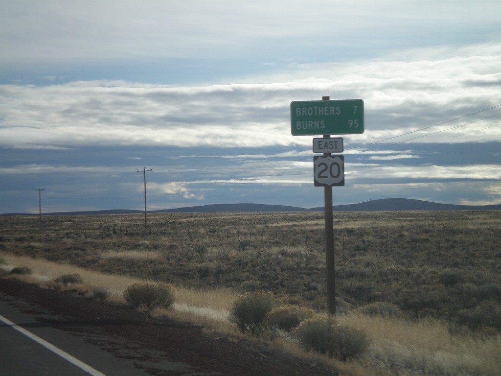
US-20 East - Distance Marker
Distance marker on US-20 east to Brothers and Burns.
Taken 01-18-2010
Brothers
Deschutes County
Oregon
United States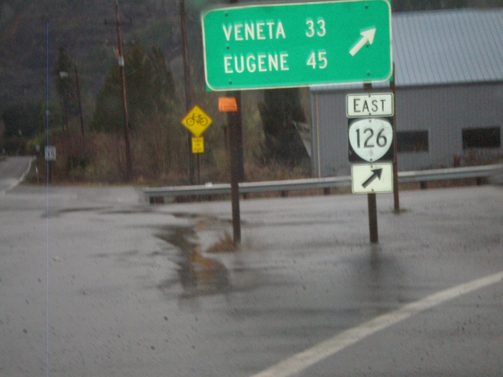
OR-126 East At OR-36
OR-126 east at OR-36 in Mapleton. Continue east on OR-126 for Veneta and Eugene.
Taken 01-17-2010

 Mapleton
Lane County
Oregon
United States
Mapleton
Lane County
Oregon
United States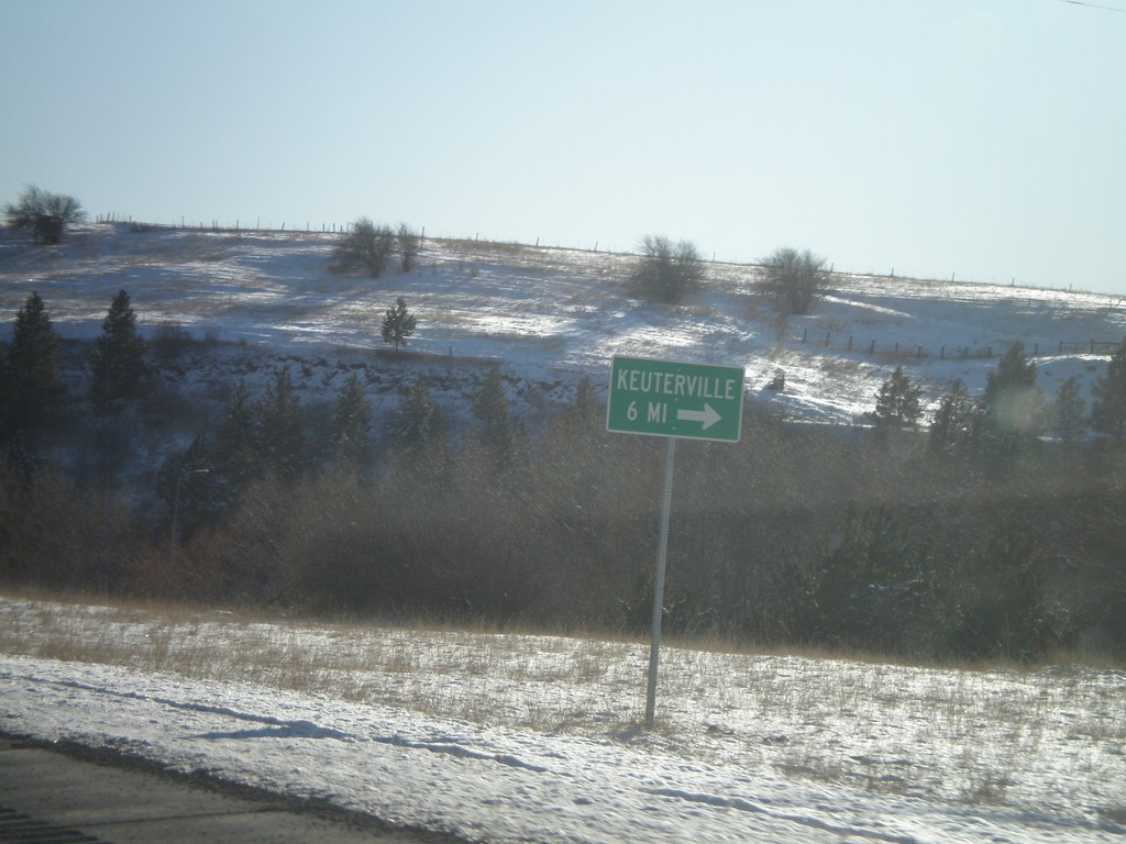
US-95 South At Cottonwood South Entrance
US-95 South at Business US-95 at the southern entrance to Cottonwood. Turn here for access to Keuterville.
Taken 12-27-2009

 Cottonwood
Idaho County
Idaho
United States
Cottonwood
Idaho County
Idaho
United States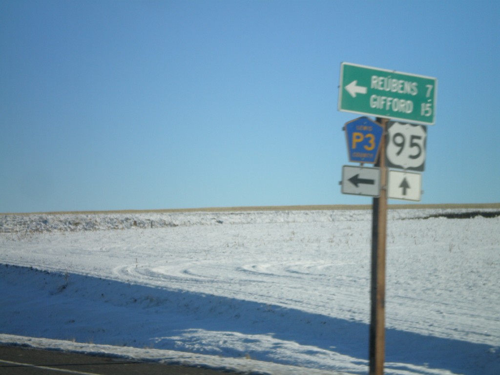
US-95 South at Lewis County Road P3
US-95 south at Lewis County Road P3 north to Reubens and Gifford.
Taken 12-27-2009
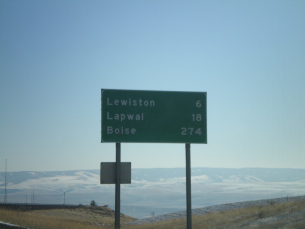
US-95 South - Distance Marker
Distance marker on US-95 south at the top of Lewiston Hill. Distance to Lewiston, Lapwai, and Boise.
Taken 12-27-2009
Genesee
Nez Perce County
Idaho
United States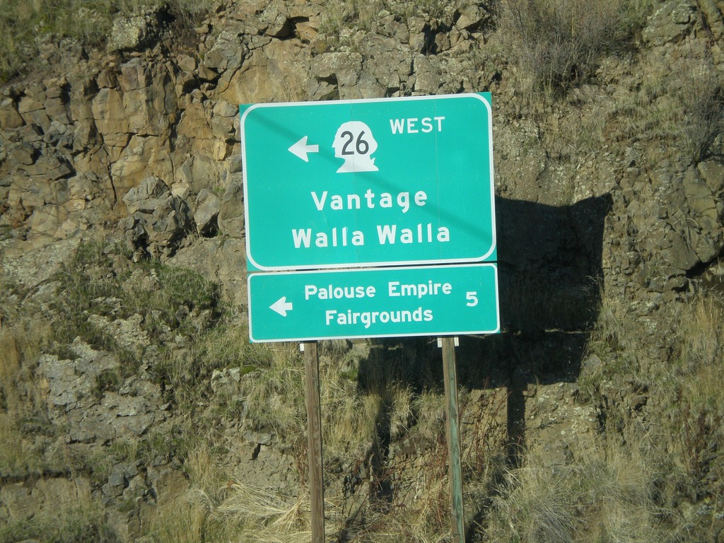
US-195 North at WA-26 West
US-195 north at WA-26 west to Vantage and Walla Walla. WA-26 is the main highway across central Washington from the Palouse region to Seattle. Use WA-26 west for the Palouse Empire Fairgrounds.
Taken 12-26-2009

 Colfax
Whitman County
Washington
United States
Colfax
Whitman County
Washington
United States