Signs Tagged With Distance Marker
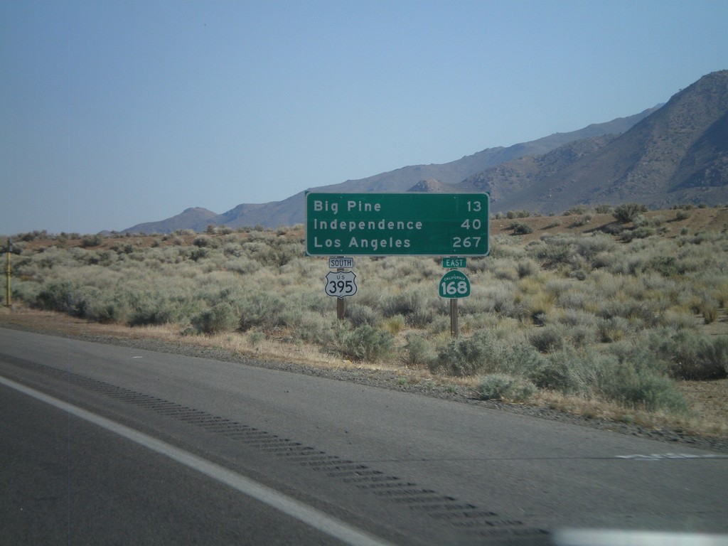
US-395 South/CA-168 East - Distance Marker
Distance marker on US-395 South/CA-168 East. Distance to Big Pine, Independence, and Los Angeles.
Taken 05-04-2012

 West Bishop
Inyo County
California
United States
West Bishop
Inyo County
California
United States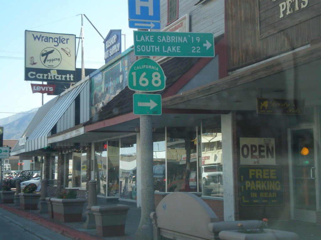
US-395 South at CA-168 West
US-395 South at CA-168 West to Lake Sabrina and South Lake. CA-168 east joins US-395 south to Big Pine.
Taken 05-04-2012
Bishop
Inyo County
California
United States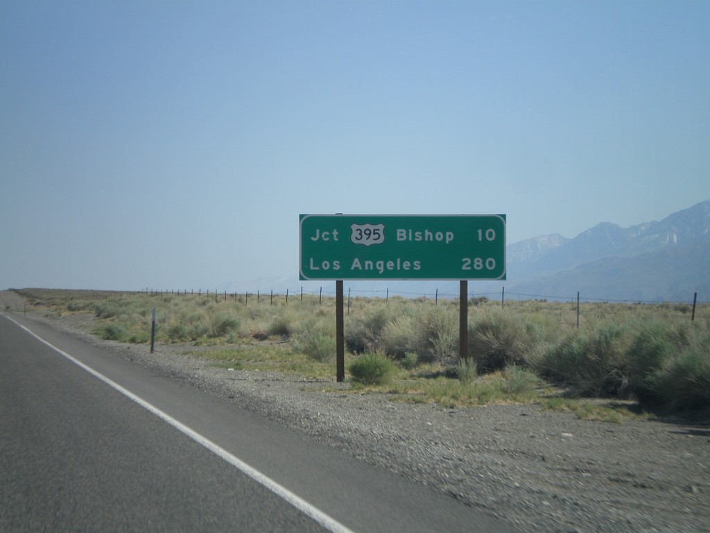
US-6 West - Distance Marker
Distance marker on US-6 west. Distances to Jct. US-395 - Bishop, and Los Angeles.
Taken 05-04-2012
 Bishop
Mono County
California
United States
Bishop
Mono County
California
United States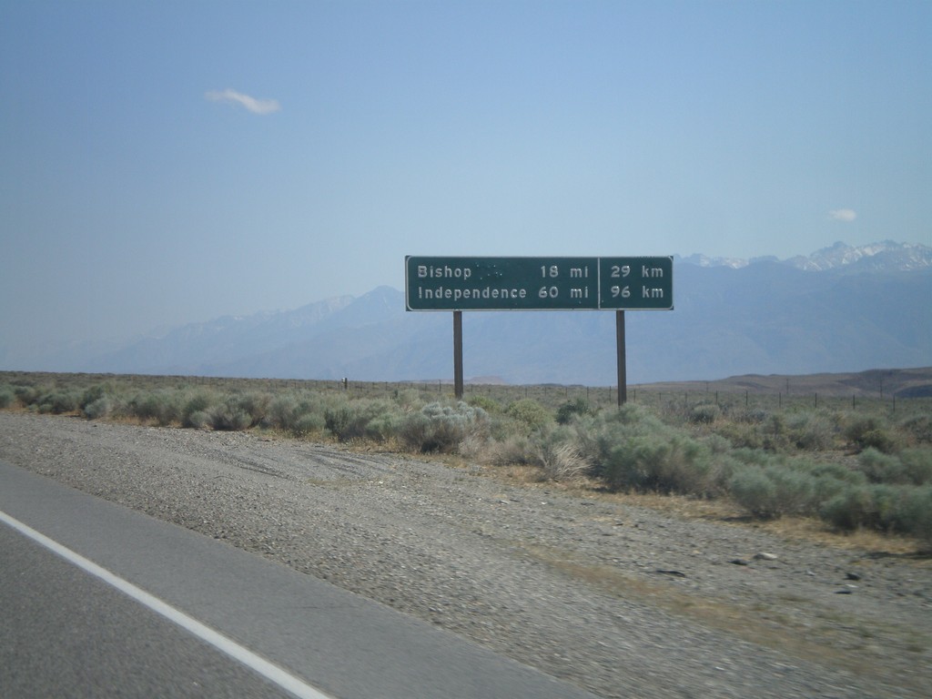
US-6 West - Distance Marker
Distance marker on US-6 west. Distance to Bishop and Independence. This is an older style distance marker which lists distances in miles and kilometers. These dual unit signs are scattered around California, although they tend to be older with button copy lettering.
Taken 05-04-2012
Chalfant Valley
Mono County
California
United States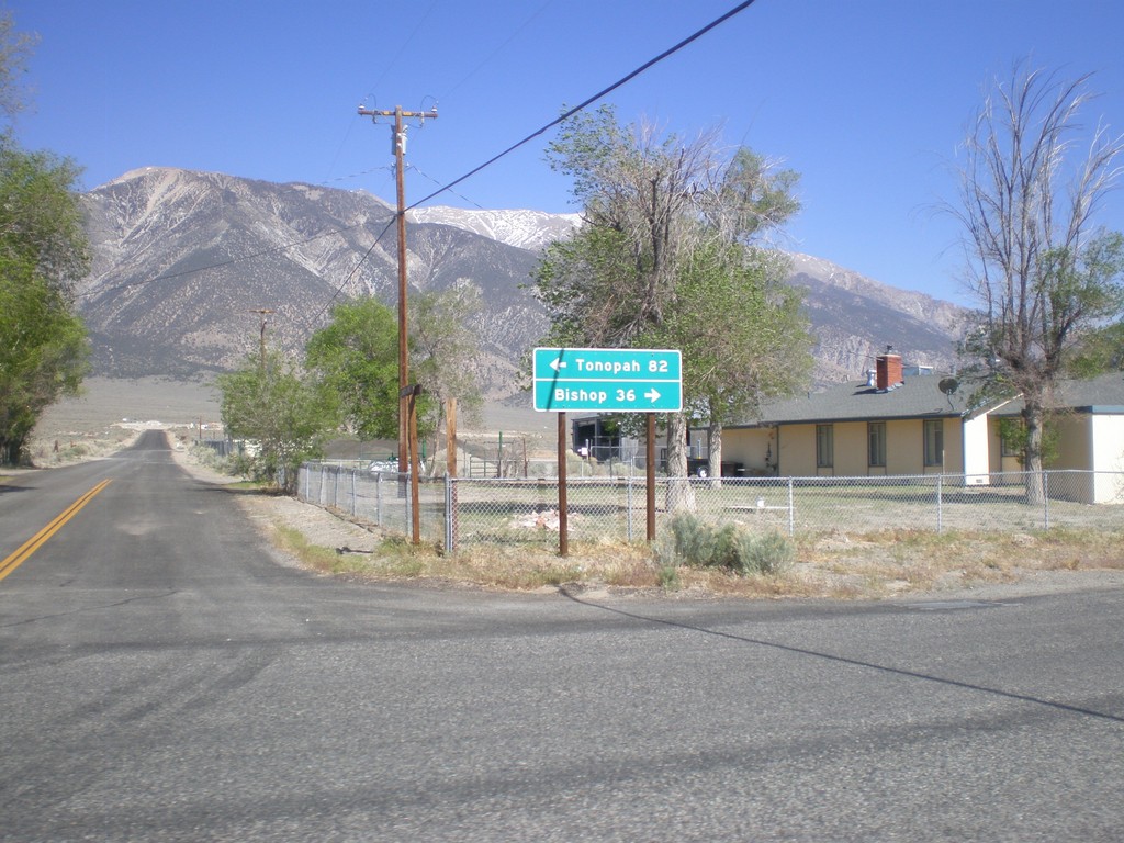
End CA-120 East at US-6
End CA-120 east at US-6. Use US-6 west for Bishop; US-6 east for Tonopah (Nevada).
Taken 05-04-2012
 Benton
Mono County
California
United States
Benton
Mono County
California
United States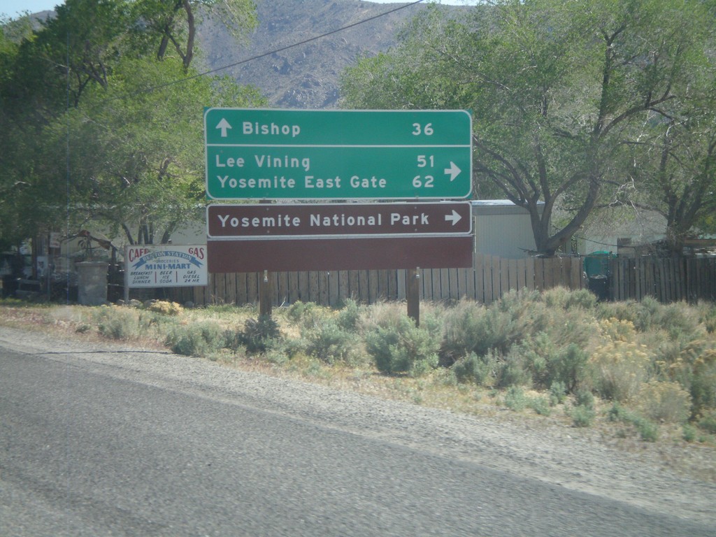
US-6 West at CA-120 West
US-6 West at CA-120 West. Use CA-120 west for Lee Vining, Yosemite East Gate, and Yosemite National Park. Continue west on US-6 for Bishop.
Taken 05-04-2012
Benton
Mono County
California
United States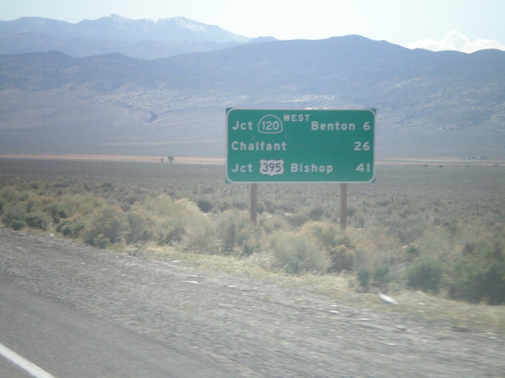
US-6 West - Distance Marker
Distance marker on US-6 west. Distance to Jct. CA-120 West/Benton, Chalfant, and Jct. US-395/Bishop. This is the first distance marker on US-6 inside of California.
Taken 05-04-2012
Benton
Mono County
California
United States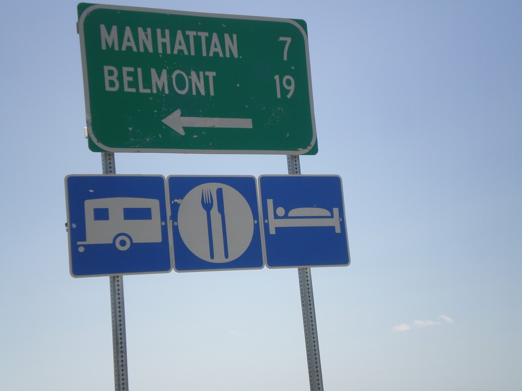
NV-376 South Approaching NV-377
NV-376 south approaching NV-377. Use NV-377 east for Manhattan and Belmont.
Taken 05-04-2012

 Manhattan
Nye County
Nevada
United States
Manhattan
Nye County
Nevada
United States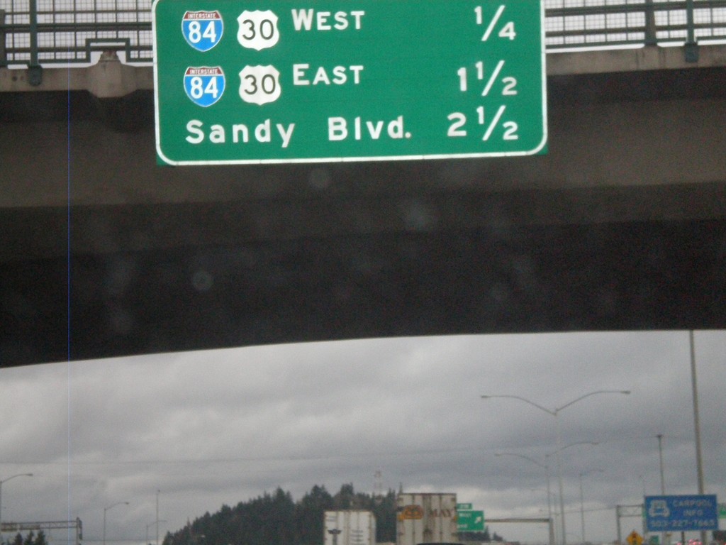
I-205 North - Distance Marker
Distance marker on I-205 north to the next three interchanges on I-205 north. Distance to I-84/US-30 West, I-84/US-30 East, and Sandy Blvd.
Taken 02-21-2012
 Portland
Multnomah County
Oregon
United States
Portland
Multnomah County
Oregon
United States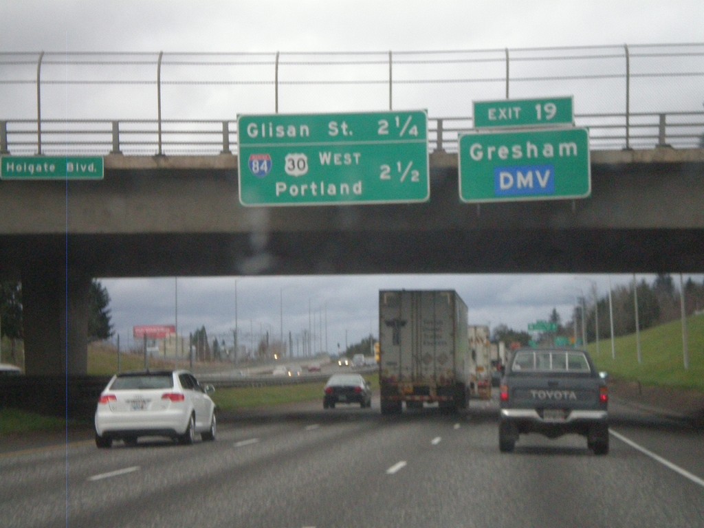
I-205 North - Exit 19 and Next Exits
I-205 north approaching Exit 9 - US-26/Powell St./Division St. Use Exit 19 for Gresham and the DMV. Distance marker for two approaching Exits - Glisan St. (Exit 21A) and I-84/US-30 West/Portland (Exit 21B).
Taken 02-21-2012
 Portland
Multnomah County
Oregon
United States
Portland
Multnomah County
Oregon
United States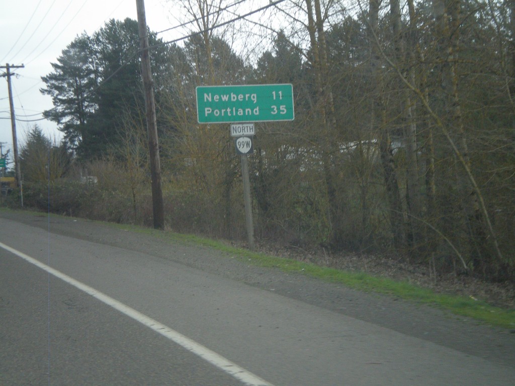
OR-99W North - Distance Marker
Distance marker on OR-99W north to Newberg and Portland. Taken on the east side of Lafayette.
Taken 02-21-2012
 Dayton
Yamhill County
Oregon
United States
Dayton
Yamhill County
Oregon
United States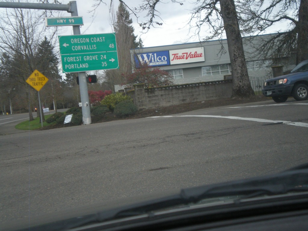
Lafayette Ave. North at OR-99W
Lafayette Ave. North at OR-99W in McMinnville. Turn left on OR-99W North for Forest Grove (via OR-47) and Portland. Turn left on OR-99W (South) for Corvallis and the Oregon Coast (via OR-18). In many places in Oregon the coast is referred to as the Oregon Coast on road signs.
Taken 02-21-2012
McMinnville
Yamhill County
Oregon
United States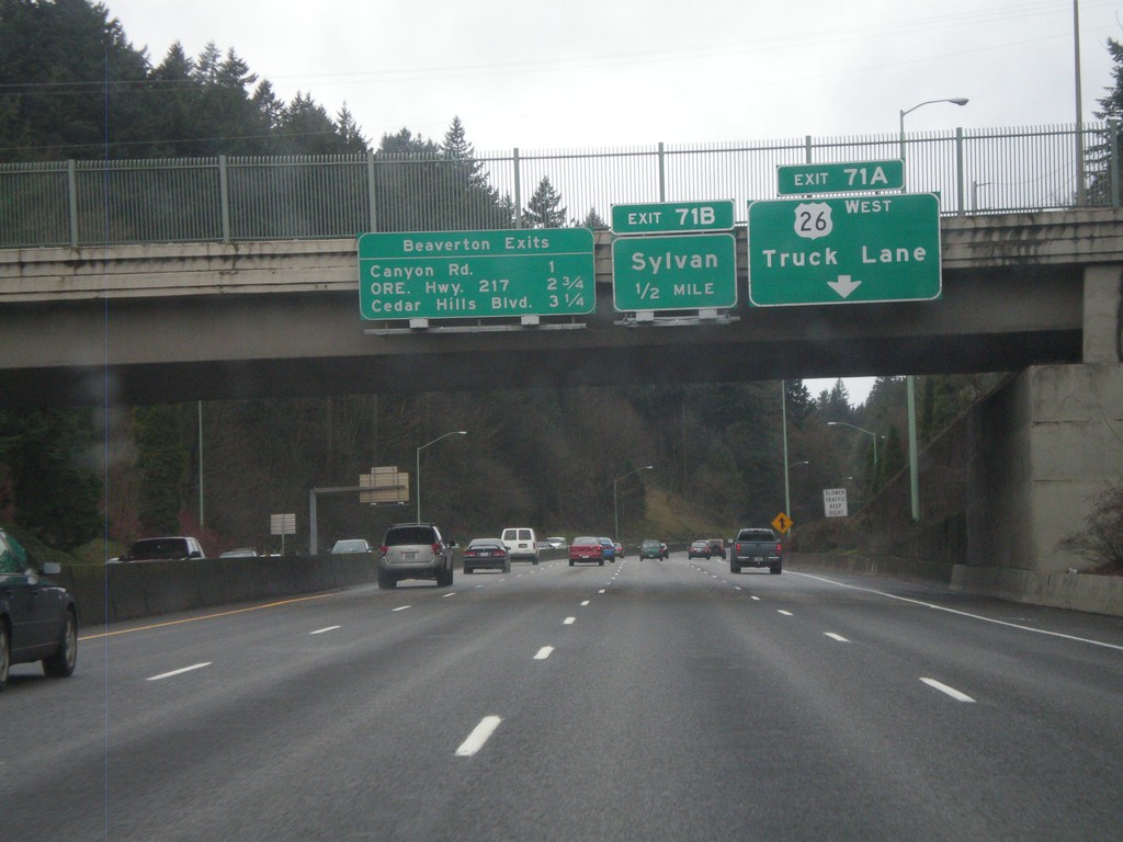
US-26 West - Beaverton Exits and Exits 71AB
US-26 West approaching Exit 71B - Sylvan. Truck traffic, including Exit 71A bound truck traffic, need to use the right truck lane. Also a sign on the bridge lists the Beaverton Exits - Canyon Road, ORE Hwy. 217, and Cedar Hills Road.
Taken 02-18-2012
Portland
Multnomah County
Oregon
United States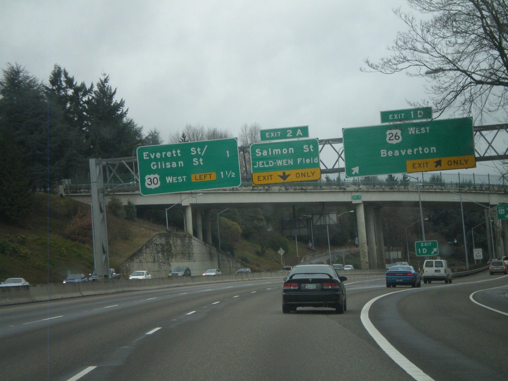
I-405 North - Exits 1D and 2A
I-405 north at Exit 1D - US-26 West/Beaverton. Approaching Exit 2A - Salmon St./JELD-WEN Field. Also a sign for the next two exits on I-405 North - Everett St./Glisan St. and US-30 West.
Taken 02-18-2012
 Portland
Multnomah County
Oregon
United States
Portland
Multnomah County
Oregon
United States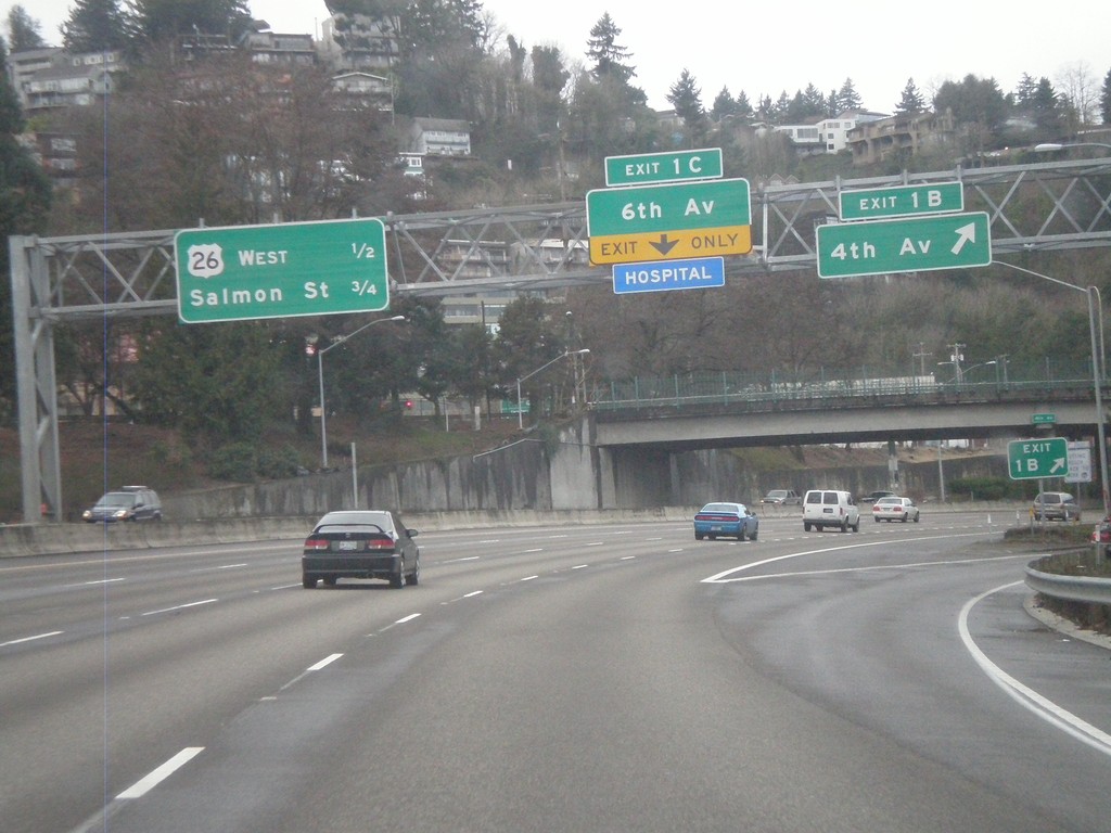
I-405 North - Exits 1B and 1C
I-405 north at Exit 1B - 4th Ave. Approaching Exit 1C - 6th Ave. Next two exits along I-405 north are US-26 West and Salmon St.
Taken 02-18-2012
Portland
Multnomah County
Oregon
United States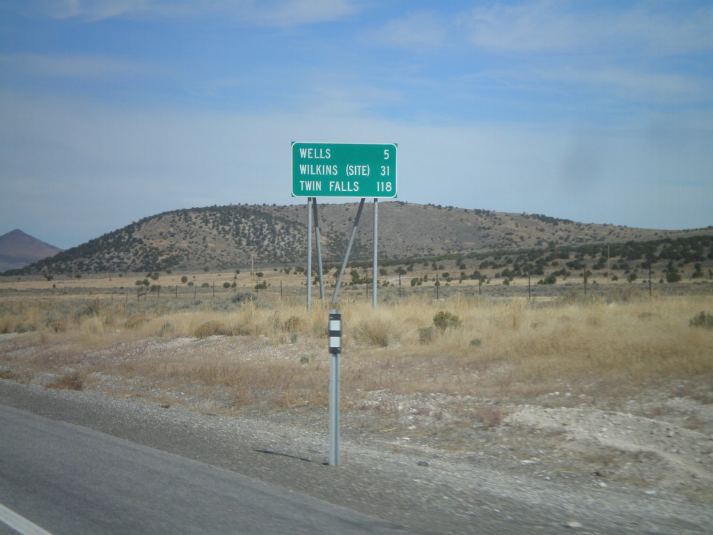
US-93 North - Distance Marker
Distance Marker on US-93 north to Wells, Wilkins (Site), and Twin Falls. Taken just north of NV-232 junction.
Taken 10-15-2011
 Wells
Elko County
Nevada
United States
Wells
Elko County
Nevada
United States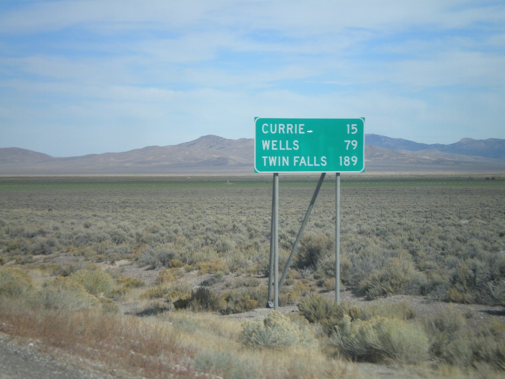
US-93 North - Distance Marker
Distance marker on US-93 north to Currie, Wells, and Twin Falls (Idaho). Taken just north of US-93/Alt. US-93 split.
Taken 10-15-2011
Ely
White Pine County
Nevada
United States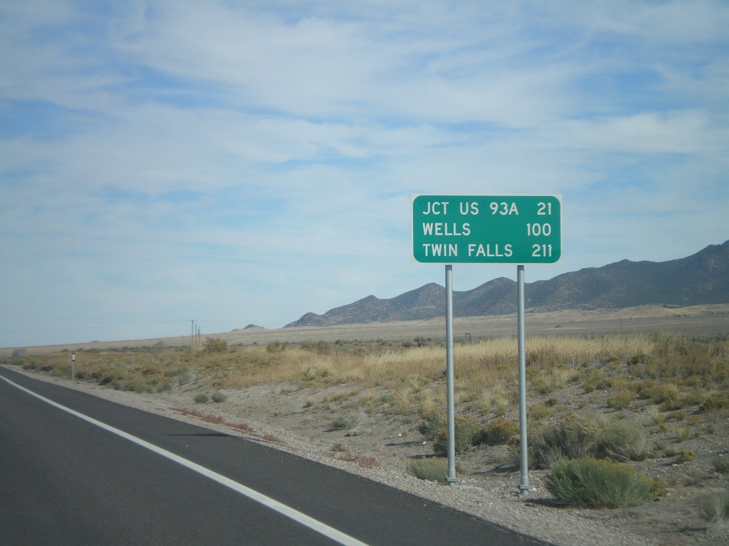
US-93 North - Distance Marker
Distance marker on US-93 north. Distance to Jct US-93A, Wells, and Twin Falls (Idaho).
Taken 10-15-2011
Schellbourne
White Pine County
Nevada
United States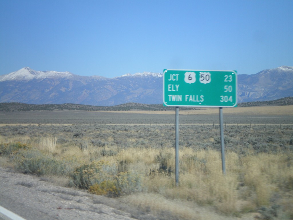
US-93 North - Distance Marker
Distance marker on US-93 north. Distance to US-6/US-50 Jct., Ely, and Twin Falls (Idaho).
Taken 10-14-2011
Pioche
White Pine County
Nevada
United States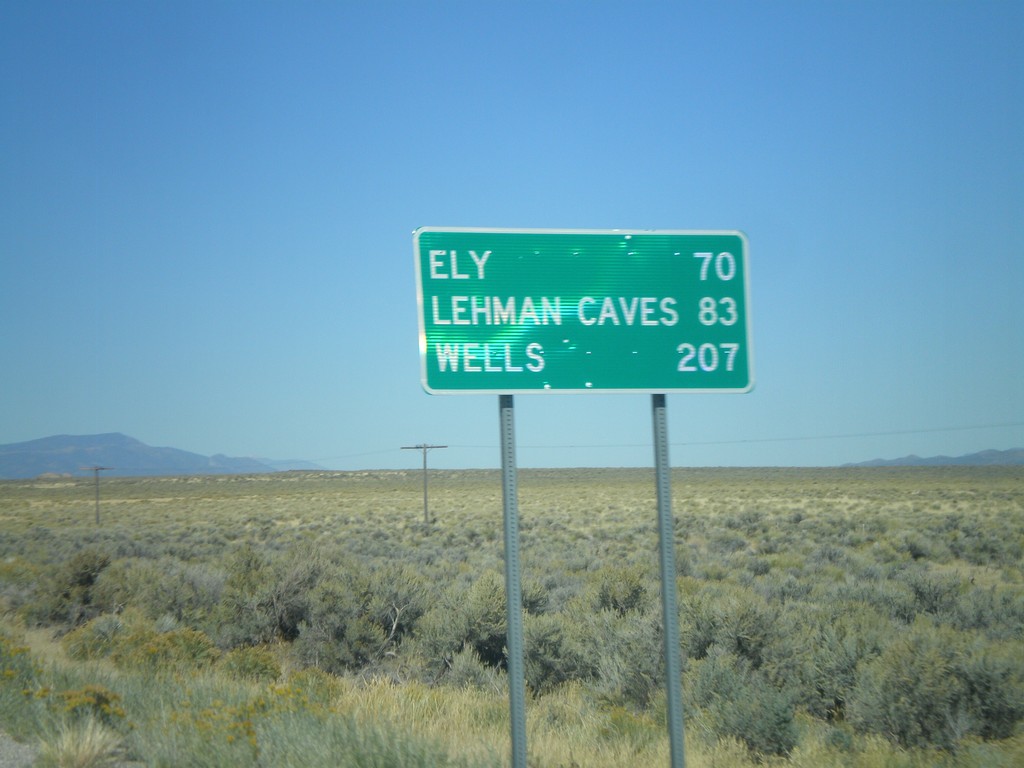
US-93 North - Distance Marker
Distance marker on US-93 north to Ely, Lehman Caves (Great Basin National Park), and Wells. Taken just north of Pony Springs.
Taken 10-14-2011
Pioche
Lincoln County
Nevada
United States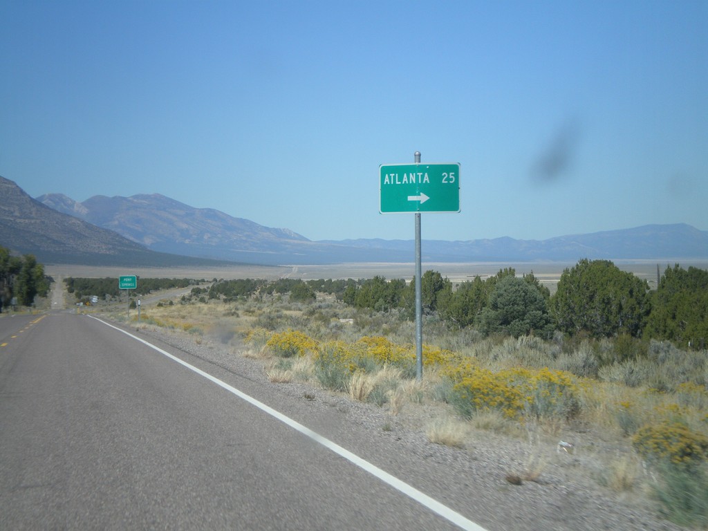
US-93 North at Atlanta Jct.
US-93 North at Atlanta Jct.
Taken 10-14-2011
Pioche
Lincoln County
Nevada
United States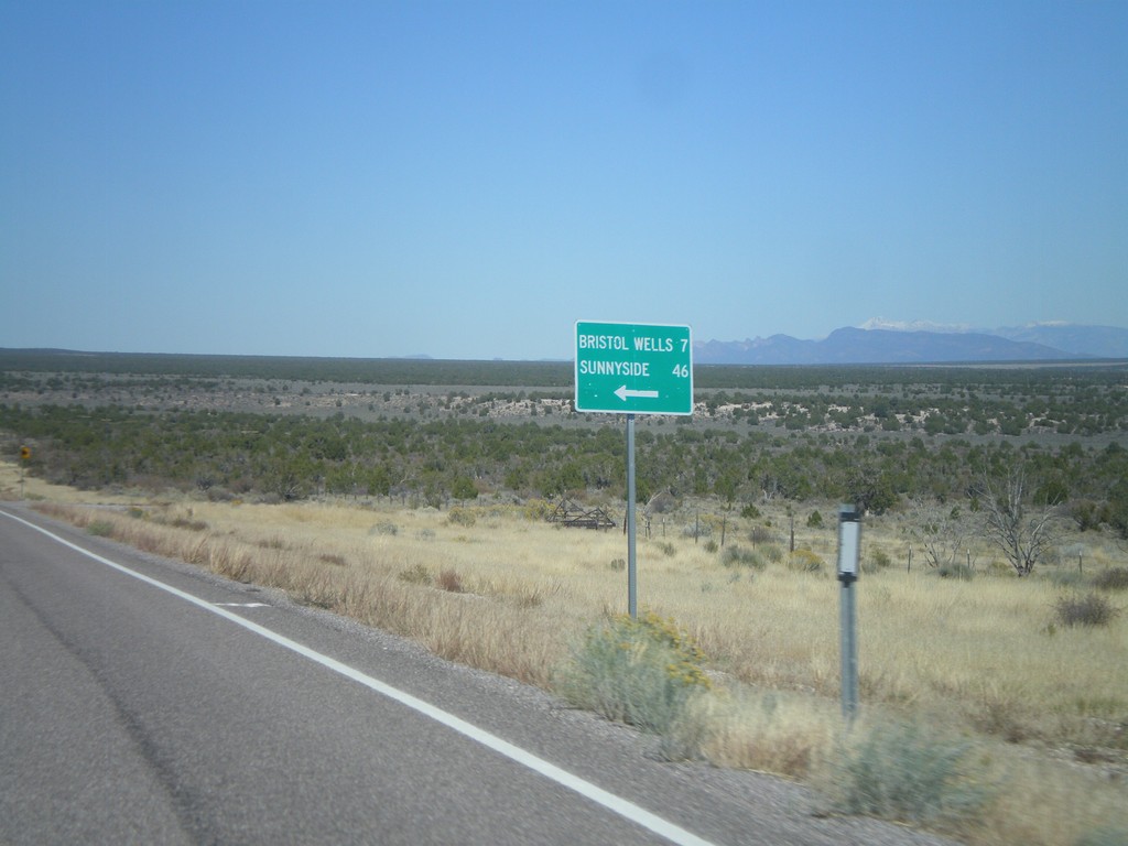
US-93 North at Bristol Wells/Sunnyside Jct.
US-93 North at Bristol Wells/Sunnyside Jct. Turn left for Bristol Wells (7 Miles) and Sunnyside (46 Miles).
Taken 10-14-2011
Pioche
Lincoln County
Nevada
United States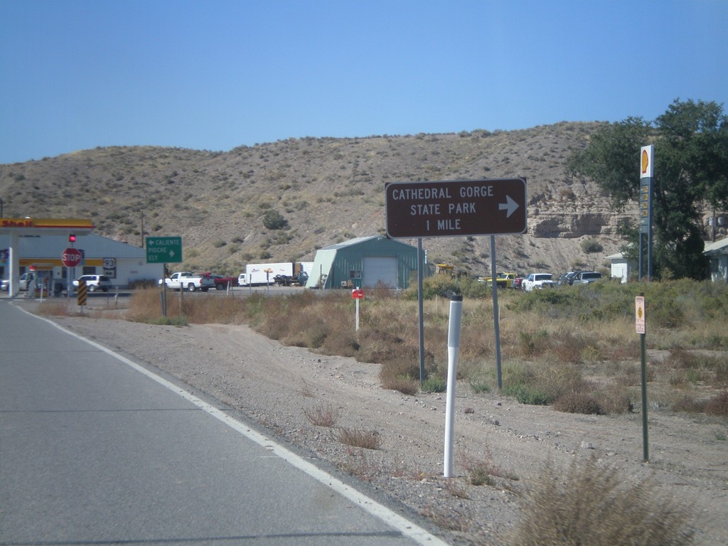
End NV-319 West at US-93
End NV-319 west at US-93. Use US-93 north for Cathedral Gorge State Park.
Taken 10-14-2011
 Panaca
Lincoln County
Nevada
United States
Panaca
Lincoln County
Nevada
United States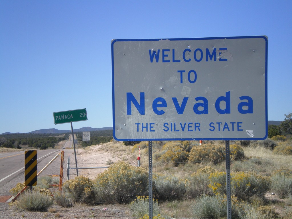
Welcome To Nevada
Welcome to Nevada - The Silver State on NV-319 west. Taken at the Utah-Nevada State Line.
Taken 10-14-2011
Modena
Lincoln County
Nevada
United States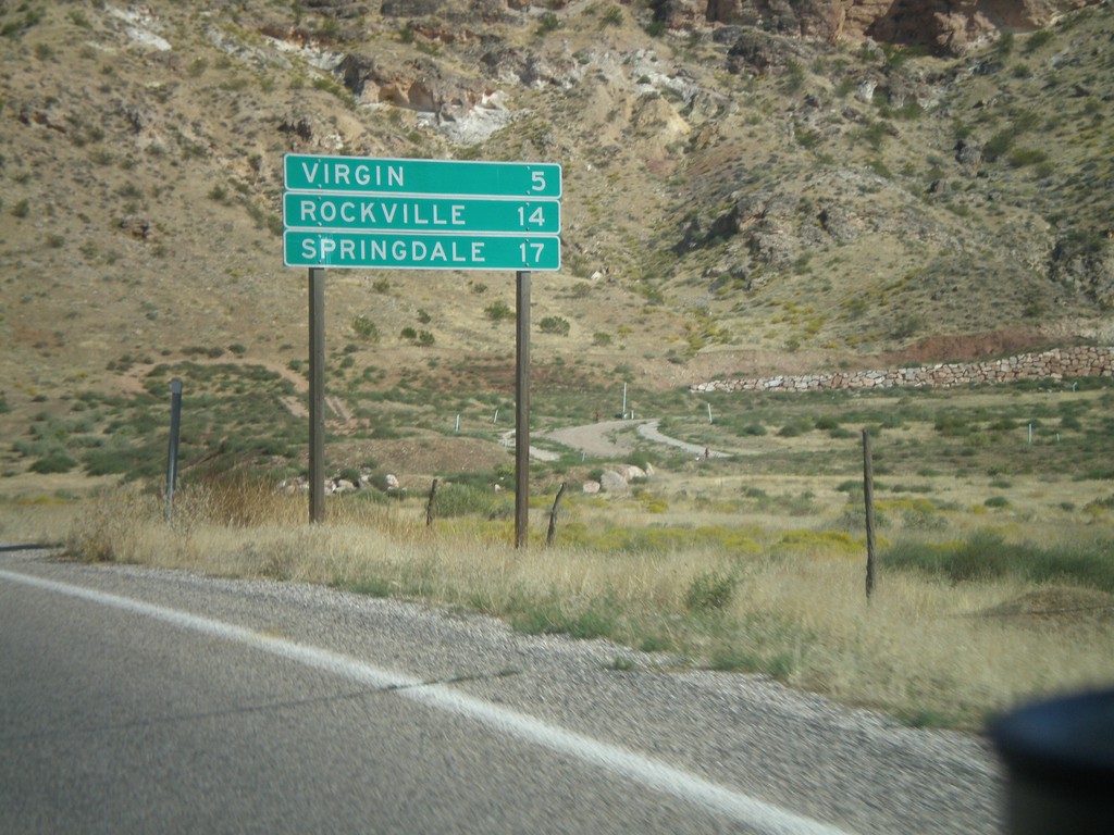
UT-9 East - Distance Marker
Distance marker on UT-9 east for Virgin, Rockville, and Springdale. Springdale is at the west entrance to Zion National Park.
Taken 10-10-2011
 La Verkin
Washington County
Utah
United States
La Verkin
Washington County
Utah
United States